 Block
From the record
3 National Register listings published here.
Sources: the National Register database, National Park Service
83 topographic sheets and 6 fire insurance atlases across 1 place.
3 National Register listings published here.
Sources: the National Register database, National Park Service
Every property in this county listed on the National Register of Historic Places, with the year it was listed and the federal nomination document.
| Photograph | Property | Type | Listed | Reference |
|---|---|---|---|---|
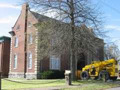 | Fohs Hall | building | 1982 | 82002682 |
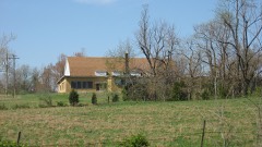 | Frances School Gymnasium | building | 1993 | 93000046 |
 | Weston Bluff Skirmish Site | site | 1998 | 98000937 |
Sampled issues, machine-read from the Library of Congress scan and published page by page, so every headline and column is searchable text.
Marion, Ky., 1904 to 1907. Machine-read from the Library of Congress scan.
Marion, Ky., 1879 to 1907. Machine-read from the Library of Congress scan.
Marion, Ky., 1907 to 1909. Machine-read from the Library of Congress scan.
Marion, Ky., 1909. Machine-read from the Library of Congress scan.
Marion, Ky., 1909 to 191?. Machine-read from the Library of Congress scan.
Marion, Ky.; Marion, KY, 1919 to Current. Machine-read from the Library of Congress scan.
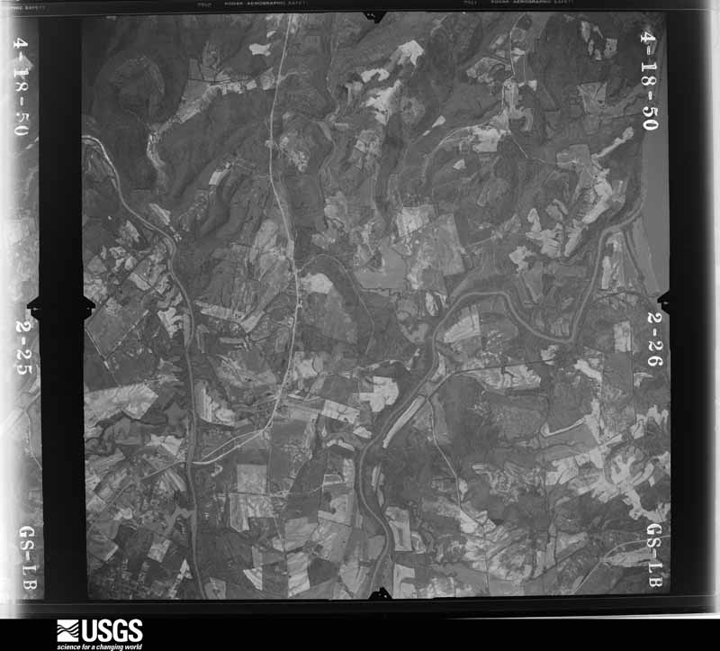
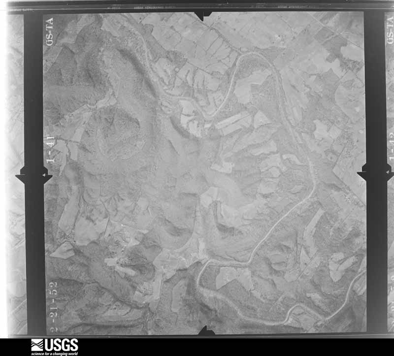
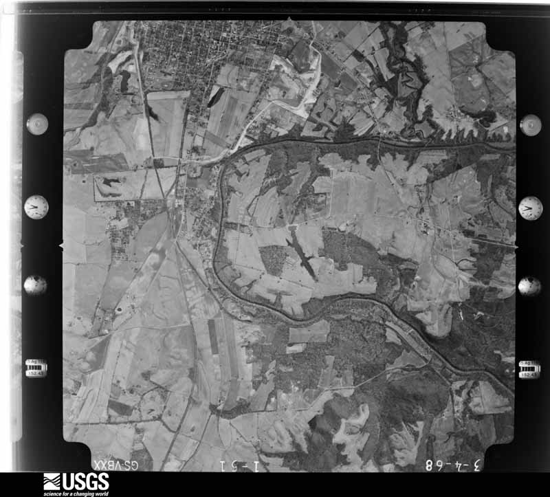
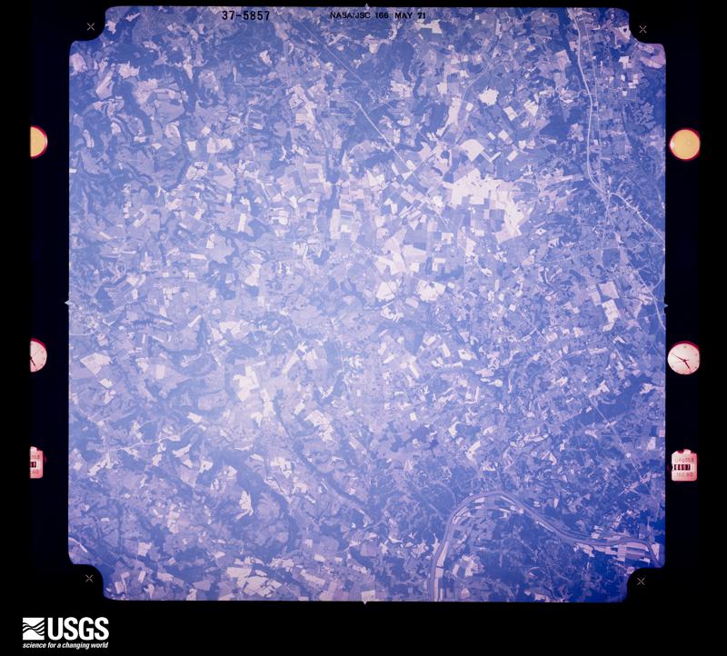
Flown by the U.S. Geological Survey between 1937 and 1989, the Aerial Photo Single Frames collection is the definitive mid-century view of the land: fields, roads and rivers as the camera saw them. The Survey holds 733 frames inside the rectangle that bounds this county; the 13 frames below were taken over the county itself, chosen across the decades of flights (at most four a year from that rectangle), so one flight cannot crowd out the rest. The full set is free to browse and download at EarthExplorer under the dataset Aerial Photo Single Frames.
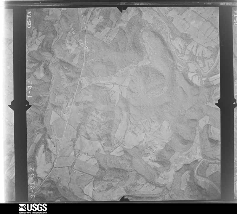
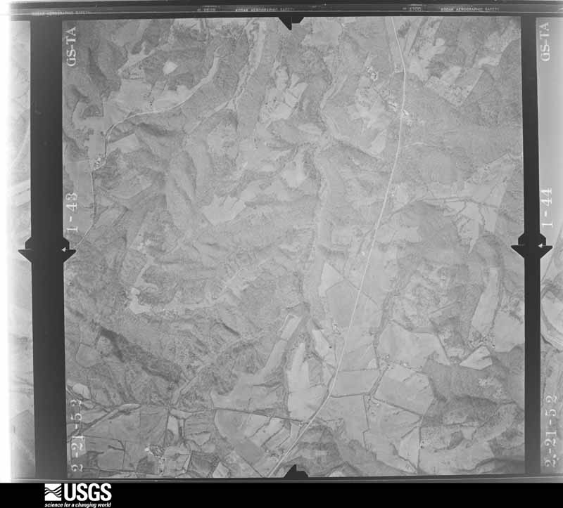
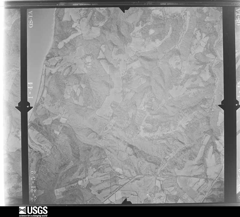
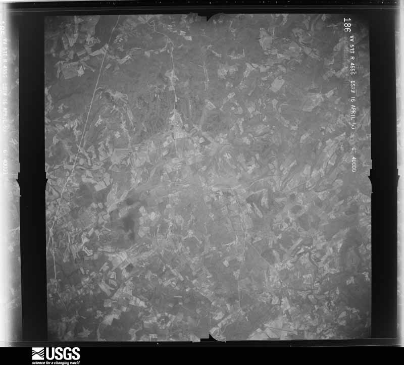
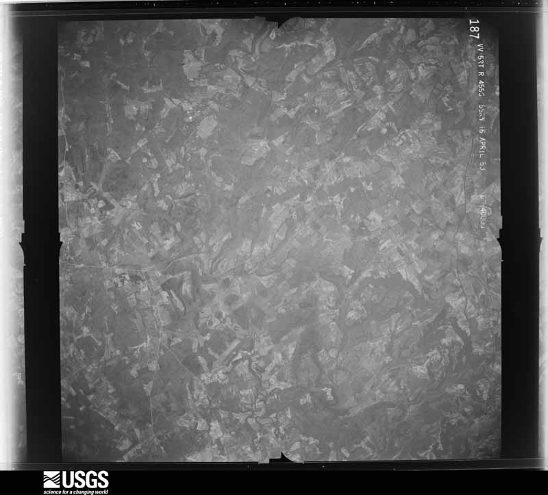
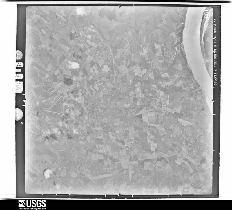
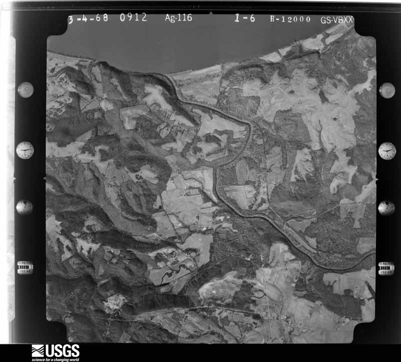
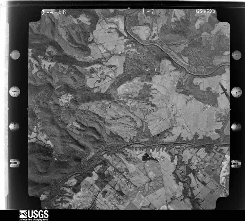

The thermometers that kept this county's weather, and the gages that measured the flow of its streams, as the federal records hold them. The extremes below are measured values from those records, not estimates.
Who lived here in 1950, one enumeration district at a time, as the Census Bureau described each district. Each row opens its official National Archives result, with Population Schedules and ED Maps available there.
Every wildfire the federal occurrence database records inside this county: 62 of them, burning about 390 acres. None started naturally and 2 were recorded as arson. Each settlement page carries the fires within five miles of it.
| Reported cause | Fires |
|---|---|
| Missing data/not specified/undetermined | 23 |
| Recreation and ceremony | 20 |
| Debris and open burning | 7 |
| Railroad operations and maintenance | 5 |
| Equipment and vehicle use | 4 |
| Arson/incendiarism | 2 |
| Misuse of fire by a minor | 1 |
The five largest, by the area the report gives. None of them was recorded as arson.
| Date | Cause | Size | Reported by | Name on the report |
|---|---|---|---|---|
| 3 January 2017 | Debris and open burning | 51 acres | Kentucky Division of Forestry | WRING ROAD |
| 4 March 2009 | Recreation and ceremony | 40 acres | Kentucky Division of Forestry | not named |
| 17 January 2009 | Recreation and ceremony | 30 acres | Kentucky Division of Forestry | not named |
| 28 July 2012 | Missing data/not specified/undetermined | 30 acres | Kentucky Division of Forestry | FRITZ RD. |
| 25 June 2003 | Missing data/not specified/undetermined | 20 acres | Kentucky Division of Forestry | not named |
| 23 September 2010 | Missing data/not specified/undetermined | 12 acres | Kentucky Division of Forestry | SINKHOLE PASTURE |
| 17 March 1999 | Equipment and vehicle use | 11 acres | Kentucky Division of Forestry | not named |
| 12 November 2011 | Railroad operations and maintenance | 10 acres | Kentucky Division of Forestry | CRAYNE CEM. RD. |
Every settlement page carries the fires within five miles of it - see the settlement index below.
The NOAA Storm Events Database holds 156 reports for this county, causing 1 death, 10 injuries and about $7,960,050 in recorded property damage. Each settlement page carries the reports that name it.
| Kind of event | Reports |
|---|---|
| Thunderstorm Wind | 63 |
| Hail | 29 |
| Flood | 25 |
| Flash Flood | 22 |
| Tornado | 12 |
| Heavy Rain | 4 |
| Dust Devil | 1 |
The most serious of them, by death, then injury, then recorded damage. The accounts are quoted exactly as the forecast office filed them.
| When | Event | Place named | Harm | What the report says |
|---|---|---|---|---|
| April 2008 | Flood | Frances | 1 killed, $20,000 | A young girl drowned in floodwaters on Highway 855 between Frances and Salem shortly before sunrise. The child was a passenger in a vehicle driven by her mother. The vehicle plunged into about eight feet of water that was over the road at a creek crossing. The vehicle immediately began floating, and both the mother and child exited. The mother lost her grip on the child, and the child immediately went under water. A boat was used to locate the child within ten minutes. Rescue workers retrieved the child, who was caught up in debris or tree limbs in about eight feet of water. The child was given CPR and rushed to a local hospital, where she was pronounced dead. The area is known to flood by local residents, and it was marked by an orange high water sign. The mother was new to the area and likely unfamiliar with the flooding problems there. About 5.5 inches of rain had fallen the night before the drowning. Countywide, numerous roads were covered with water. Several roads were closed for a few days, including Highway 120. |
| November 2005 | Tornado (F3) | Mattoon | 5 hurt, $300,000 | The tornado touched down one quarter mile west of Highway 654 and moved rapidly east-northeast. A mobile home on Highway 654 was overturned and destroyed, injuring a 12-year-old boy. A house roof was blown off. Where the tornado crossed Highway 365, a two-story home was completely demolished. The home exterior was mainly vinyl with some brick. Three persons in the house were injured. Two of the injured were treated and released, but a third person was critically injured and transferred to an Evansville hospital. The tornado was estimated to be at its strongest near Highway 365, with peak winds of 160 MPH. A small boat was carried about 400 yards, and several vehicles were moved. After crossing Highway 365, the path was roughly parallel to and less than a mile north of U.S. Highway 60. The tornado crossed Highway 60 and exited into Webster County about a mile northeast of Arflack Hill. Where the tornado crossed U.S. Highway 60, a truck trailer was overturned, and a house roof was damaged. Along the entire length of the path, numerous large trees were snapped or uprooted. |
| January 2000 | Tornado (F3) | Crayne | 3 hurt, $5,000,000 | Although the tornado tracked about 15 miles through the county with estimated top winds of 160 MPH, damage was relatively light due to the rural nature of the land. Based on aerial surveys, structures that were heavily damaged or destroyed included 85 homes, 5 to 10 businesses, and 50 to 80 barns and outbuildings. Three people in the Crayne area were transported to a hospital for non life-threatening injuries. About 35 National Guard personnel were deployed to Crittenden County, primarily for damage assessment and security operations. An emergency shelter was opened to accomodate roughly 25 homeless persons. |
| January 1999 | Thunderstorm Wind | Mattoon | 1 hurt, $20,000 | A mobile home was blown over, slightly injuring one occupant. |
| May 2003 | Tornado (F2) | Mattoon | 1 hurt | A mobile home was destroyed, and there was significant damage to a permanent home. The occupant of the mobile home received minor injuries. A barn was destroyed, and numerous trees and power lines were down. Peak winds were estimated near 120 MPH. |
| May 2003 | Flash Flood | Countywide | $400,000 | Flooding caused by torrential thunderstorm downpours forced the closure of U.S. Highway 60 and U.S. Highway 641 in Marion for about 45 minutes. Part of First Street was impassable after a culvert was pushed out of place, causing tree limbs to flow under the asphalt and push up through it. Several businesses reported minor to moderate water damage. The county high school and the county courthouse sustained minor flooding damage. Floodwaters along U.S. Highway 60 swept a man's parked car into a nearby creek. A 500-gallon propane tank behind a house floated away. Substantial damage such as washed out culverts was reported on at least a dozen rural roads. The Sheridan area received significant flooding damage. Unofficial rainfall amounts were around 3 inches in an hour. The heaviest rainfall was in northern and central parts of the county. |
| May 2011 | Flood | Tolu | $300,000 | Major flooding continued on the Ohio River from April. Based on data from river gages in nearby Pope and Gallatin Counties in Illinois, the flood crest of 2011 was two to three feet higher than the 1997 flood. This was still 6 to 9 feet lower than the record crest set in 1937. The activation of the New Madrid Floodway by the U.S. Army Corps of Engineers spared Crittenden County from an even higher crest that would have inundated even larger areas of the county. With the detonation of the Mississippi River levee at Birds Point, Missouri, the Ohio River stopped rising or rose much more slowly. The community of Tolu was evacuated, and water was halfway up the windows of a house in Tolu. U.S. Highway 60 was closed just west of the Tradewater River bridge. Backwater from the Ohio River contributed to major flooding on the Tradewater River. About two dozen houses were flooded or threatened countywide. |
| May 2010 | Flash Flood | Dycusburg | $270,000 | The Cumberland River rose rapidly as releases from Barkley Dam were increased to record levels. About a dozen residences were flooded in Dycusburg, and others were evacuated because they were isolated by floodwaters. The community that was primarily affected was Dycusburg. Water was two to three feet deep in some homes. There was extensive flooding of fields and woods. A few roads were closed, including State Route 295 at Dycusburg. |
| August 2009 | Hail | Marion | $250,000 | A swath of large hail affected much of the county. Quarter-size hail fell in Marion. Golf-ball size hail fell in Crayne. Significant hail damage occurred in Crayne, where mobile homes were riddled with holes. Windows were broken, and vehicles were damaged. Roofs and siding of houses were heavily damaged. A dozen or more homes suffered damage. Corn and soybean fields were badly damaged. |
| May 1995 | Tornado (F2) | Frances | $250,000 | no account filed |
| July 2021 | Flash Flood | New Salem | $100,000 | Several roads were closed due to flooding, including Kentucky Highway 855 north of Frances between Kentucky 70 and U.S. Highway 60. Kentucky Highway 902 was closed near the Caldwell County line. Heavy rains washed out approaches on either end of a county road bridge across Dry Fork Creek. The road was closed indefinitely. The county road foreman reported widespread damage around the county, but the bridge over Dry Fork Creek was the most severe. Crittenden County received $100,000 in state emergency funds to assist with repairs to about ten roads damaged during this round of flash flooding. A narrow corridor of excessive rainfall occurred where storms trained across the same areas for several hours. Radar estimated 6 to 9 inches fell in a narrow corridor of west Kentucky from central Livingston across southern Crittenden County. There were a few confirmed rainfall measurements of 7-plus inches in southern Crittenden County. |
| September 2011 | Thunderstorm Wind | Marion | $100,000 | The dust collector on top of a feed mill was blown off, leaving behind a large hole in the roof. A metal roof was torn off a shed behind a hardware store. The shed roof was deposited in trees. Both the feed mill and shed sustained water damage due to rainwater. Shingles were torn off roofs around town. Trees and limbs were blown down across the city, resulting in power outages. A tree limb struck a porch on a trailer. Signs were blown over. |
| September 2006 | Tornado (F1) | Sheridan | $100,000 | Numerous trees were topped or uprooted. One mobile home that was not tied down was destroyed. Several outbuildings were destroyed. Trees fell on the roofs of several homes. Many homes received minor roof damage. Peak winds were estimated near 100 MPH. This tornado was spawned by the same supercell thunderstorm that earlier produced a tornado in Livingston County, and would later produce another tornado in Webster County. |
| April 2002 | Tornado (F2) | Shadey Grove | $100,000 | The tornado was spawned by a long-lived supercell that originated over southeast Missouri and tracked across southern Illinois and western Kentucky. This tornado, which was one of the strongest and longest-lived of the night, first touched down just inside Crittenden County on State Route 120. It quickly moved into Webster County. Before moving into Webster County, about a dozen homes and farm buildings were damaged in Crittenden County. |
| June 1995 | Thunderstorm Wind | Countywide | $100,000 | Wind damage was widespread. Two empty grain bins along U.S. Highway 60 were destroyed. Trees and power lines were downed. About $8,000 damage occurred to a house in Midway after a giant oak tree fell on it. Other homes were damaged by fallen trees. Power was out for three days for a few residents. Many streets and highways, including U.S. 60, were temporarily blocked by fallen trees, debris, or flooding. Work crews spent several hours removing downed trees and limbs from roads. One man narrowly escaped injury when a tree fell on his truck as he was travelling. |
| July 2000 | Thunderstorm Wind | Marion | $70,000 | Numerous trees and power lines were blown down in the Marion area. The damage path, which was a few miles wide, extended from west to east across central portions of Crittenden County. Some roads were blocked by fallen trees. Windows were blown out of an attorney's office in Marion. A metal shed was blown across a yard. |
| February 2022 | Flash Flood | Marion | $50,000 | Highway 91 was closed on the northwest edge of Marion, where Crooked Creek flooded and destroyed a temporary detour for construction of a new bridge. |
| March 2018 | Flood | Tolu | $50,000 | Moderate flooding continued along the Ohio River from late February. The river crested very early in March. Tributaries such as the Tradewater River flooded extensively due to backwater flooding from the Ohio River. Flooding of the Tradewater River forced a couple of state roads to close. Countywide, numerous county roads and some state roads were closed. There were about ten state road closures. The Cave-In-Rock ferry connecting Illinois and Kentucky was closed due to flooding. Schools opened one hour late on some days during the flooding. |
| August 2009 | Thunderstorm Wind | Marion | $45,000 | Numerous trees and power lines were blown down. One home was damaged when power lines were pulled from the side of it. Carports were blown down. A barn was blown down. |
| October 2025 | Thunderstorm Wind | Marion | $40,000 | Thunderstorm winds produced damage in Marion. A large tree was uprooted and fell onto two vehicles, causing major damage to both. In addition, a garage had a portion of its roof removed and two other trees had some broken limbs. |
| July 2000 | Flash Flood | Marion | $40,000 | Thunderstorm rains estimated in excess of 2 inches per hour caused major road flooding in and around Marion. Roads were impassable to small vehicles due to high water. In Marion, over a foot of water on the main street flooded out a police cruiser responding to an alarm. A utility truck reported 2 feet of water over a road on the south end of Marion that doesn't normally flood. |
| May 2011 | Flood | Casad | $30,000 | no account filed |
| January 2000 | Flash Flood | Countywide | $30,000 | no account filed |
| March 2022 | Thunderstorm Wind | Mattoon | $25,000 | Several trees and a couple of power poles and lines were down. |
| May 2008 | Thunderstorm Wind | Marion | $25,000 | Downed trees and power lines were reported community wide. |
| February 2019 | Flood | Tolu | $20,000 | Moderate flooding of the Ohio River occurred. At the Shawneetown, IL gage, the river crested at 48.96 feet on February 20. Flood stage there is 33 feet, and moderate flooding begins at 43 feet. The ferry from Hardin County, IL to Crittenden County was shut down due to high water for an extended period of time. Several state roads and numerous county roads were flooded. Backwater flooding along the Tradewater River affected areas near the Webster County line. Large areas of agricultural land were flooded. Crop losses were negligible since planting was not yet underway. |
| January 2008 | Thunderstorm Wind | Crayne | $20,000 | Several trees and some power lines were reported down across the county. |
| April 2008 | Flash Flood | Repton | $20,000 | In Marion, some families were evacuated due to high water. The rescue squad assisted a mother and two children on Highway 1077 in Shady Grove. About a foot of water was over U.S. Highway 60 about three miles west of Marion. U.S. 60 was under several feet of water east of Marion, where a tractor-trailer became stranded. Several feet of water flooded U.S. Highway 641. Highway 91 was flooded and covered with large amounts of mud and rock. |
| April 2002 | Tornado (F1) | Sheridan | $20,000 | This relatively weak, short-lived tornado was spawned by the same supercell thunderstorm that produced longer and more destructive tornadoes over Livingston County and eastern Crittenden and Webster Counties. Many trees were down, and a couple of trailers were destroyed or heavily damaged. |
| August 2019 | Thunderstorm Wind | Tolu | $15,000 | Tree damage was reported in northwest Crittenden County. Large tree limbs were blown down in Tolu, damaging vehicles. Several miles west-northwest of Marion, a tree was down along State Route 1668. |
| July 2012 | Thunderstorm Wind | Mattoon | $15,000 | A few tree limbs were blown down. Some shingles and trim were blown off a couple of homes. |
| August 2009 | Heavy Rain | Marion | $10,000 | A culvert along U.S. Highway 641 was washed out, causing minor damage to the road. |
| October 2000 | Thunderstorm Wind | Countywide | $10,000 | Trees were down. |
| July 1995 | Thunderstorm Wind | Southern | $10,000 | Several trees were blown down, including one that fell on a house. |
| March 1997 | Flash Flood | Marion | $10,000 | no account filed |
| January 1996 | Thunderstorm Wind | Marion | $10,000 | no account filed |
| May 1995 | Thunderstorm Wind | Marion | $10,000 | no account filed |
| May 1998 | Thunderstorm Wind | Tolu | $8,000 | County road crews opened several county roads that were blocked by fallen trees or limbs. |
| October 2001 | Thunderstorm Wind | Dycusburg | $6,000 | There were several roofs damaged in and around Marion. At a house on U.S. 60 just outside of Marion, a privacy fence was blown over, and vinyl siding was damaged. Power lines were damaged at Dycusburg. |
| May 1999 | Thunderstorm Wind | Shadey Grove | $5,000 | Two trees were down along Highway 120. |
| May 1995 | Thunderstorm Wind | Tolu | $5,000 | Trees, power lines, and a power pole were downed. |
| May 2004 | Thunderstorm Wind | Countywide | $5,000 | no account filed |
| May 1996 | Thunderstorm Wind | Marion | $5,000 | no account filed |
| July 2022 | Thunderstorm Wind | Weston | $4,000 | One tree and several large limbs were blown down across State Route 365, about four miles from U.S. Highway 60. |
| August 2013 | Thunderstorm Wind | Frances | $4,000 | A wind gust to 58 mph was measured by a trained spotter at Frances. A tree was blown down, blocking Kentucky Highway 70 near Mexico. |
| November 2011 | Thunderstorm Wind | Tolu | $4,000 | Several trees were blown down. |
| May 2007 | Thunderstorm Wind | Marion | $4,000 | Trees were down on two streets in Marion, including one that fell on a power line. Another tree was down off Highway 506 just southeast of Marion. |
| June 1999 | Thunderstorm Wind | Countywide | $4,000 | Trees were down at scattered locations around the county. |
| June 1998 | Hail | Tolu | $4,000 | Golf ball size hail occurred. Tree limbs were down. |
| August 2005 | Thunderstorm Wind | Tolu | $3,000 | Windows were blown out of a house. Large trees were blown down. |
| April 2002 | Tornado (F1) | Marion | $3,000 | This short-lived tornado crossed U.S. Highway 60 northeast of Marion, downing numerous trees. This tornado was one in a series of tornadoes spawned by a supercell thunderstorm that tracked eastward across Livingston, Crittenden, and Webster Counties. |
| September 2000 | Thunderstorm Wind | Sheridan | $3,000 | Trees and power lines were down. |
| June 2022 | Thunderstorm Wind | Weston | $2,000 | At least a couple trees were uprooted or snapped along the Union County line between Route 60 and the Ohio River. Kentucky Route 120 was closed for over an hour by a fallen tree. |
| May 2017 | Thunderstorm Wind | Marion | $2,000 | A wind gust to 64 mph was measured at a Kentucky mesonet site. A few tree limbs were down on roads. |
| May 2013 | Thunderstorm Wind | Marion | $2,000 | Law enforcement officials reported a tree blown down with an estimated wind gust near 60 mph. |
| March 2025 | Thunderstorm Wind | Repton | $1,000 | Gust measured at Kentucky Mesonet site RPTN 4 miles northeast of Marion. |
| June 2018 | Thunderstorm Wind | Marion | $1,000 | A gust to 63 mph was measured at the Kentucky mesonet site. A power line was blown down. |
| June 1994 | Hail | Morganfield | $50 | Lightning caused the fire that destroyed the home in Tiline. |
| February 2025 | Flash Flood | New Salem | - | Flash flooding closed Highway 855 between Frances and New Salem. |
| February 2025 | Flood | Frances | - | Flash flooding from earlier in the evening transitioned to areal flooding before midnight. Highway 902 remained closed. |
The Survey's mineral resources record lists 105 workings inside this county. 5 still produce and 100 are closed or unrecorded. Each settlement page carries the workings within five miles of it.
| Commodity | Workings |
|---|---|
| Fluorine-Fluorite | 88 |
| Zinc | 8 |
| Lead, Zinc | 7 |
| Fluorine-Fluorite, Zinc, Lead | 4 |
| Zinc, Lead | 4 |
| Fluorine-Fluorite, Zinc | 4 |
| Barium-Barite | 1 |
| Stone, Crushed/Broken | 1 |
| Cobalt, Diatomite, Manganese, Nickel, Zinc | 1 |
| Fluorine-Fluorite, Lead, Zinc | 1 |
| Zinc, Fluorine-Fluorite, Lead | 1 |
| Cobalt, Nickel, Zinc | 1 |
| Cobalt, Manganese, Nickel, Zinc | 1 |
| Zinc, Nickel, Manganese, Cobalt, Diatomite | 1 |
The least common of them first, because a county's hundredth gravel pit says nothing its first ten did not.
| Where | Site | Commodity | Status | Recorded |
|---|---|---|---|---|
| Bryant Prospect | Cobalt, Nickel, Zinc | Prospect | 1901 | |
| Dike - Eaton Group Fluorspar Mines | Fluorine-Fluorite, Zinc, Lead, Barium-Barite | Producer | 1900 | |
| Givens Prospect | Zinc, Nickel, Manganese, Cobalt, Diatomite | Past Producer | 1900 | |
| Hickory Cane Mine | Zinc, Fluorine-Fluorite, Lead | Past Producer | ||
| La Rue | Fluorine-Fluorite, Lead, Zinc | Past Producer | 1933, 1934 | |
| Marion Mine & Mill | Stone, Crushed/Broken | Producer | ||
| Wallingford Prospect | Cobalt, Manganese, Nickel, Zinc | Occurrence | 1898 | |
| Yandell Mines | Cobalt, Diatomite, Manganese, Nickel, Zinc | Past Producer | 1902 | |
| Big Four Group Fluorspar Mines | Fluorine-Fluorite, Zinc, Lead | Past Producer | 1874 | |
| Blue Mine | Fluorine-Fluorite, Zinc, Lead | Past Producer | ||
| Columbia Mine | Fluorine-Fluorite, Zinc, Lead | Past Producer | ||
| Commodore Group Fluorspar Mines | Fluorine-Fluorite, Zinc, Lead | Producer | 1892 | |
| Davenport | Fluorine-Fluorite, Zinc | Past Producer | 1918, 1925 | |
| Delhi-Babb | Fluorine-Fluorite, Zinc | Past Producer | 1918 | |
| Eagle-Babb | Fluorine-Fluorite, Zinc | Past Producer | 1904, 1943 | |
| Eva Tanguay Mine | Fluorine-Fluorite, Zinc, Lead | Past Producer | ||
| K.K.Mine | Fluorine-Fluorite, Zinc, Lead | Past Producer | ||
| Levias - Crittenden Springs Group Fluorspar Mines | Fluorine-Fluorite, Zinc, Lead | Past Producer | 1903 | |
| Wring | Fluorine-Fluorite, Zinc | Prospect | 1947 | |
| Babb-Barnes Concentrator | Fluorine-Fluorite, Lead, Zinc | Plant | ||
| Babb-Barnes Mine | Fluorine-Fluorite, Lead, Zinc | Past Producer | 1899, 1974 | |
| Ben Belt Mine | Fluorine-Fluorite, Lead, Zinc | Past Producer | ||
| Commodore Mine | Fluorine-Fluorite, Lead, Zinc | Past Producer | ||
| Glendale Mines | Fluorine-Fluorite, Lead, Zinc | Past Producer | ||
| Nine Acre Mine | Fluorine-Fluorite, Lead, Zinc | Unknown | ||
| Pigmy Mine | Fluorine-Fluorite, Lead, Zinc | Past Producer | ||
| Dike-Eaton Group | Fluorine-Fluorite, Zinc | Occurrence | ||
| Lafayette Mine | Fluorine-Fluorite, Zinc | Past Producer | 1888, 1900 | |
| Larkin Croft Prospect | Fluorine-Fluorite, Zinc | Prospect | ||
| Marble Group | Fluorine-Fluorite, Zinc | Prospect | Underground | |
| Moorehill Group | Zinc | Occurrence | ||
| Old Jim Mine | Zinc | Unknown | ||
| Reynolds Metals Property | Fluorine-Fluorite, Zinc | Prospect | 1972 | |
| Vinson Deposit | Fluorine-Fluorite, Zinc | Prospect | 1962 | |
| A.Tinsley | Fluorine-Fluorite | Past Producer | ||
| Ada Florence Mine | Fluorine-Fluorite | Unknown | ||
| Ainsworth Mine | Fluorine-Fluorite | Past Producer | ||
| Andy Cooper Deposit | Fluorine-Fluorite | Prospect | ||
| Atlas No.1 Mine | Fluorine-Fluorite | Past Producer | ||
| Atlas No.2 Mine | Fluorine-Fluorite | Past Producer | ||
| Big Four Mine | Fluorine-Fluorite | Past Producer | ||
| Brown Mine | Fluorine-Fluorite | Past Producer | ||
| Butler Mine | Fluorine-Fluorite | Past Producer | ||
| C.D.Chick Prospect | Fluorine-Fluorite | Prospect | ||
| Carrie Butler | Fluorine-Fluorite | Occurrence | 1900 | |
| Clark Prospect | Fluorine-Fluorite | Prospect | ||
| Clement Mine | Fluorine-Fluorite | Unknown | ||
| Cook Mine | Fluorine-Fluorite | Past Producer | ||
| Cox Mine | Fluorine-Fluorite | Past Producer | ||
| Crystal Mines | Fluorine-Fluorite | Past Producer | ||
| Dock Watson Prospect | Fluorine-Fluorite | Prospect | ||
| Eagle-Lowery | Fluorine-Fluorite | Prospect | 1946 | |
| Eagle-Watson | Fluorine-Fluorite | Past Producer | 1918 | |
| Eagle-Wring | Fluorine-Fluorite | Past Producer | 1900, 1931 | |
| Eaton Prospect | Fluorine-Fluorite | Prospect | ||
| F Tyner | Fluorine-Fluorite | Prospect | 1900 | |
| Foley Prospect | Fluorine-Fluorite | Prospect | ||
| Formosa Deposit | Fluorine-Fluorite | Past Producer | ||
| Franklin Mine | Fluorine-Fluorite | Past Producer | ||
| George Sliger Mine | Fluorine-Fluorite | Past Producer | ||
| Gray Mine | Fluorine-Fluorite | Past Producer | ||
| H Watson | Fluorine-Fluorite | Past Producer | 1902, 1918 | |
| Hicks | Fluorine-Fluorite | Past Producer | 1900, 1929 | |
| Holly Mine | Fluorine-Fluorite | Past Producer | ||
| Horning Tract | Fluorine-Fluorite | Prospect | ||
| House Lot Mine | Fluorine-Fluorite | Past Producer | ||
| Howard Shaft | Fluorine-Fluorite | Past Producer | 1903, 1941 | |
| J Tyner | Fluorine-Fluorite | Occurrence | ||
| J Tyner | Fluorine-Fluorite | Past Producer | ||
| Jerry Croft Prospect | Fluorine-Fluorite | Prospect | ||
| John N Bebout Mine | Fluorine-Fluorite | Prospect | ||
| Keystone Mine and Mill | Fluorine-Fluorite | Past Producer | ||
| Levias-Crittenden Springs No.1 Mine | Fluorine-Fluorite | Unknown | ||
| Levias-Crittenden Springs No.1 Pros | Fluorine-Fluorite | Occurrence | ||
| Lucile Mine | Fluorine-Fluorite | Past Producer | ||
| Ludwig | Fluorine-Fluorite | Prospect | ||
| Mary Belle No. 1 Mine | Fluorine-Fluorite | Unknown | ||
| Mary Belle No. 3 Mine | Fluorine-Fluorite | Unknown | ||
| Mary Belle No.2 Mine | Fluorine-Fluorite | Unknown | ||
| Marybelle No. 4 Mine | Fluorine-Fluorite | Unknown | ||
| Mccune | Fluorine-Fluorite | Past Producer | 1926 | |
| Mcmaster Prospect | Fluorine-Fluorite | Prospect | ||
| Memphis Prospect Area No. 3 Mine | Fluorine-Fluorite | Unknown | ||
| Memphis Prospect Area No. 4 Mine | Fluorine-Fluorite | Unknown | ||
| Memphis Prospect Area No. 6 Mine | Fluorine-Fluorite | Unknown | ||
| Memphis Prospect Area No.2 Mine | Fluorine-Fluorite | Unknown | ||
| Memphis Prospect Area No.5 Mine | Fluorine-Fluorite | Unknown | ||
| Memphis Prospect Area No.7 Mine | Fluorine-Fluorite | Unknown | ||
| Memphis Prospect Area Prospect No.2 | Fluorine-Fluorite | Occurrence | ||
| Memphis Prospect Area Prospect No.3 | Fluorine-Fluorite | Occurrence | ||
| Memphis Prospect Arsea No.1 Mine | Fluorine-Fluorite | Unknown | ||
| Miller Mine No.1 | Fluorine-Fluorite | Unknown | ||
| Miller Mine No.2 | Fluorine-Fluorite | Unknown | ||
| Oxley | Fluorine-Fluorite | Prospect | 1917 | |
| R. F. C. Mill | Fluorine-Fluorite | Plant | ||
| Si Franklin Prospect | Fluorine-Fluorite | Past Producer | ||
| Sisco | Fluorine-Fluorite | Occurrence | ||
| Stalion Prospect | Fluorine-Fluorite | Prospect | ||
| Stevens | Fluorine-Fluorite | Occurrence | 1900 | |
| Summers and Conyer Propety | Fluorine-Fluorite | Past Producer | 1922, 1926 | |
| Tightwad | Fluorine-Fluorite | Past Producer | 1918, 1934 | |
| W.D.Hardin Mine | Fluorine-Fluorite | Past Producer | ||
| Waddell Prospect | Fluorine-Fluorite | Prospect | ||
| Watson | Fluorine-Fluorite | Occurrence | ||
| White Mine | Fluorine-Fluorite | Past Producer |
Named settlements recorded in the Geographic Names Information System, each with the topographic sheets covering it. Villages, hamlets and abandoned places alike. Each is shown with the nearest named watercourse or landform and the survey quadrangle it falls on. The 1 place that was also surveyed for fire insurance comes first, with the number of atlases and photographs held for them.
Marion census division · 42064 · Near Wilson Hill · Marion quadrangle
20 sheets, 1916 to 1987
Fire insurance: 6 atlases
East Crittenden census division · 42064 · By Duncan Bluff · Repton quadrangle
23 sheets, 1916 to 1996
No longer a settlement
West Crittenden census division · 42064 · On Franklin Branch · Rosiclare quadrangle
24 sheets, 1916 to 1996
No longer a settlement
East Crittenden census division · 42459 · Near Green Chapel Hollow · Dekoven quadrangle
24 sheets, 1916 to 1996
No longer a settlement
East Crittenden census division · 42064 · Near Turkey Hill · Shady Grove quadrangle
14 sheets, 1909 to 1983
No longer a settlement
South Crittenden census division · 42078 · On Flatlick Creek · Lola quadrangle
21 sheets, 1916 to 1987
No longer a settlement
East Crittenden census division · 42064 · Near Pat Duffy Hollow · Blackford quadrangle
13 sheets, 1909 to 1983
No longer a settlement
East Crittenden census division · 42064 · Fredonia quadrangle
18 sheets, 1928 to 1987
No longer a settlement
East Crittenden census division · 42064 · On Crayne Knob · Marion quadrangle
20 sheets, 1916 to 1987
East Crittenden census division · 42064 · Near Cochran Hill · Marion quadrangle
20 sheets, 1916 to 1987
No longer a settlement
East Crittenden census division · 42064 · On Sugar Creek · Shady Grove quadrangle
14 sheets, 1909 to 1983
South Crittenden census division · 42037 · On Harp Hollow Creek · Dycusburg quadrangle
18 sheets, 1928 to 1987
East Crittenden census division · 42064 · On Fishtrap Hill · Blackford quadrangle
13 sheets, 1909 to 1983
West Crittenden census division · 42064 · On Crooked Creek · Repton quadrangle
23 sheets, 1916 to 1996
West Crittenden census division · 42064 · Near Cyclone Hill · Repton quadrangle
23 sheets, 1916 to 1996
No longer a settlement
South Crittenden census division · 42064 · By Whitt Bluff · Dycusburg quadrangle
18 sheets, 1928 to 1987
East Crittenden census division · 42064 · Near Jackson Knob · Fredonia quadrangle
18 sheets, 1928 to 1987
No longer a settlement
West Crittenden census division · 42064 · On Little Hurricane Creek · Salem quadrangle
21 sheets, 1916 to 1987
No longer a settlement
West Crittenden census division · 42064 · Near Bracy Hollow · Cave-in-Rock quadrangle
23 sheets, 1916 to 1996
No longer a settlement
East Crittenden census division · 42064 · Near Crider Hill · Repton quadrangle
23 sheets, 1916 to 1996
West Crittenden census division · 42064 · On Buck Branch · Salem quadrangle
21 sheets, 1916 to 1987
No longer a settlement
South Crittenden census division · 42064 · Near Jackson Knob · Fredonia quadrangle
18 sheets, 1928 to 1987
East Crittenden census division · 42064 · On Mattoon Creek · Repton quadrangle
23 sheets, 1916 to 1996
West Crittenden census division · 42064 · On Thrilkeld Branch · Rosiclare quadrangle
24 sheets, 1916 to 1996
East Crittenden census division · 42450 · Near Bald Hill · Providence quadrangle
12 sheets, 1909 to 1983
No longer a settlement
South Crittenden census division · 42064 · On New Salem Creek · Salem quadrangle
21 sheets, 1916 to 1987
East Crittenden census division · 42064 · Near Bob Lee Phillips Hill · Blackford quadrangle
13 sheets, 1909 to 1983
South Crittenden census division · 42064 · On Clement Creek · Dycusburg quadrangle
18 sheets, 1928 to 1987
No longer a settlement
South Crittenden census division · 42064 · On Clement Creek · Dycusburg quadrangle
18 sheets, 1928 to 1987
No longer a settlement
East Crittenden census division · 42064 · Near Fishtrap Hill · Blackford quadrangle
13 sheets, 1909 to 1983
East Crittenden census division · 42064 · On Alexander Creek · Marion quadrangle
20 sheets, 1916 to 1987
South Crittenden census division · 42078 · Near Cave Hill · Salem quadrangle
21 sheets, 1916 to 1987
No longer a settlement
Marion census division · 42064 · On Pleasant Hill Branch · Marion quadrangle
20 sheets, 1916 to 1987
No longer a settlement
East Crittenden census division · 42064 · On Mattoon Creek · Repton quadrangle
23 sheets, 1916 to 1996
East Crittenden census division · 42064 · On Rosebud Hill · Blackford quadrangle
13 sheets, 1909 to 1983
No longer a settlement
East Crittenden census division · 42064 · Shady Grove quadrangle
14 sheets, 1909 to 1983
West Crittenden census division · 42064 · On Kit Love Branch · Salem quadrangle
21 sheets, 1916 to 1987
West Crittenden census division · 42064 · On Kit Love Branch · Salem quadrangle
21 sheets, 1916 to 1987
No longer a settlement
Marion census division · 42064 · Near Steep Hollow · Salem quadrangle
21 sheets, 1916 to 1987
No longer a settlement
East Crittenden census division · 42064 · On Butler Creek · Repton quadrangle
23 sheets, 1916 to 1996
No longer a settlement
West Crittenden census division · 42064 · On Caney Fork · Cave-in-Rock quadrangle
23 sheets, 1916 to 1996
East Crittenden census division · 42064 · Near Pickens Hill · Shady Grove quadrangle
14 sheets, 1909 to 1983
South Crittenden census division · 42064 · Salem quadrangle
21 sheets, 1916 to 1987
No longer a settlement
South Crittenden census division · 42064 · Near Clifty Hollow · Salem quadrangle
21 sheets, 1916 to 1987
East Crittenden census division · 42064 · On Camp Creek · Repton quadrangle
23 sheets, 1916 to 1996
The vanished settlements of Crittenden County: the places named above that are no longer on the map.
20 topographic sheets and 6 fire insurance atlases, 1895 to 1939