 Block
From the record
3 National Register listings published here.
Sources: the National Register database, National Park Service
66 topographic sheets cover 19 settlements here, and 3 properties are on the National Register of Historic Places.
3 National Register listings published here.
Sources: the National Register database, National Park Service
Every property in this county listed on the National Register of Historic Places, with the year it was listed and the federal nomination document.
| Photograph | Property | Type | Listed | Reference |
|---|---|---|---|---|
 | Martin Himler House | building | 1991 | 91001667 |
| Inez Deposit Bank | building | 2024 | 100009727 | |
 | Martin County Courthouse | building | 2006 | 06000811 |
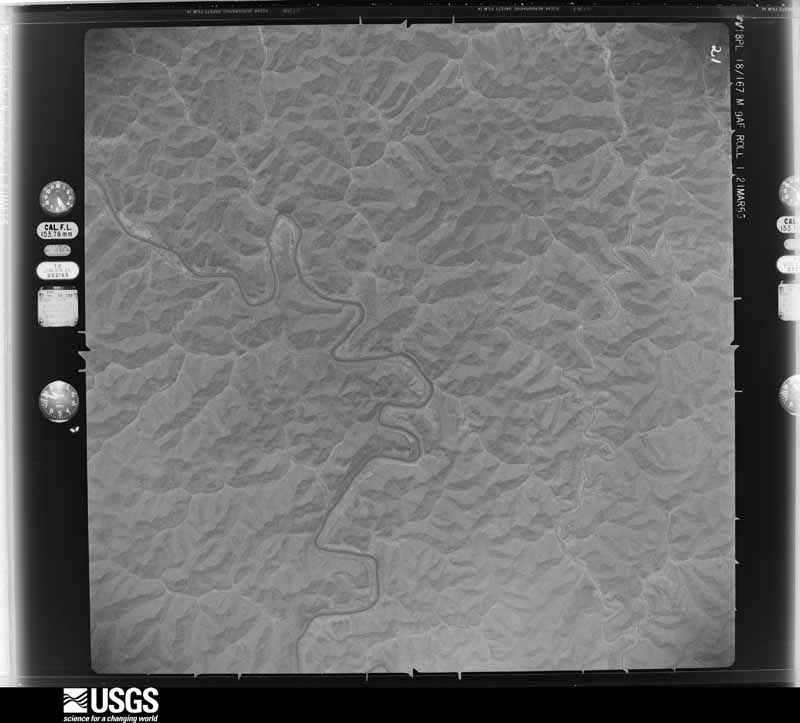
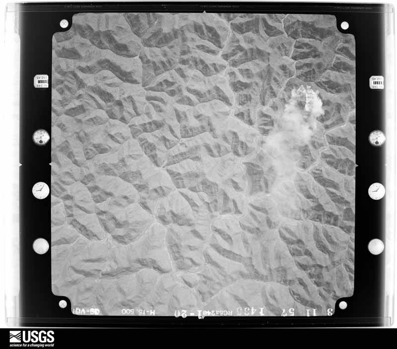
Flown by the U.S. Geological Survey between 1937 and 1989, the Aerial Photo Single Frames collection is the definitive mid-century view of the land: fields, roads and rivers as the camera saw them. The Survey holds 387 frames inside the rectangle that bounds this county; the 24 frames below were taken over the county itself, chosen across the decades of flights (at most four a year from that rectangle), so one flight cannot crowd out the rest. The full set is free to browse and download at EarthExplorer under the dataset Aerial Photo Single Frames.






















The thermometers that kept this county's weather, as the federal records hold them. The extremes below are measured values from those records, not estimates.
Who lived here in 1950, one enumeration district at a time, as the Census Bureau described each district. Each row opens its official National Archives result, with Population Schedules and ED Maps available there.
Every wildfire the federal occurrence database records inside this county: 707 of them, burning about 35,008 acres. None started naturally and 190 were recorded as arson. Each settlement page carries the fires within five miles of it.
| Reported cause | Fires |
|---|---|
| Debris and open burning | 278 |
| Arson/incendiarism | 190 |
| Missing data/not specified/undetermined | 149 |
| Recreation and ceremony | 79 |
| Railroad operations and maintenance | 4 |
| Equipment and vehicle use | 3 |
| Misuse of fire by a minor | 3 |
| Smoking | 1 |
The five largest, by the area the report gives. Five of them were set deliberately.
| Date | Cause | Size | Reported by | Name on the report |
|---|---|---|---|---|
| 8 November 2001 | Arson/incendiarism | 2,200 acres | Kentucky Division of Forestry | not named |
| 12 November 2001 | Arson/incendiarism | 1,880 acres | Kentucky Division of Forestry | not named |
| 31 October 2001 | Arson/incendiarism | 1,500 acres | Kentucky Division of Forestry | not named |
| 15 February 2011 | Recreation and ceremony | 865 acres | Kentucky Division of Forestry | PIGEON ROOST |
| 4 April 2019 | Arson/incendiarism | 814 acres | Kentucky Division of Forestry | CZAR COAL |
| 4 November 2000 | Arson/incendiarism | 800 acres | Kentucky Division of Forestry | not named |
| 22 March 2014 | Missing data/not specified/undetermined | 800 acres | Kentucky Division of Forestry | SALTWELL |
| 15 April 2010 | Debris and open burning | 567 acres | Kentucky Division of Forestry | UPPER LONG BRANCH |
Every settlement page carries the fires within five miles of it - see the settlement index below.
The NOAA Storm Events Database holds 211 reports for this county, causing no deaths, 4 injuries and about $2,759,500 in recorded property damage. Each settlement page carries the reports that name it.
| Kind of event | Reports |
|---|---|
| Thunderstorm Wind | 116 |
| Hail | 44 |
| Flash Flood | 31 |
| Flood | 19 |
| Tornado | 1 |
The most serious of them, by death, then injury, then recorded damage. The accounts are quoted exactly as the forecast office filed them.
| When | Event | Place named | Harm | What the report says |
|---|---|---|---|---|
| January 1997 | Thunderstorm Wind | Inez | 3 hurt, $15,000 | no account filed |
| October 2001 | Thunderstorm Wind | Inez | 1 hurt, $15,000 | Strong winds blew a tree down onto a car along Kentucky Route 40. The driver of the car received minor injuries. Winds also blew the metal roof off the H and R Block Building in downtown Inez and dropped it onto Main Street. All businesses along Main Street were forced to close the day after as crews removed the damage from the road. |
| March 2012 | Tornado (EF2) | Davisport | $2,000,000 | The storm damage survey team from the Jackson Weather Office determined that a tornado exited Johnson County and entered Martin County at about 725 pm EST, 4 miles west of Davisport. The tornado had weakened to EF-2 strength by the time it entered Martin County. The tornado tracked east-northeast across Martin County and exited the county and state of Kentucky just east of Warfield at around 738 pm EST. A two story brick building and several huge trees were blown down in the town of Davella as the tornado passed by just to the north. The tornado then caused damage to the second story of a home in Debord at 732 pm EST. The tornado also caused significant damage in eastern Martin county near the communities of Beauty and Lovely around 738 pm EST. ||The tornado was on the ground for a total of 48 miles in the state of Kentucky and 49 miles total. |
| June 2000 | Flash Flood | Countywide | $100,000 | Slow moving thunderstorms brought a tremendous amount of rain to the area. A bridge was washed out on County Route 2032 at Little Rockcastle Road. A residence in the area also received damage. A residence was flooded on State Route 3 along Rockcastle Creek. Three bridges were also under water in this area. Another bridge was washed out on County Route 1224 on Rockhouse Road. County Route 908, Little Black Log Road, was closed due to high water. Water flowing over State Route 40 closed roads at Black Log and Tomahawk. Water was over the road up to 2 feet deep, these roads were closed for approximately 6 hours. |
| April 2024 | Thunderstorm Wind | Stidham | $50,000 | Martin County dispatch relayed a report of a tree through a roof near the 2000 block of Tomahawk Road northwest of Inez. |
| June 2022 | Thunderstorm Wind | Inez | $50,000 | Numerous trees and power lines were blown down across all of Martin County. Inez was particularly hard hit, with trees and power lines blown down across the city, including at the following locations: Main Street, Route 908 and Turkey Creek Road, New Route 3, Route 645, Old Middlefork Road, Wickerfield Road, Buffalo Horn Road, Rockcastle Road, and Little Rockcastle Road. A tree fell onto and severely damaged a trailer at the Robinson Trailer Park in Inez. A man became trapped in his home in due to downed power lines surrounding the residence, and was still trapped as of that evening. All of the storm damage occurred roughly between 140 pm and 215 pm EDT. However, as of 6:30 pm EDT, power was still out across most of the county. |
| June 2012 | Thunderstorm Wind | Inez | $50,000 | Several trees blown down and power outages. |
| May 2008 | Thunderstorm Wind | Tomahawk | $50,000 | Numerous trees were blown down or shredded by thunderstorm wind gusts. Hall Branch Road was partially blocked by a mudslide and cable lines were down. |
| July 2007 | Thunderstorm Wind | Inez | $50,000 | Martin County 911 center reports trees and power lines down county wide. |
| June 1998 | Flash Flood | Countywide | $50,000 | A trailer court was flooded just south of Inez near Davis Branch. Numerous roads flooded. |
| May 1996 | Flash Flood | Countywide | $50,000 | no account filed |
| August 2007 | Thunderstorm Wind | Inez | $25,000 | Trees down countywide. |
| August 2019 | Thunderstorm Wind | Job | $20,000 | The local Department of Highways reported a large tree fell on a work truck on Route 3 near Marcumtown. |
| November 2003 | Flash Flood | Tomahawk | $15,000 | Kentucky Highway 40 was closed from up to two feet of flowing water and an accompanying mudslide in the community of Tomahawk. Highway 2032 was closed when up to two feet of water covered the road in the community of Pilgrim. Water was over Highway 1224 with one lane closed in the community of Davisport. Rockcastle Road (Kentucky Highway 3) was completely blocked due to a mud slide north of Inez, near Grassy Branch, knocking trees down onto power lines and causing outages. Two homes received flood damage and four received damage from a mud slide in Tomahawk, and one home on Buffalo Horn Branch had a flooded basement. |
| June 2010 | Thunderstorm Wind | Job | $10,000 | Trees were blown down on Peter Cave Branch and Big Lick Branch in Job. |
| June 2007 | Thunderstorm Wind | Tomahawk | $10,000 | Several trees blown down. |
| May 2004 | Thunderstorm Wind | Tomahawk | $10,000 | Several trees along with power lines were down along Route 40. |
| July 2004 | Thunderstorm Wind | Beauty | $10,000 | Two trees were blown down near the junction of Route 40 and Highway 2031. Trees took down power lines, leaving around 1,000 people without power. |
| April 1998 | Flash Flood | Countywide | $10,000 | no account filed |
| March 1997 | Flood | Inez | $10,000 | no account filed |
| February 2009 | Thunderstorm Wind | Inez | $9,000 | Several trees were blown down. One tree was across a power line and another across a road. |
| April 2009 | Thunderstorm Wind | Inez | $9,000 | Several trees and large limbs were blown down. |
| April 1996 | Thunderstorm Wind | Debord | $8,000 | no account filed |
| January 2008 | Thunderstorm Wind | Inez | $7,000 | Trees were blown down and blocking roads at several locations across the county. Highways 2032, 1884 and 2550 were all blocked by felled trees by wind gusts estimated at 62 mph. |
| June 2005 | Thunderstorm Wind | Inez | $7,000 | Several trees down in the area. A large tree limb destroyed a car. |
| May 2025 | Thunderstorm Wind | Pilgrim | $5,000 | Martin County dispatch reported over a dozen instances of trees blown down onto or along highways in the county. Some of the trees involved power and phone lines. The Pilgram, Warfield, and Inez communities may have been the most affected. |
| July 2023 | Flood | Oppy | $5,000 | A video showed water about 1.5 inches deep in the basement of a residence located in far eastern Martin county, near the Virginia state border, just north of the community of Nolan. The river and the creeks were still in their banks at the time of the report, but were running high. |
| April 2011 | Thunderstorm Wind | Pilgrim | $5,000 | There were trees blown down on Meade House road in Pilgrim. |
| April 2011 | Thunderstorm Wind | Warfield | $5,000 | There were trees blown down on route 292 Hode road in Warfield. |
| October 2010 | Thunderstorm Wind | Inez | $5,000 | Trees were blown down in Inez. |
| August 2007 | Thunderstorm Wind | Pilgrim | $5,000 | Trees down on Highway 292 in Riverfront area, right on Martin county line. |
| August 2005 | Flash Flood | Countywide | $5,000 | A person was stranded in a car at the intersection of Highways 2032 and 1939 near Coalpoint. Numerous roads throughout the county were impassible and closed. Some communities where the flooding occurred included Blackwolf, Wolfcreek, White Oak, Rockhorse, Pigeon Roost, Setzer Branch, and Crum Branch. |
| July 2003 | Thunderstorm Wind | Beauty | $5,000 | A tree fell on a house and a utility pole blew down on another residence on Lower Poplar Fork, off of Highway 2031. |
| April 2002 | Hail | Threeforks | $5,000 | Cars were damaged from large hail. |
| May 2002 | Thunderstorm Wind | Countywide | $5,000 | Several trees were downed by strong thunderstorm winds. Trees were reported down seven miles north of Inez, in Inez, and in Tomahawk. A 60 MPH wind gust was measured in Inez. |
| June 1998 | Flash Flood | Moree | $5,000 | Wolf Creek overflowed its banks. Houses and roads flooded. |
| March 2008 | Thunderstorm Wind | Tomahawk | $4,000 | Three trees were blown down on Route 40 near Tomahawk. Another tree was blown down on Route 3 near Inez. |
| June 2022 | Thunderstorm Wind | Pilgrim | $3,000 | Numerous trees and power lines were blown down along Peter Cave Road near the community of Pilgrim. |
| June 2022 | Thunderstorm Wind | Tomahawk | $3,000 | Numerous trees and power lines were blown down in the Tomahawk community. |
| June 2022 | Thunderstorm Wind | Lovely | $3,000 | Numerous trees and power lines were blown down along Riverfront Road in the community of Lovely. |
| June 2022 | Thunderstorm Wind | Warfield | $3,000 | Numerous trees and power lines were blown down along Hode Road in the community of Warfield. |
| June 2022 | Thunderstorm Wind | Threeforks | $3,000 | Numerous trees and power lines were blown down along Pigeon Roost Road near the community of Pilgrim. |
| October 2001 | Thunderstorm Wind | Lovely | $3,000 | Strong winds blew off a roof on a mobile home. |
| July 2000 | Thunderstorm Wind | Inez | $3,000 | Severe thunderstorm winds produced an 80 foot wide swath of tree damage. |
| July 1997 | Thunderstorm Wind | Inez | $3,000 | Trees were downed, and there was some minor roof damage. |
| June 1996 | Thunderstorm Wind | Inez | $3,000 | no account filed |
| May 1996 | Thunderstorm Wind | Milo | $3,000 | no account filed |
| October 2010 | Thunderstorm Wind | Warfield | $2,000 | Trees were blown down in Warfield. |
| March 2008 | Thunderstorm Wind | Inez | $2,000 | A couple of trees fell on roadways on old Route 3 at the one mile marker and on Route 40 near Ooten. |
| February 2008 | Thunderstorm Wind | Inez | $2,000 | Two trees were blown down by thunderstorm wind gusts on Route 908 near the Turkey Creek area, blocking both lanes of traffic. |
| April 2006 | Thunderstorm Wind | Inez | $2,000 | Roof blown off a mobile home. Three trees also blown down. |
| July 2003 | Thunderstorm Wind | Inez | $2,000 | A tree blew onto a garage. |
| October 2001 | Thunderstorm Wind | Inez | $2,000 | Strong winds blew an out building down and onto the road. |
| May 2022 | Thunderstorm Wind | Hode | $1,000 | Trees were blown down onto power lines in the community of Hode. |
| May 2022 | Thunderstorm Wind | Calf Creek | $1,000 | Trees were blown down and onto power lines near Calf Creek, resulting in power outages at nearby locations. |
| May 2016 | Flood | Inez | $1,000 | Water was over Turkey Creek Rd at the Inez water plant. One lane of the road was completely blocked with the other lane partially blocked at this location. |
| February 2015 | Flood | Inez | $1,000 | Ice jams caused area creeks to leave their banks and flood multiple homes in Inez. |
| March 2015 | Flood | Stidham | $1,000 | Kentucky 3411 at the Alpha Branch Bridge was impassable due to flooding. |
| April 2015 | Flood | Inez | $1,000 | Highway 40 near Blacklog Fork was flooded. |
| June 2014 | Flash Flood | Davella | $1,000 | Flood waters entered two homes and several garages in Davella. Several heating and cooling units at residences in the area were destroyed by the flood waters. |
The Survey's mineral resources record lists 4 workings inside this county. 3 still produce and 1 is closed or unrecorded. Each settlement page carries the workings within five miles of it.
| Commodity | Workings |
|---|---|
| Sand and Gravel, Construction | 3 |
| Clay | 1 |
The least common of them first, because a county's hundredth gravel pit says nothing its first ten did not.
| Where | Site | Commodity | Status | Recorded |
|---|---|---|---|---|
| Highway Roadcut Clay Bed | Clay | Prospect | ||
| Inez Sand | Sand and Gravel, Construction | Producer | ||
| Joe Fannin | Sand and Gravel, Construction | Producer | ||
| Rockcastle Creek Mine | Sand and Gravel, Construction | Producer |
Named settlements recorded in the Geographic Names Information System, each with the topographic sheets covering it. Villages, hamlets and abandoned places alike. Each is shown with the nearest named watercourse or landform and the survey quadrangle it falls on.
Warfield census division · 41203 · On Right Fork Buck Creek · Kermit quadrangle
26 sheets, 1887 to 1992
Inez census division · 41224 · On Spring Branch · Milo quadrangle
17 sheets, 1886 to 1992
No longer a settlement
Inez census division · 41262 · On Horsepen Branch · Inez quadrangle
16 sheets, 1886 to 1992
Warfield census division · 41267 · On Little Elk Creek · Webb quadrangle
25 sheets, 1887 to 1982
Threeforks census division · 41250 · On Caney Fork · Varney quadrangle
20 sheets, 1887 to 1992
Threeforks census division · 41250 · On Ashlog Branch · Kermit quadrangle
26 sheets, 1887 to 1992
Warfield census division · 41250 · On Pipe Mud Branch · Kermit quadrangle
26 sheets, 1887 to 1992
Inez census division · 41262 · On Williamson Branch · Milo quadrangle
17 sheets, 1886 to 1992
Threeforks census division · 41250 · Near Sycamore Hollow · Kermit quadrangle
26 sheets, 1887 to 1992
Inez census division · 41262 · On Tomahawk Branch · Inez quadrangle
16 sheets, 1886 to 1992
Warfield census division · 41267 · On Buck Creek · Kermit quadrangle
26 sheets, 1887 to 1992
Warfield census division · 41231 · On Buck Branch · Kermit quadrangle
26 sheets, 1887 to 1992
No longer a settlement
The vanished settlements of Martin County: the places named above that are no longer on the map.