 Block
From the record
2 National Register listings published here.
Sources: the National Register database, National Park Service
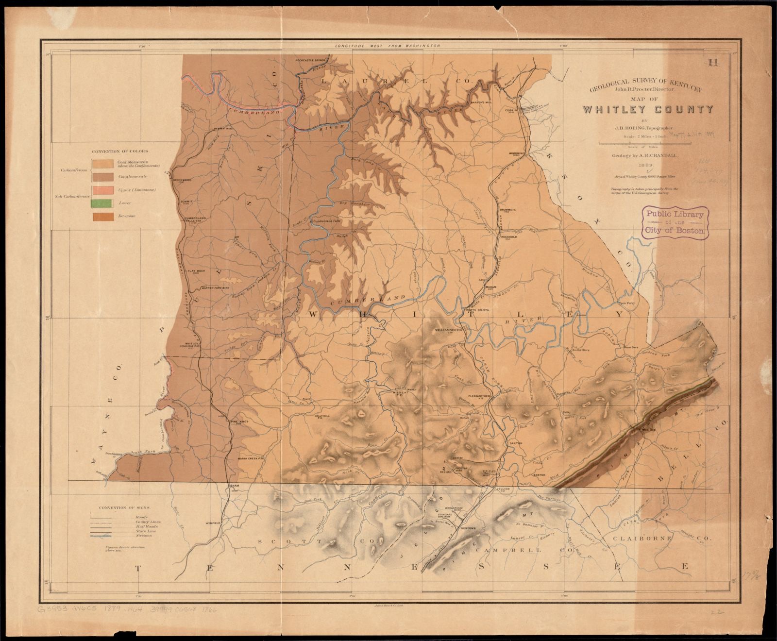
60 topographic sheets cover 32 settlements here, and 2 properties are on the National Register of Historic Places.
2 National Register listings published here.
Sources: the National Register database, National Park Service
Taken for the Office of War Information and the Farm Security Administration, who photographed the country between 1935 and 1944. Works of United States government photographers, with no known restriction on use. Each opens its catalogue record.


Every property in this county listed on the National Register of Historic Places, with the year it was listed and the federal nomination document.
| Photograph | Property | Type | Listed | Reference |
|---|---|---|---|---|
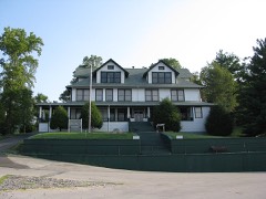 | Stearns Administrative and Commercial District | district | 1988 | 88002528 |
| Stearns Golf Course | district | 2015 | 15000654 |
Selected from the Digital Public Library of America's 1 image records catalogued for this county. Every one shown here carries a public-domain status or a licence that permits reuse on a site that carries advertising; non-commercial, share-alike and restricted images are excluded. The selection is spread across the county's towns (at most eight per town), so no single institution's bulk upload crowds out the rest. Each opens the holding library's record, and the complete set at the Digital Public Library of America is one click away.
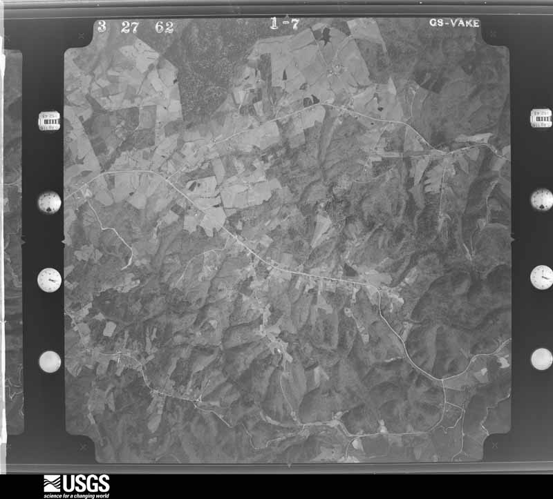
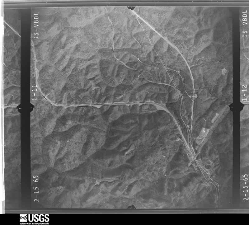
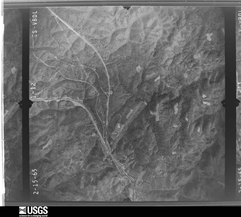
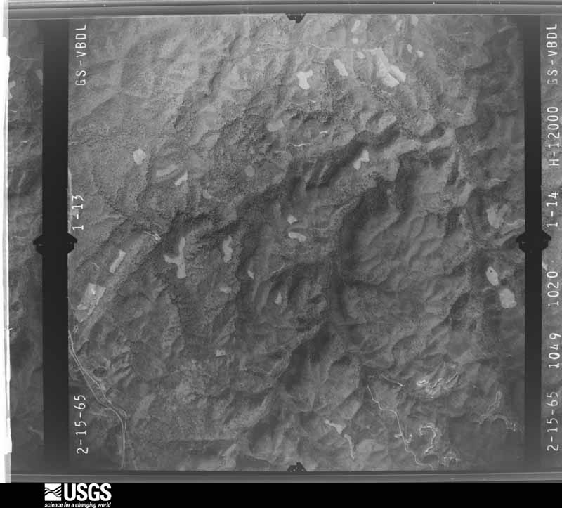
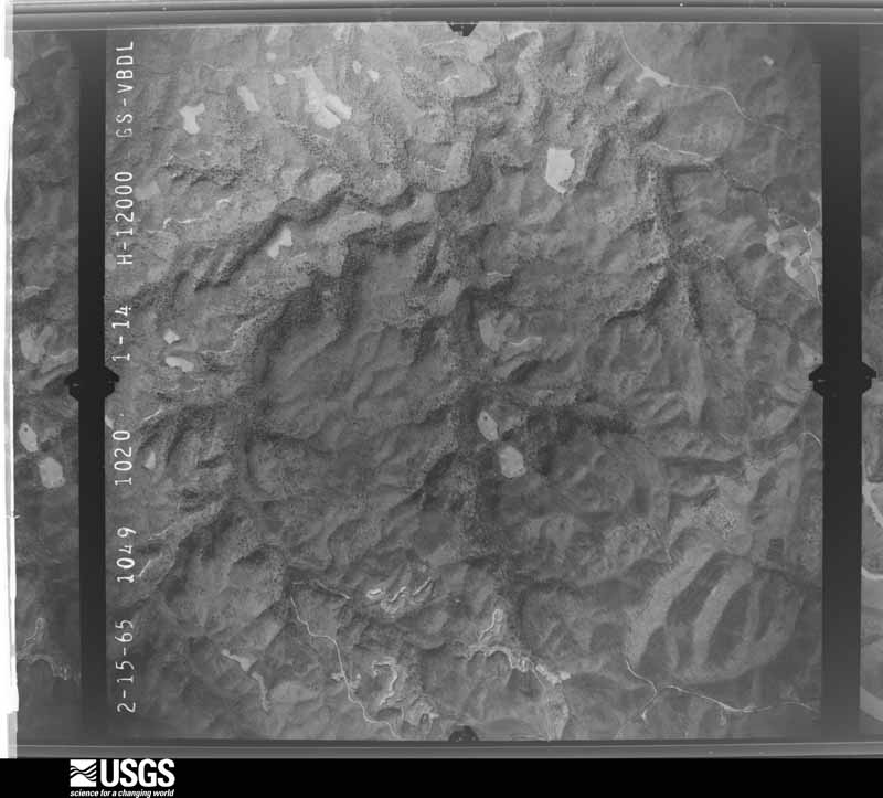
Flown by the U.S. Geological Survey between 1937 and 1989, the Aerial Photo Single Frames collection is the definitive mid-century view of the land: fields, roads and rivers as the camera saw them. The Survey holds 642 frames inside the rectangle that bounds this county; the 23 frames below were taken over the county itself, chosen across the decades of flights (at most four a year from that rectangle), so one flight cannot crowd out the rest. The full set is free to browse and download at EarthExplorer under the dataset Aerial Photo Single Frames.


















The thermometers that kept this county's weather, and the gages that measured the flow of its streams, as the federal records hold them. The extremes below are measured values from those records, not estimates.
Who lived here in 1950, one enumeration district at a time, as the Census Bureau described each district. Each row opens its official National Archives result, with Population Schedules and ED Maps available there.
Every wildfire the federal occurrence database records inside this county: 707 of them, burning about 19,434 acres. 7 started naturally and 478 were recorded as arson. Each settlement page carries the fires within five miles of it.
| Reported cause | Fires |
|---|---|
| Arson/incendiarism | 478 |
| Debris and open burning | 108 |
| Missing data/not specified/undetermined | 47 |
| Recreation and ceremony | 27 |
| Power generation/transmission/distribution | 15 |
| Railroad operations and maintenance | 13 |
| Equipment and vehicle use | 8 |
| Natural | 7 |
| Smoking | 2 |
| Misuse of fire by a minor | 2 |
The five largest, by the area the report gives. 7 of them were set deliberately.
| Date | Cause | Size | Reported by | Name on the report |
|---|---|---|---|---|
| 30 October 2000 | Arson/incendiarism | 2,079 acres | Big South Fork National River and Recreation Area | SCHOOLHOUS |
| 31 October 2000 | Arson/incendiarism | 1,952 acres | Daniel Boone National Forest | MAYBE LATER |
| 12 November 2005 | Arson/incendiarism | 1,555 acres | Daniel Boone National Forest | CAP KNOB |
| 11 November 2001 | Arson/incendiarism | 780 acres | Daniel Boone National Forest | GREAT GULF |
| 28 November 2017 | Arson/incendiarism | 667 acres | Daniel Boone National Forest | LITTLE ROCK CREEK |
| 22 November 2012 | Arson/incendiarism | 580 acres | Daniel Boone National Forest | TURKEY |
| 22 April 1999 | Missing data/not specified/undetermined | 500 acres | Daniel Boone National Forest | PIGSKIN |
| 31 October 2000 | Arson/incendiarism | 500 acres | Daniel Boone National Forest | HONEY BEE |
Every settlement page carries the fires within five miles of it - see the settlement index below.
The NOAA Storm Events Database holds 310 reports for this county, causing 2 deaths, 25 injuries and about $3,829,500 in recorded property damage. Each settlement page carries the reports that name it.
| Kind of event | Reports |
|---|---|
| Thunderstorm Wind | 174 |
| Hail | 67 |
| Flash Flood | 24 |
| Flood | 18 |
| Heavy Rain | 15 |
| Tornado | 10 |
| Funnel Cloud | 2 |
The most serious of them, by death, then injury, then recorded damage. The accounts are quoted exactly as the forecast office filed them.
| When | Event | Place named | Harm | What the report says |
|---|---|---|---|---|
| April 1980 | Tornado (F2) | not stated | 2 killed, 9 hurt, $250,000 | no account filed |
| April 1974 | Tornado (F2) | not stated | 11 hurt, $25,000 | no account filed |
| May 1973 | Tornado (F2) | not stated | 5 hurt, $25,000 | no account filed |
| September 2018 | Thunderstorm Wind | Stearns | $2,000,000 | Dispatch reported a couple of very large storage buildings, composed of metal siding and wood framing, were destroyed as severe thunderstorm winds moved through south of Whitley City. |
| November 2002 | Thunderstorm Wind | Pine Knot | $250,000 | Straight line wind caused significant damage to the Pine Knot area. During a church service, the roof of a church was torn apart, along with terrible structural damage. The steeple was completely blown off and destroyed. The church was declared a total loss. The picnic shelter next door was completely flattened. Miraculously, nobody sustained injuries, omitting a couple of scrapes and bruises. Several outbuildings were damaged and blown off of foundations. Several trailer homes suffered roof damage and were blown off of their foundations. Numerous large trees in the area were blown down and several motor vehicles sustained damage. |
| March 1967 | Tornado (F3) | not stated | $250,000 | no account filed |
| March 2020 | Tornado (EF1) | Marshes Siding | $150,000 | A supercell thunderstorm tracked across McCreary County during the late evening hours of March 12th. A National Weather Service Jackson survey team found intermittent damage along the entire path. There were three distinct areas of damage where the tornado touched down. On Chitwood Ridge Rd, several hardwood trees were snapped off. There was also a house with some roof damage.||The next area of tornado damage was on the northern side of Whitley City along north Highway 1651, where more hardwood trees were snapped off along with some damage to a few two-story buildings.||Finally, the third area of tornado damage was northeast of Whitley City on Stephens Farm Rd. A tree landed on a house, leading to major damage. There were also several more houses with roof damage and additional trees snapped off. |
| June 2004 | Thunderstorm Wind | Whitley City | $150,000 | There were roofs and porches blown off of homes. Trees and power lines were down across the county. Nearly every tree in one hollow was blown down. |
| February 2020 | Flood | Hill Top | $70,000 | Emergency Management observed portions of Yamacraw Boat Dock Rd west of Stearns along with a concrete boat ramp washed out due to flood waters. The road bed under the road and boat ramp washed down the hill side causing everything to crack and break loose, sliding down the hillside. |
| March 2020 | Thunderstorm Wind | Whitley City | $55,000 | Fire Rescue officials reported homes damaged in the Williamsburg St/Trooper Island area east of Whitley City. Power lines were also downed. |
| August 2009 | Thunderstorm Wind | Pine Knot | $50,000 | Northfork Southern Railroad was closed for approximately 3 hours due to downed trees on the tracks between Century Lane and Roundtop Road. Elsewhere across the county, a tree fell on a house in the Whitley City area and several roads were closed due to downed trees. |
| July 2008 | Thunderstorm Wind | Whitley City | $50,000 | Trees were blown down county wide by thunderstorm wind gusts. |
| June 2009 | Thunderstorm Wind | Whitley City | $30,000 | Trees down in Whitley City and throughout the county. |
| May 2008 | Thunderstorm Wind | Whitley City | $30,000 | Numerous trees were blown down by thunderstorm wind gusts throughout the county, particularly in and around Whitley City. |
| January 2008 | Thunderstorm Wind | Whitley City | $30,000 | Numerous trees were blown down county wide by wind gusts estimated at 63 mph. |
| April 1998 | Tornado (F2) | Bell Farm | $30,000 | no account filed |
| March 1967 | Tornado (F2) | not stated | $25,000 | no account filed |
| March 2020 | Thunderstorm Wind | Marshes Siding | $15,000 | A citizen reported large amounts of debris east of the train tracks at the Medical Plaza near Marshes Siding. |
| March 2012 | Thunderstorm Wind | Stearns | $15,000 | Trees and power lines were blown down in Stearns. |
| May 2011 | Thunderstorm Wind | Marshes Siding | $15,000 | Trees were blown down in the north end of the county along and north of a line from Funston to Sawyer.. |
| July 2008 | Thunderstorm Wind | Stearns | $15,000 | Three power poles and several trees were blown down on Highway 1363 near Stearns. |
| June 2006 | Thunderstorm Wind | Whitley City | $15,000 | Multiple trees and power lines down across the county. Tree also on fire in Whitley City. |
| January 1997 | Thunderstorm Wind | Whitley City | $15,000 | no account filed |
| April 2012 | Thunderstorm Wind | Whitley City | $10,000 | There were numerous trees and power lines blown down. A roof was blown off of building and now on top of a car wash. |
| February 2012 | Thunderstorm Wind | Marshes Siding | $10,000 | Trees and large limbs were blown down at Marshes Siding. A possible funnel cloud was also spotted. |
| April 2011 | Thunderstorm Wind | Stearns | $10,000 | The superintendent of McCreary county schools reported that the McCreary County Middle sustained damage from the storm. Several ridge caps were torn from the roof of the school and the press box at the football field was completely ripped off the bleachers. |
| April 2011 | Thunderstorm Wind | Silerville | $10,000 | The roof of a barn was blown off. A board was blown through the window of a truck. The top snapped off of a 20 inch diameter tree. |
| June 2009 | Thunderstorm Wind | Whitley City | $10,000 | A trained spotter estimated winds of up to 60 mph with multiple trees down 3 miles southeast of Whitley City. |
| March 2008 | Thunderstorm Wind | Stearns | $10,000 | Trees were blown down on Highways 1470, 742, and 1045. |
| July 2008 | Thunderstorm Wind | Stearns | $10,000 | Numerous large tree limbs the size of a mans upper arm were torn from trees on Pigskin Road by thunderstorm wind gusts. |
| September 2008 | Thunderstorm Wind | Pine Knot | $10,000 | Six or seven telephone poles were blown down by thunderstorm wind gusts on Highway 92 East between Route 1044 and Poplar Ford Road. |
| March 2002 | Flash Flood | Stearns | $10,000 | A trained spotter reported 4.3 inches of rain had fallen since March 16. This resulted in repeated episodes of flash flooding and numerous road closures. |
| April 1998 | Flash Flood | Countywide | $10,000 | no account filed |
| November 1996 | Flash Flood | Hollyhill | $10,000 | no account filed |
| June 2018 | Thunderstorm Wind | Whitley City | $8,000 | A Skywarn Spotter reported a portion of a roof of a commercial building blown off, along with a couple of carports being blown over, in Whitley City. |
| June 2006 | Thunderstorm Wind | Whitley City | $8,000 | Numerous trees and power lines down. |
| June 2009 | Thunderstorm Wind | Pine Knot | $7,000 | Several trees were blown down in the Pine Knot area around the intersection of Highways 27 and 92. |
| May 2024 | Thunderstorm Wind | Marshes Siding | $5,000 | Reports of trees and power lines down throughout the county, including a few trees blocking roadways. |
| February 2020 | Flash Flood | Hollyhill | $5,000 | Dispatch reported several roads with water rushing over them along Osborn Creek and near Hollyhill. This includes Granny Holt Knob being closed to traffic. |
| June 2019 | Thunderstorm Wind | Hill Top | $5,000 | Dispatch reported trees blown down throughout much of McCreary County, especially the northern portion of the county south to Whitley City. |
| April 2011 | Thunderstorm Wind | Marshes Siding | $5,000 | There were trees blown down. |
| August 2009 | Thunderstorm Wind | Pine Knot | $5,000 | Trees were blown down on Cal Hill Road. |
| June 2009 | Thunderstorm Wind | Whitley City | $5,000 | Trees were blown down in Whitley City between 553 and 623 pm. |
| March 2008 | Thunderstorm Wind | Whitley City | $5,000 | A tree fell on a powerline near Wagon Ridge on Highway 92. A tree also fell on a power line in Vanover Ridge near Parkers Lake. |
| July 2008 | Thunderstorm Wind | Stearns | $5,000 | Two trees were blown down, including one that fell on a truck. |
| July 2004 | Thunderstorm Wind | Parkers Lake | $5,000 | Large tree limbs and power lines were down. |
| May 1998 | Thunderstorm Wind | Whitley City | $5,000 | Trees were downed. |
| June 1997 | Tornado (F0) | Revelo | $5,000 | A small tornado downed trees and power lines. |
| June 1997 | Flash Flood | Whitley City | $5,000 | Flash flooding occurred along Hayes and Marsh Creeks. A car was washed downstream. |
| April 2011 | Thunderstorm Wind | Gilreath | $4,000 | There was damage to a mobile home and some 3 to 4 inch diameter tree limbs down on highway 92. |
| January 2008 | Thunderstorm Wind | Hollyhill | $4,000 | Trees were blown down onto Oscar Morgan Road at Highway 1470 by wind gusts estimated at 61 mph. |
| May 2024 | Thunderstorm Wind | Marshes Siding | $3,000 | Trees and powerlines were downed north of Whitley City. Additional tree damage was reported countywide. |
| April 2024 | Thunderstorm Wind | Marshes Siding | $3,000 | Downed trees and powerlines along the 800 block of KY-700 (Sandhill Road), NNE of Whitley City. |
| May 2011 | Thunderstorm Wind | Marshes Siding | $3,000 | Some trees were blown down in the north end of the county. |
| May 2011 | Thunderstorm Wind | Strunk | $3,000 | Trees were blown down on Rock Creek Rd, Whirly Circle, and Lum Strunk Rd. |
| May 2011 | Thunderstorm Wind | Whitley City | $3,000 | Trees were blown down on Alum Ford Rd at Yahoo Falls. |
| June 2011 | Thunderstorm Wind | Pine Knot | $3,000 | Trees were blown down with an estimated wind gust of 40-45 mph. |
| May 2011 | Thunderstorm Wind | Marshes Siding | $3,000 | Trees were blown down in a persons yard. |
| June 2009 | Thunderstorm Wind | Whitley City | $3,000 | A was blown down and onto a power line on Beulah Heights Road. |
| June 2009 | Thunderstorm Wind | Greenwood | $3,000 | Three structures were damaged by thunderstorm wind gusts. |
The Survey's mineral resources record lists 3 workings inside this county. None of them still produces: all are closed or unrecorded. Each settlement page carries the workings within five miles of it.
| Commodity | Workings |
|---|---|
| Clay | 2 |
| Silica | 1 |
The least common of them first, because a county's hundredth gravel pit says nothing its first ten did not.
| Where | Site | Commodity | Status | Recorded |
|---|---|---|---|---|
| Yamacraw Sandstone Roadcut | Silica | Prospect | ||
| Parkers Lake Shale | Clay | Prospect | ||
| Whitley Clay Bed | Clay | Prospect |
Named settlements recorded in the Geographic Names Information System, each with the topographic sheets covering it. Villages, hamlets and abandoned places alike. Each is shown with the nearest named watercourse or landform and the survey quadrangle it falls on.
Stearns-Whitley City census division · 42649 · On Icecamp Branch · Barthell quadrangle
9 sheets, 1934 to 1981
Parkers Lake census division · 42653 · On Freeman Fork · Wiborg quadrangle
16 sheets, 1890 to 1981
Co-operative census division · 42647 · On Rock Creek · Barthell quadrangle
9 sheets, 1934 to 1981
No longer a settlement
Pine Knot census division · 42649 · On Devils Creek · Barthell quadrangle
9 sheets, 1934 to 1981
Co-operative census division · 42647 · On Wolfpen Branch · Barthell quadrangle
9 sheets, 1934 to 1981
Pine Knot census division · 42649 · On Roaring Paunch Creek · Barthell quadrangle
9 sheets, 1934 to 1981
Pine Knot census division · 42649 · Near Stephens Knob · Ketchen quadrangle
16 sheets, 1890 to 1981
Co-operative census division · 42647 · Near Schoolhouse Hollow · Barthell quadrangle
9 sheets, 1934 to 1981
Parkers Lake census division · 42653 · Near Franklin Hollow · Wiborg quadrangle
16 sheets, 1890 to 1981
Parkers Lake census division · 42634 · Near Swain Ridge · Hail quadrangle
17 sheets, 1890 to 1981
Parkers Lake census division · 42634 · Near Miller Hollow · Wiborg quadrangle
16 sheets, 1890 to 1981
Stearns-Whitley City census division · 42649 · On Buncomb Branch · Whitley City quadrangle
16 sheets, 1890 to 1981
Stearns-Whitley City census division · 42647 · On Wolf Creek · Barthell quadrangle
9 sheets, 1934 to 1981
Pine Knot census division · 40769 · On Clear Creek · Hollyhill quadrangle
16 sheets, 1890 to 1981
Parkers Lake census division · 42634 · On Tom Fork · Cumberland Falls quadrangle
16 sheets, 1890 to 1981
Stearns-Whitley City census division · 42653 · Whitley City quadrangle
16 sheets, 1890 to 1981
Parkers Lake census division · 42653 · On Mile Branch · Nevelsville quadrangle
12 sheets, 1932 to 1981
Co-operative census division · 42647 · Near Poplar Spring Hollow · Barthell quadrangle
9 sheets, 1934 to 1981
Pine Knot census division · 42635 · On Wolf Pen Creek · Whitley City quadrangle
16 sheets, 1890 to 1981
Stearns-Whitley City census division · 42647 · On Battery Creek · Whitley City quadrangle
16 sheets, 1890 to 1981
Parkers Lake census division · 42634 · Near Barnett Ridge · Sawyer quadrangle
16 sheets, 1890 to 1981
Co-operative census division · 42647 · On Corder Creek · Coopersville quadrangle
11 sheets, 1932 to 1981
Stearns-Whitley City census division · 42647 · Near American Legion Knoll · Barthell quadrangle
9 sheets, 1934 to 1981
Stearns-Whitley City census division · 42647 · Near American Legion Knoll · Whitley City quadrangle
16 sheets, 1890 to 1981
Pine Knot census division · 42649 · On Chewford Creek · Winfield quadrangle
16 sheets, 1890 to 1981
Co-operative census division · 42647 · On White Oak Creek · Barthell quadrangle
9 sheets, 1934 to 1981
Stearns-Whitley City census division · 42653 · On East Apple Tree Branch · Whitley City quadrangle
16 sheets, 1890 to 1981
Parkers Lake census division · 42653 · On North Fork Koger Creek · Wiborg quadrangle
16 sheets, 1890 to 1981
Stearns-Whitley City census division · 42647 · On Worley Branch · Barthell quadrangle
9 sheets, 1934 to 1981
Stearns-Whitley City census division · 42647 · On Rock Creek · Barthell quadrangle
9 sheets, 1934 to 1981
The vanished settlements of McCreary County: the places named above that are no longer on the map.