 Block
From the record
5 National Register listings published here.
Sources: the National Register database, National Park Service
35 topographic sheets cover 21 settlements here, and 5 properties are on the National Register of Historic Places.
5 National Register listings published here.
Sources: the National Register database, National Park Service
Every property in this county listed on the National Register of Historic Places, with the year it was listed and the federal nomination document.
| Photograph | Property | Type | Listed | Reference |
|---|---|---|---|---|
 | Bell House, The | building | 2016 | 16000012 |
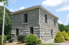 | Metcalfe County Jail | building | 2004 | 04000791 |
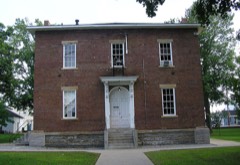 | Metcalfe County Kentucky Courthouse | building | 2000 | 00000271 |
| Stockton-Ray House | building | 1992 | 92000289 | |
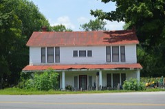 | Sulphur Well Historic District | district | 1998 | 98000932 |
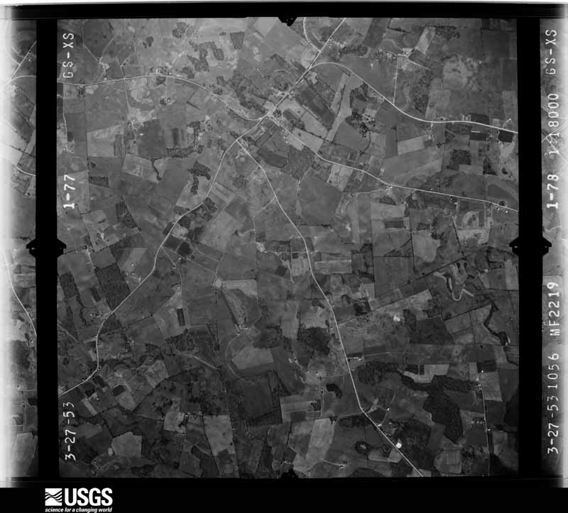
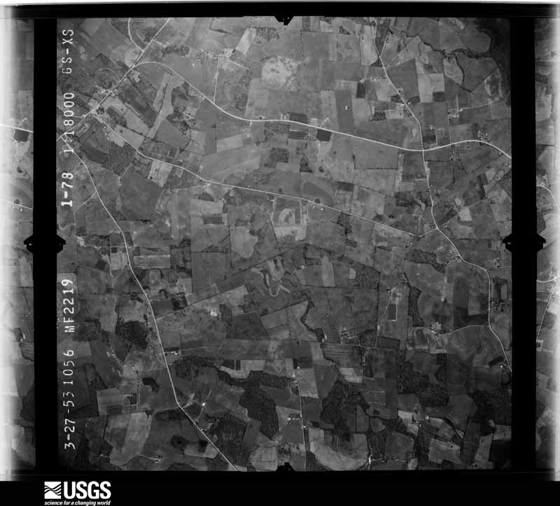
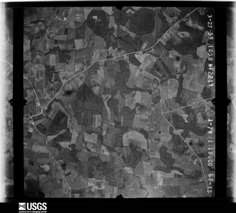
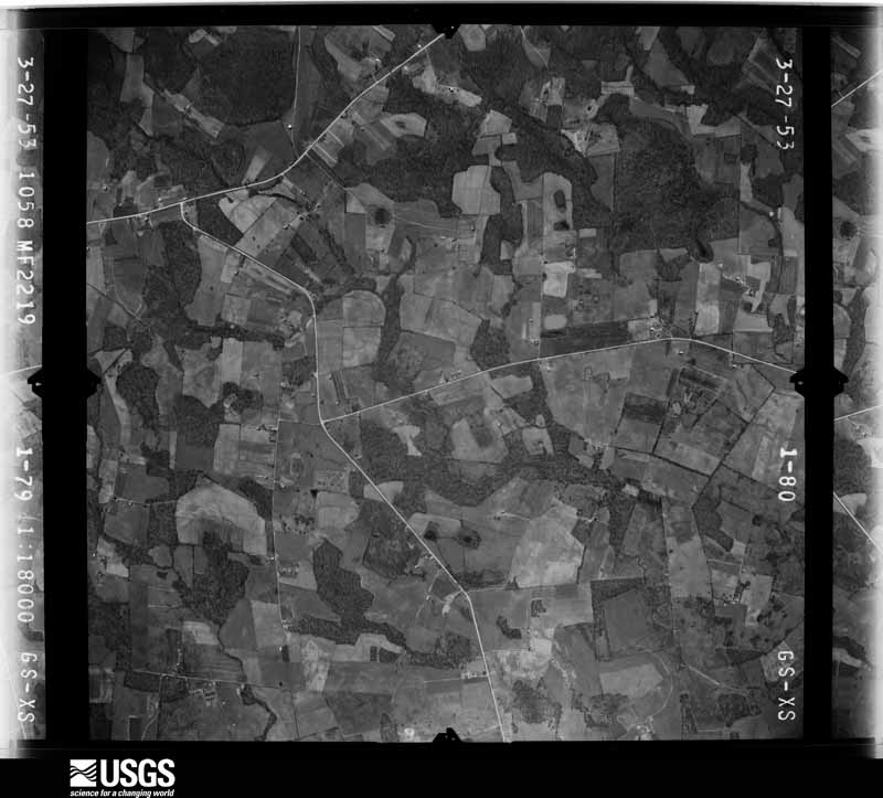
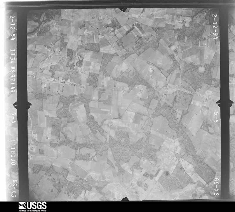
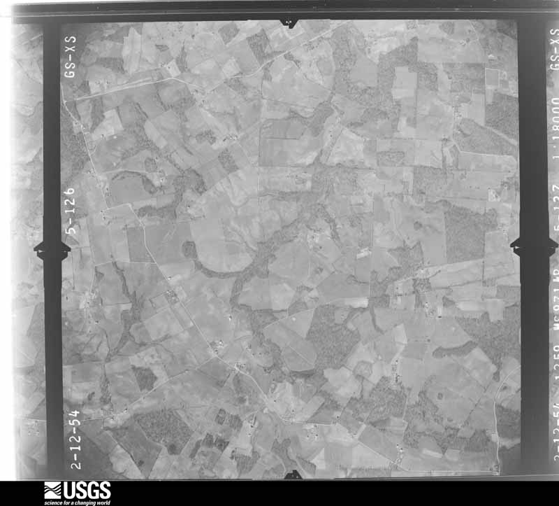
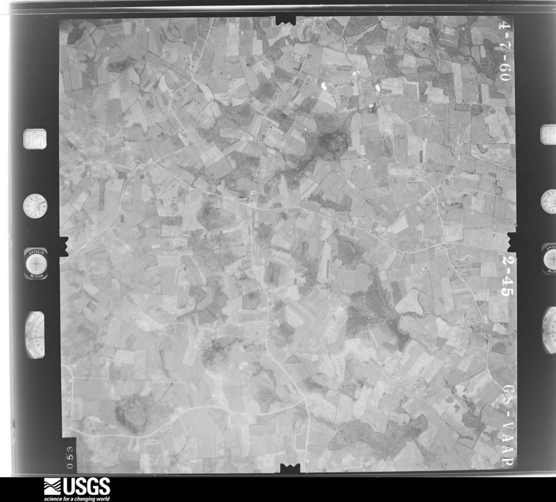
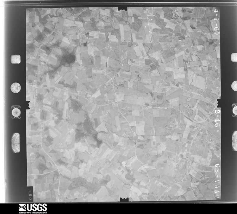
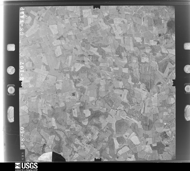
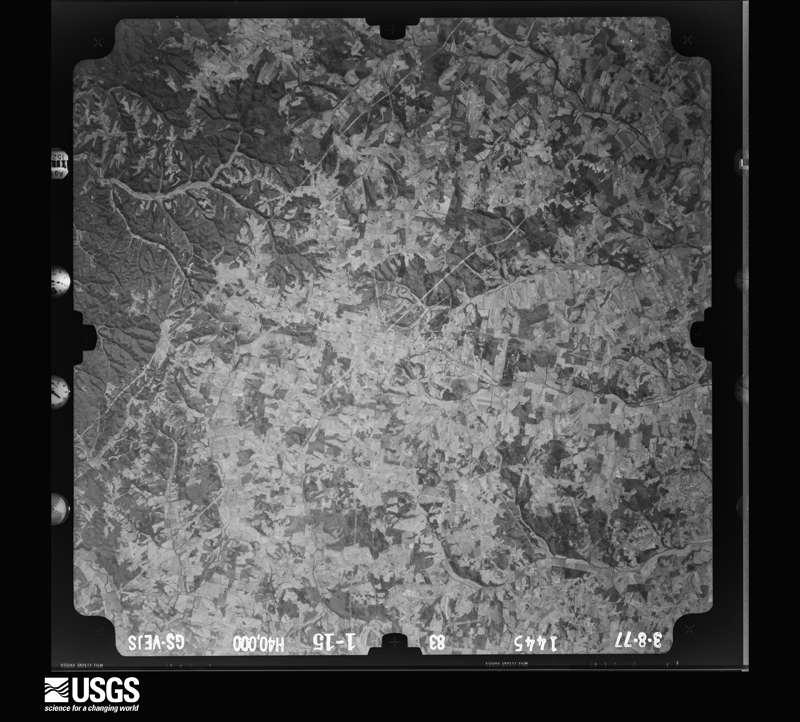
Flown by the U.S. Geological Survey between 1937 and 1989, the Aerial Photo Single Frames collection is the definitive mid-century view of the land: fields, roads and rivers as the camera saw them. The Survey holds 405 frames inside the rectangle that bounds this county; the 23 frames below were taken over the county itself, chosen across the decades of flights (at most four a year from that rectangle), so one flight cannot crowd out the rest. The full set is free to browse and download at EarthExplorer under the dataset Aerial Photo Single Frames.













The thermometers that kept this county's weather, and the gages that measured the flow of its streams, as the federal records hold them. The extremes below are measured values from those records, not estimates.
Who lived here in 1950, one enumeration district at a time, as the Census Bureau described each district. Each row opens its official National Archives result, with Population Schedules and ED Maps available there.
Every wildfire the federal occurrence database records inside this county: 117 of them, burning about 1,133 acres. 2 started naturally and 15 were recorded as arson. Each settlement page carries the fires within five miles of it.
| Reported cause | Fires |
|---|---|
| Debris and open burning | 47 |
| Missing data/not specified/undetermined | 28 |
| Arson/incendiarism | 15 |
| Recreation and ceremony | 10 |
| Railroad operations and maintenance | 8 |
| Equipment and vehicle use | 6 |
| Natural | 2 |
| Smoking | 1 |
The five largest, by the area the report gives. None of them was recorded as arson.
| Date | Cause | Size | Reported by | Name on the report |
|---|---|---|---|---|
| 30 October 2010 | Debris and open burning | 203 acres | Kentucky Division of Forestry | GORDEN BRANCH |
| 11 November 2005 | Missing data/not specified/undetermined | 160 acres | Kentucky Division of Forestry | DIVIDING RIDGE |
| 6 January 2012 | Debris and open burning | 74 acres | Kentucky Division of Forestry | SMITH FARM |
| 31 October 2010 | Debris and open burning | 63 acres | Kentucky Division of Forestry | 200 DOLLAR FIRE |
| 6 April 2010 | Debris and open burning | 50 acres | Kentucky Division of Forestry | not named |
| 12 November 2005 | Missing data/not specified/undetermined | 50 acres | Kentucky Division of Forestry | not named |
| 25 September 2007 | Missing data/not specified/undetermined | 38 acres | Kentucky Division of Forestry | not named |
| 7 April 2013 | Debris and open burning | 35 acres | Kentucky Division of Forestry | SLATE CREEK FIRE |
Every settlement page carries the fires within five miles of it - see the settlement index below.
The NOAA Storm Events Database holds 190 reports for this county, causing 3 deaths, 9 injuries and about $9,816,000 in recorded property damage. Each settlement page carries the reports that name it.
| Kind of event | Reports |
|---|---|
| Thunderstorm Wind | 112 |
| Hail | 35 |
| Tornado | 19 |
| Flash Flood | 17 |
| Flood | 7 |
The most serious of them, by death, then injury, then recorded damage. The accounts are quoted exactly as the forecast office filed them.
| When | Event | Place named | Harm | What the report says |
|---|---|---|---|---|
| March 1997 | Tornado (F2) | Summer Shade | 1 killed, 6 hurt, $1,000,000 | no account filed |
| November 1965 | Tornado (F2) | not stated | 1 killed, 1 hurt | no account filed |
| April 1998 | Tornado (F2) | Wisdom | 1 killed, $5,000,000 | no account filed |
| July 1997 | Thunderstorm Wind | Sulphur Well | 1 hurt, $100,000 | One man was injured as the mobile home he just finished collapsed on him. Also, several homes received minor damage and many barns were blown down. |
| May 2001 | Thunderstorm Wind | Edmonton | 1 hurt, $5,000 | no account filed |
| April 2006 | Hail | Center | $550,000 | no account filed |
| May 1995 | Tornado (F2) | Edmonton | $500,000 | Tornado touched down in Edmonton then traveled along U.S. 80 to the Adair County line 14 miles to the West. A mobile and three barns were destroyed. Several homes and a factory were damaged. Many trees and power lines were also blown down. |
| April 2017 | Thunderstorm Wind | Savoyard | $400,000 | Over 160 structures were damaged in a 2-3 mile wide swath extending 15 miles from near Hiseville in Barren County northeast across Metcalfe into Green County. Three EF-1 tornadoes, with maximum winds of 100-110 mph were embedded within this area. Outside of the tornadoes, maximum winds were estimated at 70-90 mph. In Metcalfe County, two of the three tornadoes touched down near the community of Center, which had been hit by a brief EF-1 tornado just eight days earlier. In addition to the dozens of structures damaged by the non-tornadic winds - including the complete destruction of several outbuildings - several headstones were blown over in a small cemetery a half mile north of Center. |
| March 2017 | Tornado (EF1) | Center | $300,000 | This squall-line tornado was on the ground for just over a quarter of a mile, but caused considerable destruction. It touched down about 0.3 miles southwest of Center, destroying two large barns and a small outbuilding in addition to taking the roof off a small home. The front porch of a nearby home was briefly raised, causing the supports to fall out. The tornado moved northeast, streaming debris from the four buildings in a cyclonic pattern and into a nearby automotive repair shop that had one door blown in and another outward. The large metal shop had minor roof damage, but was pierced in several locations by debris from the outbuildings to the southwest and the entire facility was shifted slightly off its foundation. Numerous vehicles near the repair shop sustained damage when hit by large debris from the barns to the southwest. The cab of a small pickup was crushed by debris and the vehicle blown onto Highway 969. An RV parked next to the shop was blown into a utility pole. Several other vehicles had windows broken out. Metal roof panels from the destroyed buildings, along with insulation from the small home, was wrapped around trees as far as a half mile from their origin, with other small debris observed as far as 3/4 mile from the initial touchdown location. |
| May 2010 | Flash Flood | Cedar Flat | $300,000 | Numerous roads across the county were closed due to flash flooding, and Dunham Lake dam on the north side of Edmonton was in danger of failing when water surging over the spillway eroded up to 7 feet of earth away from both sides of the concrete spillway. The rushing water also washed away the shoulder of a roadway immediately downstream of the dam. A total of eight to ten inches of rain fell across Metcalfe county from May 1-2. |
| November 1957 | Tornado (F1) | not stated | $250,000 | no account filed |
| February 2018 | Flood | Knob Lick | $200,000 | Heavy rain resulted in numerous sinkholes, several bank erosions, and road washouts across Metcalfe County, resulting in nearly $170,000 damage to public infrastructure alone, with bridge and roadway washouts. |
| April 2006 | Tornado (F2) | Summer Shade | $175,000 | Several homes and barns were destroyed on Froedge-Dubree and Pitcock Roads in the Summer Shade area, as a tornado moved from Barren into Metcalfe County. |
| April 2017 | Tornado (EF1) | Center | $150,000 | This small tornado touched down near the intersection of Iron Mountain and Kidd Roads where it heavily damaged a barn, then moved east-northeast over open farmland before hitting a farm on the west side of Center Three Springs Road. It tore the back end off a large barn there and collapsed a 60 foot silo, then crossed the road and snapped off several trees before lifting. The doors on a nearby barn were blown in. |
| July 2018 | Tornado (EF0) | Cedar Flat | $125,000 | This short-lived spin-up occurred as a northeast-moving storm interacted with outflow winds from a southeastward-moving storm in eastern Metcalfe County. The first damage occurred along Subtle Road, where a carport was overturned and a large part of a metal outbuilding's roof was torn off, in addition to snapping numerous trees. The tornado then moved east-northeast at tree-top level over wooded areas and farm fields, doing its next major damage a mile away where it pushed a double-wide mobile home to the northwest off its blocks, breaking windows, and ripping off shingles from the roof. The tornado continued on for another mile, causing occasional tree damage, and dropping debris before lifting near the east end of Groce Road, where it peeled roofing material from a metal out building. Maximum wind speeds with this tornado were estimated at 80 to 85 mph. |
| July 2012 | Thunderstorm Wind | Center | $100,000 | Winds from a microburst completely destroyed 4 barns, damaging 3 others near the intersection of Kentucky Highway 1048 and Herbert Hodges Road. |
| January 2008 | Thunderstorm Wind | Edmonton | $100,000 | Thunderstorm winds blew windows blown out of several businesses. |
| April 2017 | Tornado (EF1) | Center | $75,000 | This small, short-lived tornado touched down shortly after the previous tornado to its northwest lifted. It began in a field west of Center Peggyville Road, taking out several trees in a tree line before moving east where it destroyed a large, well-built barn, lofting debris into the air and sending it as far as 1/4 mile to the east. After crossing the road, it snapped several trees on the edge of a large grove and narrowly missed another home. |
| July 2018 | Thunderstorm Wind | Edmonton | $50,000 | The fire chief reported that trees and power lines were down, and a shop was destroyed near Edmonton along Highway 496. Highway 496 was closed due to debris. |
| March 2017 | Thunderstorm Wind | Randolph | $50,000 | State officials reported that a barn was blown down on Randolph Road. |
| July 2008 | Thunderstorm Wind | Edmonton | $50,000 | The roof was blown off a farm supply store in Edmonton. Trees were downed throughout the county. |
| June 1998 | Thunderstorm Wind | Edmonton | $50,000 | no account filed |
| August 2017 | Thunderstorm Wind | Edmonton | $40,000 | Trees fell on the roofs of two houses. |
| April 1996 | Tornado (F1) | Knob Lick | $40,000 | no account filed |
| July 2016 | Thunderstorm Wind | Savoyard | $30,000 | The Metcalfe County emergency manager reported a metal roof was peeled off a barn due to severe thunderstorm winds. |
| April 2006 | Thunderstorm Wind | Summer Shade | $25,000 | Several homes received unspecified structural damage. |
| April 2012 | Thunderstorm Wind | Knob Lick | $20,000 | One house lost a roof along Crenshaw Road. Four other homes suffered roof damage on the same street. |
| March 2006 | Thunderstorm Wind | Countywide | $20,000 | The roof was blown off a barn in Edmonton. |
| January 1997 | Tornado (F1) | Wisdom | $20,000 | no account filed |
| June 2015 | Thunderstorm Wind | Knob Lick | $15,000 | A Kentucky state official reported that several trees and power lines were down on Crenshaw Cassady Road and Cave Ridge-New Liberty Road. |
| February 2012 | Tornado (EF1) | Center | $10,000 | This EF-1 tornado touched down just southeast of Center, near Herbert-Hodges Road. It damaged several barns and snapped numerous trees along its path. |
| May 2009 | Tornado (EF0) | Savoyard | $10,000 | This tornado first touched down in Barren County, about one mile northeast of Hiseville, before tracking into Metcalfe County. While the tornado produced EF-1 damage in Barren County, only EF-0 damage occurred along the Metcalfe part of its path, uplifting a pole barn and scattering it across a field. The tornado then lifted about one mile south of Center near State Highway 1243. |
| June 2007 | Thunderstorm Wind | Randolph | $10,000 | A roof was blown off a porch. The roof was blown off a shed as well. Numerous trees and power lines were downed. |
| January 1999 | Thunderstorm Wind | Countywide | $10,000 | Several barns damaged |
| November 2000 | Thunderstorm Wind | Subtle | $10,000 | no account filed |
| March 2017 | Thunderstorm Wind | Savoyard | $5,000 | Two outbuildings along Iron Mountain Rd west of Center were partially collapsed by thunderstorm winds. |
| May 1995 | Thunderstorm Wind | Summershade | $5,000 | Trees and some barns blown down reported by Fire Department. |
| May 1995 | Thunderstorm Wind | Summershade | $5,000 | Twelve barns were damaged. |
| May 2015 | Thunderstorm Wind | Gascon | $3,000 | The Metcalfe county Emergency Manager reported several trees down across eastern Metcalfe county. There was structural damage reported to one house. |
| March 2012 | Thunderstorm Wind | Clarks Corner | $3,000 | A supercell moved north of Edmonson bringing destructive winds and large hail. Estimated 70 mph winds destroyed a tool shed on Don Lyle Road. A portion of a home's roof was removed on Odell-Vanzant Road. |
| May 2015 | Thunderstorm Wind | Edmonton | $2,000 | The Metcalfe Emergency Manager reported that a tree split and fell onto a house. Several other trees and multiple large limbs also down in the area. |
| January 2013 | Thunderstorm Wind | Edmonton | $2,000 | Several trees and power lines were downed in Edmonton. A small outbuilding was blown onto a street. |
| January 2000 | Thunderstorm Wind | Edmonton | $1,000 | Windows blown out of a house |
| March 2026 | Thunderstorm Wind | Gascon | - | A tree was blown down into the road near the intersection of US Route 68 and A H Boston Road. Another tree was reported down near the intersection of Columbia Road and Mosby Ridge Road. |
| March 2026 | Thunderstorm Wind | Cork | - | A tree was blown down along Bridgeport Road. |
| April 2025 | Flash Flood | Cedar Flat | - | Multiple roads were closed across the county due to flood waters. |
| April 2025 | Flash Flood | Wisdom | - | There was a water rescue along Dripping Springs Bragg Road. |
| December 2025 | Thunderstorm Wind | Beechville | - | A tree had to be removed after being blown across US Route 68 in northern Metcalfe County. A tree was also blown down along Muncie Court in Edmonton. |
| July 2024 | Tornado (EF0) | Willow Shade | - | The tornadic circulation continued from Cumberland County into Metcalfe County, hugging the west side of Cedar Ridge just to the east of Ferris Creek Road and Earl Hurt Road. The tornado lifted about 1.9 miles north-northeast of Dubre at a residence |along Earl Hurt Road after uprooting several more trees that were|oriented in multiple directions. A drone was flown along the|western edge of the ridge line between the initial residence that|was impacted and the lifting point, and very little limb damage|was noted. It is likely that there was some terrain interaction|along the western edge of Cedar Ridge that helped with the|circulation. Overall, the EF0 tornado was on the ground for just|under 1 mile with a maximum path width of 200 yards. There was|additional straight-line wind damage consistent with 70 to 80 mph|winds that was noted right on Ferris Fork and Ferris Creek Roads|that all had east-northeasterly orientation and appears to be inflow into the|main tornadic circulation just a couple hundred yards to the east. |
| May 2024 | Tornado (EF1) | Willow Shade | - | The National Weather Service conducted a storm survey and found a tornado occurred on Sunday, May 26th, 2024. Despite the fact that the tornado was only on the ground for a little over one mile and one minute, it tracked very briefly through Monroe, Metcalfe, and Cumberland County.||The tornado crossed into Metcalfe County for a few yards as it tracked along Bacon Branch of Leatherwood Creek near Fowler Brown Road. Most of the tree damage associated with the tornado at this point was in Cumberland County, though minor damage did occur across the county line in Metcalfe County. After a few seconds straddling the Metcalfe and Cumberland County line, the tornado would cross into Cumberland County for good. |
| March 2023 | Thunderstorm Wind | Clarks Corner | - | Trees were blown down along Knob Lick Road near Edmonton. |
| June 2023 | Thunderstorm Wind | Edmonton | - | There were numerous trees and power outages throughout the county. |
| October 2022 | Thunderstorm Wind | Knob Lick | - | Trees were blown down near the intersection of Knob Lick Road and Sulphur Well Knob Lick Road. |
| January 2022 | Thunderstorm Wind | Savoyard | - | A barn's roof was blown off and approximately 7 windows were blown out of a house. |
| July 2022 | Thunderstorm Wind | Wisdom | - | Trees were down on a property along Dripping Springs Church Road near Wisdom. |
| July 2022 | Thunderstorm Wind | Summer Shade | - | Trees were down along Summer Shade Road. |
| July 2022 | Thunderstorm Wind | Curtis | - | A couple of trees were down along Cedar Flat Curtis Road and Subtle Road. |
| May 2021 | Flash Flood | Edmonton | - | River Road was flooded. |
| May 2021 | Flash Flood | Clarks Corner | - | Parts of Knob Lick Road were under water. The time was estimated by the dispatcher. |
| May 2021 | Flash Flood | Curtis | - | The Cedar Flat Curtis Bridge flooded. |
The Survey's mineral resources record lists 1 working inside this county. It still produces. Each settlement page carries the workings within five miles of it.
| Commodity | Workings |
|---|---|
| Stone, Crushed/Broken | 1 |
The least common of them first, because a county's hundredth gravel pit says nothing its first ten did not.
| Where | Site | Commodity | Status | Recorded |
|---|---|---|---|---|
| Chapman Quarry | Stone, Crushed/Broken | Producer |
Named settlements recorded in the Geographic Names Information System, each with the topographic sheets covering it. Villages, hamlets and abandoned places alike. Each is shown with the nearest named watercourse or landform and the survey quadrangle it falls on.
Summer Shade census division · 42129 · Near Graven Hill · Summer Shade quadrangle
8 sheets, 1953 to 1985
Center census division · 42129 · On Cave Branch · Sulphur Well quadrangle
10 sheets, 1953 to 1986
Edmonton census division · 42129 · On Black Rock Creek · Edmonton quadrangle
10 sheets, 1953 to 1985
Edmonton census division · 42129 · Near Mosby Ridge · Breeding quadrangle
9 sheets, 1953 to 1985
Edmonton census division · 42129 · On Scott Branch · Edmonton quadrangle
10 sheets, 1953 to 1985
Edmonton census division · 42129 · On Skaggs Branch · Edmonton quadrangle
10 sheets, 1953 to 1985
Edmonton census division · 42129 · Near Roach Hollow · East Fork quadrangle
9 sheets, 1953 to 1986
Summer Shade census division · 42129 · On Worder Branch · Summer Shade quadrangle
8 sheets, 1953 to 1985
Center census division · On Knob Lick Creek · Sulphur Well quadrangle
10 sheets, 1953 to 1986
Summer Shade census division · 42154 · On Dry Fork Creek · Sulphur Well quadrangle
10 sheets, 1953 to 1986
Center census division · 42214 · On East Fork Little Barren River · Center quadrangle
11 sheets, 1953 to 1986
Summer Shade census division · 42166 · On Garmon Branch · Dubre quadrangle
8 sheets, 1953 to 1985