 Block
From the record
3 National Register listings published here.
Sources: the National Register database, National Park Service
74 topographic sheets cover 81 settlements here, and 3 properties are on the National Register of Historic Places.
3 National Register listings published here.
Sources: the National Register database, National Park Service
Every property in this county listed on the National Register of Historic Places, with the year it was listed and the federal nomination document.
| Photograph | Property | Type | Listed | Reference |
|---|---|---|---|---|
| Christian Church of West Liberty | building | 2010 | 10000529 | |
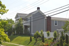 | Judge John E. Cooper House | building | 1996 | 96000824 |
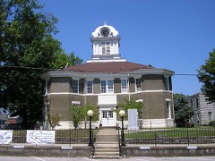 | Morgan County Courthouse | building | 1976 | 76000929 |
Sampled issues, machine-read from the Library of Congress scan and published page by page, so every headline and column is searchable text.
West Liberty, Ky., 19?? to Current. Machine-read from the Library of Congress scan.
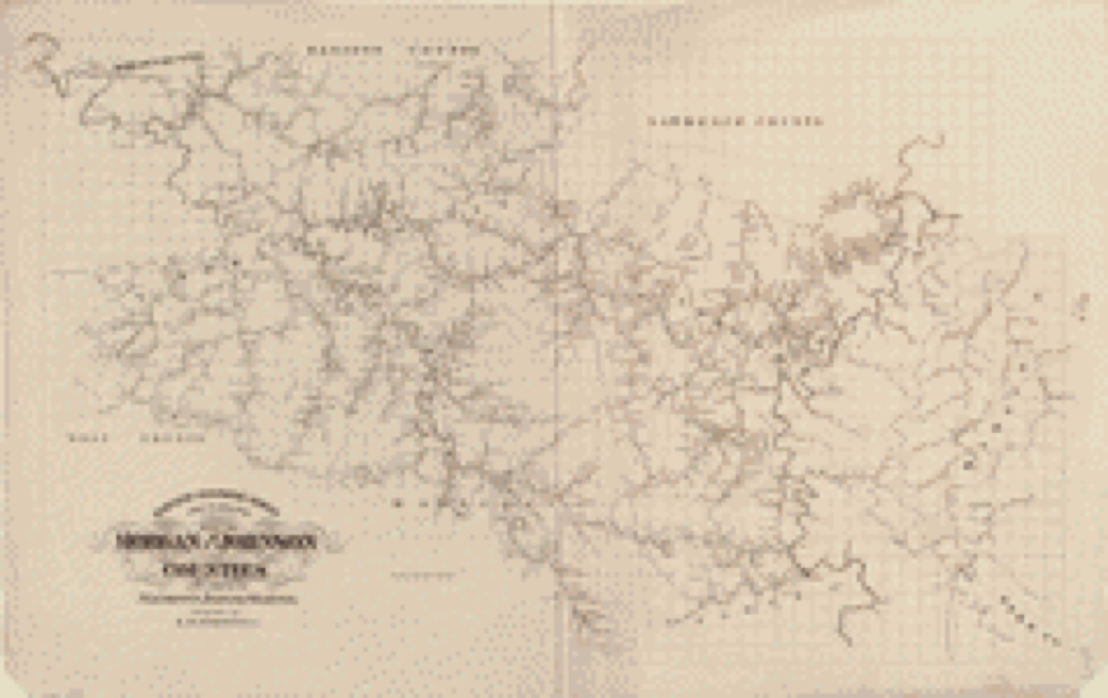
Drawn when these were printed as single large sheets: the town seen from the air, and the county divided into its farms with every owner named. Each opens the original at the Library of Congress.
The thermometers that kept this county's weather, as the federal records hold them. The extremes below are measured values from those records, not estimates.
Who lived here in 1950, one enumeration district at a time, as the Census Bureau described each district. Each row opens its official National Archives result, with Population Schedules and ED Maps available there.
Every wildfire the federal occurrence database records inside this county: 573 of them, burning about 11,370 acres. 3 started naturally and 169 were recorded as arson. Each settlement page carries the fires within five miles of it.
| Reported cause | Fires |
|---|---|
| Debris and open burning | 217 |
| Arson/incendiarism | 169 |
| Missing data/not specified/undetermined | 150 |
| Recreation and ceremony | 30 |
| Railroad operations and maintenance | 3 |
| Natural | 3 |
| Equipment and vehicle use | 1 |
The five largest, by the area the report gives. Three of them were set deliberately.
| Date | Cause | Size | Reported by | Name on the report |
|---|---|---|---|---|
| 19 November 1999 | Arson/incendiarism | 600 acres | Kentucky Division of Forestry | not named |
| 18 November 2015 | Debris and open burning | 527 acres | Kentucky Division of Forestry | SHOP BRANCH |
| 16 April 2003 | Missing data/not specified/undetermined | 300 acres | Kentucky Division of Forestry | not named |
| 10 March 2000 | Arson/incendiarism | 300 acres | Kentucky Division of Forestry | not named |
| 31 March 2015 | Debris and open burning | 260 acres | Kentucky Division of Forestry | PASTURE FORK |
| 2 November 2001 | Arson/incendiarism | 250 acres | Kentucky Division of Forestry | not named |
| 1 April 2003 | Missing data/not specified/undetermined | 200 acres | Kentucky Division of Forestry | not named |
| 25 February 2002 | Debris and open burning | 200 acres | Kentucky Division of Forestry | not named |
Every settlement page carries the fires within five miles of it - see the settlement index below.
The NOAA Storm Events Database holds 372 reports for this county, causing 6 deaths, 83 injuries and about $77,034,600 in recorded property damage. Each settlement page carries the reports that name it.
| Kind of event | Reports |
|---|---|
| Thunderstorm Wind | 241 |
| Hail | 53 |
| Flash Flood | 41 |
| Flood | 21 |
| Heavy Rain | 9 |
| Tornado | 5 |
| Funnel Cloud | 1 |
| Debris Flow | 1 |
The most serious of them, by death, then injury, then recorded damage. The accounts are quoted exactly as the forecast office filed them.
| When | Event | Place named | Harm | What the report says |
|---|---|---|---|---|
| March 2012 | Tornado (EF3) | Artville | 6 killed, 80 hurt, $75,000,000 | A storm damage survey team from the National Weather Service Forecast Office in Jackson, Kentucky confirmed that an EF-3 tornado tracked from Menifee County into Morgan County on March 2, 2012. The tornado entered Morgan County at around 546 pm EST, just to the northwest of Ezel, and tracked east-northeast making a direct hit on downtown West Liberty at around 558 pm EST. The tornado caused extensive damage to nearly every structure in town, including the 105 year old courthouse, the depression-era WPA building that houses the community center and the 100 year old West Liberty United Methodist and Christian churches. The tornado continued northeast from West Liberty through the remainder of Morgan County, causing extensive damage to numerous structures and downing thousands of trees with a consistent path width of 3/4 to 1 mile throughout the county. Estimated peak winds in Morgan County were 140 mph. The tornado crossed into Lawrence county at 610 pm EST between Moon and Terryville. Six fatalities occurred in Morgan county as a direct result of the tornado. |
| September 1972 | Tornado (F2) | not stated | 3 hurt, $25,000 | no account filed |
| June 1990 | Tornado (F1) | not stated | $250,000 | no account filed |
| September 2020 | Flash Flood | Lick Branch | $150,000 | Morgan County Dispatch reported that Cow Branch Road was closed near the community of Lenox due to water over the road, making it impassable. The EM then reported that cars had been washed down the creek, and houses had been inundated from the high water. |
| March 1997 | Flash Flood | Crockett | $150,000 | no account filed |
| July 2000 | Thunderstorm Wind | Ezel | $110,000 | Straight line wind damage associated with a severe thunderstorm produced a path of damage approximately 9 miles long and 4 miles wide. Massive amounts of tree damage occurred all of which was lying in a southeastward direction. One mobile home received roof damage when a large pine tree fell onto the home. Barns and out buildings also received minor damage to the roof tin. Several cars received major damage as trees fell upon them. |
| September 2020 | Flash Flood | Cottle | $100,000 | Emergency Management reported extensive flash flooding and damage along War Creek Road as War Creek quickly swelled out of its banks. This led to damages to cars and houses along the road. |
| September 2020 | Flash Flood | West Liberty Arpt | $100,000 | Law enforcement reported portions of Prestonsburg Street and Spaws Creek Road had been closed due to flood waters over the road after two rounds of heavy rain moved through the location. Spaws Creek Road was especially hard hit, as the EM reported Spaws Creek rose out of it banks and took out bridges and caused damage to nearby properties. |
| February 2012 | Tornado (EF2) | Mize | $100,000 | A storm damage team from the National Weather Service office in Jackson, Kentucky confirmed that an EF-2 tornado touched down in Morgan county on February 29, 2012. The tornado touched down about 6 miles southwest of West Liberty near the town of Grassy Creek. The tornado track was not continuous, but instead made several touchdowns and liftoffs before dissipating near the community of Malone. Winds were estimated at around 120 mph. Several structures were damaged along the path of the tornado, with the most extreme damage occurring to a residential structure in the Malone area. |
| April 2011 | Thunderstorm Wind | Ezel | $100,000 | Thunderstorm wind gusts uprooted trees and downed power lines in Ezel. Approximately 500 residents of the city were without power and phone service until around 930 pm that evening. |
| April 1996 | Thunderstorm Wind | Cannel City | $100,000 | no account filed |
| April 2008 | Flash Flood | Mima | $55,000 | A bridge was washed out by flood water on Highway 437. |
| September 2020 | Flood | Index | $50,000 | After another dose of heavy rain, water spilled out of a drainage ditches and onto the road near the Morgan County Tire Center in Index, Kentucky, just southwest of West Liberty. |
| June 2010 | Thunderstorm Wind | Stacy Fork | $50,000 | A tree fell on a school bus, truck, and mini van on KY 191 between mile markers 9 and 10. The vehicles appeared to be totaled. |
| June 1995 | Thunderstorm Wind | not stated | $50,000 | State police reported a tree down across a mobile home at Spaws Creek about 30 miles North of Jackson near the Morgan/Menifee County line. No injuries reported. |
| March 1997 | Thunderstorm Wind | Ezel | $50,000 | no account filed |
| March 1997 | Thunderstorm Wind | Ezel | $50,000 | no account filed |
| June 2009 | Tornado (EF1) | Relief | $35,000 | An EF1 tornado with winds of 90-95 mph touched down 1.5 miles northwest of Relief. The tornado was on the ground for 1.5 miles and had a path width of 75 yards. The tornado lifted shortly after crossing into Johnson County. Dozens of trees were damaged and numerous trees were snapped off or uprooted. |
| June 2022 | Thunderstorm Wind | Ezel | $30,000 | Trees were blown down in Ezel including onto 2 mobile homes. |
| March 2021 | Flash Flood | West Liberty Arpt | $30,000 | Pictures posted on social media showed water from Long Branch flowing across Prestonsburg Street in West Liberty, making it impassable. It had also surrounding a neighboring home. This was confirmed by the 911 dispatch as well. |
| May 2018 | Flash Flood | Moon | $30,000 | Dispatch reported flowing water covering the road on Lick Branch near the Kentucky Highway 437 bridge in Dingus. Near Moon, heavy rainfall caused water to quickly rise and inundate area basements. |
| July 2019 | Thunderstorm Wind | Greear | $25,000 | Dispatch reported trees downed on the southwest side of West Liberty. A power pole near Morgan Central Elementary School was hit by some of these trees. A vehicle was also hit by falling trees, while the roof of a house was partially torn off. |
| May 2008 | Thunderstorm Wind | West Liberty | $25,000 | Numerous trees were blown down from West Liberty to Ezel. |
| April 2011 | Thunderstorm Wind | Malone | $20,000 | There were numerous trees blown down across 844 in Stacy Fork. The largest trees was a Willow tree approximately 20 inches in diameter. |
| June 2010 | Thunderstorm Wind | Caney | $20,000 | Multiple trees were blown down and a roof was caved in on a building in Caney. |
| June 2009 | Thunderstorm Wind | Relief | $20,000 | Multiple trees were blown down and half inch diameter hail occurred. |
| November 2003 | Flash Flood | Countywide | $20,000 | People were trapped in cars due to high water on Laurel Fork Road, Railline Road (near Wrigley), and Big Bandy Road (off of Highway 650). A fast-food restaurant was flooded along United States 460, near West Liberty. |
| February 2021 | Flood | Florress | $15,000 | Report received from MPing: River/Creek is overflowing and resulting in flooding of cropland/yard/and or basement. |
| June 2017 | Thunderstorm Wind | Mize | $10,000 | Dispatch reported trees blown down on U.S. Highway 460 near Murphy Fork Road west of Mize. Tree damage also occurred near Cannel City while a utility pole was snapped. |
| June 2012 | Thunderstorm Wind | West Liberty | $10,000 | Trees were blown down in and around town. |
| June 2011 | Thunderstorm Wind | Ezel | $10,000 | Numerous trees were blown down along Hwy 882 west of Ezel. |
| April 2009 | Thunderstorm Wind | Ezel | $10,000 | Trees were blown down on Highways 460, 2498, and 772. |
| May 2008 | Thunderstorm Wind | West Liberty | $10,000 | Several trees and large limbs were blown down. |
| June 2010 | Thunderstorm Wind | West Liberty | $8,000 | A roof was blown off a house in West Liberty. |
| April 2009 | Thunderstorm Wind | Mize | $8,000 | The roof was blown off a barn. |
| June 2007 | Thunderstorm Wind | Cottle | $7,000 | Several trees down in the Lacy Creek area. |
| May 2008 | Thunderstorm Wind | Ezel | $6,000 | Two trees were blown down. Numerous tree branches were also blown down. |
| June 2007 | Thunderstorm Wind | Zag | $6,000 | Six trees down near intersection of Highways 976 and 519. |
| June 2021 | Thunderstorm Wind | Grassy Creek | $5,000 | The Morgan County emergency management reported that strong thunderstorm wind gusts had knocked down numerous trees across the county, including at least one tree over the road at Grassy Creek. |
| February 2019 | Heavy Rain | Stacy Fork | $5,000 | Local media reported a mudslide on Kentucky Highway 844 south of West Liberty due to recent heavy rain. |
| September 2018 | Debris Flow | Leisure | $5,000 | Kentucky Department of Transportation officials reported downed trees across Kentucky Highway 711 west of Wrigley. These were the result of a mudslide due to persistent rainfall over the past couple of days. This led to downed power lines and a couple of thousand of power outages. |
| June 2012 | Thunderstorm Wind | Ezel | $5,000 | Numerous trees were blown down in and around Ezel. |
| July 2012 | Thunderstorm Wind | West Liberty | $5,000 | Several trees were blown down along Liberty Rd in West Liberty near the Davis Lane intersection. Some structural damage to a trailer also occurred just west of the Morgan county hospital. |
| June 2011 | Thunderstorm Wind | West Liberty | $5,000 | Trees were blown down along Cow Branch Rd off Hwy 172 and also on Hwy 772 at mile marker 6. |
| May 2011 | Hail | Cannel City | $5,000 | Golf ball size hail caused damage to an automobile and a tow behind trailer in Cannel City. |
| June 2010 | Thunderstorm Wind | Relief | $5,000 | Trees were down on KY 437 between mile markers 11 and 12. |
| June 2010 | Thunderstorm Wind | Cannel City | $5,000 | A spotter reported that 12 inch diameter trees were blown down and a porch roof was blown off. |
| December 2009 | Flood | Murphy Fork | $5,000 | Water was over a road in Murphy Fork. Trees were also down across this same road. |
| June 2009 | Thunderstorm Wind | Kellacey | $5,000 | Large limbs were blown down along Route 985. |
| February 2008 | Thunderstorm Wind | West Liberty | $5,000 | Trees were blown onto and blocking roads near West Liberty. |
| January 2008 | Thunderstorm Wind | West Liberty | $5,000 | Trees were blown down onto Highways 2499, 172, and 460 by wind gusts estimated at 61 mph. |
| May 2002 | Thunderstorm Wind | Ezel | $5,000 | Strong winds blew a barn down onto a mobile home. |
| July 2001 | Flash Flood | Wrigley | $5,000 | Over a foot of water was flowing over the intersection of Highway 7 and 711. Water also was reported to have entered several homes in town. |
| June 1998 | Flash Flood | West Liberty | $5,000 | Numerous roads covered with water in town and surrounding areas. Some homes with water damage. |
| September 1993 | Thunderstorm Wind | not stated | $5,000 | Several trees and power lines were blown down in Centerville, Grassey Creek and Malone. |
| March 2011 | Thunderstorm Wind | Ezel | $4,000 | Large tree limbs were blown down in Ezel. |
| June 2007 | Thunderstorm Wind | Licking River | $4,000 | Several large limbs down. |
| June 2021 | Thunderstorm Wind | West Liberty | $3,000 | The Morgan County emergency management reported that strong thunderstorm wind gusts had knocked down multiple trees in the trailer park just off of KY-7, and that at least one tree had fallen onto a mobile home. |
| February 2019 | Heavy Rain | Grassy Creek | $3,000 | The Department of Highways reported a major break in pavement, made worse by heavy rain on February 23rd, on Kentucky Highway 705 near Grassy Creek. This led to an extended closure of the road. |
| June 2011 | Thunderstorm Wind | Maytown | $3,000 | Trees were blown down in downtown Maytown. |
The Survey's mineral resources record lists 5 workings inside this county. 2 still produce and 3 are closed or unrecorded. Each settlement page carries the workings within five miles of it.
| Commodity | Workings |
|---|---|
| Stone, Crushed/Broken | 3 |
| Clay | 2 |
The least common of them first, because a county's hundredth gravel pit says nothing its first ten did not.
| Where | Site | Commodity | Status | Recorded |
|---|---|---|---|---|
| Barnett Shale | Clay | Prospect | ||
| Zag Shale | Clay | Prospect | ||
| D Quarry | Stone, Crushed/Broken | Producer | ||
| Mjm Mine | Stone, Crushed/Broken | Producer | ||
| Zag Mine | Stone, Crushed/Broken | Past Producer |
Named settlements recorded in the Geographic Names Information System, each with the topographic sheets covering it. Villages, hamlets and abandoned places alike. Each is shown with the nearest named watercourse or landform and the survey quadrangle it falls on.
Cannel City census division · 41332 · On Conley Branch · Cannel City quadrangle
14 sheets, 1889 to 1982
Grassy Creek census division · 41472 · On Spring Branch · West Liberty quadrangle
14 sheets, 1889 to 1982
No longer a settlement
Wrigley census division · 41472 · On Elam Branch · Wrigley quadrangle
11 sheets, 1929 to 1982
Wrigley census division · 41472 · Near Alderson Ridge · Wrigley quadrangle
11 sheets, 1929 to 1982
Grassy Creek census division · 41425 · On Lower Long Branch · West Liberty quadrangle
14 sheets, 1889 to 1982
Cannel City census division · 41472 · On Brushy Fork · Cannel City quadrangle
14 sheets, 1889 to 1982
Cannel City census division · 41408 · On Stone Coal Fork · Cannel City quadrangle
14 sheets, 1889 to 1982
Cannel City census division · 41332 · On Bear Branch · Hazel Green quadrangle
14 sheets, 1889 to 1982
No longer a settlement
Elkfork-Ophir census division · 41472 · On Cow Branch · Lenox quadrangle
14 sheets, 1889 to 1982
No longer a settlement
Elkfork-Ophir census division · 41472 · On Cindas Creek · Dingus quadrangle
16 sheets, 1889 to 1992
Elkfork-Ophir census division · 41472 · On Stingy Fork · Dingus quadrangle
16 sheets, 1889 to 1992
No longer a settlement
West Liberty census division · 41472 · On War Creek · Lenox quadrangle
14 sheets, 1889 to 1982
Elkfork-Ophir census division · 41472 · On Hinson Branch · Dingus quadrangle
16 sheets, 1889 to 1992
Wrigley census division · 41472 · On Shoals Branch · West Liberty quadrangle
14 sheets, 1889 to 1982
Elkfork-Ophir census division · 41472 · On Paulina Branch · Dingus quadrangle
16 sheets, 1889 to 1992
Wrigley census division · 41472 · Near Ditney Ridge · Wrigley quadrangle
11 sheets, 1929 to 1982
No longer a settlement
Grassy Creek census division · 40387 · On Sage Branch · Ezel quadrangle
14 sheets, 1889 to 1982
Elkfork-Ophir census division · 41472 · On Ferguson Branch · Lenox quadrangle
14 sheets, 1889 to 1982
Elkfork-Ophir census division · 41472 · On Muddy Branch · Lenox quadrangle
14 sheets, 1889 to 1982
Grassy Creek census division · 41425 · On Meetinghouse Branch · Ezel quadrangle
14 sheets, 1889 to 1982
Wrigley census division · 41472 · On Painter Branch · West Liberty quadrangle
14 sheets, 1889 to 1982
No longer a settlement
Elkfork-Ophir census division · 41472 · On Sugar Camp Branch · Lenox quadrangle
14 sheets, 1889 to 1982
West Liberty census division · 41472 · On Jones Creek · Lenox quadrangle
14 sheets, 1889 to 1982
Grassy Creek census division · 41472 · On Greear Branch · Cannel City quadrangle
14 sheets, 1889 to 1982
Grassy Creek census division · 41472 · On Gose Branch · West Liberty quadrangle
14 sheets, 1889 to 1982
Cannel City census division · 41408 · Near Testerman Knob · Cannel City quadrangle
14 sheets, 1889 to 1982
No longer a settlement
Wrigley census division · 41472 · On Mine Branch · Bangor quadrangle
11 sheets, 1929 to 1982
No longer a settlement
West Liberty census division · 41472 · On Rocky Branch · White Oak quadrangle
12 sheets, 1889 to 1982
West Liberty census division · 41472 · On Little Caney Creek · West Liberty quadrangle
14 sheets, 1889 to 1982
Elkfork-Ophir census division · 41472 · On Gillam Branch · Dingus quadrangle
16 sheets, 1889 to 1992
Grassy Creek census division · 41425 · On Meetinghouse Branch · Ezel quadrangle
14 sheets, 1889 to 1982
No longer a settlement
West Liberty census division · 41472 · On Jones Creek · Lenox quadrangle
14 sheets, 1889 to 1982
No longer a settlement
Grassy Creek census division · 41472 · On Tarkiln Branch · Ezel quadrangle
14 sheets, 1889 to 1982
Wrigley census division · 41472 · On Devils Fork · Wrigley quadrangle
11 sheets, 1929 to 1982
Elkfork-Ophir census division · 41472 · On Mill Branch · Lenox quadrangle
14 sheets, 1889 to 1982
West Liberty census division · 41472 · On Short Branch · West Liberty quadrangle
14 sheets, 1889 to 1982
West Liberty census division · 41472 · On Caney Creek · West Liberty quadrangle
14 sheets, 1889 to 1982
Elkfork-Ophir census division · 41472 · On Turpentine Branch · Dingus quadrangle
16 sheets, 1889 to 1992
No longer a settlement
Elkfork-Ophir census division · 41472 · On Long Branch · Dingus quadrangle
16 sheets, 1889 to 1992
No longer a settlement
West Liberty census division · 41472 · On Village Branch · Cannel City quadrangle
14 sheets, 1889 to 1982
Elkfork-Ophir census division · 41472 · On Rockhouse Creek · White Oak quadrangle
12 sheets, 1889 to 1982
Grassy Creek census division · 41425 · On Little Blackwater Creek · Hazel Green quadrangle
14 sheets, 1889 to 1982
Elkfork-Ophir census division · 41472 · On Horse Mill Branch · Dingus quadrangle
16 sheets, 1889 to 1992
No longer a settlement
Elkfork-Ophir census division · 41472 · On Road Fork · Dingus quadrangle
16 sheets, 1889 to 1992
Grassy Creek census division · 41352 · On Caskey Fork · Cannel City quadrangle
14 sheets, 1889 to 1982
Elkfork-Ophir census division · 41472 · On Doc Ison Branch · Dingus quadrangle
16 sheets, 1889 to 1992
Grassy Creek census division · 41332 · On Loring Nickell Branch · Hazel Green quadrangle
14 sheets, 1889 to 1982
West Liberty census division · 41472 · Near Wells Hill · West Liberty quadrangle
14 sheets, 1889 to 1982
No longer a settlement
Cannel City census division · 41352 · On Gevedon Branch · Cannel City quadrangle
14 sheets, 1889 to 1982
Wrigley census division · 41472 · On Elam Branch · Wrigley quadrangle
11 sheets, 1929 to 1982
No longer a settlement
Elkfork-Ophir census division · 41472 · On Long Branch · Dingus quadrangle
16 sheets, 1889 to 1992
Cannel City census division · 41472 · Near Testerman Knob · Cannel City quadrangle
14 sheets, 1889 to 1982
Cannel City census division · 41408 · On Lunce Branch · Cannel City quadrangle
14 sheets, 1889 to 1982
Grassy Creek census division · 41425 · On Robinson Branch · Ezel quadrangle
14 sheets, 1889 to 1982
Grassy Creek census division · 41472 · On Shoals Branch · West Liberty quadrangle
14 sheets, 1889 to 1982
No longer a settlement
Wrigley census division · 41472 · On Lick Fork · West Liberty quadrangle
14 sheets, 1889 to 1982
Wrigley census division · 41472 · On Mordica Branch · Sandy Hook quadrangle
10 sheets, 1950 to 1982
Elkfork-Ophir census division · 41472 · On Browns Branch · Redbush quadrangle
17 sheets, 1886 to 1992
Cannel City census division · 41332 · On Nickell Fork · Cannel City quadrangle
14 sheets, 1889 to 1982
Cannel City census division · 41352 · On Halsey Branch · Cannel City quadrangle
14 sheets, 1889 to 1982
No longer a settlement
Cannel City census division · 41332 · On Conley Branch · Cannel City quadrangle
14 sheets, 1889 to 1982
No longer a settlement
Elkfork-Ophir census division · 41472 · On Sebastian Branch · White Oak quadrangle
12 sheets, 1889 to 1982
No longer a settlement
Elkfork-Ophir census division · 41421 · On Rush Branch · Lenox quadrangle
14 sheets, 1889 to 1982
No longer a settlement
Cannel City census division · 41352 · On Phipps Fork · Cannel City quadrangle
14 sheets, 1889 to 1982
Cannel City census division · 41352 · Near Pilot Knob · Cannel City quadrangle
14 sheets, 1889 to 1982
Elkfork-Ophir census division · 41472 · On Stingy Fork · Dingus quadrangle
16 sheets, 1889 to 1992
Cannel City census division · 41472 · On Stacy Fork · Cannel City quadrangle
14 sheets, 1889 to 1982
Grassy Creek census division · 41472 · On Straight Creek · West Liberty quadrangle
14 sheets, 1889 to 1982
No longer a settlement
Elkfork-Ophir census division · 41472 · On Tarkiln Branch · White Oak quadrangle
12 sheets, 1889 to 1982
No longer a settlement
Grassy Creek census division · 41472 · On Grassy Creek · West Liberty quadrangle
14 sheets, 1889 to 1982
Elkfork-Ophir census division · 41472 · On Long Branch · Dingus quadrangle
16 sheets, 1889 to 1992
No longer a settlement
West Liberty census division · 41472 · On Vance Fork · White Oak quadrangle
12 sheets, 1889 to 1982
No longer a settlement
Cannel City census division · 41472 · On Vance Fork · White Oak quadrangle
12 sheets, 1889 to 1982
No longer a settlement
West Liberty census division · 41472 · On Long Branch · West Liberty quadrangle
14 sheets, 1889 to 1982
Cannel City census division · 41332 · On Elam Branch · Lee City quadrangle
11 sheets, 1889 to 1982
Cannel City census division · 41332 · On Knatty Branch · Lee City quadrangle
11 sheets, 1889 to 1982
No longer a settlement
West Liberty census division · 41472 · On May Branch · White Oak quadrangle
12 sheets, 1889 to 1982
Grassy Creek census division · 41472 · On Spring Branch · West Liberty quadrangle
14 sheets, 1889 to 1982
Wrigley census division · 41472 · On Painter Branch · West Liberty quadrangle
14 sheets, 1889 to 1982
Wrigley census division · 41472 · On Allen Day Creek · West Liberty quadrangle
14 sheets, 1889 to 1982
The vanished settlements of Morgan County: the places named above that are no longer on the map.