 Block
From the record
1 National Register listing published here.
Sources: the National Register database, National Park Service
40 topographic sheets cover 43 settlements here, and 1 property is on the National Register of Historic Places.
1 National Register listing published here.
Sources: the National Register database, National Park Service
Every property in this county listed on the National Register of Historic Places, with the year it was listed and the federal nomination document.
| Photograph | Property | Type | Listed | Reference |
|---|---|---|---|---|
 | Moyers Buildings | building | 1982 | 82001575 |
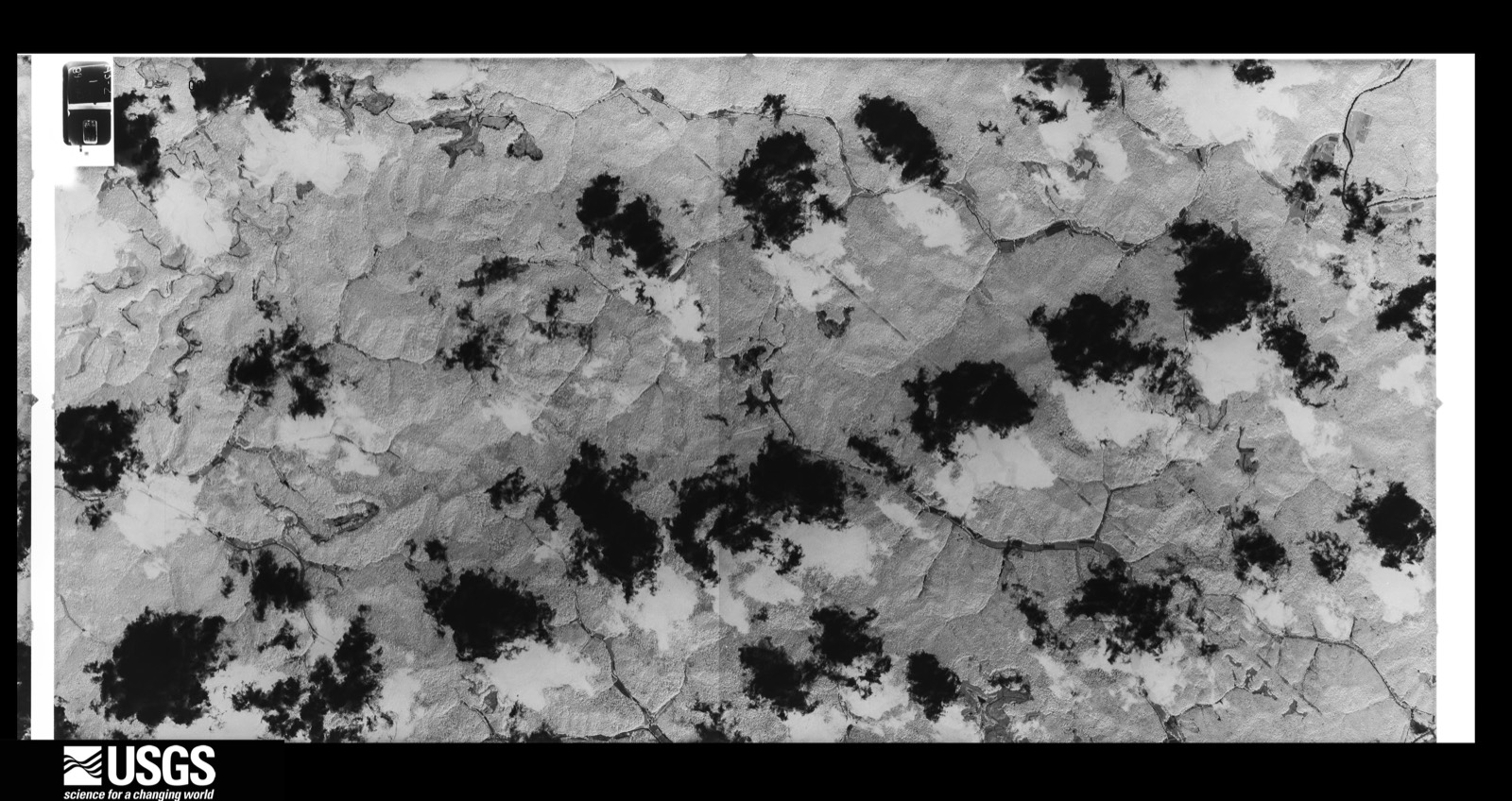
Flown by the U.S. Geological Survey between 1937 and 1989, the Aerial Photo Single Frames collection is the definitive mid-century view of the land: fields, roads and rivers as the camera saw them. The Survey holds 492 frames inside the rectangle that bounds this county; the 23 frames below were taken over the county itself, chosen across the decades of flights (at most four a year from that rectangle), so one flight cannot crowd out the rest. The full set is free to browse and download at EarthExplorer under the dataset Aerial Photo Single Frames.



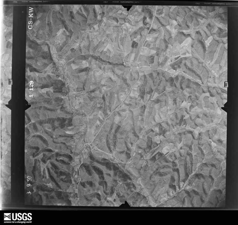




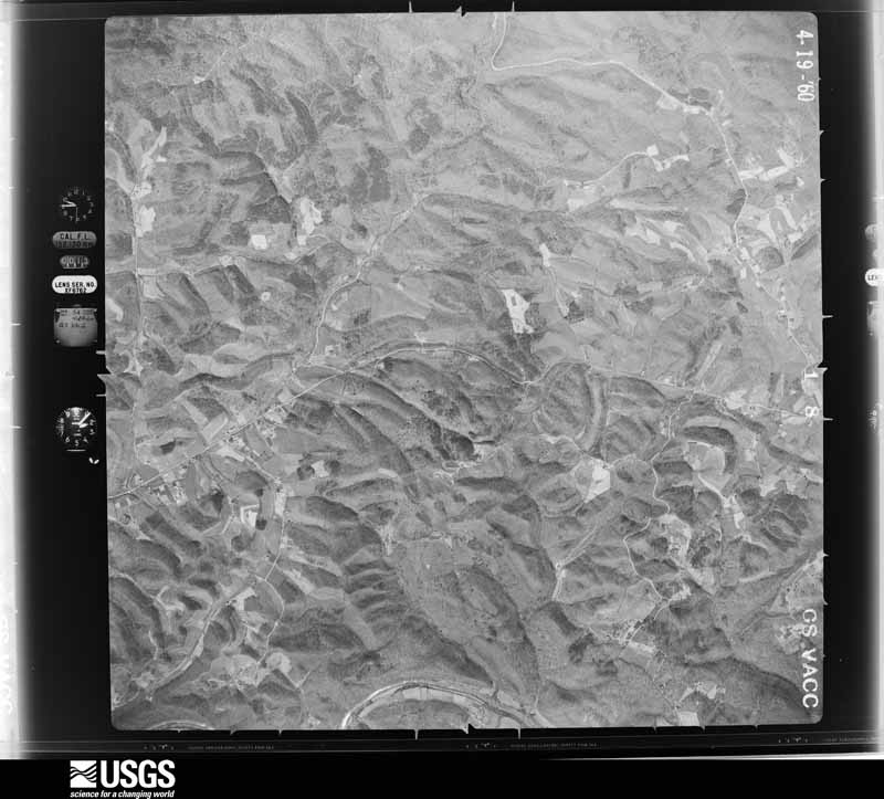
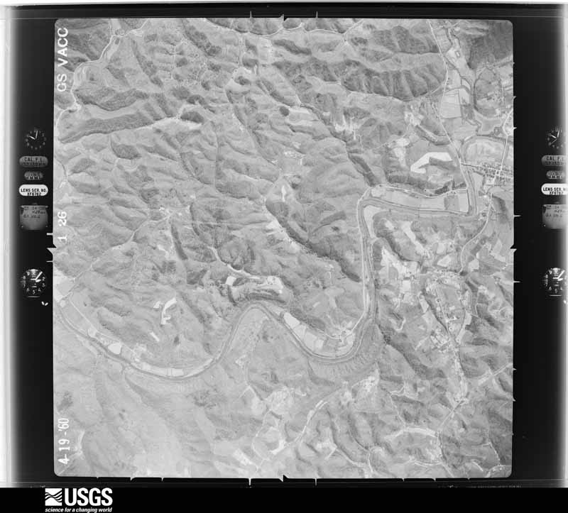







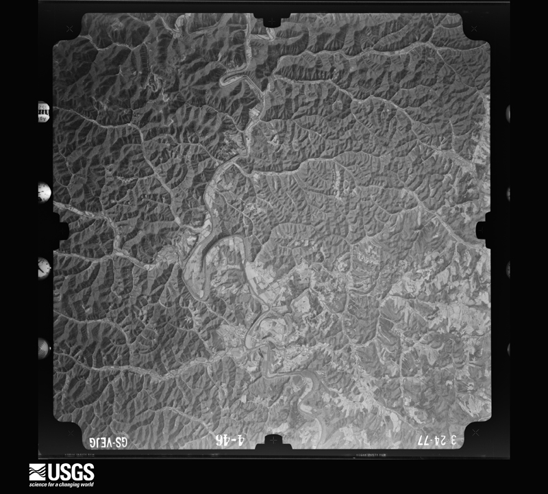




The thermometers that kept this county's weather, and the gages that measured the flow of its streams, as the federal records hold them. The extremes below are measured values from those records, not estimates.
Who lived here in 1950, one enumeration district at a time, as the Census Bureau described each district. Each row opens its official National Archives result, with Population Schedules and ED Maps available there.
Every wildfire the federal occurrence database records inside this county: 694 of them, burning about 22,769 acres. 1 started naturally and 173 were recorded as arson. Each settlement page carries the fires within five miles of it.
| Reported cause | Fires |
|---|---|
| Debris and open burning | 331 |
| Arson/incendiarism | 173 |
| Missing data/not specified/undetermined | 155 |
| Recreation and ceremony | 28 |
| Smoking | 2 |
| Natural | 1 |
| Other causes | 1 |
| Power generation/transmission/distribution | 1 |
| Equipment and vehicle use | 1 |
| Railroad operations and maintenance | 1 |
The five largest, by the area the report gives. 7 of them were set deliberately.
| Date | Cause | Size | Reported by | Name on the report |
|---|---|---|---|---|
| 1 November 2001 | Arson/incendiarism | 3,000 acres | Kentucky Division of Forestry | not named |
| 3 April 1995 | Arson/incendiarism | 1,910 acres | Daniel Boone National Forest | STEELTRAP |
| 27 October 2001 | Arson/incendiarism | 1,175 acres | Daniel Boone National Forest | PANCO OTTER BRANCH |
| 7 April 2010 | Debris and open burning | 700 acres | Kentucky Division of Forestry | ALLEN ROAD |
| 31 October 2001 | Arson/incendiarism | 500 acres | Kentucky Division of Forestry | not named |
| 13 April 2018 | Arson/incendiarism | 500 acres | Kentucky Division of Forestry | ROSE FORK |
| 13 April 2014 | Arson/incendiarism | 481 acres | Daniel Boone National Forest | BRUSHY |
| 6 April 1995 | Arson/incendiarism | 400 acres | Daniel Boone National Forest | ANGLIN CHURCH |
Every settlement page carries the fires within five miles of it - see the settlement index below.
The NOAA Storm Events Database holds 194 reports for this county, causing no deaths, no injuries and about $872,000 in recorded property damage. Each settlement page carries the reports that name it.
| Kind of event | Reports |
|---|---|
| Thunderstorm Wind | 107 |
| Hail | 41 |
| Flash Flood | 23 |
| Flood | 12 |
| Heavy Rain | 9 |
| Tornado | 2 |
The most serious of them, by death, then injury, then recorded damage. The accounts are quoted exactly as the forecast office filed them.
| When | Event | Place named | Harm | What the report says |
|---|---|---|---|---|
| May 1996 | Flash Flood | Booneville | $250,000 | no account filed |
| October 1977 | Tornado (F2) | not stated | $250,000 | no account filed |
| April 1998 | Flash Flood | Countywide | $80,000 | no account filed |
| June 2019 | Thunderstorm Wind | Island City | $70,000 | Emergency Management reported a tree blew down onto a house in Island City. This tree also brought powerlines down onto the home, adding to the damage. Additionally, several more trees were downed along Kentucky Highway 11 south of Booneville. |
| April 1998 | Flash Flood | Countywide | $60,000 | no account filed |
| May 2003 | Thunderstorm Wind | Booneville | $25,000 | Several trees blew onto a trailer, and caused nearly complete destruction. |
| April 1996 | Thunderstorm Wind | Booneville | $11,000 | no account filed |
| July 2009 | Thunderstorm Wind | Travellers Rest | $10,000 | The tops of trees were blown out and power lines were down. There also piles of small hail still on the ground at around 6:30 am. |
| June 2009 | Thunderstorm Wind | Island City | $10,000 | Four trees were blown down on Highway 1350. Trees were also downed on Halcomb Road. |
| June 2006 | Thunderstorm Wind | Booneville | $10,000 | Numerous trees and power lines down across county. Widespread power outages reported. |
| May 2003 | Thunderstorm Wind | Booneville | $10,000 | Trees were blown down on a house. |
| June 2006 | Thunderstorm Wind | Vincent | $8,000 | Several trees down blocking roads near Vincent and Travellers Rest. Also a barn was blown down and destroyed. |
| June 2008 | Thunderstorm Wind | Booneville | $7,000 | Several trees were blown down around Booneville on Routes 30, 847, 708, and 2025. |
| May 2001 | Thunderstorm Wind | Pebworth | $6,000 | A roof was blown off of a barn. Farm outbuildings were damaged and numerous trees were down. |
| September 2009 | Flash Flood | Lerose | $5,000 | The fire dept responded to a report of water in a house in Lerose. |
| January 2008 | Thunderstorm Wind | Booneville | $5,000 | Trees were blown down onto Highway 30 by wind gusts estimated at 61 mph. |
| May 2003 | Flash Flood | Booneville | $5,000 | People on a small farm near Booneville experienced an extraordinary flash flood event. Rainfall was estimated to have fallen at a rate of at least 2 and a half inches in about 15 minutes. Lightning was intense, with one person describing the event "like the night Frozen Creek washed away". The land was in a steep, bowl-shaped hillside with pastures behind a farmhouse. A tiny stream ran through these pastures, which was overwhelmed rapidly from the torrential rainfall. A "wall of water" came through the narrow area at the foot of the pasture. By the time it reached the farmhouse, the water carried so much force that it jumped a concrete wall above a basement stairwell, and poured down the stairs, building pressure as it progressed. The steel basement door was bent and ripped off of its hinges. Water poured into the 70 foot long basement, carrying large logs, limbs, big clumps of sod, and an "unbelievable amount of mud". The residents lived there since 1962, and said that they had never seen anything like this. |
| August 1999 | Thunderstorm Wind | Island City | $5,000 | A barn was completely destroyed along Highway 846 by strong winds. Several trees were also blown down. |
| July 2007 | Thunderstorm Wind | Sturgeon | $4,000 | Four trees down blocking lanes of Highway 846 near mile marker 1. |
| June 2011 | Thunderstorm Wind | Pebworth | $3,000 | A few trees were blown down in Pebworth. |
| June 2009 | Thunderstorm Wind | Island City | $3,000 | Three twelve inch diameter trees wre blown down on Holly Fork Road. |
| April 2006 | Thunderstorm Wind | Booneville | $3,000 | Roof blown off of house on Route 30. |
| September 2020 | Flood | Sturgeon | $2,000 | Candy Branch Road (Mahaffy Road) was reported flooded near the community of Sturgeon. |
| October 2009 | Thunderstorm Wind | Vincent | $2,000 | A 70 foot tall oak tree was blown down in Vincent. |
| April 2009 | Thunderstorm Wind | Blake | $2,000 | Two trees were blown down on Hwy 849. |
| June 2008 | Thunderstorm Wind | Island City | $2,000 | Two trees approximately six inches in diameter were felled by high winds. |
| April 2006 | Thunderstorm Wind | Pebworth | $2,000 | Portable metal one car garage lifted and deposited on Cherry Lane 75 feet from original location. |
| July 2006 | Thunderstorm Wind | Booneville | $2,000 | Powerlines and several large limbs down. |
| September 2006 | Thunderstorm Wind | Island City | $2,000 | Tree down on car on Highway 1350. |
| July 2001 | Thunderstorm Wind | Island City | $2,000 | Thunderstorm winds blew 2 trees down and blew siding off a home. |
| January 1999 | Thunderstorm Wind | Booneville | $2,000 | Three power pole blown down. Trees down throughout county. |
| May 2016 | Flash Flood | Pebworth | $1,000 | Dispatch and local media sent in reports of water flowing over Highway 11 and around buildings in and south of Pebworth. Road closures were reported for Spivey Road, Jug Road, Marcum Ridge Road, Highway 11 north at Pebworth, and the right hand fork of Buffalo. |
| March 2015 | Flood | Booneville | $1,000 | Highway 3347, or Shepherds Lane, was closed due to flooding. |
| July 2015 | Flash Flood | Sturgeon | $1,000 | Candy Branch Road had at least 6 inches of water flowing across it, making the road impassable. Part of the road was also washed out. |
| April 2015 | Flash Flood | Booneville | $1,000 | Highway 3346 at Sugar Camp was impassable due to flash flooding. |
| September 2014 | Flash Flood | Pebworth | $1,000 | A creek was out of its banks along Highway 11 flooding several outbuildings. |
| December 2013 | Flood | Booneville | $1,000 | Kay Wood Road was closed at the low water bridge at Fish Trap. |
| December 2013 | Flood | Booneville | $1,000 | The Upper Wolf Creek low water bridge was flooded. |
| April 2013 | Flash Flood | Booneville | $1,000 | Six to 12 inches of water was flowing across Hwy 3346 at the Sugar Camp Church. Water was also flowing across Hwy 3347. |
| October 2010 | Thunderstorm Wind | Conkling | $1,000 | A tree was blown down at the junction of RT. 11 and 846. |
| May 2009 | Flash Flood | Lerose | $1,000 | A personal property bridge was washed away by flood waters. |
| September 2009 | Thunderstorm Wind | Sturgeon | $1,000 | A tree was blown down on Highway 1071. |
| September 2009 | Thunderstorm Wind | Blake | $1,000 | A tree was blown down on Route 846. |
| June 2009 | Thunderstorm Wind | Island City | $1,000 | A volunteer weather observer reported an estimated wind gust of around 60 mph in Island City. Dime size hail fell and a few small limbs were also blown down. |
| June 2008 | Thunderstorm Wind | Booneville | $1,000 | One tree was blown down by thunderstorm wind gusts. |
| April 2025 | Thunderstorm Wind | Vincent | - | Social media showed a tree down along KY-399 near the old Vincent Post Office. |
| May 2025 | Thunderstorm Wind | Lerose | - | A social media report stated a tree was down in Lerose near the intersection of Lymans Creek Rd and KY-30. |
| May 2025 | Hail | Conkling | - | Media relayed photos of quarter sized hail that occurred south of Booneville, near the town of Taft. |
| May 2025 | Hail | Taft | - | Nickle sized hail was reported in the Sextons Creek area of Owsley County. |
| September 2024 | Thunderstorm Wind | Ricetown | - | The highway department reported that a tree was blown down onto Lower Wolfe Creek Road between Eddie Marshall Lane and KY-2024. |
| June 2023 | Thunderstorm Wind | Lerose | - | A member of the public reported two trees blown down at a residence near Lerose. |
| June 2023 | Hail | Lerose | - | A member of the public reported approximately half-dollar sized (1.25 inch) hail near Lerose. |
| June 2023 | Thunderstorm Wind | Pebworth | - | The public reported multiple trees blown down or snapped in the vicinity of Holland Lane and Fox Hunters Knob. |
| June 2023 | Thunderstorm Wind | Booneville | - | Pictures show large limbs blown and trees snapped and uprooted in the 2700 block of Fish Creek School Road. |
| May 2023 | Thunderstorm Wind | Ricetown | - | State highway garage reported a tree blown down onto KY-1768 about a half mile from the its intersection with KY-28. |
| January 2022 | Heavy Rain | Booneville | - | The Kentucky Mesonet station in Owsley County (BNVL) measured 4.29 inches of rainfall in a 48-hour period ending at 7am on January 2, 2022. |
| January 2022 | Heavy Rain | Lerose | - | A CoCoRaHS observer 4 miles NE of Booneville measured 3.60 inches of rainfall in a 48-hour period ending at 8am on January 2, 2022. |
| July 2022 | Flash Flood | Eversole | - | Water was reported flowing over the road along Bear Run near the community of Eversole. |
| July 2022 | Flash Flood | Yale | - | Multiple instances of flash flooding occurred in SW Owsley County.||At 10:00 PM EST - Pictures on social media show significant flash flood damange along Buffalo Creek, including a home washed off it's foundation and destroyed. |
| March 2021 | Flood | Conkling | - | KY-11 South is closed between mile marker 3 and 6 due to high water across the road. |
The Survey's mineral resources record lists 1 working inside this county. It is closed or unrecorded. Each settlement page carries the workings within five miles of it.
| Commodity | Workings |
|---|---|
| Clay | 1 |
The least common of them first, because a county's hundredth gravel pit says nothing its first ten did not.
| Where | Site | Commodity | Status | Recorded |
|---|---|---|---|---|
| Crane Fork Valley Shale | Clay | Prospect |
Named settlements recorded in the Geographic Names Information System, each with the topographic sheets covering it. Villages, hamlets and abandoned places alike. Each is shown with the nearest named watercourse or landform and the survey quadrangle it falls on.
Cowcreek census division · 41314 · On Smith Fork · Cowcreek quadrangle
12 sheets, 1891 to 1977
Sturgeon census division · 40486 · Sturgeon quadrangle
14 sheets, 1891 to 1977
No longer a settlement
Sturgeon census division · 41314 · On McGuire Fork · Booneville quadrangle
14 sheets, 1891 to 1977
Booneville census division · 41314 · On Buck Creek · Booneville quadrangle
14 sheets, 1891 to 1977
Sturgeon census division · 41314 · On Beals Fork · Sturgeon quadrangle
14 sheets, 1891 to 1977
No longer a settlement
Booneville census division · 41314 · On Mill Town Branch · Booneville quadrangle
14 sheets, 1891 to 1977
Booneville census division · 41314 · On Mill Town Branch · Booneville quadrangle
14 sheets, 1891 to 1977
No longer a settlement
Sturgeon census division · 41314 · On Left Fork Island Creek · Booneville quadrangle
14 sheets, 1891 to 1977
Cowcreek census division · 41351 · On Rockhouse Branch · Mistletoe quadrangle
13 sheets, 1891 to 1979
No longer a settlement
Cowcreek census division · 41351 · On Rockhouse Branch · Mistletoe quadrangle
13 sheets, 1891 to 1979
No longer a settlement
Cowcreek census division · 41314 · On Left Fork Cow Creek · Cowcreek quadrangle
12 sheets, 1891 to 1977
Sturgeon census division · 41314 · Near Turkey Knob · Booneville quadrangle
14 sheets, 1891 to 1977
No longer a settlement
Booneville census division · 41314 · On Bear Run · Booneville quadrangle
14 sheets, 1891 to 1977
Booneville census division · 41314 · On Fish Creek · Beattyville quadrangle
13 sheets, 1892 to 1982
No longer a settlement
Cowcreek census division · 41314 · On Riley Fork · Cowcreek quadrangle
12 sheets, 1891 to 1977
No longer a settlement
Cowcreek census division · 41314 · On Gabbard Branch · Booneville quadrangle
14 sheets, 1891 to 1977
No longer a settlement
Cowcreek census division · 41364 · On Stringtown Branch · Cowcreek quadrangle
12 sheets, 1891 to 1977
No longer a settlement
Sturgeon census division · 40983 · On Holly Fork · Maulden quadrangle
13 sheets, 1891 to 1979
Booneville census division · 41314 · On Spencer Fork · Cowcreek quadrangle
12 sheets, 1891 to 1977
Booneville census division · 41314 · Near Mine Knob · Booneville quadrangle
14 sheets, 1891 to 1977
Cowcreek census division · 41314 · On Steel Trap Branch · Mistletoe quadrangle
13 sheets, 1891 to 1979
Sturgeon census division · 41314 · On Rowland Branch · Booneville quadrangle
14 sheets, 1891 to 1977
Cowcreek census division · 41351 · On Rockhouse Branch · Mistletoe quadrangle
13 sheets, 1891 to 1979
Sturgeon census division · 41314 · On Crane Creek · Sturgeon quadrangle
14 sheets, 1891 to 1977
No longer a settlement
41314 · On Spruce Fork · Sturgeon quadrangle
14 sheets, 1891 to 1977
No longer a settlement
Booneville census division · 41314 · Booneville quadrangle
14 sheets, 1891 to 1977
No longer a settlement
Cowcreek census division · 41364 · On Stringtown Branch · Cowcreek quadrangle
12 sheets, 1891 to 1977
Sturgeon census division · 40486 · Sturgeon quadrangle
14 sheets, 1891 to 1977
No longer a settlement
Cowcreek census division · 41351 · On Rockhouse Branch · Mistletoe quadrangle
13 sheets, 1891 to 1979
No longer a settlement
Booneville census division · 41314 · Near Turkey Knob · Booneville quadrangle
14 sheets, 1891 to 1977
Cowcreek census division · 41364 · On Board Branch · Mistletoe quadrangle
13 sheets, 1891 to 1979
Sturgeon census division · 41314 · On Niers Branch · Oneida quadrangle
13 sheets, 1891 to 1979
No longer a settlement
Sturgeon census division · 41314 · On Lower Wolf Creek · Booneville quadrangle
14 sheets, 1891 to 1977
Booneville census division · 41314 · On Caney Fork · Beattyville quadrangle
13 sheets, 1892 to 1982
No longer a settlement
Booneville census division · 41314 · On Caney Fork · Beattyville quadrangle
13 sheets, 1892 to 1982
Sturgeon census division · 41314 · On Beals Fork · Sturgeon quadrangle
14 sheets, 1891 to 1977
Booneville census division · 41314 · On Sugar Camp Creek · Booneville quadrangle
14 sheets, 1891 to 1977
No longer a settlement
Sturgeon census division · 41314 · Near Pole Cat Hollow · Oneida quadrangle
13 sheets, 1891 to 1979
Sturgeon census division · 41314 · On Warren Chapel Branch · Sturgeon quadrangle
14 sheets, 1891 to 1977
Cowcreek census division · 41721 · On Schoolhouse Branch · Mistletoe quadrangle
13 sheets, 1891 to 1979
Cowcreek census division · 41721 · On Schoolhouse Branch · Mistletoe quadrangle
13 sheets, 1891 to 1979
The vanished settlements of Owsley County: the places named above that are no longer on the map.