 Block
From the record
14 National Register listings published here.
Sources: the National Register database, National Park Service
62 topographic sheets cover 43 settlements here, and 14 properties are on the National Register of Historic Places.
14 National Register listings published here.
Sources: the National Register database, National Park Service
Every property in this county listed on the National Register of Historic Places, with the year it was listed and the federal nomination document.
| Photograph | Property | Type | Listed | Reference |
|---|---|---|---|---|
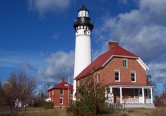 | Au Sable Light Station | building | 1978 | 78000374 |
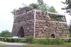 | Bay Furnace | structure | 1971 | 71000382 |
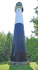 | Grand Island Harbor Rear Range Light | structure | 1990 | 90000906 |
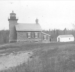 | Grand Island North Light Station | district | 1985 | 85002149 |
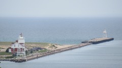 | Grand Marais Harbor of Refuge Inner and Outer Lights | structure | 2012 | 12000254 |
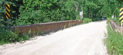 | King Road-Whitefish River Bridge | structure | 1999 | 99001463 |
 | Lobb House | building | 1976 | 76001023 |
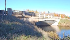 | M-28-Sand River Bridge | structure | 1999 | 99001460 |
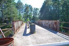 | M-94 (old)-Au Train River Bridge | structure | 1999 | 99001462 |
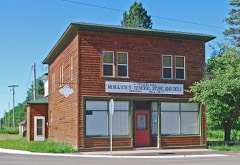 | Mikulich General Store | building | 1993 | 93000428 |
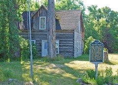 | Paulson House | building | 1972 | 72000590 |
 | Pickle Barrel House | building | 2004 | 03001548 |
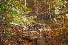 | Schoolcraft Furnace Site | site | 1977 | 77000151 |
Every wildfire the federal occurrence database records inside this county: 118 of them, burning about 412 acres. 30 started naturally and 6 were recorded as arson. Each settlement page carries the fires within five miles of it.
| Reported cause | Fires |
|---|---|
| Natural | 30 |
| Missing data/not specified/undetermined | 24 |
| Debris and open burning | 19 |
| Recreation and ceremony | 19 |
| Equipment and vehicle use | 8 |
| Arson/incendiarism | 6 |
| Smoking | 5 |
| Power generation/transmission/distribution | 4 |
| Railroad operations and maintenance | 2 |
| Other causes | 1 |
The five largest, by the area the report gives. None of them was recorded as arson.
| Date | Cause | Size | Reported by | Name on the report |
|---|---|---|---|---|
| 20 August 2007 | Missing data/not specified/undetermined | 70 acres | Michigan Department of Natural Resources | not named |
| 10 April 1995 | Debris and open burning | 47 acres | Michigan Department of Natural Resources | not named |
| 4 May 1994 | Debris and open burning | 35 acres | Michigan Department of Natural Resources | not named |
| 20 July 2012 | Natural | 26 acres | Hiawatha National Forest | TIE LAKE |
| 1 April 2010 | Debris and open burning | 26 acres | Hiawatha National Forest | WEST KENDALL |
| 27 April 2003 | Debris and open burning | 25 acres | Hiawatha National Forest | DUNKLEE |
| 13 June 1995 | Recreation and ceremony | 20 acres | Michigan Department of Natural Resources | not named |
| 3 July 2013 | Missing data/not specified/undetermined | 20 acres | Michigan Department of Natural Resources | KINGSTON PLAINS |
Every settlement page carries the fires within five miles of it - see the settlement index below.
The NOAA Storm Events Database holds 160 reports for this county, causing 1 death, 5 injuries and about $1,675,000 in recorded property damage. Each settlement page carries the reports that name it.
| Kind of event | Reports |
|---|---|
| Hail | 81 |
| Thunderstorm Wind | 52 |
| Heavy Rain | 11 |
| Tornado | 6 |
| Flash Flood | 4 |
| Lightning | 3 |
| Flood | 2 |
| Funnel Cloud | 1 |
The most serious of them, by death, then injury, then recorded damage. The accounts are quoted exactly as the forecast office filed them.
| When | Event | Place named | Harm | What the report says |
|---|---|---|---|---|
| June 1998 | Lightning | Shingleton | 1 killed | Lightning strike killed a fork lift operator at a lumber mill in Shingleton. |
| July 2006 | Lightning | Munising | 3 hurt | Lightning struck a tour boat for shipwreck cruises in Munising Bay. Three people were treated and released at a local hospital for minor injuries. |
| July 1999 | Thunderstorm Wind | Munising | 1 hurt | Downed trees blocking roads. A hiker was injured by a falling tree. |
| August 1988 | Thunderstorm Wind | not stated | 1 hurt | no account filed |
| May 2023 | Flood | Au Train | $1,000,000 | The Alger County EM reported record flooding in Au Train where around 200 homes were impacted with flooding along the Au Train River and Au Train Lake during early May. Water was overtopping the Forest Lake Dam upstream due to heavy water equivalent precipitation in the basin from the May 1-2 storm system. |
| May 1964 | Tornado (F2) | not stated | $250,000 | no account filed |
| June 2000 | Thunderstorm Wind | Trenary | $100,000 | Barn destroyed, killing a bull inside, trees down. |
| April 2025 | Flash Flood | Munising | $75,000 | Heavy rain resulted in flooding along the Anna River late Monday night into early Tuesday morning. Driveway bridges and a private road were damaged or washed out along M-94, and railroad tracks were washed out between Munising Junction and Munising. Time estimated from radar. |
| August 2017 | Thunderstorm Wind | Onola | $70,000 | Over 100 12-24 inch diameter trees were snapped and uprooted five miles west-northwest of Au Train. Two trees were down on a house along Rock River Road. Power lines were also reported down. |
| July 2023 | Thunderstorm Wind | Munising Hanley Arpt | $30,000 | There was a public report of dozens of snapped and uprooted trees seven miles east-northeast of Round Lake. |
| September 2019 | Lightning | Grand Marais | $20,000 | Lightning from a thunderstorm caused a rooftop fire at the Superior Hotel in Grand Marais on the afternoon of the 30th. Time of the report was estimated via ENTLN and GLD lightning data. |
| June 2022 | Thunderstorm Wind | Au Train | $15,000 | Over 200 residences were reported to be without power along Au Train Forest Lake Road due to thunderstorm wind damage. Power lines were also reported down near the All Seasons Tavern just south of Au Train. Time of the report was estimated from radar. |
| September 2018 | Flash Flood | Munising | $15,000 | Three to four inches of rain caused the Anna River to go over its banks in Munising reaching the bottom of the bridge on Highway H-58. Floodwaters were one to two feet deep near Brook Street and East Varnum Street with basement flooding reported along Brook Street. The parking lot of the Family Fare Supermarket was also flooded. |
| July 2013 | Thunderstorm Wind | Melstrand | $15,000 | In the Melstrand area, about 30 trees were down or snapped off and 6 to 8 trees uprooted in Melstrand. One 30-inch diameter white pine was snapped off one-third of the way up. At a cabin, sheet metal fencing which was nailed down to protect a well head was blown off and became airborne, gouging a storage shed 100 feet away with gouges 6.5 feet off the ground. |
| July 2012 | Thunderstorm Wind | Kiva | $15,000 | A thunderstorm with downburst winds estimated near 80 mph snapped off or uprooted hundreds of large trees just southwest of Kiva. |
| July 2023 | Thunderstorm Wind | Winters | $10,000 | There was a public report of several trees down and camper windows blown out. |
| June 2022 | Thunderstorm Wind | Au Train | $10,000 | Power lines and trees were reported down via social media in the Au Train area. |
| June 2024 | Thunderstorm Wind | Munising Hanley Arpt | $5,000 | A storm survey of damage six miles northeast of Round Lake in Alger County revealed straight-line wind damage with several one to two-foot diameter trees uprooted or snapped off 15-20 feet above the ground. Maximum wind gusts were estimated to be between 75-80 mph. Half dollar sized hail was also observed at the time of the original report. |
| July 2006 | Thunderstorm Wind | Grand Marais | $5,000 | Numerous trees up to ten inches in diameter uprooted along Old Seney Road 5 to 10 miles south of Grand Marais. |
| July 1997 | Hail | Sand River | $5,000 | Hail produced minor damage to several vehicles. |
| June 2017 | Heavy Rain | Grand Marais | $4,000 | The observer in Grand Marais reported several gravel and dirt highways washed out from heavy rain. |
| July 2012 | Thunderstorm Wind | Au Train | $4,000 | A 15-inch diameter branch came down on a cottage along the northwest shore of Au Train Lake. A perched roof on the porch of the cottage was also heavily damaged. Other felled branches took out a power line. The time of the report was estimated from radar. |
| July 2006 | Thunderstorm Wind | Grand Marais | $4,000 | Trees down across roads and power outages. |
| April 2025 | Flash Flood | Munising | $3,500 | An approximate 75-foot section of the paved trail in Pictured Rocks National Lakeshore Park was washed out the evening of April 28th from recent heavy rainfall and seasonal snow melt. Time estimated from radar. |
| June 1958 | Tornado (F0) | not stated | $2,500 | no account filed |
| July 1953 | Tornado (F0) | not stated | $2,500 | no account filed |
| June 2024 | Thunderstorm Wind | Forest Lake | $2,000 | Law enforcement dispatch reported a downed power line that was smoking along Hayward Road near Sixteen Mile Lake in Alger County. |
| July 2018 | Thunderstorm Wind | Winters | $2,000 | There was a public report of a few trees blown down in Menominee. |
| October 2016 | Thunderstorm Wind | Au Train | $2,000 | Several large diameter hardwood trees were snapped off at the trunks at a seasonal camp near Lake Superior. The mast for the electrical service was bent off. This was a delayed public report relayed via social media. Time of the report was estimated from radar. |
| September 2012 | Thunderstorm Wind | Wetmore | $2,000 | An eight to ten inch diameter tree was knocked down at a hotel, and a tree of unknown size was down across Highway M-28. Power was also knocked out in the area. Hail was reported hitting a truck, but the size of hail was unknown due to poor visibility. |
| May 2011 | Thunderstorm Wind | Au Train | $2,000 | Numerous 100-foot white pine trees were downed along North Shore Road near Au Train Lake. One tree fell over a power line, and a telephone pole was snapped in half. |
| October 2016 | Thunderstorm Wind | Munising | $1,500 | A spotter near Munising reported three large trees uprooted. Each tree was about two feet in diameter. Yard furniture was also blown about 50 feet and a 70 pound grill was blown over. Time of the report was estimated from radar. |
| October 2018 | Flood | Chatham | $1,000 | A spotter reported water over about 200 yards of Rock River Road north of Chatham due to more than two inches of heavy rain which fell in the previous 24 hours. |
| September 2012 | Thunderstorm Wind | Shingleton | $1,000 | Several trees estimated to be five to six inches in diameter were knocked down. |
| July 2012 | Thunderstorm Wind | Forest Lake | $1,000 | Two 10 to 12 inch diameter trees were knocked and tents were blown over at a campground. Time of the report was estimated from radar. |
| July 2025 | Hail | Forest Lake | - | Facebook comment with picture showed hail ranging from marble to quarter size. |
| July 2025 | Hail | Forest Lake | - | Hail ranged from pea to quarter size. |
| June 2024 | Hail | Chatham | - | Image of half dollar sized hail in Chatham from a social media report. |
| June 2024 | Hail | Forest Lake | - | Report via Facebook southeast of Forest Lake of between dime and quarter-sized hail along with 0.59 inches of rain. Time of the report was estimated from radar. |
| June 2024 | Hail | Munising Hanley Arpt | - | Estimated golf ball sized hail was observed along National Forest Service Highway 13 along the Alger-Schoolcraft County line. |
| June 2024 | Hail | Forest Lake | - | Report via mPING of penny-sized hail in rural Alger County. |
| July 2024 | Heavy Rain | Munising | - | There were reports on social media of minor street flooding on Onota and Maple Streets in Munising during the evening of the 15th. |
| October 2024 | Hail | Munising | - | There was a Facebook report of penny sized hail in Munising. |
| July 2023 | Hail | Forest Lake | - | There was a public report of half inch to one inch diameter hail seven miles southeast of Forest Lake. |
| July 2023 | Hail | Traunik | - | Two inch diameter hail was reported near Traunik. |
| July 2023 | Hail | Traunik | - | There was a delayed report of dime to nickel-sized hail in Traunik which shredded leaves. |
| May 2022 | Hail | Onola | - | A trained spotter four miles northeast of Deerton measured one inch diameter hail from a thunderstorm. |
| May 2022 | Hail | Onola | - | A friend of NWS employee texted pictures and video of large hail observed northeast of Deerton. Most hailstones were ping pong ball sized, but a few were as big as golf balls with large spikes. |
| June 2022 | Hail | Chatham | - | There were multiple pictures of quarter-sized hail and a half-dollar sized hail report from Chatham. |
| August 2021 | Hail | Trenary | - | Social media report of one-inch diameter hail at Trenary. The time of the report was estimated by the radar. |
| September 2020 | Hail | Munising | - | There was a social media report of one inch diameter hail in Munising from a thunderstorm on the evening of the 26th. Time of the report was estimated from radar. |
| September 2018 | Flash Flood | Munising | - | Patrons at Bear Creek Inn reported ponds overflowing onto Highway H-58 between Munising and Van Meer from heavy rainfall of three to four inches on the morning of the 5th. |
| June 2018 | Hail | Deerton | - | Penny-sized hail was reported in Deerton. |
| June 2017 | Hail | Christmas | - | There was a public report of 1.5 inch diameter hail near Christmas. The hail lasted approximately ten minutes. |
| June 2017 | Hail | Munising | - | There was a public report of golf ball sized hail at Pictured Rocks Golf Course. |
| June 2017 | Thunderstorm Wind | Grand Marais | - | A measured wind gust at the Grand Marais Light GLOS observing station. |
| June 2017 | Hail | Munising | - | A spotter reported marble to quarter-sized hail near Munising which fell for 11 minutes. |
| June 2017 | Hail | Shingleton | - | There was a public report of pea to nickel sized hail at Shingleton. |
| June 2017 | Hail | Shingleton | - | There was a public report of dime to quarter sized hail five miles north of Steuben. |
| August 2017 | Hail | Trenary | - | There was a public report of one and a half inch diameter hail near Trenary. |
The Survey's mineral resources record lists 7 workings inside this county. 3 still produce and 4 are closed or unrecorded. Each settlement page carries the workings within five miles of it.
| Commodity | Workings |
|---|---|
| Sand and Gravel, Construction | 5 |
| Fire Clay (Refractory) | 1 |
| Stone, Crushed/Broken | 1 |
The least common of them first, because a county's hundredth gravel pit says nothing its first ten did not.
| Where | Site | Commodity | Status | Recorded |
|---|---|---|---|---|
| Linberg Quarry | Stone, Crushed/Broken | Past Producer | ||
| Shaw and Lobb Clay Pit | Fire Clay (Refractory) | Past Producer | ||
| Alger Co Pits | Sand and Gravel, Construction | Past Producer | ||
| Sand River Pit | Sand and Gravel, Construction | Past Producer | ||
| State Pit # 225 | Sand and Gravel, Construction | Producer | ||
| State Pit # 65 | Sand and Gravel, Construction | Producer | ||
| State Pit # 66 | Sand and Gravel, Construction | Producer |
Named settlements recorded in the Geographic Names Information System, each with the topographic sheets covering it. Villages, hamlets and abandoned places alike. Each is shown with the nearest named watercourse or landform and the survey quadrangle it falls on.
Au Train township · 49806 · On Au Train River · Au Train quadrangle
11 sheets, 1958 to 1985
Rock River township · 49816 · On North Branch Slapneck Creek · Chatham quadrangle
11 sheets, 1958 to 1985
Au Train township · 49862 · On Gongeau Creek · Munising quadrangle
11 sheets, 1958 to 1985
Onota township · 49822 · On West Branch Laughing Whitefish River · Sand River quadrangle
11 sheets, 1932 to 1985
Au Train township · 49862 · On Bohemian Creek · Forest Lake quadrangle
11 sheets, 1958 to 1985
Rock River township · 49825 · On South Branch Slapneck Creek · Chatham quadrangle
11 sheets, 1958 to 1985
Burt township · 49839 · On Carpenter Creek · Grand Marais quadrangle
10 sheets, 1954 to 1985
Au Train township · 49862 · On Valley Spur Creek · Munising quadrangle
11 sheets, 1958 to 1985
Burt township · 49839 · On Sullivan Creek · Au Sable Point quadrangle
9 sheets, 1958 to 1984