 Block
From the record
6 National Register listings published here.
Sources: the National Register database, National Park Service
51 topographic sheets cover 24 settlements here, and 6 properties are on the National Register of Historic Places.
6 National Register listings published here.
Sources: the National Register database, National Park Service
Every property in this county listed on the National Register of Historic Places, with the year it was listed and the federal nomination document.
| Photograph | Property | Type | Listed | Reference |
|---|---|---|---|---|
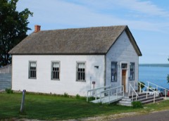 | Assinins | district | 1972 | 72000591 |
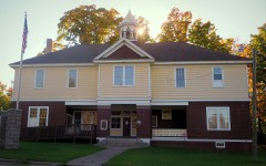 | Avon Township Hall | building | 1981 | 81000302 |
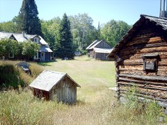 | Herman and Anna Hanka Farm | district | 1984 | 84001372 |
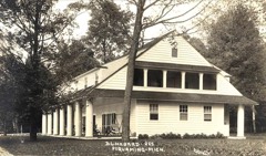 | Hebard-Ford Summer House | building | 1982 | 82002824 |
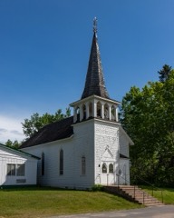 | Kewawenon Mission | building | 1980 | 80001847 |
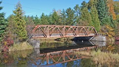 | US-41 (old)-Backwater Creek Bridge | structure | 1999 | 99001508 |
Every wildfire the federal occurrence database records inside this county: 181 of them, burning about 2,174 acres. 23 started naturally and 7 were recorded as arson. Each settlement page carries the fires within five miles of it.
| Reported cause | Fires |
|---|---|
| Debris and open burning | 58 |
| Missing data/not specified/undetermined | 26 |
| Natural | 23 |
| Recreation and ceremony | 21 |
| Fireworks | 14 |
| Equipment and vehicle use | 13 |
| Misuse of fire by a minor | 8 |
| Arson/incendiarism | 7 |
| Power generation/transmission/distribution | 5 |
| Railroad operations and maintenance | 2 |
| Other causes | 2 |
| Smoking | 2 |
The five largest, by the area the report gives. None of them was recorded as arson.
| Date | Cause | Size | Reported by | Name on the report |
|---|---|---|---|---|
| 29 April 2007 | Debris and open burning | 1,127 acres | Michigan Department of Natural Resources | BARAGA BUMP |
| 20 May 2009 | Debris and open burning | 700 acres | Michigan Agency | PINERY |
| 18 April 1994 | Equipment and vehicle use | 148 acres | Michigan Department of Natural Resources | not named |
| 21 April 2007 | Fireworks | 43 acres | Ottawa National Forest | ROTC/SMOKEY &BANDIT |
| 4 October 2012 | Natural | 18 acres | Michigan Department of Natural Resources | PESHEKEE GRADE |
| 13 November 2009 | Missing data/not specified/undetermined | 12 acres | Michigan Agency | HERMAN |
| 10 June 2017 | Debris and open burning | 9.5 acres | Michigan Department of Natural Resources | BIG LAKE |
| 12 May 2020 | Missing data/not specified/undetermined | 6.0 acres | Michigan Department of Natural Resources | HURON RIVER RD |
Every settlement page carries the fires within five miles of it - see the settlement index below.
The NOAA Storm Events Database holds 154 reports for this county, causing no deaths, no injuries and about $20,402,500 in recorded property damage. Each settlement page carries the reports that name it.
| Kind of event | Reports |
|---|---|
| Thunderstorm Wind | 76 |
| Hail | 56 |
| Heavy Rain | 12 |
| Flood | 5 |
| Tornado | 2 |
| Flash Flood | 2 |
| Lightning | 1 |
The most serious of them, by death, then injury, then recorded damage. The accounts are quoted exactly as the forecast office filed them.
| When | Event | Place named | Harm | What the report says |
|---|---|---|---|---|
| July 2022 | Hail | L Anse | $10,000,000 | Facebook photos verified hail from golf ball to baseball-sized in L'Anse. Time of the report was estimated from radar. |
| May 2025 | Flash Flood | Arnheim | $9,300,000 | A localized area of up to 4.2 inches of rainfall fell (per a public source in Pequaming) in a few hours between about 12:30 AM through about 5 AM, with the Baraga and L'Anse CWOP stations recording rain rates of a quarter to half inch of rain per 15 minutes and various stations recorded 1-2+ inch per hour rates. This sudden rainfall caused road overtopping and washouts in the communities of Keweenaw Bay, Baraga, L'Anse, and Pequaming as well as rural surrounding areas. Bus routes were rerouted and beaches were closed due to wastewater backups causing E. Coli and Fecal Coliform contamination. Many basements and private drives were flooded as well. Local rivers such as the Silver River reported up to a 5 foot increase in only a few hours. |
| May 2023 | Flood | Pelkie | $500,000 | Runoff of liquid water equivalent of up to four inches in the higher terrain of Baraga County resulted in mostly minor snowmelt flooding of rural areas along rivers and small streams through much of the first half of May. Minor flooding occurred along the Sturgeon River during this time. |
| July 2013 | Thunderstorm Wind | L Anse | $200,000 | Storms caused sporadic straight-line wind damage over a path roughly one mile long and about one-half mile wide. The estimated 65 mph peak winds uprooted trees and broke off large limbs. One tree fell on a mobile home while the owner was sitting nearby and caused a fire to break out in the kitchen when it landed on a stove. Fallen trees caused damage to other houses and totaled at least one vehicle. In addition a portion of the roof of the county road commission garage was tore off. |
| July 1999 | Thunderstorm Wind | Three Lakes | $100,000 | Trees uprooted - power lines down - some trees on houses. A resort at Lake Ruth suffered wind damage to its main lodge, three cabins, and two sheds. Six of its twelve 14 foot fishing boats were damaged beyond repair. Two houses on Lake George were seriously damaged by falling trees. |
| July 2020 | Thunderstorm Wind | Pequaming | $53,000 | Law enforcement reported a roof blown off a house in Pequaming. Numerous softwood trees were also snapped about a third of the way off the ground along 2nd Sand Road. Time of the report was estimated from radar. |
| July 2006 | Thunderstorm Wind | Covington | $50,000 | Hundreds of trees were either uprooted or snapped along a greater than 20 mile damage path. The more concentrated wind damage began near the Covington Rest Home where an outbuilding was damaged and several large tree limbs were knocked down. As the storm tracked east, numerous trees were uprooted and/or snapped mainly in an area bounded by Cemetary Road, Besonen Road and Highway M-28. Within this area, just behind the VFW building off of VFW Road, there was a localized area where nearly twenty trees were blown down. The wind damage continued across Highway M-28 and eastward along the entire length of old M-28. A resident near the intersection of old M-28 and Foy Road in Covington had a large spruce tree snap off and fall to the ground missing his house by inches. Two eyewitnesses in Covington reported hail greater than the size of quarters during the peak of the storm. Sporadic tree damage was also reported in rural areas north of King Lake Road eastward to Three Lakes. Some tree damage was also noted along Highway M-28/US-41 in Three Lakes and a resident from near Petticoat Lake reported some tree damage. |
| June 2006 | Thunderstorm Wind | Pelkie | $40,000 | 40 to 50 large trees were snapped off or uprooted between Pine Creek Road and just south of Highway M-38 near the Sturgeon River. |
| July 2022 | Hail | L Anse | $20,000 | Golf ball-sized hail was measured by a spotter two miles south of Baraga. Photos on Facebook verified the size of the hail. |
| September 2020 | Thunderstorm Wind | Pelkie | $12,000 | The observer seven miles northwest of Baraga reported several large red pines and spruce trees down from thunderstorm winds. There were approximately 8 snapped trees and over 15 uprooted trees. Power was also knocked out from the storm from 930 pm EDT on the 25th until 7 am EDT on the 26th. |
| September 2020 | Thunderstorm Wind | L Anse | $10,000 | Social media reports confirmed power outages outside of L'anse and trees reported down in L'anse and Baraga. |
| September 2020 | Thunderstorm Wind | Baraga | $10,000 | Many large healthy trees were uprooted north of Baraga. Trees appeared to be laying down in the same direction. The time of the report was estimated from radar. |
| September 2020 | Thunderstorm Wind | Baraga | $10,000 | Highway US-41 was closed due to numerous downed trees near the Pines Convenience Store north of L'anse. |
| July 1998 | Thunderstorm Wind | Covington | $10,000 | 65 mph wind gusts downed 18 to 24 inch diameter trees. |
| July 2020 | Thunderstorm Wind | Pelkie | $7,000 | Law enforcement and social media photos indicated numerous trees, large branches and power lines down blocking roads in the Pelkie area. |
| July 2022 | Thunderstorm Wind | Baraga | $5,000 | Trees and power lines were reported down along Bayshore and Pequaming Roads northeast of L'Anse. |
| June 2022 | Thunderstorm Wind | Baraga | $5,000 | Downed power lines on Tailor Road, right off of Skanee Road. Time of the damage was estimated from radar. |
| September 2019 | Flash Flood | Herman | $5,000 | The observer at Herman reported minor road washouts on Lystilla and Nestoria-Herman roads on the 25th due to flash flooding from heavy rains the night before. |
| July 2016 | Thunderstorm Wind | Alberta | $5,000 | The Baraga County Sheriff reported numerous trees down across Baraga County. One downed tree was blocking Highway US-41 south of L'anse. |
| May 1998 | Thunderstorm Wind | Baraga | $5,000 | Thunderstorm winds tore off part of the Lakeside Inn's copper roof and downed large maple trees in Baraga State Park campground. |
| July 2020 | Thunderstorm Wind | L Anse | $4,000 | Numerous power outages were reported across northwest Baraga County by UPPCO. |
| July 2016 | Thunderstorm Wind | Baraga Carlson Arpt | $3,000 | Regional law enforcement dispatch reported large trees down and snapped power lines near the intersection of Highway M-38 and Pelkie Road. This was a delayed report. |
| July 2012 | Thunderstorm Wind | Leo | $3,000 | Large trees were downed on power lines and across the road 10 miles south of M-28 on US-141. |
| July 2007 | Thunderstorm Wind | Alberta | $3,000 | Many trees and branches down along the highway. |
| June 2006 | Thunderstorm Wind | Pelkie | $3,000 | Several trees and power lines down. |
| July 2022 | Thunderstorm Wind | Zeba | $2,000 | Facebook user shared pictures of a tree down over a road and on a primary power line three miles southeast of Assinins. Time of the report was estimated from radar. |
| September 2021 | Lightning | L Anse | $2,000 | A lightning strike caused damage to a local power substation and caused power outages in L'anse in the early morning of the 7th. |
| July 2020 | Thunderstorm Wind | Pelkie | $2,000 | Online photos received showed numerous spruce trees snapped just east of Pelkie. Time of the delayed report was estimated from radar. |
| July 2020 | Thunderstorm Wind | Zeba | $2,000 | There were social media photos of power poles snapped near the intersection of Johnson Road and Bayshore Road near Zeba. Time of the delayed report was estimated from radar. |
| June 2018 | Thunderstorm Wind | Pequaming | $2,000 | The State Police Regional Dispatch reported trees down on power lines in Pequaming. |
| July 2016 | Thunderstorm Wind | Pelkie | $2,000 | Law enforcement reported downed trees on Froberg Road near Pelkie. Power outages were also reported in Baraga. |
| July 2012 | Thunderstorm Wind | Nestoria | $2,000 | Several trees were downed and a dock was ripped off. Ponding water was observed at Fence Lake Rd. |
| June 2006 | Thunderstorm Wind | Baraga | $2,000 | Several trees down. |
| June 2006 | Thunderstorm Wind | Skanee | $2,000 | Several large trees downed at cabin on Huron Bay. |
| June 2006 | Thunderstorm Wind | L Anse | $2,000 | Several trees down. |
| July 2016 | Thunderstorm Wind | Nestoria | $1,500 | There was a delayed report of tree damage observed near Craig Lake State Park on Craig Lake Road. |
| April 2013 | Flood | Baraga Carlson Arpt | $1,500 | Rapid melting of significant late season snow pack caused moderate flooding of roads over portions of Baraga County, especially along the Sturgeon River, from the 28th into the 30th. Minor flooding continued into early May. Some flooding of basements was also reported. Governor Rick Snyder declared a state of disaster in Baraga County where over 1.5 million dollars of property damage occurred due to the flooding mainly to roadway infrastructure. |
| July 2020 | Thunderstorm Wind | Nestoria | $1,000 | There was a public report of a heavy chair and wood missing from a yard west of Three Lakes. Thunderstorm winds also bent an analog antenna and knocked the power out for two hours. Time of the damage was estimated from radar. |
| July 2020 | Thunderstorm Wind | Pequaming | $1,000 | Social media photos revealed a tree snapped off a quarter of the way off the ground, falling onto power lines on Lehto Road. The delayed report was estimated from radar. |
| July 2019 | Thunderstorm Wind | Baraga | $1,000 | Thunderstorm wind damage pictures received via the internet indicated an anchored trampoline was tossed around, and half of a large tree was downed. |
| July 2019 | Thunderstorm Wind | Watton | $1,000 | Aspen trees were reported down in the Watton area. Pea-sized hail and brief heavy rain were also observed with the thunderstorms. |
| June 2017 | Thunderstorm Wind | L Anse | $1,000 | There was a delayed report from the Baraga County Fire Department of small trees blown over and branches broken off trees in L'anse. |
| July 2016 | Thunderstorm Wind | Baraga Carlson Arpt | $1,000 | Regional law enforcement dispatch reported a large poplar tree down near the intersection of Highway M-38 and Pine Creek Road. This was a delayed report. |
| July 2016 | Thunderstorm Wind | Watton | $1,000 | The observer near Watton reported three large trees down. |
| July 2016 | Thunderstorm Wind | Baraga Carlson Arpt | $1,000 | Downed tree was blocking Highway M-38 near the Sturgeon River. Time of the report was estimated from radar. |
| June 2013 | Thunderstorm Wind | Baraga Carlson Arpt | $1,000 | A fairly large tree was reported down on power lines at Pelkie Road and Highway M-38. This report by police dispatch and the sheriff's office was estimated by radar. |
| July 2012 | Thunderstorm Wind | Pequaming | $1,000 | Several 6 to 8-inch diameter trees were downed. |
| September 2011 | Thunderstorm Wind | Baraga | $1,000 | Ten inch diameter tree was downed and power was out. Hail of unknown size was also reported. |
| September 2010 | Flood | Pelkie | $1,000 | The Sturgeon River overflowed at Halonen Road seven miles northwest of Baraga. The water was estimated to be one foot deep over the road. |
| June 2007 | Thunderstorm Wind | Covington | $1,000 | Several trees down along old M-28. |
| June 2006 | Thunderstorm Wind | L Anse | $1,000 | A 50-foot tall 10-inch diameter tree broke in half. Also a 7-inch diameter poplar tree broke. |
| June 2006 | Thunderstorm Wind | Arnheim | $1,000 | A 10-inch pine tree snapped off. |
| June 2018 | Thunderstorm Wind | Nestoria | $500 | There was a report from social media of a tree down near Nestoria. |
| July 2012 | Thunderstorm Wind | Baraga | $500 | A 1-2 ft diameter willow tree was snapped off. The base of the willow tree was around 3-4 ft in diameter. Debris from the tree was strewn across the yard. |
| May 2011 | Thunderstorm Wind | Nestoria | $500 | A tree fell on power lines sparking a small fire on Imperial Heights Road just off of US-41. |
| April 2025 | Hail | Alberta | - | Hail size ranged from penny to nickel sized. Time estimated from radar. |
| October 2025 | Hail | Nestoria | - | A public report of quarter sized hail covering the ground. |
| April 2023 | Flood | Baraga Carlson Arpt | - | Flooding impacts were reported along the Sturgeon River from the 13th into the 24th. |
| April 2022 | Hail | L Anse | - | The spotter just south of Baraga observed penny-sized hail from a strong thunderstorm. |
| July 2022 | Hail | Pelkie | - | Nickel-sized hail was reported in Alston via Facebook. Time of the report was estimated from radar. The hail lasted several minutes. |
The Survey's mineral resources record lists 49 workings inside this county. 4 still produce and 45 are closed or unrecorded. Each settlement page carries the workings within five miles of it.
| Commodity | Workings |
|---|---|
| Iron | 20 |
| Sand and Gravel, Construction | 7 |
| Graphite | 5 |
| Silver | 4 |
| Vanadium | 4 |
| Gold | 4 |
| Granite | 3 |
| Lead, Vanadium, Zinc | 1 |
| Copper | 1 |
| Lead, Zinc, Uranium | 1 |
| Lead | 1 |
| Stone, Crushed/Broken | 1 |
| Slate, Dimension | 1 |
The least common of them first, because a county's hundredth gravel pit says nothing its first ten did not.
| Where | Site | Commodity | Status | Recorded |
|---|---|---|---|---|
| Arvon Slate Quarry | Stone, Crushed/Broken | Past Producer | ||
| Huron Bay Slate Co | Slate, Dimension | Past Producer | 1872 | |
| Skanee Area | Lead, Vanadium, Zinc, Copper | Occurrence | Vanadate | |
| Unnamed Lead Prospect | Lead | Occurrence | ||
| Unnamed Lead Zinc Uranium Prospect | Lead, Zinc, Uranium | Occurrence | ||
| Gomanche Creek Slate Quarry | Granite | Past Producer | ||
| N.East Branch Slate Quarry | Granite | Past Producer | ||
| Sidnaw Slate Quarry | Granite | Past Producer | ||
| Bughole Exploration | Vanadium | Prospect | 1888, 1914 | |
| Grummett (Ned Lake) Exploration | Gold, Vanadium | Prospect | 1885, 1906 | |
| Hancock Exploration | Gold, Vanadium | Prospect | 1888 | |
| Marquette Exploration | Gold | Prospect | 1883 | |
| Section 23 Silver Prospect | Silver | Prospect | ||
| Silver River Silver Prospect | Silver | Prospect | Vein | |
| Unnamed Gold Prospect | Gold | Prospect | ||
| Unnamed Silver Prospect | Silver | Prospect | ||
| Unnamed Silver Prospect | Silver | Prospect | ||
| Unnamed Vanadium Prospect | Vanadium | Occurrence | ||
| Detroit Graphite Co. Graphite Quarry | Graphite | Producer | Graphite | |
| Detroit Graphite Co.Graphite Quarry | Graphite | Past Producer | ||
| Northern Graphite Works Quarry | Graphite | Producer | Graphite | |
| Northern Graphite Works Quarry | Graphite | Past Producer | ||
| Taylor Mine | Iron, Graphite | Past Producer | 1880, 1883 | |
| Baraga County Pits | Sand and Gravel, Construction | Past Producer | ||
| Foy No 1 Pit | Sand and Gravel, Construction | Producer | ||
| Mead Pit | Sand and Gravel, Construction | Past Producer | ||
| Mead Pit | Sand and Gravel, Construction | Past Producer | ||
| Norback Pit | Sand and Gravel, Construction | Past Producer | ||
| Norback Pit | Sand and Gravel, Construction | Past Producer | ||
| Rowland Lake Pit | Sand and Gravel, Construction | Producer | ||
| Beaufort Mine | Iron | Past Producer | 1882, 1905 | |
| Beaufort Mine | Iron | Past Producer | 1882 | |
| Imperial Iron Mine | Iron | Past Producer | ||
| Imperial Mine | Iron | Past Producer | 1881, 1882 | |
| Imperial Mine (Wetmore) | Iron | Past Producer | 1882, 1933 | |
| Norwood Mine | Iron | Past Producer | 1887, 1888 | |
| Ohio Mine | Iron | Past Producer | 1961 | |
| Ohio Mine -Includes Norwood Mine | Iron | Past Producer | 1907, 1953 | |
| Portland Mine | Iron | Past Producer | 1909, 1915 | |
| Portland Open Pit | Iron | Past Producer | 1909 | |
| Spurr Mine | Iron | Past Producer | 1873, 1886 | |
| Spurr Mine | Iron | Past Producer | 1872, 1873 | |
| Steward | Iron | Prospect | 1874 | |
| Steward Mine (Orleans) | Iron | Past Producer | 1874, 1878 | |
| Taylor Mine | Iron | Past Producer | 1880 | |
| Titan Mine | Iron | Past Producer | 1882, 1888 | |
| Titan Mine | Iron | Past Producer | 1882 | |
| Webster Mine | Iron | Past Producer | 1882, 1900 | |
| Webster Mine | Iron | Past Producer | 1882 |
Named settlements recorded in the Geographic Names Information System, each with the topographic sheets covering it. Villages, hamlets and abandoned places alike. Each is shown with the nearest named watercourse or landform and the survey quadrangle it falls on.
Spurr township · 49861 · On Spurr River · Three Lakes quadrangle
15 sheets, 1956 to 1991
Arvon township · 49962 · On Black Creek · McComb Corner quadrangle
11 sheets, 1954 to 1991
Spurr township · 49861 · On Canal Town Creek · Three Lakes quadrangle
15 sheets, 1956 to 1991
Covington township · 49919 · On Vermilac River · Vermilac quadrangle
12 sheets, 1955 to 1991