 Block
From the record
9 National Register listings published here.
Sources: the National Register database, National Park Service
43 topographic sheets cover 49 settlements here, and 9 properties are on the National Register of Historic Places.
9 National Register listings published here.
Sources: the National Register database, National Park Service
Every property in this county listed on the National Register of Historic Places, with the year it was listed and the federal nomination document.
| Photograph | Property | Type | Listed | Reference |
|---|---|---|---|---|
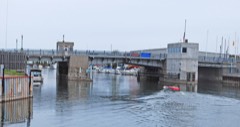 | Cheboyan Bascule Bridge | structure | 1999 | 99001509 |
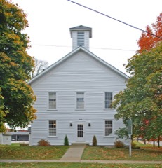 | Cheboygan County Courthouse | building | 1986 | 86001010 |
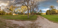 | Faunce-McMichael Farm | district | 1990 | 90000801 |
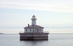 | Fourteen Foot Shoal Light Station | structure | 2005 | 05000742 |
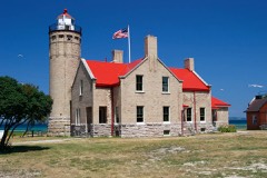 | Mackinac Point Lighthouse | building | 1969 | 69000068 |
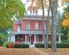 | Newton-Allaire House | building | 1983 | 83000840 |
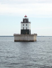 | Poe Reef Light Station | structure | 2005 | 05000985 |
 | Spectacle Reef Light Station | structure | 2005 | 05000744 |
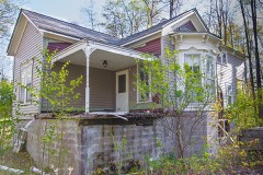 | Forrest J. Stimpson House | building | 1980 | 80001849 |
Every wildfire the federal occurrence database records inside this county: 296 of them, burning about 826 acres. 9 started naturally and 9 were recorded as arson. Each settlement page carries the fires within five miles of it.
| Reported cause | Fires |
|---|---|
| Debris and open burning | 90 |
| Equipment and vehicle use | 54 |
| Missing data/not specified/undetermined | 49 |
| Recreation and ceremony | 49 |
| Power generation/transmission/distribution | 13 |
| Misuse of fire by a minor | 9 |
| Arson/incendiarism | 9 |
| Natural | 9 |
| Smoking | 5 |
| Railroad operations and maintenance | 4 |
| Other causes | 3 |
| Fireworks | 2 |
The five largest, by the area the report gives. None of them was recorded as arson.
| Date | Cause | Size | Reported by | Name on the report |
|---|---|---|---|---|
| 18 April 1993 | Debris and open burning | 81 acres | Michigan Department of Natural Resources | not named |
| 13 June 2009 | Equipment and vehicle use | 52 acres | Michigan Department of Natural Resources | CHEBOYGAN 07 |
| 21 April 1994 | Missing data/not specified/undetermined | 51 acres | Michigan Department of Natural Resources | not named |
| 1 May 2015 | Missing data/not specified/undetermined | 44 acres | Michigan Department of Natural Resources | CHEBOYGAN 04 |
| 17 May 2005 | Smoking | 33 acres | Michigan Department of Natural Resources | not named |
| 23 April 1994 | Recreation and ceremony | 30 acres | Michigan Department of Natural Resources | not named |
| 25 March 1995 | Debris and open burning | 25 acres | Michigan Department of Natural Resources | not named |
| 25 March 1995 | Debris and open burning | 24 acres | Michigan Department of Natural Resources | not named |
Every settlement page carries the fires within five miles of it - see the settlement index below.
The NOAA Storm Events Database holds 97 reports for this county, causing no deaths, 3 injuries and about $544,750 in recorded property damage. Each settlement page carries the reports that name it.
| Kind of event | Reports |
|---|---|
| Thunderstorm Wind | 62 |
| Hail | 22 |
| Tornado | 7 |
| Lightning | 3 |
| Flood | 2 |
| Flash Flood | 1 |
The most serious of them, by death, then injury, then recorded damage. The accounts are quoted exactly as the forecast office filed them.
| When | Event | Place named | Harm | What the report says |
|---|---|---|---|---|
| August 2015 | Lightning | Atton | 2 hurt | Two people were injured by a lightning strike at a campground. They were treated and released from a local hospital later that same day. |
| May 2007 | Lightning | Indian River | 1 hurt | no account filed |
| July 2020 | Thunderstorm Wind | Cheboygan | $100,000 | A portion of the roof of the Bishop Baraga School caved in. Little additional wind damage was noted in the immediate neighborhood. However, several trees were also uprooted a few miles to the southeast. |
| August 2015 | Thunderstorm Wind | Cold Spgs | $75,000 | Many trees and power lines were downed in the Burt Lake and Mullet Lake area. Several homes were damaged by falling trees. |
| August 2003 | Lightning | Wolverine | $75,000 | Lightning started a fire which destroyed a home. |
| October 2007 | Tornado (EF1) | Tower | $30,000 | This tornado produced sporadic damage, mainly to trees, as it tracked across eastern Cheboygan County. One barn was destroyed just north of M-68, west of the community of Tower. The tornado moved out over Black Lake, where it was photographed from the shoreline, just before dissipating. Winds were estimated at 95 mph, making it an EF1. |
| July 2012 | Thunderstorm Wind | Elmhurst | $25,000 | A large number of trees were downed around northern Burt Lake, with the most concentrated damage near Mullet Burt Road and East Burk Lake Road. Some trees were were downed onto homes. |
| April 2011 | Flood | Cheboygan | $25,000 | Inverness Trail was washed out near Maynard Road. Numerous other secondary and gravel roads were washed out and closed. Water levels reached the sides of a few homes. |
| August 2003 | Thunderstorm Wind | Indian River | $25,000 | Numerous trees were downed. Some vehicles and homes were damaged by falling trees. |
| August 1978 | Tornado | not stated | $25,000 | no account filed |
| July 2020 | Thunderstorm Wind | Wolverine | $24,000 | Trees were downed across multiple roads northeast of Wolverine and southeast of Indian River. Trees and power lines were also downed in Afton. |
| July 2020 | Thunderstorm Wind | Indian River | $22,000 | A second severe thunderstorm laid down a swath of downed trees and power lines from Indian River to Afton. |
| September 2014 | Tornado (EF0) | Wolverine | $20,000 | A brief EF-0 tornado occurred in southern Cheboygan County. A number of trees were uprooted or snapped off. Peak winds were estimated at 80 mph. |
| September 2005 | Thunderstorm Wind | Countywide | $20,000 | Many trees and power lines downed. Some brush fires were ignited by fallen lines. |
| June 2017 | Thunderstorm Wind | Black Lake | $14,000 | Several large trees were downed in and outside of Black Lake Campground. One vehicle was damaged by a falling tree. |
| June 2017 | Thunderstorm Wind | Aloha | $12,000 | Roofing was damaged at the Aloha Township Fire Hall. |
| July 2011 | Thunderstorm Wind | Cheboygan | $12,000 | Two trees and numerous power lines were downed. A garage was damaged by a fallen tree. |
| July 2006 | Thunderstorm Wind | Black Lake | $8,000 | Trees downed. Pontoon boat flipped. |
| July 2019 | Thunderstorm Wind | Wolverine | $5,000 | Multiple trees were downed. |
| September 2019 | Thunderstorm Wind | Indian River Arpt | $5,000 | Trees were downed. |
| June 2017 | Thunderstorm Wind | Douglas Lake | $5,000 | Trees and power lines were downed. |
| May 2006 | Thunderstorm Wind | Black Lake | $4,000 | Numerous trees downed. |
| August 2021 | Thunderstorm Wind | Burt Lake | $3,000 | Multiple reports of trees down on SW side of Burt Lake. |
| June 2010 | Thunderstorm Wind | Burt Lake | $3,000 | Several trees were downed northwest of Wolverine. |
| June 2007 | Thunderstorm Wind | Indian River | $2,500 | Tree downed onto utility lines. |
| August 2021 | Thunderstorm Wind | Cold Spgs | $2,000 | Trees downed on East Mullet Lake Rd. |
| September 2016 | Thunderstorm Wind | Indian River | $1,500 | Several large tree limbs were downed at the Indian River Golf Club. |
| July 2024 | Flood | Indian River | $1,000 | Broadcast media shared a photo of street flooding in Indian River. Water was up to the bottom of the body on a Volkswagen sedan. |
| May 2011 | Thunderstorm Wind | Wolverine | $500 | Several large tree limbs were downed. |
| June 1955 | Tornado (F0) | not stated | $250 | no account filed |
| June 2025 | Hail | Cheboygan City Co Ar | - | Report of golf ball size hail on I-75 in Cheboygan county. Additional reports of hail up to the size of a quarter near/in the city of Cheboygan, MI between 0850 and 0900. |
| July 2025 | Thunderstorm Wind | Weadock | - | Numerous trees down with reports of a funnel cloud in the vicinity of Weadock in northern Cheboygan county. Additional reports and photos of a funnel and/or wall cloud all the way to the city of Cheboygan with this storm. |
| June 2010 | Hail | Indian River Arpt | - | Golfball sized hail fell on I-75 near mile marker 308. |
| October 2007 | Hail | Indian River | - | Thunderstorm winds estimated between 35 and 45 mph. |
| May 2005 | Hail | Wolverine | - | A number of thunderstorms in northern Michigan produced hail on the 28th. Only one produced severe-criteria hail, with dime-sized hailstones reported near Wolverine. Some storms were prolific hail producers, even it they weren't severe. Pea sized hail accumulated one to two inches deep near Posen, and two to three inches deep along US-131 northeast of Alba. |
| June 2004 | Thunderstorm Wind | Wolverine | - | A few trees were uprooted. |
| August 2002 | Tornado (F0) | Black Lake | - | Tornado developed and dissipated over Black Lake, causing no damage. |
| August 2002 | Thunderstorm Wind | Wolverine | - | Several 8-10 inch diameter trees down. |
| August 2002 | Thunderstorm Wind | Afton | - | A few trees down. |
| June 2001 | Thunderstorm Wind | Cheboygan | - | Ten inch diameter top of maple tree broken off. |
| June 2001 | Thunderstorm Wind | Indian River | - | Several trees blown down. Two docks blown onto the shore of Burt Lake. |
| August 2001 | Flash Flood | Cheboygan | - | Thunderstorms produced street flooding in the city of Cheboygan as they repeatedly developed and moved over the city. |
| July 1999 | Thunderstorm Wind | Cheboygan | - | Trees and power lines down. |
| July 1999 | Thunderstorm Wind | Cheboygan | - | Trees and power lines down. |
| September 1998 | Thunderstorm Wind | Burt Lake | - | Several trees toppled north of M-68. |
| June 1998 | Thunderstorm Wind | Indian River | - | Strong winds downed several trees. |
| August 1998 | Thunderstorm Wind | Indian River | - | Several trees toppled along Wildwood road. |
| July 1997 | Thunderstorm Wind | Tower | - | Strong thunderstorm winds toppled several trees up to 18 inches in diameter. |
| October 1997 | Thunderstorm Wind | Cheboygan | - | Numerous trees of various sizes were downed. |
| May 1995 | Hail | Apn | - | Three-quarters inch hail reported at Burt Lake by Cheboygan County Sheriff. |
| July 1995 | Thunderstorm Wind | Mackinaw City | - | Sixty mph gusts at Mackinaw City prompted the closure of the Macinac Bridge. Before all vehicles could be cleared from the bridge, building truses were blown from a flat bed truck that was on the bridge. On the south side of the bridge in Mackinac City, a travel trailer was blown over. |
| July 1995 | Thunderstorm Wind | Mackinaw City | - | A spotter reported 67 mph wind gusts on the Mackinac Bridge. |
| July 1995 | Thunderstorm Wind | Cheboygan | - | Spotter reported trees down in the town of Cheboygan. |
| July 1994 | Thunderstorm Wind | Afton | - | Strong thunderstorm winds blew down several five-inch diameter trees. |
| June 1994 | Hail | Davisburg | - | A large tree was blown down near Christopher's Restaurant on the southeast side of Mackinaw City. |
| June 1994 | Thunderstorm Wind | Cheboygan | - | A large tree was blown down near Christopher's Restaurant on the southeast side of Mackinaw City. |
| June 1994 | Thunderstorm Wind | Cass Dowagiac | - | Trees were knocked down by 60 mph winds. |
| June 1994 | Thunderstorm Wind | Cheboygan | - | Three trees, six to eight feet in diameter were blown over on the west side of Mackinaw City. |
| June 1994 | Hail | Cheboygan | - | Dime-size hail was reported between Burt Lake and Mullet Lake by storm spotters. |
| September 2019 | Hail | Black Lake | - | no account filed |
The Survey's mineral resources record lists 17 workings inside this county. 3 still produce and 14 are closed or unrecorded. Each settlement page carries the workings within five miles of it.
| Commodity | Workings |
|---|---|
| Clay | 7 |
| Sand and Gravel, Construction | 5 |
| Stone, Crushed/Broken | 5 |
The least common of them first, because a county's hundredth gravel pit says nothing its first ten did not.
| Where | Site | Commodity | Status | Recorded |
|---|---|---|---|---|
| Afton Quarry & Mill | Stone, Crushed/Broken | Past Producer | ||
| Cambell Quarry & Mill | Stone, Crushed/Broken | Prospect | ||
| Charleviox Lime & Stone | Stone, Crushed/Broken | Past Producer | ||
| Cheboygan Cement Products Pit | Sand and Gravel, Construction | Past Producer | ||
| Cheboygan Co Pit Rondo Pit | Sand and Gravel, Construction | Producer | ||
| Cheboygan Co Road Comm Pit | Sand and Gravel, Construction | Producer | ||
| Legrand Limestone Quarry | Stone, Crushed/Broken | Past Producer | ||
| Marion Stone Co.Limestone Quarry | Stone, Crushed/Broken | Past Producer | ||
| Rondo Pit & Mill | Sand and Gravel, Construction | Past Producer | ||
| State of Michigan Pit | Sand and Gravel, Construction | Producer | ||
| Cheboygan Tile&Brick Co Clay Pit | Clay | Past Producer | ||
| Hatch Farm Shale Prospect | Clay | Prospect | ||
| Unnamed Clay Prospect | Clay | Prospect | ||
| Unnamed Clay Prospect | Clay | Prospect | ||
| Unnamed Clay Prospect | Clay | Prospect | ||
| Unnamed Shale Prospect | Clay | Prospect | ||
| White Farm Shale Prospect | Clay | Prospect |
Named settlements recorded in the Geographic Names Information System, each with the topographic sheets covering it. Villages, hamlets and abandoned places alike. Each is shown with the nearest named watercourse or landform and the survey quadrangle it falls on.
Mullett township · 49721 · On Birchwood Creek · Mullett Lake quadrangle
11 sheets, 1955 to 1984
Tuscarora township · 49706 · On Hasler Creek · Burt Lake quadrangle
12 sheets, 1955 to 1986
Cheboygan city · 49721 · On Cheboygan River · Cheboygan quadrangle
12 sheets, 1955 to 1984
Tuscarora township · 49749 · Near Griswold Mountain · Burt Lake quadrangle
12 sheets, 1955 to 1986
Tuscarora township · 49749 · On Indian River · Indian River quadrangle
12 sheets, 1955 to 1986
Koehler township · 49705 · On Adair Creek · Afton quadrangle
13 sheets, 1955 to 1986
Tuscarora township · 49749 · On Indian River · Indian River quadrangle
12 sheets, 1955 to 1986
Mentor township · 49799 · On Beebe Creek · Wolverine quadrangle
12 sheets, 1955 to 1986
No longer a settlement
Waverly township · 49765 · On Fisher Creek · Hangore Heights quadrangle
12 sheets, 1955 to 1986
Tuscarora township · 49749 · On Sturgeon River · Indian River quadrangle
12 sheets, 1955 to 1986
Munro township · 49755 · On Lancaster Creek · Indianville quadrangle
11 sheets, 1955 to 1984
Mullett township · 49721 · On Birchwood Creek · Mullett Lake quadrangle
11 sheets, 1955 to 1984
Mackinaw township · 49701 · On Mill Creek · Freedom quadrangle
11 sheets, 1955 to 1984
No longer a settlement
Grant township · 49721 · On Section Seven Creek · Manning quadrangle
12 sheets, 1955 to 1984
Koehler township · 49749 · On Little Pigeon River · Indian River quadrangle
12 sheets, 1955 to 1986
Inverness township · 49721 · On Mullett Lake Creek · Mullett Lake quadrangle
11 sheets, 1955 to 1984
Benton township · 49721 · On Ballard Creek · Aloha quadrangle
12 sheets, 1955 to 1984
Mullett township · On Mullett Creek · Indian River quadrangle
12 sheets, 1955 to 1986
Inverness township · 49721 · On Silver Creek · Mullett Lake quadrangle
11 sheets, 1955 to 1984
Nunda township · 49799 · On Bradley Creek · Green Timbers quadrangle
12 sheets, 1954 to 1986
Mullett township · 49721 · On Mullett Creek · Mullett Lake quadrangle
11 sheets, 1955 to 1984
Tuscarora township · 49749 · Near Griswold Mountain · Burt Lake quadrangle
12 sheets, 1955 to 1986
Nunda township · 49799 · On West Branch Sturgeon River · Wolverine quadrangle
12 sheets, 1955 to 1986
The vanished settlements of Cheboygan County: the places named above that are no longer on the map.