 Block
From the record
6 National Register listings published here.
Sources: the National Register database, National Park Service
54 topographic sheets cover 22 settlements here, and 6 properties are on the National Register of Historic Places.
6 National Register listings published here.
Sources: the National Register database, National Park Service
Every property in this county listed on the National Register of Historic Places, with the year it was listed and the federal nomination document.
| Photograph | Property | Type | Listed | Reference |
|---|---|---|---|---|
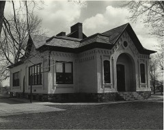 | East Ward School | building | 1980 | 80001850 |
 | Giles J. Gibbs Building-Sugar Bowl | building | 2000 | 00000223 |
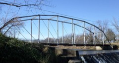 | Grist Mill Bridge, Dam and Mill Site | district | 2015 | 15000295 |
 | Main Street Building, United Church of Ovid | building | 1972 | 72000607 |
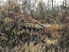 | Stony Creek Bridge | structure | 1999 | 99001467 |
 | Union School | building | 1980 | 80001851 |
Every wildfire the federal occurrence database records inside this county: 58 of them, burning about 115 acres. 8 started naturally and none was recorded as arson. Each settlement page carries the fires within five miles of it.
| Reported cause | Fires |
|---|---|
| Missing data/not specified/undetermined | 26 |
| Equipment and vehicle use | 20 |
| Natural | 8 |
| Debris and open burning | 2 |
| Recreation and ceremony | 1 |
| Power generation/transmission/distribution | 1 |
The five largest, by the area the report gives. None of them was recorded as arson.
| Date | Cause | Size | Reported by | Name on the report |
|---|---|---|---|---|
| 3 April 2010 | Debris and open burning | 48 acres | Michigan Department of Natural Resources | CLINTON 01 |
| 8 April 2019 | Equipment and vehicle use | 8.0 acres | Michigan Department of Natural Resources | DEWITT TOWNSHIP FD 1900433 - 2019 |
| 20 March 2018 | Missing data/not specified/undetermined | 4.0 acres | Michigan Department of Natural Resources | LSW EMERGENCY SERVICES FIRE DIVISION 0000131 - 201 |
| 25 March 2018 | Equipment and vehicle use | 2.0 acres | Michigan Department of Natural Resources | DEWITT AREA EMERGENCY SERVICES AUTHORITY 0000105 - |
| 8 November 2020 | Missing data/not specified/undetermined | 2.0 acres | Michigan Department of Natural Resources | LSW EMERGENCY SERVICES FIRE DIVISION 0000563 - 202 |
| 14 May 2019 | Natural | 2.0 acres | Michigan Department of Natural Resources | LSW EMERGENCY SERVICES FIRE DIVISION 0000223 - 201 |
| 4 July 2018 | Missing data/not specified/undetermined | 1.0 acres | Michigan Department of Natural Resources | DELTA TOWNSHIP FD 1826744 - 2018 |
| 15 October 2018 | Equipment and vehicle use | 1.0 acres | Michigan Department of Natural Resources | DEWITT TOWNSHIP FD 0001171 - 2018 |
Every settlement page carries the fires within five miles of it - see the settlement index below.
The NOAA Storm Events Database holds 255 reports for this county, causing 3 deaths, 27 injuries and about $19,486,950 in recorded property damage. Each settlement page carries the reports that name it.
| Kind of event | Reports |
|---|---|
| Thunderstorm Wind | 178 |
| Hail | 47 |
| Tornado | 19 |
| Flash Flood | 8 |
| Flood | 2 |
| Funnel Cloud | 1 |
The most serious of them, by death, then injury, then recorded damage. The accounts are quoted exactly as the forecast office filed them.
| When | Event | Place named | Harm | What the report says |
|---|---|---|---|---|
| April 1965 | Tornado (F4) | not stated | 1 killed, 8 hurt, $250,000 | no account filed |
| May 1998 | Thunderstorm Wind | Hubbardston | 1 killed, $502,700 | Michigan State Police EMD's Damage and Injury Assessment Report indicated $502,700 in public damage costs, 910 homes damaged, 2 homes destroyed, and 131 businesses damaged. Private property damage estimates were not available. Damage was widespread across the county, with the cities of St. Johns, Elsie, Ovid, and De Witt especially hard-hit. Law enforcement officials reported a 62-year old man was killed in Victor Township on Tuesday, June 2nd, while attempting to clear debris. He was cutting a tree into pieces with a chainsaw when a large limb sprang up and killed him. Clinton County declared a local state of emergency and was granted a Governor's disaster declaration to activate state assistance for the county. On June 24th, President Clinton granted a Major Disaster Declaration for Clinton County, making federal disaster assistance available. |
| October 2001 | Thunderstorm Wind | Maple Rapids | 1 killed, $20,000 | no account filed |
| April 1967 | Tornado (F4) | not stated | 8 hurt, $2,500,000 | no account filed |
| April 1977 | Tornado (F2) | not stated | 6 hurt, $250,000 | no account filed |
| May 1956 | Tornado (F2) | not stated | 3 hurt, $2,500,000 | no account filed |
| July 1987 | Tornado (F0) | not stated | 1 hurt, $25,000 | no account filed |
| August 2024 | Thunderstorm Wind | (Lan)Capitol Cty Arp | 1 hurt | A peak wind gust to 64 mph was measured at Lansing Capital City airport. An injury was also reported in St. John's as a result of a tree that fell onto a house. |
| August 2023 | Thunderstorm Wind | St Johns | $5,000,000 | There were numerous reports of downed power lines, trees and tree limbs across portions of Clinton county. |
| April 2013 | Flood | Matherton | $5,000,000 | Significant flooding occurred on rivers and streams across Clinton county. |
| May 2001 | Tornado (F1) | Riley | $300,000 | A F1 tornado produced maximum estimated wind speeds of 90 m.p.h. in Riley. The tornado began just south of Pratt road and moved north northwest, parallel to Forest Hill road, and ended just south of Parks road. Two sheds were destroyed and a barn was damaged. A shop at an archery range was destroyed and insulation from the shop was carried 3 miles north by the tornado. The tornado had a path length of 4.5 miles and was 50 yards wide. |
| August 1984 | Tornado (F2) | not stated | $250,000 | no account filed |
| August 1951 | Tornado (F2) | not stated | $250,000 | no account filed |
| September 2018 | Tornado (EF0) | Bath | $200,000 | The majority of damage was concentrated in the last 1.5 miles of the path near Cutler Road to the intersection of Hollister and Round Lake Roads. Damage to trees and structures was common along the tornado path. |
| June 2010 | Thunderstorm Wind | Eagle | $200,000 | Storm became severe west of Eagle where winds of 60 to 75 mph occurred before weakening temporarily east of Eagle. The damage swath was 3 miles long and up to 1 mile wide. The wind gusts caused the partial collapse of an approximately 70 year-old pole barn. The winds also downed numerous limbs, some large, and uprooted about 40 trees. |
| May 2004 | Tornado (F0) | Maple Rapids | $150,000 | A F0 tornado touched down about four miles east southeast of Maple Rapids at 3:38 p.m. EDT. The tornado was 75 yards wide with a path length of 3.5 miles. It moved east northeast at 40 m.p.h. The tornado produced the greatest amount of damage near the point of touchdown four miles east southeast of Maple Rapids just south of Island Road, where one silo was destroyed and two others were damaged. A shed was also damaged. A couple of two by fours were driven into the side of a pole barn. Shingles were damaged and ripped off of two homes. Maximum wind speeds here were estimated at 70 m.p.h. Several trees were blown down in the tornadoe's path. The tornado moved east northeast and lifted just north of Maple Rapids road and east of DeWitt road near Ferdon Creek in Clinton county. |
| July 2001 | Thunderstorm Wind | Ovid | $150,000 | no account filed |
| May 2012 | Thunderstorm Wind | St Johns | $100,000 | Clinton county law enforcement reported severe damage to four barns in the vicinity of DeWitt road and M-21 as well as numerous trees down in St. John's. |
| February 2001 | Flash Flood | Countywide | $100,000 | no account filed |
| May 2000 | Flash Flood | Countywide | $100,000 | no account filed |
| June 2021 | Hail | Ovid | $50,000 | A trained spotter measured baseball sized hail in Ovid and also reported that several trees and wires were blown down. |
| July 2014 | Thunderstorm Wind | St Johns | $50,000 | A trained spotter reported that several large trees were blown down and that a couple of outbuildings were damaged in and near St. John's. |
| July 2014 | Tornado (EF0) | St Johns Glowacki Fl | $50,000 | A NWS storm survey confirmed that an EF0 tornado with top winds of 85 mph touched down just south of Walker Rd. and moved northeast and stayed on the ground for 1.6 miles. Several trees were blown down and damage to several outbuildings was incurred. |
| April 2014 | Thunderstorm Wind | St Johns | $50,000 | Roof paneling was torn off a fire station and power lines were blown down by straight line winds of around 80 mph. |
| June 2010 | Thunderstorm Wind | (Lan)Capitol Cty Arp | $50,000 | Severe storms struck Lansing near and just southwest of Capitol City Airport with winds of 50 to 65 mph and to inch sized hail. The winds caused minor damage to the airport terminal building, downed numerous branches, and uprooted approximately 5 trees. Damage swath was 2.5 miles long and about 1.25 miles wide and straddled the borders between Clinton and Ingham counties. |
| June 2008 | Thunderstorm Wind | St Johns | $50,000 | The public reported that a modular home was destroyed near St. John's. |
| August 2007 | Thunderstorm Wind | Waoousta | $50,000 | Trees were blown down in Wacousta and a two foot diameter tree was blown onto a car in DeWitt. |
| August 2007 | Thunderstorm Wind | Eureka | $50,000 | Numerous trees were blown down across Clinton county. |
| August 2003 | Hail | Wacousta | $50,000 | One and three quarters inch diameter hail was reported in Wacousta. |
| May 1999 | Thunderstorm Wind | De Witt | $50,000 | Two to three foot diameter trees were downed by strong winds at the intersection of I-69 and US-127. |
| June 1997 | Thunderstorm Wind | Ovid | $50,000 | Severe thunderstorm winds leveled 2 buildings near the intersection of Hollister and Taft roads in Ovid Township. In addition, several buildings in the area had minor roof damage and several trees were downed. Destroyed buildings were a pole barn and a garage. No one was injured. |
| May 2001 | Flash Flood | Countywide | $50,000 | no account filed |
| May 2001 | Flash Flood | Countywide | $50,000 | no account filed |
| July 2001 | Thunderstorm Wind | St Johns | $50,000 | no account filed |
| July 2003 | Thunderstorm Wind | De Witt | $40,000 | Numerous trees and limbs were blown down in an area about one mile long three miles northwest of Laingsburg. Multiple three to eight inch diameter limbs were blown down one mile east of De Witt. |
| September 2002 | Thunderstorm Wind | Bath | $40,000 | Three barns were blown down by thunderstorm wind gusts near the intersection of Cutler and Hollister roads. Several large tres were also blown down three miles northeast of Bath along Cutler road between Upton and Hollister roads. |
| May 2004 | Thunderstorm Wind | De Witt | $30,000 | A three foot diameter tree was blown down onto a car by severe thunderstorm wind gusts. |
| May 2020 | Flood | Westphalia | $25,000 | Several roads were closed due to water over roads. |
| October 2020 | Thunderstorm Wind | Bath Univ Airpark | $25,000 | Numerous trees were blown down across portions of Clinton county. |
| July 2016 | Thunderstorm Wind | Eagle | $25,000 | Several trees and tree limbs and power lines were downed in and near Eagle and Grand Ledge. |
| July 2015 | Thunderstorm Wind | Waoousta | $25,000 | The road commission in Clinton county reported that around 12 trees were blown down across the southern portion of the county. |
| May 2013 | Thunderstorm Wind | (Lan)Capitol Cty Arp | $25,000 | Wind damage at a lumberyard in Delta township and rolled a semi truck over as well. Several large tree limbs and branches were blown down near Dewitt. An old detached garage and a pole barn were damaged as well. |
| July 2012 | Thunderstorm Wind | St Johns | $25,000 | Over 100 trees were blown down across Clinton county with the eastern portion of the county being hardest hit. |
| August 2007 | Thunderstorm Wind | St Johns | $25,000 | Several trees were blown down in and near St. John's and Eureka. |
| May 2003 | Hail | Maple Rapids | $25,000 | One and three quarters inch diameter hail was reported in Maple Rapids. |
| July 2005 | Thunderstorm Wind | Maple Rapids | $25,000 | no account filed |
| May 2001 | Flash Flood | Countywide | $25,000 | no account filed |
| June 2000 | Thunderstorm Wind | De Witt | $25,000 | no account filed |
| August 2000 | Thunderstorm Wind | Maple Rapids | $25,000 | no account filed |
| August 1979 | Tornado (F1) | not stated | $25,000 | no account filed |
| March 1977 | Tornado (F2) | not stated | $25,000 | no account filed |
| September 1977 | Tornado (F1) | not stated | $25,000 | no account filed |
| June 1976 | Tornado (F1) | not stated | $25,000 | no account filed |
| September 2005 | Thunderstorm Wind | St Johns | $20,000 | Law enforcement reported numerous trees and power lines blown down in St. John's. |
| May 2003 | Hail | De Witt | $20,000 | One inch diameter hail was reported with a severe thunderstorm in De Witt. |
| June 2005 | Thunderstorm Wind | Westphalia | $20,000 | no account filed |
| October 2001 | Thunderstorm Wind | Maple Rapids | $20,000 | no account filed |
| June 2020 | Thunderstorm Wind | Fowler | $15,000 | There were several downed trees and power outages were reported. |
| May 2013 | Thunderstorm Wind | Merle Beach | $15,000 | A Clinton county emergency manager reported that two relatively new barns were blown down by wind gusts of around 70 mph. |
| May 2003 | Hail | De Witt | $15,000 | Seven eighths inch diameter hail was reported in De Witt. |
The Survey's mineral resources record lists 17 workings inside this county. 11 still produce and 6 are closed or unrecorded. Each settlement page carries the workings within five miles of it.
| Commodity | Workings |
|---|---|
| Sand and Gravel, Construction | 14 |
| Clay | 3 |
The least common of them first, because a county's hundredth gravel pit says nothing its first ten did not.
| Where | Site | Commodity | Status | Recorded |
|---|---|---|---|---|
| John Strause Clay Prospect | Clay | Prospect | ||
| Lawson Clay Pit | Clay | Producer | ||
| Moore Clay Pit | Clay | Past Producer | ||
| American Excavating Pit | Sand and Gravel, Construction | Producer | ||
| Boichot Howe Road Pit | Sand and Gravel, Construction | Past Producer | ||
| Central Mich Sand & Gravel Co. Pit | Sand and Gravel, Construction | Producer | ||
| Clinton County Pit | Sand and Gravel, Construction | Producer | ||
| Dyer Company Portable Plant No. 2 | Sand and Gravel, Construction | Producer | ||
| Harman Sand & Gravel Pit | Sand and Gravel, Construction | Past Producer | ||
| Karber Pit & Mill | Sand and Gravel, Construction | Producer | ||
| Martin Pit & Mill | Sand and Gravel, Construction | Producer | ||
| Pohl Pit and Mill | Sand and Gravel, Construction | Producer | ||
| Pryor Brothers, Inc. Pit | Sand and Gravel, Construction | Past Producer | ||
| Pryor Brothers, Inc. Pit | Sand and Gravel, Construction | Past Producer | ||
| Pryor Brothers, Inc. Pit | Sand and Gravel, Construction | Producer | ||
| Standard Pit & Mill | Sand and Gravel, Construction | Producer | ||
| Stockwell Pit | Sand and Gravel, Construction | Producer |
Named settlements recorded in the Geographic Names Information System, each with the topographic sheets covering it. Villages, hamlets and abandoned places alike. Each is shown with the nearest named watercourse or landform and the survey quadrangle it falls on.
DeWitt Charter Township · 48820 · On Prairie Creek · Lansing North quadrangle
12 sheets, 1927 to 1983
DeWitt Charter Township · 48820 · On Prairie Creek · Lansing North quadrangle
12 sheets, 1927 to 1983
Essex township · 48853 · Near The Island · Maple Rapids quadrangle
14 sheets, 1918 to 1985
Ovid township · 48866 · On Little Maple River · Ovid West quadrangle
14 sheets, 1918 to 1985
Victor township · 48848 · On Alder Creek · Price quadrangle
14 sheets, 1928 to 1983