 Block
From the record
15 National Register listings published here.
Sources: the National Register database, National Park Service
82 topographic sheets cover 57 settlements here, and 15 properties are on the National Register of Historic Places.
15 National Register listings published here.
Sources: the National Register database, National Park Service
Every property in this county listed on the National Register of Historic Places, with the year it was listed and the federal nomination document.
| Photograph | Property | Type | Listed | Reference |
|---|---|---|---|---|
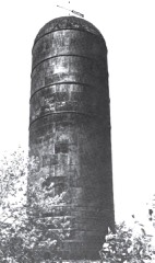 | Bay de Noquet Lumber Company Waste Burner | structure | 2011 | 11000177 |
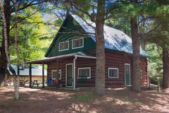 | Camp Delta-Delta Resort | district | 2017 | 100000935 |
 | Carnegie Public Library | building | 1977 | 77000712 |
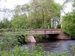 | County Road I-39- Rapid River Bridge | structure | 1999 | 99001511 |
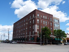 | Delta Hotel | building | 1998 | 98000350 |
 | Escanaba Central Historic District | district | 2014 | 14000123 |
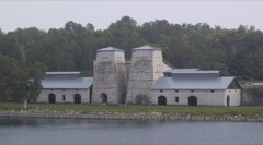 | Fayette | district | 1970 | 70000269 |
| Fayette (Boundary Increase) | district | 1996 | 96001480 | |
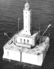 | Minneapolis Shoal Light Station | structure | 2006 | 06001025 |
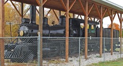 | Nahma and Northern Railway Locomotive #5 | structure | 2007 | 06001327 |
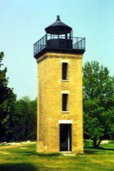 | Peninsula Point Lighthouse | building | 1975 | 75000941 |
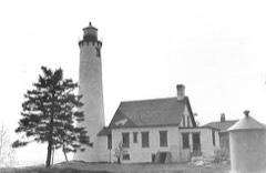 | Poverty Island Light Station | structure | 2005 | 05000984 |
 | Richter Brewery | building | 2009 | 09000202 |
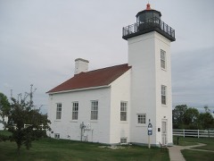 | Sand Lighthouse | building | 1997 | 97001474 |
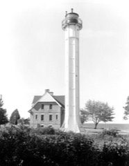 | St. Martin Island Light Station | building | 1984 | 84001387 |
Every wildfire the federal occurrence database records inside this county: 332 of them, burning about 1,363 acres. 22 started naturally and 13 were recorded as arson. Each settlement page carries the fires within five miles of it.
| Reported cause | Fires |
|---|---|
| Debris and open burning | 106 |
| Missing data/not specified/undetermined | 87 |
| Equipment and vehicle use | 30 |
| Natural | 22 |
| Railroad operations and maintenance | 19 |
| Misuse of fire by a minor | 16 |
| Recreation and ceremony | 15 |
| Arson/incendiarism | 13 |
| Power generation/transmission/distribution | 9 |
| Smoking | 6 |
| Other causes | 5 |
| Fireworks | 4 |
The five largest, by the area the report gives. One of them was set deliberately.
| Date | Cause | Size | Reported by | Name on the report |
|---|---|---|---|---|
| 30 June 2016 | Natural | 127 acres | Michigan Agency | POVERTY ISLAND |
| 4 August 2007 | Missing data/not specified/undetermined | 90 acres | Hiawatha National Forest | STONINGTON |
| 17 April 1994 | Misuse of fire by a minor | 84 acres | Michigan Department of Natural Resources | not named |
| 30 April 2003 | Debris and open burning | 45 acres | Michigan Department of Natural Resources | not named |
| 2 August 1998 | Arson/incendiarism | 45 acres | Hiawatha National Forest | SLASH PILE |
| 31 May 2007 | Missing data/not specified/undetermined | 41 acres | Michigan Department of Natural Resources | not named |
| 20 April 2002 | Fireworks | 41 acres | Michigan Department of Natural Resources | not named |
| 6 May 1992 | Debris and open burning | 40 acres | Hiawatha National Forest | not named |
Every settlement page carries the fires within five miles of it - see the settlement index below.
The NOAA Storm Events Database holds 271 reports for this county, causing no deaths, 5 injuries and about $4,994,700 in recorded property damage. Each settlement page carries the reports that name it.
| Kind of event | Reports |
|---|---|
| Thunderstorm Wind | 126 |
| Hail | 89 |
| Heavy Rain | 23 |
| Tornado | 11 |
| Funnel Cloud | 7 |
| Flood | 6 |
| Flash Flood | 6 |
| Lightning | 3 |
The most serious of them, by death, then injury, then recorded damage. The accounts are quoted exactly as the forecast office filed them.
| When | Event | Place named | Harm | What the report says |
|---|---|---|---|---|
| July 1992 | Tornado (F2) | not stated | 2 hurt, $2,500,000 | no account filed |
| May 1998 | Thunderstorm Wind | Cornell | 2 hurt, $400,000 | no account filed |
| July 1972 | Tornado (F2) | not stated | 1 hurt, $250,000 | no account filed |
| April 2026 | Flood | Ford River | $550,000 | County emergency management reported Delta County Airport closed on the 13th due to water over the runways. Power was cut to the VOR facility and water was at least 3 feet deep. At least 4 roads in the city of Escanaba were closed on the 13th. In Rapid River, water over the road closed the US-41 and US-2 intersection. A culvert washout closed County Road 503 in Bay De Noc Township from the 16th to the 17th. Water over the road on County Road 497/GG in Nahma caused the road to be closed from the 17th to the 27th. Drone footage along the Ford River provided by the emergency manager highlighted multiple structures threated, surrounded, or inundated by high water. County emergency manager estimates private property damages around 300 Thousand $USD and the public damages at approximately 250 Thousand $USD. |
| October 1997 | Thunderstorm Wind | Rock | $300,000 | no account filed |
| August 2020 | Tornado (EF1) | Pine Ridge | $150,000 | An unusual low-topped supercell with no lightning produced a brief spin-up of an EF-1 tornado west of Escanaba. The rotating wall cloud and lowering funnel were observed by travelers on Highway US-2 as the tornado initially touched down near Pete's Pick and Pull Auto Parts snapping and knocking down several trees and utility poles. A couple of trees fell on one residence in this vicinity. The tornado then crossed US-2 moving northeastward as it caused extensive damage to to several storage units at Pine Ridge Storage. The tornado continued northeastward into a wooded area where hundreds of trees were snapped and uprooted. As the thunderstorm collapsed the damage evolved into downburst wind damage at the end of its path. The tornado only lasted two minutes. |
| May 2025 | Lightning | Escanaba | $100,000 | Escanaba Public Safety investigator confirmed a lightning strike started a fire causing severe damage at the Bonifas Arts Center and Theater. The theater suffered heavy fire and water damage, with an estimated 6 to 9 months of closure. The arts center was closed for approximately two months. |
| July 2021 | Lightning | Escanaba | $100,000 | The Delta County Sherriff's Department reported two structures fires and a tree fire in Escanaba as a result of lightning strikes. It took over three and a half hours for firefighters to extinguish the first fire which occurred in the attic of a house at 514 South 12th Street. A man and his dog were rescued from one of the apartments at this residence. Fire fighter fatigue was reported to be a major difficulty at this fire due to the heat and humidity, and one firefighter sustained a minor injury while fighting the blaze. Escanaba Public Safety was assisted on the scene by Delta County Central Dispatch, the Escanaba Township and Ford River Township fire departments, Gladstone Public Safety Volunteer Fire Fighters, MSP 84, the Delta County Sheriff's Department, Rampart EMS, DTE, Escanaba City Electric and the Red Cross. ||While responding to the fire on South 12th Street, firefighters had to extinguish a tree fire and a second structure fire at an abandoned residence on 1612 North 20th Street. |
| July 2015 | Thunderstorm Wind | Rock | $100,000 | There was a delayed report via social media of damaging thunderstorm winds in the town of Rock. Two barns, two large greenhouses and a transformer were destroyed, and several vehicles were also damaged. Hundreds of large trees were downed with diameters estimated to range between eight inches to a foot. Several power lines were down causing power outages in the Rock area. The time of the report was estimated from radar. |
| April 2014 | Flood | Chandler | $85,000 | A brief warm spell following a record cold winter resulted in an unusually significant ice break up on Delta County streams and tributaries on the 11th. The unusually thick ice chunks resulted in several ice jams along the Tecoosh, Rapid, and Escanaba Rivers with the most significant along the Escanaba River north of Dam #3.||Water backing up behind an ice jam along the Tecoosh River near the town of Rapid River threatened a house but the Road Commission used heavy equipment to break up the dam and alleviate the pool of water behind it.||Another ice jam formed at the US2 bridge over Rapid River resulting in some backwater flooding and 2 lanes of US2 being closed for a time. An auto repair shop and cottage experienced minor flooding. Damage estimates were around $10K.||The most significant ice jam occurred along the Escanaba River between Boney Falls Dam and Dam #3. Water backed up rapidly behind the jam and surrounded a few houses and summer camps. Damage estimates due to flooded vehicles, trailers, out buildings, and basement flooding were around $75K. |
| June 1998 | Thunderstorm Wind | Escanaba | $75,000 | Strong winds uprooted several trees in and northwest of Escanaba, damaging roofs and windows. |
| April 2023 | Flood | Masonville | $30,000 | Michigan DOT reported snowmelt flood water over US Highway 41 between 27.75 and US Highway 2 near Rapid River on the 13th. Flooding was also reported along the Sturgeon River near Nahma Junction from the 15th through the 23rd. |
| August 2020 | Lightning | Flat Rock | $30,000 | A barn near Hyde in Delta County was struck by lightning during a thunderstorm and set on fire. The fire caused extensive damage to the second story. |
| June 1998 | Tornado (F1) | Escanaba | $25,000 | A tornado touched down at the intersection of County Road 414 and 533 northwest of Escanaba. The storm damaged the siding and roof of a house under construction. Fiberglass insulation was blown in a random manner and a cover to a hot tub was blown against the side of a tree. Approximately one half mile east, was a storage shed that had collasped and a pole barn with a door blown in. The parent storm travelled northeast with evidence of another tornado touchdown near M-35 near Brampton, 12 miles north of Escanaba. |
| July 1987 | Tornado (F3) | not stated | $25,000 | no account filed |
| July 1974 | Tornado (F1) | not stated | $25,000 | no account filed |
| August 1968 | Tornado (F1) | not stated | $25,000 | no account filed |
| July 2013 | Thunderstorm Wind | Escanaba | $20,000 | Escanaba Public Safety reported widespread trees and power lines downed in Delta County, including the towns of Escanaba, Gladstone and Rapid River. |
| July 2008 | Thunderstorm Wind | Island View | $20,000 | An EF1-rated microburst snapped off or uprooted numerous large trees in the OB Fuller County Park and Campground in Delta County on the evening of the 17th. The fallen trees also caused damage to a motorcycle and camping trailer. |
| August 2019 | Thunderstorm Wind | Gladstone | $15,000 | There was a social media report of roll-out boat dock flipped and twisted. A boat was also damaged as it was lifted onto the underside of the twisted dock. The time of the report was estimated from radar. |
| August 2015 | Hail | Kipling | $15,000 | Ping pong sized hail caused damage to vehicles near Gladstone. Time of the report was estimated from radar. |
| May 2021 | Thunderstorm Wind | North Escanaba | $10,000 | Part of a roof blew off a building in Escanaba and debris was blocking a road. The time of the report was estimated from radar. |
| July 2021 | Thunderstorm Wind | (Esc)Dlta Co Arpt Es | $10,000 | Pictures from social media showed multiple trees down in the Escanaba area from thunderstorm winds. Time of the report was estimated from radar and other sources. |
| July 2008 | Thunderstorm Wind | Island View | $10,000 | Numerous large trees were reported down. Some trees were as large as 24 inches in diameter. Downed trees also caused some slight structural damage. |
| July 2008 | Tornado (EF0) | Masonville | $10,000 | An NWS storm survey found a 50-yard wide by 150-yard long EF0-rated tornado track near the intersection of Bayshore Drive and 26th Road. The tornado uprooted large trees, drove a sheet of plywood through a motorhome and tore off a portion of a trailer roof. |
| June 2017 | Thunderstorm Wind | Kipling | $8,000 | There were reports of downed trees and power lines around the Gladstone and Rapid River areas. Time of the report was estimated from radar. |
| August 2021 | Thunderstorm Wind | Chandler | $7,000 | Photo received via local news media of a large tree uprooted at a farm near Cornell. That resident also reported several other trees down and fences were blown over on their farm.|The time of the report was estimated from radar. |
| May 2021 | Thunderstorm Wind | Escanaba | $6,000 | The Delta County Sheriff reported a tree down on a truck in Escanaba. Time of the report was estimated from radar. |
| May 2024 | Thunderstorm Wind | Ford River | $5,000 | The town supervisor reported several trees and wires down across Ford River Township which led to power outages. |
| July 2023 | Thunderstorm Wind | Hyde | $5,000 | Report from social media included description of damage and posted image. Observer stated that he came home and found large storage shed/carport thrown and wrapped around trees. The frame of the shed was destroyed and it was anchored down. Not much damage elsewhere aside from some downed tree limbs. Time of the report was estimated from radar. |
| August 2022 | Thunderstorm Wind | Rapid River | $5,000 | Multiple power outages were reported in southern Delta County with the main outage area from Gladstone eastward along US-41 and US-2 to Nahma Junction. There were multiple lightning flashes reported in that area. |
| September 2012 | Thunderstorm Wind | Perkins | $5,000 | A metal hay barn was blown over while numerous trees were knocked down in the vicinity. |
| June 2010 | Flash Flood | Cornell | $5,000 | Over four inches of rain fell in a two-hour period causing flash flooding in the Cornell area. The flooding washed out portions of County Road I. |
| June 2017 | Thunderstorm Wind | Cornell | $4,000 | There was a delayed report of downed power lines near Cornell. |
| August 2007 | Thunderstorm Wind | Escanaba | $4,000 | Trees down across the city...amount and sizes unknown. Widespread power outages. |
| May 2021 | Thunderstorm Wind | Escanaba | $3,000 | The UPPCO map showed widespread power outages across the western half of Delta County due to strong thunderstorm winds. More than 2000 customers were without power, most concentrated in Escanaba. The time of the report was estimated from radar. |
| August 2019 | Thunderstorm Wind | Gladstone | $3,000 | A media partner shared a report of huge trees down in a park, and trees laying across a road in Gladstone. Time of the report was estimated from radar. |
| July 2017 | Thunderstorm Wind | Campbell | $3,000 | There was a delayed report of several trees down from six to twelve inches in diameter five miles northeast of Perkins. Power is out with trees on power lines. |
| July 2011 | Thunderstorm Wind | (Esc)Dlta Co Arpt Es | $3,000 | Trees reported down over road near M-35 in Ford Township. |
| July 2011 | Thunderstorm Wind | Moss Lake | $3,000 | Trees reported down across Forest Highway 13. |
| July 2006 | Thunderstorm Wind | Garden | $3,000 | Trees down on power lines. |
| October 1997 | Tornado (F1) | Garden Corners | $3,000 | Brief tornado touchdown left pine trees 15-20 inches in diameter uprooted. A camp suffered structural damage to small building. |
| July 2020 | Thunderstorm Wind | Flat Rock | $2,000 | A tree and power lines were reported down near Hyde. Time of the report was estimated by radar. |
| August 2019 | Thunderstorm Wind | Gladstone | $2,000 | A media partner reported trees down at the Michigan State Police parking lot in Gladstone. Time of the report was estimated from radar. |
| June 2017 | Thunderstorm Wind | Moss Lake | $2,000 | The Delta County Sheriff reported trees down along Forest Highway 13 between County Roads 442 and 400 near Chicago Lake. |
| September 2012 | Thunderstorm Wind | Beaver | $2,000 | A trailer weighing more than 300 pounds was moved 100 feet by the strong thunderstorm winds. Trees 36 inches in diameter were also snapped by the storm winds. Several outbuildings were damaged and power was knocked out. Nickel sized hail was also reported. |
| June 2007 | Hail | Garden | $2,000 | Hail lasted approximately one minute. Numerous one-foot diameter trees were also blown down. |
| July 1996 | Thunderstorm Wind | Cornell | $2,000 | no account filed |
| June 2025 | Thunderstorm Wind | Sac Bay | $1,000 | Public report of downed trees between Sac Bay and Fayette. Most of Garden Peninsula lost power for around 2 hours. |
| May 2024 | Thunderstorm Wind | Flat Rock | $1,000 | Pictures of a large tree snapped in Flat Rock. |
| May 2024 | Thunderstorm Wind | Escanaba | $1,000 | Facebook photos were relayed by a local meteorologist of large tree limbs down in the Escanaba area. |
| May 2024 | Thunderstorm Wind | Gladstone | $1,000 | Pictures relayed by local broadcast media of several medium to large tree branches down in Gladstone. |
| June 2024 | Thunderstorm Wind | Cornell | $1,000 | Public report from social media of a downed tree in a driveway approximately three miles north of Cornell. |
| June 2022 | Thunderstorm Wind | Garden | $1,000 | There was a social media report of a tree down and large swing blown down just west of Garden. |
| June 2022 | Thunderstorm Wind | Gladstone | $1,000 | There was a public report of a poplar tree snapped halfway up the tree on the bluff in Gladstone. Another tree was snapped near the base of the trunk. |
| June 2022 | Thunderstorm Wind | Larch | $1,000 | Escanaba Public Safety Dispatch reported a damaged tree down on a power line near the Michigan DNR station in Escanaba. |
| May 2021 | Thunderstorm Wind | Tesch | $1,000 | Tree down blocking a road a mile southeast of Tesch. Time of the report was estimated from radar. |
| July 2020 | Thunderstorm Wind | Escanaba | $1,000 | Law enforcement reported multiple small trees down in north Escanaba. Time of report was estimated from radar. |
| July 2020 | Thunderstorm Wind | Rapid River | $1,000 | The Delta County Road Commission reported a few minor trees down partially blocking a lane near the intersection of Highway US-2 and Highway US-41 in Rapid River. The time of the delayed report was estimated from radar. |
| July 2020 | Thunderstorm Wind | Stonington | $1,000 | The Delta County Road Commission reported a few minor trees down blocking a lane on County Road 511 in Stonington. The time of the delayed report was estimated from radar. |
The Survey's mineral resources record lists 21 workings inside this county. 14 still produce and 7 are closed or unrecorded. Each settlement page carries the workings within five miles of it.
| Commodity | Workings |
|---|---|
| Sand and Gravel, Construction | 12 |
| Stone, Crushed/Broken | 5 |
| Fire Clay (Refractory) | 2 |
| Limestone, General | 2 |
The least common of them first, because a county's hundredth gravel pit says nothing its first ten did not.
| Where | Site | Commodity | Status | Recorded |
|---|---|---|---|---|
| Algonquin Delta Clay Pit | Fire Clay (Refractory) | Past Producer | ||
| Read 150-B | Limestone, General | Producer | Sedimentary | |
| Soo Hill Clay Pit Shale | Fire Clay (Refractory) | Past Producer | ||
| Trenton Limestone | Limestone, General | Past Producer | ||
| Bichler Quarry | Stone, Crushed/Broken | Producer | ||
| Brannstrom Quarry | Stone, Crushed/Broken | Past Producer | ||
| Dolomite Quarry | Stone, Crushed/Broken | Past Producer | ||
| Fox Valley Construction Co Quarry | Stone, Crushed/Broken | Producer | ||
| Weldum Quarry | Stone, Crushed/Broken | Past Producer | ||
| Bichler Gravel & Concrete Co Pit | Sand and Gravel, Construction | Producer | ||
| City of Escanaba Pit | Sand and Gravel, Construction | Producer | ||
| County Pit | Sand and Gravel, Construction | Producer | ||
| Delta Co Pits | Sand and Gravel, Construction | Producer | ||
| Gladstone Pit | Sand and Gravel, Construction | Producer | ||
| Goedert Sand Pit | Sand and Gravel, Construction | Past Producer | ||
| Holmberg Pit | Sand and Gravel, Construction | Producer | ||
| Jaeger Pit | Sand and Gravel, Construction | Producer | ||
| Pacquin Pit | Sand and Gravel, Construction | Producer | ||
| Payne & Dolan Pit | Sand and Gravel, Construction | Producer | ||
| Pit No. 207 Delta Company Rd Comm. | Sand and Gravel, Construction | Producer | ||
| Steve Marvic Sand & Gravel Pit | Sand and Gravel, Construction | Producer |
Named settlements recorded in the Geographic Names Information System, each with the topographic sheets covering it. Villages, hamlets and abandoned places alike. Each is shown with the nearest named watercourse or landform and the survey quadrangle it falls on.
Ford River township · 49829 · On Ford River · Ford River quadrangle
8 sheets, 1954 to 1985
Masonville township · 49878 · On Whitefish River · Rapid River quadrangle
10 sheets, 1932 to 1985
Gladstone city · 49837 · Near Butlers Island · Gladstone quadrangle
9 sheets, 1932 to 1985
Garden township · 49878 · On Fishdam River · Garden Corners quadrangle
10 sheets, 1932 to 1985
Ford River township · 49807 · On No See-um Creek · Ford River quadrangle
8 sheets, 1954 to 1985
Brampton township · 49837 · Near Butlers Island · Gladstone quadrangle
9 sheets, 1932 to 1985
Masonville township · 49878 · On Dillabough Creek · Rapid River quadrangle
10 sheets, 1932 to 1985
Masonville township · 49878 · On Tacoosh River · Rapid River quadrangle
10 sheets, 1932 to 1985
Ford River township · 49807 · On North Branch Bark River · Ford River quadrangle
8 sheets, 1954 to 1985
Wells township · 49829 · On Bichler Creek · Gladstone quadrangle
9 sheets, 1932 to 1985
No longer a settlement
Maple Ridge township · 49878 · Rock SE quadrangle
12 sheets, 1932 to 1985
No longer a settlement
Masonville township · 49878 · On Rapid River · Rapid River quadrangle
10 sheets, 1932 to 1985
Maple Ridge township · 49880 · On Nookomis kabekong · Cornell quadrangle
9 sheets, 1932 to 1985
The vanished settlements of Delta County: the places named above that are no longer on the map.