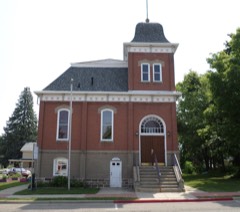
Block
From the record
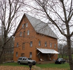
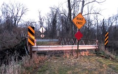
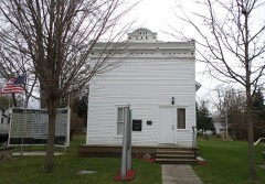
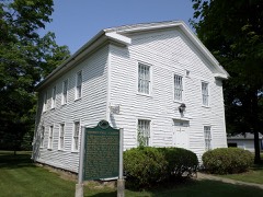
18 National Register listings published here.
Sources: the National Register database, National Park Service
81 topographic sheets cover 34 settlements here, and 18 properties are on the National Register of Historic Places.
18 National Register listings published here.
Sources: the National Register database, National Park Service
Every property in this county listed on the National Register of Historic Places, with the year it was listed and the federal nomination document.
Every wildfire the federal occurrence database records inside this county: 106 of them, burning about 155 acres. 12 started naturally and none was recorded as arson. Each settlement page carries the fires within five miles of it.
| Reported cause | Fires |
|---|---|
| Missing data/not specified/undetermined | 54 |
| Equipment and vehicle use | 35 |
| Natural | 12 |
| Recreation and ceremony | 2 |
| Debris and open burning | 1 |
| Fireworks | 1 |
| Smoking | 1 |
The five largest, by the area the report gives. None of them was recorded as arson.
| Date | Cause | Size | Reported by | Name on the report |
|---|---|---|---|---|
| 23 March 2018 | Equipment and vehicle use | 25 acres | Michigan Department of Natural Resources | OLIVET FD 0000069 - 2018 |
| 24 April 2018 | Equipment and vehicle use | 11 acres | Michigan Department of Natural Resources | POTTERVILLE-BENTON TWP FD 0000060 - 2018 |
| 16 March 2020 | Equipment and vehicle use | 5.0 acres | Michigan Department of Natural Resources | BELLEVUE FD 0020-82 - 2020 |
| 3 April 2019 | Equipment and vehicle use | 5.0 acres | Michigan Department of Natural Resources | SUNFIELD FD 2019079 - 2019 |
| 1 April 2018 | Natural | 3.0 acres | Michigan Department of Natural Resources | HAMLIN TOWNSHIP FIRE/RESCUE 0000042 - 2018 |
| 29 April 2018 | Equipment and vehicle use | 3.0 acres | Michigan Department of Natural Resources | HAMLIN TOWNSHIP FIRE/RESCUE 0000056 - 2018 |
| 29 July 2018 | Debris and open burning | 2.0 acres | Michigan Department of Natural Resources | HAMLIN TOWNSHIP FIRE/RESCUE 0000103 - 2018 |
| 27 March 2019 | Equipment and vehicle use | 2.0 acres | Michigan Department of Natural Resources | CHARLOTTE FD 0000185 - 2019 |
Every settlement page carries the fires within five miles of it - see the settlement index below.
The NOAA Storm Events Database holds 230 reports for this county, causing 2 deaths, 53 injuries and about $69,682,751 in recorded property damage. Each settlement page carries the reports that name it.
| Kind of event | Reports |
|---|---|
| Thunderstorm Wind | 125 |
| Hail | 67 |
| Tornado | 25 |
| Flash Flood | 8 |
| Funnel Cloud | 3 |
| Flood | 2 |
The most serious of them, by death, then injury, then recorded damage. The accounts are quoted exactly as the forecast office filed them.
| When | Event | Place named | Harm | What the report says |
|---|---|---|---|---|
| April 1977 | Tornado (F4) | not stated | 1 killed, 44 hurt, $2,500,000 | no account filed |
| June 2008 | Tornado (EF1) | Needmore | 1 killed | A storm survey team determined that an EF1 tornado developed over Cochran road about four miles southwest of Grand Ledge. Though briefly weakening to EF0 status shortly after descent... the tornado regained it's EF1 status before finally lifting immediately east of the Eckert Plant in Lansing.||Some large tree limbs were blown down and a few spruce trees were uprooted by winds estimated to be up to 63 mph along Mulliken road and Needmore highway. More significant damage was noted on Cochran road north of Needmore highway. Numerous trees and limbs were blown down... a porch awning was blown off and a garage was completely destroyed. An EF1 tornado rating was assigned for the damage on Cochran road. ||The tornado continued on Strange highway briefly weakening to EF0. Multiple large trees were uprooted along Strange highway approaching M-100 (Hartel road). Moderate to significant roof damage was observed on four different homes heading north on M-100 where the tornado regained it's EF1 status. ||Dozens of large spruces and maples were uprooted on Mt. Hope highway |and four barns were destroyed. Significant roof damage to homes reappeared as well. A woman was killed when a large trailer was flipped on top of her in Delta township on Mt. Hope highway between Nixon and Guinea roads. ||The tornado continued toward a subdivision on the west side of Lansing. |Numerous large trees were uprooted on North Cambridge road and a few landed on homes. The country club of Lansing was also affected by downed trees and limbs as the tornado moved into far western Ingham county. |
| August 2007 | Tornado (EF3) | Charlotte | 5 hurt, $40,000,000 | A NWS storm survey team determined that an EF-3 (Enhanced-Fujita Tornado Scale Rating) tornado with wind speeds estimated at 140 mph produced the most severe damage along a path from M-50 just north of Kinsel Highway to just west of M-100 and Vermontville Highway near Potterville, Michigan. The storm survey indicated a tornado path which was 200 to 300 yards wide and 6.5 miles long.||Fifteen homes were either destroyed or severely damaged. A roof was blown off a single story home and windward facing walls were blown in. The majority of the roof and garage from this home were not found. A roof was blown off of a two story home and the upper story front walls were blown in. Additional damage included the partial collapse of the upper story of a home, and another house was blown off of the foundation. Two barns were destroyed and another incurred heavy damage just west of Potterville. |
| September 2001 | Tornado (F1) | Potterville | 1 hurt, $10,000,000 | no account filed |
| July 1974 | Tornado (F1) | not stated | 1 hurt, $250,000 | no account filed |
| May 1955 | Tornado (F2) | not stated | 1 hurt, $250,000 | no account filed |
| June 1951 | Tornado (F1) | not stated | 1 hurt, $2,500 | no account filed |
| August 2023 | Thunderstorm Wind | Grand Ledge Arpt | $5,000,000 | Severe thunderstorm winds blew down numerous trees and tree limbs and power lines across portions of Eaton county. Some houses were damaged from falling trees and some power poles were damaged. Numerous trees were also snapped or uprooted in and near Grand Ledge along with damaged utility lines and buildings. |
| April 2013 | Flood | Woodbury | $3,000,000 | Heavy rainfall caused significant flooding on rivers and streams across Eaton county. |
| May 2011 | Thunderstorm Wind | Charlotte | $1,000,000 | A swath of damage approximately 12 miles long and 0.5 to 1 mile in width occurred SE of Charlotte to just NNE of Eaton Rapids. The damage resulted from a bowing segment of a line echo wave pattern which downed numerous trees and power lines. Several homes in the area sustained roof damage, and one home approximately 3 mi NW of Eaton Rapids was partially destroyed. However, that home was not properly attached to its foundation. Several barns were also damaged, one of which was destroyed. |
| May 2011 | Thunderstorm Wind | Brookfield | $1,000,000 | The bow echo impacted mainly rural areas of Brookfield and Hamlin Townships. The damage path, which was 8 miles long and up to 1 mile in width, was an extension of the damage path seen in Calhoun county. Hundreds of trees were either uprooted or snapped, and a half of a dozen farms received property damage. |
| July 2011 | Flash Flood | Woodbury | $1,000,000 | Six to eight inches of rain fell across much of Eaton county from the late evening hours of July 27 through the early morning hours of July 29. This caused flash flooding and numerous road closures and washouts. A co-op observer measured 7.15 inches of rain in Diamondale. Three to four feet of ponding water in a field in Diamondale damaged several pieces of farm equipment that were part of a farm implement show.||Interstate 69 was closed in Eaton County between Vermontville Highway and Windsor Road due to rapidly flowing water over the road. |
| October 2001 | Thunderstorm Wind | Kalamo | $1,000,000 | no account filed |
| June 2008 | Flash Flood | Bellevue | $600,000 | Numerous road washouts were reported across portions of Eaton county. As a result a presidential disaster declaration was issued. |
| September 2014 | Thunderstorm Wind | Olivet Station | $500,000 | Numerous large trees were blown down across portions of Eaton county. The town of Eaton Rapids was especially hard hit, where wind gusts estimated at up to 75 mph brought down numerous trees and power lines. There were thousands of power outages. |
| May 2001 | Tornado (F0) | Chester | $300,000 | A F0 tornado touched down just south of Valley highway and moved north, paralleling Chester road, and ending just north of Gresham highway. The tornado had a path length of 6 miles, a width of 50 yards, and produced maximum estimated wind speeds to 70 m.p.h. The tornado produced tree damage and peeled shingles off the roof of a church. A small airplane was also flipped over. |
| August 1986 | Tornado (F2) | not stated | $250,000 | no account filed |
| March 1976 | Tornado (F1) | not stated | $250,000 | no account filed |
| August 1951 | Tornado (F1) | not stated | $250,000 | no account filed |
| June 2024 | Thunderstorm Wind | Vermontville | $100,000 | Numerous trees were blown down between Vermontville and Eaton Rapids. |
| July 2021 | Thunderstorm Wind | Bretton Woods | $100,000 | Several trees and power lines were blown down across portions of Eaton county. |
| May 2020 | Flood | Gresham | $100,000 | There were numerous road closures due to flooding. |
| August 2007 | Thunderstorm Wind | Eaton Rapids Skyway | $100,000 | Several trees and power lines were blown down and a couple of trees fell on homes near Eaton Rapids and Lansing. |
| August 2004 | Thunderstorm Wind | Vermontville | $100,000 | The Maple Valley High School in Vermontville suffered significant damage including a roof which was partially torn off and sections of windows which were blown in. |
| February 2001 | Flash Flood | Countywide | $100,000 | no account filed |
| May 2000 | Flash Flood | Countywide | $100,000 | no account filed |
| May 2000 | Hail | Charlotte | $80,000 | no account filed |
| April 2023 | Hail | Sunfield | $50,000 | A trained spotter near Sunfield reported hail over an inch in diameter. |
| September 2019 | Thunderstorm Wind | Woodbury | $50,000 | There were two houses that sustained damage in the form of broken windows and lost roofing and shingle damage. |
| July 2017 | Thunderstorm Wind | Eaton Rapids | $50,000 | Several trees were blown down in Eaton Rapids and across other portions of Eaton county. |
| June 2013 | Flash Flood | Oneida Center | $50,000 | I-69 was flooded near Potterville and several roads in the Potterville and Dimondale areas were flooded or washed out with a few cars stalled and flipped over by flood waters. There were no injuries or fatalities. |
| November 2013 | Thunderstorm Wind | Petrieville | $50,000 | Three residences and trees and outbuildings damaged by wind gusts up to 70 mph and possible very brief EF-0 tornado. |
| June 2009 | Thunderstorm Wind | Eaton Rapids | $50,000 | A severe thunderstorm damages a grain silo, a Burger King sign, and blew down tens of trees just south of the city center. |
| May 2004 | Thunderstorm Wind | Bellevue | $50,000 | Severe thunderstorm wind gusts blew a roof off of a garage. Two 24 inch diameter pine trees were blown down. |
| May 2004 | Thunderstorm Wind | Mulliken | $50,000 | A barn was blown down by a severe thunderstorm wind gust near the intersection of Dow and St. Joe roads. |
| August 2004 | Tornado (F0) | Vermontville | $50,000 | A very brief touchdown of a F0 tornado occurred in Vermontville. There were no injuries and fatalities. However, a tin roof was blown off of a house on First Street in Vermontville. |
| May 1999 | Thunderstorm Wind | Countywide | $50,000 | Numerous trees and power lines were downed across the county. A small plane at the Fitch Beach Airport in Charlotte was flipped over by strong winds. |
| July 2001 | Thunderstorm Wind | Grand Ledge | $50,000 | no account filed |
| August 2007 | Thunderstorm Wind | Kalamo | $40,000 | Trees and limbs were blown down near the intersection of Carlisle and Mason roads and a chimney was blown down. |
| May 2004 | Hail | Charlotte | $40,000 | Three quarters inch hail was reported in Eaton Rapids and several trees were blown down in Charlotte. |
| May 2004 | Hail | Charlotte | $40,000 | One and three quarters inch diameter hail was reported by law enforcement in Charlotte. |
| July 2003 | Hail | Eaton Rapids | $40,000 | A report of one inch diameter hail was received from Eaton Rapids. |
| May 2000 | Hail | Grand Ledge | $40,000 | no account filed |
| July 2003 | Thunderstorm Wind | Charlotte | $30,000 | A few trees and power lines were blown down in Charlotte. Numerous trees and power lines were blown down across most of Eaton county between 10:25 and 10:35 E.S.T. |
| June 2024 | Thunderstorm Wind | Chester | $25,000 | Several large trees were blown down. |
| August 2022 | Thunderstorm Wind | Eaton Rapids | $25,000 | Several trees were blown down across Eaton county. |
| June 2019 | Thunderstorm Wind | Bellevue | $25,000 | Several large trees were blown down. |
| June 2005 | Hail | Grand Ledge | $25,000 | Three quarters inch diameter hail was reported by a spotter seven miles west of Lansing. |
| May 2004 | Thunderstorm Wind | Bellevue | $25,000 | Several trees were blown down two miles east of Bellevue. |
| September 2001 | Thunderstorm Wind | Charlotte | $25,000 | An isolated severe thunderstorm produced wind gusts that blew down numerous 12-16 inch diameter trees. Most of the trees were blown down along an area just under a mile long and a tenth of a mile wide in Charlotte. |
| June 2005 | Thunderstorm Wind | Mulliken | $25,000 | no account filed |
| July 2005 | Thunderstorm Wind | Grand Ledge | $25,000 | no account filed |
| July 2005 | Thunderstorm Wind | Bellevue | $25,000 | no account filed |
| April 2001 | Hail | Bellevue | $25,000 | no account filed |
| May 2001 | Flash Flood | Countywide | $25,000 | no account filed |
| June 2000 | Thunderstorm Wind | Vermontville | $25,000 | no account filed |
| August 2000 | Hail | Eaton Rapids | $25,000 | no account filed |
| August 2000 | Thunderstorm Wind | Vermontville | $25,000 | no account filed |
| June 1976 | Tornado (F1) | not stated | $25,000 | no account filed |
| April 1970 | Tornado (F1) | not stated | $25,000 | no account filed |
The Survey's mineral resources record lists 22 workings inside this county. 10 still produce and 12 are closed or unrecorded. Each settlement page carries the workings within five miles of it.
| Commodity | Workings |
|---|---|
| Sand and Gravel, Construction | 11 |
| Clay | 7 |
| Quartz | 1 |
| Iron | 1 |
| Stone, Crushed/Broken | 1 |
| Limestone, General | 1 |
The least common of them first, because a county's hundredth gravel pit says nothing its first ten did not.
| Where | Site | Commodity | Status | Recorded |
|---|---|---|---|---|
| Bellevue Limestone | Stone, Crushed/Broken | Producer | ||
| Bellevue Quarry | Limestone, General | Producer | 1946 | |
| Charlotte Plant | Iron | Producer | ||
| Pryor Brothers Pit | Quartz | Past Producer | ||
| American Sewer Pipe Co Shale Pit | Clay | Past Producer | ||
| Briggs Co Clay Pit | Clay | Past Producer | ||
| Fc Hunt Clay Prospect | Clay | Prospect | ||
| Grand Ledge Clay Prod Co Shale Pit | Clay | Past Producer | ||
| Lawson Clay Pit | Clay | Past Producer | ||
| Lawson Road Mine | Clay | Past Producer | ||
| Olivet Brick&Tile Co Clay Pit | Clay | Past Producer | ||
| Briggs Dredge & Mill | Sand and Gravel, Construction | Producer | ||
| Charlotte Pit & Mill | Sand and Gravel, Construction | Past Producer | ||
| Crandell Brothers Trucking Co Pit | Sand and Gravel, Construction | Producer | ||
| Crandell Ionia Road Pit & Mill | Sand and Gravel, Construction | Past Producer | ||
| Eaton Pit | Sand and Gravel, Construction | Producer | ||
| Pit No. 3 & Mill | Sand and Gravel, Construction | Producer | ||
| Potterville Pit | Sand and Gravel, Construction | Producer | ||
| Pryor Brothers Pit | Sand and Gravel, Construction | Past Producer | ||
| Rieth - Riley Construction Company | Sand and Gravel, Construction | Producer | ||
| Vermontville Sand and Gravel Pit | Sand and Gravel, Construction | Past Producer | ||
| Whittum Pit & Mill | Sand and Gravel, Construction | Producer |
Named settlements recorded in the Geographic Names Information System, each with the topographic sheets covering it. Villages, hamlets and abandoned places alike. Each is shown with the nearest named watercourse or landform and the survey quadrangle it falls on.
Delta Charter Township · 48906 · On Carrier Creek · Wacousta quadrangle
11 sheets, 1927 to 1983
Windsor Charter Township · 48821 · On Silver Creek · Dimondale quadrangle
14 sheets, 1910 to 1983
Eaton Rapids city · 48827 · On Spring Brook · Eaton Rapids quadrangle
13 sheets, 1910 to 1983
Grand Ledge city · 48837 · On Sandstone Creek · Wacousta quadrangle
11 sheets, 1927 to 1983
Chester township · 48813 · On Little Thornapple River · Hoytville quadrangle
10 sheets, 1949 to 1983
Eaton Rapids township · 48827 · On Harris Drain · Aurelius quadrangle
13 sheets, 1910 to 1983
Chester township · 48813 · On Little Thornapple River · Hoytville quadrangle
10 sheets, 1949 to 1983
Vermontville township · 49096 · On Shanty Brook · Saubee Lake quadrangle
10 sheets, 1950 to 1984
Windsor Charter Township · 48821 · On Silver Creek · Dimondale quadrangle
14 sheets, 1910 to 1983