Block
From the record
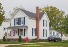
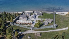
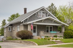
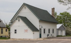
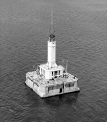
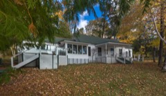
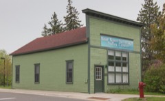
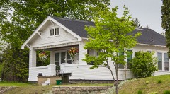
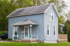
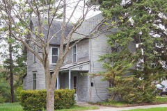
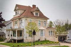
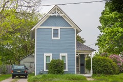
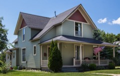
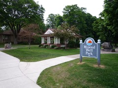
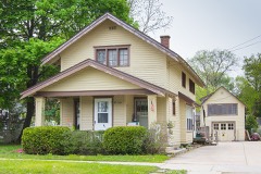
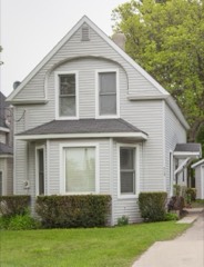
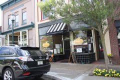
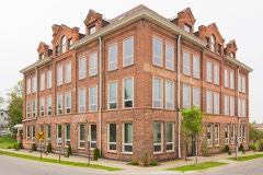
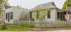
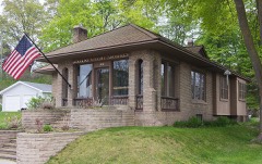
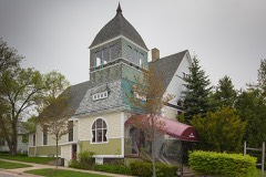
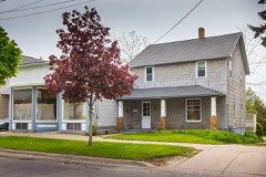
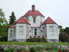
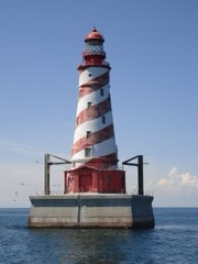
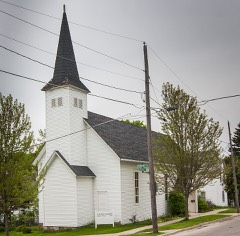
49 National Register listings published here, 3 of them National Historic Landmarks.
Sources: the National Register database, National Park Service
39 topographic sheets cover 33 settlements here, and 49 properties are on the National Register of Historic Places.
49 National Register listings published here, 3 of them National Historic Landmarks.
Sources: the National Register database, National Park Service
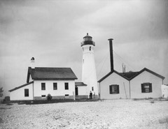
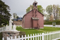
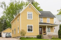
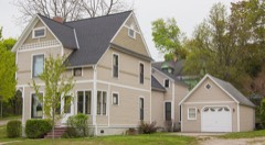
Every property in this county listed on the National Register of Historic Places, with the year it was listed and the federal nomination document.
Every wildfire the federal occurrence database records inside this county: 156 of them, burning about 362 acres. 8 started naturally and 2 were recorded as arson. Each settlement page carries the fires within five miles of it.
| Reported cause | Fires |
|---|---|
| Missing data/not specified/undetermined | 45 |
| Debris and open burning | 44 |
| Equipment and vehicle use | 29 |
| Recreation and ceremony | 13 |
| Natural | 8 |
| Misuse of fire by a minor | 7 |
| Fireworks | 3 |
| Power generation/transmission/distribution | 3 |
| Arson/incendiarism | 2 |
| Other causes | 1 |
| Railroad operations and maintenance | 1 |
The five largest, by the area the report gives. None of them was recorded as arson.
| Date | Cause | Size | Reported by | Name on the report |
|---|---|---|---|---|
| 29 March 2007 | Equipment and vehicle use | 40 acres | Michigan Department of Natural Resources | not named |
| 23 April 1994 | Missing data/not specified/undetermined | 32 acres | Michigan Department of Natural Resources | not named |
| 30 August 2012 | Missing data/not specified/undetermined | 24 acres | Michigan Department of Natural Resources | EMMET 10 - LAKEVIEW |
| 6 May 1992 | Debris and open burning | 20 acres | Michigan Department of Natural Resources | not named |
| 16 April 2008 | Debris and open burning | 16 acres | Michigan Department of Natural Resources | EMMET 02 |
| 7 July 2006 | Equipment and vehicle use | 15 acres | Michigan Department of Natural Resources | not named |
| 15 April 2004 | Misuse of fire by a minor | 15 acres | Michigan Department of Natural Resources | not named |
| 13 November 2016 | Fireworks | 7.0 acres | Michigan Department of Natural Resources | not named |
Every settlement page carries the fires within five miles of it - see the settlement index below.
The NOAA Storm Events Database holds 85 reports for this county, causing no deaths, 1 injury and about $638,500 in recorded property damage. Each settlement page carries the reports that name it.
| Kind of event | Reports |
|---|---|
| Thunderstorm Wind | 57 |
| Hail | 18 |
| Tornado | 5 |
| Flash Flood | 2 |
| Waterspout | 1 |
| Lightning | 1 |
| Flood | 1 |
The most serious of them, by death, then injury, then recorded damage. The accounts are quoted exactly as the forecast office filed them.
| When | Event | Place named | Harm | What the report says |
|---|---|---|---|---|
| August 2001 | Thunderstorm Wind | Alanson | 1 hurt | no account filed |
| July 2020 | Thunderstorm Wind | Bay View | $135,000 | Severe winds caused extensive tree damage and some property damage in Petoskey and Bay View. Many trees and large limbs were downed, damaging a few structures. A large sign outside of a hotel was blown down, and trees on the property were uprooted. The Pennsylvania Plaza Building in Petoskey suffered damage to roofing and exterior brickwork. |
| June 1998 | Hail | Petoskey | $100,000 | Large hail up to 2.50" in diameter caused $100,000 worth of damage to cars on two lots west of Petoskey. |
| July 2020 | Flash Flood | Menonaqua Beach | $80,000 | Thunderstorms moved repeatedly over the same area on the afternoon of the 18th. Rainfall amounts of 2 to 4 inches were estimated to fall from just northeast of Petoskey, on toward Indian River. Measured rainfall amounts by the next morning were as high as 5.25 inches near Afton, though this occurred over multiple rounds of thunderstorms, not just this late afternoon batch. Flash flooding was reported in the community of Oden in Emmet County, where knee-high water flooded homes along Pingree Avenue, on the east side of town. |
| August 2003 | Thunderstorm Wind | Petoskey | $51,000 | Numerous trees and power lines were downed. Several homes and cottages were damaged by falling trees near Crooked and Pickerel Lakes, and a small aluminum boat was tossed into a tree. At a dealership in Petoskey, trailers were rolled off of a parking lot and into a ditch. |
| September 2018 | Thunderstorm Wind | Harbor Pt | $40,000 | Several trees were downed in Harbor Springs, and a couple of homes were damaged by fallen trees. |
| June 2005 | Thunderstorm Wind | Petoskey | $25,000 | Numerous trees were downed from downtown Petoskey to the M-119/US-31 intersection. A restaurant at that intersection was damaged by a falling tree. |
| August 1987 | Tornado (F0) | not stated | $25,000 | no account filed |
| July 1957 | Tornado (F1) | not stated | $25,000 | no account filed |
| July 2007 | Thunderstorm Wind | Petoskey | $22,000 | Many trees and power lines were downed, from the east end of Little Traverse Bay, extending inland a few miles. One car was crushed by a falling tree. A woman at Petoskey State Park was briefly trapped inside a motorhome. |
| June 2011 | Flash Flood | Good Hart | $18,000 | A culvert was washed out along Levering Road (C-66) a few miles east of Cross Village. Substantial soil erosion occurred in the yards of some homes. The co-operative observer, one mile east of Cross Village, measured 4.79 inches of rain in 12 hours, most of which fell in a four hour period either side of midnight. |
| July 2007 | Thunderstorm Wind | Petoskey | $15,000 | A few trees and numerous tree limbs were downed. A car at the Petoskey post office was damaged by a falling tree. |
| September 2005 | Thunderstorm Wind | Countywide | $15,000 | Numerous trees and power lines downed across Emmet County. |
| June 2001 | Thunderstorm Wind | Petoskey | $15,000 | Numerous large tree limbs blown down. One large limb fell on house causing roof and chimney damage. |
| June 2017 | Thunderstorm Wind | Brutus | $9,000 | Trees were downed in Maple River Township. |
| June 2010 | Thunderstorm Wind | Bay View | $8,000 | Numerous trees were downed in Petoskey. |
| October 2018 | Thunderstorm Wind | Harbor Spgs Boyne Fl | $6,000 | Several trees were downed by thunderstorm winds. |
| June 2017 | Thunderstorm Wind | Stutsmanville | $6,000 | Trees were downed onto power lines. |
| June 2017 | Thunderstorm Wind | Epsilon | $6,000 | Trees were downed onto power lines, near the intersection of Pickerel Lake Road and Silver Creek Road. |
| October 2016 | Thunderstorm Wind | Bliss | $6,000 | Multiple trees and power lines were downed. |
| August 2015 | Thunderstorm Wind | Brutus | $6,000 | Several trees and power lines were downed. |
| September 2022 | Flood | Harbor Pt | $5,000 | M-119 (Bluff Dr) closed at Harrison St due to significant erosion of shoulder of highway. Time estimated. |
| July 2004 | Thunderstorm Wind | Pellston | $5,000 | Trees and power lines were downed. |
| September 2019 | Thunderstorm Wind | Harbor Pt | $4,000 | A couple of trees were downed, one onto power lines, causing a localized power outage. |
| May 2011 | Lightning | Petoskey | $4,000 | Lightning struck a home, igniting a small roof fire that was brought under control within an hour. |
| June 1955 | Tornado (F1) | not stated | $2,500 | no account filed |
| August 2021 | Thunderstorm Wind | Harbor Pt | $2,000 | Reports of trees downed. |
| July 2006 | Thunderstorm Wind | Alanson | $2,000 | Large tree limbs downed into a backyard. |
| June 2012 | Thunderstorm Wind | Crab Lake | $1,000 | A couple of large trees were downed along I-75 near mile marker 336. |
| August 2018 | Thunderstorm Wind | Harbor Pt | - | Gust measured at the Harbor Springs Airport. |
| October 2018 | Thunderstorm Wind | (Pln)Emmet Co Apt Pe | - | Measured wind gust at Pellston Regional Airport. |
| June 2010 | Hail | Bay View | - | A spotter reported penny-sized hail near the US-31 and US-131 intersection. |
| October 2005 | Hail | Cross Vlg | - | Thunderstorms developed over the warm waters of far northern Lake Michigan, just ahead of a cold front. The strongest storm produced large hail as it came onshore. |
| August 2002 | Thunderstorm Wind | Harbor Spgs | - | Trees and power lines down. |
| October 2002 | Thunderstorm Wind | Petoskey | - | Two trees down. |
| September 2001 | Thunderstorm Wind | Petoskey | - | Trees down. |
| July 1999 | Thunderstorm Wind | Harbor Spgs | - | Large park benches ripped from ground and thrown. |
| August 1999 | Waterspout | Petoskey | - | Unseasonably cold air over the warmer waters of Lake Michigan triggered numerous cold air funnel clouds over Little Traverse Bay; three of which developed into waterspouts. |
| July 1999 | Thunderstorm Wind | Pellston Arpt | - | Many trees and power lines down. Wind gust measured by automated wind equipment. |
| August 1998 | Thunderstorm Wind | Conway | - | Several trees toppled near Conway. |
| July 1997 | Thunderstorm Wind | Harbor Spgs | - | Strong thunderstorm winds toppled several utility poles around Harbor Springs. |
| October 1997 | Thunderstorm Wind | Carp Lake | - | Numerous trees of various sizes were downed. |
| October 1997 | Thunderstorm Wind | Bliss | - | Numerous trees of various sizes were downed in Wilderness State Park. |
| July 1995 | Thunderstorm Wind | not stated | - | A spotter reported 50 mph winds at the south end of the Mackinac Bridge, with 30 to 50 mph gusts as far south as Petoskey ahead of a bowing line of thunderstorms sweeping in from northern Lake Michigan. |
| June 1994 | Thunderstorm Wind | Cheboygan | - | Two foot diameter maple trees were downed and several 6-12" diameter trees were blown down. A corn bin and numerous branches were also downed. |
| June 1994 | Thunderstorm Wind | Cheboygan | - | Sheriffs reported structural damage to a barn in Bliss Township. |
| September 2019 | Hail | Levering | - | no account filed |
| July 2012 | Thunderstorm Wind | (Pln)Emmet Co Apt Pe | - | no account filed |
| September 2012 | Hail | (Pln)Emmet Co Apt Pe | - | no account filed |
| June 2011 | Hail | Bay View | - | no account filed |
| June 2008 | Hail | Brutus | - | no account filed |
| July 2006 | Hail | Alanson | - | no account filed |
| June 2005 | Hail | Petoskey | - | no account filed |
| June 2005 | Hail | Conway | - | no account filed |
| April 2002 | Hail | Petoskey | - | no account filed |
| July 2000 | Hail | Pellston | - | no account filed |
| June 1999 | Thunderstorm Wind | Petoskey | - | no account filed |
| September 1998 | Thunderstorm Wind | Pellston | - | no account filed |
| June 1998 | Hail | Petoskey | - | no account filed |
| August 1998 | Hail | Petoskey | - | no account filed |
The Survey's mineral resources record lists 16 workings inside this county. 9 still produce and 7 are closed or unrecorded. Each settlement page carries the workings within five miles of it.
| Commodity | Workings |
|---|---|
| Sand and Gravel, Construction | 9 |
| Stone, Crushed/Broken | 4 |
| Clay | 2 |
| Stone | 1 |
The least common of them first, because a county's hundredth gravel pit says nothing its first ten did not.
| Where | Site | Commodity | Status | Recorded |
|---|---|---|---|---|
| Penn Dixie Plant | Stone | Past Producer | ||
| Petoskey Shale Mine & Mill | Clay | Past Producer | ||
| Unnamed Shale Prospect | Clay | Prospect | ||
| Bell Limestone Quarry | Stone, Crushed/Broken | Past Producer | ||
| Kegomic Limestone Quarry | Stone, Crushed/Broken | Past Producer | ||
| Petoskey Crushed Stone Co.Ls.Quarry | Stone, Crushed/Broken | Past Producer | ||
| W.E.Smith Limestone Quarry | Stone, Crushed/Broken | Past Producer | ||
| Backus Pit & Mill | Sand and Gravel, Construction | Producer | ||
| Blumke Pit & Mill | Sand and Gravel, Construction | Producer | ||
| Bosma Pit & Mill | Sand and Gravel, Construction | Producer | ||
| Frenches Pit | Sand and Gravel, Construction | Producer | ||
| Jurek Pit | Sand and Gravel, Construction | Producer | ||
| Koboski Pit & Mill | Sand and Gravel, Construction | Producer | ||
| Kuchnicki Pit | Sand and Gravel, Construction | Producer | ||
| Noggel Pit | Sand and Gravel, Construction | Producer | ||
| Snider Pit & Mill | Sand and Gravel, Construction | Producer |
Named settlements recorded in the Geographic Names Information System, each with the topographic sheets covering it. Villages, hamlets and abandoned places alike. Each is shown with the nearest named watercourse or landform and the survey quadrangle it falls on.
Bear Creek township · 49770 · On Tannery Creek · Harbor Springs quadrangle
14 sheets, 1955 to 1983
Cross Village township · 49740 · On Wycamp Creek · Cross Village quadrangle
12 sheets, 1955 to 1984
Harbor Springs city · 49740 · Harbor Springs quadrangle
14 sheets, 1955 to 1983
Little Traverse township · 49740 · On Tannery Creek · Harbor Springs quadrangle
14 sheets, 1955 to 1983
Pleasantview township · 49740 · Near Mount Pisage · Larks Lake quadrangle
11 sheets, 1955 to 1984
Littlefield township · 49706 · Near Oden Island · Alanson quadrangle
14 sheets, 1955 to 1983