 Block
From the record
6 National Register listings published here.
Sources: the National Register database, National Park Service
36 topographic sheets cover 30 settlements here, and 6 properties are on the National Register of Historic Places.
6 National Register listings published here.
Sources: the National Register database, National Park Service
Every property in this county listed on the National Register of Historic Places, with the year it was listed and the federal nomination document.
| Photograph | Property | Type | Listed | Reference |
|---|---|---|---|---|
 | Alma Downtown Historic District | district | 2013 | 13000904 |
 | Gratiot County Courthouse | building | 1976 | 76002291 |
 | Ithaca Downtown Historic District | district | 2005 | 05001510 |
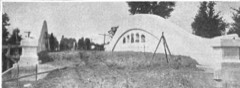 | Lincoln Road-Pine River Bridge | structure | 1999 | 99001516 |
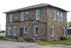 | Dr. Charles H. MacLachlan Sanitarium and House | building | 1982 | 82000533 |
 | Wright Opera house Block Complex | building | 2013 | 13000443 |
Every wildfire the federal occurrence database records inside this county: 41 of them, burning about 120 acres. 8 started naturally and none was recorded as arson. Each settlement page carries the fires within five miles of it.
| Reported cause | Fires |
|---|---|
| Missing data/not specified/undetermined | 23 |
| Equipment and vehicle use | 8 |
| Natural | 8 |
| Recreation and ceremony | 1 |
| Smoking | 1 |
The five largest, by the area the report gives. None of them was recorded as arson.
| Date | Cause | Size | Reported by | Name on the report |
|---|---|---|---|---|
| 1 April 2019 | Equipment and vehicle use | 61 acres | Michigan Department of Natural Resources | GRATIOT 01 |
| 25 April 2019 | Equipment and vehicle use | 8.0 acres | Michigan Department of Natural Resources | BRECKENRIDGE-WHEELER FD 0000081 - 2019 |
| 26 April 2019 | Natural | 7.0 acres | Michigan Department of Natural Resources | ITHACA FD 0000160 - 2019 |
| 22 March 2018 | Natural | 3.0 acres | Michigan Department of Natural Resources | BRECKENRIDGE-WHEELER FD 0000011 - 2018 |
| 29 June 2012 | Smoking | 2.7 acres | Michigan Department of Natural Resources | GRATIOT 01 |
| 24 March 2019 | Missing data/not specified/undetermined | 2.0 acres | Michigan Department of Natural Resources | ASHLEY VFD 0019041 - 2019 |
| 26 February 2018 | Natural | 2.0 acres | Michigan Department of Natural Resources | ALMA FD 0000040 - 2018 |
| 17 July 2019 | Equipment and vehicle use | 1.0 acres | Michigan Department of Natural Resources | ASHLEY VFD 0019105 - 2019 |
Every settlement page carries the fires within five miles of it - see the settlement index below.
The NOAA Storm Events Database holds 159 reports for this county, causing 2 deaths, 8 injuries and about $7,297,500 in recorded property damage. Each settlement page carries the reports that name it.
| Kind of event | Reports |
|---|---|
| Thunderstorm Wind | 93 |
| Hail | 42 |
| Tornado | 15 |
| Flash Flood | 6 |
| Flood | 2 |
| Heavy Rain | 1 |
The most serious of them, by death, then injury, then recorded damage. The accounts are quoted exactly as the forecast office filed them.
| When | Event | Place named | Harm | What the report says |
|---|---|---|---|---|
| May 1956 | Tornado (F2) | not stated | 1 killed, 4 hurt, $250,000 | no account filed |
| June 1968 | Tornado (F2) | not stated | 1 killed, $25,000 | no account filed |
| June 1956 | Tornado (F2) | not stated | 2 hurt, $250,000 | no account filed |
| April 1965 | Tornado (F2) | not stated | 1 hurt, $250,000 | no account filed |
| May 2001 | Tornado (F1) | Elwell | 1 hurt, $150,000 | A man was slightly injured when a shed he was in collapsed, a pickup truck was flipped over, and two building were partially unroofed by a F1 tornado that touched down in Elwell. The tornado produced maximum estimated wind speeds to 110 m.p.h. It had a path length of 3 miles and a width of 40 yards. The tornado touched down just south of Van Buren road, then moved northwest through the town of Elwell, and ended just north of M-46. |
| April 2013 | Flood | Riverdale | $3,000,000 | Heavy rainfall caused significant flooding on rivers and streams across Gratiot county. |
| May 1998 | Thunderstorm Wind | Riverdale | $610,000 | Michigan State Police EMD's Damage and Injury Assessment Report indicated $610,000 in public damage costs, 2675 homes damaged, 10 homes destroyed, and 100 businesses destroyed. Private damage cost estimates were not available. The county reported significant public health and safety risks due to the widespread loss of power and telephone service. The Michigan National Guard supplied a generator and water supply tanker to the Michigan Department of Corrections to address the need for power and water at the Mid-Michigan Correctional Facility in St. Louis, in Gratiot County. Gratiot County declared a local state of emergency and was granted a Governor's declaration to activate state assistance for the county. On June 24th, President Clinton granted a Major Disaster Declaration for Gratiot County, making federal disaster assistance available. |
| August 2011 | Tornado (EF0) | Galloway | $500,000 | A National Weather Service Storm Survey Team confirmed an EF-0 tornado briefly touched down on Tuesday, August 9th, 2011 in Lafayette Township in Gratiot County. This tornado was on the ground for about 250 yards in Lafeyette Township causing significant damage to a 99 year old family farm. This same storm produced a weak EF-0 tornado that touched down briefly for about 200 yards in a corn field in Lakefield Township in Saginaw County. Some very minor crop damage was found along the path between the two tornado touchdowns. Maximum wind gusts were estimated to be around 80mph in Lafayette Township. |
| September 2021 | Hail | Sickles | $250,000 | Hail up to two and a half inches in diameter was reported near Sickles that dented vehicles and caused significant damage. Some wind damage was reported as well. |
| June 1982 | Tornado (F2) | not stated | $250,000 | no account filed |
| August 2021 | Thunderstorm Wind | St Louis | $150,000 | Numerous trees and tree limbs and power lines were blown down across portions of Gratiot county. |
| May 2020 | Flood | Ithaca | $100,000 | Over a dozen roads were closed countywide due to water over roads. The Pine River went over flood stage and impacted roads in Alma. |
| May 2000 | Flash Flood | Countywide | $100,000 | no account filed |
| August 2021 | Thunderstorm Wind | Forest Hill | $75,000 | A state official reported that a tree was blown down onto a house. |
| July 2007 | Thunderstorm Wind | Forest Hill | $75,000 | Several reports of seven eighths to one and three quarters inch diameter hail were received from in to two miles north northwest of Alma. Numerous trees and power lines were blown down in and near Alma and concrete walls were blown down at the old refinery on Superior street in Alma. |
| May 2024 | Thunderstorm Wind | Elwell | $50,000 | A few trees and power lines were brought down. |
| June 2024 | Thunderstorm Wind | Beebe | $50,000 | Several power outages and downed trees and limbs were reported. |
| July 2023 | Thunderstorm Wind | Ashley | $50,000 | A house had shingles ripped off, a covered porch was blown down and several trees were blown down. A barn was also damaged. |
| May 1999 | Thunderstorm Wind | Countywide | $50,000 | Several trees and limbs were downed. |
| May 2001 | Flash Flood | Countywide | $50,000 | no account filed |
| May 2001 | Flash Flood | Countywide | $50,000 | no account filed |
| July 2001 | Thunderstorm Wind | Riverdale | $50,000 | no account filed |
| June 2017 | Thunderstorm Wind | Bannister | $40,000 | An isolated severe thunderstorm produced wind damage that included roof damage to a couple of barns, a house and a mobile home. Several trees were also blown down. The damage occurred near the intersection of McClellan and Taft roads east northeast to the county line. |
| June 2005 | Thunderstorm Wind | St Louis | $40,000 | Law enforcement reported numerous trees were blown down in St. Louis and a large number of trees were blown down in Breckenridge. |
| May 2001 | Tornado (F0) | Ithaca | $25,000 | A F0 tornado producing maximum estimated wind speeds to 60 m.p.h. touched down just north of Pierce road, and moved north through downtown Ithaca, ending north of St. Charles street. The tornado had a path length of 2.5 miles and a width of 50 yards. The only damage observed was to trees. |
| July 2001 | Thunderstorm Wind | Bannister | $25,000 | no account filed |
| May 2001 | Flash Flood | Countywide | $25,000 | no account filed |
| October 2001 | Thunderstorm Wind | Ashley | $25,000 | no account filed |
| June 2000 | Thunderstorm Wind | Alma | $25,000 | no account filed |
| June 2000 | Thunderstorm Wind | Bannister | $25,000 | no account filed |
| July 2000 | Hail | Ashley | $25,000 | no account filed |
| April 1965 | Tornado (F2) | not stated | $25,000 | no account filed |
| April 1965 | Tornado (F2) | not stated | $25,000 | no account filed |
| April 1965 | Tornado (F2) | not stated | $25,000 | no account filed |
| October 1954 | Tornado (F2) | not stated | $25,000 | no account filed |
| November 2024 | Tornado (EF0) | Middleton | $20,000 | An EF-0 developed with a path along Hayes Road between Rich Road and Alger |Road in southwest Gratiot county. Sporadic and isolated damage to trees occurred. |One tree in particular was uprooted and fell onto a chain link fence and a few headstones at a cemetery. |
| April 2014 | Thunderstorm Wind | Alma | $20,000 | Power lines were blown down and there was damage to a garage roof in Riverdale. |
| August 2007 | Thunderstorm Wind | Perrinton | $20,000 | Several trees were blown down in Ithaca and Perrinton. |
| July 2007 | Thunderstorm Wind | Breckenridge | $20,000 | Three trees were blown down and one fell on a house. |
| August 2007 | Thunderstorm Wind | Bannister | $20,000 | A tree took wires down east of the Wilson and Blair roads intersection. |
| June 2003 | Hail | Perrinton | $20,000 | A severe thunderstorm produced three quarters inch diameter hail in Perrinton. |
| May 1998 | Thunderstorm Wind | Ithaca | $20,000 | Several large trees and power lines downed in Ithaca and scattered reports of the same across Gratiot County. |
| July 2006 | Thunderstorm Wind | St Louis | $20,000 | no account filed |
| June 2005 | Thunderstorm Wind | Ithaca | $20,000 | no account filed |
| August 2000 | Thunderstorm Wind | Countywide | $20,000 | no account filed |
| August 2000 | Thunderstorm Wind | Sumner | $20,000 | no account filed |
| July 2000 | Thunderstorm Wind | Sumner | $20,000 | no account filed |
| July 2000 | Hail | Perrinton | $20,000 | no account filed |
| August 2004 | Thunderstorm Wind | Ithaca | $15,000 | An emergency manager three miles east of Ithaca reported that several trees and limbs as well as power lines were blown down. |
| May 2003 | Hail | Perrinton | $15,000 | The last severe thunderstorm across the area during the early morning hours produced seven eighths inch diameter hail in Perrinton. |
| September 2001 | Thunderstorm Wind | Alma | $15,000 | no account filed |
| September 2022 | Thunderstorm Wind | Breckenridge | $10,000 | Several trees were blown down near Breckenridge. |
| September 2018 | Thunderstorm Wind | New Haven Center | $10,000 | Several trees were blown down on Pierce Rd. between Bliss Rd. and Pingree Rd. |
| May 2013 | Thunderstorm Wind | Alma | $10,000 | A trained spotter reported large trees and power lines down near Alma and estimated wind gusts of up to 70 to 75 mph. |
| November 2013 | Thunderstorm Wind | Forest Hill | $10,000 | A trained spotter measured a 67 mph wind gust 2 miles north of Alma. A few trees were also blown down. |
| October 2006 | Hail | Breckenridge | $10,000 | A trained spotter reported large hail in Breckenridge. |
| June 2004 | Hail | Ithaca | $10,000 | Seven eighths inch diameter hail was reported three miles south of Ithaca. |
| June 2004 | Thunderstorm Wind | Ashley | $10,000 | Several large trees and branches were blown down in Ashley. |
| February 1999 | Thunderstorm Wind | Alma | $10,000 | Some trees and power lines were downed by strong winds. |
| July 1999 | Thunderstorm Wind | Ithaca | $10,000 | Power lines and trees were downed in Ithaca. |
The Survey's mineral resources record lists 14 workings inside this county. 7 still produce and 7 are closed or unrecorded. Each settlement page carries the workings within five miles of it.
| Commodity | Workings |
|---|---|
| Sand and Gravel, Construction | 7 |
| Clay | 6 |
| Bromine | 1 |
| Salt, Calcium, Magnesite | 1 |
The least common of them first, because a county's hundredth gravel pit says nothing its first ten did not.
| Where | Site | Commodity | Status | Recorded |
|---|---|---|---|---|
| Velsicol Chem. Natural Brine Plant | Bromine, Salt, Calcium, Magnesite | Past Producer | ||
| Ashley Tile Co Clay Pit | Clay | Past Producer | ||
| C D Peet Clay Pit | Clay | Past Producer | ||
| J O Thomas Clay Pit | Clay | Past Producer | ||
| Kennet Co Clay Pit | Clay | Past Producer | ||
| Riverside Brick&Tile Co Clay Pit | Clay | Past Producer | ||
| St Louis Tile Co Clay Pit | Clay | Past Producer | ||
| Elm Hall Pit & Mill | Sand and Gravel, Construction | Producer | ||
| Gratiot Pit & Mill | Sand and Gravel, Construction | Producer | ||
| Hubscher & Sons Pit | Sand and Gravel, Construction | Producer | ||
| P. & B. Gravel Co. Pit | Sand and Gravel, Construction | Producer | ||
| P. & B. Gravel Co. Pit | Sand and Gravel, Construction | Producer | ||
| Pit No. 1 | Sand and Gravel, Construction | Producer | ||
| Roslund Sand and Gravel | Sand and Gravel, Construction | Producer |
Named settlements recorded in the Geographic Names Information System, each with the topographic sheets covering it. Villages, hamlets and abandoned places alike. Each is shown with the nearest named watercourse or landform and the survey quadrangle it falls on.
Washington township · 48879 · On Collier Creek · Pompeii quadrangle
13 sheets, 1918 to 1985
St. Louis city · 48880 · On Horse Creek · Saint Louis quadrangle
14 sheets, 1935 to 1985