Block
From the record
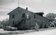
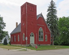
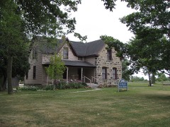
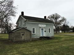
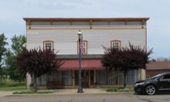
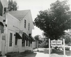
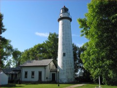
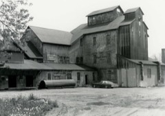
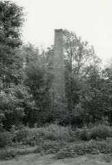
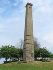
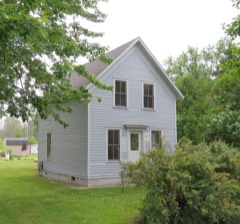
27 National Register listings published here.
Sources: the National Register database, National Park Service
47 topographic sheets cover 36 settlements here, and 27 properties are on the National Register of Historic Places.
27 National Register listings published here.
Sources: the National Register database, National Park Service
Every property in this county listed on the National Register of Historic Places, with the year it was listed and the federal nomination document.
Every wildfire the federal occurrence database records inside this county: 53 of them, burning about 457 acres. 3 started naturally and 1 was recorded as arson. Each settlement page carries the fires within five miles of it.
| Reported cause | Fires |
|---|---|
| Missing data/not specified/undetermined | 31 |
| Equipment and vehicle use | 12 |
| Debris and open burning | 3 |
| Natural | 3 |
| Misuse of fire by a minor | 1 |
| Recreation and ceremony | 1 |
| Power generation/transmission/distribution | 1 |
| Arson/incendiarism | 1 |
The five largest, by the area the report gives. None of them was recorded as arson.
| Date | Cause | Size | Reported by | Name on the report |
|---|---|---|---|---|
| 9 October 2012 | Missing data/not specified/undetermined | 257 acres | Michigan Department of Natural Resources | HURON 01 - HEISTERMAN ISLAND |
| 11 April 2005 | Equipment and vehicle use | 66 acres | Huron-Manistee National Forest | UNDERWOOD HILL FIRE |
| 13 April 2005 | Debris and open burning | 36 acres | Michigan Department of Natural Resources | not named |
| 22 April 2019 | Power generation/transmission/distribution | 27 acres | Michigan Department of Natural Resources | HURON 01 |
| 13 April 2019 | Debris and open burning | 12 acres | Michigan Department of Natural Resources | PORT AUSTIN FD 0000011 - 2019 |
| 7 May 2020 | Missing data/not specified/undetermined | 5.7 acres | Michigan Department of Natural Resources | HURON 01 |
| 14 April 2003 | Misuse of fire by a minor | 4.9 acres | Michigan Department of Natural Resources | not named |
| 14 April 2003 | Missing data/not specified/undetermined | 4.6 acres | Michigan Department of Natural Resources | not named |
Every settlement page carries the fires within five miles of it - see the settlement index below.
The NOAA Storm Events Database holds 294 reports for this county, causing 3 deaths, 7 injuries and about $7,141,950 in recorded property damage. Each settlement page carries the reports that name it.
| Kind of event | Reports |
|---|---|
| Thunderstorm Wind | 182 |
| Hail | 79 |
| Tornado | 18 |
| Flash Flood | 5 |
| Lightning | 5 |
| Waterspout | 3 |
| Flood | 2 |
The most serious of them, by death, then injury, then recorded damage. The accounts are quoted exactly as the forecast office filed them.
| When | Event | Place named | Harm | What the report says |
|---|---|---|---|---|
| July 1995 | Thunderstorm Wind | Countywide | 1 killed, $300,000 | no account filed |
| May 1998 | Thunderstorm Wind | Caseville | 1 killed, $35,000 | no account filed |
| July 1987 | Thunderstorm Wind | not stated | 1 killed | no account filed |
| June 2021 | Tornado (EF2) | Port Crescent | 6 hurt, $1,900,000 | A tornado touched down 4 miles SW of Port Austin just north of the intersection between Port Crescent Rd and Sand Rd. The tornado began as an EF-0, producing several snapped trees and tree limbs, uprooted trees, and damage to barns and outbuildings. The tornado then tracked northeast and crossed M-53 just south of its intersection with M-25. At this point, the tornado produced EF-2 damage to six houses, with three roofs completely detached, one house with major roof damage, two garages and one barn completely destroyed, and substantial tree damage. Estimated peak winds were 120 mph.|The tornado continued to track northeast toward N Hellems Rd and paralleled Pointe Aux Barques Rd, where numerous pine trees were damaged or destroyed and |some hardwood trees were snapped, consistent with EF-1 damage. The |tornado then tracked across the Eagle Bay public access point and |into Lake Huron. |
| August 2001 | Tornado (F0) | Harbor Beach | 1 hurt, $5,000 | A waterspout moved onshore from Harbor Beach harbor. Once the waterspout made landfall, it become classified as a tornado. The tornado moved over the pier and went up a short hill near Water Street, then it dissipated. An elderly couple at an art fair attempted to hold onto belongings and were thrown to the ground with their belongings strewn on top of them. The elderly woman disslocated a shoulder and broke an arm, requireing an overnight hospital stay. One tree was also knocked over and fell onto a van. |
| June 1984 | Tornado (F3) | not stated | $2,500,000 | no account filed |
| June 2008 | Thunderstorm Wind | Bad Axe | $500,000 | Large trees uprooted and flagpoles snapped in half in downtown Bad Axe. Local media also reported some building damage in Bad Axe. A truck and garage were damaged. |
| July 2002 | Lightning | Bad Axe | $300,000 | A newspaper reported that lightning struck a meat packing plant and started a fire, causing serious damage. |
| October 2007 | Tornado (EF1) | Port Hope | $250,000 | A tornado spun up at 0126EST four miles west of Port Hope. It touched down at a farmstead and caused substantial damage, rated EF1. Large heavy farm machinery was lifted and displaced, and a farm shed was moved about 120 feet off of its foundation. Also, the walls of a large barn were lifted 6 to 8 feet from their foundation. Total property damages were estimated at $250K. The average path width was 100 yards. |
| July 2006 | Lightning | Harbor Beach | $200,000 | A local newspaper article included a photograph of a home burned down. The fire was sparked by an electrical line blown down onto the home by thunderstorm winds. The couple was able to escape the home without injury. The value of the home itself was $150K, not including its contents. The couple lost all of their belongings in the fire. Total damages were roughly estimated at $200K. |
| July 2021 | Tornado (EF0) | Port Austin | $100,000 | A tornado touched down near the intersection of N Hellman and Grindstone Rd, 1 mile east of Port Austin. Shortly after the tornado touched down, an outbuilding was destroyed, marking its peak intensity of 80 mph winds. As the tornado tracked east, a field of soybean crops was damaged. Numerous trees were then damaged as the tornado approached Sullivan Rd, in which the damage swath was approximately 50 yards in width. The tornado continued to track eastward, causing damage to a fence line before lifting just prior to reaching Tomlinson Rd. |
| July 2010 | Tornado (EF0) | Huron City | $75,000 | A National Weather Service Storm Survey confirmed a weak EF0 tornado hit the Lighthouse County Park in Huron County. The tornado touched down at 1011 PM about 1.5 miles northwest of the Park, and tracked over and close to Lighthouse Road. The tornado, with maximum winds of 80 mph, then continued to track southeast, moving through the County Park and exiting out into Lake Huron at 1013 PM. The total path length was estimated at 2 miles, with a maximum width of 75 yards. |Numerous trees were blown down, one of which fell onto a camper. Roof damage was also observed at one home. |
| July 2006 | Thunderstorm Wind | Harbor Beach | $75,000 | Local newspaper articles reported that the storms left behind a trail of destruction through Harbor Beach, with numerous trees, some very large, ripped from their roots and power lines down through the entire area. The storms left the entire city without power. Many vehicles and structures, including homes, were damaged by fallen debris. Several boats were tossed about and washed ashore on Sand Point. An NWS survey confirmed that this area was struck by a microburst with winds up to 100 MPH. Remarkably, No injuries or deaths were reported. Total property damage in Harbor Beach was estimated at $75K. |
| May 2000 | Tornado (F1) | White Rock | $60,000 | no account filed |
| August 2015 | Tornado (EF1) | Kilmanagh | $50,000 | A tornado touched down 0.25 miles west of the intersection of Sebewaing and Shebeon roads. The tornado traveled along or just north of Sebewaing road for its lifespan as it moved eastward. After the tornado touched down it quickly intensified to EF1 with maximum winds of 90 mph. The roof and walls of a barn were destroyed, along with tree damage observed. And tree damage. Damage in Owendale included destruction of outbuildings, siding peeled off a garage, as well as trees snapped and uprooted. There was also a small warehouse with westward-facing garage doors blown in, a cinder block wall blown out, and uplifted roof. The tornado lifted just north of the intersection of Sebewaing and Elkton roads. |
| June 2014 | Thunderstorm Wind | Redman | $50,000 | Numerous trees and wires reported down. Some trees uprooted and fell onto houses and cars. A party store and barn roofs were also blown off. |
| June 2011 | Thunderstorm Wind | Sebewaing | $50,000 | Dozens of trees and powerlines down. |
| June 2008 | Thunderstorm Wind | Port Austin | $50,000 | Local media reported downed electrical poles and trees. |
| September 2002 | Thunderstorm Wind | Port Austin | $50,000 | Storm spotters reported that a large tree was uprooted and blown onto a house in thunderstorms winds. The house sustained extensive damage. |
| February 1997 | Flash Flood | Countywide | $50,000 | no account filed |
| May 2000 | Flash Flood | Pigeon | $35,000 | no account filed |
| July 2000 | Lightning | Bad Axe | $35,000 | no account filed |
| July 2014 | Lightning | Caseville | $30,000 | Lightning caused a house fire. |
| June 2007 | Thunderstorm Wind | Kinde | $30,000 | A trained spotter reported two barns blown down. Total damages were estimated at roughly $30K. |
| September 2002 | Thunderstorm Wind | Owendale | $30,000 | Emergency management reported several trees and power lines blown onto the road in thunderstorm winds. The roof and west wall of a barn was also reportedly blown off in thunderstorm winds. |
| October 2020 | Thunderstorm Wind | Gotts Corners | $25,000 | A metal grain silo was blown down. The roof of a garage was also blown off. |
| July 2006 | Thunderstorm Wind | Caseville | $25,000 | A trained spotter reported numerous trees blown down. Docks were twisted and part of a decorative wall of bricks along the Pigeon River collapsed. Several homes were damaged. Total damages in this area were roughly estimated at around $25K. No injuries or deaths were reported. |
| June 2004 | Tornado (F1) | Harbor Beach | $25,000 | A tornado tracked near Rapson Road from Minden to Klug Roads. Widespread tree damage was reported, along with minor property damage. One property alone along Rapson Road lost 44 trees, many of which were more than 100 years old and very large. Outbuildings were moved off their foundations, with a portion of a metal roof on a barn torn off. |
| June 1992 | Tornado (F0) | not stated | $25,000 | no account filed |
| July 1974 | Tornado (F2) | not stated | $25,000 | no account filed |
| July 2011 | Thunderstorm Wind | Helena | $20,000 | Dozens of trees blown down, blocking roads in a four to five mile area. |
| September 2002 | Thunderstorm Wind | Bay Port | $20,000 | A grain silo sustained some minor damage from thunderstorm winds. Some windows were also reported to have been blown out of a barn. |
| May 1998 | Thunderstorm Wind | Pigeon | $20,000 | no account filed |
| August 1998 | Thunderstorm Wind | Bad Axe | $18,000 | A isolated severe thunderstorm downed several trees and power lines. One large tree fell onto a house. |
| November 2015 | Tornado (EF0) | Bad Axe | $15,000 | An NWS damage survey found a brief tornado that began just south of M-53 at Barrie Road in Bad Axe. The tornado bent over two billboards with I-beams, partially blew of a roof, and caused extensive tree damage before lifting near M-53 and Western Avenue in Bad Axe. Peak winds were estimated to be 85 mph. |
| August 2000 | Thunderstorm Wind | Port Austin | $15,000 | A large tree was blown down onto a vehicle. |
| August 2015 | Thunderstorm Wind | Kinde | $10,000 | A barn was damaged, large train wagons tossed, and box trailer destroyed. |
| August 2015 | Thunderstorm Wind | Port Austin Afs | $10,000 | A barn and out buildings roofs blown off and some walls knocked down. |
| June 2005 | Thunderstorm Wind | Ulby | $10,000 | Trees were blown down. A garage was also blown off it's foundation. |
| July 1999 | Thunderstorm Wind | Bad Axe | $10,000 | no account filed |
| July 2007 | Thunderstorm Wind | Pigeon | $8,000 | A trained spotter reported numerous trees down, damaging at least one house and one shed. |
| June 2007 | Thunderstorm Wind | Bad Axe | $6,000 | A trained spotter reported that part of a roof was blown off of a barn. Large tree branches were also blown down. Property damages were estimated at roughly $6K. |
| May 1999 | Thunderstorm Wind | Bad Axe | $6,000 | no account filed |
| August 1998 | Thunderstorm Wind | Harbor Beach | $6,000 | no account filed |
| July 2016 | Thunderstorm Wind | Sebewaing | $5,000 | Big trees and numerous wires reported blown down. |
| November 2015 | Thunderstorm Wind | Bad Axe | $5,000 | An NWS damage survey confirmed a swath of downburst winds just south and east of the city of Bad Axe. The damage began along Bad Axe Road just northwest of Huron County Memorial Airport, which reported a wind gust of 73 mph at 6:50 am EST. The swath continued northeastward toward the intersection of M-19 and M-142 East of Bad Axe. There was extensive tree damage in the damage swath. Mostly pine trees were snapped in half and uprooted. |
| May 2014 | Thunderstorm Wind | Ulby | $5,000 | Power lines were reported down. |
| July 2014 | Lightning | Caseville | $5,000 | Building damage caused by lightning stroke. |
| June 2011 | Thunderstorm Wind | Bay Port | $5,000 | Numerous trees and tree limbs blown down. |
| June 2011 | Thunderstorm Wind | Bad Axe | $5,000 | A large tree fell onto a house. |
| August 2000 | Hail | Bad Axe | $5,000 | Several cars were dented by dime sized hail. |
| November 2019 | Flood | Sebewaing Arpt | $5,000 | no account filed |
| May 1998 | Thunderstorm Wind | Bad Axe | $5,000 | no account filed |
| May 1998 | Thunderstorm Wind | Harbor Beach | $5,000 | no account filed |
| August 2000 | Thunderstorm Wind | Caseville | $4,000 | A few power lines and large tree limbs were downed. |
| June 2020 | Thunderstorm Wind | Pinnebog | $3,000 | Power poles snapped from the wind. |
| July 2017 | Thunderstorm Wind | Caseville | $3,000 | Power lines reported down. |
| April 2001 | Thunderstorm Wind | Bad Axe | $2,500 | A large Big Boy sign was toppled. |
| May 1991 | Tornado (F1) | not stated | $2,500 | no account filed |
| June 1975 | Tornado (F0) | not stated | $2,500 | no account filed |
The Survey's mineral resources record lists 20 workings inside this county. 11 still produce and 9 are closed or unrecorded. Each settlement page carries the workings within five miles of it.
| Commodity | Workings |
|---|---|
| Sand and Gravel, Construction | 9 |
| Clay | 4 |
| Stone, Crushed/Broken | 2 |
| Limestone, General | 2 |
| Stone | 1 |
| Limestone, Dimension | 1 |
| Asbestos | 1 |
The least common of them first, because a county's hundredth gravel pit says nothing its first ten did not.
| Where | Site | Commodity | Status | Recorded |
|---|---|---|---|---|
| Pigeon Plant | Asbestos | Producer | ||
| Wallace Stone Plant | Stone | Producer | ||
| Wallace Stone Quarry | Limestone, Dimension | Past Producer | ||
| Bayport Quarry Limestone | Stone, Crushed/Broken | Past Producer | ||
| Sebewaing Limekiln Mill | Limestone, General | Past Producer | ||
| Wallace Stone Plant | Limestone, General | Producer | Sedimentary | |
| Windsor Limestone Quarry | Stone, Crushed/Broken | Past Producer | ||
| Reinhold Clay Pit | Clay | Past Producer | ||
| Unnamed Shale Prospect | Clay | Prospect | ||
| Unnamed Shale Prospect | Clay | Prospect | ||
| Wyers Clay Pit | Clay | Past Producer | ||
| Dunlap Pit | Sand and Gravel, Construction | Producer | ||
| Grind Stone City Sandstone Quarry | Sand and Gravel, Construction | Past Producer | ||
| Huron Co Road Comm Pit | Sand and Gravel, Construction | Producer | ||
| M-19 Pit and Wash Plant | Sand and Gravel, Construction | Producer | ||
| Tanton Pit and Mill | Sand and Gravel, Construction | Producer | ||
| Ubly Pit | Sand and Gravel, Construction | Producer | ||
| Vollmer Dredge & Mill | Sand and Gravel, Construction | Producer | ||
| Vollmer Sand and Gravel Co. Pit | Sand and Gravel, Construction | Producer | ||
| Wagner Ready-Mix Pit | Sand and Gravel, Construction | Producer |
Named settlements recorded in the Geographic Names Information System, each with the topographic sheets covering it. Villages, hamlets and abandoned places alike. Each is shown with the nearest named watercourse or landform and the survey quadrangle it falls on.
Sand Beach township · 48441 · On Spring Creek · Harbor Beach quadrangle
10 sheets, 1954 to 1984
Pointe Aux Barques township · 48467 · On Grant Creek · Port Austin East quadrangle
10 sheets, 1954 to 1984
Port Austin township · 48467 · On Bird Creek · Port Austin East quadrangle
10 sheets, 1954 to 1984
Hume township · 48467 · On Pinnebog River · Port Austin West quadrangle
10 sheets, 1954 to 1984
Bloomfield township · 48468 · On East Branch Willow Creek · Redman quadrangle
9 sheets, 1954 to 1984
Sebewaing township · 48759 · On Sebewaing River · Sebewaing quadrangle
9 sheets, 1954 to 1984
Fairhaven township · 48759 · On Shebeon Creek · Bay Port West quadrangle
9 sheets, 1954 to 1984
Fairhaven township · 48720 · On Shebeon Creek · Bay Port West quadrangle
9 sheets, 1954 to 1984
Sherman township · 48441 · On White Rock Creek · Forestville quadrangle
10 sheets, 1954 to 1984