 Block
From the record
16 National Register listings published here.
Sources: the National Register database, National Park Service
46 topographic sheets cover 26 settlements here, and 16 properties are on the National Register of Historic Places.
16 National Register listings published here.
Sources: the National Register database, National Park Service
Every property in this county listed on the National Register of Historic Places, with the year it was listed and the federal nomination document.
| Photograph | Property | Type | Listed | Reference |
|---|---|---|---|---|
 | Alvah N. Belding Memorial Library | building | 1993 | 93000427 |
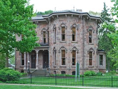 | John C. Blanchard House | building | 1974 | 74002346 |
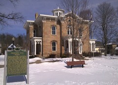 | Hall-Fowler Memorial Library | building | 1971 | 71000398 |
 | Ionia County Courthouse | building | 1979 | 79001155 |
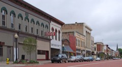 | Ionia Downtown Commercial Historic District | district | 1984 | 84001437 |
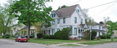 | Ionia Historic District | district | 1984 | 84001443 |
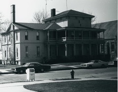 | Lovell-Webber House | building | 1974 | 74000988 |
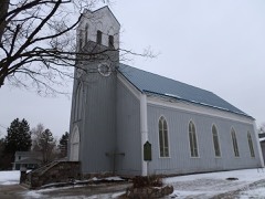 | Muir Church of Christ | building | 1983 | 83000852 |
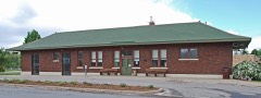 | Pere Marquette Railway Belding Depot | building | 1997 | 97000282 |
 | Portland Downtown Historic District | district | 2005 | 05000153 |
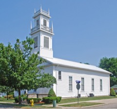 | Portland First Congregational Church | building | 1984 | 84000542 |
 | Portland High School | building | 2016 | 16000508 |
 | Richardson Silk Mill | building | 1985 | 85002496 |
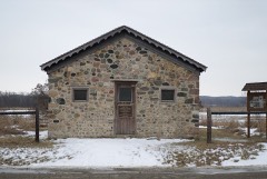 | Sessions Schoolhouse | building | 1985 | 85000278 |
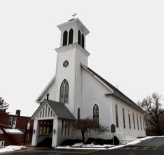 | St. John the Baptist Catholic Church Complex | district | 2001 | 01001019 |
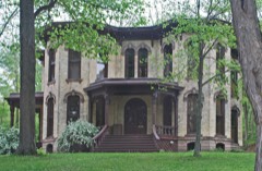 | William H. VanderHeyden House | building | 1990 | 90001959 |
Every wildfire the federal occurrence database records inside this county: 76 of them, burning about 536 acres. 9 started naturally and 1 was recorded as arson. Each settlement page carries the fires within five miles of it.
| Reported cause | Fires |
|---|---|
| Equipment and vehicle use | 33 |
| Missing data/not specified/undetermined | 19 |
| Natural | 9 |
| Debris and open burning | 7 |
| Smoking | 3 |
| Misuse of fire by a minor | 3 |
| Recreation and ceremony | 1 |
| Arson/incendiarism | 1 |
The five largest, by the area the report gives. One of them was set deliberately.
| Date | Cause | Size | Reported by | Name on the report |
|---|---|---|---|---|
| 15 April 2003 | Debris and open burning | 192 acres | Michigan Department of Natural Resources | PALO |
| 9 April 1994 | Arson/incendiarism | 150 acres | Michigan Department of Natural Resources | not named |
| 2 April 1994 | Misuse of fire by a minor | 60 acres | Michigan Department of Natural Resources | not named |
| 17 April 2015 | Smoking | 27 acres | Michigan Department of Natural Resources | IONIA 01 |
| 12 July 2018 | Smoking | 15 acres | Michigan Department of Natural Resources | BERLIN-ORANGE FD 0000214 - 2018 |
| 13 April 2004 | Smoking | 10 acres | Michigan Department of Natural Resources | not named |
| 28 March 2019 | Equipment and vehicle use | 5.0 acres | Michigan Department of Natural Resources | SARANAC FD 0000156 - 2019 |
| 1 August 2007 | Misuse of fire by a minor | 4.2 acres | Michigan Department of Natural Resources | not named |
Every settlement page carries the fires within five miles of it - see the settlement index below.
The NOAA Storm Events Database holds 216 reports for this county, causing no deaths, 22 injuries and about $29,739,500 in recorded property damage. Each settlement page carries the reports that name it.
| Kind of event | Reports |
|---|---|
| Thunderstorm Wind | 147 |
| Hail | 37 |
| Tornado | 25 |
| Flash Flood | 3 |
| Flood | 3 |
| Lightning | 1 |
The most serious of them, by death, then injury, then recorded damage. The accounts are quoted exactly as the forecast office filed them.
| When | Event | Place named | Harm | What the report says |
|---|---|---|---|---|
| April 1967 | Tornado (F2) | not stated | 6 hurt, $250,000 | no account filed |
| June 2015 | Tornado (EF1) | Kent Corner | 5 hurt, $3,200,000 | A NWS storm survey determined that an EF-1 tornado struck Portland in Ionia county. The estimated peak wind speed was 110 mph. There was damage to homes and businesses throughout portions of Portland and more than 50 structures were impacted with roof damage and broken windows. Dozens of trees were snapped and uprooted. Three churches were heavily damaged. There were 5 minor injuries and no fatalities. |
| June 1992 | Thunderstorm Wind | not stated | 5 hurt | no account filed |
| May 1998 | Thunderstorm Wind | Belding | 2 hurt, $300,000 | Michigan State Police EMD's Damage and Injury Assessment Report indicated $150,000 in public damage costs, another $150,000 in private property damage, 2000 homes damaged, 10 homes destroyed, and 10 businesses damaged. Two injuries were reported. Most of the significant damage was reported across the northern portion of the county including the cities of Belding, Muir, and Pewamo and the townships of Otisco, Orleans, Ronald, North Plains, and Lyons. Ionia County declared a local state of emergency and was granted a Governor's disaster declaration to activate state assistance to the county. On June 24th, President Clinton granted a Major Disaster Declaration for Ionia County, making federal disaster assistance available. |
| July 1986 | Thunderstorm Wind | not stated | 2 hurt | no account filed |
| August 1988 | Tornado (F1) | not stated | 1 hurt, $25,000 | no account filed |
| July 1997 | Lightning | Lake Odessa | 1 hurt | A 15-year-old boy was struck by lightning around 2 PM EDT Tuesday, July 8, 1997, behind the rectory of St. Edward Catholic Church in Lake Odessa. Luke Stebbins was taken to Pennock Hospital in Hastings by rescue personnel, where doctors were able to resuscitate him. Lake Odessa Police Chief John Shaw said Stebbins suffered a heart attack and some swelling of the brain when he was struck. The boy was transferred to Butterworth Hospital in Grand Rapids later that evening in critical condition. On July 23rd, he was transferred to Mary Freebed Hospital for rehabilitation. |
| August 2023 | Thunderstorm Wind | Clarksville | $10,000,000 | Numerous trees and tree limbs were blown down. 15 power poles were snapped and numerous trees were snapped or uprooted in Saranac. In Portland several trees were also snapped or uprooted. |
| April 2013 | Flood | Belding | $7,000,000 | Heavy rainfall caused significant flooding on rivers and streams across Ionia county. |
| April 2011 | Hail | Cooks Corners | $4,000,000 | Trained spotters reported that a severe thunderstorm produced hail up to 1.5 inches in diameter on the northeast side of Belding. The swath was up to one mile wide and was part of the swath that began in extreme northeast Ottawa County based on correlation with spotter reports and radar hail products. |
| August 2016 | Tornado (EF1) | Orleans | $750,000 | Tornado damage began just east of Orleans and moved northeast where it crossed M-44, bringing several large trees down, one of which fell on a house. The tornado then crossed West Long Lake Road where the concrete block wall of a garage was blown out and the wind peeled shingles off the roof of a house.||A path of tree damage about a hundred yards wide continued to the northeast and narrowed. The last damage noted was a few downed trees on East Boyer Road|about 3.5 miles southeast of Sheridan. |
| April 2023 | Hail | Lake Odessa | $500,000 | Hail up to tennis ball sized was reported across portions of Ionia county. It did considerable damage to area roofs and siding of homes. |
| February 2019 | Flood | Portland | $400,000 | An ice jam formed and held in Portland for three weeks, resulting in significant flooding and around 200,000 dollars in damage to public facilities. |
| July 2014 | Tornado (EF0) | Collins | $300,000 | A NWS storm survey confirmed that an EF-0 tornado touched down near Reeder Rd. between south Sunfield highway and south Keefer highway. Five farm buildings were damaged and one home lost roofing material and numerous trees were blown down. |
| June 2021 | Tornado (EF1) | Lake Odessa | $250,000 | An NWS storm survey determined that an EF-1 tornado occurred north of Lake Odessa. Multiple homes and barns were damaged at the following locations: Bippley/Jordan Lake Road, Ainsworth Road, and Harwood Road. Convergent tracks were observed through corn and wheat fields. Trees were blown down or snapped. Wood power poles were snapped on Clarksville Road near the end point of the tornado. |
| November 1989 | Tornado (F2) | not stated | $250,000 | no account filed |
| July 1995 | Thunderstorm Wind | Portland | $150,000 | Hundreds of trees were blown down resulting in 24-hour power outages and damage to houses and garages. A grain bin and two pole barns were blown down east of the city. |
| August 2022 | Thunderstorm Wind | Campbell Corners | $100,000 | Several trees and power lines were blown down across Ionia county. |
| July 2022 | Thunderstorm Wind | Hillcrest | $100,000 | Wind gusts to around 60 mph brought down several trees and power lines. |
| May 2020 | Flood | Muir | $100,000 | Numerous roads were closed due to flooding in and near Ionia. |
| September 2019 | Thunderstorm Wind | Saranac | $100,000 | The public reported that a large barn was blown off it's foundation and there was minor damage to a small barn in the same area near Woodbury. Scattered wind damage was also noted from southeast of Lowell to Lake Odessa in the form of scattered downed trees and limbs. |
| May 2001 | Tornado (F0) | Clarksville | $100,000 | A tornado that passed 2 miles northwest of Clarksville cut a silo in half, and lifted the roofs off of two barns. Several trees were also damaged. It was a F0 tornado with a length of one mile and width of 50 yards. |
| May 2000 | Flash Flood | Countywide | $100,000 | no account filed |
| August 2024 | Thunderstorm Wind | Ionia | $75,000 | Several large trees were blown down and there were power outages in the Ionia area. |
| June 2021 | Tornado (EF0) | Campbell Corners | $75,000 | An NWS storm survey determined an EF-0 tornado occurred with path length of a mile.There was damage to 2 properties - including a farm off Vedder Road with the silo top ripped off and barns damaged. Tree line damage just northeast of the Bell |Road/Vedder Road intersection is approximately where the tornado lifted off the surface. |
| June 2023 | Thunderstorm Wind | Portland | $50,000 | Multiple trees and limbs were blown down in the Portland area and across portions of the county. |
| July 2019 | Thunderstorm Wind | Saranac | $50,000 | Several trees were blown down. |
| July 2014 | Tornado (EF0) | Pewamo | $50,000 | An NWS storm survey concluded that an EF-0 tornado touched down near Pewamo. Several trees were blown down and structures were damaged. The tornado was on the ground for less than a mile. |
| July 2006 | Thunderstorm Wind | Belding | $50,000 | The public in Belding reported numerous trees were blown down. |
| May 1999 | Thunderstorm Wind | Saranac | $50,000 | Gusty thunderstorm winds tore the roof off a barn just southwest of Saranac. |
| July 2001 | Thunderstorm Wind | Ionia | $50,000 | no account filed |
| May 2000 | Thunderstorm Wind | Central Portion | $50,000 | no account filed |
| December 2007 | Thunderstorm Wind | Portland | $40,000 | Trees and power lines were blown down onto Grand River avenue. |
| July 2003 | Hail | Saranac | $40,000 | One inch diameter hail was reported in Clarksville. One tree was blown down two miles south of Saranac. |
| July 2005 | Thunderstorm Wind | Lyons | $35,000 | no account filed |
| July 2006 | Thunderstorm Wind | Saranac | $30,000 | Trees were blown down in Saranac and Muir. |
| August 2022 | Thunderstorm Wind | Frost Corners | $25,000 | A tree was blown down onto a house on Charlotte Highway near Butler road. |
| July 2019 | Thunderstorm Wind | Saranac | $25,000 | Several trees and power lines were blown down. |
| August 2019 | Thunderstorm Wind | Shiloh | $25,000 | Several trees and power lines were blown down. |
| August 2016 | Thunderstorm Wind | Ionia | $25,000 | Trees fell on two homes in Ionia and numerous tree limbs were blown down. |
| July 2015 | Thunderstorm Wind | Clarksville | $25,000 | The Ionia county road commission estimated that about two dozen trees were blown down across the county. |
| August 2015 | Thunderstorm Wind | Hillcrest | $25,000 | An Ionia county official reported that trees were blown down across several roads and at several intersections in portions of Ionia county. |
| September 2010 | Thunderstorm Wind | Saranac | $25,000 | An NWS storm survey reported spotty tree damage across portions of Ionia county. |
| August 2007 | Thunderstorm Wind | Belding | $25,000 | Numerous trees were blown down throughout the county. |
| July 2006 | Thunderstorm Wind | Ionia | $25,000 | Numerous trees were blown down in and near Ionia. |
| June 2003 | Hail | Ionia | $25,000 | Three quarters inch diameter hail was reported five miles northwest of Ionia. An isolated report from the same location indicated that a lone tree had been blown down. |
| June 2005 | Thunderstorm Wind | Ionia | $25,000 | no account filed |
| June 2005 | Thunderstorm Wind | Smyrna | $25,000 | no account filed |
| June 2005 | Thunderstorm Wind | Saranac | $25,000 | no account filed |
| September 2001 | Thunderstorm Wind | Saranac | $25,000 | no account filed |
| June 2000 | Thunderstorm Wind | Portland | $25,000 | no account filed |
| June 2000 | Thunderstorm Wind | Saranac | $25,000 | no account filed |
| August 2000 | Thunderstorm Wind | Ionia | $25,000 | no account filed |
| June 1992 | Tornado (F1) | not stated | $25,000 | no account filed |
| September 1990 | Tornado (F1) | not stated | $25,000 | no account filed |
| March 1976 | Tornado (F2) | not stated | $25,000 | no account filed |
| August 2020 | Thunderstorm Wind | Belding | $20,000 | A few trees and tree limbs were blown down. |
| July 2016 | Thunderstorm Wind | Ionia | $20,000 | Several trees were blown down near and over M-21 near to just west of Ionia. Law enforcement also reported several power lines were downed in Ionia. |
| July 2015 | Thunderstorm Wind | Ionia | $20,000 | Several trees were blown down across Ionia county, with several trees down at Appletree and M-66. |
| May 2006 | Thunderstorm Wind | Saranac | $20,000 | Trees were blown down just east of Saranac and also just north of Ionia. |
The Survey's mineral resources record lists 13 workings inside this county. 11 still produce and 2 are closed or unrecorded. Each settlement page carries the workings within five miles of it.
| Commodity | Workings |
|---|---|
| Sand and Gravel, Construction | 11 |
| Fire Clay (Refractory) | 1 |
| Clay | 1 |
The least common of them first, because a county's hundredth gravel pit says nothing its first ten did not.
| Where | Site | Commodity | Status | Recorded |
|---|---|---|---|---|
| Ionia Pottery Company Clay Pit | Fire Clay (Refractory) | Past Producer | ||
| Saranac Clay Pit | Clay | Past Producer | ||
| Cole Brothers Pit | Sand and Gravel, Construction | Producer | ||
| Grumfield Pit and Mill | Sand and Gravel, Construction | Producer | ||
| Ionia Co. Road Comm. Pit | Sand and Gravel, Construction | Producer | ||
| Ionia Co. Road Comm. Pit | Sand and Gravel, Construction | Producer | ||
| Ionia Co. Road Comm. Pit | Sand and Gravel, Construction | Producer | ||
| Ionia Co. Road Comm. Pit | Sand and Gravel, Construction | Producer | ||
| Ionia Co. Road Comm. Pit | Sand and Gravel, Construction | Producer | ||
| Ionia Co. Road Comm. Pit | Sand and Gravel, Construction | Producer | ||
| Ionia Co. Road Comm. Pit | Sand and Gravel, Construction | Producer | ||
| Smith Pit | Sand and Gravel, Construction | Producer | ||
| Williams Bros No 1 | Sand and Gravel, Construction | Producer |
Named settlements recorded in the Geographic Names Information System, each with the topographic sheets covering it. Villages, hamlets and abandoned places alike. Each is shown with the nearest named watercourse or landform and the survey quadrangle it falls on.
Portland township · 48851 · On Ayers Branch · Portland North quadrangle
10 sheets, 1945 to 1983
Danby township · 48875 · On McCausey Branch · Eagle quadrangle
10 sheets, 1945 to 1983
North Plains township · 48845 · On Stoughton Creek · Hubbardston quadrangle
10 sheets, 1954 to 1985
Odessa township · 48849 · On Tupper Creek · Lake Odessa quadrangle
12 sheets, 1916 to 1984
Portland city · 48875 · On Looking Glass River · Portland South quadrangle
10 sheets, 1945 to 1983