Block
From the record
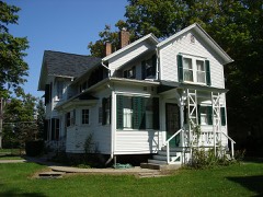
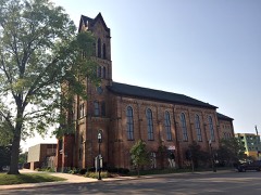
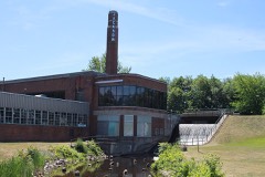
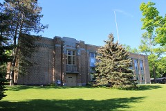
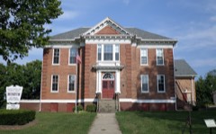
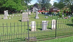
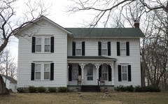
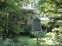
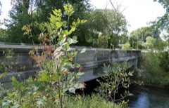
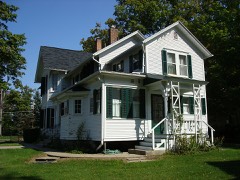
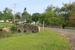
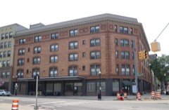
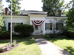
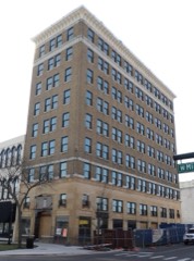
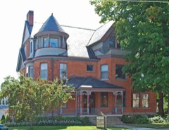
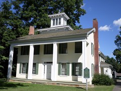
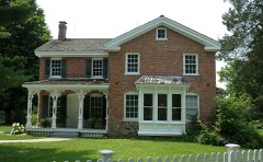
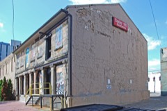
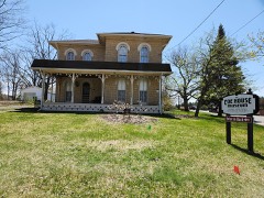
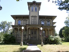
29 National Register listings published here.
Sources: the National Register database, National Park Service
71 topographic sheets cover 38 settlements here, and 29 properties are on the National Register of Historic Places.
29 National Register listings published here.
Sources: the National Register database, National Park Service
Every property in this county listed on the National Register of Historic Places, with the year it was listed and the federal nomination document.
Every wildfire the federal occurrence database records inside this county: 240 of them, burning about 563 acres. 41 started naturally and 2 were recorded as arson. Each settlement page carries the fires within five miles of it.
| Reported cause | Fires |
|---|---|
| Equipment and vehicle use | 105 |
| Missing data/not specified/undetermined | 77 |
| Natural | 41 |
| Recreation and ceremony | 6 |
| Debris and open burning | 5 |
| Smoking | 4 |
| Arson/incendiarism | 2 |
The five largest, by the area the report gives. Two of them were set deliberately.
| Date | Cause | Size | Reported by | Name on the report |
|---|---|---|---|---|
| 11 April 1996 | Arson/incendiarism | 96 acres | Michigan Department of Natural Resources | not named |
| 29 April 2018 | Equipment and vehicle use | 40 acres | Michigan Department of Natural Resources | BLACKMAN-LEONI TOWNSHIP DPS 7512 - 2018 |
| 2 April 2019 | Equipment and vehicle use | 40 acres | Michigan Department of Natural Resources | RIVES-TOMPKINS FD 150 - 2019 |
| 11 April 1996 | Arson/incendiarism | 36 acres | Michigan Department of Natural Resources | not named |
| 17 April 2015 | Missing data/not specified/undetermined | 20 acres | Michigan Department of Natural Resources | JACKSON 01 |
| 11 April 1996 | Equipment and vehicle use | 20 acres | Michigan Department of Natural Resources | not named |
| 6 May 2019 | Natural | 15 acres | Michigan Department of Natural Resources | CAMBRIDGE FD 314 - 2019 |
| 11 May 2018 | Equipment and vehicle use | 14 acres | Michigan Department of Natural Resources | JACKSON 01 - HAWKINS RD FIRE |
Every settlement page carries the fires within five miles of it - see the settlement index below.
The NOAA Storm Events Database holds 306 reports for this county, causing 1 death, 15 injuries and about $9,977,750 in recorded property damage. Each settlement page carries the reports that name it.
| Kind of event | Reports |
|---|---|
| Thunderstorm Wind | 218 |
| Hail | 62 |
| Tornado | 19 |
| Flash Flood | 5 |
| Funnel Cloud | 1 |
| Flood | 1 |
The most serious of them, by death, then injury, then recorded damage. The accounts are quoted exactly as the forecast office filed them.
| When | Event | Place named | Harm | What the report says |
|---|---|---|---|---|
| June 1982 | Tornado (F3) | not stated | 1 killed, 1 hurt, $2,500,000 | no account filed |
| July 1969 | Tornado (F1) | not stated | 11 hurt, $25,000 | no account filed |
| June 1991 | Tornado (F1) | not stated | 1 hurt, $25,000 | no account filed |
| June 1991 | Thunderstorm Wind | not stated | 1 hurt | no account filed |
| July 1987 | Thunderstorm Wind | not stated | 1 hurt | no account filed |
| April 2013 | Flood | Springport | $3,000,000 | Heavy rainfall caused significant flooding on rivers and streams across Jackson county. |
| July 2011 | Flash Flood | Springport | $500,000 | Six to eight inches of rain fell across far northern Jackson county from the late evening hours of July 27 through the early morning hours of July 29. This caused flash flooding and several road closures and washouts across that area. |
| June 1998 | Tornado (F1) | Rives Jct | $500,000 | The Jackson County Emergency Management Coordinator confirmed a weak tornado touched down just west of Layton Corners, in rural eastern Rives Township, and travelled east-southeast to near Waterloo, along the Washtenaw County line. The tornado was not on the ground for the entire 11.3 mile path, but due to the heavily wooded rural areas it traversed, exact path lengths could not be determined. Path width was narrow, estimated to be 50 yards at maximum width. No injuries or deaths were associated with this F1 tornado. Damage consisted of downed trees and power lines, roof damage to approximately 12 homes, minor structural damage mainly caused by large hail (broken windows, damaged siding, damaged vehicles and aluminum campers) and fallen trees, and overturned boats on Pleasant Lake in Henrietta Township. Hail was estimated to have reached 2 to 3 inches in diameter in association with this tornadic storm. The most significant damage was reported around the Pleasant Lake area, where several boats were overturned and several homes reported minor to moderate structural damage. Along North Meridian Road from near Layton Corners along the west end of Pleasant Lake, 2 homes reported destroyed garages. Pleasant Lake County Park was closed due to downed trees. Waterloo State Recreation Area reported hundreds of trees uprooted, which resulted in the closing of some roads and horse trails. Power outages totaled 5,800 in the affected areas of Henrietta and Waterloo Townships. Damage was estimated at approximately $500,000. |
| March 1976 | Tornado (F2) | not stated | $250,000 | no account filed |
| March 1976 | Tornado (F2) | not stated | $250,000 | no account filed |
| August 2021 | Thunderstorm Wind | Jefferson | $200,000 | There were numerous reports of downed, snapped and uprooted trees. |
| March 2006 | Tornado (F1) | Leoni | $200,000 | The tornado began near Napoleon Road just north of Center Lake and moved northeast. Two small barns collapsed and a patio addition was blown away near the intersection of Page and Noon roads. Minor roof damage occurred at a house on Michigan avenue and a dozen large spruce trees were uprooted. The total damage path was 7 miles long and 200 feet wide and this F1 tornado was on the ground for approximately ten minutes. No injuries or fatalities occurred. |
| July 2023 | Tornado (EF0) | Munith | $100,000 | A brief EF-0 tornado occurred just north of Whitehead Lake and south of Territorial road in northeast Jackson county. It moved east northeast and lifted just northeast of Leeke road and north of Bowdish road. Intermitted damage was foudn along the path primarily to trees and crops. One business along the path sustained some minor structural damage that included roof damage and siding damage to an outbuilding. |
| July 2023 | Tornado (EF0) | Munith | $100,000 | A brief EF-0 tornado occurred southeast of Stockbridge. It touched down near Orchard Creek east of Fitchburg road and south of Baseline road. Several dozen large trees were impacted with several uprooted trees along the path. Several homes on Musbach road had minor roof damage or damage from tree debris. The tornado lifted near Dewey road. |
| September 2018 | Tornado (EF0) | Kibby Cobb | $100,000 | The tornado mostly had damage indicating 65 mph winds but reached 80 mph at its strongest point halfway through its life. It began at the western Jackson City limits north of the Cascades Golf Course and continued north-northeast to cross Washington Avenue. The tornado then weakened near the railroad tracks near Hibbard Avenue. Many trees or limbs were snapped and several trees were uprooted. |
| August 2007 | Thunderstorm Wind | Jackson | $100,000 | Numerous trees were blown down throughout the county. |
| February 2001 | Flash Flood | Countywide | $100,000 | no account filed |
| August 2000 | Thunderstorm Wind | Jackson | $100,000 | no account filed |
| May 2000 | Flash Flood | Countywide | $100,000 | no account filed |
| June 2001 | Thunderstorm Wind | Jackson | $75,000 | no account filed |
| August 2021 | Thunderstorm Wind | Parma | $50,000 | Trained spotters reported that several large trees and tree limbs were blown down. |
| August 2021 | Thunderstorm Wind | Hanover | $50,000 | Several trees were uprooted and snapped off along a five mile path along Moscow road. |
| August 2020 | Thunderstorm Wind | Brooklyn | $50,000 | Several trees were blown down near Brooklyn and at least one fell on a house. |
| July 2016 | Thunderstorm Wind | (Jxn)Reynolds Fld Ja | $50,000 | Severe thunderstorm winds brought down numerous trees and limbs, some of which fell on homes, cars and power lines. |
| June 2004 | Hail | Rives Jct | $50,000 | Four and one quarters inch diameter hail was reported at the intersection of Berry and US-127 roads. Several reports of smaller hail were also reported in and near Rives Junction. |
| May 1999 | Hail | Parma | $50,000 | 0.75" hail was reported in Parma. Numerous trees and power lines were also brought down in the Napoleon and Clark Lake areas. |
| August 2002 | Flash Flood | Jackson | $50,000 | no account filed |
| May 2000 | Thunderstorm Wind | Parma | $50,000 | no account filed |
| May 2004 | Hail | Jackson | $40,000 | Seven eighths inch diameter hail was reported 5 miles south of Jackson, and several power poles were blown down near Jackson as well. |
| May 2004 | Hail | Rives Jct | $40,000 | The broadcast media reported one and three quarters inch diameter hail near I-127 in Rives Junction and a trained spotter reported one and three quarters inch diameter hail in Munith. |
| May 2004 | Hail | Jackson | $30,000 | Two inch diameter hail was reported by the public in Jackson. |
| July 2003 | Thunderstorm Wind | Jackson | $30,000 | Law enforcement in Jackson reported that several trees and power lines were blown down. |
| July 2003 | Thunderstorm Wind | Jackson | $30,000 | Numerous reports of blown down trees and power lines were received from across Jackson county. |
| August 2000 | Hail | Rives Jct | $30,000 | no account filed |
| June 2024 | Thunderstorm Wind | Hanover | $25,000 | Several trees were blown down near Hanover. |
| June 2019 | Thunderstorm Wind | Henrietta | $25,000 | Law enforcement reported that several trees and power lines were blown down in the Pleasant Lake area. |
| July 2006 | Thunderstorm Wind | Jackson | $25,000 | Numerous trees were blown down across the city of Jackson. |
| March 2003 | Thunderstorm Wind | Jackson | $25,000 | Numerous trees were blown down across Jackson county, and two large trees were uprooted two miles west of Brooklyn. |
| September 1997 | Thunderstorm Wind | Jackson | $25,000 | Jackson County Central Dispatch reported trees, power lines, and traffic lights were downed in and around the city of Jackson. A large tree limb fell across a van parked at the corner of N. Wisner and Norfolk Streets in Jackson. A Consumers Energy spokesman reported 5,000 customers lost power across Jackson County because of the severe thunderstorms. Water was also knocked out briefly at the Jackson Water Department, which resulted in customers not having water or having reduced water pressure until backup systems kicked in. |
| July 2005 | Thunderstorm Wind | Hanover | $25,000 | no account filed |
| June 2001 | Thunderstorm Wind | Napoleon | $25,000 | no account filed |
| July 2001 | Thunderstorm Wind | Parma | $25,000 | no account filed |
| June 1990 | Tornado (F1) | not stated | $25,000 | no account filed |
| April 1974 | Tornado (F2) | not stated | $25,000 | no account filed |
| June 1960 | Tornado (F2) | not stated | $25,000 | no account filed |
| August 2022 | Thunderstorm Wind | (Jxn)Reynolds Fld Ja | $20,000 | Several trees were blown down in and near Jackson. |
| June 2007 | Thunderstorm Wind | Pleasant Lake | $20,000 | Multiple trees and power lines were blown down along the Ingham/Jackson county line. |
| June 2006 | Thunderstorm Wind | Pulaski | $20,000 | Several trees were blown down in Pulaski and near Hanover. |
| June 2006 | Hail | Brooklyn | $20,000 | Hail ranging anywhere from one and a quarter to seven eighths inches in diameter was reported in Brooklyn. |
| May 2004 | Thunderstorm Wind | Spring Arbor | $20,000 | One tree was blown down in Spring Arbor, Brooklyn and Hanover. |
| August 2003 | Thunderstorm Wind | Jackson | $20,000 | Numerous trees were blown down across Hanover township. |
| August 2003 | Thunderstorm Wind | Jackson | $20,000 | A 77 m.p.h. wind gust was recorded in the city of Jackson. |
| July 2002 | Thunderstorm Wind | Jackson | $20,000 | An isolated severe thunderstorm during the morning in Jackson produced several high wind gusts, causing several large trees and limbs to be blown down. One large tree was blown down on a home on the west side of Jackson, and another report of a tree blown down onto a home in Jackson was received as well. Another large tree limb was blown down and blocked a road. |
| September 2002 | Thunderstorm Wind | Parma | $20,000 | Several trees were blown down in Parma and also in Jackson by thunderstorm wind gusts, as reported by local law enforecement. |
| August 2001 | Thunderstorm Wind | Spring Arbor | $20,000 | An isolated severe thunderstorm blew down numerous trees in Spring Arbor. Several trees fell on power lines, causing scattered power outages. |
| July 2000 | Hail | Rives Jct | $20,000 | no account filed |
| September 2013 | Thunderstorm Wind | Pleasant Lake | $15,000 | Isolated trees and limbs were blown down in southern Jackson county. |
| August 2007 | Thunderstorm Wind | Springport | $15,000 | Several trees were blown down in Springport. A couple of trees were also blown down near Jackson. |
| June 2006 | Thunderstorm Wind | Parma | $15,000 | Several trees were blown down two miles east of Parma. |
| September 2005 | Hail | Grass Lake | $15,000 | The public reported one and three quarters inch diameter hail in Grass Lake. |
The Survey's mineral resources record lists 22 workings inside this county. 11 still produce and 11 are closed or unrecorded. Each settlement page carries the workings within five miles of it.
| Commodity | Workings |
|---|---|
| Sand and Gravel, Construction | 10 |
| Clay | 5 |
| Stone, Crushed/Broken | 4 |
| Flagstone | 3 |
The least common of them first, because a county's hundredth gravel pit says nothing its first ten did not.
| Where | Site | Commodity | Status | Recorded |
|---|---|---|---|---|
| Jude Sandstone Quarry | Flagstone | Producer | ||
| Jude Stone Quarry | Flagstone | Producer | ||
| Napoleon Sandstone Quarry | Flagstone | Producer | ||
| Hawkins Limestone Quarry | Stone, Crushed/Broken | Past Producer | ||
| Jeffrey Quarry and Mill | Stone, Crushed/Broken | Past Producer | ||
| Portage River Limestone Quarry | Stone, Crushed/Broken | Past Producer | ||
| Spring Arbor Limestone Quarry | Stone, Crushed/Broken | Past Producer | ||
| Am Vitr Prod Co Clay Shale Quarry | Clay | Past Producer | ||
| Am Vitrified Prod Co Clay Shale Pit | Clay | Past Producer | ||
| Grand Ledge Clay Shale Pit | Clay | Past Producer | ||
| Peninsular Port.Cement Co Clay Pit | Clay | Past Producer | ||
| Zenith Portland Cement Co Clay Pit | Clay | Past Producer | ||
| Bill Smith Sand and Gravel Co. Pit | Sand and Gravel, Construction | Producer | ||
| Grass Lake Pit No. 1 | Sand and Gravel, Construction | Producer | ||
| Mellen Camp Pit & Mill | Sand and Gravel, Construction | Producer | ||
| Palmer Sand and Gravel Pit | Sand and Gravel, Construction | Producer | ||
| Parma Sandstone Exposure | Sand and Gravel, Construction | Unknown | ||
| Parma Sandstone Outcrop | Sand and Gravel, Construction | Prospect | ||
| Pickett & Schreur Inc. Pit | Sand and Gravel, Construction | Producer | ||
| Pickett & Schreur Inc. Pit | Sand and Gravel, Construction | Producer | ||
| Stevick Pit & Mill | Sand and Gravel, Construction | Producer | ||
| Whittaker and Gooding Co. Pit | Sand and Gravel, Construction | Producer |
Named settlements recorded in the Geographic Names Information System, each with the topographic sheets covering it. Villages, hamlets and abandoned places alike. Each is shown with the nearest named watercourse or landform and the survey quadrangle it falls on.
Leoni township · 49254 · Near Goat Island · Michigan Center quadrangle
17 sheets, 1935 to 1983
Henrietta township · 49259 · On Cahaogan Creek · Pleasant Lake quadrangle
13 sheets, 1919 to 1983
Napoleon township · 49201 · On Willow Creek · Michigan Center quadrangle
17 sheets, 1935 to 1983
Henrietta township · 49201 · On Wildcat Creek · Gilletts Lake quadrangle
12 sheets, 1919 to 1983
Springport township · 49284 · Near Jerusalem Hills · Springport quadrangle
12 sheets, 1919 to 1983
Norvell township · 49230 · On Plum Brook Drain · Onsted quadrangle
13 sheets, 1948 to 1983
Norvell township · 49230 · On Plum Brook Drain · Onsted quadrangle
13 sheets, 1948 to 1983
Summit township · 49201 · On Sharp Creek · Jackson South quadrangle
19 sheets, 1935 to 1983
Sandstone township · 49201 · On Indian Brook · Jackson North quadrangle
12 sheets, 1919 to 1983