Block
From the record
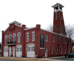
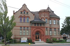
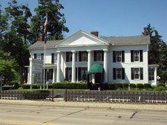
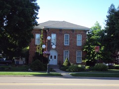
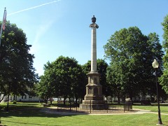
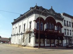
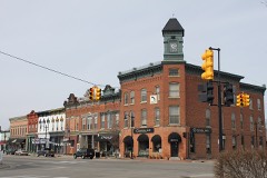
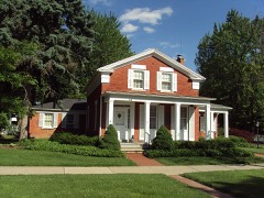
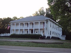
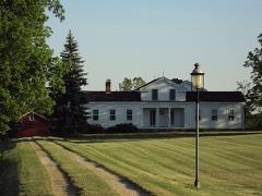
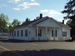
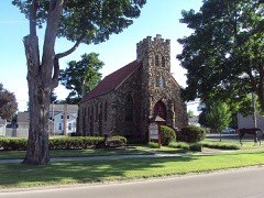
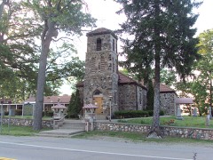
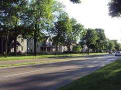
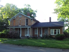
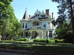
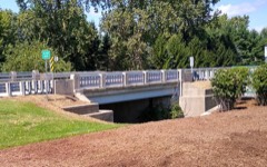
45 National Register listings published here.
Sources: the National Register database, National Park Service
109 topographic sheets cover 53 settlements here, and 45 properties are on the National Register of Historic Places.
45 National Register listings published here.
Sources: the National Register database, National Park Service
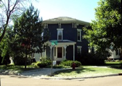
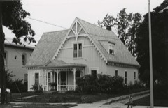
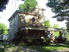
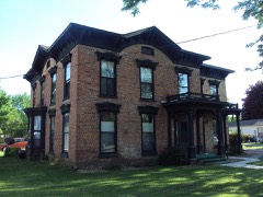
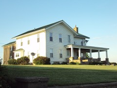
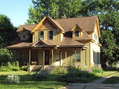
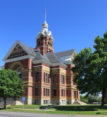
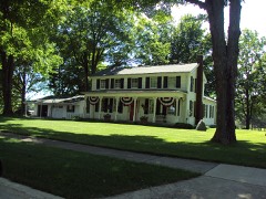
Every property in this county listed on the National Register of Historic Places, with the year it was listed and the federal nomination document.
Every wildfire the federal occurrence database records inside this county: 121 of them, burning about 226 acres. 23 started naturally and none was recorded as arson. Each settlement page carries the fires within five miles of it.
| Reported cause | Fires |
|---|---|
| Equipment and vehicle use | 46 |
| Missing data/not specified/undetermined | 43 |
| Natural | 23 |
| Debris and open burning | 5 |
| Recreation and ceremony | 3 |
| Smoking | 1 |
The five largest, by the area the report gives. None of them was recorded as arson.
| Date | Cause | Size | Reported by | Name on the report |
|---|---|---|---|---|
| 8 April 2019 | Debris and open burning | 40 acres | Michigan Department of Natural Resources | DOVER-HUDSON TOWNSHIP/CLAYTON FD 0000085 - 2019 |
| 7 April 2019 | Equipment and vehicle use | 15 acres | Michigan Department of Natural Resources | ADDISON FD 0000463 - 2019 |
| 5 April 2019 | Missing data/not specified/undetermined | 13 acres | Michigan Wetland Management District | MIMWR-FY19-WF-SCHOONOVER WPA |
| 23 March 2018 | Equipment and vehicle use | 10 acres | Michigan Department of Natural Resources | HUDSON FD 0000042 - 2018 |
| 10 November 2020 | Missing data/not specified/undetermined | 6.7 acres | Michigan Department of Natural Resources | LENAWEE 01 |
| 9 April 2019 | Equipment and vehicle use | 6.0 acres | Michigan Department of Natural Resources | ADRIAN TOWNSHIP FD 0000233 - 2019 |
| 27 March 2019 | Natural | 5.0 acres | Michigan Department of Natural Resources | RIDGEWAY TOWNSHIP FD 0000066 - 2019 |
| 3 November 2020 | Natural | 4.0 acres | Michigan Department of Natural Resources | CAMBRIDGE FD 835 - 2020 |
Every settlement page carries the fires within five miles of it - see the settlement index below.
The NOAA Storm Events Database holds 514 reports for this county, causing 10 deaths, 98 injuries and about $35,097,530 in recorded property damage. Each settlement page carries the reports that name it.
| Kind of event | Reports |
|---|---|
| Thunderstorm Wind | 314 |
| Hail | 136 |
| Tornado | 33 |
| Lightning | 18 |
| Flash Flood | 10 |
| Flood | 3 |
The most serious of them, by death, then injury, then recorded damage. The accounts are quoted exactly as the forecast office filed them.
| When | Event | Place named | Harm | What the report says |
|---|---|---|---|---|
| April 1965 | Tornado (F4) | not stated | 5 killed, 42 hurt, $25,000,000 | no account filed |
| April 1965 | Tornado (F4) | not stated | 4 killed, 41 hurt | no account filed |
| August 2003 | Lightning | Adrian | 1 killed | A woman was struck by lightning and killed standing in her backyard. |
| May 2000 | Thunderstorm Wind | Adrian | 3 hurt, $960,000 | no account filed |
| April 1974 | Tornado (F2) | not stated | 3 hurt, $25,000 | no account filed |
| August 1964 | Tornado (F3) | not stated | 2 hurt, $25,000 | no account filed |
| September 1986 | Thunderstorm Wind | not stated | 2 hurt | no account filed |
| April 1996 | Hail | Clayton | 1 hurt, $1,000,000 | no account filed |
| July 1998 | Thunderstorm Wind | Addison | 1 hurt, $65,000 | no account filed |
| May 1988 | Tornado (F0) | not stated | 1 hurt, $2,500 | no account filed |
| May 2004 | Thunderstorm Wind | Adrian | 1 hurt | Trees and wires were blown down. A large tree landed on a house. A tree also fell on a woman. She was treated for minor injuries at Bixby Medical Center. |
| July 1991 | Thunderstorm Wind | not stated | 1 hurt | no account filed |
| April 1996 | Thunderstorm Wind | Hudson | $1,000,000 | no account filed |
| April 1996 | Hail | Adrian | $1,000,000 | no account filed |
| April 1996 | Thunderstorm Wind | Adrian | $1,000,000 | no account filed |
| June 2010 | Tornado (EF1) | Rome Center | $500,000 | A tornado touched down at 148 am at Southard Highway and Woerner Road in Lenawee County. The tornado then tracked 2.5 miles east southeast to Springville Highway before lifting at 152 am. The path width was 250 yards with maximum winds of 90 mph as it crossed US 223, which is classified at an EF1. Several buildings were destroyed and numerous trees were downed by this tornado. |
| June 2021 | Tornado (EF1) | Riga | $250,000 | A tornado touched down south of Cemetery Rd and east of Silberhorn Hwy heading east-northeast. The tornado damaged at least five homes, four outbuildings, three barns, and numerous trees. Damage included a mix of uprooted trees, snapped large limbs, roof loss, collapsed barn walls, fallen power poles, a toppled chimney, blown out fencing, and an overturned air conditioner unit. Large sections of sheet metal from a destroyed small sheet metal silo were also lofted over a quarter mile downstream. The tornado inflicted damage on a final metal barn roof |as it neared the Lenawee/Monroe county line then lifted prior to |Rodesiler Hwy between Simpson and Stadler Rd. Estimated peak winds was 90 mph. |
| July 2007 | Lightning | Adrian | $250,000 | A local newspaper reported $250K in lightning damages to computer, radio and telephone equipment at county buildings in downtown Adrian. |
| June 1979 | Tornado (F2) | not stated | $250,000 | no account filed |
| March 1976 | Tornado (F2) | not stated | $250,000 | no account filed |
| March 2009 | Flood | Palmyra | $200,000 | no account filed |
| June 2002 | Lightning | Tecumseh | $150,000 | Lightning struck a home and set it on fire. The home sustained serious damage from the fire. |
| August 2001 | Lightning | Morenci | $150,000 | Lightning ignited a barn. The fire completely destroyed the barn and the contents inside it; including a truck, a tractor, a grain truck, a travel trailer, lawn mowers and tools. Firefighters managed to save the house next to the barn. The house sustained only minor damage. |
| June 2006 | Flash Flood | South Portion | $150,000 | no account filed |
| July 1998 | Thunderstorm Wind | Adrian | $145,000 | no account filed |
| May 2000 | Thunderstorm Wind | Tecumseh | $125,000 | no account filed |
| June 2015 | Flood | Munson | $100,000 | Many roads in southern Lenawee county were closed due to flooding, with a few roads washed out. |
| June 2008 | Flash Flood | Adrian | $100,000 | Law enforcement reported flash flooding with water up to car hoods on some local roads in the city of Adrian. |
| July 2008 | Flash Flood | Addison | $100,000 | Local dispatch reported widespread flooding across western and southern sections of Lenawee county. |
| July 2002 | Lightning | Britton | $100,000 | A newspaper reported that lightning struck a home in Macon Township and set it on fire, causing considerable damage. |
| July 1998 | Thunderstorm Wind | Hudson | $100,000 | no account filed |
| August 1995 | Thunderstorm Wind | Morenci | $80,000 | Strong straight-line winds associated with a thunderstorm destroyed five mobile homes in a campground. Extenseive damage was done to the roof of a house when a large tree fell on the roof. |
| July 2007 | Hail | Adrian | $75,000 | Hail the size of golf balls pelted the area, denting many vehicles. Total property damages were estimated at roughly $75K. |
| July 2007 | Hail | Adrian | $75,000 | A local newspaper reported hail damages to sheriff's department patrol cars at the Lenawee County Fair. Total property damages, including other vehicles parked in the fairgrounds parking lot, were estimated at roughly $75K. |
| June 2008 | Thunderstorm Wind | Morenci | $60,000 | Local media reported trees and wires. A garage and car were also damaged. |
| May 2010 | Thunderstorm Wind | Birdsall | $50,000 | Numerous trees, large branches, and power lines reported down. |
| July 2007 | Lightning | Adrian | $50,000 | A local newspaper reported lightning damage to electrical systems at Delphi Automotive Systems. Total property damages were estimated at roughly $50K. |
| March 2006 | Lightning | Adrian | $50,000 | A lightning strike sparked a house fire leading to smoke and water damage estimated at 35K to the structure and 15K to the contents. |
| July 2002 | Lightning | Adrian | $50,000 | A newspaper reported that lightning struck a home and set it on fire. |
| August 2002 | Thunderstorm Wind | Rollin | $50,000 | The newspaper reported that thunderstorm winds blew over several large trees near Posey Lake. One of the trees fell onto a sport utility vehicle and crushed it. Another tree fell onto a garage and damaged the siding and another one fell onto the roof of a home. |
| June 1994 | Tornado (F0) | Blissfield | $50,000 | Two witnesses confirmed sighting of tornado touchdown, preceded by a brief hail storm, that destroyed a 75 x 100 foot cattle barn, a 30 x 70 foot pig barn, and an antique windmill. Another 50 x 70 foot barn was damaged, and a fallen tree damaged the wall of a home. |
| August 1998 | Flash Flood | Adrian | $50,000 | no account filed |
| August 1997 | Thunderstorm Wind | Cement City | $50,000 | no account filed |
| August 2022 | Thunderstorm Wind | Onsted | $40,000 | Numerous trees and power lines down in Cambridge Township. A home also sustained roof damage. |
| June 2006 | Tornado (F0) | Addison | $40,000 | An F0 intensity tornado with winds of 60 to 70 MPH touched down approximately 4 miles south of Addison in Rollin Township on Wednesday, June 21st. The damage path was concentrated in a 100 yard wide path for a length of approximately 2 miles, extending from Rollin Highway just south of Burton Road eastward along Burton Road to the intersection of Burton Road and Shierson Highway. The most extensive damage along the path was to large trees near the Burton Road and Townley Highway intersection. Several homes received minor structural damage from falling trees associated with this tornado. Total property damages were roughly estimated at $40K. Average path width was 25 yards. |
| July 1998 | Thunderstorm Wind | Ridgeway | $40,000 | no account filed |
| May 2000 | Thunderstorm Wind | Morenci | $35,000 | no account filed |
| July 2023 | Thunderstorm Wind | Adrian | $30,000 | A couple large trees were blown down. One tree fell onto a house, causing extensive roof damage. |
| June 2008 | Thunderstorm Wind | Morenci | $30,000 | Numerous trees and power lines reported down. |
| July 2008 | Thunderstorm Wind | Adrian Lenawee Arpt | $30,000 | Wires and power poles reported down. |
| June 2006 | Thunderstorm Wind | Adrian | $30,000 | A local newspaper reported that a roof was blown off a house in Adrian. Property damage was roughly estimated at $30K. |
| May 2010 | Thunderstorm Wind | Adrian | $25,000 | A tree fell onto a Dodge pickup truck on South Main street. A large branch also blocked one southbound lane of Main street. |
| June 2008 | Thunderstorm Wind | Medina | $25,000 | A roof was reported blown off a house on Lime Creek Road. |
| June 2008 | Thunderstorm Wind | Cambridge Jct | $25,000 | Trees and wires reported down. |
| July 2008 | Thunderstorm Wind | Addison | $25,000 | Many large trees reported down, shutting down US-127. |
| June 2006 | Thunderstorm Wind | Clayton | $25,000 | A local newspaper included a picture of a collapsed section of the rear wall of a 125 year old two-story brick building located at Clayton Crossing. The damage to the building was roughly estimated at $40K. The fire chief said the building was a safety hazard and would need to be demolished. |
| March 1998 | Tornado (F1) | Tipton | $25,000 | no account filed |
| April 1988 | Tornado (F0) | not stated | $25,000 | no account filed |
| May 1983 | Tornado (F2) | not stated | $25,000 | no account filed |
| May 1983 | Tornado (F2) | not stated | $25,000 | no account filed |
The Survey's mineral resources record lists 21 workings inside this county. 13 still produce and 8 are closed or unrecorded. Each settlement page carries the workings within five miles of it.
| Commodity | Workings |
|---|---|
| Sand and Gravel, Construction | 12 |
| Fire Clay (Refractory) | 7 |
| Clay | 2 |
The least common of them first, because a county's hundredth gravel pit says nothing its first ten did not.
| Where | Site | Commodity | Status | Recorded |
|---|---|---|---|---|
| Am.Brick and Tile Co Clay Pit | Clay | Past Producer | ||
| Comfort Brick and Tile Pit | Clay | Past Producer | ||
| Atkin's Clay Pit | Fire Clay (Refractory) | Past Producer | ||
| Bliss's Coal Pit | Fire Clay (Refractory) | Producer | ||
| Packard Clay Pit | Fire Clay (Refractory) | Past Producer | ||
| Ruff's Clay Pit | Fire Clay (Refractory) | Past Producer | ||
| Rupp's Clay Pit | Fire Clay (Refractory) | Past Producer | ||
| Saxton and Son Clay Pit | Fire Clay (Refractory) | Past Producer | ||
| Wilt's Clay Pit | Fire Clay (Refractory) | Past Producer | ||
| Adrian Sand and Gravel | Sand and Gravel, Construction | Producer | ||
| Adrian Sand and Gravel Pit | Sand and Gravel, Construction | Producer | ||
| Brady Gravel Pit | Sand and Gravel, Construction | Producer | ||
| Burkett Construction Co. Pit | Sand and Gravel, Construction | Producer | ||
| Cambridge Junction Pit No. 2 | Sand and Gravel, Construction | Producer | ||
| Cliff Brownell Pit | Sand and Gravel, Construction | Producer | ||
| Cole Brothers Lanawee County Pit | Sand and Gravel, Construction | Producer | ||
| Gallop Pit No. 4 | Sand and Gravel, Construction | Producer | ||
| Irish Hills Pit | Sand and Gravel, Construction | Producer | ||
| Stamm Brothers Sand and Gravel Pit | Sand and Gravel, Construction | Producer | ||
| Stevick Pit | Sand and Gravel, Construction | Producer | ||
| Tecumseh Gravel Pit | Sand and Gravel, Construction | Producer |
Named settlements recorded in the Geographic Names Information System, each with the topographic sheets covering it. Villages, hamlets and abandoned places alike. Each is shown with the nearest named watercourse or landform and the survey quadrangle it falls on.
Woodstock township · 49220 · On Bowen Drain · Addison quadrangle
9 sheets, 1953 to 1990
Ridgeway township · 49229 · On Springbrook Drain · Deerfield quadrangle
12 sheets, 1939 to 1986
Cambridge township · 49230 · On Briggs Lake Creek · Onsted quadrangle
13 sheets, 1948 to 1983
Woodstock township · 49233 · On Burk Drain · Cement City quadrangle
18 sheets, 1935 to 1983
Rollin township · 49253 · On Horton Drain · Addison quadrangle
9 sheets, 1953 to 1990
Woodstock township · 49220 · On Horton Drain · Cement City quadrangle
18 sheets, 1935 to 1983
Fairfield township · 49221 · On Mitchell Drain · Jasper quadrangle
10 sheets, 1953 to 1990
Adrian city · 49221 · On Savage Drain · Adrian quadrangle
12 sheets, 1953 to 1990
Madison Charter Township · 49221 · On Porter Drain · Jasper quadrangle
10 sheets, 1953 to 1990
Clinton township · 49286 · On Dillingham Creek · Tecumseh North quadrangle
15 sheets, 1904 to 1989
Seneca township · 49256 · On Seneca Drain · Clayton quadrangle
11 sheets, 1953 to 1990
Raisin township · 49221 · On South Branch River Raisin · Tecumseh South quadrangle
11 sheets, 1939 to 1986
Fairfield township · 49248 · On Raymond Drain · Jasper quadrangle
10 sheets, 1953 to 1990
Ridgeway township · 49229 · On Springbrook Drain · Deerfield quadrangle
12 sheets, 1939 to 1986
Rome township · 49221 · On Stoddard Drain · Rome Center quadrangle
9 sheets, 1953 to 1990
Madison Charter Township · 49279 · On Stony Creek · Jasper quadrangle
10 sheets, 1953 to 1990
Palmyra township · 49268 · On Pope Drain · Tecumseh South quadrangle
11 sheets, 1939 to 1986