 Block
From the record
22 National Register listings published here, 3 of them National Historic Landmarks.
Sources: the National Register database, National Park Service
85 topographic sheets cover 35 settlements here, and 22 properties are on the National Register of Historic Places.
22 National Register listings published here, 3 of them National Historic Landmarks.
Sources: the National Register database, National Park Service
Every property in this county listed on the National Register of Historic Places, with the year it was listed and the federal nomination document.
| Photograph | Property | Type | Listed | Reference |
|---|---|---|---|---|
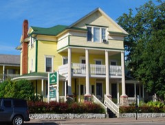 | John Chambers House | building | 1982 | 82002849 |
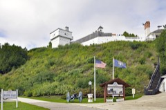 | Fort Mackinac | district | 1970 | 70000280 |
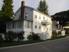 | Mathew Geary House | building | 1971 | 71000407 |
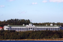 | Grand Hotel | building | 1972 | 72000637 |
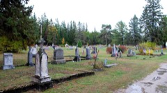 | Gros Cap Cemetery | site | 1971 | 71000406 |
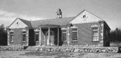 | Hessel School | building | 2019 | 100004234 |
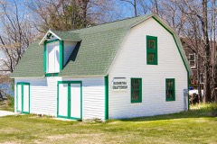 | Hiawatha Sportsman's Club 1931 Maintenance Building and Commissary | building | 2011 | 11000865 |
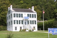 | Indian Dormitory | building | 1971 | 71000408 |
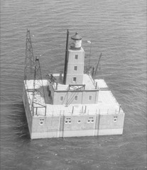 | Lansing Shoals Light Station | structure | 2005 | 05000979 |
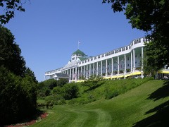 | Mackinac Island | district | 1966 | 66000397 |
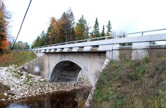 | Mackinac Trail-Carp River Bridge | structure | 1999 | 99001528 |
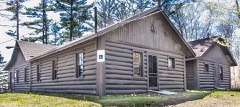 | Manitou Lodge | building | 2011 | 11000866 |
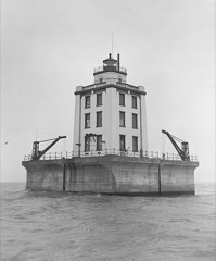 | Martin Reef Light Station | structure | 2005 | 05000743 |
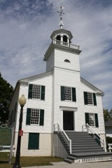 | Mission Church | building | 1971 | 71000409 |
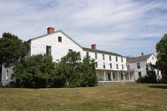 | Mission House | building | 1971 | 71000410 |
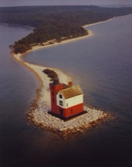 | Round Island Lighthouse | building | 1974 | 74000994 |
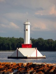 | Round Island Passage Light | structure | 2013 | 13000583 |
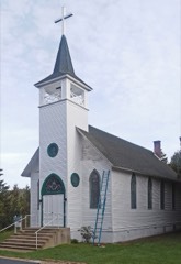 | Sacred Heart-Gros Cap Church | building | 2016 | 16000217 |
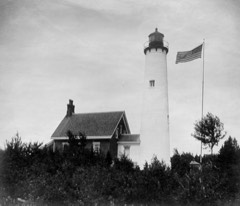 | St. Helena Island Light Station | district | 1988 | 88000442 |
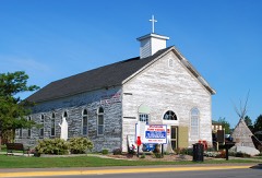 | St. Ignace Mission | site | 1966 | 66000398 |
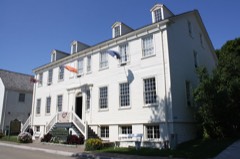 | Robert Stuart House | building | 1971 | 71000411 |
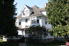 | Lawrence Andrew Young Cottage | building | 1997 | 97000800 |
Every wildfire the federal occurrence database records inside this county: 163 of them, burning about 2,468 acres. 20 started naturally and 2 were recorded as arson. Each settlement page carries the fires within five miles of it.
| Reported cause | Fires |
|---|---|
| Debris and open burning | 48 |
| Missing data/not specified/undetermined | 29 |
| Recreation and ceremony | 27 |
| Natural | 20 |
| Equipment and vehicle use | 14 |
| Power generation/transmission/distribution | 7 |
| Fireworks | 4 |
| Railroad operations and maintenance | 4 |
| Misuse of fire by a minor | 4 |
| Smoking | 3 |
| Arson/incendiarism | 2 |
| Other causes | 1 |
The five largest, by the area the report gives. None of them was recorded as arson.
| Date | Cause | Size | Reported by | Name on the report |
|---|---|---|---|---|
| 23 August 1999 | Recreation and ceremony | 900 acres | Hiawatha National Forest | TROLL FIRE |
| 5 May 1999 | Missing data/not specified/undetermined | 775 acres | Michigan Department of Natural Resources | MACKINAC3 |
| 29 April 2003 | Debris and open burning | 172 acres | Hiawatha National Forest | LOVEGROVE |
| 18 April 2015 | Fireworks | 55 acres | Hiawatha National Forest | PRAIRIE LANE |
| 14 April 2003 | Debris and open burning | 40 acres | Hiawatha National Forest | SIMMONS ROAD |
| 10 July 2018 | Recreation and ceremony | 38 acres | Michigan Department of Natural Resources | CLARK TOWNSHIP VFD 0201827 - 2018 |
| 7 May 2003 | Debris and open burning | 33 acres | Michigan Department of Natural Resources | not named |
| 15 May 2018 | Natural | 32 acres | Michigan Department of Natural Resources | HESSEL |
Every settlement page carries the fires within five miles of it - see the settlement index below.
The NOAA Storm Events Database holds 59 reports for this county, causing no deaths, 1 injury and about $360,000 in recorded property damage. Each settlement page carries the reports that name it.
| Kind of event | Reports |
|---|---|
| Thunderstorm Wind | 31 |
| Hail | 18 |
| Flash Flood | 5 |
| Tornado | 4 |
| Lightning | 1 |
The most serious of them, by death, then injury, then recorded damage. The accounts are quoted exactly as the forecast office filed them.
| When | Event | Place named | Harm | What the report says |
|---|---|---|---|---|
| July 1984 | Tornado (F2) | not stated | 1 hurt, $25,000 | no account filed |
| March 2000 | Lightning | St Ignace | $150,000 | Fire fighters in Saint Ignace believe a bolt of lightning caused a fire at the Father Marquette Memorial Museum in Saint Ignace. The fire destroyed the building. The Museum honored Father Marquette, the man who founded Saint Ignace 300 years previous. |
| July 1995 | Thunderstorm Wind | Brevort Lake | $50,000 | Over 100 trees in Brevort Lake Campground fell over tents and campers. |
| August 2004 | Flash Flood | Epoufette | $40,000 | Heavy rain swelled the Cut River in central Mackinac County. The river washed out part of the west approach to the bridge that carried US-2 across the river. A portion of Epoufette Bay Road was also washed out. |
| June 2007 | Thunderstorm Wind | Mackinac Is | $35,000 | Several trees were downed. One tree fell onto a century-old cottage, causing substantial damage to the roof and porch, and shattering windows. Large limbs were downed at the Grand Hotel golf course, and fencing was damaging along Huron Road. |
| September 2010 | Flash Flood | Moran | $18,000 | A large culvert washed out, rendering East Lake Road impassable just north of Moran. A pick-up truck fell into the washed-out section, which the driver did not see just after rounding a corner. |
| June 2014 | Thunderstorm Wind | St Ignace Arpt | $16,000 | Several trees and power lines were downed on the north side of the city of St Ignace, as well as on Mackinac Island. |
| June 2017 | Thunderstorm Wind | St Ignace | $9,000 | A camper was flipped over on the Mackinac Bridge. A 60 mph gust was measured at the Mackinac Island Airport. |
| August 2005 | Thunderstorm Wind | Curtis | $6,000 | Tree damage occurred in and west of Curtis. Two boats on the south shore of Manistique Lake were flipped over. |
| July 2006 | Thunderstorm Wind | Curtis | $5,000 | Trees and power lines downed. |
| July 1995 | Thunderstorm Wind | Mackinac Bridge | $5,000 | Trailer tipped over on bridge by wind. |
| September 2005 | Thunderstorm Wind | St Ignace | $1,000 | Large tree downed by wind at Foley Creek Campground. |
| March 2025 | Hail | Charles | - | Report of nickel size hail 7.5 miles WNW of Hessel in eastern Mackinac county. |
| May 2022 | Hail | Hessel | - | Golf ball sized hail in Hessel. Time estimated by radar. |
| July 2013 | Thunderstorm Wind | Curtis | - | Wind gusts to 60 mph were estimated in the Curtis area. |
| May 2011 | Tornado (EF0) | Manistique Lake | - | The waterspout formed from an otherwise unimpressive rain shower on the Helmer Bay portion of Manistique Lake in Luce County. It drifted south, crossing into Mackinac County, and soon dissipated over the southeastern portion of the lake. |
| July 2006 | Hail | Point Aux Pins | - | Nickel sized hail on Bois Blanc Island. |
| August 2004 | Flash Flood | Epoufette | - | The flooding (see earlier report) took about an hour and a half to disperse. |
| July 2002 | Thunderstorm Wind | Curtis | - | Numerous trees down. |
| August 2002 | Hail | Moran | - | Damage to patrol car. |
| August 2002 | Thunderstorm Wind | Hessel | - | Numerous 14-16 inch diameter trees down. |
| October 2002 | Thunderstorm Wind | Gould City | - | A few trees down. |
| June 2001 | Thunderstorm Wind | Countywide | - | Numerous reports of trees and power lines down around Eckerman, Engadine, St. Ignace and Cedarville. |
| July 1999 | Flash Flood | Engadine | - | Few inches of standing water on local streets. |
| July 1999 | Thunderstorm Wind | Curtis | - | Trees down. |
| September 1998 | Hail | St Ignace | - | Hail briefly covered the ground. |
| July 1995 | Thunderstorm Wind | Curtis | - | Measured wind gust of 67 mph. Numerous trees down in and around Curtis. |
| July 1995 | Thunderstorm Wind | Engadine | - | Numerous trees down. |
| July 1995 | Thunderstorm Wind | Epoufette | - | Estimated winds of greater than 60 mph. Big trees down. |
| July 1995 | Tornado | Cut River Bridge | - | Unconfirmed tornado reported by public. |
| July 1995 | Thunderstorm Wind | Mackinac Bridge | - | Winds gust of 90 mph measured on bridge. Sustained wind of 85-88 mph lasted for about 10 minutes. Lightning damaged the main bridge power generator. |
| October 2016 | Hail | Moran | - | no account filed |
| July 2016 | Hail | St Ignace | - | no account filed |
| September 2014 | Hail | Curtis | - | no account filed |
| July 2013 | Thunderstorm Wind | Mackinac Is Arpt | - | no account filed |
| July 2013 | Hail | Curtis | - | no account filed |
| July 2008 | Hail | Curtis | - | no account filed |
| August 2008 | Hail | Charles | - | no account filed |
| August 2008 | Hail | Hessel | - | no account filed |
| July 2007 | Hail | Cedarville | - | no account filed |
| August 2003 | Hail | Engadine | - | no account filed |
| July 2002 | Thunderstorm Wind | St Ignace | - | no account filed |
| August 2002 | Thunderstorm Wind | Moran | - | no account filed |
| August 2002 | Hail | St Ignace | - | no account filed |
| April 2001 | Flash Flood | Central Portion | - | no account filed |
| August 2001 | Hail | Gould City | - | no account filed |
| August 2001 | Thunderstorm Wind | Engadine | - | no account filed |
| August 2001 | Thunderstorm Wind | Curtis | - | no account filed |
| July 1996 | Hail | Engadine | - | no account filed |
| August 1988 | Tornado (F1) | not stated | - | no account filed |
| July 1987 | Thunderstorm Wind | not stated | - | no account filed |
| July 1985 | Thunderstorm Wind | not stated | - | no account filed |
| July 1984 | Thunderstorm Wind | not stated | - | no account filed |
| June 1983 | Thunderstorm Wind | not stated | - | no account filed |
| September 1983 | Thunderstorm Wind | not stated | - | no account filed |
| August 1979 | Thunderstorm Wind | not stated | - | no account filed |
| August 1979 | Hail | not stated | - | no account filed |
| September 1976 | Thunderstorm Wind | not stated | - | no account filed |
| September 1975 | Thunderstorm Wind | not stated | - | no account filed |
The Survey's mineral resources record lists 31 workings inside this county. 25 still produce and 6 are closed or unrecorded. Each settlement page carries the workings within five miles of it.
| Commodity | Workings |
|---|---|
| Sand and Gravel, Construction | 20 |
| Stone, Crushed/Broken | 7 |
| Fire Clay (Refractory) | 1 |
| Dolomite | 1 |
| Limestone, General | 1 |
| Silica | 1 |
The least common of them first, because a county's hundredth gravel pit says nothing its first ten did not.
| Where | Site | Commodity | Status | Recorded |
|---|---|---|---|---|
| Cedarville Quarry | Dolomite | Producer | 1955 | |
| East Hical Quarry | Limestone, General | Producer | 1930 | |
| Plateau Site | Silica | Producer | Sedimentary | |
| Pryor and Reavie Clay Pit | Fire Clay (Refractory) | Past Producer | ||
| Cedarville Plant | Stone, Crushed/Broken | Producer | ||
| Fiborn Limestone Quarry | Stone, Crushed/Broken | Past Producer | ||
| Gould City Limestone Exposure | Stone, Crushed/Broken | Prospect | ||
| Hunt Spur Limestone Exposure | Stone, Crushed/Broken | Prospect | ||
| Inland Lime & Stone Co. Quarry | Stone, Crushed/Broken | Producer | ||
| Ozark Limestone Quarry | Stone, Crushed/Broken | Past Producer | ||
| Union Carbide's Hendricks Ls Quarry | Stone, Crushed/Broken | Past Producer | ||
| A.O. Quarry | Sand and Gravel, Construction | Producer | ||
| Bawks and Beacom Sand Pit | Sand and Gravel, Construction | Producer | ||
| Duncon Pit | Sand and Gravel, Construction | Producer | ||
| Feske Pit | Sand and Gravel, Construction | Producer | ||
| Gould City Pit | Sand and Gravel, Construction | Producer | ||
| Mackinac County Pits-Lake Pit | Sand and Gravel, Construction | Producer | ||
| Mike Mangene Inc. Pit | Sand and Gravel, Construction | Producer | ||
| Ozanich Sand and Gravel Pit | Sand and Gravel, Construction | Producer | ||
| Reuben Abram Excavating Pit | Sand and Gravel, Construction | Producer | ||
| Rudy Sherlund Pit | Sand and Gravel, Construction | Producer | ||
| Sand Products Corp Pit | Sand and Gravel, Construction | Producer | ||
| State of Michigan Pit | Sand and Gravel, Construction | Producer | ||
| State of Michigan Pit | Sand and Gravel, Construction | Producer | ||
| State of Michigan Pit | Sand and Gravel, Construction | Producer | ||
| State of Michigan Pit | Sand and Gravel, Construction | Producer | ||
| Taylor Pit | Sand and Gravel, Construction | Producer | ||
| Taylor Pit | Sand and Gravel, Construction | Producer | ||
| Vertz Pit | Sand and Gravel, Construction | Producer | ||
| Whitehead Co. Pit | Sand and Gravel, Construction | Producer | ||
| Whitehead Co. Pit | Sand and Gravel, Construction | Producer |
Named settlements recorded in the Geographic Names Information System, each with the topographic sheets covering it. Villages, hamlets and abandoned places alike. Each is shown with the nearest named watercourse or landform and the survey quadrangle it falls on.
Mackinac Island city · 49757 · On Browns Brook · Evergreen Shores quadrangle
11 sheets, 1931 to 1984
Clark township · 49719 · On Pearson Creek · Cedarville quadrangle
10 sheets, 1955 to 1984
St. Ignace township · 49781 · On Hoban Creek · Evergreen Shores quadrangle
11 sheets, 1931 to 1984
Mackinac Island city · 49757 · Near Mackinac Island · Round Island quadrangle
10 sheets, 1955 to 1984
Mackinac Island city · 49757 · Near Mackinac Island · Round Island quadrangle
10 sheets, 1955 to 1984
Mackinac Island city · 49757 · On Mackinac Island · Round Island quadrangle
10 sheets, 1955 to 1984
Garfield township · 49827 · On Furlong Creek · Millecoquins quadrangle
11 sheets, 1931 to 1985
Garfield township · 49762 · On Naubinway Island · Naubinway quadrangle
10 sheets, 1954 to 1985
Clark township · 49719 · Near Dollar Island · Goose Island quadrangle
10 sheets, 1955 to 1984
Bois Blanc township · 49775 · On Sucker Creek · Cheboygan quadrangle
12 sheets, 1955 to 1984
Marquette township · 49745 · On Nunns Creek · Pontchartrain Shores quadrangle
11 sheets, 1954 to 1984
Clark township · 49719 · Near Little Island · Cedarville quadrangle
10 sheets, 1955 to 1984
Marquette township · 49745 · On Crooked Creek · Pontchartrain Shores quadrangle
11 sheets, 1954 to 1984