 Block
From the record
9 National Register listings published here.
Sources: the National Register database, National Park Service
55 topographic sheets cover 49 settlements here, and 9 properties are on the National Register of Historic Places.
9 National Register listings published here.
Sources: the National Register database, National Park Service
Every property in this county listed on the National Register of Historic Places, with the year it was listed and the federal nomination document.
| Photograph | Property | Type | Listed | Reference |
|---|---|---|---|---|
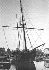 | ALVIN CLARK (schooner) | structure | 1974 | 74000996 |
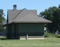 | Milwaukee Chicago St. Paul and Pacific Railroad Station | building | 1982 | 82002852 |
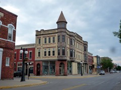 | First Street Historic District | district | 1974 | 74000997 |
 | Charles G. Janson Garage | building | 2010 | 10000615 |
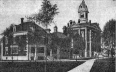 | Menominee County Courthouse | building | 1975 | 75000958 |
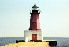 | Menominee Pierhead Light Station | structure | 2005 | 05000738 |
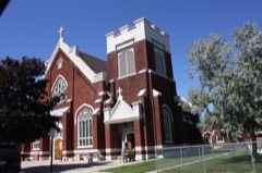 | St. John the Baptist Catholic Church | building | 1995 | 95000865 |
| J.W. Wells State Park | district | 2002 | 02000040 | |
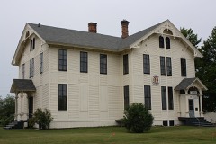 | Wisconsin Land and Lumber Company Office Building | building | 1991 | 91000901 |
Every wildfire the federal occurrence database records inside this county: 375 of them, burning about 1,407 acres. 16 started naturally and 21 were recorded as arson. Each settlement page carries the fires within five miles of it.
| Reported cause | Fires |
|---|---|
| Debris and open burning | 147 |
| Missing data/not specified/undetermined | 87 |
| Equipment and vehicle use | 43 |
| Arson/incendiarism | 21 |
| Recreation and ceremony | 18 |
| Railroad operations and maintenance | 17 |
| Natural | 16 |
| Misuse of fire by a minor | 9 |
| Smoking | 7 |
| Power generation/transmission/distribution | 5 |
| Fireworks | 3 |
| Other causes | 2 |
The five largest, by the area the report gives. None of them was recorded as arson.
| Date | Cause | Size | Reported by | Name on the report |
|---|---|---|---|---|
| 22 April 1994 | Debris and open burning | 58 acres | Michigan Department of Natural Resources | not named |
| 3 April 1995 | Debris and open burning | 54 acres | Michigan Department of Natural Resources | not named |
| 3 April 1994 | Equipment and vehicle use | 53 acres | Michigan Department of Natural Resources | not named |
| 19 May 2013 | Other causes | 43 acres | Michigan Department of Natural Resources | MENOMINEE 0004 |
| 14 April 1994 | Debris and open burning | 40 acres | Michigan Department of Natural Resources | not named |
| 13 September 1995 | Natural | 40 acres | Michigan Department of Natural Resources | not named |
| 29 April 2003 | Equipment and vehicle use | 39 acres | Michigan Department of Natural Resources | not named |
| 29 April 2003 | Missing data/not specified/undetermined | 39 acres | Michigan Agency | MENOM #16 |
Every settlement page carries the fires within five miles of it - see the settlement index below.
The NOAA Storm Events Database holds 245 reports for this county, causing 1 death, 13 injuries and about $6,281,000 in recorded property damage. Each settlement page carries the reports that name it.
| Kind of event | Reports |
|---|---|
| Thunderstorm Wind | 127 |
| Hail | 91 |
| Heavy Rain | 10 |
| Tornado | 9 |
| Flash Flood | 3 |
| Lightning | 2 |
| Flood | 2 |
| Funnel Cloud | 1 |
The most serious of them, by death, then injury, then recorded damage. The accounts are quoted exactly as the forecast office filed them.
| When | Event | Place named | Harm | What the report says |
|---|---|---|---|---|
| June 1985 | Tornado (F1) | not stated | 1 killed, $2,500 | no account filed |
| July 1986 | Tornado (F3) | not stated | 12 hurt, $2,500,000 | no account filed |
| September 2014 | Lightning | Powers | 1 hurt | A man was struck by lightning in Powers but was reported to be conscious and bleeding. |
| April 2026 | Flood | Faithorn | $877,000 | County emergency management reported 20 to 30 roads flooded by 9:45 AM on the 12th, with significant flooding of the US-2 rail underpass in Powers as well as much of the surrounding town and the nearby town of Wilson. On the 13th, railroad tracks in Faithorn were washed out. In the overnight of the 13th into the 14th, County Road 563 washed out at Wilson Creek. One water rescue was performed in Harris Township on the 14th.Due to the severity of the flooding, a Disaster Declaration Request was approved by the president on June 30th. |
| June 2022 | Thunderstorm Wind | Faithorn | $500,000 | The NWS storm survey team observed widespread damage from Faithorn to Hermansville with several structures severely damaged and thousands of trees uprooted or snapped off. Downed trees and powerlines resulted in impassable roads. |The NWS survey team also concluded that the damage was characteristic of intense straight line winds of 100 to 110 mph. This is supported by radar data which showed a classic descending rear inflow jet (strong high altitude winds descending to the ground) surging northeastward across this area. In addition, the downed trees fell in mainly the same direction along with signs of divergent flow in the damage pattern. |
| July 2017 | Lightning | Harris | $500,000 | The Seventh Day Adventist Church near Wilson was struck by lightning and the subsequent fire destroyed the church. |
| May 2015 | Hail | Stephenson | $500,000 | The spotter near Stephenson reported two-inch diameter hail, although most hail stones covering the ground were smaller. The large hail damaged roofs on homes across Stephenson, and the combination of the hail and heavy rainfall rates of 1-2 inches per hour clogged storm sewers and caused flooding of the Stephenson School. |
| May 1991 | Tornado (F2) | not stated | $250,000 | no account filed |
| May 1991 | Tornado (F3) | not stated | $250,000 | no account filed |
| September 1972 | Tornado (F2) | not stated | $250,000 | no account filed |
| June 2018 | Flash Flood | Spalding | $175,000 | Nearly three inches of heavy rain flooded or washed out 40 to 50 roads from Spalding Township through Daggett to Stephenson. The Menominee County Emergency Manager reported that flooding damaged farms and toppled trees in the area as well. There were only two homes with damage reports such as basement flooding. The Stephenson Fire Department started a pumping operation, which local farmers assisted with as well, to pump around 12,000 gallons per minute to stay ahead of the flooding. Governor Rick Snyder declared a state of disaster for Menominee County as flood damage estimates totaled nearly $175,000. |
| July 2006 | Hail | Menominee | $100,000 | Hail up to golf ball size combined with strong winds resulted in significant damage to roofs, siding, and automobiles. |
| July 2010 | Thunderstorm Wind | Menominee | $50,000 | Widespread tree damage occurred...most extensively in the 1st Street area. A tree fell on a car and another had roots exposed. A boat and a trailer were overturned. Two trees fell into power lines and a power pole...snapping the pole. |
| June 2025 | Thunderstorm Wind | Daggett | $49,500 | Public report from Daggett that a pine tree broke off at base approximately 2 to 3 feet in diameter. Another 1 to 2 foot diameter tree split and took down a power line. A large willow tree at 3 to 4 feet in diameter at the base took down additional powerlines, blocking N Frenchtown Road. Time estimated by broadcast media who forwarded the report. |
| July 1987 | Tornado (F3) | not stated | $25,000 | no account filed |
| July 2023 | Thunderstorm Wind | Stephenson | $20,000 | Report on Facebook of a tree down on a garage, couple of dead trees down, and small branches on roadways. Picture of downed tree was provided. |
| July 2019 | Thunderstorm Wind | Fox | $20,000 | Trees were snapped and uprooted with somewhat dense coverage at Fox County Park. There were reports of large trees on a car and some campers. Tree sizes varied from six inches to two to three feet in diameter. |
| June 2007 | Tornado (EF0) | Banat | $20,000 | At 6:47 pm, a tornado touched down approximately 4 miles west of Banat in a forested area west of County Road 356. The EF-0 tornado was approximately 125 yards wide as it tore a quarter-mile path through forested areas and across County Road 356. With winds estimated at 80 mph, the tornado uprooted or snapped more than fifty large trees (diameter in excess of a foot and height greater than 50 feet) along its path before dissipating over forested swampland. |
| July 2021 | Flash Flood | Cunard | $10,000 | Social media posts and dual-pol radar estimated four to eight inches of rain on the afternoon of the 14th from Cunard to Hermansville. There were pictures posted of roads flooded near Cunard and the golf course flooded in Hermansville. |
| July 2017 | Thunderstorm Wind | Hermansville | $10,000 | The Delta County Dispatch reported that a tree had fallen on a van on French Town Road near Hermansville. |
| August 2016 | Tornado (EF1) | Cunard | $10,000 | An EF1 tornado touched down just south of the intersection of County Roads 579 and 388 near Hermansville and traveled northeast for 1.25 miles before lifting as it crossed County Road 388. Numerous trees were snapped and uprooted along the path. Small farm equipment was also tossed around as the tornado passed close to a nearby farm and home. |
| July 2020 | Thunderstorm Wind | Wilson | $8,000 | There was a report of a car window smashed through with a tree and a silo leaning sideways due to thunderstorm winds near Wilson. |
| July 2011 | Thunderstorm Wind | Powers | $8,000 | The Menominee County Sheriff's Office reported numerous trees and power lines down across the northern portion of Menominee County. |
| August 2023 | Thunderstorm Wind | Carney | $7,000 | Delayed Facebook report of large trees uprooted, a pole barn blown off its foundation and a garage door blown in. Time of the report was estimated from radar. |
| July 2019 | Thunderstorm Wind | Cedar River | $5,000 | Trees were snapped and uprooted with sporadic coverage across J.W. Wells State Park. The beach at the park was closed due to power line and tree damage. Tree sizes varied from six inches to two to three feet in diameter. |
| June 2017 | Thunderstorm Wind | Menominee | $5,000 | There were multiple reports of trees down around the Menominee area. Time of the report was estimated from radar. |
| August 2015 | Thunderstorm Wind | Menominee | $5,000 | A spotter reported several large tree limbs and trees down throughout the city of Menominee. |
| July 2012 | Thunderstorm Wind | (Mnm)Twin Co Apt Men | $5,000 | Dozens of tree branches were snapped off, and several large trees more than 18 inches in diameter fell onto grave markers at the Riverside Cemetery. Extensive tree damage was also reported at the Riverside Golf Club. Many trees greater than two feet in diameter were uprooted across the course. Very strong winds were observed by the golf club staff, but no damage was apparent to buildings. |
| May 2012 | Thunderstorm Wind | Stephenson | $5,000 | Power lines and trees were reported down across the railroad tracks in Menominee. Emergency services were activated for the area. |
| August 2011 | Tornado (EF0) | Longrie | $5,000 | About a dozen trees were uprooted and numerous branches broken in the Escanaba River State Forest along the Menominee River. |
| July 2011 | Thunderstorm Wind | Stephenson | $5,000 | Power lines and trees reported down in Lake Township. |
| July 2011 | Thunderstorm Wind | Banat | $5,000 | Approximately one-foot diameter trees reported down...along with multiple reports of power lines down. Various 6-8 inch diameter branches were also reported down. |
| July 2011 | Thunderstorm Wind | Daggett | $5,000 | Trees were reported down on power lines along Anderson Road in Daggett County between 9 and 930 pm CDT. |
| August 2023 | Thunderstorm Wind | Carney | $4,000 | Facebook report from Carney with pictures of two different trees down on private property and a garage door blown in. |
| July 2020 | Thunderstorm Wind | Wilson | $4,000 | A 10-foot by 20-foot horse shelter was blown down and tossed 50 feet near Wilson. Power was also knocked out in the area due to fallen trees on power lines. |
| July 2011 | Thunderstorm Wind | Carney | $4,000 | Trees reported down across roads and over power lines. County Road 38 was closed. |
| July 2006 | Thunderstorm Wind | Menominee | $4,000 | Many roads closed across southern Menominee County due to trees and power lines down. A few trees were on fire. Three-foot diameter older willow tree snapped near base at Highway 41 and Willow Tree Road. |
| August 2023 | Thunderstorm Wind | Cedar River | $3,000 | A called-in report of trees down on Highway M-35 just north of Cedar River. |
| June 2022 | Thunderstorm Wind | Cunard | $3,000 | There was a social media report of trees down four miles northwest of Hermansville. |
| May 2021 | Thunderstorm Wind | Kew | $3,000 | A spotter reported trees down over power lines just north of the city of Menominee. |
| July 2019 | Thunderstorm Wind | Cedar River | $3,000 | Law enforcement reported numerous trees down along Highway M-35 four miles southwest of Cedar River. |
| July 2011 | Thunderstorm Wind | Wallace | $3,000 | Various trees reported down on power lines. Time is estimated from radar. |
| August 2008 | Thunderstorm Wind | Ingallston | $3,000 | Several one to two foot diameter trees were snapped off and uprooted between Beattie Creek Lane and Number 7 Road. Damage occurred on the east and west side of Highway M-35. |
| June 2021 | Thunderstorm Wind | Daggett | $2,000 | A report from social media with shared pictures of a downed tree branch and a flipped carport. The observer said there was also a lot of pea-sized hail and extremely heavy rain. The time of report was estimated via radar. |
| May 2021 | Thunderstorm Wind | Nadeau | $2,000 | A spotter reported a tree and a power line down across the intersection of Highway US-41 and Menard Street in Nadeau. US-41 was closed to remove debris. |
| July 2020 | Thunderstorm Wind | Wilson | $2,000 | There was a report of multiple trees down in Wilson. |
| July 2020 | Thunderstorm Wind | La Branch | $2,000 | There was a report of a tree down on an above-ground pool in Perronville. The time of the report was estimated from radar. |
| July 2018 | Thunderstorm Wind | Daggett | $2,000 | Law enforcement reported trees down just east of Daggett on County Road 358. |
| May 2018 | Thunderstorm Wind | Spalding | $2,000 | There was a delayed report and photo via social media of an old garage blown onto Ekberg Road in Spalding. Other reports of minor wind damage were received in Nadeau and Spalding townships, but no specific time or location were shared. |
| July 2017 | Thunderstorm Wind | Longrie | $2,000 | There was a delayed report of numerous trees down completely blocking a road seven miles southwest of Swanson. |
| July 2017 | Thunderstorm Wind | Koss | $2,000 | Multiple trees were down on Menominee County Road 577 near the Wisconsin state line. The time of the report was estimated from radar. |
| July 2017 | Thunderstorm Wind | Daggett | $2,000 | Several large trees were snapped or uprooted just west of Daggett. One of the large trees was two to three feet in diameter. |
| August 2013 | Thunderstorm Wind | Menominee | $2,000 | Three trees of unknown diameter blown down in Menominee along with a number of large tree branches. County dispatch reports a metal utility shed was also blown out of a yard. |
| July 2010 | Thunderstorm Wind | La Branch | $2,000 | Numerous trees were reported down along the snowmobile/ATV trail in La Branche. |
| August 2008 | Thunderstorm Wind | Carbondale | $2,000 | Several trees and many branches were knocked down. One downed tree was greater than one foot in diameter. A large poplar tree was also snapped. |
| May 2007 | Thunderstorm Wind | Menominee | $2,000 | Top of a pine tree fell on a car on 48th Avenue along the north city limits of Menominee. |
| July 2006 | Thunderstorm Wind | Menominee | $2,000 | Numerous 8-inch cedar trees snapped in cemetary near Birch Creek Road and Bay De Noc Road. |
| June 2017 | Thunderstorm Wind | Fox | $1,500 | There were several trees down along Highway M-35 from thunderstorm winds. |
| August 2000 | Thunderstorm Wind | Faithorn | $1,500 | Three large trees and a power pole down. |
| August 2023 | Thunderstorm Wind | Cedar River | $1,000 | Facebook report from Cedar River of a tree down on a private driveway along with a power outage. Time of the report was estimated from radar. |
The Survey's mineral resources record lists 14 workings inside this county. 12 still produce and 2 are closed or unrecorded. Each settlement page carries the workings within five miles of it.
| Commodity | Workings |
|---|---|
| Sand and Gravel, Construction | 12 |
| Stone, Crushed/Broken | 1 |
| Zinc | 1 |
The least common of them first, because a county's hundredth gravel pit says nothing its first ten did not.
| Where | Site | Commodity | Status | Recorded |
|---|---|---|---|---|
| Back Forty | Zinc | Prospect | ||
| Menominee Stone Crusher Co.Ls.Pit | Stone, Crushed/Broken | Past Producer | ||
| B & K Pit | Sand and Gravel, Construction | Producer | ||
| Daggett Pit | Sand and Gravel, Construction | Producer | ||
| Gudwar Pit | Sand and Gravel, Construction | Producer | ||
| Menimone County Road Comm. Pit | Sand and Gravel, Construction | Producer | ||
| Menimonee County Road Comm. Pit | Sand and Gravel, Construction | Producer | ||
| Menimonee County Road Comm. Pit | Sand and Gravel, Construction | Producer | ||
| Menominee County Piche Pit | Sand and Gravel, Construction | Producer | ||
| Menominee County Road Comm. Pit | Sand and Gravel, Construction | Producer | ||
| Slawinski Pit | Sand and Gravel, Construction | Producer | ||
| Sobieski Pit | Sand and Gravel, Construction | Producer | ||
| State of Michigan Pit | Sand and Gravel, Construction | Producer | ||
| State of Michigan Pit | Sand and Gravel, Construction | Producer |
Named settlements recorded in the Geographic Names Information System, each with the topographic sheets covering it. Villages, hamlets and abandoned places alike. Each is shown with the nearest named watercourse or landform and the survey quadrangle it falls on.
Ingallston township · 49858 · On Fowler Creek · Arthur Bay quadrangle
9 sheets, 1954 to 1989
Ingallston township · 49858 · On Rochereau Creek · Arthur Bay quadrangle
9 sheets, 1954 to 1989
Menominee township · 49858 · On Hill Creek · Birch Creek quadrangle
9 sheets, 1939 to 1981
Menominee township · 49893 · On Big Spring Creek · Wallace quadrangle
8 sheets, 1949 to 1982
Cedarville township · 49887 · On Cedar River · Cedar River quadrangle
9 sheets, 1954 to 1989
Daggett township · 49821 · Near Peterson Park · Stephenson quadrangle
8 sheets, 1949 to 1982
Faithorn township · 49892 · On Faithorn Creek · Faithorn quadrangle
11 sheets, 1939 to 1982
Meyer township · 49847 · On Camp Two Creek · Hermansville quadrangle
7 sheets, 1954 to 1989
Ingallston township · 49858 · On Beattie Creek · Birch Creek quadrangle
9 sheets, 1939 to 1981
Ingallston township · 49858 · On Johnson Creek · Arthur Bay quadrangle
9 sheets, 1954 to 1989
Menominee city · 49858 · On Kirby Creek · Marinette East quadrangle
9 sheets, 1939 to 1981
Stephenson township · 49887 · On Baird Creek · Stephenson quadrangle
8 sheets, 1949 to 1982
Spalding township · 49874 · On Alder Brook · Hermansville quadrangle
7 sheets, 1954 to 1989