Block
From the record
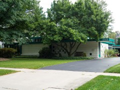
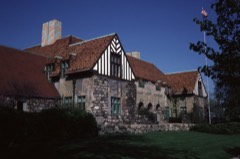
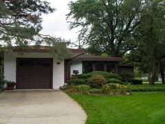
27 National Register listings published here, 2 of them National Historic Landmarks.
Sources: the National Register database, National Park Service
46 topographic sheets cover 31 settlements here, and 27 properties are on the National Register of Historic Places.
27 National Register listings published here, 2 of them National Historic Landmarks.
Sources: the National Register database, National Park Service
Every property in this county listed on the National Register of Historic Places, with the year it was listed and the federal nomination document.
Every wildfire the federal occurrence database records inside this county: 335 of them, burning about 937 acres. 19 started naturally and 10 were recorded as arson. Each settlement page carries the fires within five miles of it.
| Reported cause | Fires |
|---|---|
| Debris and open burning | 103 |
| Missing data/not specified/undetermined | 83 |
| Equipment and vehicle use | 47 |
| Recreation and ceremony | 33 |
| Natural | 19 |
| Arson/incendiarism | 10 |
| Misuse of fire by a minor | 10 |
| Power generation/transmission/distribution | 8 |
| Other causes | 7 |
| Smoking | 7 |
| Fireworks | 5 |
| Railroad operations and maintenance | 3 |
The five largest, by the area the report gives. None of them was recorded as arson.
| Date | Cause | Size | Reported by | Name on the report |
|---|---|---|---|---|
| 17 April 2004 | Natural | 186 acres | Michigan Department of Natural Resources | KAWKAWLIN CREEK FIRE |
| 28 April 2003 | Recreation and ceremony | 156 acres | Michigan Department of Natural Resources | EDENVILLE |
| 23 March 1996 | Debris and open burning | 35 acres | Michigan Department of Natural Resources | not named |
| 15 April 1995 | Misuse of fire by a minor | 32 acres | Michigan Department of Natural Resources | not named |
| 30 March 2006 | Debris and open burning | 27 acres | Michigan Department of Natural Resources | not named |
| 14 April 2003 | Debris and open burning | 21 acres | Michigan Department of Natural Resources | not named |
| 10 April 1994 | Debris and open burning | 18 acres | Michigan Department of Natural Resources | not named |
| 23 March 1996 | Debris and open burning | 16 acres | Michigan Department of Natural Resources | not named |
Every settlement page carries the fires within five miles of it - see the settlement index below.
The NOAA Storm Events Database holds 281 reports for this county, causing no deaths, 13 injuries and about $341,271,000 in recorded property damage. Each settlement page carries the reports that name it.
| Kind of event | Reports |
|---|---|
| Thunderstorm Wind | 148 |
| Hail | 103 |
| Tornado | 10 |
| Flood | 9 |
| Lightning | 6 |
| Flash Flood | 5 |
The most serious of them, by death, then injury, then recorded damage. The accounts are quoted exactly as the forecast office filed them.
| When | Event | Place named | Harm | What the report says |
|---|---|---|---|---|
| September 1986 | Thunderstorm Wind | not stated | 12 hurt | no account filed |
| April 1974 | Tornado (F2) | not stated | 1 hurt, $25,000 | no account filed |
| June 2017 | Flash Flood | Coleman | $116,400,000 | Five to eight inches of rain fell, leading to widespread major flooding. 57 homes were destroyed with over 1900 homes damaged. 193 roads and bridges damaged or destroyed. |
| May 2020 | Flash Flood | Edenville | $100,000,000 | The failure of Edenville Dam lead to the failure of the Sanford Dam downstream and historic flooding along the Tittabawassee River as the river stage at Midland reached 35.05 feet on May 20th. Widespread homes and businesses suffered damage. Two bridges were washed away and the highway U.S. 10 bridge was also damaged. |
| May 2020 | Flash Flood | Sanford | $100,000,000 | The Sanford Dam failed due to the failure of the Edenville Dam upstream in response to widespread heavy rain. This lead to historic flooding along the Tittabawassee River as the river stage at Midland reached 35.05 feet on May 20th. Approximately 1000 buildings or homes were severely damaged or destroyed, with about 1500 homes or buildings being affected or suffering minor flood damage in total across Midland County. |
| May 2020 | Flood | Pleasant Vly | $10,000,000 | Widespread flooding closed over 100 roads across Bay, Midland, and Saginaw Counties. |
| July 2014 | Hail | Midland | $5,000,000 | no account filed |
| July 2014 | Hail | Mapleton | $2,000,000 | no account filed |
| April 2013 | Flood | Alamanda | $1,400,000 | The Tittawassee River at Midland crested at 28.37 feet on April 20th at 5Z. |
| July 2014 | Hail | Midland | $1,000,000 | no account filed |
| July 2014 | Hail | Midland | $1,000,000 | no account filed |
| July 2014 | Hail | Mapleton | $1,000,000 | no account filed |
| June 1996 | Flash Flood | Countywide | $1,000,000 | no account filed |
| June 2008 | Thunderstorm Wind | Edenville | $500,000 | Numerous large trees down. Boats flipped over on Wixon Lake. |
| July 1995 | Thunderstorm Wind | Countywide | $300,000 | no account filed |
| April 2013 | Flood | Coleman | $250,000 | no account filed |
| May 1999 | Tornado (F2) | Midland | $150,000 | no account filed |
| May 1998 | Thunderstorm Wind | Sanford | $150,000 | no account filed |
| July 2014 | Hail | Midland | $100,000 | no account filed |
| May 1998 | Thunderstorm Wind | Midland | $100,000 | no account filed |
| March 2012 | Tornado (EF1) | Alamanda | $75,000 | An EF1 tornado with winds estimated at 90 mph started near Weinert and Lewis Roads where a Garage was destroyed. The tornado moved northeast damaging 3 or more pole barns and uprooting trees, especially around Alamando and Mando Roads and near the end of the Tornado path at M-18 and Shaffer Road. The tornado path was 5.1 miles with a maximum width of 125 yards. The tornado ended at 648 PM EDT. |
| June 2008 | Thunderstorm Wind | Coleman | $75,000 | Trees and wires reported down. |
| July 2007 | Thunderstorm Wind | Sanford | $75,000 | A National Weather Service field survey confirmed that straight line winds as high as 70 MPH blew down numerous large trees. At least 10 homes on Peterson Drive suffered damage from falling trees, some suffering heavy damage. Total damages to the homes were estimated at roughly $75K. |
| July 2001 | Thunderstorm Wind | Edenville | $75,000 | Trees and power lines were blown. The old Gransden building on M-30 lost part of its roof. A tree fell on a truck in Hope Township. A barn roof was partially blown off causing flat tires to a few motorists. One tree fell on a home. |
| May 1998 | Thunderstorm Wind | Coleman | $75,000 | no account filed |
| July 2007 | Thunderstorm Wind | Sanford | $60,000 | A National Weather Service field survey confirmed that straight line winds as high as 80 MPH blew down numerous large trees, including 10 huge oak trees on M-30 near Dague Road. These trees caused significant damages after falling on one family's home, pole barn, car and truck. Total damages were estimated at $60K. |
| August 2022 | Thunderstorm Wind | Floyd | $50,000 | Multiple large trees and power lines reported down across Midland County. |
| May 2006 | Lightning | Midland | $50,000 | Lightning struck a house on Claremont St in Midland, sparking a fire. The fire burned along the electrical wiring and destroyed most of the home's attic. The home also sustained major damage to insulation and trusses, as well as to electrical and water systems. Total damages were estimated at $50K. |
| July 2006 | Thunderstorm Wind | Midland | $50,000 | A trained spotter reported trees blown down in Midland. A local newspaper article also included a picture of a very large 80 foot honey locust tree lying on top of a home. The tree punched through the back sunroom of the home. A neighbor also lost a 50 foot cherry tree due to the thunderstorm winds. Several other large trees were reported blown down across the city of Midland. Midland County was hit particularly hard. Thousands of customers lost power, with most going without power for 3 to 4 days due to the extent of the tree damage across the region. The road commission responded to 24 calls of trees down across roadways. Midland firefighters responded to 50 storm related calls, most involving downed trees and power lines. The most damage in the city occurred from Nelson Street to the downtown area, and in the area of Nakoma Drive and Jefferson Avenue. At least one vehicle was damaged due to fallen debris. Property damage in the area was roughly estimated at around $50K. |
| May 1998 | Thunderstorm Wind | Edenville | $50,000 | no account filed |
| July 2014 | Hail | Midland | $25,000 | no account filed |
| July 1999 | Thunderstorm Wind | Midland | $25,000 | no account filed |
| April 1976 | Tornado (F1) | not stated | $25,000 | no account filed |
| June 1973 | Tornado (F0) | not stated | $25,000 | no account filed |
| June 1951 | Tornado (F1) | not stated | $25,000 | no account filed |
| March 2006 | Flood | Midland | $20,000 | no account filed |
| June 1999 | Thunderstorm Wind | Sanford | $10,000 | no account filed |
| July 1997 | Thunderstorm Wind | Edenville | $10,000 | no account filed |
| September 1997 | Lightning | Coleman | $10,000 | no account filed |
| May 2001 | Thunderstorm Wind | Midland | $8,000 | Numerous trees were downed in a small area. |
| June 2000 | Thunderstorm Wind | Sanford | $7,000 | no account filed |
| February 1999 | Thunderstorm Wind | Midland | $6,000 | no account filed |
| September 2011 | Thunderstorm Wind | Midland | $5,000 | Numerous trees and powerlines reported down. |
| July 2007 | Thunderstorm Wind | Sanford | $5,000 | Law enforcement reported a large tree down on a house. Damages to the home were minor. Many trees and power lines were down in the heavily populated area off North West River Road next to Sanford Lake. Power lines had to be pulled from several homes. Total damages were estimated at roughly $5K. |
| July 2006 | Lightning | Midland | $5,000 | Lightning struck a home, sparking a fire. Property damage was roughly estimated at $5K. |
| June 2002 | Lightning | Midland | $5,000 | Lightning struck an oak tree. Parts of the tree landed on a trailer and caused minor damage. |
| August 1993 | Thunderstorm Wind | Midland | $5,000 | Thunderstorm winds knocked down a large tree across a street in the city. Several large branches were snapped off trees, pulling power lines down. |
| September 2010 | Thunderstorm Wind | Midland | $4,000 | Numerous tress and powerlines were reported down. |
| April 2001 | Thunderstorm Wind | Coleman | $4,000 | A garage door and some windows were blown out of an EMS center. |
| June 1999 | Thunderstorm Wind | Midland | $4,000 | no account filed |
| May 2011 | Thunderstorm Wind | Larkin | $3,000 | A spotter measured a 71 mph thunderstorm wind gust which uprooted trees. |
| September 2010 | Thunderstorm Wind | Larkin | $3,000 | Over two dozen trees were blown down, with larger ones around 18 inches in diameter. |
| June 2009 | Thunderstorm Wind | Oil City | $3,000 | Several small trees were reported blown down. |
| July 2008 | Thunderstorm Wind | Bombay | $3,000 | Wires reported down. |
| June 2008 | Thunderstorm Wind | Larkin | $3,000 | Several Trees reported down. |
| June 1999 | Thunderstorm Wind | Midland | $3,000 | no account filed |
| May 2006 | Thunderstorm Wind | Midland | $2,500 | Trained spotter reported that several trees were blown down in the city of Midland by thunderstorm winds. The Midland Fire Chief reported five "really big trees" and numerous power wires down across area streets, including Hancock, Jay, Clay, and Cottonwood Streets. Debris from trees in the Clay and Jay street areas took crews four hours to clean up. |
| September 1974 | Tornado (F1) | not stated | $2,500 | no account filed |
| May 2013 | Thunderstorm Wind | Sanford | $2,000 | Trees and powerlines reported down. |
| July 2014 | Hail | Midland | $1,000 | no account filed |
The Survey's mineral resources record lists 12 workings inside this county. 4 still produce and 8 are closed or unrecorded. Each settlement page carries the workings within five miles of it.
| Commodity | Workings |
|---|---|
| Clay | 4 |
| Magnesite | 3 |
| Fire Clay (Refractory) | 3 |
| Bromine, Iodine, Calcium | 1 |
| Potassium | 1 |
| Halite | 1 |
The least common of them first, because a county's hundredth gravel pit says nothing its first ten did not.
| Where | Site | Commodity | Status | Recorded |
|---|---|---|---|---|
| Dow Chemical Company - Midland Michigan Operations | Halite | Past Producer | 1892 | |
| Dow-Midland | Magnesite, Bromine, Iodine, Calcium | Producer | 1940 | |
| Midland Property | Potassium | Unknown | ||
| Dow Chemical Co--Hope, Mich. | Magnesite | Producer | ||
| Fish's Tile Plant Clay Pit | Fire Clay (Refractory) | Past Producer | ||
| Martin Marietta-Midland | Magnesite | Plant | ||
| Midland Brick and Tile Co Clay Pit | Fire Clay (Refractory) | Producer | ||
| Woodworth's Clay Pit | Fire Clay (Refractory) | Past Producer | ||
| Dow Chemical Co Clay Pit | Clay | Past Producer | ||
| N.North Bradley Clay Pit | Clay | Past Producer | ||
| Ne North Bradley Clay Pit | Clay | Past Producer | ||
| Tittabawassee Clay Pit | Clay | Past Producer |
Named settlements recorded in the Geographic Names Information System, each with the topographic sheets covering it. Villages, hamlets and abandoned places alike. Each is shown with the nearest named watercourse or landform and the survey quadrangle it falls on.
Midland Charter Township · 48640 · On Bullock Creek · Midland South quadrangle
13 sheets, 1954 to 1984
Edenville township · 48628 · On Tobacco River · Edenville quadrangle
11 sheets, 1954 to 1984
Larkin Charter Township · 48642 · On Miller Drain · Midland North quadrangle
11 sheets, 1954 to 1984
Edenville township · 48657 · On Varity Creek · Edenville quadrangle
11 sheets, 1954 to 1984
No longer a settlement
The vanished settlements of Midland County: the places named above that are no longer on the map.