 Block
From the record
15 National Register listings published here.
Sources: the National Register database, National Park Service
113 topographic sheets cover 53 settlements here, and 15 properties are on the National Register of Historic Places.
15 National Register listings published here.
Sources: the National Register database, National Park Service
Every property in this county listed on the National Register of Historic Places, with the year it was listed and the federal nomination document.
| Photograph | Property | Type | Listed | Reference |
|---|---|---|---|---|
 | George Armstrong Custer Equestrian Monument | object | 1994 | 94001430 |
 | Detroit River Light Station | building | 1983 | 83000886 |
 | Dundee Historic District | district | 1990 | 90001239 |
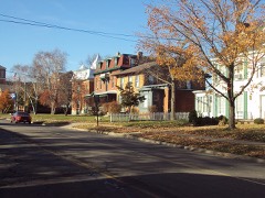 | East Elm-North Macomb Street Historic District | district | 1982 | 82002853 |
 | Hall of the Divine Child | building | 2017 | 100000885 |
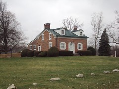 | Edward Loranger House | building | 1984 | 84001807 |
 | Gov. Robert McClelland House | building | 1971 | 71000415 |
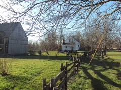 | Navarre-Anderson Trading Post | building | 1972 | 72000645 |
 | Rudolph Nims House | building | 1972 | 72000644 |
 | Old Village Historic District | district | 1982 | 82002854 |
 | Sawyer House | building | 1977 | 77000721 |
 | St. Mary's Academy Historic District | district | 2019 | 82005047 |
 | St. Mary's Church Complex Historic District | district | 1982 | 82002855 |
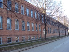 | Weis Manufacturing Company | building | 1981 | 81000313 |
 | Wing-Allore House | building | 2014 | 14001008 |
Every wildfire the federal occurrence database records inside this county: 179 of them, burning about 750 acres. 19 started naturally and 1 was recorded as arson. Each settlement page carries the fires within five miles of it.
| Reported cause | Fires |
|---|---|
| Equipment and vehicle use | 88 |
| Missing data/not specified/undetermined | 62 |
| Natural | 19 |
| Debris and open burning | 4 |
| Recreation and ceremony | 4 |
| Arson/incendiarism | 1 |
| Smoking | 1 |
The five largest, by the area the report gives. One of them was set deliberately.
| Date | Cause | Size | Reported by | Name on the report |
|---|---|---|---|---|
| 27 April 2019 | Debris and open burning | 300 acres | Michigan Department of Natural Resources | BERLIN CHARTER TWP FD STATION 1 NEWPORT 2019258 - |
| 23 March 2019 | Equipment and vehicle use | 80 acres | Michigan Department of Natural Resources | LONDON-MAYBEE-RAISINVILLE FD 0000077 - 2019 |
| 12 November 2005 | Debris and open burning | 77 acres | Michigan Department of Natural Resources | not named |
| 7 November 2010 | Arson/incendiarism | 69 acres | Michigan Department of Natural Resources | MONROE 02 |
| 24 March 2018 | Equipment and vehicle use | 10 acres | Michigan Department of Natural Resources | WHITEFORD TOWNSHIP VFD 0000083 - 2018 |
| 27 March 2019 | Equipment and vehicle use | 10 acres | Michigan Department of Natural Resources | BEDFORD FD 0000672 - 2019 |
| 1 May 2018 | Equipment and vehicle use | 10 acres | Michigan Department of Natural Resources | MILAN AREA FD 1800343 - 2018 |
| 17 May 2013 | Missing data/not specified/undetermined | 8.5 acres | Detroit River International Wildlife Refuge | PLUM CREEK |
Every settlement page carries the fires within five miles of it - see the settlement index below.
The NOAA Storm Events Database holds 489 reports for this county, causing 17 deaths, 93 injuries and about $78,816,000 in recorded property damage. Each settlement page carries the reports that name it.
| Kind of event | Reports |
|---|---|
| Thunderstorm Wind | 313 |
| Hail | 112 |
| Tornado | 41 |
| Lightning | 11 |
| Flash Flood | 5 |
| Flood | 5 |
| Waterspout | 2 |
The most serious of them, by death, then injury, then recorded damage. The accounts are quoted exactly as the forecast office filed them.
| When | Event | Place named | Harm | What the report says |
|---|---|---|---|---|
| April 1965 | Tornado (F4) | not stated | 6 killed, 5 hurt, $2,500,000 | no account filed |
| April 1965 | Tornado (F4) | not stated | 5 killed, 5 hurt | no account filed |
| June 1953 | Tornado (F4) | not stated | 4 killed, 18 hurt, $250,000 | no account filed |
| April 1965 | Tornado (F4) | not stated | 2 killed, 29 hurt, $2,500,000 | no account filed |
| June 2010 | Tornado (EF2) | Rea | 11 hurt, $50,000,000 | A tornado touched down at 211 am at County Line Road and Rankin Road in Monroe county. This tornado then tracked east southeast, moving through Dundee at 217 AM. Maximum sustained winds of 130 to 135 mph where estimated just west of Dundee, which is classified at a high end EF2. The width of the tornado at that time was 800 yards. As it passed through Dundee. The tornado was still classified a low end EF2 with maximum winds of 115 mph. The tornado then tracked another 7 miles along highway 50 before lifting at 227 am at the Dixon Road intersection, causing generally EF0 damage to the east of Dundee. The total path of this tornado reached 13 miles. |
| June 2024 | Lightning | Azalia | 4 hurt | no account filed |
| April 1974 | Tornado (F3) | not stated | 3 hurt, $250,000 | no account filed |
| June 1973 | Tornado (F2) | not stated | 2 hurt, $250,000 | no account filed |
| June 2005 | Thunderstorm Wind | Monroe | 2 hurt, $10,000 | Three RV's were blown over. A Carleton woman was injured at the Harbortown RV Resort on LaPlaisance Road. Another person was injured at Sterling State Park. |
| August 1995 | Thunderstorm Wind | Newport | 2 hurt, $5,000 | Trees and powerlines were blown down. |
| August 1997 | Thunderstorm Wind | Temperance | 2 hurt, $5,000 | no account filed |
| October 1999 | Lightning | Dundee | 2 hurt | no account filed |
| April 1963 | Tornado (F3) | not stated | 1 hurt, $250,000 | no account filed |
| May 1964 | Tornado (F2) | not stated | 1 hurt, $25,000 | no account filed |
| September 2001 | Thunderstorm Wind | Maybee | 1 hurt, $20,000 | Garage was blown down. |
| June 1998 | Thunderstorm Wind | Maybee | 1 hurt, $15,000 | no account filed |
| June 2005 | Thunderstorm Wind | Erie | 1 hurt | Trees and utility poles were blown down. One motorist was slightly injured when power lines fell on his SUV. |
| July 2002 | Thunderstorm Wind | Monroe | 1 hurt | A newspaper reported that a large tree blew over in thunderstorm winds and fell onto a man, trapping him in his back yard. |
| September 1986 | Thunderstorm Wind | not stated | 1 hurt | no account filed |
| September 1986 | Thunderstorm Wind | not stated | 1 hurt | no account filed |
| June 2010 | Tornado (EF1) | Detroit Beach | $10,000,000 | A tornado touched down at 233 am just southwest of Woodland Beach. The tornado tracked 5 miles to the northeast, reaching Estral Beach at 239 am before moving into Lake Erie. The path width was 500 yards with estimated maximum winds of 90 mph, which is classified at an EF1. This tornado impacted the Fermi nuclear power facility, peeling off a section of the roof and some siding on storage buildings. Over 125 homes and 23 vehicles were damaged, with many trees downed. |
| November 2019 | Flood | Monroe | $4,000,000 | no account filed |
| March 2009 | Flood | Woodland Beach | $3,000,000 | no account filed |
| August 2023 | Tornado (EF1) | Grafton | $1,000,000 | The weak tornado touched down in a farm field in Ash Township north of Newport Road and half a mile west of North Telegraph Road. The tornado tracked southeast and hit Frenchtown Villa Mobile Home Park where the bulk of the damage occurred on the north side of the park. Roofs were torn off and a manufactured home was flipped over. Other damage included shingle and roof damage on the northeast side of the park. Maximum winds were estimated to be 100 mph. The tornado continued to track southeast and crossed over I-75 by the Meijer Distribution Center where large tree limbs were downed to the east of the center. As the tornado continued southeast, several large tree limbs were downed with leaning power poles noted. The tornado dissipated in a farm field about half a mile east of North Dixie Highway and south of Post Road in Frenchtown Township in Monroe County. |
| August 2023 | Flood | Oakville | $1,000,000 | Flood waters from the flash flooding slowly receded. |
| September 2018 | Tornado (EF1) | Monroe Custer Arpt | $500,000 | The path began as weak EF0 damage, mainly to trees, until near Reinhardt and Heiss roads where it became a solid EF0. The tornado reached EF1 strength near Toben and South Stony Creek roads where roofing material was removed leaving exposed trusses and windows that were blown out of homes in the area. Garage doors were also blown in and many trees were damaged and uprooted. EF0 damage to siding and tree limbs was noted before the tornado dissipated near North Stoney Creek road and the railroad|tracks. |
| July 1998 | Thunderstorm Wind | Monroe | $315,000 | no account filed |
| August 2023 | Tornado (EF1) | South Rockwood | $300,000 | The weak tornado touched down on Carleton Rockwood Road, one mile east of Telegraph Road. The tornado tracked eastward across Armstrong Road where there were numerous large tree limbs down. There were multiple trees that were snapped and tops taken off, along with some house shingles partially torn off near Brandon Road. The tornado continued to track east across I-75 and South Huron River Drive into where numerous large tree limbs were blown down, one of which fell on a house. There was also a roof partially torn off and garage door damaged near South Huron River Drive and North Dixie Highway. Maximum winds were estimated to be 105 mph. The tornado then crossed into Wayne County and moved over the Lake Erie Metropark Golf Course with multiple large tree limbs downed before ending at the Detroit River. The total path length of the tornado as it moved through Monroe and Wayne counties was 5.4 miles. |
| June 1973 | Tornado (F2) | not stated | $250,000 | no account filed |
| March 1968 | Tornado (F2) | not stated | $250,000 | no account filed |
| July 1995 | Thunderstorm Wind | Countywide | $200,000 | A powerfull line of thunderstorms swept across southeast Michigan from northwest to southeast late in the afternoon on the 13th. An 18-year-old man was killed near Harbor Beach in Huron County when a barn that he was working in collapsed. A 50-year-old man suffered a broken leg when a tree limb fell on him near Croswell, in Sanilac County. The strong winds produced widespread power outages. Detroit Edison reported that 410,000 customers lost power in southeast Michigan due to the storm, which was the highest total for any storm since July, 1991. In addition, the winds produced widespread damage to trees and man-made structures. A State Farm Insurance Agent estimated that total damage claims of over $2 million would be filed. AAA Michigan expected to recieve claims from homeowners of over $3 million. The United States Coast Guard received dozens of distress calls as the storms moved across lakes Huron, Saint Clair and Erie, but no injuries or deaths were reported. (M18BU). |
| September 2018 | Tornado (EF0) | South Rockwood Arpt | $150,000 | An EF0 tornado began in Berlin Township in Monroe County just south of Sigler Road on North Dixie Highway. The tornado moved northeast about 2 miles before exiting Monroe County in South Rockwood. The tornado continue for another 2 miles before dissipating in Wayne County. The tornado remained at EF0 strength throughout the entire path. Damage in Monroe County included multiple limbs and large trees downed. |
| June 2010 | Tornado (EF1) | Azalia | $100,000 | An NWS storm survey confirmed a tornado touched down just north of the Cone Rd exit off US 23...about 2 miles south of Milan at 10:06 PM June 23. The tornado lifted about 2 1/2 miles northeast of Maybee, near Steffas Rd between Scofield and Zink. The total path length was 11 1/2 miles with an average path width of 50 yards. The tornado was rated an EF0 along most of its path, producing winds of 60 to 70 MPH. However, EF1 damage with winds estimated at 90 MPH was found near Tuttle Hill Rd in London Township where a roof was torn off of a pole barn and substantial tree damage was found. The width of this tornado had briefly extended to 100 yards in this location. Several homes also had roof and shingle damage - mainly in and near the town of Scofield. |
| May 2000 | Thunderstorm Wind | Petersburg | $80,000 | no account filed |
| August 2007 | Thunderstorm Wind | Monroe | $75,000 | Law enforcement reported widespread trees down throughout the city of Monroe and across eastern portions of Monroe County. Many homes and businesses suffered damage. The City of Monroe declared an emergency later in the night and asked people to stay off the streets. Winds were estimated at 65 MPH. Total property damages were estimated at roughly $75K. |
| June 2006 | Lightning | Monroe | $75,000 | Lightning struck a home and a fire smoldered for 3 hours before erupting into a full blown fire. The home and the family's contents sustained heavy water, smoke and heat damage. No injuries were sustained. Total property damage was roughly estimated at 75K based on pictures included in the newspaper. |
| June 2009 | Thunderstorm Wind | Detroit Beach | $70,000 | Trees and power lines were reported down. |
| June 2006 | Thunderstorm Wind | Temperance | $65,000 | NWS storm survey reported a 40 foot by 40 foot roof section blown off the Bedford High School gymnasium. Numerous trees were also blown down in the area. The damage to the roof was so extensive that the entire roof had to be replaced, costing the school approximately $65K. |
| August 2023 | Thunderstorm Wind | South Rockwood | $50,000 | Large trees observed blown down. |
| December 2015 | Thunderstorm Wind | Ottawa Lake | $50,000 | A wind damage swath was observed where multiple trees were downed. Shingles were blown off two roofs, and an out building destroyed. Two barn roofs were also blown off. |
| March 2012 | Tornado (EF0) | Yargerville | $50,000 | A tornado was confirmed in central Monroe county. The tornado was rated an EF0, with maximum wind speeds of 85 mph. The estimated path length of the tornado is 0.5 miles with a maximum width of 50 yards. Damage occurred along Ida Center Road just east of Lewis Rd. The damage consisted of siding and shingles blown off a house, a tipped car, a shed destroyed and trees blown down. |
| June 2006 | Tornado (F0) | Estral Beach | $50,000 | A very thin tornado briefly touched down just west of Chinavere Road and just north of Dixie Highway in Berlin Township at 1434 EST on Tuesday, June 27th. The tornado tracked southeast and lifted as it moved across Dixie Highway. The Tornado was rated an F0 anticyclonic tornado with winds up to 65 MPH. The tornado was on the ground for less than a minute but long enough to blow over a loaded tractor-trailer rig weighing 45,000 pounds parked next to a home. Only minor structural damage occurred to the home. The tornado created crop-circle like patterns in a neighboring wheat field. No injuries or deaths were reported. Property damages included the loss of the truck, confirmed at $50K. The same storm cell produced a waterspout over Lake Erie just moments later. |
| June 2001 | Thunderstorm Wind | Monroe | $50,000 | Several trees, large limbs, and power lines were downed. Two cars in Monroe were smashed by falling trees. A home in Woodland Beach was heavily damaged when a tree fell on it. Power was out in downtown Monroe well into the next day. |
| April 2000 | Lightning | Maybee | $50,000 | A lightning-caused fire destroyed a farmhouse. |
| September 2014 | Flash Flood | Carleton | $50,000 | no account filed |
| June 2006 | Flash Flood | South Portion | $50,000 | no account filed |
| July 1998 | Thunderstorm Wind | Maybee | $50,000 | no account filed |
| June 2006 | Thunderstorm Wind | Dundee | $40,000 | NWS storm survey reported a barn destroyed and numerous trees down. Wind gusts estimated to 65 MPH. Property damage estimated at $30K. Tree damage estimated at $10K. |
| July 1999 | Thunderstorm Wind | Monroe | $40,000 | no account filed |
| June 2008 | Thunderstorm Wind | Petersburg | $35,000 | Trees reported down. |
| May 2000 | Thunderstorm Wind | Maybee | $35,000 | no account filed |
| May 2000 | Flash Flood | Countywide | $30,000 | no account filed |
| April 2026 | Thunderstorm Wind | Lambertville Arpt | $25,000 | Metal tower attached to the north side and on top of the grain elevators blown east and collapsed on the train tracks in front of the grain elevators. Tarp roofing damage also noted across the street on Lynch Road. |
| April 2023 | Tornado (EF0) | Rea | $25,000 | The tornado touched down at the intersection of Brewer Rd and Petersburg Rd west southwest of Dundee. Damage in this area included a stand of pine trees down, damage to an outbuilding, and some significant shingle damage to a house with winds estimated at 75 mph in strength. The tornado then tracked along Brewer Rd with damage consisting of sporadic downed large limbs as Brewer Rd turned into Riley St. upon entering into the village of Dundee. Estimated wind speeds increased to a peak of 80 mph in downtown Dundee...specifically in the immediate vicinity of Memorial Park...with increased wind speeds aided by funneling effects between downtown buildings. Damage in this area consisted of a roof being partially blown off, windows blown out, downed limbs, and nearby car damage. The tornado then tracked further east northeastward until ending near the intersection of Dixon Rd and Sullivan Rd with continued sporadic downed large limbs. |
| February 2017 | Lightning | Patterson Gardens | $25,000 | A house fire was reported due to a lightning strike, causing extensive damage in the attic. A hole was also observed in the roof. |
| May 2001 | Thunderstorm Wind | Newport | $25,000 | A thunderstorm wind gust destroyed a barn, flinging the metal roof into a neighbor's yard. A boat and furniture inside the barn were damaged. |
| June 2001 | Thunderstorm Wind | Maybee | $25,000 | Several trees and power lines were downed. One tree fell onto an Exeter Township home. |
| August 1979 | Tornado (F1) | not stated | $25,000 | no account filed |
| August 1979 | Tornado (F1) | not stated | $25,000 | no account filed |
| August 1979 | Tornado (F1) | not stated | $25,000 | no account filed |
The Survey's mineral resources record lists 21 workings inside this county. 7 still produce and 14 are closed or unrecorded. Each settlement page carries the workings within five miles of it.
| Commodity | Workings |
|---|---|
| Stone, Crushed/Broken | 7 |
| Fire Clay (Refractory) | 5 |
| Limestone, General | 4 |
| Sand and Gravel, Construction | 3 |
| Silica | 1 |
| Clay | 1 |
The least common of them first, because a county's hundredth gravel pit says nothing its first ten did not.
| Where | Site | Commodity | Status | Recorded |
|---|---|---|---|---|
| Schesberger Sandstone Exposure | Silica | Past Producer | ||
| South Rockwood Clay Mine | Clay | Past Producer | ||
| Deer Lake Farm Pit | Sand and Gravel, Construction | Producer | ||
| E. Rockwood Glass Sand Exposure | Sand and Gravel, Construction | Past Producer | ||
| Wargle Pit | Sand and Gravel, Construction | Producer | ||
| Little Sink Quarry Limestone | Limestone, General | Past Producer | ||
| Lula Quarry Limestone | Limestone, General | Past Producer | ||
| Otter Limestone Quarry | Limestone, General | Past Producer | ||
| Petersburg Limestone Exposure | Limestone, General | Prospect | ||
| Maybee Brick and Tile Co Clay Pit | Fire Clay (Refractory) | Past Producer | ||
| Meyer Brothers'Clay Pit | Fire Clay (Refractory) | Past Producer | ||
| Rhu's Clay Pit | Fire Clay (Refractory) | Past Producer | ||
| Ritter's Clay Pit | Fire Clay (Refractory) | Past Producer | ||
| Scotfield Tile Co Clay Pit | Fire Clay (Refractory) | Past Producer | ||
| Dundee Quarry and Plant | Stone, Crushed/Broken | Producer | ||
| Grape Quarry | Stone, Crushed/Broken | Producer | ||
| Ida Quarry- Plant & Mill | Stone, Crushed/Broken | Producer | ||
| Maybee Quarry | Stone, Crushed/Broken | Producer | ||
| Monroe Quarry | Stone, Crushed/Broken | Past Producer | ||
| Ottawa Lake Quarry | Stone, Crushed/Broken | Producer | ||
| Turtle Lake Pit | Stone, Crushed/Broken | Past Producer |
Named settlements recorded in the Geographic Names Information System, each with the topographic sheets covering it. Villages, hamlets and abandoned places alike. Each is shown with the nearest named watercourse or landform and the survey quadrangle it falls on.
Monroe Charter Township · 48161 · On Pike Swale · Erie quadrangle
18 sheets, 1912 to 1986
Frenchtown township · 48162 · On Sandy Creek · Stony Point quadrangle
18 sheets, 1912 to 1986
Berlin Charter Township · 48166 · On Langton Drain · Estral Beach quadrangle
13 sheets, 1942 to 1986
Monroe Charter Township · 48161 · On Anweiler Drain · Monroe quadrangle
17 sheets, 1912 to 1986
Exeter township · 48117 · On Cranberry Drain · Carleton quadrangle
17 sheets, 1906 to 1989
No longer a settlement
Frenchtown township · 48162 · On Little Sandy Creek · Stony Point quadrangle
18 sheets, 1912 to 1986
Ida township · 48140 · On Fitzgerald Drain · Lambertville East quadrangle
19 sheets, 1912 to 1986
Bedford township · 48182 · On Salter Creek · Toledo quadrangle
16 sheets, 1900 to 1986
Berlin Charter Township · 48166 · On Yoas Drain · Flat Rock quadrangle
16 sheets, 1906 to 1989
Berlin Charter Township · 48166 · On Little Swan Creek · Stony Point quadrangle
18 sheets, 1912 to 1986
Monroe Charter Township · 48161 · On Anweiler Drain · Monroe quadrangle
17 sheets, 1912 to 1986
Summerfield township · 49270 · On Miller Drain · Dundee quadrangle
16 sheets, 1912 to 1986
Summerfield township · 49270 · On Russell Drain · Dundee quadrangle
16 sheets, 1912 to 1986
Dundee township · 48131 · On Middle Branch Macon Creek · Dundee quadrangle
16 sheets, 1912 to 1986
Whiteford township · 48182 · On Sink Creek · Lambertville West quadrangle
16 sheets, 1912 to 1986
Bedford township · 48177 · On North Branch Cone Creek · Lambertville East quadrangle
19 sheets, 1912 to 1986
Monroe Charter Township · 48161 · On French Creek · Monroe quadrangle
17 sheets, 1912 to 1986
Berlin Charter Township · 48179 · On Port Creek · Flat Rock quadrangle
16 sheets, 1906 to 1989
Frenchtown township · 48162 · On Webb and Reisdorf Drain · Stony Point quadrangle
18 sheets, 1912 to 1986
Frenchtown township · 48166 · On Walker Drain · Stony Point quadrangle
18 sheets, 1912 to 1986
Bedford township · 48182 · On North River · Lambertville East quadrangle
19 sheets, 1912 to 1986
Erie township · 48133 · On Silver Creek · Lambertville East quadrangle
19 sheets, 1912 to 1986
Monroe Charter Township · 48161 · On Anweiler Drain · Monroe quadrangle
17 sheets, 1912 to 1986
Frenchtown township · 48162 · On Stony Creek · Stony Point quadrangle
18 sheets, 1912 to 1986
La Salle township · 48182 · On Middle Branch Otter Creek · Lambertville East quadrangle
19 sheets, 1912 to 1986
The vanished settlements of Monroe County: the places named above that are no longer on the map.