 Block
From the record
6 National Register listings published here.
Sources: the National Register database, National Park Service
47 topographic sheets cover 17 settlements here, and 6 properties are on the National Register of Historic Places.
6 National Register listings published here.
Sources: the National Register database, National Park Service
Every property in this county listed on the National Register of Historic Places, with the year it was listed and the federal nomination document.
| Photograph | Property | Type | Listed | Reference |
|---|---|---|---|---|
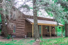 | Jared H. Gay House | building | 1989 | 88003235 |
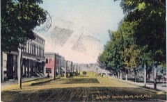 | Hart Downtown Historic District | district | 2015 | 15000814 |
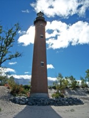 | Little Sable Point Light Station | structure | 1984 | 84001827 |
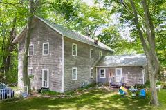 | Charles Mears Silver Lake Boardinghouse | building | 1986 | 86002115 |
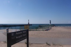 | Navigation Structures at Pentwater Harbor | structure | 2001 | 00001638 |
| US 31-Pentwater River Bridge | structure | 1999 | 99001534 |
Every wildfire the federal occurrence database records inside this county: 288 of them, burning about 1,192 acres. 14 started naturally and 20 were recorded as arson. Each settlement page carries the fires within five miles of it.
| Reported cause | Fires |
|---|---|
| Debris and open burning | 77 |
| Equipment and vehicle use | 63 |
| Missing data/not specified/undetermined | 56 |
| Recreation and ceremony | 27 |
| Arson/incendiarism | 20 |
| Natural | 14 |
| Other causes | 9 |
| Misuse of fire by a minor | 7 |
| Smoking | 6 |
| Power generation/transmission/distribution | 5 |
| Fireworks | 4 |
The five largest, by the area the report gives. Two of them were set deliberately.
| Date | Cause | Size | Reported by | Name on the report |
|---|---|---|---|---|
| 27 April 2003 | Arson/incendiarism | 106 acres | Michigan Department of Natural Resources | PODUNK |
| 23 April 1995 | Recreation and ceremony | 94 acres | Michigan Department of Natural Resources | not named |
| 29 May 1992 | Recreation and ceremony | 68 acres | Michigan Department of Natural Resources | not named |
| 19 April 2005 | Debris and open burning | 67 acres | Michigan Department of Natural Resources | not named |
| 3 May 2015 | Arson/incendiarism | 50 acres | Michigan Department of Natural Resources | OCEANA 06 |
| 14 April 2003 | Debris and open burning | 47 acres | Michigan Department of Natural Resources | not named |
| 27 September 2009 | Missing data/not specified/undetermined | 40 acres | Michigan Department of Natural Resources | OCEANA 04 |
| 3 April 2020 | Missing data/not specified/undetermined | 39 acres | Michigan Department of Natural Resources | OCEANA 02 - MICKEY MOUSE |
Every settlement page carries the fires within five miles of it - see the settlement index below.
The NOAA Storm Events Database holds 116 reports for this county, causing no deaths, 41 injuries and about $9,565,000 in recorded property damage. Each settlement page carries the reports that name it.
| Kind of event | Reports |
|---|---|
| Thunderstorm Wind | 63 |
| Hail | 41 |
| Flash Flood | 6 |
| Tornado | 5 |
| Flood | 1 |
The most serious of them, by death, then injury, then recorded damage. The accounts are quoted exactly as the forecast office filed them.
| When | Event | Place named | Harm | What the report says |
|---|---|---|---|---|
| May 1998 | Thunderstorm Wind | Pentwater | 37 hurt, $4,020,000 | Michigan State Police EMD Damage and Injury Assessment Report indicated $4,018,760 in public damage costs, 37 injuries, 26 homes destroyed, 1415 homes damaged, 6 businesses destroyed, and 109 businesses damaged. Private damage cost estimates were not available. Oceana County declared a local state of emergency and was granted a Governor's disaster declaration to activate state assistance for the county. On June 24th, President Clinton granted a Major Disaster Declaration for Oceana County, making available federal disaster assistance. |
| March 1977 | Tornado (F1) | not stated | 3 hurt, $25,000 | no account filed |
| August 1978 | Tornado (F2) | not stated | 1 hurt, $250,000 | no account filed |
| April 2013 | Flood | Pentwater | $3,000,000 | Heavy rain caused significant flooding on rivers and streams across Newaygo county. |
| May 2001 | Flash Flood | Countywide | $500,000 | no account filed |
| July 2006 | Thunderstorm Wind | Shelby | $250,000 | Hundreds of trees were blown down across Oceana county. |
| May 1991 | Tornado (F2) | not stated | $250,000 | no account filed |
| June 2024 | Thunderstorm Wind | Pentwater | $200,000 | Numerous reports of downed trees and power lines were received. A peak wind gust of 68 mph was also measured. |
| June 2023 | Thunderstorm Wind | Shelby | $100,000 | Numerous trees and power lines were blown down across the county. |
| November 2020 | Thunderstorm Wind | Hart | $100,000 | Numerous trees were blown down across parts of Oceana county. |
| February 2001 | Flash Flood | Countywide | $100,000 | no account filed |
| June 2024 | Thunderstorm Wind | Hart Shelby Arpt | $50,000 | Several trees were blown down and one fell on a home. |
| June 2000 | Thunderstorm Wind | Hart | $50,000 | no account filed |
| July 2000 | Hail | Walkerville | $50,000 | no account filed |
| May 2000 | Thunderstorm Wind | Shelby | $50,000 | no account filed |
| May 2001 | Flash Flood | Countywide | $25,000 | no account filed |
| May 2001 | Flash Flood | Countywide | $25,000 | no account filed |
| September 1990 | Tornado (F1) | not stated | $25,000 | no account filed |
| July 1967 | Tornado (F1) | not stated | $25,000 | no account filed |
| July 2018 | Thunderstorm Wind | Shelby | $20,000 | Area media reported that the roof was blown off of a garage near Shelby and that a large tree was blown down. |
| August 2018 | Thunderstorm Wind | Mears | $20,000 | Several trees were uprooted or snapped off near Silver Lake. |
| August 2006 | Thunderstorm Wind | Mears | $20,000 | Several trees and power lines were blown down near Mears and Pentwater. |
| May 2004 | Hail | Pentwater | $20,000 | A severe thunderstorm produced three quarters to seven eighths inch diameter hail across portions of Oceana county. |
| May 2003 | Hail | New Era | $20,000 | Two reports of one inch diameter hail was received from New Era. |
| July 1999 | Thunderstorm Wind | Countywide | $20,000 | Several trees were downed across Oceana county. |
| August 2024 | Thunderstorm Wind | Walkerville | $15,000 | Several trees were blown down near Ruby creek. |
| July 2006 | Hail | Shelby | $15,000 | A trained spotter reported three quarters inch hail in Shelby. |
| May 2004 | Hail | New Era | $15,000 | Three quarters inch diameter hail was reported in New Era by amateur radio operators. |
| August 2003 | Thunderstorm Wind | Crystal Vly | $15,000 | A large tree was blown down across 126th street in Crystal Valley, and another tree was blown down onto an auto four miles north of New Era. |
| July 1995 | Thunderstorm Wind | Walkerville | $15,000 | Thunderstorm winds uprooted large trees and severely damaged at least two unoccupied mobile homes. |
| July 2005 | Thunderstorm Wind | Pentwater | $15,000 | no account filed |
| June 2020 | Thunderstorm Wind | Hart | $10,000 | Several trees were blown down. |
| August 2015 | Thunderstorm Wind | New Era | $10,000 | The Oceana county road commission reported that several trees were blown down along Arthur road that blocked the road. |
| June 2006 | Hail | Ferry | $10,000 | One inch hail was reported by the public in Ferry and the hail briefly covered the ground. |
| October 2006 | Hail | Ferry | $10,000 | Three quarters inch hail was reported in Ferry. |
| October 2006 | Hail | Walkerville | $10,000 | The public reported seven eighths inch diameter hail in Colfax. |
| October 2006 | Hail | Walkerville | $10,000 | Three quarters inch diameter hail was reported in Colfax. |
| October 2006 | Hail | Shelby | $10,000 | Seven eighths inch diameter hail was reported two miles west of Shelby. |
| March 2005 | Thunderstorm Wind | Hart | $10,000 | The Oceana county road commission reported that six trees were blown down across the county. |
| August 2004 | Thunderstorm Wind | Rothbury | $10,000 | Several trees were blown down in Rothbury, as reported by law enforcement. |
| August 2003 | Thunderstorm Wind | Countywide | $10,000 | Several trees were blown down and uprooted by severe thunderstorm wind gusts in Colfax. |
| August 2003 | Thunderstorm Wind | Countywide | $10,000 | Several trees were blown down in Colfax. |
| July 2002 | Thunderstorm Wind | Hart | $10,000 | A few trees were blown down in Hard and several more trees were blown down across Oceana county, which also knocked down several power lines. |
| May 1998 | Thunderstorm Wind | Pentwater | $10,000 | Several trees and power lines downed in Pentwater. |
| July 2006 | Hail | Shelby | $10,000 | no account filed |
| October 2006 | Hail | Walkerville | $10,000 | no account filed |
| October 2006 | Hail | Walkerville | $10,000 | no account filed |
| July 2005 | Thunderstorm Wind | Hart | $10,000 | no account filed |
| April 2002 | Hail | Pentwater | $10,000 | no account filed |
| August 2002 | Hail | New Era | $10,000 | no account filed |
| March 2000 | Hail | Rothbury | $10,000 | no account filed |
| March 2000 | Hail | Hart | $10,000 | no account filed |
| July 2006 | Hail | Walkerville | $5,000 | One inch diameter hail was reported three miles south of Walkerville. |
| August 2005 | Thunderstorm Wind | Walkerville | $5,000 | The public reported several trees blown down two miles west of Walkerville. |
| March 2004 | Hail | Shelby | $5,000 | A severe thunderstorm produced three quarters inch hail in Shelby. |
| May 2002 | Hail | Mears | $5,000 | A severe thunderstorm produced three quarters inch hail in Mears, and one inch hail was reported three miles west of Mears. |
| May 2002 | Hail | Shelby | $5,000 | Three quarters to one inch hail was reported in Shelby. |
| April 2002 | Thunderstorm Wind | Hesperia | $5,000 | no account filed |
| April 2002 | Thunderstorm Wind | Hesperia | $5,000 | no account filed |
| September 2001 | Thunderstorm Wind | Hart | $5,000 | no account filed |
The Survey's mineral resources record lists 12 workings inside this county. 8 still produce and 4 are closed or unrecorded. Each settlement page carries the workings within five miles of it.
| Commodity | Workings |
|---|---|
| Sand and Gravel, Construction | 9 |
| Fire Clay (Refractory) | 3 |
The least common of them first, because a county's hundredth gravel pit says nothing its first ten did not.
| Where | Site | Commodity | Status | Recorded |
|---|---|---|---|---|
| Hart Clay Pit | Fire Clay (Refractory) | Past Producer | ||
| Pentwater E.Lowlands Clay Pit | Fire Clay (Refractory) | Past Producer | ||
| Silver Lake | Fire Clay (Refractory) | Past Producer | ||
| Beckman Pit | Sand and Gravel, Construction | Producer | ||
| Beckman Pit | Sand and Gravel, Construction | Producer | ||
| Hart Packing Company Pit | Sand and Gravel, Construction | Past Producer | ||
| Oceana Co Rd Comm | Sand and Gravel, Construction | Producer | ||
| Oceana County Road Commission Pit | Sand and Gravel, Construction | Producer | ||
| Oceana County Road Commission Pit | Sand and Gravel, Construction | Producer | ||
| Oceana County Road Commission Pit | Sand and Gravel, Construction | Producer | ||
| Syers Pit | Sand and Gravel, Construction | Producer | ||
| Wambaugh Pit | Sand and Gravel, Construction | Producer |
Named settlements recorded in the Geographic Names Information System, each with the topographic sheets covering it. Villages, hamlets and abandoned places alike. Each is shown with the nearest named watercourse or landform and the survey quadrangle it falls on.
Pentwater township · 49449 · On Pentwater River · Pentwater quadrangle
10 sheets, 1932 to 1983
Hart township · 49420 · On South Branch Pentwater River · Hart quadrangle
12 sheets, 1931 to 1983
Benona township · 49455 · On Silver Creek · Little Point Sable quadrangle
6 sheets, 1954 to 1983
Pentwater township · 49449 · On Pentwater River · Pentwater quadrangle
10 sheets, 1932 to 1983
Greenwood township · 49421 · On Brayton Drain · Hesperia quadrangle
11 sheets, 1931 to 1985
Benona township · 49455 · On Stony Creek · Town Corners quadrangle
7 sheets, 1954 to 1983