 Block
From the record
6 National Register listings published here.
Sources: the National Register database, National Park Service
78 topographic sheets cover 38 settlements here, and 6 properties are on the National Register of Historic Places.
6 National Register listings published here.
Sources: the National Register database, National Park Service
Every property in this county listed on the National Register of Historic Places, with the year it was listed and the federal nomination document.
| Photograph | Property | Type | Listed | Reference |
|---|---|---|---|---|
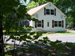 | Bergland Administrative Site | building | 2005 | 05000103 |
| Ernest J. and Edna Humphrey Farm | building | 2022 | 100007921 | |
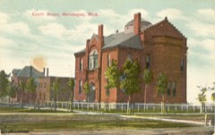 | Ontonagon County Courthouse | building | 1980 | 80001888 |
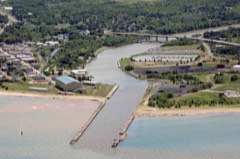 | Ontonagon Harbor Piers Historic District | structure | 2001 | 01001313 |
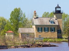 | Ontonagon Lighthouse | structure | 1975 | 75000960 |
 | Ontonagon School | building | 2011 | 11000308 |
Every wildfire the federal occurrence database records inside this county: 62 of them, burning about 189 acres. 6 started naturally and 2 were recorded as arson. Each settlement page carries the fires within five miles of it.
| Reported cause | Fires |
|---|---|
| Debris and open burning | 14 |
| Missing data/not specified/undetermined | 12 |
| Railroad operations and maintenance | 12 |
| Recreation and ceremony | 8 |
| Natural | 6 |
| Power generation/transmission/distribution | 3 |
| Arson/incendiarism | 2 |
| Equipment and vehicle use | 2 |
| Fireworks | 1 |
| Other causes | 1 |
| Smoking | 1 |
The five largest, by the area the report gives. One of them was set deliberately.
| Date | Cause | Size | Reported by | Name on the report |
|---|---|---|---|---|
| 8 April 2017 | Arson/incendiarism | 62 acres | Ottawa National Forest | MILL TOWN |
| 21 May 1994 | Missing data/not specified/undetermined | 25 acres | Ottawa National Forest | not named |
| 15 August 2003 | Missing data/not specified/undetermined | 17 acres | Michigan Department of Natural Resources | not named |
| 30 April 1998 | Power generation/transmission/distribution | 15 acres | Ottawa National Forest | VICTORIA |
| 20 August 2007 | Equipment and vehicle use | 11 acres | Michigan Department of Natural Resources | not named |
| 29 April 2003 | Missing data/not specified/undetermined | 7.0 acres | Ottawa National Forest | 730 |
| 7 May 2015 | Natural | 6.6 acres | Michigan Department of Natural Resources | MASS |
| 15 November 1994 | Smoking | 5.8 acres | Michigan Department of Natural Resources | not named |
Every settlement page carries the fires within five miles of it - see the settlement index below.
The NOAA Storm Events Database holds 145 reports for this county, causing no deaths, no injuries and about $10,697,000 in recorded property damage. Each settlement page carries the reports that name it.
| Kind of event | Reports |
|---|---|
| Thunderstorm Wind | 69 |
| Hail | 54 |
| Heavy Rain | 11 |
| Flash Flood | 5 |
| Tornado | 3 |
| Flood | 2 |
| Wildfire | 1 |
The most serious of them, by death, then injury, then recorded damage. The accounts are quoted exactly as the forecast office filed them.
| When | Event | Place named | Harm | What the report says |
|---|---|---|---|---|
| April 2023 | Flood | Ewen | $8,000,000 | Michigan DOT closed Highway M-28 at Ewen due to snowmelt flooding over the bridge along the South Branch of the Ontonagon River from the 13th until the 18th. Traffic was detoured via US-2 and US-45. Ontonagon County was added to the state emergency declaration by Governor Whitmer on the 21st to assist in flood recovery efforts. |
| July 2025 | Flash Flood | Firesteel | $1,600,000 | Several roads were washed out in the Misery Bay area, including Misery Bay Road, Lots Road, Kemppa Road, and Wolf Creek Road. Some residents were stranded for hours due to the washouts. Newer culverts were blown out due to the flooding. |
| April 2013 | Flood | Merriweather | $550,000 | Rapid melting of significant late season snow pack caused moderate flooding of roads in the Bergland, Bruce Crossing and Rockland areas from the 28th into the 30th. Minor flooding continued into early May. Some flooding of basements was also reported. A portion of Highway M-28 was closed from Bergland to Bruce Crossing due to flooding. Governor Rick Snyder declared a state of disaster in Ontonagon County where nearly $ 550,000 in property damage occurred due to the flooding mainly to roadway infrastructure. |
| June 1953 | Tornado (F1) | not stated | $250,000 | no account filed |
| July 2016 | Thunderstorm Wind | Ontonagon | $100,000 | The Ontonagon Emergency Manager reported dozens of trees down in and around the village of Ontonagon, including several down on homes. Power was out in the village for nearly eight hours. |
| June 2024 | Flash Flood | Firesteel | $50,000 | Nearly five inches of rain from the evening of the 18th into the early morning of the 19th caused flash flooding in the Ontonagon area as a culvert washed out and resulted in the closure of Lakeshore Drive east of Ontonagon. |
| July 2022 | Flash Flood | White Pine | $20,000 | Heavy rain estimates of 4 to 5 inches from early morning through late afternoon caused a washout of Norwich Road in Ontonagon County 13 miles south of Highway M-64. |
| August 2011 | Tornado (EF0) | Ontonagon | $20,000 | A strong EF0 tornado with winds estimated around 85 mph touched down at the River Pines RV Park and Campground and then skipped northeastward across the village lifting on the east side of the Ontonagon Golf Course. Most of the damage was confined to snapped and uprooted trees, snapped power poles, a small flipped boat, minor roof damage, and some structural damage to a garage. There were no injuries. |
| May 2010 | Flash Flood | Ontonagon | $15,000 | The Ontonagon Sheriff's office reported roads in and near Ontonagon washed out due to heavy rainfall of two to three inches which fell in less than an hour. Flooding on River Street in Ontonagon forced water over the sidewalks and into some area businesses. |
| June 2022 | Flash Flood | Nonesuch | $10,000 | Rainfall estimates of 2 to 3 inches from thunderstorms during the day on the 13th caused flash flooding on the south end of Porcupine Mountains State Park. The South Boundary Road was closed from Summit Peak to the Gogebic County line due to water over the road. The park headquarters posted videos of water running over the road on their Facebook page. |
| July 2023 | Thunderstorm Wind | Ewen | $5,000 | The Ontonagon County Dispatch reported a few trees of unknown size down on power lines in Ewen. |
| July 2020 | Thunderstorm Wind | Nonesuch | $5,000 | Widespread power outages were reported across Ontonagon County by UPPCO, especially from White Pine northeast to Ontonagon. |
| June 2018 | Thunderstorm Wind | Greenland | $5,000 | There was a report via social media of a barn destroyed near Mass City. |
| June 2017 | Thunderstorm Wind | Paulding | $4,000 | Multiple trees were reported down in Paulding. |
| June 2017 | Thunderstorm Wind | Simar | $4,000 | There was a delayed report of multiple trees down on Forest Highway 16 in Ontonagon County between Mass City and Nisula. Time of the report was estimated from radar. |
| July 2016 | Thunderstorm Wind | Mass | $4,000 | The Gogebic County Sheriff reported numerous trees down in and around Mass City. |
| July 2012 | Thunderstorm Wind | Bergland | $4,000 | The Ontonagon sheriff received numerous reports of downed trees and powerlines on the southern end of Ontonagon county, mainly near Bergland along M-64. |
| August 2011 | Thunderstorm Wind | Silver City | $4,000 | The spotter at the headquarters of Porcupine Mountains State Park reported severe downdrafts, trees falling, dime-sized hail, significant lightning and heavy rain and runoff for approximately 20 minutes. Four large trees fell across roads, blocking lanes in the park. |
| July 2008 | Thunderstorm Wind | Bergland | $4,000 | Numerous large trees were reported down along East Shore Road eastward to Paulding. |
| July 2006 | Thunderstorm Wind | Ewen | $4,000 | Outbuildings on farm destroyed. Highway construction signs blown down. |
| June 2018 | Thunderstorm Wind | Mass | $3,000 | The State Police Regional Dispatch reported downed power poles in Mass City. |
| July 2011 | Thunderstorm Wind | Paulding | $3,000 | Trees reported down across town...dimension of trees unknown. |
| August 1998 | Thunderstorm Wind | Rockland | $3,000 | 18 inch diameter tree down on a van. Tree down across Creek Rroad. |
| July 2023 | Thunderstorm Wind | Ewen | $2,000 | There was a picture posted on social media of a large tree and power line down across a road in Ewen. |
| July 2022 | Heavy Rain | Firesteel | $2,000 | There was a public report of an estimated three inches of heavy rain by Misery Bay in Ontonagon which caused minor flooding around the garage and yard of the property there. |
| July 2020 | Thunderstorm Wind | Ewen | $2,000 | There was a report of several trees snapped or uprooted between Ewen and Bruce Crossing. The time of the delayed report was estimated from radar. |
| June 2018 | Thunderstorm Wind | Wood Spur | $2,000 | The State Police Regional Dispatch reported trees down over a road five miles southeast of Ontonagon. |
| June 2018 | Thunderstorm Wind | Trout Creek | $2,000 | Aspen trees eight inches in diameter were blown down near the roots at Trout Creek. Report was relayed via social media. |
| July 2016 | Thunderstorm Wind | Merriweather | $2,000 | There was a public report of several trees down around Lake Gogebic five miles southeast of Merriweather. |
| August 2013 | Thunderstorm Wind | Bergland | $2,000 | Several trees were downed, and one of the trees was estimated to have a 12-15 inch diameter. Time of the event was estimated from radar. |
| July 2011 | Thunderstorm Wind | Ewen | $2,000 | Trees reported down...dimensions unknown. Time was estimated by radar. Pea-sized hail was also reported. |
| July 2011 | Thunderstorm Wind | Bruce Crossing | $2,000 | Trees reported down. Time was estimated from the radar. |
| April 2010 | Thunderstorm Wind | Calderwood | $2,000 | Numerous trees were snapped off near Bond Falls. |
| June 2007 | Thunderstorm Wind | Ontonagon | $2,000 | Several 8-12 inch diameter trees blown down across roads. |
| June 2006 | Thunderstorm Wind | Mass | $2,000 | Tree blown down taking power line with it. |
| August 2021 | Thunderstorm Wind | Bruce Crossing | $1,000 | Report of a tree down along the side of Highway M-28 near Bruce Crossing. A delayed report with the time estimated from radar. |
| May 2021 | Thunderstorm Wind | Mass | $1,000 | Delayed report of tree down on powerline. |
| July 2020 | Thunderstorm Wind | Paulding | $1,000 | There were social media reports of a few spruce trees knocked down in Paulding. The time of the delayed report was estimated from radar. |
| September 2019 | Thunderstorm Wind | Paulding | $1,000 | A poplar and spruce tree were reported down across the street of the Running Bear Resort and from nearby trails. Other trees were reported down, but were cleared off the road before being observed by reporter. Timing of the wind damage report was estimated from radar. |
| June 2018 | Thunderstorm Wind | Paulding | $1,000 | The observer in Paulding reported via social media that a sign was damaged at the COOP site there. |
| July 2012 | Thunderstorm Wind | Paulding | $1,000 | Trees were downed onto a power line. No specifics were known on the diameter or the timing of the event. |
| May 2025 | Thunderstorm Wind | Bruce Crossing | - | Dispatch reported a large tree down at US-45 and Himanka Hill Road. |
| May 2024 | Hail | Ewen | - | One inch diameter hail reported in Ewen. The hail lasted 5-10 minutes. |
| July 2022 | Hail | Rockland | - | Quarter-sized hail was reported at Rockland via Facebook. The hail lasted five minutes and the time of the report was estimated from radar. |
| June 2022 | Hail | Firesteel | - | A delayed report of quarter-sized hail near Misery Bay. |
| June 2022 | Hail | Firesteel | - | Pictures of nickel to quarter-sized hail from Twitter seven miles east of Fourteen Mile Point. Time of the report was estimated from radar. |
| May 2021 | Hail | Paulding | - | The observer reported nickel-sized hail in Paulding. |
| July 2019 | Hail | Wainola | - | Nickel-sized hail was reported from a thunderstorm south of Mass City via a photo through social media. |
| May 2017 | Heavy Rain | Paulding | - | The observer in Paulding measured nearly two and half inches of rain in 24 hours. |
| October 2016 | Hail | Rockland | - | A spotter in Rockland observed penny-sized hail covering the ground. |
| August 2014 | Heavy Rain | Silver City | - | There was a public report of 1.91 inches of rainfall in Silver City over approximately 36 hours. |
| September 2014 | Heavy Rain | Paulding | - | Rainfall totals between 1.5 and 3.5 inches were reported across Gogebic County from the evening of the 9th through the afternoon of the 10th...heaviest near the Bruce Crossing area. |
| August 2013 | Hail | Bergland | - | Gusty winds were also observed which knocked down some small limbs. |
| May 2012 | Hail | Wainola | - | Gusts up to 40 mph were reported with the storm. |
| July 2012 | Heavy Rain | Calderwood | - | The observer near Paulding measured 2.12 inches of rainfall during the event. |
| July 2012 | Heavy Rain | Rockland | - | The observer near Rockland measured nearly three inches of rainfall in about an hour. |
| May 2012 | Heavy Rain | Firesteel | - | The observer ten miles east of Ontonagon measured 1.75 inches of total rainfall. A small creek on the residence was reported over its banks. The observer at Rockland measured 2.80 inches of storm total rainfall. |
| September 2012 | Thunderstorm Wind | Wainola | - | A spotter just south of Mass City measured 63 mph wind gusts from a line of thunderstorms moving through the area. Pea-sized hail was also reported. |
| June 2012 | Heavy Rain | Bergland | - | Observers from Bergland and Paulding to Rockland measured nearly two inches of storm total rainfall. |
| October 2012 | Heavy Rain | Paulding | - | Locations throughout Ontonagon County measured between two to three inches of rainfall during the event. |
The Survey's mineral resources record lists 99 workings inside this county. 9 still produce and 90 are closed or unrecorded. Each settlement page carries the workings within five miles of it.
| Commodity | Workings |
|---|---|
| Copper | 78 |
| Silver | 18 |
| Copper, Silver | 5 |
| Sand and Gravel, Construction | 4 |
| Stone, Crushed/Broken | 3 |
| Gold, Silver | 2 |
| Clay | 1 |
| Gold | 1 |
The least common of them first, because a county's hundredth gravel pit says nothing its first ten did not.
| Where | Site | Commodity | Status | Recorded |
|---|---|---|---|---|
| Beaser Silver Prospect | Gold | Occurrence | 1873 | |
| Hydraulic-Press Brick Co. Shale Pit | Clay | Past Producer | ||
| (Facility) White Pine Copper Refinery | Copper, Gold, Silver | Plant | ||
| (Facility) White Pine Copper Smelter | Copper, Gold, Silver | Plant | ||
| George Hocking Construction Co Qy | Stone, Crushed/Broken | Producer | ||
| George Hocking Construction Co Qy | Stone, Crushed/Broken | Past Producer | ||
| Howes White Pine Quarry | Stone, Crushed/Broken | Producer | ||
| Fox Valley Pits | Sand and Gravel, Construction | Producer | ||
| George Hocking Const Pit | Sand and Gravel, Construction | Producer | ||
| National Sandstone Exposure | Sand and Gravel, Construction | Past Producer | ||
| Ontonagon County Road Comm. Pit | Sand and Gravel, Construction | Producer | ||
| Michigan | Copper, Silver | Past Producer | 1898, 1904 | |
| Minesota | Copper, Silver | Past Producer | 1848, 1856 | |
| National | Copper, Silver | Past Producer | 1848, 1853 | |
| Old Mass | Copper, Silver | Past Producer | 1856, 1857 | |
| Rockland | Copper, Silver | Past Producer | 1853, 1854 | |
| Adventure Consolidated Mine | Copper, Silver | Past Producer | 1850, 1851, 1917 | |
| Boston & North American Silver Prospect | Silver | Prospect | 1845, 1846 | |
| Caledonia Mine (Nebraska) | Copper, Silver | Producer | 1855, 1863 | |
| Cleveland Silver Prospect | Silver | Past Producer | 1874, 1875 | |
| Evergreen Series | Copper, Silver | Past Producer | 1848 | |
| Flintsteel River Mine | Copper, Silver | Past Producer | 1853, 1881 | |
| Lone Rock Silver Prospect | Silver | Prospect | 1859, 1860 | |
| Mammoth Silver Prospect | Silver | Occurrence | 1873 | |
| Mass Consolidated Mine | Copper, Silver | Past Producer | 1849, 1850 | |
| Michigan Mine | Copper, Silver | Past Producer | 1898, 1921 | |
| Minesota Mine | Copper, Silver | Past Producer | 1848, 1885 | |
| National Mine | Copper, Silver | Past Producer | 1848, 1908 | |
| Ontonagon Silver Mine | Silver | Past Producer | 1873 | |
| Rockland Mine | Copper, Silver | Past Producer | 1853, 1880 | |
| Scranton Silver Mine | Silver | Past Producer | 1872 | |
| Superior Silver Mine | Silver | Past Producer | 1873, 1876 | |
| White Pine | Copper, Silver | Producer | 1865, 1953 | |
| White Pine Mine | Copper, Silver | Past Producer | 1937, 1945, 1995 | |
| Algomah Mine | Copper | Past Producer | 1910, 1956 | |
| Algonquin Mine | Copper | Past Producer | 1847 | |
| Artic | Copper | Past Producer | 1904 | |
| Aztec | Copper | Past Producer | 1852 | |
| Belt Mine (Piscatauqua) | Copper | Past Producer | Secondary Enrichment | |
| Bohemian Mine | Copper | Past Producer | 1848, 1886 | |
| Boston & Lake Superior Exploration | Copper | Prospect | 1849, 1854 | |
| Brooklyn Mine | Copper | Past Producer | 1860 | |
| Carp Lake Mine | Copper | Past Producer | 1858, 1898 | |
| Cascade Prospect | Copper | Prospect | Fissure | |
| Cherokee Mine | Copper | Past Producer | 1864, 1917 | |
| Cleveland Mine | Copper | Past Producer | Secondary Enrichment | |
| Clifton Mine | Copper | Past Producer | 1853, 1855 | |
| Collins Mine | Copper | Past Producer | Secondary Enrichment | |
| Copper Crown Mine | Copper | Past Producer | 1904, 1908 | |
| Cuyahoga Mine | Copper | Past Producer | Secondary Enrichment | |
| Derby Mine | Copper | Past Producer | 1852, 1865 | |
| Eureka Mine | Copper | Past Producer | 1863 | |
| Firesteel Mine | Copper | Past Producer | 1852, 1855 | |
| Halliwell Mine | Copper | Past Producer | 1896, 1906 | |
| Hartford Mine | Copper | Past Producer | 1864 | |
| Henwood Mine (Douglass Houghton) | Copper | Past Producer | 1850, 1856 | |
| Hilton Mine | Copper | Past Producer | 1850, 1890 | |
| Hudson Mine | Copper | Past Producer | 1850, 1864 | |
| Indiana Mine | Copper | Past Producer | 1862, 1916 | |
| Knowlton Mine | Copper | Past Producer | 1896, 1906 | |
| Lafayette Mine | Copper | Past Producer | 1844, 1865 | |
| Lake | Copper | Past Producer | 1905, 1909 | |
| Lake Cu Mine | Copper | Past Producer | ||
| Lake Mine | Copper | Past Producer | 1905, 1919 | |
| Lake Superior Mine | Copper | Past Producer | Secondary Enrichment | |
| Mass | Copper | Past Producer | ||
| Mass Cu Mine | Copper | Past Producer | ||
| Mendenhall Mine | Copper | Past Producer | 1846, 1847 | |
| Merryweather Prospect | Copper | Prospect | 1852 | |
| Nassau Mine | Copper | Past Producer | Secondary Enrichment | |
| Nebraska | Copper | Past Producer | 1855 | |
| Nonesuch Copper Mine | Copper | Past Producer | ||
| Nonesuch Mine | Copper | Past Producer | 1867, 1885 | |
| North Lake Mine | Copper | Past Producer | 1908, 1918 | |
| Norwich | Copper | Past Producer | 1846, 1852 | |
| Norwich Mine | Copper | Past Producer | 1846, 1850, 1900 | |
| Ohio Trap Rock Mine | Copper | Past Producer | 1846, 1858 | |
| Old Mass Mine | Copper | Past Producer | 1849, 1884 | |
| Ontonagon Mine | Copper | Past Producer | Secondary Enrichment | |
| Peninsula Mine | Copper | Past Producer | 1850, 1854 | |
| Pittsburg Mine | Copper | Past Producer | 1852, 1856 | |
| Ridge Cu Mine | Copper | Past Producer | ||
| Scranton Mine | Copper | Past Producer | Secondary Enrichment | |
| Sharon Mine | Copper | Past Producer | 1852, 1855 | |
| South Lake Mine | Copper | Past Producer | Secondary Enrichment | |
| Superior | Copper | Past Producer | 1855, 1860 | |
| Toltec | Copper | Past Producer | 1850, 1853 | |
| Toltec Mine | Copper | Past Producer | Secondary Enrichment | |
| Tremont Mine (Devon) | Copper | Past Producer | Vein | |
| Union Copper Mine | Copper | Past Producer | ||
| Union Mine | Copper | Past Producer | 1846, 1907 | |
| United States Exploration | Copper | Prospect | 1852 | |
| Victoria | Copper | Past Producer | 1849, 1850 | |
| Victoria Mine (Cushin) | Copper | Past Producer | 1849, 1924 | |
| W.White Pine Smith Explorat. Copper | Copper | Prospect | ||
| Wauneta Exploration | Copper | Prospect | 1899 | |
| What Cheer Mine | Copper | Past Producer | 1855 | |
| White Pine Copper Co. Extension | Copper | Prospect | ||
| White Pine Extension Mine | Copper | Past Producer | 1872, 1915, 1918 |
Named settlements recorded in the Geographic Names Information System, each with the topographic sheets covering it. Villages, hamlets and abandoned places alike. Each is shown with the nearest named watercourse or landform and the survey quadrangle it falls on.
Bergland township · 49910 · On Three Bears Creek · Bergland quadrangle
12 sheets, 1956 to 1999
Stannard township · 49912 · On House Creek · Bruce Crossing quadrangle
13 sheets, 1949 to 1999
Ontonagon township · 49953 · On Austin Creek · Ontonagon South quadrangle
9 sheets, 1955 to 1979
Greenland township · 49929 · Near Adventure Mountain · Greenland quadrangle
13 sheets, 1950 to 1982
Carp Lake township · 49953 · Near Green Mountain Peak · Carp River East quadrangle
14 sheets, 1956 to 1994
Bergland township · 49910 · On Merriweather Creek · Bergland quadrangle
12 sheets, 1956 to 1999
Greenland township · 49948 · Near Adventure Mountain · Greenland quadrangle
13 sheets, 1950 to 1982
Bergland township · 49947 · On Merriweather Creek · Merriweather quadrangle
12 sheets, 1956 to 1999
Carp Lake township · 49953 · On West Branch Iron River · White Pine quadrangle
15 sheets, 1949 to 1979
Stannard township · 49912 · On Slough Creek · Paynesville quadrangle
12 sheets, 1949 to 1982
Rockland township · 49960 · On Patty Creek · Rockland quadrangle
14 sheets, 1949 to 1999
Ontonagon township · 49953 · On Ontonagon River · Ontonagon South quadrangle
9 sheets, 1955 to 1979
Haight township · 49912 · On Scott and Howe Creek · Paulding quadrangle
14 sheets, 1952 to 1999
Rockland township · 49960 · Near C Shaft Hill · Rockland quadrangle
14 sheets, 1949 to 1999
Carp Lake township · 49953 · On Big Iron River · White Pine quadrangle
15 sheets, 1949 to 1979
Haight township · 49912 · On Bluff Creek · Paulding quadrangle
14 sheets, 1952 to 1999
Interior township · 49967 · On Rolston Creek · Trout Creek quadrangle
14 sheets, 1952 to 1999
Carp Lake township · 49971 · On Paystreak Creek · White Pine quadrangle
15 sheets, 1949 to 1979