 Block
From the record
3 National Register listings published here.
Sources: the National Register database, National Park Service
50 topographic sheets cover 16 settlements here, and 3 properties are on the National Register of Historic Places.
3 National Register listings published here.
Sources: the National Register database, National Park Service
Every property in this county listed on the National Register of Historic Places, with the year it was listed and the federal nomination document.
| Photograph | Property | Type | Listed | Reference |
|---|---|---|---|---|
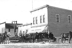 | Johannesburg Manufacturing Company Store | building | 2009 | 09000475 |
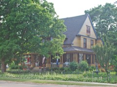 | Frank A. and Rae E. Harris Kramer House | building | 2002 | 02001507 |
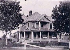 | Quick, James A. and Lottie J. (Congdon), House | building | 2016 | 16000509 |
Every wildfire the federal occurrence database records inside this county: 435 of them, burning about 1,190 acres. 9 started naturally and 43 were recorded as arson. Each settlement page carries the fires within five miles of it.
| Reported cause | Fires |
|---|---|
| Debris and open burning | 116 |
| Equipment and vehicle use | 85 |
| Missing data/not specified/undetermined | 72 |
| Arson/incendiarism | 43 |
| Recreation and ceremony | 38 |
| Misuse of fire by a minor | 36 |
| Power generation/transmission/distribution | 14 |
| Smoking | 11 |
| Natural | 9 |
| Fireworks | 5 |
| Railroad operations and maintenance | 4 |
| Other causes | 2 |
The five largest, by the area the report gives. Four of them were set deliberately.
| Date | Cause | Size | Reported by | Name on the report |
|---|---|---|---|---|
| 17 April 1995 | Arson/incendiarism | 484 acres | Michigan Department of Natural Resources | not named |
| 13 April 2012 | Recreation and ceremony | 44 acres | Michigan Department of Natural Resources | OTSEGO 04 |
| 14 May 2019 | Missing data/not specified/undetermined | 40 acres | Michigan Department of Natural Resources | OTSEGO 06 BULLS EYE |
| 27 April 2003 | Debris and open burning | 35 acres | Michigan Department of Natural Resources | not named |
| 17 April 1995 | Arson/incendiarism | 35 acres | Michigan Department of Natural Resources | not named |
| 24 July 2012 | Arson/incendiarism | 24 acres | Michigan Department of Natural Resources | OTSEGO 26 - 4 CORNERS |
| 17 April 1995 | Arson/incendiarism | 19 acres | Michigan Department of Natural Resources | not named |
| 22 August 2006 | Missing data/not specified/undetermined | 17 acres | Michigan Department of Natural Resources | not named |
Every settlement page carries the fires within five miles of it - see the settlement index below.
The NOAA Storm Events Database holds 151 reports for this county, causing 2 deaths, 45 injuries and about $53,176,500 in recorded property damage. Each settlement page carries the reports that name it.
| Kind of event | Reports |
|---|---|
| Thunderstorm Wind | 82 |
| Hail | 57 |
| Tornado | 5 |
| Lightning | 4 |
| Flood | 2 |
| Flash Flood | 1 |
The most serious of them, by death, then injury, then recorded damage. The accounts are quoted exactly as the forecast office filed them.
| When | Event | Place named | Harm | What the report says |
|---|---|---|---|---|
| May 2022 | Tornado (EF3) | Elmira | 2 killed, 44 hurt, $50,000,000 | This tornado formed in Antrim county 4 miles east of Alba and continued into Otsego county 100 yards SE of the Alba Rd/Old Alba Rd intersection. The tornado continued to move east northeast for almost 16 additional miles before dissipating around 1.75 miles northeast of Sparr. The tornado was rated EF3 in Otsego county based on damage surveyed in multiple locations around the Gaylord area. The first of these locations was damage in the Nottingham Forest manufactured home community. Multiple units were completely destroyed with debris blown away from the original locations of the units (DI 4, DOD 12). The second location was the business district of Gaylord where the buildings of Hobby Lobby, Maurices, and Jimmy Johns experienced collapses of exterior walls where interior walls remained standing (DI 10, DOD 8). The last location, which had the highest estimated wind speed of 150 mph, was damage found to homes on Berkshire Ln on the northeast side of Gaylord. Most exterior walls were collapsed and only partial interior walls were left standing (DI 2, DOD 8). The tornado dissipated at 1457 EST about 1.75 miles northeast of Sparr. Two fatalities were reported in the Nottingham Forest community, along with 44 injuries reported from various locations around Gaylord. The maximum path width in Otsego county was 200 yards. |
| August 2018 | Thunderstorm Wind | Gaylord Otsego Arpt | 1 hurt, $1,200,000 | A swath of widespread wind damage extended from west-southwest to east of the city of Gaylord. Some of the most concentrated damage was along Van Tyle Road between Hayes Tower Road and Dickerson Road. Hundreds of trees were snapped off or uprooted. Several buildings and vehicles were damaged by falling trees. At least two homes were destroyed. One person was taken to the local hospital for minor injuries after a tree landed their home. The roof of a small business on the west side of Gaylord was partially removed. Power was knocked out to much of the area. |
| July 2009 | Lightning | Gaylord | $500,000 | A lightning strike ignited a rapidly-spreading fire that destroyed the Alpine Haus apartment complex. All residents were safely evacuated, but 52 people were left homeless. |
| September 2014 | Thunderstorm Wind | Otsego Lake | $295,000 | Widespread tree damage, and spotty structural damage, occurred in far southern Otsego County, near and east of Waters. Some residential areas east of Waters were inaccessible for many hours after the event, until downed trees could be cleared off of roads. Several vehicles and homes were damaged by fallen trees. One carport in Waters was blown a considerable distance. |
| July 1974 | Tornado (F3) | not stated | $250,000 | no account filed |
| September 2014 | Tornado (EF1) | Johannesburg | $215,000 | An EF-1 tornado carved a path across southeast Otsego County. A large number of hardwood and softwood trees were downed, with several falling on area residences. Peak winds were estimated at 110 mph. |
| July 2020 | Thunderstorm Wind | Johannesburg | $150,000 | An estimated 350 to 400 trees were downed in and around the Louis M. Groen Nature Preserve. |
| July 2008 | Thunderstorm Wind | Gaylord | $55,000 | A swath of wind damage occurred from west of Gaylord, to central Otsego Lake. Trees were downed along M-32, Hayes Tower Road, and West Otsego Lake Drive. One very large limb was downed onto a cabin near the Beaver Creek Resort. Some damage was done to boats and docks on Otsego Lake. |
| July 1995 | Thunderstorm Wind | Gaylord | $50,000 | Thunderstorm winds destroyed a dock and damaged a boat on the northeast corner of Otsego Lake. |
| July 1995 | Thunderstorm Wind | Vanderbilt | $50,000 | Numerous trees and power lines were brought down by strong thunderstorm winds around Pickerel Lake. |
| July 1995 | Thunderstorm Wind | Gaylord | $50,000 | Strong thunderstorm winds damaged a 60' X 60' tent set up for an entertainment event, causing and estimated $25 thousand to $30 thousand in damage to light and sound equipment inside the tent. Thunderstorm winds also caused minor damage to the roof of the Community Education Building in Gaylord. |
| August 2018 | Thunderstorm Wind | Elmira | $35,000 | A number of large trees were downed from Elmira to Gaylord, including a few onto homes. |
| August 2003 | Thunderstorm Wind | Vanderbilt | $35,000 | Siding was ripped off the post office in Vanderbilt. Numerous trees were downed, one of which heavily damaged a Vanderbilt home. |
| July 2020 | Thunderstorm Wind | Arbutus Beach | $28,000 | A few trees were snapped in the Wah Wah Soo Beach area along Otsego Lake. Further east, several trees were downed in the Michaywe development, including on the golf course. One tree was downed onto a home in Michaywe. |
| July 1969 | Tornado | not stated | $25,000 | no account filed |
| July 2014 | Thunderstorm Wind | Gaylord | $24,000 | Two large trees were downed, one a healthy tree that fell on a vehicle, the second a rotting tree that fell on a home. |
| August 2015 | Thunderstorm Wind | Elmira | $20,000 | Scattered trees were downed from near Elmira to Gaylord. A few homes and vehicles were damaged by falling trees. |
| September 2005 | Thunderstorm Wind | Gaylord | $18,000 | Numerous trees and large limbs were knocked down. A golf course in Bagley Township lost sixty trees to high winds. |
| July 2024 | Flood | Elmira | $15,000 | Three to six inches of rain fell in the Elmira area in a few hours resulting in flooding in yards and farm fields. A photo of a washout in a gravel driveway showed the rear end of an extended cab pickup partially engulfed by the washout, up to the depth of the top of the rear tires. |
| July 2007 | Thunderstorm Wind | Gaylord | $15,000 | Several trees were downed. One building was damaged by a falling tree, and a car on South Otsego Avenue near the library was also struck and damaged. |
| July 2020 | Thunderstorm Wind | Sparr | $14,000 | A downed large tree limb damaged the edge of a house roof. |
| June 2005 | Thunderstorm Wind | Arbutus Beach | $12,000 | A tree was downed onto a house. A shore station (a small garage-like structure that sits on a dock) on Otsego Lake was ripped off a dock and tossed into the lake. |
| November 2013 | Tornado (EF0) | Waters | $11,000 | A tornado briefly touched down, and immediately crossed I-75, in extreme southern Otsego County. The tornado touched down just north of mile marker 268. Numerous evergreen and poplar trees were downed. Most trees were simply blown over, a few were snapped. Estimated peak wind speeds were 65 to 75 mph. |
| September 2016 | Thunderstorm Wind | Vanderbilt | $7,000 | One utility pole and multiple power lines were downed at the Vanderbilt Area School. Multiple trees were downed at the intersection of Grant and Elm Streets. |
| July 2019 | Thunderstorm Wind | Gaylord Otsego Arpt | $6,000 | Several trees and power lines were downed. |
| November 2013 | Thunderstorm Wind | Sparr | $6,000 | Multiple trees were downed. |
| May 2018 | Hail | Otsego Lake | $5,000 | Hailstones as large as half-dollars fell at the National Weather Service Office for several minutes. |
| August 2006 | Thunderstorm Wind | Elmira | $5,000 | Trees downed. |
| July 1995 | Thunderstorm Wind | Johannesburg | $5,000 | Large tree limbs were knocked down from thunderstorm winds, blocking Douglas Lake Road. |
| July 1995 | Thunderstorm Wind | Gaylord | $5,000 | Strong thunderstorm winds knocked down several trees along Elba Road. |
| July 1995 | Thunderstorm Wind | Gaylord | $5,000 | Thunderstorm winds brought down a power line and a five inch diameter tree on Old Elba Road. |
| July 1994 | Thunderstorm Wind | Gaylord | $5,000 | A house was damaged and several trees were blown down or snapped off by thunderstorm winds along Morgan Road near Poquette Road. |
| July 1994 | Thunderstorm Wind | Gaylord | $5,000 | Strong winds damaged a barn roof and house near the intersection of Oregon and Parameter Roads. |
| April 1993 | Thunderstorm Wind | Gaylord | $5,000 | Thunderstorm winds ripped several hundred hardwood trees from the ground or snapped them off in a path 200 yards wide and extending 3 miles to the northeast. The roof and some external damage was done to a residence along the Haynes-Tower Line road 3.5 miles south of Highway M-32. |
| August 2021 | Thunderstorm Wind | Waters | $4,000 | Tree down on top of vehicle. |
| August 2021 | Thunderstorm Wind | Waters | $4,000 | Tree down on top of vehicle. |
| July 2020 | Thunderstorm Wind | Arbutus Beach | $4,000 | A few trees and large tree limbs were in the Michaywe development. |
| July 2005 | Thunderstorm Wind | Gaylord | $4,000 | Trees and large limbs were downed in southeast Otsego County. |
| June 2023 | Thunderstorm Wind | Arbutus Beach | $3,000 | Trees downed on Old State Rd. |
| August 2021 | Thunderstorm Wind | Elmira | $3,000 | Trees downed near Estelle RD and Van Tyle RD. |
| August 2021 | Thunderstorm Wind | Gaylord | $3,000 | Trees down near Parmater RD and Pyke School RD. |
| August 2021 | Thunderstorm Wind | Johannesburg | $3,000 | Trees downed near M-32 and Rock Rd. |
| May 2011 | Thunderstorm Wind | Arbutus Beach | $3,000 | Two trees and several large limbs were downed. |
| August 2006 | Thunderstorm Wind | Gaylord | $3,000 | Several trees downed. |
| July 2003 | Flash Flood | Arbutus Beach | $3,000 | A small line of thunderstorms developed from near Alba to Waters around midday. The National Weather Service office in Gaylord picked up 2.63 inches of rain in about 45 minutes. Basement flooding was reported in the Lakes of the North area, and significant shoulder damage occurred to Mancelona Road, between Passenheim Road and West Otsego Lake Drive. Emergency repairs were needed to the road the next day. |
| June 1999 | Lightning | Elmira | $3,000 | Three horses and one pony were killed by lightning when the tree they were standing under was struck. |
| June 2023 | Thunderstorm Wind | Arbutus Beach | $2,000 | Delayed report of a tree down at a residence in Michaywe. |
| July 2018 | Thunderstorm Wind | Otsego Lake | $2,000 | A tree and multiple large limbs were downed onto power lines along West Otsego Lake Drive. |
| June 2007 | Thunderstorm Wind | Arbutus Beach | $2,000 | A tree was downed near West Otsego Lake Drive and Johns Street. Another tree was felled on Old State Road near I-75. |
| October 2007 | Thunderstorm Wind | Gaylord | $1,500 | A large tree was blown down by thunderstorm winds. |
| August 2021 | Thunderstorm Wind | Gaylord | $1,000 | Trees damaged. |
| August 2009 | Thunderstorm Wind | Vanderbilt | $1,000 | A large tree was downed near Martindale and Pyke School Roads. |
| July 2024 | Flood | Gaylord | $500 | NWS Employee reported flooding of underpass at I-75 and M-32 in Gaylord, along with several other instances of street flooding in the city. KGLR ASOS reported 1.30 inches of rain in approximately 20 minutes; 24 hour total of 2.07 inches ending 7am EST July 30th. |
| July 1995 | Thunderstorm Wind | Gaylord | $500 | A 10-inch-diameter poplar tree was uprooted by strong thunderstorm winds. |
| September 2025 | Hail | Gaylord Otsego Arpt | - | Video of hail of at least quarter to half dollar size falling on Old Alba Rd southwest of Gaylord, MI in Otsego county. |
| July 2024 | Thunderstorm Wind | Otsego Lake | - | Report of downed power lines on the east side of Otsego Lake near Otsego Lake State Park. |
| July 2024 | Thunderstorm Wind | Arbutus Beach | - | Reports of large limbs and trees up to around 9 inch diameter broken and knocked down in the vicinity of Michaywe, including a snapped off birch tree leaning on a house on Opal Lake Rd near the golf course. |
| July 2024 | Thunderstorm Wind | Otsego Lake | - | Reports of downed powerlines and multiple healthy large trees down on the southwest side of Otsego lake, including a tree on a house and a tree down over West Otsego Lake Drive, which resulted in West Otsego Lake Drive being closed for a time. |
| July 2024 | Thunderstorm Wind | Johannesburg | - | Powerlines down. |
| July 2024 | Thunderstorm Wind | Otsego Lake | - | NWS Employee passed along a report from a neighbor of a large part of a tree downed that punctured a garage roof. |
The Survey's mineral resources record lists 14 workings inside this county. 12 still produce and 2 are closed or unrecorded. Each settlement page carries the workings within five miles of it.
| Commodity | Workings |
|---|---|
| Sand and Gravel, Construction | 13 |
| Fire Clay (Refractory) | 1 |
The least common of them first, because a county's hundredth gravel pit says nothing its first ten did not.
| Where | Site | Commodity | Status | Recorded |
|---|---|---|---|---|
| Comstock's Clay Pit | Fire Clay (Refractory) | Past Producer | ||
| City Pit | Sand and Gravel, Construction | Producer | ||
| Hoogerhyde Pit | Sand and Gravel, Construction | Producer | ||
| Mason Excavating Co. Pit | Sand and Gravel, Construction | Past Producer | ||
| Mccay Pit | Sand and Gravel, Construction | Producer | ||
| Otsego County Pit-Glancy | Sand and Gravel, Construction | Producer | ||
| Otsego County Road Commission Pit | Sand and Gravel, Construction | Producer | ||
| Otsego County Road Commission Pit | Sand and Gravel, Construction | Producer | ||
| Otsego County Road Commission Pit | Sand and Gravel, Construction | Producer | ||
| Otsego County Road Commission Pit | Sand and Gravel, Construction | Producer | ||
| Poor Farm Pit | Sand and Gravel, Construction | Producer | ||
| State of Michigan Pit | Sand and Gravel, Construction | Producer | ||
| State of Michigan Pit | Sand and Gravel, Construction | Producer | ||
| State of Michigan Pit | Sand and Gravel, Construction | Producer |
Named settlements recorded in the Geographic Names Information System, each with the topographic sheets covering it. Villages, hamlets and abandoned places alike. Each is shown with the nearest named watercourse or landform and the survey quadrangle it falls on.
Chester township · 49733 · Near Redner Hill · Turtle Lake quadrangle
15 sheets, 1949 to 1989
Corwith township · 49795 · On Pickerel Creek · Green Timbers quadrangle
12 sheets, 1954 to 1986
Chester township · 49733 · On Chub Creek · Turtle Lake quadrangle
15 sheets, 1949 to 1989
Chester township · 49735 · On Turtle Creek · Turtle Lake quadrangle
15 sheets, 1949 to 1989