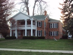
Block
From the record
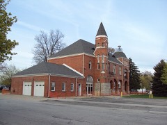
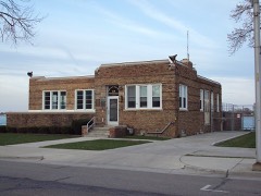
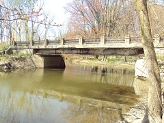
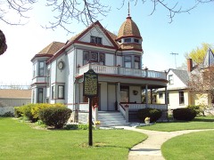
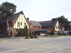
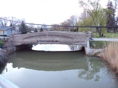
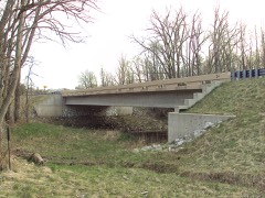
28 National Register listings published here, 2 of them National Historic Landmarks.
Sources: the National Register database, National Park Service
112 topographic sheets cover 67 settlements here, and 28 properties are on the National Register of Historic Places.
28 National Register listings published here, 2 of them National Historic Landmarks.
Sources: the National Register database, National Park Service
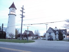
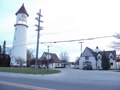
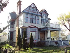
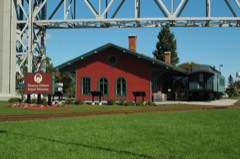
Every property in this county listed on the National Register of Historic Places, with the year it was listed and the federal nomination document.
Every wildfire the federal occurrence database records inside this county: 125 of them, burning about 285 acres. 11 started naturally and none was recorded as arson. Each settlement page carries the fires within five miles of it.
| Reported cause | Fires |
|---|---|
| Missing data/not specified/undetermined | 49 |
| Equipment and vehicle use | 47 |
| Natural | 11 |
| Debris and open burning | 6 |
| Recreation and ceremony | 6 |
| Smoking | 4 |
| Misuse of fire by a minor | 2 |
The five largest, by the area the report gives. None of them was recorded as arson.
| Date | Cause | Size | Reported by | Name on the report |
|---|---|---|---|---|
| 15 April 2003 | Debris and open burning | 54 acres | Michigan Department of Natural Resources | not named |
| 12 September 2003 | Equipment and vehicle use | 33 acres | Michigan Department of Natural Resources | not named |
| 22 April 2005 | Missing data/not specified/undetermined | 27 acres | Michigan Department of Natural Resources | not named |
| 11 April 1996 | Misuse of fire by a minor | 20 acres | Michigan Department of Natural Resources | not named |
| 9 April 1994 | Smoking | 12 acres | Michigan Department of Natural Resources | not named |
| 1 July 2019 | Equipment and vehicle use | 10 acres | Michigan Department of Natural Resources | MEMPHIS VFD 2019197 - 2019 |
| 20 April 2018 | Smoking | 6.0 acres | Michigan Department of Natural Resources | GRANT TOWNSHIP FD 0000032 - 2018 |
| 18 April 2020 | Natural | 5.0 acres | Michigan Department of Natural Resources | BERLIN TOWNSHIP FD 0000039 - 2020 |
Every settlement page carries the fires within five miles of it - see the settlement index below.
The NOAA Storm Events Database holds 414 reports for this county, causing 5 deaths, 103 injuries and about $49,547,750 in recorded property damage. Each settlement page carries the reports that name it.
| Kind of event | Reports |
|---|---|
| Thunderstorm Wind | 277 |
| Hail | 91 |
| Tornado | 23 |
| Flood | 13 |
| Lightning | 7 |
| Flash Flood | 3 |
The most serious of them, by death, then injury, then recorded damage. The accounts are quoted exactly as the forecast office filed them.
| When | Event | Place named | Harm | What the report says |
|---|---|---|---|---|
| May 1953 | Tornado (F4) | not stated | 2 killed, 68 hurt, $2,500,000 | no account filed |
| June 2010 | Tornado (EF1) | Thornton | 1 killed, 4 hurt, $700,000 | A tornado occurred at 706 pm in Clyde Township in St. Clair County. |One fatality and 4 injuries resulted from this tornado as it hit a campground just north of I-69 and west of Wadhams. The tornado touched down north of Lapeer Rd along Rabidue Rd and continued eastward for 2.9 miles before lifting between Lapeer Rd and the Black River just east of Abbottsford Rd. This tornado was rated EF1 with maximum winds around 95 mph, which occurred at and just east of the Fort Trodd Campground.|About 10 campers were damaged or destroyed. |
| March 1991 | Thunderstorm Wind | not stated | 1 killed | no account filed |
| March 1991 | Thunderstorm Wind | not stated | 1 killed | no account filed |
| June 1953 | Tornado (F4) | not stated | 23 hurt, $250,000 | no account filed |
| May 1983 | Tornado (F3) | not stated | 3 hurt, $25,000,000 | no account filed |
| March 1991 | Thunderstorm Wind | not stated | 2 hurt | no account filed |
| May 1984 | Tornado (F1) | not stated | 1 hurt, $25,000 | no account filed |
| June 2011 | Lightning | Port Huron Arpt | 1 hurt | A 30 year old woman was struck by lighting as she tried to enter her automobile. She become unconscious and was not breathing. CPR was performed. She was transported to the hospital and did survive. |
| July 2023 | Lightning | Yale | 1 hurt | no account filed |
| November 2019 | Flood | Anchorville | $11,900,000 | no account filed |
| June 1996 | Flash Flood | Nrn 1/2 Of Co. | $2,500,000 | no account filed |
| September 1984 | Tornado (F3) | not stated | $2,500,000 | no account filed |
| June 2008 | Thunderstorm Wind | Marine City | $1,000,000 | Local media reported widespread trees and power lines down. A few trees fell onto vehicles and houses. Boats were also overturned. |
| February 2021 | Flood | Port Huron | $550,000 | At least 20 houses were reported to be impacted with flooding, with major damage occurring to 3 of houses. |
| September 2008 | Flood | Yale | $300,000 | no account filed |
| April 2013 | Flood | Capac | $250,000 | no account filed |
| August 2009 | Thunderstorm Wind | Port Huron | $175,000 | Dozens of trees and power lines were reported blown down. Trees blocked roads and at least two fell onto houses. |
| July 2000 | Hail | Algonac | $125,000 | no account filed |
| May 1998 | Thunderstorm Wind | Marysville | $125,000 | no account filed |
| September 2002 | Thunderstorm Wind | Algonac | $100,000 | The media and trained spotters reported numerous large trees blown down in Algonac and on Harsens Island. One tree fell onto the roof of a home. A pickup truck was destroyed by a fallen tree. Two tool sheds were also destroyed by fallen trees. |
| June 2009 | Flood | Capac | $100,000 | no account filed |
| June 2023 | Thunderstorm Wind | Port Huron | $75,000 | Trees and wires reported down across St. Clair County. |
| July 1999 | Tornado (F1) | Jeddo | $60,000 | no account filed |
| August 2021 | Thunderstorm Wind | Algonac Arpt | $50,000 | Up to 25 downed wires from Harsens Island to St. Clair. |
| June 2011 | Flood | Yale | $50,000 | Central dispatch reported numerous roads closed and washed out. There was a substantial amount of flooding in Burtchville, Fort Gratiot, and the northeastern townships. Up to 100 homes received some form of flood damage, as the rain overwhelmed the drainage system. |
| July 2007 | Thunderstorm Wind | Port Huron | $50,000 | Law enforcement reported numerous trees and power poles down in Fort Gratiot, covering a 2 square mile area between Keewahdin and Carrigan Roads. Several homes received damage from falling trees. No one was injured. Total property damages were estimated at roughly $50K. |
| May 2004 | Tornado (F1) | Gardendale | $50,000 | A tornado touched down and damaged a strip mall on Krafft Road and 24th Avenue in Fort Gratiot. Damage was reported across a 1.5 mile area stretching from Sapphire Lane and Krafft Road to the Lowe's home improvement store on 24th Avenue. Six to 10 homes had shingles or siding torn off or other minor damage. About 24 cars were damaged at the shopping center. A construction trailer in the parking lot of the Mercy Village retirement community was blown over, and the vinyl-siding ripped from the west side of the building. Trees were also uprooted along the path of the tornado. No injuries were reported. |
| June 1995 | Thunderstorm Wind | Port Huron | $50,000 | Strong thunderstorm winds knocked down trees and caused widespread power outages. |
| July 1995 | Thunderstorm Wind | not stated | $50,000 | Strong thunderstorm winds brought down numerous trees and power lines across the southeast portion of Clare County, causing widespread power outages. |
| August 1993 | Thunderstorm Wind | Sparlingville | $50,000 | Large trees were downed and uprooted. Power lines and TV antennas were also blown down by thunderstorm winds that were gusted to an estimated at 60 to 70 mph. |
| October 2021 | Tornado (EF0) | Fargo | $40,000 | A brief weak tornado touched down in northeastern St. Clair County. There was damage to a carport, pine trees were snapped, a cornfield was flattened, and there was some roof and siding damage to one home. Max winds were estimated at 70 mph. |
| September 2020 | Thunderstorm Wind | Gardendale | $40,000 | Two dozen trees uprooted and blown over, as well as sheared at the top. Three trees fell onto homes, and two homes suffered roof damage. |
| June 1996 | Tornado (F1) | Imlay City | $40,000 | no account filed |
| November 2015 | Tornado (EF0) | Fargo | $25,000 | An NWS damage survey confirmed a brief tornado east of Yale in St. Clair county. This tornado touched down around 0.25 miles east of the intersection of Kilgore and Jeddo Roads and traveled eastward along Jeddo Road before lifting just east of the intersection with Duce Road. Three outbuildings or barns were destroyed and another had its roof partially peeled off. There were also 5 to 10 snapped or uprooted trees and two snapped power poles. Peak winds were estimated to be 85 mph. |
| April 2009 | Thunderstorm Wind | Riley Center | $25,000 | Trees and wires were reported down, along with shingles blown off roofs. |
| April 2009 | Thunderstorm Wind | Blaine | $25,000 | A barn was blown down, along with trees and shingles off a roof. |
| April 2009 | Thunderstorm Wind | Jeddo | $25,000 | Trees and wires were reported down, along with shingles blown off roofs. |
| April 2009 | Thunderstorm Wind | Blaine | $25,000 | Shingles and siding blown off homes. |
| August 2007 | Thunderstorm Wind | St Clair | $25,000 | The local newspaper included photographs of a 35-foot motor home on its side. The wind also picked up and tossed a 300-pound table across the patio at the same home and blew a large tree down on the home next door. Total property damages were estimated at roughly $25K. |
| May 1998 | Thunderstorm Wind | Capac | $25,000 | no account filed |
| June 1996 | Tornado (F2) | Yale | $25,000 | no account filed |
| March 1991 | Tornado (F1) | not stated | $25,000 | no account filed |
| September 1990 | Tornado (F1) | not stated | $25,000 | no account filed |
| August 1978 | Tornado | not stated | $25,000 | no account filed |
| September 1977 | Tornado (F1) | not stated | $25,000 | no account filed |
| May 1975 | Tornado (F2) | not stated | $25,000 | no account filed |
| June 1975 | Tornado (F1) | not stated | $25,000 | no account filed |
| July 1999 | Thunderstorm Wind | Ruby | $22,000 | no account filed |
| August 2022 | Thunderstorm Wind | Algonac | $20,000 | Numerous trees and power lines down in Algonac. |
| July 2010 | Thunderstorm Wind | Pearl Beach | $20,000 | Multiple trees and powerlines reported down. One tree fell onto a house, while another tree landed on a truck. |
| September 2001 | Lightning | Anchorville | $20,000 | Lightning struck a tree, causing the tree to break and land on top of a house. |
| October 2001 | Thunderstorm Wind | Yale | $20,000 | A large tree fell onto a home, damaging part of the roof. |
| July 1999 | Thunderstorm Wind | Port Huron | $18,000 | no account filed |
| July 2011 | Thunderstorm Wind | Emmett | $15,000 | Numerous trees reported down across the county. |
| June 2011 | Thunderstorm Wind | Lakeport | $15,000 | Trees and powerlines reported down. |
| May 2004 | Tornado (F0) | Jeddo | $15,000 | A tornado tracked along Logana road. Several mature pine trees were uprooted. There was also damage to a barn, vehicle, and porch. |
| July 1999 | Thunderstorm Wind | Harsens Is | $14,000 | no account filed |
| June 2011 | Thunderstorm Wind | Port Huron Arpt | $12,000 | A NWS storm survey team determined the damage produced in Fort Gratiot was a result of straight line winds estimated up to 75 mph. The damage occured along a 200 yard section of Keewahdin road and included: a shed that was blown over, a car which was moved in a parking lot, two wooden powerline poles that were partially snapped and downed tree limbs from two hardwood trees. |
| July 1999 | Thunderstorm Wind | Marine City | $11,000 | no account filed |
The Survey's mineral resources record lists 16 workings inside this county. 9 still produce and 7 are closed or unrecorded. Each settlement page carries the workings within five miles of it.
| Commodity | Workings |
|---|---|
| Sand and Gravel, Construction | 6 |
| Salt | 4 |
| Fire Clay (Refractory) | 4 |
| Clay | 1 |
| Halite | 1 |
The least common of them first, because a county's hundredth gravel pit says nothing its first ten did not.
| Where | Site | Commodity | Status | Recorded |
|---|---|---|---|---|
| Amcord Cement Co. Pit | Clay | Producer | ||
| St. Clair Salt Mine | Halite | Producer | 1863, 1883 | |
| Diamond Crystal Salt Company | Salt | Producer | ||
| Engleman's Clay Pit | Fire Clay (Refractory) | Past Producer | ||
| Morton Salt Co--Marysville, Mich. | Salt | Past Producer | ||
| Morton Salt Co--Port Huron, Mich. | Salt | Past Producer | ||
| Port Huron Salt Co. | Salt | Past Producer | ||
| Shriner Brick Co.Clay Pit | Fire Clay (Refractory) | Past Producer | ||
| W.Avoca Clay Sample | Fire Clay (Refractory) | Prospect | ||
| W.River Clay Sample | Fire Clay (Refractory) | Prospect | ||
| Click Pit & Mill | Sand and Gravel, Construction | Producer | ||
| Smock Pit | Sand and Gravel, Construction | Producer | ||
| St Clair County Road Commission Pit | Sand and Gravel, Construction | Producer | ||
| St Clair County Road Commission Pit | Sand and Gravel, Construction | Producer | ||
| St Clair County Road Commission Pit | Sand and Gravel, Construction | Producer | ||
| Strauchman Pit | Sand and Gravel, Construction | Producer |
Named settlements recorded in the Geographic Names Information System, each with the topographic sheets covering it. Villages, hamlets and abandoned places alike. Each is shown with the nearest named watercourse or landform and the survey quadrangle it falls on.
Ira township · 48023 · On Marsac Creek · New Baltimore quadrangle
12 sheets, 1914 to 1981
Cottrellville township · 48039 · On Belle River · Marine City quadrangle
13 sheets, 1914 to 1981
Columbus township · 48063 · On Schriber Drain · Goodells quadrangle
12 sheets, 1928 to 1991
Ira township · 48023 · On Beaubien Creek · Marine City quadrangle
13 sheets, 1914 to 1981
Clay township · 48028 · Near Russell Island · Algonac quadrangle
13 sheets, 1914 to 1981
Burtchville township · 48059 · On Milwaukee Creek · Lakeport quadrangle
10 sheets, 1954 to 1984
Marine City city · 48039 · On Belle River · Marine City OE E quadrangle
5 sheets, 1954 to 1981
Cottrellville township · 48039 · On Belle River · Marine City quadrangle
13 sheets, 1914 to 1981
Brockway township · 48097 · Yale quadrangle
9 sheets, 1954 to 1984
No longer a settlement
Clay township · 48028 · Near Club Island · Saint Clair Flats quadrangle
12 sheets, 1914 to 1981
Burtchville township · 48059 · On Wixon Drain · Jeddo OE E quadrangle
8 sheets, 1954 to 1984
Clay township · 48001 · On Swartout Creek · Marine City quadrangle
13 sheets, 1914 to 1981
Clay township · 48001 · On Beaubien Creek · Marine City quadrangle
13 sheets, 1914 to 1981
Clay township · 48001 · Near Russell Island · Algonac quadrangle
13 sheets, 1914 to 1981
Clay township · 48001 · On Swartout Creek · Algonac quadrangle
13 sheets, 1914 to 1981
St. Clair township · 48079 · On Cooper Drain · Rattle Run quadrangle
13 sheets, 1928 to 1991
Clay township · 48028 · Near Muscamoot Ridge · Saint Clair Flats quadrangle
12 sheets, 1914 to 1981
Kimball township · 48074 · On Liverance Drain · Smiths Creek quadrangle
12 sheets, 1928 to 1991
Port Huron Charter Township · 48060 · On Baldwin Drain · Port Huron quadrangle
15 sheets, 1912 to 1991
Kimball township · 48074 · On South Branch Pine River · Smiths Creek quadrangle
12 sheets, 1928 to 1991
The vanished settlements of St. Clair County: the places named above that are no longer on the map.