 Block
From the record
14 National Register listings published here.
Sources: the National Register database, National Park Service
41 topographic sheets cover 37 settlements here, and 14 properties are on the National Register of Historic Places.
14 National Register listings published here.
Sources: the National Register database, National Park Service
Every property in this county listed on the National Register of Historic Places, with the year it was listed and the federal nomination document.
| Photograph | Property | Type | Listed | Reference |
|---|---|---|---|---|
 | R. C. Burtis House | building | 1975 | 75000962 |
 | First Presbyterian Church | building | 2006 | 06001029 |
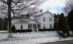 | Hart, Jr., Lovira and Esther Maria Parker, Farm | district | 2004 | 04000599 |
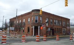 | Hotel Columbia | building | 1992 | 91001998 |
 | Hotel Montague | building | 1991 | 91000875 |
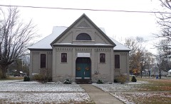 | McKinley School | building | 1972 | 72000655 |
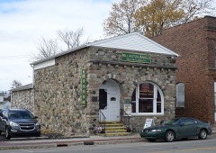 | Millington Bank Building | building | 1995 | 95001387 |
| Moore, William J. and Lovila (Wooley), House | building | 2024 | 100010162 | |
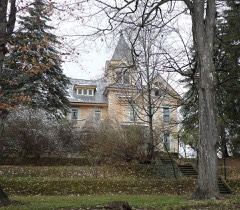 | Townsend North House | building | 1977 | 77000723 |
 | Randall House | building | 1976 | 76001035 |
 | Smith House | building | 1972 | 72000656 |
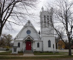 | Trinity Episcopal Church | building | 1975 | 75000961 |
 | Tuscola County Courthouse | building | 1996 | 96001419 |
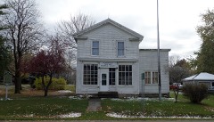 | Watrous General Store | building | 1974 | 74000998 |
Every wildfire the federal occurrence database records inside this county: 100 of them, burning about 730 acres. 9 started naturally and 2 were recorded as arson. Each settlement page carries the fires within five miles of it.
| Reported cause | Fires |
|---|---|
| Missing data/not specified/undetermined | 53 |
| Equipment and vehicle use | 18 |
| Debris and open burning | 11 |
| Natural | 9 |
| Recreation and ceremony | 5 |
| Arson/incendiarism | 2 |
| Misuse of fire by a minor | 1 |
| Smoking | 1 |
The five largest, by the area the report gives. One of them was set deliberately.
| Date | Cause | Size | Reported by | Name on the report |
|---|---|---|---|---|
| 18 April 2012 | Arson/incendiarism | 335 acres | Michigan Department of Natural Resources | TUSCOLA 01 - COUNTY LINE FIRE |
| 3 April 2010 | Debris and open burning | 70 acres | Ottawa National Wildlife Refuge | 4/3/2010 |
| 14 April 2004 | Missing data/not specified/undetermined | 68 acres | Michigan Department of Natural Resources | not named |
| 18 April 2009 | Debris and open burning | 63 acres | Michigan Department of Natural Resources | TUSCOLA 01 |
| 9 April 1994 | Missing data/not specified/undetermined | 60 acres | Michigan Department of Natural Resources | not named |
| 13 April 2004 | Missing data/not specified/undetermined | 6.7 acres | Michigan Department of Natural Resources | not named |
| 20 March 2019 | Missing data/not specified/undetermined | 6.0 acres | Michigan Department of Natural Resources | MAYVILLE FD 0000020 - 2019 |
| 1 April 1994 | Smoking | 6.0 acres | Michigan Department of Natural Resources | not named |
Every settlement page carries the fires within five miles of it - see the settlement index below.
The NOAA Storm Events Database holds 338 reports for this county, causing no deaths, 2 injuries and about $15,100,450 in recorded property damage. Each settlement page carries the reports that name it.
| Kind of event | Reports |
|---|---|
| Thunderstorm Wind | 218 |
| Hail | 87 |
| Tornado | 22 |
| Flood | 7 |
| Flash Flood | 3 |
| Lightning | 1 |
The most serious of them, by death, then injury, then recorded damage. The accounts are quoted exactly as the forecast office filed them.
| When | Event | Place named | Harm | What the report says |
|---|---|---|---|---|
| October 2007 | Tornado (EF1) | Millington | 1 hurt, $500,000 | This tornado touched down at 0016EST, just southwest of the town of Millington, near the intersection of Barnes and Fulmer roads. It tracked northeastward and was on the ground for 2 miles before lifting near Main street and Caine Road in Millington. This tornado was rated a strong EF1 with winds estimated around 105 mph. A modular home was completely destroyed, another home received substantial damage after being battered by debris from the destroyed modular home and a framed house lost a section of its roof. Miraculously, a 14-month-old baby, sleeping in a crib in the modular home, received only minor cuts and bruises after being tossed 25 feet and buried under about 4 feet of beams, rafters, and other debris from the demolished home. Total property damages were estimated at $500K. The average path width was 30 yards. |
| May 1971 | Tornado (F2) | not stated | 1 hurt, $250,000 | no account filed |
| June 1996 | Flash Flood | Countywide | $6,500,000 | no account filed |
| May 2019 | Flood | Reese | $4,200,000 | no account filed |
| June 2015 | Tornado (EF2) | Tuscola | $550,000 | A tornado touched down just west of Pine Ridge RV Campground in far southeast Saginaw county and tracked generally east along Birch Run Road, lifting near Mcpherson Road in Tuscola County 2 miles south of Millington. Trees were blown down and shingles were observed off houses. The tornado peaked in intensity near Buell and Belsay Roads, with estimated wind speeds up to 115 mph. Major structure damage occurred to one house, with another home suffering damage to roof and wall. Two minor injuries occurred at the campground. The total path length of the tornado ended up being around 11.2 miles, with 2.4 miles occurring in Saginaw County. |
| July 1994 | Hail | Caro | $500,000 | A severe thunderstorm moved southeast across Tuscola County on the 6th, dropping large hail over the communities of Fairgrove and Caro. In Caro, a car dealership suffered damages in excess of $100,000 to their stock of both used and new cars. |
| October 2007 | Tornado (EF1) | Deford | $400,000 | A tornado spun up at 0045EST two miles west of Deford. It began near Deckerville and Dodge roads and tracked northeastward for 3 miles before lifting. The most significant damage was rated EF1 with winds estimated at 95 MPH. A garage was destroyed, several houses sustained roof damage, and a fifth-wheel was tossed into a pond on top a truck that had already been tossed into the pond. A man sleeping in the fifth-wheel received no injuries. Numerous trees were also snapped off or uprooted. Total property damages were estimated at $400K. The average path width was 100 yards. |
| April 2013 | Flood | Unionville | $250,000 | no account filed |
| August 1984 | Tornado (F2) | not stated | $250,000 | no account filed |
| June 1982 | Tornado (F2) | not stated | $250,000 | no account filed |
| June 1982 | Tornado (F1) | not stated | $250,000 | no account filed |
| April 1965 | Tornado (F2) | not stated | $250,000 | no account filed |
| August 2006 | Lightning | Akron | $100,000 | A newspaper reported that a lightning strike had caused a house to burn down. Lightning struck the home on Saturday evening, the 26th, sparking electrical problems. The electrical problem caused the home to go up in flames 24 hours later, at 1830 EST on the 27th. Total property damages were estimated at $100K. |
| November 2003 | Tornado (F1) | Akron | $100,000 | A National Weather Service storm survey confirmed a tornado touched down near the intersection of Kirk and Akron Roads. Grain bins along Kirk and Cass City roads were destroyed. A barn near Ringle and Dickerson roads was also damaged just before the tornado lifted. In addition, a trailer house was a moved over eight feet and a shed was damaged. The tornado also brought down tree limbs and power lines. |
| May 1998 | Thunderstorm Wind | Caro | $100,000 | no account filed |
| September 2008 | Flood | Quanicassee | $75,000 | no account filed |
| October 2001 | Tornado (F0) | Quanicassee | $50,000 | The Bay County tornado moved into Tuscola County near Darbee Road in Gilford Township. The tornado moved northeast to Saginaw Bay where it lifted. Along the damage path, a pole barn was destroyed, the side of another barn was badly damaged, a fruit and vegatable stand was toppled, an irrigation system was badly damaged, numerous large trees were uprooted, and one home sustained minor damage to its front porch. |
| February 1997 | Flash Flood | Countywide | $50,000 | no account filed |
| May 2002 | Thunderstorm Wind | Akron | $35,000 | no account filed |
| June 2008 | Thunderstorm Wind | Caro | $30,000 | Numerous trees reported down. |
| June 2008 | Thunderstorm Wind | Unionville | $25,000 | Local media reported downed electrical poles and trees. |
| June 2005 | Flash Flood | South Central Portion | $25,000 | Water over many roads between Vassar, Caro, and Mayville. Davenport University in Caro also experienced minor flooding. |
| May 1998 | Thunderstorm Wind | Unionville | $25,000 | no account filed |
| July 1983 | Tornado (F1) | not stated | $25,000 | no account filed |
| September 1996 | Thunderstorm Wind | Deford | $20,000 | no account filed |
| August 2000 | Thunderstorm Wind | Reese | $18,000 | A number of trees, large limbs, and power lines were blown down. |
| August 2022 | Thunderstorm Wind | Millington | $15,000 | Numerous trees and power lines down in and around Millington. |
| May 2006 | Thunderstorm Wind | Kingston | $15,000 | Thunderstorm downburst winds destroyed a barn near Kingston. The owner described seeing what looked like a funnel cloud prior to taking cover in the basement. When she came back up she reported her barn was gone. It was determined that the damage was caused by a microburst with windspeeds estimated between 60 and 70 MPH. Property damage was estimated at $15K. |
| April 1998 | Thunderstorm Wind | Caro | $15,000 | no account filed |
| September 2010 | Thunderstorm Wind | Mayville | $10,000 | Numerous trees and power lines reported down. |
| September 2010 | Thunderstorm Wind | Kingston | $10,000 | Numerous trees and power lines reported down. |
| June 2008 | Thunderstorm Wind | Mayville | $10,000 | A tree and wires were reported down at Snover Road and M-24. |
| August 2007 | Thunderstorm Wind | Cass City | $10,000 | A large tree fell through the roof of a home on Elmwood Road just south of Cass City. Total property damage was estimated at roughly $10K. |
| March 2006 | Flood | Caro | $10,000 | no account filed |
| July 2000 | Thunderstorm Wind | Millington | $10,000 | no account filed |
| May 1998 | Thunderstorm Wind | Millington | $10,000 | no account filed |
| May 1998 | Thunderstorm Wind | Kingston | $10,000 | no account filed |
| July 1999 | Thunderstorm Wind | Caro | $8,000 | no account filed |
| July 1999 | Thunderstorm Wind | Vassar | $7,000 | no account filed |
| August 2007 | Thunderstorm Wind | Fairgrove | $6,000 | A trained spotter reported many tree branches 3 to 5 inches in diameter down in Fairgrove. The local Police Chief reported the heaviest damage just outside the village limits where trees and power lines were down. A temporary storage shed was also destroyed by the wind. |
| May 1998 | Thunderstorm Wind | Akron | $6,000 | no account filed |
| October 2019 | Thunderstorm Wind | Millington | $5,000 | Trees and tree limbs blown onto power lines. |
| July 2016 | Thunderstorm Wind | Kingston | $5,000 | Large trees and power lines reported blown down. |
| July 2013 | Thunderstorm Wind | Unionville | $5,000 | Trees and power lines reporte down. |
| July 2013 | Thunderstorm Wind | Caro | $5,000 | Trees and power lines reported down. |
| July 2013 | Thunderstorm Wind | Deford | $5,000 | Trees and power lines reported down. |
| June 2011 | Thunderstorm Wind | Quanicassee | $5,000 | Trees and large tree limbs blown down. |
| June 2010 | Thunderstorm Wind | East Dayton | $5,000 | Straight line wind damage occured on Cat Lake road just north of East Blackmore road with several trees snapped in half. |
| June 2008 | Thunderstorm Wind | Caro | $5,000 | Numerous tree limbs and trees reported down, along with damaged windows. |
| May 2004 | Tornado (F1) | Millington | $5,000 | A tornado touched down 1 mile west of Fostoria. Numerous trees were blown down. Two homes also sustained roof damage. |
| March 2006 | Flood | Vassar | $5,000 | no account filed |
| May 1998 | Thunderstorm Wind | Fairgrove | $5,000 | no account filed |
| June 1998 | Tornado (F0) | Cass City | $5,000 | no account filed |
| May 1998 | Thunderstorm Wind | Vassar | $5,000 | no account filed |
| May 1998 | Thunderstorm Wind | Cass City | $5,000 | no account filed |
| July 1995 | Thunderstorm Wind | Caro | $5,000 | no account filed |
| September 2010 | Thunderstorm Wind | Millington | $4,000 | Numerous trees and power lines reported down. |
| August 2015 | Thunderstorm Wind | Colwood | $3,000 | Two power lines downed, along with 3 power poles damaged. |
| September 2014 | Thunderstorm Wind | Akron | $3,000 | Power lines down. |
| July 2000 | Thunderstorm Wind | Cass City | $3,000 | no account filed |
The Survey's mineral resources record lists 37 workings inside this county. 31 still produce and 6 are closed or unrecorded. Each settlement page carries the workings within five miles of it.
| Commodity | Workings |
|---|---|
| Sand and Gravel, Construction | 36 |
| Silica | 1 |
The least common of them first, because a county's hundredth gravel pit says nothing its first ten did not.
| Where | Site | Commodity | Status | Recorded |
|---|---|---|---|---|
| Great Lake Minerals | Silica | Producer | Sedimentary | |
| Andersen Sand and Gravel Co. Pit | Sand and Gravel, Construction | Past Producer | ||
| Andersen Sand and Gravel Company | Sand and Gravel, Construction | Producer | ||
| Arnold Pit and Mill | Sand and Gravel, Construction | Past Producer | ||
| Baxter Pit | Sand and Gravel, Construction | Producer | ||
| Kaestor Pit and Mill | Sand and Gravel, Construction | Producer | ||
| Peterhans Sand and Gravel Pit | Sand and Gravel, Construction | Producer | ||
| Pit No 1 and Plant M-46 | Sand and Gravel, Construction | Producer | ||
| Plant No 2 | Sand and Gravel, Construction | Producer | ||
| Powell Sand and Gravel Pit | Sand and Gravel, Construction | Producer | ||
| Richmond Pit & Mill | Sand and Gravel, Construction | Producer | ||
| Sargent Sand Co. Pit | Sand and Gravel, Construction | Past Producer | ||
| Sargent Sand Co. Pit | Sand and Gravel, Construction | Producer | ||
| Sargent Sand Co. Pit | Sand and Gravel, Construction | Producer | ||
| Sargent Sand Co. Pit | Sand and Gravel, Construction | Past Producer | ||
| Sargent Sand Co. Pit | Sand and Gravel, Construction | Producer | ||
| Sargent Sand Co. Pit | Sand and Gravel, Construction | Past Producer | ||
| Sargent Sand Co. Pit | Sand and Gravel, Construction | Producer | ||
| Schwaderer Pit No 1 | Sand and Gravel, Construction | Producer | ||
| Smith Pit | Sand and Gravel, Construction | Producer | ||
| Tuckeys Ready Mix and Gravel Pit | Sand and Gravel, Construction | Producer | ||
| Tuscola County Road Commission Pit | Sand and Gravel, Construction | Producer | ||
| Tuscola County Road Commission Pit | Sand and Gravel, Construction | Producer | ||
| Tuscola County Road Commission Pit | Sand and Gravel, Construction | Producer | ||
| Tuscola County Road Commission Pit | Sand and Gravel, Construction | Producer | ||
| Tuscola County Road Commission Pit | Sand and Gravel, Construction | Producer | ||
| Tuscola County Road Commission Pit | Sand and Gravel, Construction | Producer | ||
| Tuscola County Road Commission Pit | Sand and Gravel, Construction | Producer | ||
| Tuscola County Road Commission Pit | Sand and Gravel, Construction | Producer | ||
| Tuscola County Road Commission Pit | Sand and Gravel, Construction | Producer | ||
| Tuscola County Road Commission Pit | Sand and Gravel, Construction | Producer | ||
| Tuscola County Road Commission Pit | Sand and Gravel, Construction | Producer | ||
| Tuscola County Road Commission Pit | Sand and Gravel, Construction | Producer | ||
| Tuscola County Road Commission Pit | Sand and Gravel, Construction | Producer | ||
| Vassar Drying Plant | Sand and Gravel, Construction | Plant | ||
| Vassar Gravel Pit & Mill | Sand and Gravel, Construction | Producer | ||
| Washburn Road Pit | Sand and Gravel, Construction | Unknown |
Named settlements recorded in the Geographic Names Information System, each with the topographic sheets covering it. Villages, hamlets and abandoned places alike. Each is shown with the nearest named watercourse or landform and the survey quadrangle it falls on.
Elkland township · 48726 · On North Branch Cass River · Cass City quadrangle
8 sheets, 1954 to 1984
Wells township · 48723 · On Daytona Creek · East Dayton quadrangle
9 sheets, 1954 to 1990
Elkland township · 48726 · On North Branch Cass River · Cass City quadrangle
8 sheets, 1954 to 1984
Wisner township · 48733 · On Quanicassee River · Quanicassee quadrangle
9 sheets, 1954 to 1984
Columbia township · 48767 · On East Branch Wiscoggin Drain · Sebewaing quadrangle
9 sheets, 1954 to 1984