 Block
Grayling, Michigan
14 topographic sheets cover this place, the earliest surveyed in 1949 and the latest in 1989. It stands in Grayling Charter Township. It lies in ZIP code area 49738. It stands on Simpson Creek. The Survey maps it on the Grayling quadrangle. 1,867 people lived here at the 2020 count. It stands 1,138 feet above sea level.
Research this city
On record in Grayling
Buildings and businesses the archive holds for this place. Each opens its own page, with the source record it came from.
On the National Register 1 record
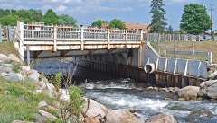 M-27-Au Sable River Bridgelisted 1999
Population over time
2 figuresGrayling fell from 1,884 to 1,867 between 2010 and 2020. These are the recorded population figures Wikidata holds for this place, reached through the Geographic Names Information System number this page is keyed on rather than by name, so they belong to this place and not to another of the same name. Most are census counts, but not all are: an early figure may be a founding or settlement estimate, and an estimate published within five years of a census is left out. The change column is computed, and is left blank where more than 20 years separate a figure from the one before it, because a gap that long is not a change between two counts.
| Year | People | Change |
|---|---|---|
| 2010 | 1,884 | |
| 2020 | 1,867 | -17 (-1%) |
Topographic sheets covering this place
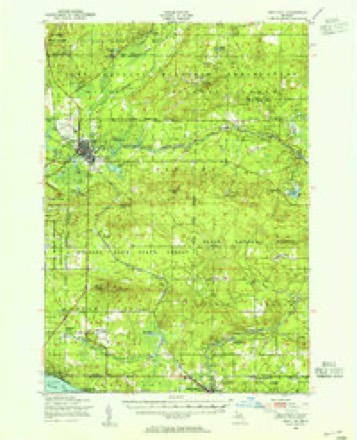
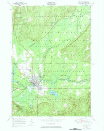
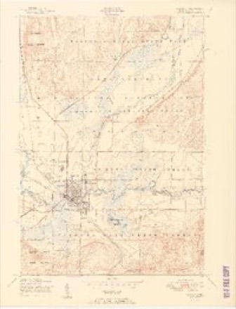
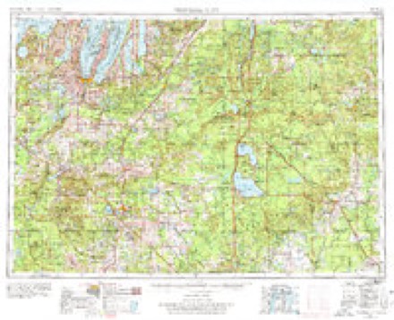
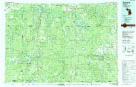
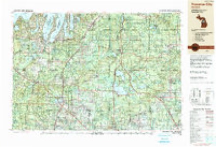
7 surveys from 14 printed sheetsMatched by testing this settlement's coordinate against the published boundary of every sheet in the United States Geological Survey's historical collection. Each opens the scanned sheet at the Survey.
- 1949 USGS Grayling quadrangle1:62500
- 1950 USGS Grayling quadrangle1:24000, 2 printings
- 1951 USGS Grayling quadrangle1:24000, 2 printings
- 1954 USGS Traverse City quadrangle1:250000, 4 printings
- 1958 USGS Traverse City quadrangle1:250000, 2 printings
- 1983 USGS Grayling quadrangle1:100000, 2 printings
- 1989 USGS Traverse City quadrangle1:250000
Fires near this place
95 since 1992Regional context, not property-specific evidence. The federal wildfire occurrence database lists 95 fires within 5 miles of Grayling between 1992 and 2020, burning about 1,545 acres in total. 1 started naturally. 7 were recorded as arson. Distance is straight-line from the map coordinates, so a fire counted here may appear on a neighbouring settlement's page as well.
| Reported cause | Fires |
|---|---|
| Missing data/not specified/undetermined | 25 |
| Equipment and vehicle use | 22 |
| Debris and open burning | 13 |
| Railroad operations and maintenance | 9 |
| Arson/incendiarism | 7 |
| Recreation and ceremony | 6 |
| Misuse of fire by a minor | 6 |
| Power generation/transmission/distribution | 3 |
| Smoking | 2 |
| Other causes | 1 |
| Natural | 1 |
The most recent of them, most recent first, with the day each was reported and the service that recorded it.
| Date | Cause | Size | Reported by | Name on the report |
|---|---|---|---|---|
| 8 September 2002 | Power generation/transmission/distribution | under an acre | Michigan Department of Natural Resources | not named |
| 12 September 2002 | Power generation/transmission/distribution | 2.6 acres | Michigan Department of Natural Resources | not named |
| 7 August 1992 | Missing data/not specified/undetermined | under an acre | Michigan Department of Natural Resources | not named |
| 5 August 2019 | Missing data/not specified/undetermined | 1.0 acres | Michigan Department of Natural Resources | LOVELLS TOWNSHIP FD 0039329 - 2019 |
| 2 August 2019 | Missing data/not specified/undetermined | 1.0 acres | Michigan Department of Natural Resources | BEAVER CREEK FD 19197 - 2019 |
| 2 August 2019 | Equipment and vehicle use | under an acre | Michigan Department of Natural Resources | CRAWFORD 07 - I-75 254MM NBOUND |
| 17 August 2019 | Equipment and vehicle use | 1.0 acres | Michigan Department of Natural Resources | GRAYLING FD 2019168 - 2019 |
| 17 August 2008 | Arson/incendiarism | 1.0 acres | Michigan Department of Natural Resources | CRAWFORD - BLAAUW |
Settlements close enough to share some of these fires:
Storms near this place
51 since 1993Regional context, not property-specific evidence. The National Weather Service names Grayling in 51 storm reports between 1993 and 2024: 26 thunderstorm wind, 19 hail, 5 tornado, 1 flash flood. No death or injury is recorded in these reports. Each account below is quoted exactly as the forecast office filed it, from the NOAA Storm Events Database, and each date opens the federal record of that event.
| When | Event | Place named | Harm | What the report says |
|---|---|---|---|---|
| July 1995 | Thunderstorm Wind | Grayling | $500,000 | Numerous trees and power lines were brought down by strong thunderstorm winds, some of which damaged houses and vehicles on the way down. |
| June 2012 | Tornado (EF1) | Grayling | $60,000 | This EF1 tornado impacted the Forest Dunes Golf Club. The initial touchdown was near the entrance to the club. Damage along the first half of the path was sporadic, with some trees uprooted and/or snapped. Damage intensity increased as the tornado reached a clear-cut area adjacent to its path, allowing the winds to more directly strike a large stand of trees. Damage in this one stand, alongside one of the fairways at the club, was considerable, with the majority of the trees felled. All told, over 100 trees were uprooted and/or snapped, including a mix of hardwoods and softwoods. Maximum winds were estimated at 100 mph. |
| July 1995 | Thunderstorm Wind | Grayling | $50,000 | Numerous trees and power lines were downed from thunderstorm winds along and over Stephan Bridge Road. |
| July 1995 | Thunderstorm Wind | Grayling | $50,000 | Strong thunderstorm winds knocked down numerous trees and power lines across Beaver Creek Township, blocking a few roadways. |
| August 1993 | Tornado (F1) | Grayling | $50,000 | A small tornado touched down 2 miles north of the Crawford-Roscommon County border and 1.5 miles west of Interstate 75 then moved northeast for just under 8 miles before lifting. It dropped a tree on a house at the initial touchdown location then moved northeast generally tree-topping and doing only minor damage until it crossed Interstate 75. After crossing Interstate 75 the tornado strengthened and began doing widespread tree damage. In the next 1.5 miles it destroyed nearly a thousand large hardwoods and pines damaged a travel trailer and outbuildings at one residence and damaged the roof of another then tore the roof off of a 12- X 60-foot mobile home. After passing the intersection of Johnson and Seven Mile Roads 5.5 miles northwest of the village of Roscommon it proceeded northeast through a heavily wooded area for nearly another 4 miles uprooting or snapping off well in excess of another thousand trees. |
| June 2005 | Thunderstorm Wind | Grayling | $40,000 | A large swath of sporadic tree damage occurred in eastern and northeast Crawford County. Several homes were damaged by falling trees. |
| June 2024 | Tornado (EF0) | Grayling | $21,000 | A tornado briefly touched down on the Forest Dunes Golf Club grounds. Golfers on the course observed trees being blown down, but no injuries were reported. Among other numerous downed trees with this event, a couple trees fell on a house located on the club grounds. |
| October 2007 | Thunderstorm Wind | Grayling | $16,000 | A large tree was downed onto a house, resulting in significant structural damage. |
| November 2013 | Thunderstorm Wind | Grayling | $9,000 | Multiple trees downed in the Grayling area. |
| October 2007 | Thunderstorm Wind | Grayling | $9,000 | Numerous trees were downed, and siding was ripped off of a home. |
| June 2017 | Thunderstorm Wind | Grayling | $8,000 | Multiple trees and power lines were downed in South Branch Township. |
| July 2006 | Thunderstorm Wind | Grayling | $8,000 | Trees and power lines downed. |
| July 2006 | Flash Flood | Grayling | $6,000 | Runoff overwhelmed drainage system on Michigan Avenue. Water backed up from the street into storefronts. |
| June 2008 | Thunderstorm Wind | Grayling | $5,000 | Several large trees were downed. |
| September 2005 | Thunderstorm Wind | Grayling | $5,000 | Trees were downed. |
| July 1995 | Thunderstorm Wind | Grayling | $5,000 | A spotter on the northwest corner of Higgins Lake reported a wind gust of 62 mph with the passage of an intense gust front. Thunderstorm winds brought down numerous trees and a few power lines in the area. |
| August 1995 | Thunderstorm Wind | Grayling | $5,000 | Numerous trees were brought down from strong thunderstorm winds between Grayling and Hartwick Pines along M-93. |
| July 1994 | Thunderstorm Wind | Grayling | $5,000 | Damaging thunderstorm winds uprooted numerous trees and tore down power lines along the southeast shore of Lake Margrethe. Four buildings, mostly garages, sustained roof damage on Poplar Avenue and Margrethe Boulevard. An antique car was also damaged in this area. |
| June 2007 | Thunderstorm Wind | Grayling | $4,000 | Several trees were downed near the I-75 and US-127 split. |
| June 2008 | Thunderstorm Wind | Grayling | $3,000 | Trees were downed. |
| July 2006 | Thunderstorm Wind | Grayling | $2,000 | Trees downed just north of Higgins Lake. |
| July 1994 | Thunderstorm Wind | Grayling | $500 | Thunderstorm winds uprooted, tore down or snapped off several trees along highway M-72, 0.4 mile west of Au Sable Trail. |
| July 1994 | Thunderstorm Wind | Grayling | $500 | Several trees uprooted, torn down or snapped off by strong thunderstorm winds along Au Sable Trail. |
| July 1994 | Thunderstorm Wind | Grayling | $500 | Several trees uprooted, torn down or snapped off by strong thunderstorm winds near intersection of Tomahawk Court and Yorke Trail. |
| July 1994 | Thunderstorm Wind | Grayling | $50 | Several trees uprooted, torn down or snapped off by strong thunderstorm winds along the north portion of the Interstate 75 Business Loop in the community of Grayling. |
| June 2005 | Hail | Grayling | - | Penny-sized hail reported 2 miles north of Roscommon. |
| July 2004 | Hail | Grayling | - | Hail covered the ground. |
| July 2004 | Hail | Grayling | - | Near Deerheart Valley. |
| July 2002 | Thunderstorm Wind | Grayling | - | Numerous trees down. |
| May 2001 | Hail | Grayling | - | An upper low and the associated cold air aloft caused scattered thunderstorms to develop during the afternoon and evening hours across northern Lower Michigan. A few of the thunderstorms produced severe hail. |
| August 2001 | Thunderstorm Wind | Grayling | - | Trees down. |
| June 2000 | Thunderstorm Wind | Grayling | - | Several trees were blown down. |
| May 1998 | Tornado (F0) | Grayling | - | The brief tornado touchdown heavilly damaged 1 home. |
| July 1997 | Tornado (F1) | Grayling | - | The tornado associated with this thunderstorm initially touched down in the far southeast corner of the county. The thunderstorm produced straight-line wind damage to trees along its entire path across the southern part of the county with tonadic damage first reported in far southeast portions of the county. The tornado briefly touched down an then lifted back up into the storm. This pattern of continuous straight line wind damage with occasional brief tornado touchdowns continued into Oscoda county as the storm tracked eastward. This was a strong F1 tornado. |
| July 1995 | Hail | Grayling | - | Golf ball-size hail was reported along Lake Margrethe. |
| July 1994 | Hail | Grayling | - | Hail three-quarter inch in diameter was reported to Crawford County Central Dispatch along the west shore of Lake Margrethe. |
| July 1994 | Thunderstorm Wind | Grayling | - | Numerous trees were uprooted, torn down, or snapped off by strong thunderstorm winds along the south side of Hunter Road, from M-18 east to the county line. |
| June 2015 | Hail | Grayling | - | no account filed |
| July 2014 | Hail | Grayling | - | no account filed |
| June 2011 | Hail | Grayling | - | no account filed |
| April 2011 | Hail | Grayling | - | no account filed |
| April 2011 | Hail | Grayling | - | no account filed |
| July 2006 | Hail | Grayling | - | no account filed |
| June 2005 | Hail | Grayling | - | no account filed |
| May 2002 | Hail | Grayling | - | no account filed |
| August 2001 | Hail | Grayling | - | no account filed |
| May 1998 | Hail | Grayling | - | no account filed |
| May 1998 | Thunderstorm Wind | Grayling | - | no account filed |
| June 1998 | Hail | Grayling | - | no account filed |
| April 1995 | Hail | Grayling | - | no account filed |
| April 1993 | Hail | Grayling | - | no account filed |
Nearest settlements
The eight closest, with where each one stands in the county. Distances are straight-line, computed from the Geographic Names Information System coordinates.
| Map | Place | Distance | Sheets |
|---|---|---|---|
| Collens Landing | 3.2 miles | 14 | |
| Lake Margrethe | 3.2 miles | 14 | |
| Danish Landing | 3.5 miles | 14 | |
| Rasmus | 3.9 miles | 14 | |
| Louis Cabin Landing | 4.1 miles | 14 | |
| McIntyre Landing | 5.0 miles | 14 | |
| Babbits Resort | 5.4 miles | 13 | |
| Skyline Village | 6.3 miles | 13 |
Elsewhere
Matched on this settlement's Geographic Names Information System number rather than its name, so it cannot be a different place of the same name in another state.
| Wikipedia article on Grayling | An encyclopaedic summary. Its text is share-alike, so it is linked here rather than copied. |
| Wikidata item Q2738881 | The structured record the population and elevation above come from. Public domain (CC0). |
Provenance
This settlement is recorded in the Geographic Names Information System as feature 627264. The sheet list is computed by point-in-boundary test against the United States Geological Survey's historical topographic inventory. Both are works of the United States government and carry no copyright under 17 U.S.C. 105.
Wildfire. Short, Karen C. 2022. Spatial wildfire occurrence data for the United States, 1992-2020 [FPA_FOD_20221014]. 6th Edition. Fort Collins, CO: Forest Service Research Data Archive. https://doi.org/10.2737/RDS-2013-0009.6 Collected with United States Government funding and usable without additional permissions or fees.
Storms. NOAA National Centers for Environmental Information, Storm Events Database https://www.ncei.noaa.gov/stormevents/ A work of the United States government, no copyright under 17 U.S.C. 105. Narratives are quoted verbatim from the National Weather Service report and are not edited or summarised.