 Block
From the record
One of 10 National Register listings published here for Mason County · listed in 2020 · category: Building.
Sources: the National Register database, National Park Service
Listed on the National Register of Historic Places in 2020.
One of 10 National Register listings published here for Mason County · listed in 2020 · category: Building.
Sources: the National Register database, National Park Service
Regional context, not property-specific evidence. The federal wildfire occurrence database lists 13 fires within 5 miles of Haskell Manufacturing Company Building between 1996 and 2019, burning about 82 acres in total. None started naturally. None was recorded as arson. Distance is straight-line from the map coordinates, so a fire counted here may appear on a neighbouring settlement's page as well.
| Reported cause | Fires |
|---|---|
| Missing data/not specified/undetermined | 5 |
| Equipment and vehicle use | 4 |
| Debris and open burning | 3 |
| Recreation and ceremony | 1 |
The most recent of them, most recent first, with the day each was reported and the service that recorded it.
| Date | Cause | Size | Reported by | Name on the report |
|---|---|---|---|---|
| 25 July 2012 | Equipment and vehicle use | 16 acres | Michigan Department of Natural Resources | MASON 02 - VICTORY |
| 17 July 2019 | Missing data/not specified/undetermined | 1.0 acres | Michigan Department of Natural Resources | PERE MARQUETTE FD 0000204 - 2019 |
| 15 July 2019 | Missing data/not specified/undetermined | 1.0 acres | Michigan Department of Natural Resources | PERE MARQUETTE FD 0000202 - 2019 |
| 8 May 2005 | Recreation and ceremony | 4.5 acres | Michigan Department of Natural Resources | not named |
| 5 May 2019 | Missing data/not specified/undetermined | 1.0 acres | Michigan Department of Natural Resources | HAMLIN TOWNSHIP FD 0000080 - 2019 |
| 28 May 1996 | Equipment and vehicle use | 1.5 acres | Michigan Department of Natural Resources | not named |
| 17 May 2019 | Equipment and vehicle use | 1.0 acres | Michigan Department of Natural Resources | DALTON TOWNSHIP FD 0000364 - 2019 |
| 14 May 2019 | Missing data/not specified/undetermined | 1.0 acres | Michigan Department of Natural Resources | PERE MARQUETTE FD 0000120 - 2019 |
Regional context, not property-specific evidence. The federal mineral resources record lists 8 workings within 5 miles of Haskell Manufacturing Company Building: 4 producers, 3 past producers, 1 plant. 5 still produce. What was taken out: Magnesite, Sand and Gravel, Construction, Bromine, Calcium, Halite. Distance is straight-line from the map coordinates, so a quarry counted here may appear on a neighbouring settlement's page as well.
| Where | Site | Commodity | Status | Recorded |
|---|---|---|---|---|
| Dow Chemical - Ludington | Halite | Producer | Sedimentary | |
| Dow-Ludington | Magnesite, Bromine, Calcium | Producer | 1942 | |
| Keiser's Clay Pit | Fire Clay (Refractory) | Past Producer | ||
| Ludington Site | Silica | Past Producer | Sedimentary | |
| Ludington Mill | Sand and Gravel, Construction | Past Producer | ||
| Ludington Pit | Sand and Gravel, Construction | Producer | ||
| Dow Chemicals--Ludington, Mich. | Magnesite | Producer | ||
| Harbison-Walker | Magnesite | Plant | 1957 |
Regional context, not property-specific evidence. The National Weather Service names Ludington, the town this property stands in, in 23 storm reports between 1995 and 2021: 18 thunderstorm wind, 5 hail. The reports record 5 injuries. Each account below is quoted exactly as the forecast office filed it, from the NOAA Storm Events Database, and each date opens the federal record of that event.
| When | Event | Place named | Harm | What the report says |
|---|---|---|---|---|
| May 1998 | Thunderstorm Wind | Ludington | 5 hurt, $1,000,000 | Michigan Department of State Police - Emergency Management Division's (EMD's) Damage and Injury Assessment Report indicated $398,000 in public damage costs, 66 homes damaged, 3 homes destroyed, and 4 businesses damaged. Five injuries were reported, one of which required hospitilization. In addition, 12 vacation/secondary residences incurred major damage and 9 had minor damage. Newspaper and media reports indicated public and private damage costs combined exceeded $1.0 Million. Mason County declared a local state of emergency and was granted a Governor's disaster declaration to activate state assistance for the county. On June 24th, President Clinton granted a Major Disaster Declaration for Mason County, making federal disaster assistance available. |
| May 2012 | Hail | Ludington | $25,000 | A county official reported hail up to one and three quarters inch in diameter in Scottville. |
| July 2012 | Thunderstorm Wind | Ludington | $25,000 | A 66 mph peak wind gust was measured near Ludington and many trees and power lines were blown down. |
| July 2006 | Thunderstorm Wind | Ludington | $25,000 | Numerous trees were blown down along the Lake Michigan shoreline. |
| May 1998 | Thunderstorm Wind | Ludington | $25,000 | Numerous trees and power lines downed in Ludington. A large tree was blown over onto a house at 907 E. Russell Street. Three vehicles were also damaged at the mentioned residence. |
| September 1997 | Thunderstorm Wind | Ludington | $25,000 | A peak wind gust of 57 mph registered at the Mason County Airport just east of Ludington when a line of severe thunderstorms moved onshore around 12:15 AM EDT, Wednesday, September 17, 1997. The Mason County Road Commission reported trees and power lines were downed across the county, cutting power to 500 customers of Consumers Energy and Western Michigan Electric Cooperative. One tree, nine feet in circumference, toppled onto the roof of the Ludington Outboard Club building along the Pere Marquette Lake. |
| June 2000 | Thunderstorm Wind | Ludington | $25,000 | no account filed |
| August 2006 | Thunderstorm Wind | Ludington | $20,000 | Law enforcement reported that several trees were blown down across southern Mason county. |
| July 2018 | Thunderstorm Wind | Ludington | $10,000 | Mason county dispatch reported that several trees were blown down across multiple locations in Mason county. |
| October 2015 | Thunderstorm Wind | Ludington | $10,000 | An isolated severe thunderstorm near Ludington produced wind gusts estimated at around 60 mph that brought down some scattered trees and power lines. Seven eighths inch diameter hail was also reported in Ludington. |
| March 2005 | Hail | Ludington | $10,000 | A trained spotter reported three quarters inch diameter hail three miles north of Ludington. |
| August 2004 | Thunderstorm Wind | Ludington | $10,000 | Law enforcement in Ludington reported that a couple of trees were blown down. |
| February 1999 | Thunderstorm Wind | Ludington | $10,000 | Trees were reported downed by strong winds in Ludington. |
| August 2021 | Thunderstorm Wind | Ludington | $5,000 | Several trees were blown down along US-31. |
| August 2005 | Thunderstorm Wind | Ludington | $5,000 | Several trees were blown down six miles south southeast of Ludington. |
| April 2002 | Hail | Ludington | $5,000 | no account filed |
| May 2012 | Hail | Ludington | - | The public estimated three quarters inch hail in Ludington. |
| September 2012 | Thunderstorm Wind | Ludington | - | An isolated severe thunderstorm brought down a couple of trees about four miles south of Ludington. One tree came down at Lakeshore Drive near the Ludington pumped storage plant and another tree came down in Riverton township. |
| April 2008 | Thunderstorm Wind | Ludington | - | A measured 52 knot wind gust was recorded at the Mason county airport. |
| June 2008 | Thunderstorm Wind | Ludington | - | Law enforcement reported several trees and power lines were blown down in the Ludington and Hamlin Lake areas. |
| September 1998 | Hail | Ludington | - | 1 inch hail produced by Supercell moving east at 35 mph. |
| May 1998 | Thunderstorm Wind | Ludington | - | U.S. Coast Guard in Ludington reported a 78-mph wind gust as derecho moved onshore. |
| May 1995 | Thunderstorm Wind | Ludington | - | A spotter in Ludington observed a gust of 59 mph in the shore area south of downtown Ludington. Three large trees were reported downed by the wind two miles northeast of Freesoil. One of the tree trunks was about 18 inches in diameter. |
No historic map-sheet match is published for this property yet. That does not mean no map exists. This record needs a coordinate-quality review before it can be joined to a sheet boundary. Browse the county's mapped places while that work is pending.
Other National Register properties close enough to walk or drive between, ordered by distance from this one. Both positions come from the same geocoding pass that matched these properties to their map sheets.
| Photograph | Property | Distance | Listed |
|---|---|---|---|
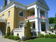 | William A. and Catherine Cartier House | 0.7 miles | 2014 |
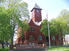 | Mason County Courthouse | 0.7 miles | 1988 |
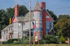 | East Ludington Avenue Historic District | 0.7 miles | 2022 |
 | S.S. BADGER (carferry) | 1.2 miles | 2009 |
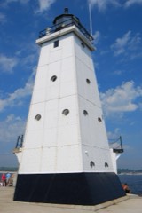 | Ludington North Breakwater Light | 1.4 miles | 2005 |
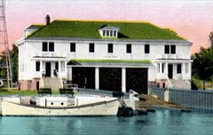 | Ludington United States Coast Guard Station | 1.6 miles | 2010 |
| National Archives record | The nomination case file for reference 100005785 in Record Group 79. |
| Mason County | All 10 listed properties in this county. |