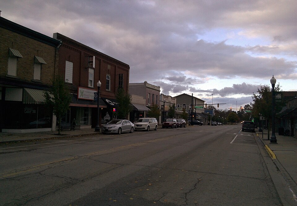
Listed on the National Register of Historic Places in 2021.
From the record
“The Wayland Downtown Historic District is primarily commercial historic district located on Main and Superior Streets, between Maple and Pine Streets and between Church and Forest Streets in Wayland, Michigan. It was added to the National Register of Historic Places in 2011.”
Wikipedia article Wayland Downtown Historic District, CC BY-SA 4.0.
One of 33 National Register listings published here for Allegan County · listed in 2021 · category: District.
This is an incorporated village of some 700 inhabitants, situated in the northwest corner of the township of Wayland. It is a station on the Grand Rapids and Indiana Railroad, distant twenty-seven miles north of Kalamazoo, twenty-one miles south from Grand Rapids, twenty miles northeast of Allegan, the county-seat, one hundred and seventy-two miles from pics and one hundred and sixtyeight from Chicago.
The Lake-Shore and Michigan Southern Railroad was first completed, and, as its road-bed at Hilliard's Station was but four miles distant west from Wayland, there were many here who did not believe the Grand Rapids and Indiana Railroad Company would run their line through that village. Consequently, an exodus (though a small one) took place. The latter road, however, was completed in the summer of 1870, since which time not many important changes have occurred, except: at the station where are situated William E. White's grist-mill, a saw-mill, and a large unoccupied building erected for the purpose of manufacturing chairs. In the village proper the most recent acquisition is a commodious brick school building, which was completed in 1879 at a cost of $4500, including site, etc.
Regional context, not property-specific
evidence. The
federal wildfire occurrence database
lists 14 fires within 5 miles of Wayland Downtown Historic District
between 1996 and 2020, burning about 41 acres in total. 2 started naturally. None was recorded as arson.
Distance is straight-line from the map coordinates, so a fire counted
here may appear on a neighbouring settlement's page as well.
Reported cause
Fires
Equipment and vehicle use
5
Missing data/not specified/undetermined
3
Natural
2
Recreation and ceremony
2
Misuse of fire by a minor
1
Debris and open burning
1
The most recent of
them, most recent first, with the day each was reported and the service
that recorded it.
Regional context, not property-specific
evidence. The National Weather Service names
Wayland, the town this property stands in, in 22 storm reports between 1994 and 2023: 13 thunderstorm wind, 8 hail, 1 flash flood.
No death or injury is recorded in these reports. Each account below is quoted exactly as the forecast office
filed it, from the NOAA Storm Events Database, and each date
opens the federal record of that event.
The Wayland Police Department reported numerous trees and power lines downed across the area. Some people were trapped in vehicles under felled power lines.
No historic map-sheet match is published
for this property yet. That does not mean no map exists. This record needs
a coordinate-quality review before it can be joined to a sheet boundary.
Browse the county's mapped places while that work is
pending.
Listing record. National Park Service National Register of Historic Places, listed-properties dataset, current to 2026-05-22.
Map join. Address geocoded through the United States Census geocoder, then tested against the published boundary of every sheet in the USGS Historical Topographic Map Collection.
How this page is made. Listing fields come from federal records; map-sheet coverage is a labelled coordinate-to-boundary calculation, not a source-field claim.
Wildfire. Short, Karen C. 2022. Spatial wildfire occurrence data for the United States, 1992-2020 [FPA_FOD_20221014]. 6th Edition. Fort Collins, CO: Forest Service Research Data Archive. https://doi.org/10.2737/RDS-2013-0009.6 Collected with United States Government funding and usable without additional permissions or fees.
Storms. NOAA National Centers for Environmental Information, Storm Events Database https://www.ncei.noaa.gov/stormevents/ A work of the United States government, no copyright under 17 U.S.C. 105. Narratives are quoted verbatim from the National Weather Service report and are not edited or summarised.
 Block