 Block
From the record
9 National Register listings published here.
Sources: the National Register database, National Park Service
26 topographic sheets cover 15 settlements here, and 9 properties are on the National Register of Historic Places.
9 National Register listings published here.
Sources: the National Register database, National Park Service
Every property in this county listed on the National Register of Historic Places, with the year it was listed and the federal nomination document.
| Photograph | Property | Type | Listed | Reference |
|---|---|---|---|---|
 | Big Stone County Courthouse | building | 1985 | 85001764 |
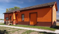 | Milwaukee Chicago St. Paul and Pacific Depot | building | 1986 | 86002118 |
 | Columbian Hotel | building | 1985 | 85001766 |
| District No. 13 School | building | 1985 | 85001772 | |
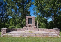 | Graceville Historical Marker | site | 2004 | 04001358 |
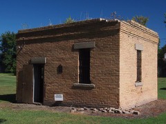 | Odessa Jail | building | 1986 | 86001916 |
| Ortonville Commercial Historic District | district | 1985 | 85001765 | |
 | Ortonville Free Library | building | 1985 | 85001767 |
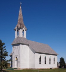 | St. Pauli Norwegian Evangelical Lutheran Church | building | 2010 | 10000581 |
Every wildfire the federal occurrence database records inside this county: 26 of them, burning about 8,748 acres. None started naturally and 3 were recorded as arson. Each settlement page carries the fires within five miles of it.
| Reported cause | Fires |
|---|---|
| Missing data/not specified/undetermined | 14 |
| Debris and open burning | 5 |
| Arson/incendiarism | 3 |
| Recreation and ceremony | 2 |
| Other causes | 1 |
| Equipment and vehicle use | 1 |
The five largest, by the area the report gives. One of them was set deliberately.
| Date | Cause | Size | Reported by | Name on the report |
|---|---|---|---|---|
| 14 April 2004 | Arson/incendiarism | 7,330 acres | Minnesota Department of Natural Resources | LOUISBURGRADE |
| 12 April 2003 | Missing data/not specified/undetermined | 590 acres | Morris National Wildlife Refuge | DISMAL SWAMP |
| 16 November 2012 | Missing data/not specified/undetermined | 265 acres | Morris National Wildlife Refuge | HOFFMAN |
| 10 May 2013 | Debris and open burning | 117 acres | Morris National Wildlife Refuge | 285G |
| 9 December 2002 | Missing data/not specified/undetermined | 94 acres | Morris National Wildlife Refuge | BIG W WPA WILDFIRE |
| 17 April 2001 | Missing data/not specified/undetermined | 80 acres | Morris National Wildlife Refuge | HILLMAN |
| 22 May 2014 | Missing data/not specified/undetermined | 80 acres | Minnesota Department of Natural Resources | not named |
| 5 April 1992 | Missing data/not specified/undetermined | 41 acres | Morris National Wildlife Refuge | HILLMANB14 |
Every settlement page carries the fires within five miles of it - see the settlement index below.
The NOAA Storm Events Database holds 250 reports for this county, causing no deaths, no injuries and about $1,907,000 in recorded property damage. Each settlement page carries the reports that name it.
| Kind of event | Reports |
|---|---|
| Thunderstorm Wind | 113 |
| Hail | 104 |
| Flood | 14 |
| Tornado | 13 |
| Flash Flood | 3 |
| Funnel Cloud | 3 |
The most serious of them, by death, then injury, then recorded damage. The accounts are quoted exactly as the forecast office filed them.
| When | Event | Place named | Harm | What the report says |
|---|---|---|---|---|
| May 1996 | Tornado (F3) | Clinton | $1,500,000 | no account filed |
| June 2024 | Flood | Artichoke | $332,000 | Heavy rain from thunderstorms, in concert with an already wet spring, resulted in flooding that damaged township roads and culverts. Damage assessments between Otrey and Artichoke Lake townships reached 331655.85 dollars. |
| June 2008 | Flash Flood | Beardsley | $50,000 | no account filed |
| July 1959 | Tornado (F1) | not stated | $25,000 | no account filed |
| July 2025 | Thunderstorm Wind | Barry | - | Storm chasers reported that 6 and 10 inch diameter tree branches snapped at the intersection of MN-28 and Big Stone County Road 59. |
| July 2025 | Thunderstorm Wind | Barry | - | Trained spotters posted images of tree damage in the town of Barry. |
| July 2025 | Hail | Johnson | - | Hail up to 1.5 inches in diameter was observed with a storm near the town of Johnson. |
| July 2025 | Thunderstorm Wind | Ortonville Arpt | - | The Automated Weather Observation System near Ortonville measured peak wind gusts of 60 mph. |
| July 2025 | Thunderstorm Wind | Ortonville Arpt | - | The Minnesota Department of Transportation Road Weather Information System near Odessa measured peak wind gusts of 60 mph. |
| July 2025 | Flood | Johnson | - | Heavy rainfall resulted in the flooding of fields and ditches in and around the town of Johnson. |
| July 2025 | Thunderstorm Wind | Barry | - | A trained spotter reported a 61 mph wind gust from a rooftop anemometer at the intersection of MN-28 and Big Stone County Road 59. Nearby crop damage was also reported. |
| July 2025 | Thunderstorm Wind | Barry | - | One and half miles west of Barry, numerous tree limbs up to 18 inches in diameter were downed and several smaller trees were snapped at the base. |
| August 2025 | Thunderstorm Wind | Ortonville | - | A trained spotter surveying for damage reported multiple trees topped, uprooted or damaged at a farmstead northeast of Ortonville. Minor structural damage to a small grain bin and outbuilding included shingles torn from the roof. |
| July 2024 | Hail | Graceville | - | Hail stones were estimated at 3 inches, resulting in blown out windows and damage to the roof at the residence. Windows on vehicles were also smashed. |
| April 2023 | Flood | Ortonville | - | The Minnesota River at Big Stone Lake reached a level of 972.7 or 1.2 feet above flood. An unknown number of cabins and businesses along the lake experienced some degree of flooding or water damage. |
| May 2022 | Thunderstorm Wind | Artichoke | - | Several uprooted and snapped trees on the property. A machine shed was leaning east and another barn leaning northeast. The house on the property was also leaning with a several inch gap between the house and the chimney. The house was deemed unlivable. |
| May 2022 | Thunderstorm Wind | Artichoke | - | Estimated 80 mph wind gusts dented a grain bin and uprooted trees. |
| May 2022 | Tornado (EF1) | Correll | - | A storm chaser documented the brief tornado touchdown. Two farmsteads were damaged. The first farm was located near 410th St and 590th Ave. This farm exhibited a clear track through trees on the property, the house had shingle damage and damage occurred to small outbuildings. Roughly three quarters of a mile to the north, near 400th St, the second property was damaged. This property had a grain bin swept off the base, complete destruction of machine shed, shingle damage to the home and a clear path of mangled trees. |
| June 2022 | Thunderstorm Wind | Odessa | - | The time of the peak wind gust was estimated based on radar. |
| August 2021 | Thunderstorm Wind | Odessa | - | Several branches were downed, and some shingles were blown off a roof by estimated 65 mph winds. |
| October 2021 | Tornado (EF0) | Odessa | - | A tornado was photographed north of Odessa. |
| October 2021 | Tornado (EF0) | Clinton | - | The Graceville, MN Fire Department observed a tornado. |
| October 2021 | Tornado (EF0) | Barry | - | A tornado was photographed south of Barry. |
| July 2020 | Thunderstorm Wind | Graceville | - | Sixty mph winds were estimated. |
| August 2020 | Thunderstorm Wind | Graceville | - | An estimated sixty mph wind took the top off an evergreen tree. |
| August 2019 | Hail | Odessa | - | Quarter size hail shredded some bean fields. |
| May 2017 | Thunderstorm Wind | Clinton | - | Some trees were downed in Clinton by seventy mph winds. |
| June 2017 | Thunderstorm Wind | Clinton | - | Multiple trees were uprooted and snapped in Clinton by estimated eighty mph winds. |
| June 2017 | Thunderstorm Wind | Odessa | - | Eighty mph winds dented several grain bins, took off a section of a machine shed roof, tipped over a grain auger, along with breaking some windows. |
| June 2017 | Thunderstorm Wind | Ortonville Arpt | - | Seventy mph winds damaged an outbuilding. |
| June 2017 | Thunderstorm Wind | Johnson | - | Seventy mph winds caused minor damage to the roof of a barn. |
| June 2017 | Thunderstorm Wind | Johnson | - | Eighty mph winds completely destroyed an open faced shed. |
| June 2017 | Thunderstorm Wind | Ortonville | - | Sixty-five mph winds damaged a shed along with downing some large branches. |
| June 2017 | Thunderstorm Wind | Johnson | - | Seventy mph winds caused a partial loss of a roof. |
| June 2017 | Tornado (EF1) | Clinton | - | Storm chasers and residents observed a brief tornado on the leading edge of a line of storms. The tornado moved over one farmstead damaging multiple structures. Over half of the tin roof was ripped from the house along with considerable damage to the siding of the house. One machine shed was completely destroyed. Another machine shed had damage to the southward facing walls and lost over half of the roof. A third machine shed had extensive damage to the westward facing walls and lost over half of the roof. An empty grain bin was completely removed from the cement base and an attached auger was toppled. Another grain bin was dented at the top. One power pole was snapped, with other poles downed due to the weight of the wires. Widespread tree damage including snapped trunks, uprooted trees, and large broken branches occurred on the property. A small area of corn crop was razed to the ground. Some debris was driven into the ground, while other debris was lofted roughly 2000 feet to the northeast. |
| June 2017 | Thunderstorm Wind | Ortonville Arpt | - | Eighty mph winds snapped multiple trees along with downing many large tree branches. Some electrical lines were also downed. |
| June 2017 | Thunderstorm Wind | Ortonville | - | Eighty mph winds ripped the patio off of a house which also caused roof damage. |
| June 2017 | Thunderstorm Wind | Ortonville | - | Eighty mph winds uprooted many trees at the Ortonville golf course. |
| June 2017 | Thunderstorm Wind | Artichoke | - | Eighty mph winds caved in the sides of two grain bins. |
| June 2017 | Thunderstorm Wind | Barry | - | Eighty mph winds took out the wall of a machine shed along with damaging the roof. |
| June 2017 | Thunderstorm Wind | Graceville | - | Eighty mph winds collapsed the walls of a machine shed. |
| June 2016 | Thunderstorm Wind | Graceville | - | Seventy mph winds damaged a grain elevator. |
| June 2016 | Tornado (EF0) | Barry | - | A thin rope tornado touched down briefly with no damage reported. |
| June 2016 | Tornado (EF0) | Barry | - | A tornado touched down to the west of Barry for several minutes with no damage reported. |
| July 2016 | Flash Flood | Ortonville Arpt | - | Several roads were flooded from Ortonville to several miles to the northeast. The sewer system also failed in Ortonville for a time. |
| July 2016 | Thunderstorm Wind | Clinton | - | Sixty mph winds were estimated. |
| July 2016 | Thunderstorm Wind | Clinton | - | Estimated sixty mph winds caused damage to crops. |
| May 2014 | Hail | Correll | - | Large hail broke skylight in the home. |
| June 2013 | Thunderstorm Wind | Ortonville | - | Many large trees were downed by eighty mph winds. |
| June 2013 | Thunderstorm Wind | Ortonville Arpt | - | Eighty mph winds brought several trees and power lines down in Ortonville. Also part of a roof and wall of a building were damaged. |
| June 2013 | Thunderstorm Wind | Ortonville Arpt | - | Eighty mph winds caused major damage in and around Ortonville with numerous trees down, some roofs destroyed, along with many grain bins damaged. |
| June 2013 | Thunderstorm Wind | Artichoke | - | Winds gusted to sixty mph. |
| June 2012 | Thunderstorm Wind | Odessa | - | Several power poles were snapped about four feet off the ground by very strong winds of over 100 mph. |
| June 2012 | Thunderstorm Wind | Ortonville | - | Winds over 100 mph caused quite a bit of tree damage in Ortonville. Some trees were downed along with many tree branches. Some businesses sustained some facade damage. There were a few structures that suffered roof damage ranging from loss of shingles to a section of the roof being blown off. A storage building on the east side of town near the intersections of Highway 75 and 12 was blown down with a grain bin destroyed half mile east. Another grain bin suffered damage when it was hit by debris from the first grain bin. |
| July 2012 | Thunderstorm Wind | Odessa | - | Sixty mph winds brought down several tree branches. |
| July 2011 | Thunderstorm Wind | Clinton | - | Eighty mph winds downed several trees with several telephone poles leaning. |
| July 2011 | Thunderstorm Wind | Clinton | - | A very large cottonwood tree was uprooted by ninety mph winds. |
| July 2011 | Thunderstorm Wind | Clinton | - | Numerous large trees were downed on a farm southeast of Clinton. |
| July 2011 | Thunderstorm Wind | Clinton | - | Eighty mph winds plus caused widespread tree and structural damage on a farm southeast of Clinton. Many trees were downed. Two outbuildings lost their roofs with significant damage to one of the outbuildings. A garage was completely moved off of its foundation and destroyed. |
| July 2011 | Thunderstorm Wind | Ortonville | - | Sixty mph winds were estimated in Ortonville. |
The Survey's mineral resources record lists 4 workings inside this county. All of them still produce. Each settlement page carries the workings within five miles of it.
| Commodity | Workings |
|---|---|
| Granite | 2 |
| Stone, Crushed/Broken | 2 |
| Sand and Gravel, Construction | 2 |
The least common of them first, because a county's hundredth gravel pit says nothing its first ten did not.
| Where | Site | Commodity | Status | Recorded |
|---|---|---|---|---|
| Agate Quarry | Granite, Stone, Crushed/Broken | Producer | ||
| Hillman Pit | Sand and Gravel, Construction | Producer | ||
| Ortonville Quarry & Mill | Granite, Stone, Crushed/Broken | Producer | ||
| Sibson Pit and Mill | Sand and Gravel, Construction | Producer |
Named settlements recorded in the Geographic Names Information System, each with the topographic sheets covering it. Villages, hamlets and abandoned places alike. Each is shown with the nearest named watercourse or landform and the survey quadrangle it falls on.
Ortonville city · 56278 · On Whetstone River · Ortonville quadrangle
7 sheets, 1953 to 1985
Ortonville city · 56278 · On Whetstone River · Ortonville quadrangle
7 sheets, 1953 to 1985
Foster township · 56211 · On Fish Creek · Big Stone Lake West quadrangle
8 sheets, 1953 to 1985