 Block
From the record
11 National Register listings published here.
Sources: the National Register database, National Park Service
26 topographic sheets cover 17 settlements here, and 11 properties are on the National Register of Historic Places.
11 National Register listings published here.
Sources: the National Register database, National Park Service
Every property in this county listed on the National Register of Historic Places, with the year it was listed and the federal nomination document.
| Photograph | Property | Type | Listed | Reference |
|---|---|---|---|---|
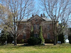 | Ole Carlson House | building | 1982 | 82002944 |
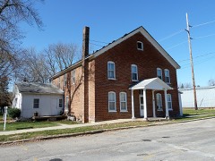 | Eureka Hotel | building | 1982 | 82002941 |
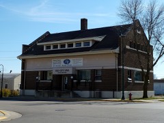 | Kasson Municipal Building | building | 1982 | 82002942 |
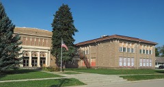 | Kasson Public School | building | 2007 | 07001242 |
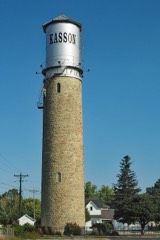 | Kasson Water Tower | structure | 1976 | 76001051 |
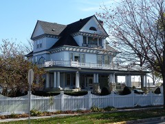 | Jacob Leuthold Jr. House | building | 1982 | 82002943 |
| Mantorville Historic District | district | 1974 | 74001017 | |
| Mantorville and Red Wing Stage Road-Mantorville Section | structure | 1991 | 91001062 | |
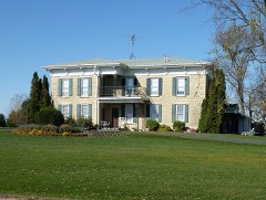 | Perry Nelson House | building | 1982 | 82002939 |
| Wasioja Historic District | district | 1975 | 75000977 | |
| West Concord High School | building | 2021 | 100006007 |
The NOAA Storm Events Database holds 360 reports for this county, causing no deaths, 1 injury and about $15,689,850 in recorded property damage. Each settlement page carries the reports that name it.
| Kind of event | Reports |
|---|---|
| Hail | 145 |
| Thunderstorm Wind | 125 |
| Tornado | 22 |
| Heavy Rain | 18 |
| Funnel Cloud | 17 |
| Flash Flood | 17 |
| Flood | 11 |
| Lightning | 5 |
The most serious of them, by death, then injury, then recorded damage. The accounts are quoted exactly as the forecast office filed them.
| When | Event | Place named | Harm | What the report says |
|---|---|---|---|---|
| June 2006 | Lightning | Claremont | 1 hurt, $400,000 | no account filed |
| May 1996 | Thunderstorm Wind | Dodge Center | $8,500,000 | no account filed |
| September 2010 | Flood | Rice Lake | $2,000,000 | Rivers, creeks, and streams as well as low-lying areas throughout the county were flooded due to very heavy rainfall. At least 20 roads were closed across the county, while a few bridges were damaged and needed reconstruction. Specific road closures included State Highway 56, State Highway 24 as the Middle Fork of the Zumbro River flooded, and County Road 7. One home was destroyed, 4 others had major damage, and 57 others reported minor damage. |
| August 2007 | Flood | Dodge Center | $600,000 | Law enforcement officials reported some roads washed out or still under water. |
| September 2010 | Flash Flood | Rice Lake | $500,000 | Many roads and culverts across the county were washed out. |
| June 2014 | Flash Flood | Rice Lake | $413,000 | Runoff from heavy rain caused numerous streams across Dodge County to go out of their banks. The subsequent flooding damaged several roads with county engineers identifying 75 locations across the county that would need to be repaired. |
| May 2012 | Lightning | Eden | $250,000 | Lightning struck a tower located next to a house with the power surge traveling through some cables to enter the house. The house, located north of Dodge Center, did not immediately catch on fire, but by the time the fire was reported and fire fighters arrived, the attic was fully engulfed in flames. The house is considered a total loss. |
| June 2012 | Lightning | Eden | $250,000 | Two buildings and around 200 turkeys were destroyed in an early morning fire started by lightning. Four fire departments responded to the blaze and needed four hours to extinguish the blaze. |
| May 1968 | Tornado (F1) | not stated | $250,000 | no account filed |
| July 2009 | Hail | Dodge Center | $222,000 | no account filed |
| March 2017 | Thunderstorm Wind | Mantorville | $150,000 | North of Mantorville, thunderstorm winds pushed a barn about 40 feet off its foundation, several metal outbuildings were destroyed, the top third of a concrete silo was blown off and two metal corn bins were destroyed. |
| June 2019 | Flash Flood | Rice Lake | $145,000 | Thunderstorms with very heavy rain dumped between 3 and 7 inches across much of Dodge County. Flash flooding resulted from this rain with water covering numerous roads, including U.S. Highway 14. Near Wasioja, 605th Street was washed out. A truck tried to drive through flood waters on State Highway 56 and was swept into a nearby field. The occupants of the truck were not injured. |
| June 1998 | Flash Flood | Hayfield | $120,000 | no account filed |
| August 2010 | Tornado (EF1) | Hayfield | $110,000 | The tornado damage path began just south of State Highway 30 west of Hayfield. The tornado did move off to the northeast nearing State Highway 56 before taking a north northwest track until it lifted just south of County Road 6. Damage was noted to soybean and corn fields, numerous trees and limbs were snapped and uprooted, roofing damage occurred to a metal barn/shed, while an old barn was lifted off of its foundation for a complete loss. Also, a local residence had some small beams knocked out from underneath a porch on the front of the house. |
| June 1998 | Thunderstorm Wind | West Concord | $110,000 | no account filed |
| August 2007 | Flash Flood | Dodge Center | $100,000 | Flooding was limited mostly to ditches. Homes reported with water in basements. Railroad beds were washed out. Reports began coming into the dispatch center around 6 p.m. |
| July 2009 | Hail | Claremont | $100,000 | no account filed |
| June 1998 | Thunderstorm Wind | Claremont | $100,000 | no account filed |
| July 2017 | Thunderstorm Wind | Claremont | $70,000 | A turkey farm north of Claremont sustained roof damage to two buildings, but no turkeys were hurt. Power lines were also blown down. |
| July 2000 | Flash Flood | Countywide | $65,000 | no account filed |
| July 2022 | Thunderstorm Wind | Kasson | $60,000 | Roofing material was blown off the movie theater in Kasson, allowing water to enter the building which damaged the ceiling and walls. |
| December 2021 | Thunderstorm Wind | Kasson | $50,000 | Part of the roof was blown off a large livestock building south of Kasson. |
| June 2019 | Hail | Dodge Center | $50,000 | Two inch diameter hail was reported in Dodge Center. |
| June 2019 | Hail | Dodge Center | $50,000 | Two inch diameter hail was reported in Dodge Center. |
| June 2019 | Hail | Kasson | $50,000 | Baseball sized hail fell in Kasson. The hail broke several vehicle windows and damaged the siding on houses. |
| June 2019 | Hail | Dodge Center | $50,000 | Tennis ball sized hail was reported in Dodge Center. |
| June 2019 | Hail | Kasson | $50,000 | Golf ball sized hail was reported in Kasson. |
| September 2007 | Flash Flood | West Concord | $50,000 | Heavy rainfall caused flooding over County Roads 24, 5, and 1. Cars stalled in flood waters and local fire department personnel had to evacuate people from nearby homes and farm, in addition to the rescue of stranded motorists. |
| July 2024 | Thunderstorm Wind | Dodge Center | $45,000 | Local officials reported power poles down near Dodge Center. |
| July 2025 | Thunderstorm Wind | Kasson | $35,000 | Dodge County emergency management reported numerous large tree branches snapped and large trees uprooted in Kasson. Some minor structure damage to homes along with downed power lines was also reported from resulting tree damage. |
| June 2005 | Lightning | Hayfield | $35,000 | no account filed |
| July 2017 | Thunderstorm Wind | Claremont | $30,000 | Trees were uprooted and a roof blown off a building northeast of Claremont. |
| June 2010 | Tornado (EF1) | Hayfield | $30,000 | This was the second tornado of the night to hit Dodge County. It formed over Steele County where it was rated an EF2, and then moved into Dodge County affecting rural areas of the county northeast of Blooming Prairie. Most of the damage occurred near County Roads 3 and 4 where roofs were partially torn off buildings and trees were blown down. |
| August 2007 | Flash Flood | Kasson | $30,000 | Flooding reported in Kasson. |
| August 2023 | Thunderstorm Wind | Claremont | $25,000 | Broadcast media reported 600 people without electricity in Claremont and the Town of Dodge Center. |
| July 2019 | Flash Flood | Rice Lake | $25,000 | Water covered roads in and around Dodge Center after slow moving thunderstorms dropped between 2 and 6 inches of rain. Several roads had to be closed until the water receded. |
| July 2016 | Thunderstorm Wind | Mantorville | $25,000 | A steel framed outbuilding was destroyed northeast of Mantorville. The debris was blown into and damaged a grain bin. |
| July 2000 | Flash Flood | South Portion | $25,000 | no account filed |
| June 1999 | Thunderstorm Wind | Kasson | $25,000 | no account filed |
| October 1973 | Tornado (F1) | not stated | $25,000 | no account filed |
| May 1968 | Tornado (F1) | not stated | $25,000 | no account filed |
| June 1961 | Tornado (F1) | not stated | $25,000 | no account filed |
| June 1998 | Thunderstorm Wind | Hayfield | $22,000 | no account filed |
| July 2022 | Thunderstorm Wind | Claremont | $20,000 | Strong winds damaged a couple of structures in the Claremont area, including a roof blown off a shed. Several large trees were also blown down. |
| June 2008 | Flood | Hayfield | $20,000 | no account filed |
| June 1999 | Thunderstorm Wind | Kasson | $20,000 | no account filed |
| March 1998 | Hail | Mantorville | $20,000 | no account filed |
| May 1998 | Thunderstorm Wind | Oslo | $18,000 | no account filed |
| May 1998 | Thunderstorm Wind | Dodge Center | $18,000 | no account filed |
| August 2024 | Thunderstorm Wind | Mantorville | $15,000 | The public reported a powerline blown down in Mantorville. |
| July 2009 | Hail | Claremont | $15,000 | no account filed |
| July 2009 | Hail | West Concord | $15,000 | no account filed |
| June 2000 | Flood | Countywide | $12,000 | no account filed |
| August 2023 | Thunderstorm Wind | Claremont | $10,000 | Public reported considerable damage sustained to a grain bin near Claremont, relayed via Broadcast Media. |
| December 2021 | Tornado (EF1) | West Concord | $10,000 | An EF1 tornado formed in far northern Dodge County north of West Concord and then moved northeast into Goodhue County. Two farms along the path of the tornado sustained minor damage. |
| September 2019 | Lightning | Hayfield | $10,000 | A lightning strike caused a structure fire in Blooming Prairie. |
| July 2017 | Thunderstorm Wind | Claremont | $10,000 | A building sustained damage northeast of Claremont. |
| June 2012 | Thunderstorm Wind | West Concord | $10,000 | Several trees and power lines were blown down producing power outages north of a line from between West Concord and Dodge Center east to the Dodge/Olmsted county line. |
| October 2007 | Flood | West Concord | $10,000 | Heavy rain produced flooding along the Middle Fork of the Zumbro River causing it to exceed 100 yards wide at some points. A bridge along County Road 7 caused the river to dam which also led to more flooding. Water was 2 to 3 feet deep running through fields and many roads were impassable. |
| August 2006 | Flash Flood | Countywide | $10,000 | no account filed |
The Survey's mineral resources record lists 5 workings inside this county. 3 still produce and 2 are closed or unrecorded. Each settlement page carries the workings within five miles of it.
| Commodity | Workings |
|---|---|
| Sand and Gravel, Construction | 2 |
| Stone, Crushed/Broken | 2 |
| Clay | 1 |
The least common of them first, because a county's hundredth gravel pit says nothing its first ten did not.
| Where | Site | Commodity | Status | Recorded |
|---|---|---|---|---|
| Dodge County Clay Deposit | Clay | Occurrence | ||
| Fairbanks Quarry | Stone, Crushed/Broken | Past Producer | ||
| Paulson Pit | Sand and Gravel, Construction | Producer | ||
| Stussy Quarry | Stone, Crushed/Broken | Producer | ||
| Walt Love Pit and Mill | Sand and Gravel, Construction | Producer |
Named settlements recorded in the Geographic Names Information System, each with the topographic sheets covering it. Villages, hamlets and abandoned places alike. Each is shown with the nearest named watercourse or landform and the survey quadrangle it falls on.
Mantorville city · 55955 · On Masten Creek · Dodge Center quadrangle
11 sheets, 1953 to 1989
Wasioja township · 55927 · On Dodge Center Creek · Dodge Center quadrangle
11 sheets, 1953 to 1989
Ripley township · 55917 · Hayfield NW quadrangle
7 sheets, 1954 to 1985
No longer a settlement
The vanished settlements of Dodge County: the places named above that are no longer on the map.