 Block
From the record
13 National Register listings published here.
Sources: the National Register database, National Park Service
38 topographic sheets cover 18 settlements here, and 13 properties are on the National Register of Historic Places.
13 National Register listings published here.
Sources: the National Register database, National Park Service
Every property in this county listed on the National Register of Historic Places, with the year it was listed and the federal nomination document.
| Photograph | Property | Type | Listed | Reference |
|---|---|---|---|---|
 | Alexandria Public Library | building | 1985 | 85001817 |
| Alexandria Residential Historic District | district | 1991 | 90002120 | |
 | Brandon Auditorium and Fire Hall | building | 1985 | 85001928 |
 | Thomas F. Cowing House | building | 1985 | 85001821 |
 | Douglas County Courthouse | building | 1985 | 85001816 |
 | Great Northern Passenger Depot | building | 1985 | 85001760 |
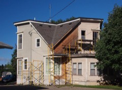 | John B. Johnson House | building | 1977 | 77000730 |
| Lake Carlos State Park WPA/Rustic Style Group Camp | building | 1992 | 92000776 | |
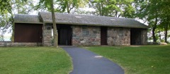 | Lake Carlos State Park WPA/Rustic Style Historic District | district | 1992 | 89001654 |
 | Knute Nelson House | building | 1977 | 77000729 |
| August Tonn Farmstead | building | 1985 | 85002485 | |
 | U.S. Post Office-Alexandria | building | 1979 | 79001238 |
 | Noah P. Ward House | building | 1985 | 85001822 |
Every wildfire the federal occurrence database records inside this county: 169 of them, burning about 2,294 acres. 1 started naturally and 23 were recorded as arson. Each settlement page carries the fires within five miles of it.
| Reported cause | Fires |
|---|---|
| Debris and open burning | 103 |
| Arson/incendiarism | 23 |
| Missing data/not specified/undetermined | 23 |
| Smoking | 7 |
| Equipment and vehicle use | 6 |
| Recreation and ceremony | 6 |
| Natural | 1 |
The five largest, by the area the report gives. One of them was set deliberately.
| Date | Cause | Size | Reported by | Name on the report |
|---|---|---|---|---|
| 18 October 2018 | Debris and open burning | 307 acres | Fergus Falls Wetland Management District | SCHULTZ LAKE WF |
| 6 May 2018 | Debris and open burning | 190 acres | Minnesota Department of Natural Resources | not named |
| 17 December 2002 | Debris and open burning | 120 acres | Minnesota Department of Natural Resources | not named |
| 17 April 2020 | Missing data/not specified/undetermined | 100 acres | Minnesota Department of Natural Resources | not named |
| 17 November 1999 | Arson/incendiarism | 85 acres | Minnesota Department of Natural Resources | not named |
| 23 May 2009 | Smoking | 71 acres | Minnesota Department of Natural Resources | not named |
| 5 May 1998 | Debris and open burning | 60 acres | Minnesota Department of Natural Resources | not named |
| 29 April 1992 | Debris and open burning | 60 acres | Minnesota Department of Natural Resources | not named |
Every settlement page carries the fires within five miles of it - see the settlement index below.
The NOAA Storm Events Database holds 374 reports for this county, causing 1 death, 13 injuries and about $3,719,000 in recorded property damage. Each settlement page carries the reports that name it.
| Kind of event | Reports |
|---|---|
| Thunderstorm Wind | 169 |
| Hail | 158 |
| Tornado | 26 |
| Funnel Cloud | 11 |
| Flash Flood | 6 |
| Heavy Rain | 3 |
| Lightning | 1 |
The most serious of them, by death, then injury, then recorded damage. The accounts are quoted exactly as the forecast office filed them.
| When | Event | Place named | Harm | What the report says |
|---|---|---|---|---|
| June 2022 | Thunderstorm Wind | Holmes City | 1 killed, 1 hurt, $25,000 | A tree fell on a camper, and unfortunately one of the two individuals inside the camper was killed. The other individual was injured and hospitalized. |
| July 1970 | Tornado (F2) | not stated | 5 hurt, $2,500,000 | no account filed |
| October 1996 | Tornado (F2) | Alexandria | 4 hurt | no account filed |
| October 1996 | Tornado (F1) | Garfield | 2 hurt | no account filed |
| July 1999 | Thunderstorm Wind | Holmes City | 1 hurt | Large trees toppled, one onto a camper; slight injury to man inside. Estimated winds. |
| June 1990 | Tornado (F2) | not stated | $250,000 | no account filed |
| April 2001 | Flash Flood | Countywide | $200,000 | no account filed |
| July 2011 | Thunderstorm Wind | Kensington | $150,000 | Numerous trees and power lines were blown down across the southern part of Douglas County from Kensington to Garfield, and Holmes City. In addition, straight line winds damaging two roofs of two commercial buildings in the southern part of the county. |
| April 2012 | Tornado (EF0) | Holmes City | $100,000 | Local law enforcement officials confirmed that a tornado briefly touched down northeast of Farwell, Minnesota. Based on damage of a 30-40 foot pole barn, and minor damage to a second barn, the tornado was rated an EF0 with top winds of 75 mph. |
| July 2011 | Flash Flood | Holmes City | $100,000 | Two waves of very heavy rainfall occurred between 6 and 8 am, and started causing significant flooding around the communities of Carlos, Alexandria, and Osakis, Minnesota. Nearly 7 inches of rain fell in a short period of time near Osakis, where local officials reported several inches of water over the roadways. A few areas received basement flooding and a local high school reported flooding in classrooms. |
| August 2011 | Thunderstorm Wind | Kensington | $100,000 | Numerous trees and power lines were blown down across a large part of southwest and south central Douglas County. |
| July 2011 | Thunderstorm Wind | Holmes City | $50,000 | Numerous large trees and power lines were blown down from near Holmes City, to Forada, Minnesota. |
| July 2010 | Tornado (EF1) | Brandon | $50,000 | A barn, three sheds, two grain bins, and a rabbit hutch were destroyed. |
| August 2010 | Tornado (EF1) | Evansville | $25,000 | A National Weather Service Storm Damage Survey from the Grand Forks, North Dakota Office determined that an EF-1 tornado touched down about one mile north of Wendell in Grant County, and had an intermittent track east-southeast through Grant County. It then moved east across northwestern Douglas County to the south side of Evansville, before lifting. Total path length from Grant County into Douglas County was about 21 miles. Damage was confined to large trees, but several power poles were blown down in Evansville, causing a city wide power outage. |
| July 2002 | Flash Flood | Southeast Portion | $25,000 | Rainfall totaled 3.5 to 7 inches across southeastern Douglas County, producing water over numerous roads from Alexandria to Osakis. County Road 31 between Osakis and Nelson was closed, but no roads were washed out. Numerous basements were flooded. |
| May 1965 | Tornado (F2) | not stated | $25,000 | no account filed |
| May 1965 | Tornado (F2) | not stated | $25,000 | no account filed |
| June 1961 | Tornado (F0) | not stated | $25,000 | no account filed |
| July 2011 | Thunderstorm Wind | Brandon | $15,000 | Several large trees and power lines were blown down. |
| August 2010 | Thunderstorm Wind | Brandon | $15,000 | Several trees and power lines were blown down north of Brandon, Minnesota. |
| August 2010 | Thunderstorm Wind | Forada | $15,000 | Several trees and power lines were blown down near Hudson Township. |
| July 2010 | Thunderstorm Wind | Brandon | $10,000 | Straight line winds caused several 12 inch diameter trees to be blown down, along with a trailer flipped over near Brandon, Minnesota. |
| May 2022 | Thunderstorm Wind | Carlos | $5,000 | Several trees were blown down in Carlos, with damage to a garage door. |
| May 2022 | Thunderstorm Wind | Osakis | $5,000 | Several power poles were tipped sideways and walls were blown out in a large steel shed. |
| August 2014 | Thunderstorm Wind | Forada | $2,000 | An outbuilding was destroyed along with trees blown down near Alexandria. |
| August 2011 | Thunderstorm Wind | Evansville | $2,000 | Power lines were blown down. |
| June 2025 | Thunderstorm Wind | Evansville | - | Thunderstorm wind gust of 62 mph measured by MNDOT RWIS. |
| June 2025 | Thunderstorm Wind | (Axn)Chndlr Fld Alxn | - | Thunderstorm wind gust of 70 mph measured at Chandler Field. |
| June 2025 | Thunderstorm Wind | Alexandria | - | Thunderstorm wind gust estimated at 65 mph downed several trees in Alexandria. |
| June 2025 | Thunderstorm Wind | Forada | - | Thunderstorm winds estimated at 65 mph downed several trees, including one on a farm building south of Alexandria. |
| June 2025 | Thunderstorm Wind | (Axn)Chndlr Fld Alxn | - | Thunderstorm wind gust of 58 mph measured at Alexandria airport. |
| July 2025 | Thunderstorm Wind | (Axn)Chndlr Fld Alxn | - | ASOS station KAXN recorded a 59 mph wind gust as a thunderstorm passed through Alexandria MN. |
| July 2025 | Thunderstorm Wind | (Axn)Chndlr Fld Alxn | - | This was a very isolated wind gust with no reported damage associated with it. The storm collapsed and dumped what was left of its core over KAXN where the 69 mph gust was measured. |
| July 2024 | Thunderstorm Wind | Alexandria | - | Multiple trees were down along with power lines on roads. |
| July 2024 | Funnel Cloud | Osakis | - | Video and photos of a funnel over Lake Osakis were provided. It was not possible to determine if there was any ground contact. The time was estimated based on radar. |
| May 2022 | Tornado (EF2) | Forada | - | A tornado entered Douglas County from Pope County, just east of Lake Reno. It immediately demolished a garage and broke many hundreds of trees before hitting an area of homes along the east side of Maple Lake in the city of Forada. Dozens of homes had roofs torn off, garages and sheds destroyed. It threw a car several hundred feet. The tornado tore part of the roof off from the fire station. It continued beyond Forada and hit numerous farmsteads before hitting the west side of the city of Nelson, where a farm lost most outbuildings and a home lost its roof. The tornado continued moving northeast, hitting more farms, before dissipating several miles east of Carlos. Maximum winds were estimated to be 120 mph. |
| June 2022 | Thunderstorm Wind | Millerville | - | A few large trees were snapped off at the top west of Millerville. |
| May 2022 | Thunderstorm Wind | Holmes City | - | The roof was blown off a store. |
| May 2022 | Thunderstorm Wind | Garfield | - | Power lines were blown down in Garfield. |
| May 2022 | Tornado (EF1) | Alexandria | - | A fast moving tornado (storms were moving northeast at 70 mph) touched down near Donna Drive and West Meadow Lane on the northwest edge of Alexandria, then tracked across Lake Darling before hitting land again along County Road 11. Numerous houses were hit on the south side of Lake Darling. After crossing Lake Darling, the tornado damage was mostly to trees, with less damage directly to houses, as the tornado was becoming weaker in this area. It dissipated on land shortly after moving across a small part of the southwest portion of Lake Carlos. Maximum winds were estimated at 110 mph. |
| April 2020 | Hail | Melby | - | A few reports of large hail, measured up to one inch in diameter (Along the Grant/Douglas County line near Ashby) occurred over northwest Douglas County. The swath of hail extended to the northeast, close to Millersville, where lots of pea to dime size fell. |
| August 2020 | Tornado (EF0) | Osakis | - | This tornado mostly moved over a soybean field, but did clip a grove of trees. Video of the tornado was filmed by a storm chaser. |
| August 2020 | Funnel Cloud | (Axn)Chndlr Fld Alxn | - | A funnel cloud was observed at the Alexandria airport. |
| October 2020 | Thunderstorm Wind | Garfield | - | No damage reports were received. |
| July 2019 | Hail | Kensington | - | Numerous reports of large hail occurred from north of Farwell, to north of Forada, and south of Osakis. The largest hail stone was golf ball size north of Forada. This is the continuation of the long hail swath that developed across Stevens County, and moved into far northwest Pope County, before entering Douglas County near Farwell. |
| July 2019 | Thunderstorm Wind | Carlos | - | A few large tree branches were blown down near Carlos. |
| June 2018 | Hail | Carlos | - | The local park ranger reported nickel size hail for approximately 3 minutes northwest of Carlos. |
| May 2018 | Thunderstorm Wind | Osakis | - | A power line was blown down near Osakis. |
| June 2018 | Thunderstorm Wind | Osakis | - | A power line was blown down near County Road 3, and Bird Lake Road. |
| June 2017 | Thunderstorm Wind | Kensington | - | Three buildings at a farm, including a machine shop, were completely destroyed by thunderstorm winds. Radar indicates a mini bow echo went through the area. Several other buildings, including a turkey barn, were also damaged. Three barns, two shops, a machine shed and a garage were all damaged. |
| June 2017 | Thunderstorm Wind | Melby | - | A few trees were blown down and uprooted near Melby. Some structural damage occur to a local home with ripped shingles and damaged siding. |
| September 2017 | Thunderstorm Wind | Brandon | - | About one dozen trees were broken or uprooted at two farms south of Brandon. A barn at the northern end of the damage lost part of its roof as wind got in through an open door. It appeared the damage was due to a downburst. |
| September 2017 | Thunderstorm Wind | Brandon | - | Dozens of trees were broken or uprooted from the area just north of Brandon to Leaf Valley Township. It appeared the damage was definitely due to a downburst, with a divergent pattern at Devils Lake. |
| July 2017 | Tornado (EF0) | Brandon | - | The tornado knocked down a few dozen trees, but there was no structural damage. |
| July 2017 | Tornado (EF0) | Carlos | - | Hundreds of trees were uprooted or broken near Lake Carlos. Some trees fell on power lines. No structural damage was noted or reported. |
| July 2017 | Thunderstorm Wind | (Axn)Chndlr Fld Alxn | - | There were numerous trees blown down in the city of Alexandria. |
| May 2016 | Funnel Cloud | Osakis | - | A storm chaser observed a funnel cloud west of West Union. |
| June 2016 | Thunderstorm Wind | Alexandria | - | A large tree blew down over a road east of Alexandria, near Lake Geneva. |
| July 2016 | Thunderstorm Wind | Carlos | - | Several large tree branches were blown down in Carlos. |
| July 2016 | Thunderstorm Wind | Millerville | - | A few power poles were blown down east of Millerville. |
The Survey's mineral resources record lists 9 workings inside this county. 6 still produce and 3 are closed or unrecorded. Each settlement page carries the workings within five miles of it.
| Commodity | Workings |
|---|---|
| Sand and Gravel, Construction | 7 |
| Clay | 1 |
| Limestone, General | 1 |
The least common of them first, because a county's hundredth gravel pit says nothing its first ten did not.
| Where | Site | Commodity | Status | Recorded |
|---|---|---|---|---|
| Douglas County Clay Deposit | Clay | Occurrence | ||
| Douglas County Marl Bed | Limestone, General | Occurrence | ||
| Hanson Pit and Mill | Sand and Gravel, Construction | Producer | ||
| Jensen Pit and Mill | Sand and Gravel, Construction | Past Producer | ||
| Northland Pit and Mill | Sand and Gravel, Construction | Producer | ||
| Okerlund Pit | Sand and Gravel, Construction | Producer | ||
| R & R Mill | Sand and Gravel, Construction | Producer | ||
| Wayne Lee Pit and Mill | Sand and Gravel, Construction | Producer | ||
| Wonderlake Pit | Sand and Gravel, Construction | Producer |
Named settlements recorded in the Geographic Names Information System, each with the topographic sheets covering it. Villages, hamlets and abandoned places alike. Each is shown with the nearest named watercourse or landform and the survey quadrangle it falls on.