 Block
From the record
9 National Register listings published here.
Sources: the National Register database, National Park Service
35 topographic sheets cover 30 settlements here, and 9 properties are on the National Register of Historic Places.
9 National Register listings published here.
Sources: the National Register database, National Park Service
Every property in this county listed on the National Register of Historic Places, with the year it was listed and the federal nomination document.
| Photograph | Property | Type | Listed | Reference |
|---|---|---|---|---|
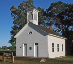 | District No. 1 School | building | 1980 | 80002078 |
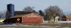 | Edward Erickson Farmstead | building | 1980 | 80002071 |
| Farmers Cooperative Mercantile Company of West Stanford | building | 80002079 | ||
 | Isanti County Courthouse | building | 1980 | 80002074 |
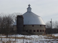 | Linden Barn | building | 1980 | 80002075 |
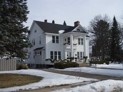 | Oscar Olson House | building | 1980 | 80002073 |
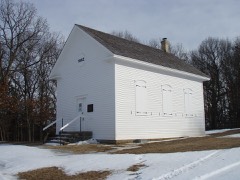 | St. John's Lutheran Church | building | 1980 | 80002072 |
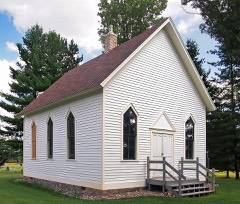 | Svenska Mission Kyrka i Sodre Maple Ridge | building | 1980 | 80002077 |
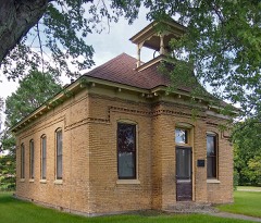 | West Riverside School | building | 1980 | 80002076 |
Every wildfire the federal occurrence database records inside this county: 781 of them, burning about 2,630 acres. 3 started naturally and 58 were recorded as arson. Each settlement page carries the fires within five miles of it.
| Reported cause | Fires |
|---|---|
| Debris and open burning | 408 |
| Missing data/not specified/undetermined | 115 |
| Equipment and vehicle use | 105 |
| Arson/incendiarism | 58 |
| Recreation and ceremony | 37 |
| Smoking | 19 |
| Railroad operations and maintenance | 14 |
| Misuse of fire by a minor | 11 |
| Fireworks | 5 |
| Power generation/transmission/distribution | 5 |
| Natural | 3 |
| Other causes | 1 |
The five largest, by the area the report gives. Two of them were set deliberately.
| Date | Cause | Size | Reported by | Name on the report |
|---|---|---|---|---|
| 10 April 2009 | Recreation and ceremony | 130 acres | Minnesota Department of Natural Resources | not named |
| 7 April 2004 | Arson/incendiarism | 99 acres | Minnesota Department of Natural Resources | not named |
| 20 April 2010 | Fireworks | 93 acres | Minnesota Department of Natural Resources | not named |
| 21 April 1993 | Equipment and vehicle use | 90 acres | Minnesota Department of Natural Resources | not named |
| 4 April 2005 | Recreation and ceremony | 70 acres | Minnesota Department of Natural Resources | not named |
| 19 March 2012 | Debris and open burning | 60 acres | Minnesota Department of Natural Resources | LOW RENT |
| 25 March 2016 | Smoking | 59 acres | Minnesota Department of Natural Resources | not named |
| 15 April 2009 | Arson/incendiarism | 52 acres | Minnesota Department of Natural Resources | not named |
Every settlement page carries the fires within five miles of it - see the settlement index below.
The NOAA Storm Events Database holds 225 reports for this county, causing no deaths, 4 injuries and about $2,750,500 in recorded property damage. Each settlement page carries the reports that name it.
| Kind of event | Reports |
|---|---|
| Hail | 99 |
| Thunderstorm Wind | 91 |
| Tornado | 14 |
| Heavy Rain | 10 |
| Flash Flood | 5 |
| Funnel Cloud | 5 |
| Lightning | 1 |
The most serious of them, by death, then injury, then recorded damage. The accounts are quoted exactly as the forecast office filed them.
| When | Event | Place named | Harm | What the report says |
|---|---|---|---|---|
| July 1995 | Tornado (F1) | Cambridge | 3 hurt, $1,500,000 | Tornado touched down one mile west of Cambridge and moved east through western and southern Cambridge. Lifted off ground 16 minutes later, about seven miles east of Cambridge. Twenty homes, two apartment buildings, a senior citizen center, a hospital and a water treatment plant were damaged or destroyed. Heaviest property damage in Carraige Hills Drive Housing Development. Agricultural damage to 500 acres. There were three minor injuries. |
| October 1996 | Tornado (F1) | Cambridge | 1 hurt | no account filed |
| July 2020 | Thunderstorm Wind | Springvale | $250,000 | A NWS Storm Survey indicated that numerous trees were blown down across north central and northeast Isanti County. The damage was in a swath about two miles wide. The hardest hit areas were west of Stanchfield, through the town, and to the east of Stanchfield. Several large sheds were also damaged in this area. |
| June 1981 | Tornado (F2) | not stated | $250,000 | no account filed |
| June 2001 | Tornado (F1) | Day | $200,000 | NWS damage survey indicated tornado trekked from 2 miles E of Day to the northeastern corner of Braham, exiting Isanti county at 1835 CST, and then headed into Kanabec county. Two barns were brought down, a dozen outbuildings damaged. Trees toppled, a few sheds were smashed, and siding was ripped off houses in the northwestern side of Braham. |
| May 2022 | Thunderstorm Wind | Cambridge | $100,000 | In addition to a trained spotter measured wind speed of 63 MPH east of Cambridge, several large trees were blown over at the Pine Village Mobile Home Park in Cambridge. |
| July 1997 | Flash Flood | Isanti | $100,000 | Estimate of four inches of rain in less than one hour. Major damage to wastewater treatment facility under construction. |
| May 2022 | Thunderstorm Wind | Braham | $50,000 | Several trees blew down near Braham, including damage to an outbuilding. |
| August 2018 | Hail | Carmody | $50,000 | A swath of large hail, up to golf ball size, continued into Isanti County from west of Day, to the far northeast corner near Braham. Vehicles were reported damage from the hail stones. |
| July 2011 | Tornado (EF0) | Carmody | $50,000 | An EF-0 tornado continued southeast across northwest Isanti County, before turning directly south along County Road 58 west of Dalbo, and north of Carmody, Minnesota. The tornado ended less than a half mile north of South Stanchfield Lake. The most intense damage occurred along County Road 58 where concentrated tree damage was present, along with a resident garage which was shifted off its foundation. Another resident had small structure damage to shingles or roof damage. Two trailers at this residences slid a short distance, while one of the trailers flipped over. Maximum wind speeds were 70 to 80 mph along with a path length of approximately 5 miles. |
| August 2002 | Thunderstorm Wind | Stanchfield | $50,000 | Roof blown off portion of church. |
| June 2001 | Hail | Braham | $50,000 | Numerous cars, windows, roofs and siding damaged. |
| July 2001 | Thunderstorm Wind | Cambridge | $50,000 | Bleachers blown over. Portion of Walmart greenhouse ripped off and destroyed. |
| May 2012 | Thunderstorm Wind | Spencer Brook | $25,000 | In addition to a private weather station that measured 75 mph peak wind gust, Spencer Brook had damage associated with a micro-burst. The severe winds caused three large trees to blow down, along with damage to a homes roof and siding. |
| May 2012 | Thunderstorm Wind | Isanti | $10,000 | Numerous reports of downed trees and power lines across southern Isanti County between Highway 47 and 65, north of 245 Street. |
| August 2022 | Flash Flood | Cambridge | $5,000 | Several observations from local media to law enforcement indicated flooding occurring in the Cambridge city limits. The local cooperative observer reported 4.38 inches of rainfall in less than 2 hours with pictures around the city indicating stalled cars in flooded roadways. In addition, a local business had water damage from the runoff. |
| August 2010 | Thunderstorm Wind | Oxlip | $5,000 | A few power lines were blown down due to severe straight-line winds. |
| July 2001 | Thunderstorm Wind | Cambridge | $5,000 | The swath of damaging wind that started 4 W Princeton in Mille Lacs County at 0400 persisted to just southwest of Cambridge. Numerous trees were felled. |
| September 2021 | Thunderstorm Wind | Bodum | $500 | Several tree branches were blown down between Cambridge and Isanti. Based on several wind sensors near the area, the highest wind gusts were around 40 mph. |
| June 2025 | Thunderstorm Wind | Isanti | - | Thunderstorm wind gust estimated at 65 mph downed a large tree across driveway. |
| June 2025 | Thunderstorm Wind | Cambridge Muni Arpt | - | Large tree branch snapped, about 6 inches in diameter. |
| August 2024 | Thunderstorm Wind | Blomford | - | Trees measuring 8 inches in diameter snapped halfway up from the base near Cty Rd 5 and Durant St. East of Isanti. |
| August 2024 | Thunderstorm Wind | Isanti | - | Delayed report of multiple large trees down throughout Isanti, time estimated from radar. |
| August 2024 | Thunderstorm Wind | Crown | - | Hundreds of trees were broken or uprooted from a downburst that spread out to be three or four miles wide. Some trees fell on houses, sheds, and vehicles. A neighborhood on the east side of Lake Francis was especially hard hit. The winds also blew portions of roofs off of several farm buildings. |
| August 2024 | Tornado (EF1) | Isanti | - | A tornado developed in Anoka County and moved through portions of Oak Grove, St Francis, and East Bethel before crossing into Isanti County. In Isanti County, twofarm outbuildings weredestroyed and a pole barnsustained roof damage. Hundreds of trees were also broken or uprooted. |
| September 2024 | Thunderstorm Wind | Oxlip | - | A photo showed a 10 inch diameter pine tree that was snapped. |
| July 2023 | Hail | Weber | - | Strong thunderstorm produced a combination of quarter size hail up to half-dollar size hail. |
| May 2022 | Thunderstorm Wind | Oxlip | - | Several dozen trees were blown down or uprooted on the northwest side of Long Lake and northeast of Lake Francis. |
| May 2022 | Thunderstorm Wind | Bradford | - | Several large tree branches were blown down in Bradford. |
| May 2022 | Thunderstorm Wind | Springvale | - | Wind damage to trees was noted on a social media video in Springvale Township, which is northwest of Cambridge. |
| May 2022 | Hail | Isanti | - | There was a social media picture of 1.5 inch hail. |
| May 2022 | Hail | Isanti | - | There was a social media picture of golf ball size hail. |
| May 2022 | Hail | Cambridge | - | There was a social media picture of 1.25 inch hail. |
| July 2020 | Tornado (EF1) | Day | - | The tornado made contact just west of Day and traveled just north of a few houses, then hit a farm where multiples trees were uprooted or broken. A partially filled grain bin was also blown off its foundation. The tornado continued across open fields and wooded areas before dissipating. An anemometer on the southern edge of the tornado measured 87 mph. |
| July 2020 | Hail | Isanti | - | There was a lot of smaller hail, but a few hail stones were as large as half dollar size. |
| July 2018 | Heavy Rain | Braham | - | A measured rainfall report of 3.07 inches fell west near Braham in 24 hours. |
| May 2018 | Thunderstorm Wind | Bradford | - | Sporadic trees and power lines were blown down around Bradford, Minnesota. |
| June 2016 | Thunderstorm Wind | Isanti | - | Several trees were blown down in the city of Isanti. |
| June 2016 | Thunderstorm Wind | Cambridge Muni Arpt | - | Several trees were blown down in the city of Cambridge, with portions of the city without power. |
| July 2016 | Funnel Cloud | Oxlip | - | A funnel was caught on video close to the ground near Marget Lake, but it could not be determined whether it touched down. |
| July 2016 | Thunderstorm Wind | Spencer Brook | - | Several large tree limbs and a few small trees were toppled near Spencer Brook. |
| July 2015 | Thunderstorm Wind | Cambridge Muni Arpt | - | A large tree was blown down near Cambridge. |
| July 2015 | Thunderstorm Wind | Braham | - | A large tree was uprooted near Braham. |
| June 2013 | Heavy Rain | Walbo | - | Storm total rainfall amount of 2.20 inches was measured near Walbo. |
| September 2013 | Thunderstorm Wind | Crown | - | Several large trees were blown down across southwestern Isanti County. |
| May 2012 | Heavy Rain | Pine Brook | - | A local observer measured 3.60 inches in the last 24 hours. |
| May 2012 | Heavy Rain | Dalbo | - | A local observer measured 4.25 inches in the last 24 hours. |
| May 2012 | Heavy Rain | Oxlip | - | A local observer measured 5.50 inches in the last 24 hours. |
| May 2012 | Thunderstorm Wind | Blomford | - | A storm survey was conducted in eastern Isanti County and revealed storm damage to areas east of Blomford, Minnesota. Several trees were uprooted east of Blomford, Minnesota. |
| August 2012 | Thunderstorm Wind | Cambridge | - | A large tree was blown down on Emerson Avenue. |
| June 2012 | Thunderstorm Wind | Crown | - | Several large tree branches were blown down at the intersection of Highway 47, and County Road 53. |
| July 2011 | Thunderstorm Wind | Cambridge Muni Arpt | - | Nearly 1,000 trees fell in a heavily wooded area along an 1/8-mile stretch of gravel road in the Cambridge, Minnesota area. |
| July 2011 | Thunderstorm Wind | Isanti | - | Several large tree limbs were blown down near Isanti, Minnesota. |
| July 2011 | Thunderstorm Wind | Cambridge | - | The wind was measured by a trained spotter. |
| July 2011 | Thunderstorm Wind | Weber | - | Several trees were blown down southwest of North Branch, Minnesota. |
| August 2011 | Thunderstorm Wind | Crown | - | Several large tree branches were blown down east of Crown. |
| August 2011 | Thunderstorm Wind | Isanti | - | Several large trees were blown down south of Isanti. |
| August 2011 | Thunderstorm Wind | Isanti | - | Multiple trees were blown down near Isanti. |
| July 2011 | Thunderstorm Wind | Carmody | - | Scattered downburst wind damage occurred in much of Dalbo Township, northwest of the town of Dalbo. Damage was confined to trees and crops. The most concentrated damage occurred north of County Road 13, near 389th Avenue Northwest, eastward to Xenon Street Northwest. |
| June 2010 | Heavy Rain | Pine Brook | - | A local observer reported 4.10 inches of rain west of Cambridge between 230 and 430 am. |
The Survey's mineral resources record lists 1 working inside this county. It is closed or unrecorded. Each settlement page carries the workings within five miles of it.
| Commodity | Workings |
|---|---|
| Peat | 1 |
The least common of them first, because a county's hundredth gravel pit says nothing its first ten did not.
| Where | Site | Commodity | Status | Recorded |
|---|---|---|---|---|
| Isanti County Peat Bogs | Peat | Past Producer |
Named settlements recorded in the Geographic Names Information System, each with the topographic sheets covering it. Villages, hamlets and abandoned places alike. Each is shown with the nearest named watercourse or landform and the survey quadrangle it falls on.
Spencer Brook township · 55371 · On Spencer Brook · Wyanett quadrangle
12 sheets, 1953 to 1991
Spencer Brook township · 55008 · On Green Lake Brook · Wyanett quadrangle
12 sheets, 1953 to 1991