 Block
From the record
2 National Register listings published here.
Sources: the National Register database, National Park Service
30 topographic sheets cover 12 settlements here, and 2 properties are on the National Register of Historic Places.
2 National Register listings published here.
Sources: the National Register database, National Park Service
Every property in this county listed on the National Register of Historic Places, with the year it was listed and the federal nomination document.
| Photograph | Property | Type | Listed | Reference |
|---|---|---|---|---|
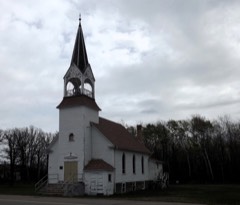 | Clearwater Evangelical Lutheran Church | building | 1999 | 99001386 |
 | Red Lake County Courthouse | building | 1983 | 83000941 |
Every wildfire the federal occurrence database records inside this county: 8 of them, burning about 123 acres. None started naturally and 1 was recorded as arson. Each settlement page carries the fires within five miles of it.
| Reported cause | Fires |
|---|---|
| Misuse of fire by a minor | 3 |
| Missing data/not specified/undetermined | 2 |
| Debris and open burning | 2 |
| Arson/incendiarism | 1 |
The five largest, by the area the report gives. One of them was set deliberately.
| Date | Cause | Size | Reported by | Name on the report |
|---|---|---|---|---|
| 1 October 2012 | Missing data/not specified/undetermined | 94 acres | Glacial Ridge | RED LAKE FIRE |
| 15 August 2013 | Debris and open burning | 20 acres | Minnesota Department of Natural Resources | not named |
| 5 May 2011 | Arson/incendiarism | 4.0 acres | Red Lake Agency | RED LAKE 192 |
| 6 May 1995 | Misuse of fire by a minor | 2.0 acres | Red Lake Agency | R257 |
| 15 October 1996 | Debris and open burning | 2.0 acres | Red Lake Agency | R260 |
| 1 April 1992 | Misuse of fire by a minor | under an acre | Red Lake Agency | not named |
| 26 May 1996 | Misuse of fire by a minor | under an acre | Red Lake Agency | R191 |
| 20 March 2016 | Missing data/not specified/undetermined | under an acre | Glacial Ridge | DITCH 64 |
Every settlement page carries the fires within five miles of it - see the settlement index below.
The NOAA Storm Events Database holds 216 reports for this county, causing no deaths, 1 injury and about $4,047,700 in recorded property damage. Each settlement page carries the reports that name it.
| Kind of event | Reports |
|---|---|
| Hail | 112 |
| Thunderstorm Wind | 63 |
| Tornado | 20 |
| Flash Flood | 13 |
| Flood | 5 |
| Funnel Cloud | 2 |
| Lightning | 1 |
The most serious of them, by death, then injury, then recorded damage. The accounts are quoted exactly as the forecast office filed them.
| When | Event | Place named | Harm | What the report says |
|---|---|---|---|---|
| June 2010 | Tornado (EF1) | Dorothy | 1 hurt | This tornado tracked northeastward for roughly 2 miles. The tornado blew a parked semi tractor-trailer rig off the highway and injured the driver. Peak winds were estimated at 90 mph. |
| July 1980 | Tornado (F2) | not stated | $2,500,000 | no account filed |
| August 2001 | Thunderstorm Wind | Oklee | $500,000 | The roof was torn off a new apartment building and blown into a field. Many trees were blown down, some into homes and powerlines. The roof was torn off of one mobile home while another was flipped over. 13 grain bins were damaged, 6 completely destroyed. The county highway department building was reduced to rubble and one truck inside was damaged. |
| April 2022 | Flash Flood | Terrebonne | $250,000 | Portions of County Road 92, between Plummer and Red Lake Falls were closed off due to debris jams and flooding along the Clearwater River. The Clearwater River at Plummer rose over 6 feet by the evening of the 23rd, due to the combination of a rapid snowmelt and from 1 to 2 inches of rainfall in the river basin. |
| August 2001 | Thunderstorm Wind | Oklee | $150,000 | 8 grain bins were damaged and a semi trailer was overturned. |
| August 2001 | Thunderstorm Wind | Brooks | $125,000 | 6 large grain bins were destroyed. |
| August 2001 | Thunderstorm Wind | Red Lake Falls | $110,000 | An airplane hanger and a crop dusting airplane were destroyed by the strong wind. |
| April 2006 | Flood | Countywide | $109,000 | Due to the quick snowmelt, water quickly drained into low areas, damaging many roads and bridges around the county. Red Lake County received a Presidential Disaster Declaration for damages caused by spring flooding. |
| June 2002 | Lightning | Red Lake Falls | $100,000 | Lightning hit the county courthouse, which also houses the sheriff's department. The department's computers, phone lines, and 911 system were damaged. |
| May 2001 | Thunderstorm Wind | Dorothy | $30,000 | A barn roof was torn off and thrown in a nearby ditch, damaging the top of a silo as it went by. |
| August 2001 | Thunderstorm Wind | Red Lake Falls | $25,000 | A pole barn sustained roof and door damage and a communications tower was blown over. |
| June 1978 | Tornado (F2) | not stated | $25,000 | no account filed |
| July 1967 | Tornado (F1) | not stated | $25,000 | no account filed |
| July 2006 | Tornado (F0) | Huot | $20,000 | A tornado touched down intermittently along a 2.5 mile track to the south, which began in Red Lake county and ended in Polk county. The tornado swirled swaths of grain and flipped a shed door up onto the shed roof. It also broke off numerous large tree branches in shelterbelts along its path. Peak wind speeds were estimated at 65 mph. |
| May 2001 | Hail | Red Lake Falls | $20,000 | Eight windows in a house, 2 garage windows, and a car window were broken by the large hail. |
| August 2001 | Thunderstorm Wind | Red Lake Falls | $15,000 | A 3 stall garage was destroyed. |
| May 2010 | Flash Flood | Plummer | $10,000 | Numerous farm fields were flooded across the central and eastern portions of Red Lake County. |
| May 2010 | Flash Flood | Red Lake Falls | $5,000 | Several sections of farm land were flooded by excessive rainfall. A few farm access roads were also under water. |
| May 1998 | Thunderstorm Wind | Oklee | $5,000 | The strong wind blew a trailer off its foundation and its entryway was blown off. Several trees were blown over and a pole shed was damaged. |
| April 2009 | Flood | Wylie | $5,000 | no account filed |
| March 2009 | Flood | Dorothy | $5,000 | no account filed |
| August 2001 | Thunderstorm Wind | Brooks | $3,000 | Numerous trees were blown down. |
| June 1975 | Tornado (F0) | not stated | $2,500 | no account filed |
| July 2006 | Tornado (F0) | Red Lake Falls | $2,000 | The tornado continued intermittently along the 2.5 mile damage track. Numerous large tree branches were broken off in shelterbelts along the track and large hay bales were tumbled around. Peak winds were estimated at about 70 mph. |
| July 2001 | Flash Flood | Red Lake Falls | $2,000 | Street flooding was reported in Red Lake Falls. |
| July 1997 | Thunderstorm Wind | Huot | $2,000 | Strong wind blew over a shed and several trees. |
| July 2001 | Flash Flood | Plummer | $1,000 | Water was reported over Highway 1. |
| July 2001 | Thunderstorm Wind | Oklee | $500 | Branches were blown down. |
| July 1997 | Thunderstorm Wind | Dorothy | $500 | no account filed |
| May 2002 | Thunderstorm Wind | Red Lake Falls | $200 | A large tree was blown down. |
| August 2025 | Hail | Plummer | - | Measured hail stone shown with ruler in picture shared on social media south of Plummer. Hail stone was picked up 45 minutes after it fell. Time estimated by radar. |
| August 2025 | Hail | Oklee | - | Report of quarter size hail in Oklee. |
| August 2025 | Thunderstorm Wind | Red Lake Falls | - | Roofing panels blown off 3 buildings on the west side of Red Lake Falls. Time estimated from radar. |
| August 2025 | Hail | Red Lake Falls | - | Hail fell for 15 minutes with largest hail stones up to 2 inches in Red Lake Falls. Time estimated by radar. |
| June 2025 | Thunderstorm Wind | Brooks | - | MN dot mesonet station MN068 Brooks, MN. |
| June 2025 | Thunderstorm Wind | Brooks | - | Measured gust at MN dot MN068 Brooks, MN. |
| August 2023 | Hail | Perault | - | Public reports quarter sized hail 5 SSW Red Lake Falls. States beans and corn crop suffered damage. Beans stripped to the stems. |
| June 2022 | Hail | Brooks | - | Hail Quarter To Golf Ball Sized. Trees Uprooted. Reports And Photos Posted To Social Media. |
| June 2022 | Thunderstorm Wind | Brooks | - | Multiple semi truck trailer combinations were blown off hwy 59, between Brooks and Plummer. Time estimated based on radar. |
| June 2022 | Thunderstorm Wind | Oklee | - | Semi truck trailer combination blown over near Oklee. Numerous large trees snapped or uprooted across lambert township. Several farmstead steel grain bins caved in, at least one collapsed. Thunderstorm wind gusts estimated from 80 to 90 mph in a 2 to 3 mile wide path. Winds in excess of 60 mph were reported over a several mile wide area. Time estimated based on radar. |
| June 2022 | Thunderstorm Wind | Oklee | - | Numerous poplar, ash, box elder, and spruce trees were snapped or uprooted across farmsteads in Garnes and Equality townships between 440 and 448 pm cdt. A pole shed was blown open and metal sheathing and roofing spread downwind for over half a mile. |
| May 2022 | Hail | Oklee | - | Received a video of very heavy rain accompanied by 1-inch hail via social media. |
| June 2022 | Thunderstorm Wind | Brooks | - | Peak wind was measured at a MNDOT RWIS station on Hwy 59. |
| June 2022 | Hail | Oklee | - | Photo and report of 1 inch hail was received via social media. Time estimated based on radar. |
| May 2022 | Hail | Oklee | - | Hail ranging from the size of ping pong balls to golf balls was reported, with photos sent via social media. |
| July 2022 | Thunderstorm Wind | Oklee | - | Received a report of large tree branches and limbs broken. Power outages reported. |
| July 2022 | Hail | Red Lake Falls Arpt | - | Received a public report of heavy rain and hail up to the size of quarters. |
| July 2022 | Hail | Plummer | - | Received a public report of up to penny sized hail and very heavy rain. |
| September 2020 | Thunderstorm Wind | Red Lake Falls | - | The wind gust was estimated. |
| September 2020 | Thunderstorm Wind | Terrebonne | - | The wind gust was measured by a personal weather station. |
| June 2020 | Thunderstorm Wind | Brooks | - | Large branches were blown down and numerous power outages were reported. |
| June 2020 | Thunderstorm Wind | Plummer | - | A few large tree branches were blown down in shelterbelts. |
| August 2020 | Hail | Oklee | - | Dime to quarter sized hail fell. |
| September 2019 | Hail | Dorothy | - | Winds also gusted to around 50 mph. |
| June 2018 | Thunderstorm Wind | Brooks | - | The wind gust was measured by a MNDOT RWIS sensor. |
| September 2017 | Thunderstorm Wind | Brooks | - | Numerous four to six inch diameter tree branches were broken down in shelterbelts across southern Poplar River Township. A nearby MNDOT RWIS mesonet station also lost power. |
| May 2016 | Tornado (EF0) | Oklee | - | Two funnel clouds were noted between Brooks and Oklee between 110 and 115 PM CST, with at least one brief touchdown reported in an open field. |
| July 2016 | Thunderstorm Wind | Red Lake Falls | - | Many large tree branches were blown down. Large sections of roofing were peeled off a warehouse on the south side of town. |
| July 2016 | Tornado (EF1) | Dorothy | - | The tornado began in Polk County, and tracked intermittently for about five miles to two miles southeast of Dorothy, in Red Lake County. The tornado blew down numerous large trees in shelterbelts, rolled a horse trailer, blew apart a calf shed, and blew down a hay shed. Peak winds were estimated at 90 mph. |
| August 2015 | Thunderstorm Wind | Oklee | - | Numerous large tree branches and limbs were broken down across portions of Roland Township, resulting in widespread power outages. |
The Survey's mineral resources record lists 2 workings inside this county. All of them still produce. Each settlement page carries the workings within five miles of it.
| Commodity | Workings |
|---|---|
| Sand and Gravel, Construction | 2 |
The least common of them first, because a county's hundredth gravel pit says nothing its first ten did not.
| Where | Site | Commodity | Status | Recorded |
|---|---|---|---|---|
| Bradshaw Gravel Pit & Mill | Sand and Gravel, Construction | Producer | ||
| County Hwy Pit | Sand and Gravel, Construction | Producer |
Named settlements recorded in the Geographic Names Information System, each with the topographic sheets covering it. Villages, hamlets and abandoned places alike. Each is shown with the nearest named watercourse or landform and the survey quadrangle it falls on.
Red Lake Falls city · 56750 · On Clearwater River · Red Lake Falls quadrangle
10 sheets, 1918 to 1984
Terrebonne township · 56750 · On Terrebonne Creek · Terrebonne quadrangle
10 sheets, 1918 to 1984