 Block
Biscay, Minnesota
10 topographic sheets cover this place, the earliest surveyed in 1953 and the latest in 1986. It stands in Biscay City. It lies in ZIP code area 55336. The Survey maps it on the Biscay quadrangle. 113 people lived here at the 2020 count. It stands 1,024 feet above sea level.
Population over time
2 figuresBiscay grew from 113 to 113 between 2010 and 2020. These are the recorded population figures Wikidata holds for this place, reached through the Geographic Names Information System number this page is keyed on rather than by name, so they belong to this place and not to another of the same name. Most are census counts, but not all are: an early figure may be a founding or settlement estimate, and an estimate published within five years of a census is left out. The change column is computed, and is left blank where more than 20 years separate a figure from the one before it, because a gap that long is not a change between two counts.
| Year | People | Change |
|---|---|---|
| 2010 | 113 | |
| 2020 | 113 | 0 (0%) |
Topographic sheets covering this place
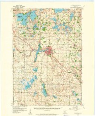
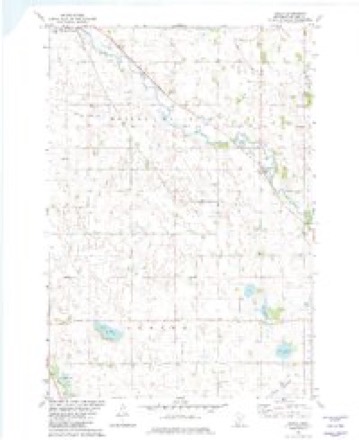
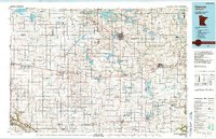
7 surveys from 10 printed sheetsMatched by testing this settlement's coordinate against the published boundary of every sheet in the United States Geological Survey's historical collection. Each opens the scanned sheet at the Survey.
- 1953 USGS New Ulm quadrangle1:250000, 3 printings
- 1957 USGS New Ulm quadrangle1:250000
- 1958 USGS Hutchinson quadrangle1:62500
- 1958 USGS New Ulm quadrangle1:250000
- 1967 USGS New Ulm quadrangle1:250000
- 1982 USGS Biscay quadrangle1:24000
- 1986 USGS Glencoe quadrangle1:100000, 2 printings




In the county-history sources
1,690 words on this townshipHistory of McLeod County, Minnesota, published 1917 names this settlement in its chapter on Biscay City. These are the passages that mention it, exactly as the scans read.
The village of Biscay, which is the principal market place of the beautiful and fertile township of Hassan Valley, is situated in the southeast portion of the town on the Chicago, Milwaukee & St. Paul Railway, and is the home of the first cooperative creamery organized in Minnesota. Land in the Vicinity sells at from $65 to $125 per acre, and the surrounding country is occupied by well cultivated farms, the dairy interests being in a particularly flourishing condition. The village has a present population of about 100.
Passage source: History of McLeod County, Minnesota, published 1917.
The Biscay post office was established in 1889 and was at first located in the elevator office. John Kennedy, the first postmaster, served until November 10, 1910, when he was succeeded by John M. Kennedy, who had charge of the mails until November 21, 1911. From that time until March 1, 1912, the acting postmaster was Daniel Kennedy. Frank A. Osmek was then appointed postmaster and has served up to the present time, being assisted by his wife. The second location of the office was in the railroad depot. Afterwards it was located in the creamery and also for awhile in the mill, being then removed to the store owned by J. Kennedy. On March 1, 1912, a transfer of location was made to the old Danek building, formerly occupied by the bank, and about July 1, it was moved to its present location in the dwelling owned by the postmaster, August 1, 1906, it became a registered letter and money order office and at the same time the rural route was established, R. Engel being the present carrier.
Passage source: History of McLeod County, Minnesota, published 1917.
The First State Bank of Biscay was incorporated February 1, 1909, by Lyman Wakefield, of Minneapolis; Charles Fiman, of Hutchinson; Sam G. Anderson, of Hutchinson; John Kennedy, of Biseay; Henry Ulrich, of Biscay; William Schultz, of Biscay; and Frank J. Kolar, Jy., of Biscay. The first officers and directors were as follows: John Kennedy, president; Sam G. Anderson, Jr., vice-president; Charles Fiman, cashier; John Kennedy, Sam G. Anderson, Jr., Lyman E. Wakefield, Charles Fiman, Frank J. Kolar, Jv., Henry Ulrich, and William Schultz. On February 17, 1909, the bank opened its doors for business. The subsequent changes in the official staff and directorate have been as follows: November 30, 1909, William Schultz was elected president in place of John Kennedy, deceased. Robert Vollmer became cashier August 16, 1911. January 9, 1912, the directors elected were: A. H. Ames, 8. G. Anderson, Jy., Lyman E. Wakefield, William Schultz, Henry Ulrich, Geo. A. Holmes and Robert Vollmer. E.B.J. Rouf was elected caghier May 28, 1913, the new directors being William Schultz, Frank A, Osmek, George A. Holmes, Theo, Filk, Sam G. Andergon, Jr., John Tesmer, W. E. Jergens. June 13, 1914, M. CG. Kimm was elected cashier, the new officers being' William Schuliz, president; George A. Holmes, vice-president; M. G. Kimm, cashier. Directors, William Schultz, Theo, Filk, George A, Holmes, M. G. Kimm, F. A. Osmek, W. E, Jergens, and John
Passage source: History of McLeod County, Minnesota, published 1917.
Machine-read from a century-old scan, so expect the errors a machine makes: misspelled names, dropped words, stray characters.
Read the whole chapter on Biscay City - it names this place 2 more 2 times.
Fires near this place
1 since 2012Regional context, not property-specific evidence. The federal wildfire occurrence database lists 1 fire within 5 miles of Biscay in 2012, burning about 23 acres in total. None started naturally. None was recorded as arson. Distance is straight-line from the map coordinates, so a fire counted here may appear on a neighbouring settlement's page as well.
| Reported cause | Fires |
|---|---|
| Debris and open burning | 1 |
The most recent of them, most recent first, with the day each was reported and the service that recorded it.
| Date | Cause | Size | Reported by | Name on the report |
|---|---|---|---|---|
| 4 December 2012 | Debris and open burning | 23 acres | Minnesota Department of Natural Resources | not named |
Settlements close enough to share some of these fires:
Mines and quarries near this place
1 within 5 milesRegional context, not property-specific evidence. The federal mineral resources record lists 1 working within 5 miles of Biscay: 1 producer. All of them still produce. What was taken out: Sand and Gravel, Construction. Distance is straight-line from the map coordinates, so a quarry counted here may appear on a neighbouring settlement's page as well.
| Where | Site | Commodity | Status | Recorded |
|---|---|---|---|---|
| Jergens Pit and Mill | Sand and Gravel, Construction | Producer |
Storms near this place
16 since 2000Regional context, not property-specific evidence. The National Weather Service names Biscay in 16 storm reports between 2000 and 2023: 9 hail, 4 tornado, 2 thunderstorm wind, 1 flash flood. No death or injury is recorded in these reports. Each account below is quoted exactly as the forecast office filed it, from the NOAA Storm Events Database, and each date opens the federal record of that event.
| When | Event | Place named | Harm | What the report says |
|---|---|---|---|---|
| August 2020 | Tornado (EF1) | Biscay | $250,000 | An NWS survey found damage consistent with an EF-1 tornado in Mcleod County between Biscay and Glencoe. Maximum wind speeds of 95 MPH snapped and uprooted several trees and damaged outbuildings. There were numerous photos and videos of this tornado shared on social media. |
| July 2019 | Tornado (EF0) | Biscay | - | An EF0 tornado developed 3 miles southwest of Biscay and tracked northeast to just north of Biscay, Minnesota before dissipating. Corn was flattened along the path and some trees were uprooted near Minnesota Highway 22, and 150th Street. The maximum wind speed was estimated at 85 mph. |
| August 2017 | Tornado (EF0) | Biscay | - | A brief EF0 tornado between Hutchinson and Biscay. It tracked through corn fields and damaged a few trees. |
| September 2014 | Thunderstorm Wind | Biscay | - | A large tree branch was blown off in the town of Biscay. |
| June 2012 | Flash Flood | Biscay | - | Highway 22, between County Road 11 and 67, northwest of Biscay was closed due to flooding. The public reported up to 5 feet of water over the roadway. |
| September 2006 | Tornado (F0) | Biscay | - | An NWS damage survey confirmed that a tornado tore through corn and bean fields. It dissipated about 100 feet west of a rural Biscay church. |
| April 2004 | Thunderstorm Wind | Biscay | - | A corn crib was destroyed and a barn was blown 6 feet off its stone foundation. Trees were downed in the vicinity. |
| June 2023 | Hail | Biscay | - | no account filed |
| August 2020 | Hail | Biscay | - | no account filed |
| April 2012 | Hail | Biscay | - | no account filed |
| August 2007 | Hail | Biscay | - | no account filed |
| April 2004 | Hail | Biscay | - | no account filed |
| June 2004 | Hail | Biscay | - | no account filed |
| July 2003 | Hail | Biscay | - | no account filed |
| August 2002 | Hail | Biscay | - | no account filed |
| May 2000 | Hail | Biscay | - | no account filed |
Nearest settlements
The eight closest, with where each one stands in the county. Distances are straight-line, computed from the Geographic Names Information System coordinates.
| Map | Place | Distance | Sheets |
|---|---|---|---|
| Koniska | 3.3 miles | 10 | |
| Komensky | 5.5 miles | 11 | |
| South Silver Lake | 5.6 miles | 10 | |
| Sumter | 6.1 miles | 10 | |
| Hutchinson | 6.5 miles | 11 | |
| Heatwole | 6.6 miles | 10 | |
| Silver Lake | 6.7 miles | 10 | |
| Glencoe | 7.7 miles | 10 |
Elsewhere
Matched on this settlement's Geographic Names Information System number rather than its name, so it cannot be a different place of the same name in another state.
| Wikipedia article on Biscay | An encyclopaedic summary. Its text is share-alike, so it is linked here rather than copied. |
| Wikidata item Q2231801 | The structured record the population and elevation above come from. Public domain (CC0). |
Provenance
This settlement is recorded in the Geographic Names Information System as feature 655408. The sheet list is computed by point-in-boundary test against the United States Geological Survey's historical topographic inventory. Both are works of the United States government and carry no copyright under 17 U.S.C. 105.
Wildfire. Short, Karen C. 2022. Spatial wildfire occurrence data for the United States, 1992-2020 [FPA_FOD_20221014]. 6th Edition. Fort Collins, CO: Forest Service Research Data Archive. https://doi.org/10.2737/RDS-2013-0009.6 Collected with United States Government funding and usable without additional permissions or fees.
Mines and quarries. USGS Mineral Resources Data System (MRDS) https://mrdata.usgs.gov/mrds/ A work of the United States government, no copyright under 17 U.S.C. 105.
Storms. NOAA National Centers for Environmental Information, Storm Events Database https://www.ncei.noaa.gov/stormevents/ A work of the United States government, no copyright under 17 U.S.C. 105. Narratives are quoted verbatim from the National Weather Service report and are not edited or summarised.