 Block
Boyd, Minnesota
9 topographic sheets cover this place, the earliest surveyed in 1953 and the latest in 1986. It stands in Ten Mile Lake Township. It lies in ZIP code area 56218. The Survey maps it on the Boyd quadrangle. 141 people lived here at the 2020 count. It stands 1,050 feet above sea level.
Population over time
2 figuresBoyd fell from 175 to 141 between 2010 and 2020. These are the recorded population figures Wikidata holds for this place, reached through the Geographic Names Information System number this page is keyed on rather than by name, so they belong to this place and not to another of the same name. Most are census counts, but not all are: an early figure may be a founding or settlement estimate, and an estimate published within five years of a census is left out. The change column is computed, and is left blank where more than 20 years separate a figure from the one before it, because a gap that long is not a change between two counts.
| Year | People | Change |
|---|---|---|
| 2010 | 175 | |
| 2020 | 141 | -34 (-19%) |
Topographic sheets covering this place
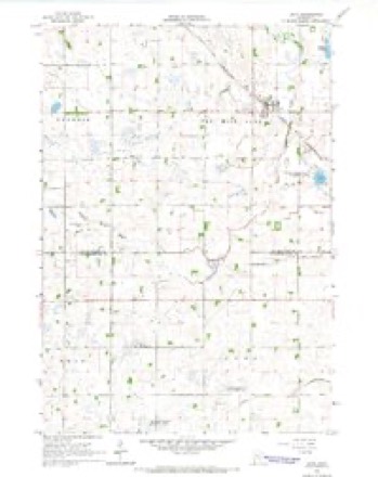
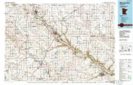
6 surveys from 9 printed sheetsMatched by testing this settlement's coordinate against the published boundary of every sheet in the United States Geological Survey's historical collection. Each opens the scanned sheet at the Survey.
- 1953 USGS New Ulm quadrangle1:250000, 3 printings
- 1957 USGS New Ulm quadrangle1:250000
- 1958 USGS New Ulm quadrangle1:250000
- 1965 USGS Boyd quadrangle1:24000
- 1967 USGS New Ulm quadrangle1:250000
- 1986 USGS Montevideo quadrangle1:100000, 2 printings




Storms near this place
38 since 2000Regional context, not property-specific evidence. The National Weather Service names Boyd in 38 storm reports between 2000 and 2023: 24 hail, 9 thunderstorm wind, 2 tornado, 2 funnel cloud. No death or injury is recorded in these reports. Each account below is quoted exactly as the forecast office filed it, from the NOAA Storm Events Database, and each date opens the federal record of that event.
| When | Event | Place named | Harm | What the report says |
|---|---|---|---|---|
| March 2010 | Flood | Boyd | $515,000 | Several county roads became inundated due to flood waters along the Minnesota River.||Monetary costs were based on FEMA, State, and Local assistance which includes the following categories; debris removal, emergency protective measures, road systems and bridges, water control facilities, and utilities. |
| June 2002 | Tornado (F1) | Boyd | $10,000 | Tornado embedded within a rain-wrapped storm was videotaped as it crossed open country. The tornado continued into Yellow Medicine County. |
| May 2023 | Hail | Boyd | - | CoCoRaHS observer recorded quarter size hail 4 miles WSW of Watson, MN. This cell would continue northward across county lines into Chippewa County before weakening. |
| May 2022 | Thunderstorm Wind | Boyd | - | Several tops of pine trees were snapped off near Boyd. |
| May 2022 | Thunderstorm Wind | Boyd | - | A large pine tree was blown down northeast of Boyd. |
| May 2022 | Hail | Boyd | - | There was a social media picture of 3 inch hail. |
| June 2017 | Thunderstorm Wind | Boyd | - | Large branches were blown down. |
| June 2015 | Thunderstorm Wind | Boyd | - | A measured wind gust of 56 knots occurred northwest of Boyd. |
| July 2015 | Thunderstorm Wind | Boyd | - | A measured wind gust of 54 knots was reported by a trained spotter with a private weather station northwest of Boyd. |
| July 2008 | Hail | Boyd | - | In addition winds estimated between 50 and 55 mph. |
| July 2007 | Funnel Cloud | Boyd | - | Funnel was spotted over the southwestern portion of the city. |
| June 2006 | Hail | Boyd | - | Some crops had significant damage. Siding dented. Some vehicles damaged. |
| June 2006 | Thunderstorm Wind | Boyd | - | Several trees down. |
| May 2006 | Thunderstorm Wind | Boyd | - | USPS truck blown over, several large trees toppled, some sheared off 10 to 12 feet from the ground, large area of corn stalks flattened. |
| May 2006 | Thunderstorm Wind | Boyd | - | Thin metal border on side of roof blown off house. |
| May 2005 | Hail | Boyd | - | A deputy sheriff reported nickel sized hail. |
| June 2005 | Hail | Boyd | - | Quarter sized hail dented cars and broke windows. |
| September 2005 | Hail | Boyd | - | Golf ball to baseball sized hail fell in and just east of Boyd. |
| September 2005 | Funnel Cloud | Boyd | - | A trained spotter reported a funnel cloud with the storm that produced baseball sized hail just east of Boyd. This storm was the same one that dropped a tornado 8 miles northwest of Granite Falls less than one half hour later. |
| June 2002 | Thunderstorm Wind | Boyd | - | Few trees down, including one through roof of house. |
| July 2000 | Tornado (F0) | Boyd | - | Minor crop damage. |
| May 2022 | Hail | Boyd | - | no account filed |
| May 2022 | Hail | Boyd | - | no account filed |
| August 2020 | Hail | Boyd | - | no account filed |
| June 2017 | Hail | Boyd | - | no account filed |
| June 2015 | Hail | Boyd | - | no account filed |
| July 2007 | Hail | Boyd | - | no account filed |
| May 2006 | Hail | Boyd | - | no account filed |
| July 2006 | Hail | Boyd | - | no account filed |
| May 2006 | Hail | Boyd | - | no account filed |
| July 2006 | Hail | Boyd | - | no account filed |
| July 2006 | Hail | Boyd | - | no account filed |
| July 2004 | Hail | Boyd | - | no account filed |
| June 2004 | Hail | Boyd | - | no account filed |
| June 2002 | Hail | Boyd | - | no account filed |
| June 2002 | Hail | Boyd | - | no account filed |
| May 2000 | Hail | Boyd | - | no account filed |
| May 2000 | Hail | Boyd | - | no account filed |
Nearest settlements
The eight closest, with where each one stands in the county. Distances are straight-line, computed from the Geographic Names Information System coordinates.
| Map | Place | Distance | Sheets |
|---|---|---|---|
| Dawson | 9.9 miles | 8 | |
| Lac qui Parle | 10.5 miles | 9 | |
| Providence | 11.2 miles | 8 | |
| Cerro Gordo | 15.6 miles | 6 | |
| Madison | 19.1 miles | 6 | |
| Haydenville | 24.2 miles | 7 | |
| Louisburg | 26.1 miles | 6 | |
| Bellingham | 28.4 miles | 7 |
Elsewhere
Matched on this settlement's Geographic Names Information System number rather than its name, so it cannot be a different place of the same name in another state.
| Wikipedia article on Boyd | An encyclopaedic summary. Its text is share-alike, so it is linked here rather than copied. |
| Wikidata item Q2334000 | The structured record the population and elevation above come from. Public domain (CC0). |
Provenance
This settlement is recorded in the Geographic Names Information System as feature 640405. The sheet list is computed by point-in-boundary test against the United States Geological Survey's historical topographic inventory. Both are works of the United States government and carry no copyright under 17 U.S.C. 105.
Storms. NOAA National Centers for Environmental Information, Storm Events Database https://www.ncei.noaa.gov/stormevents/ A work of the United States government, no copyright under 17 U.S.C. 105. Narratives are quoted verbatim from the National Weather Service report and are not edited or summarised.