 Block
Gaylord, Minnesota
11 topographic sheets cover this place, the earliest surveyed in 1953 and the latest in 1986. It stands in Gaylord City. It lies in ZIP code area 55334. The Survey maps it on the Gaylord quadrangle. 2,273 people lived here at the 2020 count. It stands 1,014 feet above sea level.
Research this city
On record in Gaylord
Buildings and businesses the archive holds for this place. Each opens its own page, with the source record it came from.
On the National Register 2 records
 Gaylord City Parklisted 2012
 Sibley County Courthouse and Sheriff's Residence and Jaillisted 1988
Population over time
2 figuresGaylord fell from 2,305 to 2,273 between 2010 and 2020. These are the recorded population figures Wikidata holds for this place, reached through the Geographic Names Information System number this page is keyed on rather than by name, so they belong to this place and not to another of the same name. Most are census counts, but not all are: an early figure may be a founding or settlement estimate, and an estimate published within five years of a census is left out. The change column is computed, and is left blank where more than 20 years separate a figure from the one before it, because a gap that long is not a change between two counts.
| Year | People | Change |
|---|---|---|
| 2010 | 2,305 | |
| 2020 | 2,273 | -32 (-1%) |
Topographic sheets covering this place
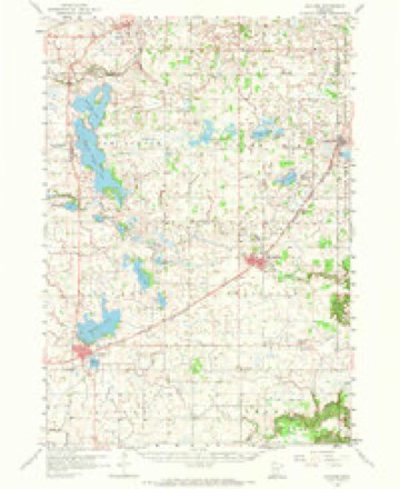
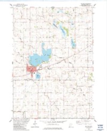
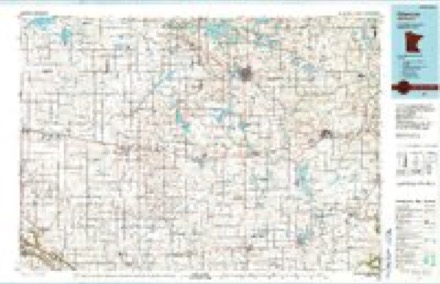
7 surveys from 11 printed sheetsMatched by testing this settlement's coordinate against the published boundary of every sheet in the United States Geological Survey's historical collection. Each opens the scanned sheet at the Survey.
- 1953 USGS New Ulm quadrangle1:250000, 3 printings
- 1957 USGS New Ulm quadrangle1:250000
- 1958 USGS Gaylord quadrangle1:62500, 2 printings
- 1958 USGS New Ulm quadrangle1:250000
- 1967 USGS New Ulm quadrangle1:250000
- 1982 USGS Gaylord quadrangle1:24000
- 1986 USGS Glencoe quadrangle1:100000, 2 printings




Storms near this place
51 since 1994Regional context, not property-specific evidence. The National Weather Service names Gaylord in 51 storm reports between 1994 and 2025: 18 thunderstorm wind, 16 hail, 8 tornado, 5 funnel cloud. No death or injury is recorded in these reports. Each account below is quoted exactly as the forecast office filed it, from the NOAA Storm Events Database, and each date opens the federal record of that event.
| When | Event | Place named | Harm | What the report says |
|---|---|---|---|---|
| June 2019 | Thunderstorm Wind | Gaylord | $50,000 | A machine shed was completed destroyed on a farm 3 miles southeast of Gaylord, near the intersection of County Road 13, and 62. There were also power lines blown down in Gaylord. Two cows also perished at this farm. |
| July 2019 | Thunderstorm Wind | Gaylord | $15,000 | A 20 foot tall tree was snapped, and fell onto a minivan in Gaylord. |
| June 2010 | Thunderstorm Wind | Gaylord | $15,000 | Several trees and power lines were blown down near Gaylord, Minnesota. |
| May 2022 | Thunderstorm Wind | Gaylord | $1,000 | A 10 inch diameter tree was snapped and landed on a power line. |
| July 2025 | Thunderstorm Wind | Gaylord | - | Report of trees down in the town of Gaylord. |
| July 2024 | Thunderstorm Wind | Gaylord | - | Multiple trees and branches up to 20 inches in diameter were down. |
| June 2020 | Flash Flood | Gaylord | - | Several local officials and trained spotters indicated the excessive rainfall caused numerous roads to flood between Gibbon, Winthrop, and Gaylord. Flood waters came out of the middle branch of the Rush River, and over the golf course in Winthrop. Even as the flood waters receded several roads were closed or partially reopened. |
| July 2020 | Tornado (EF1) | Gaylord | - | Large branches were lofted when the tornado went through a line of trees, but otherwise the tornado moved across corn and bean fields. The tornado was captured on video by a storm chaser and a local resident. |
| July 2020 | Tornado (EF0) | Gaylord | - | A brief tornado was filmed by a storm chaser. It hit a few trees and knocked down some large branches. |
| August 2017 | Tornado (EF0) | Gaylord | - | A tornado developed east-northeast of Winthrop and tracked toward the west-northwest. It flattened some corn, uprooted trees, and caused other tree damage. Near the end of its path, it destroyed a structurally compromised barn. The maximum wind speed is estimated to have been 80 mph. Most of the path was determined through a combination of NWS storm survey and reviewing high-res satellite imagery. |
| August 2017 | Tornado (EF1) | Gaylord | - | The strongest tornado of the day developed in northern Nicollet county and lifted into|Sibley county. This was a multi-vortex tornado. Video shows one vortex struck a farmstead directly causing significant damage to trees and out buildings. |
| August 2017 | Tornado (EF0) | Gaylord | - | A tornado moved across corn fields. It was recorded on video by a storm chaser. Placement of tornado track was based on video and high-res satellite imagery. |
| June 2014 | Heavy Rain | Gaylord | - | A local observer had a 12 hour rainfall report of 4.87 inches. |
| June 2013 | Thunderstorm Wind | Gaylord | - | Several large trees were blown down along County Road 21. |
| May 2012 | Thunderstorm Wind | Gaylord | - | A large tree was uprooted on Division Street in downtown Gaylord. |
| May 2012 | Heavy Rain | Gaylord | - | A local observer measured 3.46 inches in the last 24 hours. |
| May 2012 | Heavy Rain | Gaylord | - | A local observer measured 3.85 inches in the last 24 hours. |
| June 2012 | Hail | Gaylord | - | Crop damage was reported due to the combination of strong winds and hail around Gaylord. |
| May 2011 | Tornado (EF0) | Gaylord | - | A storm chaser and trained spotters saw a brief tornado touch down west of Gaylord, Minnesota. No damage occurred. This tornado was video taped by the chaser. |
| June 2008 | Tornado (EF0) | Gaylord | - | Tornado touched down briefly in an open field. |
| July 2008 | Thunderstorm Wind | Gaylord | - | Measured with anemometer. |
| June 2007 | Thunderstorm Wind | Gaylord | - | Trees downed along County Road 10 from two to three miles west of Gaylord. A report from KARE-TV described trees felled at a local farm just outside Gaylord, along with shingle damage to the farmer's home. |
| August 2006 | Hail | Gaylord | - | Dime to nickel size hail covered the ground in Transit Township, section 23. |
| June 2005 | Thunderstorm Wind | Gaylord | - | Several large trees, power lines, and many branches were downed across the city. Trees fell onto homes on Division Street and Seventh Street. Six trees were lost on the Gaylord Game Protective League grounds just east of town. A branch nearly 2 feet in diameter fell onto a car on Fourth Street. The roof of the visitors dugout at Walsh Field was blown off. The high winds continued for nearly 15 minutes according to the city police. |
| July 2004 | Thunderstorm Wind | Gaylord | - | Medium sized trees were downed onto County Road 52 by Rice Lake. |
| August 2002 | Thunderstorm Wind | Gaylord | - | Numerous trees and power lines down. Wall collapsed at a concrete block building. Minor roof damage to business. |
| June 1998 | Thunderstorm Wind | Gaylord | - | Power lines down. Estimated windspeed. |
| May 1998 | Thunderstorm Wind | Gaylord | - | Large tree blown over. Estimated windspeed. |
| July 1997 | Thunderstorm Wind | Gaylord | - | Garage blown down. Garage was under construction. Estimated windspeed. |
| July 1995 | Tornado (F0) | Gaylord | - | Tree damage at farmstead. |
| April 1994 | Hail | Gaylord | - | Severe thunderstorms dropped golf ball-size hail at Gaylord and strong thunderstorm winds tore a canopy from a local Inn and debris was blown onto several homes. Two persons were injured and damage to three homes was reported. |
| June 1994 | Thunderstorm Wind | Gaylord | - | A number of trees were uprooted by strong winds. |
| July 1994 | Thunderstorm Wind | Gaylord | - | Several trees were uprooted by strong thunderstorm winds. |
| October 2023 | Hail | Gaylord | - | no account filed |
| October 2023 | Hail | Gaylord | - | no account filed |
| July 2022 | Hail | Gaylord | - | no account filed |
| August 2020 | Hail | Gaylord | - | no account filed |
| August 2020 | Funnel Cloud | Gaylord | - | no account filed |
| June 2019 | Hail | Gaylord | - | no account filed |
| March 2014 | Hail | Gaylord | - | no account filed |
| June 2012 | Hail | Gaylord | - | no account filed |
| June 2012 | Hail | Gaylord | - | no account filed |
| June 2008 | Hail | Gaylord | - | no account filed |
| April 2002 | Hail | Gaylord | - | no account filed |
| April 2002 | Hail | Gaylord | - | no account filed |
| July 1999 | Funnel Cloud | Gaylord | - | no account filed |
| July 1999 | Funnel Cloud | Gaylord | - | no account filed |
| June 1999 | Hail | Gaylord | - | no account filed |
| September 1998 | Hail | Gaylord | - | no account filed |
| June 1998 | Funnel Cloud | Gaylord | - | no account filed |
| June 1996 | Funnel Cloud | Gaylord | - | no account filed |
Nearest settlements
The eight closest, with where each one stands in the county. Distances are straight-line, computed from the Geographic Names Information System coordinates.
| Map | Place | Distance | Sheets |
|---|---|---|---|
| New Rome | 6.8 miles | 11 | |
| Winthrop | 7.8 miles | 10 | |
| New Auburn | 8.3 miles | 11 | |
| Arlington | 8.3 miles | 11 | |
| Rush River | 10.8 miles | 9 | |
| Green Isle | 14.2 miles | 11 | |
| Jessenland | 15.8 miles | 11 | |
| Gibbon | 16.3 miles | 11 |
Elsewhere
Matched on this settlement's Geographic Names Information System number rather than its name, so it cannot be a different place of the same name in another state.
| Wikipedia article on Gaylord | An encyclopaedic summary. Its text is share-alike, so it is linked here rather than copied. |
| Wikidata item Q1012309 | The structured record the population and elevation above come from. Public domain (CC0). |
Provenance
This settlement is recorded in the Geographic Names Information System as feature 644060. The sheet list is computed by point-in-boundary test against the United States Geological Survey's historical topographic inventory. Both are works of the United States government and carry no copyright under 17 U.S.C. 105.
Storms. NOAA National Centers for Environmental Information, Storm Events Database https://www.ncei.noaa.gov/stormevents/ A work of the United States government, no copyright under 17 U.S.C. 105. Narratives are quoted verbatim from the National Weather Service report and are not edited or summarised.