 Block
From the record
One of 60 National Register listings published here for Goodhue County · listed in 1979 · category: Building.
Sources: the case file at the National Archives · the National Register database, National Park Service
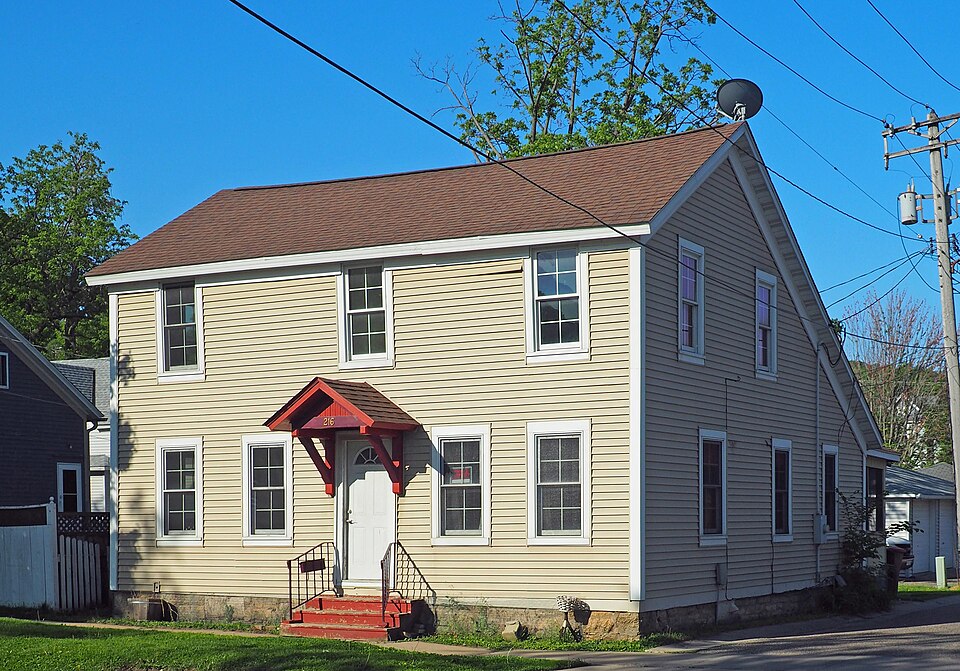
Listed on the National Register of Historic Places in 1979.
One of 60 National Register listings published here for Goodhue County · listed in 1979 · category: Building.
Sources: the case file at the National Archives · the National Register database, National Park Service
An account from the chapter on Red Wing city. The inset identifies its exact source book and publication year.
On the afternoon of the 27th of December, 1855, the first execution of the death penalty was carried into effect by the hanging of a Dakota Indian named Yuhozee, for the murder of a German woman. The circumstances of the murder are thus stated: The murdered woman was traveling with others above Shakopee, when Yuhozee and some other Indians met them.
The chapter on Red Wing City in History of Goodhue County, Including a Sketch of the Territory and State of Minnesota; Together with an Account of the Early French Discoveries, Indian Massacres, the Part Borne by Minnesota's Patriots in the War of the Great Rebellion, and a Full and Complete History of the County from the Time of Its Occupancy by Swiss Missionaries in 1838. Pioneer Incidents, Biographical Sketches of Early and Prominent Settlers and Representative Men, and of Its Cities, Towns, Churches, Schools, Secret Societies, Etc, published 1878 names Red Wing. This is what it says, exactly as the scans read.
Frontenac. The site of this post is on an island on the west side of the channel of the Mississippi River, about eight miles above Red Wing, and is therefore in Goodhue county. The island was easily accessible by canoes, yet very retired. The fort was erected as a barrier and protection against hostile Indians. Referring to its location, Charlevoix said: "The island has a beautiful prairie, and the French of Canada have made it a channel of commerce for the western posts, and many pass the winter here, because it is a good country for hunting." It is said that the foundation of this old fort is still pretty clearly outlined. Its location, at least, is well known to many of the residents of Goodhue county, whose farms are in the near vicinity of the island upon which it was built.
At Wabasha there was a trading post in charge of Alexis Bailly, where was also the home of the old voyageur, A. Rogue. F. S. Richards kept a store house at the foot of Lake Pepin, probably at or near the site of the fort built by Perrot. An eccentric character, named Wells, whose wife was a hois hrule, and the daughter of the old-time trader Duncan Graham, lived on the west side of the lake. Wells lived in a stone house, probably the first of the kind erected in any part of the territory. At Red Wing there was a cluster of bark wigwams and a
Machine-read from a century-old scan, so expect the errors a machine makes: misspelled names, dropped words, stray characters.
Read the whole chapter on Red Wing City - 82,091 words on its settlement, mills, schools and churches.
Regional context, not property-specific evidence. The federal wildfire occurrence database lists 6 fires within 5 miles of Dr. Charles Hewitt Laboratory between 1994 and 2020, burning about 29 acres in total. None started naturally. None was recorded as arson. Distance is straight-line from the map coordinates, so a fire counted here may appear on a neighbouring settlement's page as well.
| Reported cause | Fires |
|---|---|
| Recreation and ceremony | 2 |
| Missing data/not specified/undetermined | 2 |
| Equipment and vehicle use | 1 |
| Debris and open burning | 1 |
The most recent of them, most recent first, with the day each was reported and the service that recorded it.
| Date | Cause | Size | Reported by | Name on the report |
|---|---|---|---|---|
| 23 September 2012 | Debris and open burning | under an acre | Minnesota Department of Natural Resources | not named |
| 7 May 2018 | Recreation and ceremony | 5.5 acres | Minnesota Department of Natural Resources | not named |
| 23 April 1994 | Recreation and ceremony | 2.0 acres | Minnesota Department of Natural Resources | not named |
| 15 March 2020 | Missing data/not specified/undetermined | 4.4 acres | Minnesota Department of Natural Resources | not named |
| 15 March 2020 | Missing data/not specified/undetermined | 2.2 acres | Minnesota Department of Natural Resources | not named |
| 3 October 2012 | Equipment and vehicle use | 15 acres | Minnesota Department of Natural Resources | not named |
Regional context, not property-specific evidence. The federal mineral resources record lists 13 workings within 5 miles of Dr. Charles Hewitt Laboratory: 5 producers, 4 past producers, 4 occurrences. 5 still produce. What was taken out: Sand and Gravel, Construction, Stone, Crushed/Broken, Clay. Distance is straight-line from the map coordinates, so a quarry counted here may appear on a neighbouring settlement's page as well.
| Where | Site | Commodity | Status | Recorded |
|---|---|---|---|---|
| Red Wing Sewer Pipe Clay Pit No 1 | Clay | Past Producer | ||
| Hager City Dolomite Deposit #1 | Stone, Crushed/Broken | Occurrence | ||
| Hager City Dolomite Deposit #2 | Stone, Crushed/Broken | Occurrence | ||
| Richardson Quarry | Stone, Crushed/Broken | Past Producer | ||
| Bryan Pit & Plant | Sand and Gravel, Construction | Producer | ||
| Hager City Gravel Deposit | Sand and Gravel, Construction | Occurrence | ||
| Hager City Gravel Pit #1 | Sand and Gravel, Construction | Past Producer | ||
| Hager City Gravel Pit #2 | Sand and Gravel, Construction | Past Producer | ||
| Hager City Pit | Sand and Gravel, Construction | Producer | ||
| Red Wing Pit | Sand and Gravel, Construction | Producer |
Regional context, not property-specific evidence. The National Weather Service names Red Wing, the town this property stands in, in 44 storm reports between 1996 and 2026: 22 thunderstorm wind, 18 hail, 2 lightning, 1 flash flood. The reports record 1 death and 1 injury. Each account below is quoted exactly as the forecast office filed it, from the NOAA Storm Events Database, and each date opens the federal record of that event.
| When | Event | Place named | Harm | What the report says |
|---|---|---|---|---|
| June 2016 | Thunderstorm Wind | Red Wing | 1 killed, 1 hurt | Numerous trees were blown down between Red Wing and Wacouta. An individual was injured during this storm from a fallen tree that landed on a detached garage, and trapped him as the garage collapsed. |
| June 2021 | Thunderstorm Wind | Red Wing | $100,000 | There were numerous trees blown down around and in the city of Red Wing. Some of the trees caused damage as they landed on power lines, roofs and vehicles. As the storms moved east into Wisconsin, the Red Wing airport had a measured wind gust of 75 mph. |
| August 2020 | Thunderstorm Wind | Red Wing | $100,000 | There was lots of wind damage in Red Wing where many trees and branches were blown down, including damage to roofs, and power outages throughout the city. There was a measured wind report from a private weather station of 61 mph west of Red Wing at 1635 LST. |
| June 2019 | Hail | Red Wing | $50,000 | There were several reports of large hail, up to quarter size, around Red Wing and the Hay Creek area. Some damage occurred to roofs. |
| June 2016 | Lightning | Red Wing | $50,000 | Early morning thunderstorms caused a house fire in Red Wing. The home was located on 1175 Golf Ridge Circle. Most of the structural damage was to the outside of the house with some charring of some flooring and walls, and some water damage from a water pipe that was in contact with the gas line. There was also a hole in the gas line from the electrical current passing through. |
| June 2013 | Thunderstorm Wind | Red Wing | $50,000 | The owner of Bill's Bay Marina in Red Wing, Minnesota, received damage to their |dock fingers, as severe winds caused these dock fingers to twist and mangle up. |
| July 2015 | Lightning | Red Wing | $2,000 | The Red Wing Fire Department reported a bolt of lightning caused a small fire of the exterior of a home at 1141 East Ave in Red Wing. The small fire was extinguished within minutes and no injuries were reported. |
| June 2019 | Thunderstorm Wind | Red Wing | - | Several trees were damaged on the west side of Red Wing. |
| July 2018 | Thunderstorm Wind | Red Wing | - | Several reports of small trees, tree limbs, and power lines blown down in Red Wing. |
| August 2018 | Thunderstorm Wind | Red Wing | - | A storm survey of two neighborhoods in Red Wing determined damage was due to a downburst. The roof of a home was partially removed, the garage door to a large machine shed was blown in, and a few dozen trees were uprooted. |
| July 2016 | Thunderstorm Wind | Red Wing | - | A few power lines were blown down near Red Wing. |
| June 2013 | Thunderstorm Wind | Red Wing | - | A large tree limb blew down on a power line and started a fire. |
| June 2013 | Thunderstorm Wind | Red Wing | - | Severe wind blew large hay bales across a field. |
| June 2005 | Thunderstorm Wind | Red Wing | - | Several trees were downed. One downed tree blocked a road. |
| June 2005 | Thunderstorm Wind | Red Wing | - | Three inch branches were downed. |
| August 2005 | Thunderstorm Wind | Red Wing | - | Trees and numerous large branches were downed. One downed tree fell onto a pickup truck. |
| June 2004 | Thunderstorm Wind | Red Wing | - | The Corps of Engineers wind sensor at Lock and Dam #3 recorded a gust of 68 MPH. Trees were downed. |
| May 2001 | Thunderstorm Wind | Red Wing | - | Truck blown off road. A few trees down. |
| June 2001 | Thunderstorm Wind | Red Wing | - | Scattered trees down in Red Wing. This was the last report in Minnesota from a mesocyclone and complex of storms that produced its first severe weather in Swift County (9 N Kerkhoven) at 1427. |
| June 2001 | Funnel Cloud | Red Wing | - | Wall cloud lingered over Red Wing for nearly 30 minutes, and a brief funnel cloud was spotted. |
| July 2000 | Hail | Red Wing | - | Corn stripped in Wacouta, Welch and Florence townships as storm tracked to the southeast. |
| July 2000 | Thunderstorm Wind | Red Wing | - | Numerous trees down. |
| June 1999 | Thunderstorm Wind | Red Wing | - | Trees blown down. Estimated windspeed. |
| June 1998 | Thunderstorm Wind | Red Wing | - | Trees blown down. Estimated windspeed. |
| June 1998 | Thunderstorm Wind | Red Wing | - | Roofs torn off houses. Mobile home destroyed. Businesses damaged. Many trees blown down throughout city. Estimated windspeed. |
| July 1997 | Thunderstorm Wind | Red Wing | - | Several trees down. Estimated windspeed. |
| April 2026 | Hail | Red Wing | - | no account filed |
| April 2026 | Hail | Red Wing | - | no account filed |
| May 2022 | Hail | Red Wing | - | no account filed |
| April 2022 | Hail | Red Wing | - | no account filed |
| May 2017 | Hail | Red Wing | - | no account filed |
| May 2017 | Hail | Red Wing | - | no account filed |
| June 2016 | Hail | Red Wing | - | no account filed |
| May 2011 | Hail | Red Wing | - | no account filed |
| June 2007 | Hail | Red Wing | - | no account filed |
| June 2007 | Hail | Red Wing | - | no account filed |
| May 2006 | Hail | Red Wing | - | no account filed |
| June 2006 | Hail | Red Wing | - | no account filed |
| April 2004 | Hail | Red Wing | - | no account filed |
| July 2002 | Hail | Red Wing | - | no account filed |
| July 1997 | Flash Flood | Red Wing | - | no account filed |
| July 1997 | Hail | Red Wing | - | no account filed |
| June 1997 | Hail | Red Wing | - | no account filed |
| June 1996 | Thunderstorm Wind | Red Wing | - | no account filed |
No historic map-sheet match is published for this property yet. That does not mean no map exists. This record needs a coordinate-quality review before it can be joined to a sheet boundary. Browse the county's mapped places while that work is pending.
Other National Register properties close enough to walk or drive between, ordered by distance from this one. Both positions come from the same geocoding pass that matched these properties to their map sheets.
| Photograph | Property | Distance | Listed |
|---|---|---|---|
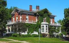 | Pratt-Tabor House | under 500 feet | 1979 |
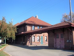 | Chicago Great Western Depot | 0.1 miles | 1980 |
 | Red Wing Mall Historic District | 0.1 miles | 1980 |
 | T. B. Sheldon Memorial Auditorium | 0.1 miles | 1976 |
 | Keystone Building | 0.2 miles | 1979 |
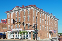 | St. James Hotel and Buildings (Boundary Increase) | 0.2 miles | 1982 |
| National Archives record | The nomination case file for reference 79001240 in Record Group 79. |
| Goodhue County | All 60 listed properties in this county. |