
BlockBefore
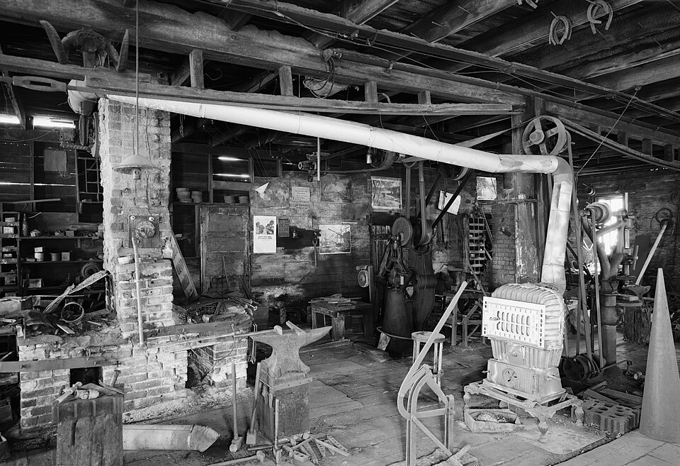
Photograph of City Blacksmith Shop
Photograph by Jet Lowe, Public domain. Via Wikimedia Commons.

City Blacksmith Shop

Built in 1898. Listed on the National Register of Historic Places in 1980.

From the record

“The City Blacksmith Shop or Hanzlik Blacksmith Shop in Lamberton in the U.S. state of Minnesota is located at Douglas Street and 2nd Avenue. The building was built by George Nigg Senior and Paul Schaffran in 1897.”

Wikipedia article City Blacksmith Shop, CC BY-SA 4.0.

One of 23 National Register listings published here for Redwood County · listed in 1980 · category: Building · built in 1898.

Sources: the Wikipedia article · the case file at the National Archives · the National Register database, National Park Service
The listing

  • What is counted as historic. The nomination lists 1 building as contributing to the listing.
  • Address. Douglas St. and 2nd Ave., Lamberton, 56152
  • When was it listed? August 1980
  • Category. building
  • Also known as. Redwood County MRA
  • Township. Lamberton township
  • When was it built? 1898
  • National Register reference number. 80002133 - the number the National Park Service assigned this property when it was listed, and the key its nomination file is catalogued under at the National Archives.

The ground it stands on

7,270 words

The chapter on Lamberton Township in The History of Redwood County, Minnesota, published 1916 names Lamberton. This is what it says, exactly as the scans read.

Lamberton township is located on the south border of Redwood county, and embraces Congressional township 109-37. It is bounded on the north by Waterbury, on the east by Charlestown, on the south by Cottonwood county, and on the west by North Hero. The Cottonwood river crosses it near the northcentral part, flowing in a southeasterly direction. Two small creeks flow northward into the Cottonwood. The "Winona-Tracy division of the Chicago and Northwestern passes westward through the center of this township. The surface is rolling. The only village is Lamherton. There are three school houses. The predominating nationality is German and American.

Passage source: The History of Redwood County, Minnesota, published 1916.

Beginning with March 2, 1868, the west part of this township was included in Yellow Medicine township, and after Yellow Medicine county was organized March 6, 1871, was considered a part of Redwood Falls township, together with the eastern part, which in the meantime has been considered a part of Redwood Falls township since the organization of Redwood county. When Charlestown was created May 3, 1872, it included the present township of Lamberton. Lamberton township was created by the county commissioners, May 3, 1872.

Passage source: The History of Redwood County, Minnesota, published 1916.

Machine-read from a century-old scan, so expect the errors a machine makes: misspelled names, dropped words, stray characters.

Read the whole chapter on Lamberton Township - 7,270 words on its settlement, mills, schools and churches.

Storms near this property

13 since 1997

Regional context, not property-specific evidence. The National Weather Service names Lamberton, the town this property stands in, in 13 storm reports between 1997 and 2024: 6 hail, 5 thunderstorm wind, 1 tornado, 1 heavy rain. No death or injury is recorded in these reports. Each account below is quoted exactly as the forecast office filed it, from the NOAA Storm Events Database, and each date opens the federal record of that event.

WhenEvent Place namedHarm What the report says
July 1997HailLamberton$200,000Damage estimate for Lamberton and Morgan areas. Grapefruit size hail did considerable damage to crops in Lamberton area. Hail also stripped trees of leaves, broke off tree limbs, shattered windows and put holes in siding.
June 2024Heavy RainLamberton-A total of 2.5 to 3.5 inches of rain fell from multiple rounds of thunderstorms. CoCoRaHS observers measured 3.0 inches in Lucan.
October 2023HailLamberton-Photo provided via social media of hailstone next to a quarter. The size of the hailstone was estimated to be golf ball size.
April 2004Tornado (F1)Lamberton-The tornado traveled across mainly rural areas where little if any damage occurred. However, one farm 4 miles north of Sanborn sustained significant damage when the tornado struck a large shop made of clay blocks. The building was destroyed and many of the tools inside the building were damaged. Debris from the building was scattered across nearby fields. A metal corn crib was also damaged on the farm.
September 2004Thunderstorm WindLamberton-A 71 MPH wind gust was recorded by an automated weather sensor at a school.
August 2000Thunderstorm WindLamberton-Few trees down, including one on house.
July 1999Thunderstorm WindLamberton-Few trees broken in half. Winds estimated.
June 1998Thunderstorm WindLamberton-Trees blown down.
July 1997Thunderstorm WindLamberton-Several trees blown down. Estimated windspeed.
May 2012HailLamberton-no account filed
July 2004HailLamberton-no account filed
April 2001HailLamberton-no account filed
July 1998HailLamberton-no account filed

Every storm recorded in Redwood County

Map coverage status

No historic map-sheet match is published for this property yet. That does not mean no map exists. This record needs a coordinate-quality review before it can be joined to a sheet boundary. Browse the county's mapped places while that work is pending.

Listed places nearby

2 within 8 miles

Other National Register properties close enough to walk or drive between, ordered by distance from this one. Both positions come from the same geocoding pass that matched these properties to their map sheets.

Photograph PropertyDistance Listed
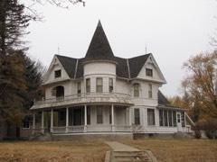
J. A. Anderson House0.2 miles1980
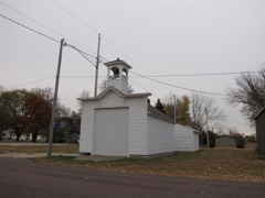
Revere Fire Hall5.0 miles1980

Sources for this property

National Archives recordThe nomination case file for reference 80002133 in Record Group 79.
Wikipedia articleCommunity-written account of this property, licensed CC BY-SA.
Redwood CountyAll 23 listed properties in this county.

Provenance

  • Listing record. National Park Service National Register of Historic Places, listed-properties dataset, current to 2026-05-22.
  • Map join. Address geocoded through the United States Census geocoder, then tested against the published boundary of every sheet in the USGS Historical Topographic Map Collection.
  • How this page is made. Listing fields come from federal records; map-sheet coverage is a labelled coordinate-to-boundary calculation, not a source-field claim.
  • Storms. NOAA National Centers for Environmental Information, Storm Events Database https://www.ncei.noaa.gov/stormevents/ A work of the United States government, no copyright under 17 U.S.C. 105. Narratives are quoted verbatim from the National Weather Service report and are not edited or summarised.