 Block
From the record
One of 23 National Register listings published here for Redwood County · listed in 1980 · category: Building.
Sources: the case file at the National Archives · the National Register database, National Park Service
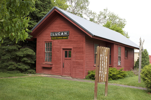
Listed on the National Register of Historic Places in 1980.
One of 23 National Register listings published here for Redwood County · listed in 1980 · category: Building.
Sources: the case file at the National Archives · the National Register database, National Park Service
The chapter on Granite Rock Township in The History of Redwood County, Minnesota, published 1916 names Lucan. This is what it says, exactly as the scans read.
Granite Rock township is located in the west central part of Redwood county, and embraces Congressional township 111-38. It is bounded on the north by Vesta, on the east by Vail, on the south by Johnsonville, and on the west by Westline. A branch of the Redwood river crosses it on the northern side, flowing in a northeasterly direction. The Evan-Marshall branch of the Chicago and Northwestern passes due east and west through its, center. The surface is generally rolling. Its only village is Lucan. The trading centers are Lucan, Vesta, Wabasso, and Redwood Falls. There are five school houses. The predominating nationality is German.
Passage source: The History of Redwood County, Minnesota, published 1916.
Machine-read from a century-old scan, so expect the errors a machine makes: misspelled names, dropped words, stray characters.
Read the whole chapter on Granite Rock Township - 433 words on its settlement, mills, schools and churches.
Regional context, not property-specific evidence. The National Weather Service names Lucan, the town this property stands in, in 10 storm reports between 2002 and 2025: 5 hail, 2 thunderstorm wind, 1 funnel cloud, 1 tornado. No death or injury is recorded in these reports. Each account below is quoted exactly as the forecast office filed it, from the NOAA Storm Events Database, and each date opens the federal record of that event.
| When | Event | Place named | Harm | What the report says |
|---|---|---|---|---|
| April 2012 | Tornado (EF0) | Lucan | $250,000 | Several witnesses and storm spotters observed a tornado touchdown south of Lucan, Minnesota. The tornado tracked to the southeast and damaged a farmhouse, which included several outbuildings, a greenhouse, pole barn, and shed. Based on damage the tornado was rated an EF0 with top winds of 80 mph. The tornado lifted one quarter of a mile southeast of the farmhouse where debris was thrown one half mile. |
| August 2002 | Thunderstorm Wind | Lucan | $40,000 | Part of roof from shed ripped off. Several trees down, including one on shed. Grain bin tipped over. |
| July 2018 | Heavy Rain | Lucan | - | A measured rainfall report of 4.55 inches fell west of Lucan in 24 hours. |
| June 2005 | Funnel Cloud | Lucan | - | Law enforcement reported seeing a funnel cloud reach half way to the ground, then lift back into the clouds. |
| August 2004 | Thunderstorm Wind | Lucan | - | A barbeque grill was blown 35 feet across gravel and crashed into the side of a garage. |
| August 2025 | Hail | Lucan | - | no account filed |
| May 2008 | Hail | Lucan | - | no account filed |
| June 2004 | Hail | Lucan | - | no account filed |
| August 2004 | Hail | Lucan | - | no account filed |
| May 2002 | Hail | Lucan | - | no account filed |
No historic map-sheet match is published for this property yet. That does not mean no map exists. This record needs a coordinate-quality review before it can be joined to a sheet boundary. Browse the county's mapped places while that work is pending.
Other National Register properties close enough to walk or drive between, ordered by distance from this one. Both positions come from the same geocoding pass that matched these properties to their map sheets.
| Photograph | Property | Distance | Listed |
|---|---|---|---|
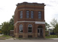 | Milroy State Bank Building | 7.1 miles | 1980 |
| Commercial Hotel | 7.5 miles | 1980 |
| National Archives record | The nomination case file for reference 80002135 in Record Group 79. |
| Redwood County | All 23 listed properties in this county. |