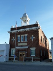
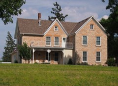
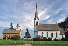
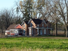
Built in 1880. Listed on the National Register of Historic Places in 1982.
From the record
“The Osmund Osmundson House is a historic house in Nerstrand, Minnesota, United States. The private home was placed on the National Register of Historic Places (NRHP) on April 6, 1982.”
Wikipedia article Osmund Osmundson House, CC BY-SA 4.0.
One of 76 National Register listings published here for Rice County · listed in 1982 · category: Building · built in 1880.
National Register reference number.82003025- the number the National Park Service assigned this property when it was listed, and the key its nomination file is catalogued under at the National Archives.
Regional context, not property-specific
evidence. The federal mineral resources record lists
3 workings within 5 miles of Osmund Osmundson House: 3 producers.
All of them still produce. What was taken out: Stone, Crushed/Broken, Sand and Gravel, Construction. Distance is straight-line from the
map coordinates, so a quarry counted here may appear on a neighbouring
settlement's page as well.
Regional context, not property-specific
evidence. The National Weather Service names
Nerstrand, the town this property stands in, in 16 storm reports between 1998 and 2024: 6 hail, 5 thunderstorm wind, 2 tornado, 1 heavy rain.
No death or injury is recorded in these reports. Each account below is quoted exactly as the forecast office
filed it, from the NOAA Storm Events Database, and each date
opens the federal record of that event.
A storm survey noted tin blown off part of a large machine shed. About a dozen trees were broken. All damage was blown to the east-northeast. It is possible the tornado east of Nerstrand started in this area, but that was impossible to determine.
A storm survey determined that a tornado hit a farm east of Nerstrand. Several trees were downed, and a shed was destroyed. The wind also blew down a power pole, landing on a barn which then caught on fire. The tornado may have started southwest of Nerstrand, but it was impossible to determine from the damage pattern. Maximum winds were estimated at around 70 mph.
No historic map-sheet match is published
for this property yet. That does not mean no map exists. This record needs
a coordinate-quality review before it can be joined to a sheet boundary.
Browse the county's mapped places while that work is
pending.
Listed places nearby
5 within 8 miles
Other National Register properties close
enough to walk or drive between, ordered by distance from this one. Both
positions come from the same geocoding pass that matched these properties
to their map sheets.
Listing record. National Park Service National Register of Historic Places, listed-properties dataset, current to 2026-05-22.
Map join. Address geocoded through the United States Census geocoder, then tested against the published boundary of every sheet in the USGS Historical Topographic Map Collection.
How this page is made. Listing fields come from federal records; map-sheet coverage is a labelled coordinate-to-boundary calculation, not a source-field claim.
Mines and quarries. USGS Mineral Resources Data System (MRDS) https://mrdata.usgs.gov/mrds/ A work of the United States government, no copyright under 17 U.S.C. 105.
Storms. NOAA National Centers for Environmental Information, Storm Events Database https://www.ncei.noaa.gov/stormevents/ A work of the United States government, no copyright under 17 U.S.C. 105. Narratives are quoted verbatim from the National Weather Service report and are not edited or summarised.
 Block