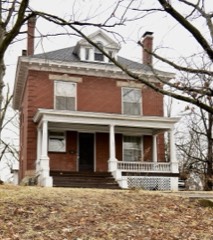
Block
From the record
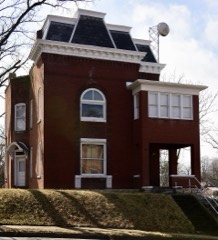
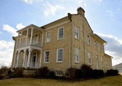
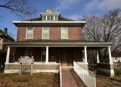
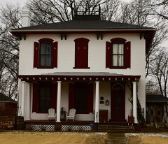
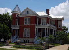
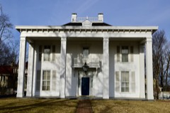
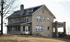
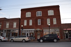
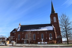
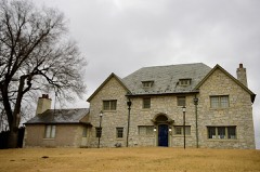
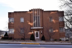
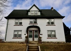
54 National Register listings published here.
Sources: the National Register database, National Park Service
56 topographic sheets cover 33 settlements here, and 54 properties are on the National Register of Historic Places.
54 National Register listings published here.
Sources: the National Register database, National Park Service
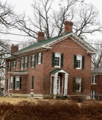
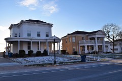
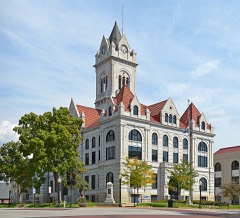
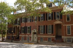
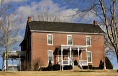
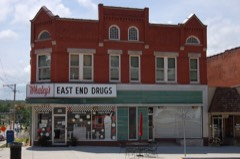
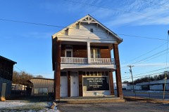
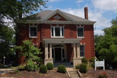
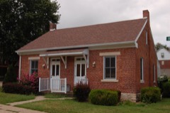
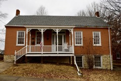
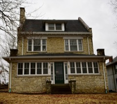
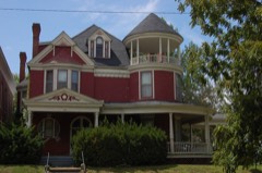
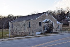
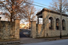
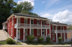
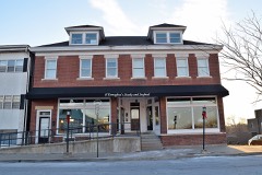
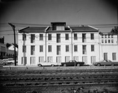
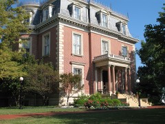
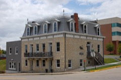
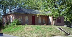
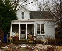
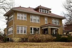
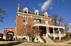
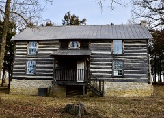
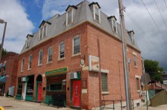
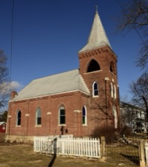
Every property in this county listed on the National Register of Historic Places, with the year it was listed and the federal nomination document.
Every wildfire the federal occurrence database records inside this county: 24 of them, burning about 192 acres. None started naturally and none was recorded as arson. Each settlement page carries the fires within five miles of it.
| Reported cause | Fires |
|---|---|
| Debris and open burning | 11 |
| Missing data/not specified/undetermined | 10 |
| Recreation and ceremony | 2 |
| Power generation/transmission/distribution | 1 |
The five largest, by the area the report gives. None of them was recorded as arson.
| Date | Cause | Size | Reported by | Name on the report |
|---|---|---|---|---|
| 9 March 2014 | Missing data/not specified/undetermined | 80 acres | Missouri Department of Conservation | not named |
| 29 April 2018 | Missing data/not specified/undetermined | 30 acres | Missouri Department of Conservation | 177430-02626-04292018-1650 |
| 10 March 2014 | Missing data/not specified/undetermined | 20 acres | Missouri Department of Conservation | not named |
| 6 March 2005 | Debris and open burning | 20 acres | Missouri State Fire Marshal's Office | not named |
| 7 March 2014 | Missing data/not specified/undetermined | 10 acres | Missouri Department of Conservation | not named |
| 4 October 2017 | Debris and open burning | 5.0 acres | Missouri Department of Conservation | not named |
| 31 December 2011 | Missing data/not specified/undetermined | 4.0 acres | Missouri Department of Conservation | not named |
| 22 April 2019 | Missing data/not specified/undetermined | 4.0 acres | Missouri Department of Conservation | 178709-02626-04222019-1040 |
Every settlement page carries the fires within five miles of it - see the settlement index below.
The NOAA Storm Events Database holds 344 reports for this county, causing 1 death, 34 injuries and about $182,896,660 in recorded property damage. Each settlement page carries the reports that name it.
| Kind of event | Reports |
|---|---|
| Hail | 147 |
| Thunderstorm Wind | 140 |
| Flash Flood | 26 |
| Tornado | 12 |
| Flood | 9 |
| Lightning | 8 |
| Heavy Rain | 2 |
The most serious of them, by death, then injury, then recorded damage. The accounts are quoted exactly as the forecast office filed them.
| When | Event | Place named | Harm | What the report says |
|---|---|---|---|---|
| August 2016 | Flash Flood | Marion | 1 killed | Up to five inches of rain fell in a short amount of time causing flash flooding during the late evening hours of July 31st into the early morning hours of August 1st. Numerous roads were flooded including Missouri Boulevard in Jefferson City. Five water rescues were performed due to stranded motorists. Also, a body was discovered in Wears Creek in Washington Park near the ice arena after the flood waters went down. It was determined that it was a 51 year old homeless man who had drowned in the flood waters during the early morning hours of August 1st. Occupants of a home in the 1300 block of Satinwood drive had to be rescued when a nearby creek overflowed its banks surround the structure. The ice arena at Washington Park was flooded with about 3 feet of water from Wears Creek. |
| May 2019 | Tornado (EF3) | Scrivner | 32 hurt, $170,000,000 | A tornado crossed from Miller County (WFO Springfields County Warning Area) into Cole County at 1120 PM. As the tornado tracked to the northeast it crossed Lake Carmel and tore the roof off of a one story home on the northeast shore of the lake. Numerous trees were either snapped off or uprooted in the area as well. Damage to the home was rated EF2. Further northeast another one story home lost its roof on Highway D just northwest of intersection with Cole Brook Lane. Damage to this home was rated EF2. The tornado strengthened from an EF-2 to an EF-3 as it moved into a subdivision off of Heritage Highway just west of U.S. Highway 54, indicated by the complete collapse of a home and complete destruction of a double wide manufactured home. As the tornado moved northeast into the Jefferson City area it destroyed or greatly damaged a warehouse and car dealership, where at least 750 cars were totaled. As it moved into downtown Jefferson City, it caused severe damage to well made residential structures. The tornado crossed the Missouri River and entered Callaway County just to the east-northeast of Jefferson City. The tornado was rated EF3 in Cole County with a path length of 17.08 miles and a max path width of 1500 yards. Thirty two people sustained injuries in Cole County. At least 516 residential buildings, 82 commercial buildings and 30 government buildings sustained moderate to major damage from the tornado in Cole County with another 500 buildings sustaining only minor damage. Overall the tornado was rated EF3 with a path length of 32.63 miles and a max path width of 1500 yards. |
| June 2018 | Lightning | Jefferson City | 1 hurt | Storms were moving through the area. One person was struck by lightning in his front yard in Jefferson City. The man sustained non-life threatening injuries. |
| June 2008 | Lightning | St Martin | 1 hurt | A 17 year old male was struck by lightning in Binder Memorial State Park west of Jefferson City. The victim was revived by paramedics and airlifted to a local hospital. He was released from the hospital a week later. |
| April 1994 | Tornado (F1) | Elston to Frankenstei | $5,000,000 | An intermittent damage track was produced by this tornado. Several mobile homes in Elston had awnings torn off while other houses sustained damage to shingles. Around 0235 CST the tornado crossed the Missouri River into extreme southern Callaway County and produce what was described as minor structural damage to the building of a trucking firm in Old Cedar City near the intersection of Highway 63 and Highway 54. The tornado then touched down at the Jefferson City Airport and damaged the roof of a National Guard aviation hangar. Two helicopters and several private aircraft were also damaged. At approximately 0245 CST the tornado crossed the Missouri River again into Osage county. Several barns near Frankenstein had part of thier roofs blown off. |
| March 2020 | Hail | Lohman | $3,000,000 | A wide swath of large hail fell between St. Martins and Jefferson City. The largest hail stones were 3 inches in diameter. There were numerous reports of dents on vehicles and car windows broken out. At least 800 hundred cars sustained damage at car dealerships in the Jefferson City area. The largest hail stones were reported in St. Martins, Elston, and Jefferson City. |
| October 1986 | Tornado (F2) | not stated | $2,500,000 | no account filed |
| August 1999 | Thunderstorm Wind | Jefferson City | $1,000,000 | no account filed |
| July 2015 | Flash Flood | St Thomas | $750,000 | Up to three inches of rain fell onto already saturated soils causing flash flooding. Numerous roads were flooded including Route W south of Wardsville and Lower Bottom Road just northeast of St. Thomas. A portion of Lower Bottom Road was washed out and the cost to repair it will be around $750,000. |
| May 1983 | Tornado (F1) | not stated | $250,000 | no account filed |
| April 2024 | Hail | Russellville | $100,000 | Large hail of up to 1.75 inches in diameter fell across Cole County in an east-northeast line. The largest stones were reported in Wardsville where there was damage to siding. Severe hail was also reported in Russellville and Taos. |
| April 1994 | Thunderstorm Wind | Taos | $50,000 | Strong winds ripped part of the roof off several small sheds. |
| April 1994 | Thunderstorm Wind | Jefferson City | $50,000 | Strong winds knocked over large trees and several road signs. Shingles were also blown off sections of roofs. |
| July 2002 | Thunderstorm Wind | Brazito | $40,000 | Thunderstorm wind gusts destroyed a double wide mobile home that was being transported on Highway 54 near Brazito. |
| May 1980 | Tornado (F2) | not stated | $25,000 | no account filed |
| October 1966 | Tornado (F1) | not stated | $25,000 | no account filed |
| July 2011 | Lightning | Brazito | $20,000 | Lightning struck a building that housed the sales/gift shop of a nursery. Fire spread rapidly through the building and it is considered a total loss. No injuries were reported and the other buildings nearby were unharmed. |
| April 2023 | Thunderstorm Wind | St Martin | $15,000 | Thunderstorm winds snapped a couple of power poles in Elston. |
| July 2022 | Thunderstorm Wind | St Martin | $15,000 | Thunderstorm winds blew down numerous large tree limbs in the Rainbow Hills and Hunters Run area of Apache Flats. |
| May 2024 | Thunderstorm Wind | Jefferson City | $10,000 | Numerous tree limbs and several trees were blown down in Jefferson City. One light post was partially blown over. A few windows were blown out of the second story of a house. |
| July 2008 | Lightning | Henley | $10,000 | Lightning struck a barn in far southwestern Cole county. It burned to the ground in less than half an hour. |
| December 2021 | Thunderstorm Wind | St Thomas | $5,000 | Thunderstorm winds blew off part of a metal roof on a storage building in St. Thomas. Just southeast of Osage Bend, a large tree with a shallow root ball was tipped over. Also, numerous large tree limbs were snapped off. |
| June 2007 | Lightning | Jefferson City | $5,000 | Lightning strikes knocked out power to at least 6000 customers and also started a house fire. A house in the 1500 block of Vieth Drive was hit around 8:00 am CDT, knocking a hole in the side of the home. A small fire started causing about $5000 in damage. |
| April 1994 | Thunderstorm Wind | Russellville | $5,000 | Numerous trees and power lines were blown down. Shingles were also ripped off several houses in Russellville. Two barns were blown apart near the intersection of County Roads AA and A. Damage in Jefferson City lasted about 10 minutes. |
| April 1994 | Thunderstorm Wind | Saint Martins | $5,000 | Numerous trees and power lines were blown down. Shingles were also ripped off several houses in Russellville. Two barns were blown apart near the intersection of County Roads AA and A. Damage in Jefferson City lasted about 10 minutes. |
| April 1994 | Thunderstorm Wind | Jefferson CIty | $5,000 | Numerous trees and power lines were blown down. Shingles were also ripped off several houses in Russellville. Two barns were blown apart near the intersection of County Roads AA and A. Damage in Jefferson City lasted about 10 minutes. |
| July 1998 | Flash Flood | Countywide | $5,000 | no account filed |
| May 2007 | Flood | Jefferson City | $2,000 | The Missouri River flooded parts of the north border of Cole County from Jefferson City to Osage City. Sandbagging was done to protect parking lots for State buildings near the Capitol. |
| July 1995 | Thunderstorm Wind | Jefferson City | $1,200 | Strong wind gusts damaged power lines, utility poles, and trees around the city. |
| June 2013 | Flood | Marion | $1,000 | The Missouri River started June in flood and hit major flood levels cresting on the 2nd. The river fell below flood stage on the 5th. Damage was limited to some flooded roads and flooded farmland. |
| June 2008 | Flash Flood | Marion | $1,000 | Up to three inches of rain fell on already saturated soils in Cole county. Several secondary roads were closed for a time due to flooding including Highway 179 near Marion. |
| April 2008 | Flash Flood | Wardsville | $1,000 | Very heavy rain, between one and two inches, fell in a short amount of time on already saturated soils. Numerous secondary roads were flooded including Meadows Ford Road and Murphys Ford Road. |
| July 1995 | Thunderstorm Wind | Jefferson City | $400 | Large trees and power lines were blown down across the city. Wind gusts were reported as high as 60 mph along with dime-size hail. The damaging wind lasted for nearly 10 minutes. |
| March 1984 | Tornado (F0) | not stated | $30 | no account filed |
| May 1983 | Tornado (F0) | not stated | $30 | no account filed |
| April 2026 | Hail | Eugene | - | An emergency manager estimated hail size between golf balls and tennis balls. Photo provided was representative of tennis ball sized hail. |
| April 2026 | Tornado (EF0) | Marion | - | A brief tornado touched down along High Point Road and travelled northeast. The tornado caused tree damage before crossing the Missouri River into Boone County. |
| April 2026 | Thunderstorm Wind | Cole Jct | - | Thunderstorm winds downed tree branches which littered a road. |
| May 2025 | Thunderstorm Wind | St Martin | - | Cole County Dispatch reported several trees with limbs down in rural Cole County. |
| September 2025 | Thunderstorm Wind | Scruggs | - | Photos on Facebook show a healthy tree uprooted by thunderstorm winds in a neighborhood near the Cole County Fairgrounds. |
| March 2024 | Hail | St Martin | - | A right split intensified as it neared Jefferson City, producing up to 1.25 inch hail just west of town. The storm quickly weakened as it exited Cole County. No damage was reported. |
| August 2023 | Thunderstorm Wind | Honey Creek | - | Thunderstorm winds blew down several trees along Tanner Bridge Road and Route B around 2 miles west southwest of Wardsville. |
| August 2023 | Hail | St Martin | - | A wide swath of large hail fell across the northern portions of Cole County. Large hail was reported in Saint Martins, Apache Flats and Jefferson City. |
| July 2023 | Thunderstorm Wind | Schubert | - | Thunderstorm winds blew down several trees and numerous tree limbs just east of Taos. |
| July 2023 | Thunderstorm Wind | Scott | - | Several smaller trees were blown over. |
| July 2023 | Thunderstorm Wind | Jefferson City | - | Thunderstorm winds blew down several trees. A couple of trees fell onto power lines pulling them down. |
| June 2021 | Flash Flood | Marion | - | After up to three inches of rain fell from late evening on June 24th through the early morning hours of June 25th, another round of heavy rain developed and moved across Cole County. Up to an additional 4 inches of rain fell causing flash flooding. Numerous roads were flooded across the northern half of the county, including portions of Walnut, West Miller, Waverly, Virginia and Kansas Streets in central portions of Jefferson City. Numerous water rescues were performed on the west side of town as well as in the central sections of town after a number of vehicles were driven into the flood waters. No injuries were reported. |
| July 2020 | Flash Flood | Scrivner | - | Up to four inches of rain fell in a short amount of time causing flash flooding. Numerous roads were flooded across the southern portions of Cole County, including over the western portions of Brazito. |
| August 2020 | Thunderstorm Wind | Scott | - | Thunderstorm winds blew down several trees in Brazito. Also, a large tree was uprooted on Henwick Lane on the west side of Jefferson City. |
| July 2020 | Flash Flood | Jefferson City | - | Up to six inches of rain fell in a about a two hour period causing flash flooding. Numerous roads were closed including U.S. Highway 50. Apartments were flooded near the intersection of McCarty Street and East High Street and ones located on nearby Christopher Place due to Gray's Creek rising well out of its banks. This forced the residents to evacuate both complexes. Nine water rescues were performed in Jefferson City after vehicles were driven into the flood waters and stalled. Area around U.S. Highway 50 and Missouri Blvd., as well as The Millbottom Area, were flooded when Wears Creek rose well above its banks. Also, Wears Creek flooding affected the Washington Park and Vivion Field areas. No injuries were reported. |
| July 2020 | Thunderstorm Wind | Jefferson City | - | Thunderstorm winds blew down a large tree near Stadium and Southwest Boulevard. Also, numerous tree limbs and several small to medium trees were blown down around town. |
| June 2019 | Thunderstorm Wind | Jefferson City | - | Thunderstorm winds snapped off a medium sized tree in town. |
| May 2019 | Thunderstorm Wind | Eugene | - | A line of storms moved from southwest to northeast across Cole County. Numerous trees, tree limbs and power lines were blown down across the county. |
| May 2018 | Thunderstorm Wind | Russellville | - | Thunderstorm winds caused minor roof damage to a couple of farm outbuildings in Russellville. |
| May 2017 | Flood | Jefferson City | - | The Moreau River remained above major flood stage through the afternoon hours on May 1st due to very heavy rain over the river basin. A number of secondary roads were closed due to the river flooding. Also, the river rose to the bottom of Tanner Bridge. No structures were affected by the flooding. |
| May 2017 | Thunderstorm Wind | Scruggs | - | Thunderstorm winds blew down several large trees, numerous tree limbs and power lines around town. A couple of power poles were snapped off and some shingles blown off of a few homes on the west side of town. |
| May 2017 | Tornado (EF1) | Wardsville | - | A weak tornado touched down briefly about one mile northwest of Wardsville, MO. The tornado was on the ground for approximately two minutes, and traveled about one mile. The tornado initially touched down in a small subdivision and caused minor damage to the roof of a single family home. The tornado then preceded northeast causing tree damage and striking another home where it caused significant damage to the roof. The estimated wind speed was 100 miles per hour at this residence. The tornado continued moving northeast uprooting and snapping trees. Two large trees fell on a home near the end of the tornado's path. The tornado finally dissipated on the southwest bank of the Moreau River where it broke the tops off of a few trees. Overall, the tornado was rated EF1 with a path length of 0.95 miles and a max path width of 75 yards. No deaths or injuries were reported. |
| August 2017 | Thunderstorm Wind | Elston | - | Thunderstorm winds blew down several trees onto power lines around town. |
| April 2017 | Flood | Jefferson City | - | The Moreau River went above major flood stage during the evening hours of April 30th due to very heavy rain over the river basin. A number of secondary roads were closed due to the river flooding. Also, the river rose to the bottom of Tanner Bridge. No structures were affected by the flooding. |
| May 2017 | Thunderstorm Wind | Brazito | - | Thunderstorm winds blew down a large tree in Brazito. |
The Survey's mineral resources record lists 137 workings inside this county. 6 still produce and 131 are closed or unrecorded. Each settlement page carries the workings within five miles of it.
| Commodity | Workings |
|---|---|
| Stone, Crushed/Broken | 59 |
| Barium-Barite | 40 |
| Lead, Zinc | 14 |
| Lead | 7 |
| Sand and Gravel, Construction | 5 |
| Iron | 3 |
| Zinc | 3 |
| Clay | 2 |
| Zinc, Lead | 2 |
| Barium-Barite, Lead, Zinc | 1 |
| Zinc, Barium-Barite, Lead | 1 |
| Barium-Barite, Lead, Zinc, Coal | 1 |
| Barium-Barite, Zinc | 1 |
The least common of them first, because a county's hundredth gravel pit says nothing its first ten did not.
| Where | Site | Commodity | Status | Recorded |
|---|---|---|---|---|
| Blue Jack Mine | Barium-Barite, Zinc | Past Producer | ||
| Reed Diggings | Zinc, Barium-Barite, Lead | Past Producer | ||
| Scheplar Pit | Barium-Barite, Lead, Zinc | Past Producer | ||
| Unknown | Barium-Barite, Lead, Zinc, Coal | Past Producer | ||
| Dougan Pit | Zinc, Lead | Past Producer | ||
| Enloe Pit | Zinc, Lead | Past Producer | ||
| Unknown-Shale | Clay | Past Producer | ||
| Unknown-Shale | Clay | Past Producer | ||
| Blue Jack Mine | Barium-Barite, Zinc | Past Producer | Surface | |
| C. Weber Mine | Barium-Barite, Zinc | Past Producer | 1900 | |
| Unknown-Iron | Iron | Past Producer | ||
| Unknown-Iron | Iron | Past Producer | ||
| Unknown-Iron | Iron | Past Producer | ||
| Unknown-Zn | Zinc | Past Producer | ||
| Farmers Concrete Mine | Sand and Gravel, Construction | Past Producer | ||
| Leonard Barnhart Sand & Gravel | Sand and Gravel, Construction | Producer | ||
| Roweth Sand & Gravel Pit | Sand and Gravel, Construction | Producer | ||
| Unknown-S&G | Sand and Gravel, Construction | Past Producer | ||
| Unknown-S&G | Sand and Gravel, Construction | Past Producer | ||
| Chambers Jack Prospect | Lead | Past Producer | ||
| Chambers Lead Mine | Lead | Past Producer | ||
| Dunlap Diggings | Lead | Past Producer | ||
| Leonard Scott Mine | Lead | Past Producer | ||
| Unknown-Lead | Lead | Past Producer | ||
| Weaver Dig | Lead | Past Producer | ||
| Wenger Lead Prospect | Lead | Past Producer | ||
| Boaz Pit | Lead, Zinc | Past Producer | ||
| Brounele Farm Lead Mine | Lead, Zinc | Past Producer | ||
| Caspary Mine | Lead, Zinc | Past Producer | ||
| Central Mine | Lead, Zinc | Past Producer | ||
| Eureka - Scott Mine | Lead, Zinc | Past Producer | ||
| Fowler Mine | Lead, Zinc | Past Producer | ||
| Henderson Diggings | Lead, Zinc | Past Producer | ||
| Mcmillan Shaft | Lead, Zinc | Past Producer | ||
| Rapp Mine | Lead, Zinc | Past Producer | ||
| Streits Mine | Lead, Zinc | Past Producer | ||
| Unknown-Lead & Zinc | Lead, Zinc | Past Producer | ||
| Unknown-Lead and Zinc | Lead, Zinc | Past Producer | ||
| Unknown-Lead and Zinc | Lead, Zinc | Past Producer | ||
| Weaver Diggings | Lead, Zinc | Past Producer | ||
| Brenning Mine | Barium-Barite | Past Producer | ||
| Campbell Bros. Barium Mine | Barium-Barite | Past Producer | ||
| Campbell Brothers Mine | Barium-Barite | Past Producer | ||
| Circle Deposit | Barium-Barite | Past Producer | ||
| Dunlap Diggings | Barium-Barite | Past Producer | ||
| Eugene Barite Mine | Barium-Barite | Past Producer | ||
| Frank Barite Mine | Barium-Barite | Past Producer | ||
| Goller Mine Number 2 | Barium-Barite | Past Producer | ||
| Goller Mine Number One | Barium-Barite | Past Producer | ||
| Goller No. 3 Mine | Barium-Barite | Past Producer | Surface | |
| Henley Bank | Barium-Barite | Past Producer | ||
| Henley Pit | Barium-Barite | Past Producer | ||
| Henry Payne Land | Barium-Barite | Past Producer | ||
| Hickory Hill Mine | Barium-Barite | Past Producer | ||
| Jones Land | Barium-Barite | Past Producer | ||
| Kroger Barite Mine | Barium-Barite | Past Producer | ||
| Lutheran Church Property | Barium-Barite | Past Producer | Surface | |
| Mathis Land | Barium-Barite | Past Producer | ||
| Murphy Mine | Barium-Barite | Past Producer | ||
| Old Circle Barite Mine | Barium-Barite | Past Producer | ||
| Pioneer Mine | Barium-Barite | Past Producer | ||
| Reaves Mine | Barium-Barite | Past Producer | ||
| Scott Mine | Barium-Barite | Past Producer | Surface | |
| Scott Mine | Barium-Barite | Past Producer | ||
| Steenbergen Mine | Barium-Barite | Past Producer | Surface | |
| Steenbergen Mine | Barium-Barite | Past Producer | ||
| Unknown | Barium-Barite | Past Producer | ||
| Unknown | Barium-Barite | Past Producer | ||
| Unknown-Ba | Barium-Barite | Past Producer | ||
| Unknown-Ba | Barium-Barite | Past Producer | ||
| Unknown-Ba | Barium-Barite | Past Producer | ||
| Unknown-Ba | Barium-Barite | Past Producer | ||
| Unknown-Barite | Barium-Barite | Past Producer | ||
| Unknown-Barite | Barium-Barite | Past Producer | ||
| Unknown-Ls | Barium-Barite | Past Producer | ||
| Unknown-Ls | Barium-Barite | Past Producer | ||
| Wemhaner Washer | Barium-Barite | Past Producer | ||
| Wilson Mine | Barium-Barite | Past Producer | ||
| Brown Quarries | Stone, Crushed/Broken | Past Producer | ||
| Gordon Land | Stone, Crushed/Broken | Past Producer | ||
| Groose Quarry | Stone, Crushed/Broken | Past Producer | ||
| Hitch Quarry | Stone, Crushed/Broken | Past Producer | ||
| Jeff City Quarry | Stone, Crushed/Broken | Past Producer | ||
| Jeff-Cole Quarry and Mill | Stone, Crushed/Broken | Past Producer | ||
| Kieselback Quarry | Stone, Crushed/Broken | Past Producer | ||
| Marion Quarry | Stone, Crushed/Broken | Producer | ||
| Mineral Wool Investment Pit | Stone, Crushed/Broken | Past Producer | ||
| Plant # 1 | Stone, Crushed/Broken | Producer | ||
| Plant # 2 | Stone, Crushed/Broken | Producer | ||
| State Penitentiary Quarry | Stone, Crushed/Broken | Past Producer | ||
| Unknown | Stone, Crushed/Broken | Past Producer | ||
| Unknown | Stone, Crushed/Broken | Producer | ||
| Unknown | Stone, Crushed/Broken | Past Producer | ||
| Unknown | Stone, Crushed/Broken | Past Producer | ||
| Unknown - Ls | Stone, Crushed/Broken | Past Producer | ||
| Unknown - Ls | Stone, Crushed/Broken | Past Producer | ||
| Unknown - Ls | Stone, Crushed/Broken | Past Producer | ||
| Unknown-Ls | Stone, Crushed/Broken | Past Producer | ||
| Unknown-Ls | Stone, Crushed/Broken | Past Producer | ||
| Unknown-Ls | Stone, Crushed/Broken | Past Producer | ||
| Unknown-Ls | Stone, Crushed/Broken | Past Producer | ||
| Unknown-Ls | Stone, Crushed/Broken | Past Producer | ||
| Unknown-Ls | Stone, Crushed/Broken | Past Producer | ||
| Unknown-Ls | Stone, Crushed/Broken | Past Producer | ||
| Unknown-Ls | Stone, Crushed/Broken | Past Producer | ||
| Unknown-Ls | Stone, Crushed/Broken | Past Producer | ||
| Unknown-Ls | Stone, Crushed/Broken | Past Producer | ||
| Unknown-Ls | Stone, Crushed/Broken | Past Producer | ||
| Unknown-Ls | Stone, Crushed/Broken | Past Producer | ||
| Unknown-Ls | Stone, Crushed/Broken | Past Producer | ||
| Unknown-Ls | Stone, Crushed/Broken | Past Producer | ||
| Unknown-Ls | Stone, Crushed/Broken | Past Producer | ||
| Unknown-Ls | Stone, Crushed/Broken | Past Producer | ||
| Unknown-Ls | Stone, Crushed/Broken | Past Producer | ||
| Unknown-Ls | Stone, Crushed/Broken | Past Producer | ||
| Unknown-Ls | Stone, Crushed/Broken | Past Producer | ||
| Unknown-Ls | Stone, Crushed/Broken | Past Producer | ||
| Unknown-Ls | Stone, Crushed/Broken | Past Producer | ||
| Unknown-Ls | Stone, Crushed/Broken | Past Producer | ||
| Unknown-Ls | Stone, Crushed/Broken | Past Producer | ||
| Unknown-Ls | Stone, Crushed/Broken | Past Producer | ||
| Unknown-Ls | Stone, Crushed/Broken | Past Producer | ||
| Unknown-Ls | Stone, Crushed/Broken | Past Producer | ||
| Unknown-Ls | Stone, Crushed/Broken | Past Producer | ||
| Unknown-Ls | Stone, Crushed/Broken | Past Producer | ||
| Unknown-Ls | Stone, Crushed/Broken | Past Producer | ||
| Unknown-Ls | Stone, Crushed/Broken | Past Producer | ||
| Unknown-Ls | Stone, Crushed/Broken | Past Producer | ||
| Unknown-Ls | Stone, Crushed/Broken | Past Producer | ||
| Unknown-Ls | Stone, Crushed/Broken | Past Producer | ||
| Unknown-Ls | Stone, Crushed/Broken | Past Producer | ||
| Unknown-Ls | Stone, Crushed/Broken | Past Producer | ||
| Unknown-Ls | Stone, Crushed/Broken | Past Producer | ||
| Unknown-Ls | Stone, Crushed/Broken | Past Producer | ||
| Unknown-Ls | Stone, Crushed/Broken | Past Producer | ||
| Unknown-Ls | Stone, Crushed/Broken | Past Producer | ||
| Wade Quarry | Stone, Crushed/Broken | Past Producer |
Named settlements recorded in the Geographic Names Information System, each with the topographic sheets covering it. Villages, hamlets and abandoned places alike. Each is shown with the nearest named watercourse or landform and the survey quadrangle it falls on.
Moreau township · 65074 · Russellville quadrangle
18 sheets, 1886 to 1982
No longer a settlement
Marion township · 65023 · Near Fox Island · Hartsburg quadrangle
20 sheets, 1886 to 2000
No longer a settlement
Jefferson township · 65109 · On Grays Creek · Jefferson City quadrangle
26 sheets, 1886 to 1982
Jefferson township · 65101 · On Wears Creek · Jefferson City quadrangle
26 sheets, 1886 to 1982
Moreau township · 65074 · On Millbrook Branch · Brazito quadrangle
19 sheets, 1888 to 1987
Osage township · 65101 · On Higgins Creek · Wardsville quadrangle
17 sheets, 1888 to 1987
Liberty township · 65101 · On Rising Creek · Osage City quadrangle
23 sheets, 1886 to 1982
Marion township · 65109 · On Bennie Branch · Lohman quadrangle
20 sheets, 1886 to 1982
Clark township · 65040 · On White Oak Creek · Meta quadrangle
17 sheets, 1888 to 1987
No longer a settlement
The vanished settlements of Cole County: the places named above that are no longer on the map.