 Block
From the record
4 National Register listings published here.
Sources: the National Register database, National Park Service
77 topographic sheets cover 41 settlements here, and 4 properties are on the National Register of Historic Places.
4 National Register listings published here.
Sources: the National Register database, National Park Service
Every property in this county listed on the National Register of Historic Places, with the year it was listed and the federal nomination document.
| Photograph | Property | Type | Listed | Reference |
|---|---|---|---|---|
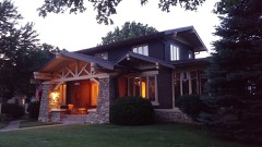 | Lewis Shaw Coleman House | building | 2016 | 16000727 |
| Lawrence County Bank Building | building | 2005 | 05000119 | |
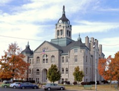 | Lawrence County Courthouse | building | 1980 | 80002374 |
| Pierce City Fire Station, Courthouse and Jail | building | 1998 | 98001108 |
Every wildfire the federal occurrence database records inside this county: 242 of them, burning about 1,459 acres. 2 started naturally and 21 were recorded as arson. Each settlement page carries the fires within five miles of it.
| Reported cause | Fires |
|---|---|
| Debris and open burning | 106 |
| Missing data/not specified/undetermined | 86 |
| Arson/incendiarism | 21 |
| Equipment and vehicle use | 15 |
| Smoking | 10 |
| Railroad operations and maintenance | 2 |
| Natural | 2 |
The five largest, by the area the report gives. Two of them were set deliberately.
| Date | Cause | Size | Reported by | Name on the report |
|---|---|---|---|---|
| 17 July 2012 | Missing data/not specified/undetermined | 200 acres | Missouri Department of Conservation | LAWRENCE 2210 |
| 5 July 2013 | Missing data/not specified/undetermined | 100 acres | Missouri Department of Conservation | not named |
| 5 August 2001 | Arson/incendiarism | 80 acres | Missouri Department of Conservation | not named |
| 29 March 1998 | Debris and open burning | 60 acres | Missouri Department of Conservation | not named |
| 9 June 2018 | Missing data/not specified/undetermined | 60 acres | Missouri Department of Conservation | 177145-05558-06092018-1104 |
| 11 March 1996 | Debris and open burning | 40 acres | Missouri Department of Conservation | not named |
| 12 December 1996 | Arson/incendiarism | 40 acres | Missouri Department of Conservation | not named |
| 16 February 1997 | Missing data/not specified/undetermined | 40 acres | Missouri Department of Conservation | not named |
Every settlement page carries the fires within five miles of it - see the settlement index below.
The NOAA Storm Events Database holds 751 reports for this county, causing 12 deaths, 54 injuries and about $177,630,730 in recorded property damage. Each settlement page carries the reports that name it.
| Kind of event | Reports |
|---|---|
| Hail | 278 |
| Thunderstorm Wind | 259 |
| Flash Flood | 112 |
| Flood | 47 |
| Tornado | 30 |
| Heavy Rain | 21 |
| Funnel Cloud | 3 |
| Drought | 1 |
The most serious of them, by death, then injury, then recorded damage. The accounts are quoted exactly as the forecast office filed them.
| When | Event | Place named | Harm | What the report says |
|---|---|---|---|---|
| May 2003 | Tornado (F3) | Pierce City | 5 killed, 33 hurt, $27,500,000 | no account filed |
| December 2002 | Tornado (F2) | Mt Vernon | 2 killed, 17 hurt, $500,000 | no account filed |
| March 2006 | Tornado (F3) | Verona | 1 killed, 1 hurt, $5,000,000 | A supercell thunderstorm that produced a tornado in Newton County, spawned a large tornado in Lawrence County approximately one mile north of Verona. The tornado damaged 46 structures and destroyed 21. One fatality occurred from flying debris striking an elderly man in his frame home north of Marionville. This tornado basically followed a similar path that another F-3 tornado tracked along during the 4 May 2003 tornado outbreak. |
| December 2015 | Flash Flood | Verona | 1 killed, $1,500,000 | A 37 year old male was swept off of Farm Road 1130 due to flash flooding. The flooding occurred along a small tributary of Browning Hollow which is a tributary of the Spring River. Nearly all low water crossings across the county were flooded. There was several rural and county roads which sustained damage from flooding. This storm report will contain the damage estimates for the entire county for this event. |
| December 2018 | Tornado (EF1) | Aurora | 1 killed, $250,000 | An EF-1 tornado developed just west of the water tower and tracked northeast to the Aurora Motel, where one fatality occurred. The tornado then tracked northward across Highway 60 and impacted Sutherlands before dissipating. Path length was near one half mile. Peak wind was estimated at 105 mph. |
| March 2008 | Flash Flood | Red Oak | 1 killed, $100,000 | Four to six inches of rain fell over Lawrence County. All locations that typically experience flooding during periods of excessive rainfall were flooded. One fatality occurred in Kelly Creek near Monett. A 19 year old male died after walking into the swift current. |
| May 2013 | Flood | Mt Vernon Arpt | 1 killed | Two people attempted to cross a low water bridge on County Road 2110 three miles west of Mount Vernon along the Spring River. One male was rescued in the river and the other male drowned. His body was later recovered. Heavy rainfall from the previous night led to elevated water levels on area streams. |
| March 1976 | Tornado (F3) | not stated | 2 hurt, $250,000 | no account filed |
| November 2005 | Tornado (F1) | Mt Vernon | 1 hurt, $750,000 | NWS storm survey determined that an F1 tornado touched down south of Mt. Vernon near the intersection of Highway 39 and FF. The tornado then moved east for five miles before lifting at county road 1230. The path was 75 yards wide. Several homes suffered moderate to significant damage. Most damage was predominantly to roofs while several trees were uprooted. One woman was injured in her home. |
| April 2026 | Hail | Verona | $118,000,000 | A hail swath from a mile to 3 miles wide began near southwest of Aurora and continued to the northeast across southeastern Lawrence County. Hail from quarters to softballs in size fell along a path from Aurora to Marionville as an intensifying left moving supercell moved to the northeast across the County. Along the storms path, numerous homes, vehicles, businesses, equipment, crops, livestock and other structures were damaged by hail before the storm passed into far western Christian County. |
| November 2003 | Hail | Aurora | $6,000,000 | A supercell thunderstorm tracked over the community of Aurora launching hail to the size of baseballs over the central and northern sections of the city. Numerous structures in the downtown area lost windows and sustained minor damage from the large hail. Two car lots were affected along with significant roof damage to homes. |
| May 2009 | Thunderstorm Wind | Plew | $3,000,000 | Sixty to 85 mph winds caused widespread wind damage across much of Lawrence County. Damage consisted of trees, power poles, structures, and business signs. Winds destroyed a garage along with several outbuildings in Round Grove, and three homes experienced roof and window damage in an area of intense tree damage. A few businesses in Mount Vernon experienced roof and window damage. One home in Miller was destroyed from winds estimated at 85 mph. In Pierce City, most of the city experienced power loss from damaged power lines and poles. Large trees were downed and blocked nearly one half dozen roads, while a roof was completely torn off of an auto shop on Commercial Street. |
| August 2007 | Flash Flood | Miller | $2,500,000 | Volunteer observations near the community of Miller measured nearly 12 inches of rain during the early morning hours as the remnants of Tropical Storm Erin passed over the county. Very serious flash flooding resulted in numerous water rescues across northern sections of the county. Several roads and low water bridges were washed out. |
| October 1979 | Tornado (F2) | not stated | $2,500,000 | no account filed |
| April 1996 | Thunderstorm Wind | Monett | $1,000,000 | no account filed |
| April 2000 | Thunderstorm Wind | Countywide | $900,000 | no account filed |
| April 2017 | Flash Flood | Rescue | $800,000 | Several homes and business sustained flood damage across the county. Numerous roads and bridges were severely damaged or washed away across the county. This report will contain the total dollar estimate for flood damage to infrastructure, businesses, and homes across Lawrence County. |
| November 2001 | Tornado (F1) | Aurora | $750,000 | no account filed |
| April 2026 | Hail | Mt Vernon | $500,000 | Tennis ball sized hail was reported in town with multiple homes and vehicles suffering damage from large hail. |
| January 2008 | Flash Flood | Greys Pt | $500,000 | Training thunderstorms caused significant flooding over countless locations in Lawrence County. Numerous roads and low water crossings were washed away. A few specific locations that experienced this flooding include a low water crossing on Farm Road 2170 approximately one quarter of a mile east of its intersection with Highway K, a section of Farm Road 1200 near its intersection with 2165. An observer near the intersection of Farm Road 1200 and Farm Road 2165 measured over five inches of rain. |
| October 2007 | Tornado (EF0) | Verona | $500,000 | A National Weather Service storm survey revealed that an EF-2 tornado touched down approximately one and a half miles north of Verona and tracked across rural areas of eastern Lawrence County. The tornado damaged five homes along with a dairy barn and a saw mill. |
| May 2011 | Tornado (EF2) | Pierce City | $300,000 | This is the continuation of the National Weather Service storm survey of the EF-2 tornado touched down five miles east northeast of Diamond, Missouri. After the tornado crossed into Lawrence County it remained on the ground for approximately seven miles of its 17 mile long track and lifted approximately three miles north of Monett. The maximum wind speeds were estimated at 120 miles per hour. The tornado damage path had a maximum width of one half mile. There were numerous trees uprooted, one mobile home was destroyed, half of a machine shop building was destroyed several outbuildings were destroyed and several homes had significant roof damage. One home had a garage door collapse along with siding damage and a separate garage had collapsed walls. |
| April 2026 | Hail | Mt Vernon | $250,000 | Hail to the size of tennis balls was reported, damaging several roofs and vehicles. |
| April 2025 | Tornado (EF1) | Verona | $250,000 | An National Weather Service survey found that an EF-1 tornado began at 9:00 AM near Highway 60 between Verona and Aurora and ended in eastern Aurora just east of Highway 60. The tornado had a path length of 4.88 miles, a width of 100 yards, and maximum wind speeds of 90 mph. The tornado damaged the roof of a church, caused minor damage to several other structures, and uprooted many large trees. |
| April 2011 | Flash Flood | Stinson | $250,000 | Route DD was closed due to flooding.||The total cost estimate for flooding damages for Lawrence County for this entire episode has been included. This includes roads, bridges, and structures which were affected. |
| September 1973 | Tornado (F1) | not stated | $250,000 | no account filed |
| April 2025 | Tornado (EF1) | Friestatt | $200,000 | An NWS survey found that an EF-1 tornado began at 8:55 AM 3 miles south of Freistatt near CR 1090 and CR 2210. The tornado had a path length of 4.18 miles, a width of 100 yards, and maximum wind speeds of 90 mph. It ended at 9:00 AM around CR 1125 and CR 1131. The tornado uprooted many trees and damaged many large limbs. It also damaged the roofs of outbuildings including a turkey barn and a residence. At its peak intensity, the tornado destroyed a small outbuilding, uprooted many trees, downed powerlines, and threw tin well downwind. |
| May 2021 | Flash Flood | Marionville | $200,000 | Widespread flooding was reported in town where rainfall accumulations of two to five inches led to flash flooding in Marionville. Five homes were impacted by flood waters and at least one water rescue was performed, no injuries were reported. Highway 60 and County Road 1140 were also flooded which contributed to a vehicle accident which caused injuries to three people. |
| June 2020 | Thunderstorm Wind | Mt Vernon | $200,000 | Multiple trees, power lines and poles were reported down in town. Numerous power outages were reported as well. Damage was reported to several buildings in town and on the square downtown. |
| July 2015 | Flash Flood | Pierce City | $200,000 | There was about 3 feet of flowing water over County Road 1050 between State Highway 37 and Highway 60. This storm report will contain the overall flood damage estimates across Lawrence County for this storm event. There were several episodes and heavy rainfall events which led to a compound affect to the flooding damage. Numerous roads, bridges, and low water crossings were heavily damaged. |
| April 2020 | Thunderstorm Wind | Friestatt | $150,000 | Several reports were received from multiple sources across the county. Winds were reported at 60 mph as a line of storms moved through the county. Reports were received from the cities of Miller, Aurora, Freistatt and Lawrenceburg. Multiple trees, large branches, power poles and lines were downed by the high winds. In the Miller fire district a downed line caused a grass small fire. Minor siding and shingle damage was reported to a few homes in Lawrenceburg. No injuries were reported. |
| April 2019 | Tornado (EF1) | Albatross | $150,000 | A National Weather Service storm survey confirmed an EF-1 tornado. This was the first of two tornadoes that touched down in the Miller area. The most concentrated damage was to a metal building on Highway 39 that had a large portion of the roof torn off. The occupant of the building saw the tornado approaching. Damage to trees southwest of that location marked the beginning of the track. Intermittent damage then extended along a path through southeast Miller, along Highway DD near the intersection of Main Street. The tornado continued northeast into inaccessible areas though damage to trees and an outbuilding was again noted along Farm Road 1140. Maximum wind speeds were estimated at 95 mph. |
| April 2025 | Tornado (EF0) | Marionville | $100,000 | A National Weather Service survey found that an EF-0 tornado began at 9:09 AM near the Lawrence County and Stone County line along CR 2210, about 2 miles west of Bradfield. The tornado had a path length of 5.17 miles, a width of 50 yards, and maximum wind speeds of 80 mph. It ended at 9:14 AM along Barke Road on the Lawrence County border side of the intersection of Stone and Christian counties. The tornado mainly uprooted many large trees in a convergent pattern, resulting in some nearby structural damage to a few outbuildings. |
| May 2024 | Tornado (EF1) | Verona | $100,000 | This is a continuation of the tornado that touched down in northern Barry County. As it continued to track into Lawrence County, this tornado continued to cause EF-1 damage, resulting in downed powerlines, and roofing panels to be torn off of a barn. Continuing further northeast south of Aurora, a mobile home was flipped over, several trees were uprooted or snapped, powerlines were down, and several houses had roof damage. |
| January 2018 | Tornado (EF1) | Opal | $100,000 | A NWS storm survey found that a brief EF-1 tornado touched down in rural Lawrence County south of Mount Vernon. A couple of farm buildings were blown down on Farm Road 2155. One barn was destroyed. At least one home had minor roof damage. Several trees were uprooted and blown down along the path. A large tree smashed two cars. Estimated maximum wind speed was up to 95 mph. |
| May 2015 | Tornado (EF1) | Friestatt | $100,000 | A NWS storm survey found an EF-1 tornado touched down about 3 miles northeast of Monett and lifted about 3 miles east of Freistatt. This tornado had a path length of about 4 miles and a width of 100 yards. Several outbuildings were completely destroyed. and one house had minor roof and siding damage. Numerous trees were uprooted or snapped along the path. The maximum winds estimated were up to 90 mph. |
| July 2003 | Thunderstorm Wind | Marionville | $80,000 | no account filed |
| August 2018 | Tornado (EF1) | Bonham | $75,000 | A National Weather Service storm survey determined that an EF1 tornado touched down near Highway Z and 39 in Barry County and continued north northeast for approximately 3.4 miles before crossing into Lawrence County ending west of Marionville. Maximum wind speeds were estimated at 90mph, a width 100 yards and total distance 9.4 miles. Numerous outbuildings damaged along the path, trees were uprooted, some power lines were downed, and two mobile homes had portions of their roofs removed. The tornado initially touched down at 6:36 pm in Barry County and ended lifted at 7:01 pm in Lawrence County. |
| January 2008 | Tornado (EF0) | Aurora | $75,000 | A National Weather storm survey revealed that an EF-0 tornado tracked across rural southeast Lawrence County. This tornado damaged a few farm houses and outbuildings. The damage track barely continued into Christian County as the tornado lifted a few yards east of the county line. |
| April 2025 | Thunderstorm Wind | Friestatt | $60,000 | A home suffered moderate siding and roof damage from high winds. |
| April 2025 | Thunderstorm Wind | Friestatt | $50,000 | Multiple trees and powerlines were reported down. |
| April 2025 | Thunderstorm Wind | Aurora | $50,000 | A vehicle was trapped in downed power lines. No injuries were reported. |
| July 2023 | Thunderstorm Wind | Verona | $50,000 | Nearly half the roof decking and shingles were removed from the roof of a home by high winds. |
| May 2021 | Flash Flood | Verona | $50,000 | A water rescue was performed to remove five people from the roof of a flooded home. no injuries occurred. |
| March 2017 | Hail | Stotts City | $50,000 | This report was from social media with pictures. There was damage to cars and homes in the Stotts City area. |
| May 2017 | Tornado (EF1) | Stotts City | $50,000 | An EF-1 tornado touched down southwest of Mount Vernon. The tornado damaged a few outbuildings and crossed I-44. At least one car was blown off the interstate near mile marker 43. The car had a large piece of wood flown through the windshield but the driver was not injured. Several trees were uprooted. Estimated maximum winds were up to 95 mph. |
| September 2014 | Thunderstorm Wind | Aurora | $50,000 | A report from social media with a picture showed a mobile home with significant roof damage. |
| August 2012 | Thunderstorm Wind | Miller | $50,000 | Numerous trees and power lines were blown down around the town of Miller. The high school bleachers at the football field were blown across the field. The high school scoreboard was completely blown down and destroyed. |
| August 2012 | Hail | Pierce City | $50,000 | Several cars had dents and cracked wind shields. |
| April 1993 | Thunderstorm Wind | Monett | $50,000 | Downburst wind gusts to 70 mph uprooted numerous trees, damaged many roofs, and destroyed a mobile home. |
| April 1993 | Thunderstorm Wind | Halltown | $50,000 | Seven large barns were damaged. |
| August 2012 | Hail | Pierce City | $50,000 | no account filed |
| April 2025 | Thunderstorm Wind | Friestatt | $40,000 | A home suffered minor siding and roof damage. |
| May 2023 | Thunderstorm Wind | Logan | $40,000 | Multiple trees and powers lines were reported down on Highway 14. |
| July 2023 | Thunderstorm Wind | Marionville | $40,000 | Winds of 60 mph downed several power lines. |
| August 2019 | Thunderstorm Wind | Lawrenceburg | $40,000 | Minor damage to a home and outbuilding were reported with several trees also uprooted in the Lawrenceburg area. Additionally, a house suffered damage along with multiple outbuildings and numerous trees uprooted eight miles east of Miller on Highway DD. |
| September 2009 | Flash Flood | Friestatt | $40,000 | Bridges were washed out along State Highway H. |
| April 2025 | Thunderstorm Wind | Friestatt | $25,000 | A large tree was blown onto a home causing minor damage. |
| March 2025 | Thunderstorm Wind | Chesapeake | $25,000 | Thunderstorm wind gusts ripped off shingles of homes in Chesapeake. |
| April 2024 | Thunderstorm Wind | Red Oak | $25,000 | Two large irrigation pivot arms were blown over and damaged by high winds. |
The Survey's mineral resources record lists 397 workings inside this county. 1 still produces and 396 are closed or unrecorded. Each settlement page carries the workings within five miles of it.
| Commodity | Workings |
|---|---|
| Lead, Zinc | 183 |
| Zinc, Lead | 133 |
| Stone, Crushed/Broken | 41 |
| Iron | 12 |
| Zinc | 6 |
| Lead | 5 |
| Clay | 5 |
| Limestone, Dimension | 4 |
| Copper | 2 |
| Copper, Lead | 1 |
| Sand and Gravel, Construction | 1 |
| Kaolin | 1 |
| Barium-Barite, Lead, Zinc | 1 |
| Barium-Barite, Iron | 1 |
The least common of them first, because a county's hundredth gravel pit says nothing its first ten did not.
| Where | Site | Commodity | Status | Recorded |
|---|---|---|---|---|
| Unknown - Barite & Iron | Barium-Barite, Iron | Past Producer | ||
| Unknown - Clay | Kaolin | Past Producer | ||
| Unknown - Clay & Iron | Iron, Clay | Past Producer | ||
| Unknown - Lead & Copper | Copper, Lead | Past Producer | ||
| Unknown - Lead & Zinc & Barite | Barium-Barite, Lead, Zinc | Past Producer | ||
| Unknown - Lead & Zinc & Iron | Lead, Zinc, Iron | Prospect | ||
| Unknown - S&G | Sand and Gravel, Construction | Past Producer | ||
| Unknown - Lead & Zinc & Copper | Lead, Zinc, Copper | Past Producer | ||
| Williams Mine | Copper | Past Producer | ||
| Unknown - Ls.Dim | Limestone, Dimension | Past Producer | ||
| Unknown - Ls.Dim | Limestone, Dimension | Past Producer | ||
| Unknown - Ls.Dim | Limestone, Dimension | Past Producer | ||
| Unknown - Ls.Dim | Limestone, Dimension | Past Producer | ||
| Hawkins Mine | Clay | Prospect | ||
| Queen City Mine | Lead | Past Producer | ||
| Richeys Mine | Lead | Past Producer | ||
| Sumner's Shaft | Clay | Past Producer | ||
| Unknown - Clay | Clay | Past Producer | ||
| Unknown - Clay | Clay | Past Producer | ||
| Unknown - Clay | Clay | Past Producer | ||
| Unknown - Lead | Lead | Prospect | ||
| Unknown - Lead | Lead | Past Producer | ||
| Unknown - Lead | Lead | Past Producer | ||
| American Zinc Mine | Zinc | Past Producer | ||
| Greenland Shaft | Zinc | Past Producer | ||
| Unknown - Zinc | Zinc | Past Producer | ||
| Unknown - Zinc | Zinc | Past Producer | ||
| Unknown - Zinc | Zinc | Past Producer | ||
| Unknown - Zinc | Zinc | Prospect | ||
| Unknown - Iron | Iron | Prospect | ||
| Unknown - Iron | Iron | Past Producer | ||
| Unknown - Iron | Iron | Past Producer | ||
| Unknown - Iron | Iron | Past Producer | ||
| Unknown - Iron | Iron | Past Producer | ||
| Unknown - Iron | Iron | Prospect | ||
| Unknown - Iron | Iron | Past Producer | ||
| Unknown - Iron | Iron | Past Producer | ||
| Unknown - Iron | Iron | Past Producer | ||
| Unknown - Iron | Iron | Prospect | ||
| Unknown - Iron | Iron | Past Producer | ||
| Unknown - Iron | Iron | Past Producer | ||
| Brumback Quarry | Stone, Crushed/Broken | Past Producer | ||
| Davis Quarry | Stone, Crushed/Broken | Past Producer | ||
| Gibbs Quarry | Stone, Crushed/Broken | Past Producer | ||
| Griesemer Quarry No.3 & Plant | Stone, Crushed/Broken | Producer | ||
| John Fenton's Quarry | Stone, Crushed/Broken | Past Producer | ||
| Kiewit Quarry | Stone, Crushed/Broken | Past Producer | ||
| Mason Quarry | Stone, Crushed/Broken | Past Producer | ||
| Menefee Quarry | Stone, Crushed/Broken | Past Producer | ||
| Nicholas Quarry | Stone, Crushed/Broken | Past Producer | ||
| Pierce City Lime Co. North Quarry | Stone, Crushed/Broken | Past Producer | ||
| Pierce City Lime Co. South Quarry | Stone, Crushed/Broken | Past Producer | ||
| Rose and Son Quarry | Stone, Crushed/Broken | Past Producer | ||
| Sifferman Quarry | Stone, Crushed/Broken | Unknown | ||
| Smerdon Quarry | Stone, Crushed/Broken | Unknown | ||
| Sullivan Quarry | Stone, Crushed/Broken | Past Producer | ||
| Unknown - Ls | Stone, Crushed/Broken | Past Producer | ||
| Unknown - Ls | Stone, Crushed/Broken | Past Producer | ||
| Unknown - Ls | Stone, Crushed/Broken | Past Producer | ||
| Unknown - Ls | Stone, Crushed/Broken | Past Producer | ||
| Unknown - Ls | Stone, Crushed/Broken | Past Producer | ||
| Unknown - Ls | Stone, Crushed/Broken | Past Producer | ||
| Unknown - Ls | Stone, Crushed/Broken | Past Producer | ||
| Unknown - Ls | Stone, Crushed/Broken | Past Producer | ||
| Unknown - Ls | Stone, Crushed/Broken | Past Producer | ||
| Unknown - Ls | Stone, Crushed/Broken | Past Producer | ||
| Unknown - Ls | Stone, Crushed/Broken | Past Producer | ||
| Unknown - Ls | Stone, Crushed/Broken | Past Producer | ||
| Unknown - Ls | Stone, Crushed/Broken | Past Producer | ||
| Unknown - Ls | Stone, Crushed/Broken | Past Producer | ||
| Unknown - Ls | Stone, Crushed/Broken | Past Producer | ||
| Unknown - Ls | Stone, Crushed/Broken | Past Producer | ||
| Unknown - Ls | Stone, Crushed/Broken | Past Producer | ||
| Unknown - Ls | Stone, Crushed/Broken | Past Producer | ||
| Unknown - Ss | Stone, Crushed/Broken | Past Producer | ||
| Unknown - Ss | Stone, Crushed/Broken | Past Producer | ||
| Unknown - Ss | Stone, Crushed/Broken | Past Producer | ||
| Unknown - Ss | Stone, Crushed/Broken | Past Producer | ||
| Unknown - Ss | Stone, Crushed/Broken | Past Producer | ||
| Unknown - Ss | Stone, Crushed/Broken | Past Producer | ||
| Unknown - Ss | Stone, Crushed/Broken | Past Producer | ||
| Unknown - Ss | Stone, Crushed/Broken | Past Producer | ||
| Allen Mine | Zinc, Lead | Past Producer | ||
| Annie Roonie Mine | Zinc, Lead | Past Producer | ||
| Apple and Son Mine | Zinc, Lead | Past Producer | ||
| Aquatic Mine | Zinc, Lead | Past Producer | ||
| Arrow Mine | Zinc, Lead | Past Producer | ||
| Aurora District-Missouri | Zinc, Lead | Occurrence | ||
| Babe Ruth Mine | Zinc, Lead | Past Producer | ||
| Baker North Mine | Zinc, Lead | Past Producer | ||
| Baker South Mine | Zinc, Lead | Past Producer | ||
| Baldwin Mine | Zinc, Lead | Past Producer | ||
| Baptist Mine | Zinc, Lead | Past Producer | ||
| Barefoot Mine | Zinc, Lead | Past Producer | ||
| Barker Mine | Zinc, Lead | Past Producer | ||
| Ben Buster Mine | Zinc, Lead | Past Producer | ||
| Big Bonanza Mine | Zinc, Lead | Past Producer | ||
| Big Six Mine | Zinc, Lead | Past Producer | ||
| Black Crook Mine | Zinc, Lead | Past Producer | ||
| Blankenship Mine | Zinc, Lead | Past Producer | ||
| Blue Bell Mine | Zinc, Lead | Past Producer | ||
| Blue Mine | Zinc, Lead | Past Producer | ||
| Bonanza Mine | Zinc, Lead | Past Producer | ||
| Boston-Loy Mine | Zinc, Lead | Past Producer | ||
| Bowyer Mine | Zinc, Lead | Past Producer | ||
| Browning Shaft | Zinc, Lead | Past Producer | ||
| C.C.C. Mine | Zinc, Lead | Past Producer | ||
| Congregational Mine | Zinc, Lead | Past Producer | ||
| Daugherty Mine | Zinc, Lead | Past Producer | ||
| Dog Mine | Zinc, Lead | Past Producer | ||
| Dresser North Mine | Zinc, Lead | Past Producer | ||
| Dresser South Mine | Zinc, Lead | Past Producer | ||
| Duke Mine | Zinc, Lead | Past Producer | ||
| East Mogul Mine | Zinc, Lead | Past Producer | ||
| Easton and Munday Mine | Zinc, Lead | Past Producer | ||
| Eaton Number One Mine | Zinc, Lead | Past Producer | ||
| Field Shaft | Zinc, Lead | Past Producer | ||
| First Methodist Mine | Zinc, Lead | Past Producer | ||
| First National Mine | Zinc, Lead | Past Producer | ||
| Flying Dutchman Mine | Zinc, Lead | Past Producer | ||
| Game Cock Mine | Zinc, Lead | Past Producer | ||
| George Curtis Mine | Zinc, Lead | Past Producer | ||
| Georgette Mine | Zinc, Lead | Past Producer | ||
| Goodwins Shaft | Zinc, Lead | Past Producer | ||
| Harding Mine | Zinc, Lead | Past Producer | ||
| Howbush Mine | Zinc, Lead | Past Producer | ||
| Jack Rabbit East Mine | Zinc, Lead | Past Producer | ||
| Julia West Shaft | Zinc, Lead | Past Producer | ||
| Jumbo Mine | Zinc, Lead | Past Producer | ||
| King David Mine | Zinc, Lead | Past Producer | ||
| Kline Tract | Zinc, Lead | Past Producer | 1910 | |
| Liles 1886 Discovery | Zinc, Lead | Past Producer | ||
| Little Betsy Mine | Zinc, Lead | Past Producer | ||
| Maryland Mine | Zinc, Lead | Past Producer | ||
| Mayflower Mine | Zinc, Lead | Past Producer | ||
| Metropolitan Mine | Zinc, Lead | Past Producer | ||
| Minor Mine | Zinc, Lead | Past Producer | ||
| Monarch Mine | Zinc, Lead | Past Producer | ||
| Mt. Vernon Mine | Zinc, Lead | Past Producer | ||
| Neucomb Mine | Zinc, Lead | Past Producer | ||
| New Wheat and Loy Mine | Zinc, Lead | Past Producer | ||
| North Mine | Zinc, Lead | Past Producer | ||
| Number Five Mine | Zinc, Lead | Past Producer | ||
| Number Four Mine | Zinc, Lead | Past Producer | ||
| Number Nine Mine | Zinc, Lead | Past Producer | ||
| Number One Mine | Zinc, Lead | Past Producer | ||
| Number Two Mine | Zinc, Lead | Past Producer | ||
| Number Two Mine | Zinc, Lead | Past Producer | ||
| Ohio Mine | Zinc, Lead | Past Producer | ||
| Old Pump Mine | Zinc, Lead | Past Producer | ||
| Old Wheat and Loy Mine | Zinc, Lead | Past Producer | ||
| Oriental Mine | Zinc, Lead | Past Producer | ||
| Osborn Mine | Zinc, Lead | Past Producer | ||
| Owens Mine | Zinc, Lead | Past Producer | 1900, 1941 | |
| Perry and Dingman Mine | Zinc, Lead | Past Producer | ||
| Persimmon Mine | Zinc, Lead | Past Producer | ||
| Porter Mine | Zinc, Lead | Past Producer | ||
| Pup Mine | Zinc, Lead | Past Producer | ||
| Purdy and Jones Shaft | Zinc, Lead | Past Producer | ||
| Red Wasp Mine | Zinc, Lead | Past Producer | ||
| Richardson North Mine | Zinc, Lead | Past Producer | ||
| Richardson South Mine | Zinc, Lead | Past Producer | ||
| Rodgers Mine | Zinc, Lead | Past Producer | ||
| Rolla Mine | Zinc, Lead | Past Producer | ||
| Scott Mine | Zinc, Lead | Past Producer | ||
| Scott and Gregory Mine | Zinc, Lead | Past Producer | ||
| Scott and Phelps Shaft | Zinc, Lead | Past Producer | ||
| Second Methodist Mine | Zinc, Lead | Past Producer | ||
| Seven Devils Mine | Zinc, Lead | Past Producer | ||
| Shaw and Sullivan Mine | Zinc, Lead | Past Producer | ||
| Sphalerite Number One Mine | Zinc, Lead | Past Producer | ||
| Sphalerite Number Two Mine | Zinc, Lead | Past Producer | ||
| Two Jakes Mine | Zinc, Lead | Past Producer | ||
| Umatilla Mine | Zinc, Lead | Past Producer | ||
| United Zinc Co. No. Four North Mine | Zinc, Lead | Past Producer | ||
| United Zinc Co. Number One Mine | Zinc, Lead | Past Producer | ||
| United Zinc Co. Number Two Mine | Zinc, Lead | Past Producer | ||
| Unknown - Lead & Zinc | Zinc, Lead | Past Producer | ||
| Unknown - Lead & Zinc | Zinc, Lead | Past Producer | ||
| Unknown - Lead & Zinc | Zinc, Lead | Past Producer | ||
| Unknown - Lead & Zinc | Zinc, Lead | Past Producer | ||
| Unknown - Lead & Zinc | Zinc, Lead | Past Producer | ||
| Unknown - Lead & Zinc | Zinc, Lead | Past Producer | ||
| Unknown - Lead & Zinc | Zinc, Lead | Past Producer | ||
| Unknown - Lead & Zinc | Zinc, Lead | Past Producer | ||
| Unknown - Lead & Zinc | Zinc, Lead | Past Producer | ||
| Unknown - Lead & Zinc | Zinc, Lead | Past Producer | ||
| Unknown - Lead & Zinc | Zinc, Lead | Past Producer | ||
| Unknown - Lead & Zinc | Zinc, Lead | Prospect | ||
| Unknown - Lead & Zinc | Zinc, Lead | Past Producer | ||
| Unknown - Lead & Zinc | Zinc, Lead | Past Producer | ||
| Unknown - Lead & Zinc | Zinc, Lead | Prospect | ||
| Unknown - Lead & Zinc | Zinc, Lead | Past Producer | ||
| Unknown - Lead & Zinc | Zinc, Lead | Past Producer | ||
| Unknown - Lead & Zinc | Zinc, Lead | Past Producer | ||
| Unknown - Lead & Zinc | Zinc, Lead | Prospect | ||
| Unknown - Lead & Zinc | Zinc, Lead | Past Producer | ||
| Unknown - Lead & Zinc | Zinc, Lead | Past Producer | ||
| Unknown - Lead & Zinc | Zinc, Lead | Past Producer | ||
| Unknown - Lead & Zinc | Zinc, Lead | Past Producer | ||
| Unknown - Lead & Zinc | Zinc, Lead | Past Producer | ||
| Unknown - Lead & Zinc | Zinc, Lead | Past Producer | ||
| Unknown - Lead & Zinc | Zinc, Lead | Past Producer | ||
| Unknown - Lead & Zinc | Zinc, Lead | Past Producer | ||
| Unknown - Lead & Zinc | Zinc, Lead | Past Producer | ||
| Unknown - Lead & Zinc | Zinc, Lead | Past Producer | ||
| Unknown - Lead & Zinc | Zinc, Lead | Past Producer | ||
| Unknown - Lead & Zinc | Zinc, Lead | Past Producer | ||
| Unknown - Lead & Zinc | Zinc, Lead | Past Producer | ||
| Unknown - Lead & Zinc | Zinc, Lead | Past Producer | ||
| Unknown - Lead & Zinc | Zinc, Lead | Past Producer | ||
| Unknown - Lead & Zinc | Zinc, Lead | Past Producer | ||
| Unknown - Lead & Zinc | Zinc, Lead | Past Producer | ||
| Unknown - Lead & Zinc | Zinc, Lead | Past Producer | ||
| World's Herald Mine | Zinc, Lead | Past Producer | ||
| Abrams Shaft | Lead, Zinc | Past Producer | ||
| Argyle Mine | Lead, Zinc | Past Producer | ||
| Ashens Mine | Lead, Zinc | Past Producer | ||
| Babe Charley Mine | Lead, Zinc | Past Producer | ||
| Baby Ed Mine | Lead, Zinc | Past Producer | ||
| Baldwin Mine | Lead, Zinc | Past Producer | ||
| Biglow Mine | Lead, Zinc | Past Producer | ||
| Boy Charley Mine | Lead, Zinc | Past Producer | ||
| Buchanan Mine | Lead, Zinc | Past Producer | ||
| Buckeye Mine | Lead, Zinc | Past Producer | ||
| Budweiser Mine | Lead, Zinc | Past Producer | ||
| Bull Run Mine | Lead, Zinc | Past Producer | ||
| Burney Mine | Lead, Zinc | Past Producer | ||
| C.P. Mine | Lead, Zinc | Past Producer | ||
| Calamity Mine | Lead, Zinc | Past Producer | ||
| Carlin Mine | Lead, Zinc | Past Producer | ||
| Chief Mine | Lead, Zinc | Past Producer | ||
| Childress Shaft | Lead, Zinc | Past Producer | ||
| Christian Mine | Lead, Zinc | Past Producer | ||
| Cinch Mine | Lead, Zinc | Past Producer | ||
| Coats Mine | Lead, Zinc | Past Producer | ||
| Coleman Brothers Mine | Lead, Zinc | Past Producer | ||
| Columbia Mine | Lead, Zinc | Past Producer | ||
| Cotton Tail Mine | Lead, Zinc | Past Producer | ||
| D.B.Loy and Co. Mine | Lead, Zinc | Past Producer | ||
| Daisy Bell Mine | Lead, Zinc | Past Producer | ||
| Double Bob Mine | Lead, Zinc | Past Producer | ||
| East End Mine | Lead, Zinc | Past Producer | ||
| Feaster Mine | Lead, Zinc | Past Producer | ||
| Federal Mine | Lead, Zinc | Past Producer | ||
| Ferguson and Co. Mine | Lead, Zinc | Past Producer | ||
| Globe Prospect Number One | Lead, Zinc | Prospect | ||
| Globe Prospect Number Two | Lead, Zinc | Prospect | ||
| Gold Dust Mine | Lead, Zinc | Past Producer | ||
| Good Friday Mine | Lead, Zinc | Past Producer | ||
| Goodman Mine | Lead, Zinc | Past Producer | ||
| Grandpa's Wonder Mine | Lead, Zinc | Past Producer | ||
| Griffith Mine | Lead, Zinc | Past Producer | ||
| Hafford and Peak Mine | Lead, Zinc | Past Producer | ||
| Hale Mine | Lead, Zinc | Past Producer | ||
| Hall Mine | Lead, Zinc | Past Producer | ||
| Hays City Mine | Lead, Zinc | Past Producer | ||
| Holy Moses Mine | Lead, Zinc | Past Producer | ||
| Homestead Mine | Lead, Zinc | Past Producer | ||
| Honaker Mine | Lead, Zinc | Past Producer | ||
| Hoosier North Mine | Lead, Zinc | Past Producer | ||
| Hoosier South Mine | Lead, Zinc | Past Producer | ||
| Hubble Mine | Lead, Zinc | Past Producer | ||
| I. X. L. Mine | Lead, Zinc | Past Producer | ||
| Illinois Shaft | Lead, Zinc | Past Producer | ||
| Independence Mine | Lead, Zinc | Past Producer | ||
| Indiana Mine | Lead, Zinc | Past Producer | ||
| Jack Rabbit West Mine | Lead, Zinc | Past Producer | ||
| James Mine | Lead, Zinc | Past Producer | ||
| Judd Mine | Lead, Zinc | Past Producer | ||
| Julia C. Mine | Lead, Zinc | Past Producer | ||
| Keys Mine | Lead, Zinc | Past Producer | ||
| Keystone Mine | Lead, Zinc | Past Producer | ||
| Klondike Mine | Lead, Zinc | Past Producer | ||
| Larkin Mine | Lead, Zinc | Past Producer | ||
| Last Chance Mine | Lead, Zinc | Past Producer | ||
| Lawrenceburg Mine | Lead, Zinc | Past Producer | ||
| Lee and Company Mine | Lead, Zinc | Past Producer | ||
| Lightning Mine | Lead, Zinc | Past Producer | ||
| Line Shaft | Lead, Zinc | Past Producer | ||
| Little Nugget Mine | Lead, Zinc | Past Producer | ||
| Little Rolla Mine | Lead, Zinc | Past Producer | ||
| Log Cabin Mine | Lead, Zinc | Past Producer | ||
| Long and Company East Mine | Lead, Zinc | Past Producer | ||
| Long and Company West Mine | Lead, Zinc | Past Producer | ||
| Louisville Mine | Lead, Zinc | Past Producer | ||
| Lucky Bill Mine | Lead, Zinc | Past Producer | ||
| Lucky Dick Mine | Lead, Zinc | Past Producer | ||
| Lucky Jack Mine | Lead, Zinc | Past Producer | ||
| Lulu Mine | Lead, Zinc | Past Producer | ||
| M. Collough Mine | Lead, Zinc | Past Producer | ||
| M.K.T. Mine | Lead, Zinc | Past Producer | ||
| Martian Shaft | Lead, Zinc | Past Producer | ||
| Mccloud Mine | Lead, Zinc | Past Producer | ||
| Mcclure Mine | Lead, Zinc | Past Producer | ||
| Melton Mine | Lead, Zinc | Past Producer | ||
| Mill Shaft | Lead, Zinc | Past Producer | ||
| Mooney Mine | Lead, Zinc | Past Producer | ||
| Morgan Mine | Lead, Zinc | Past Producer | ||
| Mystic Valley Shaft | Lead, Zinc | Past Producer | ||
| Nieely Mine | Lead, Zinc | Past Producer | ||
| Number Six Mine | Lead, Zinc | Past Producer | ||
| Patti Rosa Mine | Lead, Zinc | Past Producer | ||
| Porter Mine | Lead, Zinc | Past Producer | ||
| Post and Reynolds Mine | Lead, Zinc | Past Producer | ||
| Rickman Mine | Lead, Zinc | Past Producer | ||
| Ritter Mine | Lead, Zinc | Past Producer | ||
| Rosebud East Mine | Lead, Zinc | Past Producer | ||
| Rosebud West Mine | Lead, Zinc | Past Producer | ||
| Rustler Mine | Lead, Zinc | Past Producer | ||
| Sand Ridge Mine | Lead, Zinc | Past Producer | ||
| Sandoval Mine | Lead, Zinc | Past Producer | ||
| Sandy Hill Mine | Lead, Zinc | Past Producer | ||
| Sassafrass Mine | Lead, Zinc | Past Producer | ||
| Schmook Mine | Lead, Zinc | Past Producer | ||
| Second National Mine | Lead, Zinc | Past Producer | ||
| Sedalia Mine | Lead, Zinc | Past Producer | ||
| Shaft One | Lead, Zinc | Past Producer | ||
| Shipman Mine | Lead, Zinc | Past Producer | ||
| Sholten Mine | Lead, Zinc | Past Producer | ||
| Shot Gun Mine | Lead, Zinc | Past Producer | ||
| Smith Mine | Lead, Zinc | Past Producer | ||
| South Bonanza Mine | Lead, Zinc | Past Producer | ||
| South Shaft | Lead, Zinc | Past Producer | ||
| Southworth Shaft | Lead, Zinc | Past Producer | ||
| Spann Mine | Lead, Zinc | Past Producer | ||
| Spillman - Campbell Mine | Lead, Zinc | Past Producer | ||
| Spring River Shaft | Lead, Zinc | Past Producer | ||
| Springfield Mine | Lead, Zinc | Past Producer | ||
| Sprinkle Mine | Lead, Zinc | Past Producer | ||
| St. Clair Mine | Lead, Zinc | Past Producer | ||
| Stanberry Diggings | Lead, Zinc | Past Producer | ||
| Starr Mine | Lead, Zinc | Past Producer | ||
| Summit City Mine | Lead, Zinc | Past Producer | ||
| Sunshine Mine | Lead, Zinc | Past Producer | ||
| Third National Mine | Lead, Zinc | Past Producer | ||
| Thurman Mine | Lead, Zinc | Past Producer | ||
| Thurman Mine | Lead, Zinc | Past Producer | ||
| Tom Thumb Mine | Lead, Zinc | Past Producer | ||
| Trilby Mine | Lead, Zinc | Past Producer | ||
| Turkey Track Mine | Lead, Zinc | Past Producer | ||
| Tyndatz Mine | Lead, Zinc | Past Producer | ||
| United Zinc Co. No. Four South Mine | Lead, Zinc | Past Producer | ||
| United Zinc Co. Number Three Mine | Lead, Zinc | Past Producer | ||
| Unknown - Lead & Zinc | Lead, Zinc | Past Producer | ||
| Unknown - Lead & Zinc | Lead, Zinc | Past Producer | ||
| Unknown - Lead & Zinc | Lead, Zinc | Past Producer | ||
| Unknown - Lead & Zinc | Lead, Zinc | Past Producer | ||
| Unknown - Lead & Zinc | Lead, Zinc | Prospect | ||
| Unknown - Lead & Zinc | Lead, Zinc | Past Producer | ||
| Unknown - Lead & Zinc | Lead, Zinc | Past Producer | ||
| Unknown - Lead & Zinc | Lead, Zinc | Past Producer | ||
| Unknown - Lead & Zinc | Lead, Zinc | Past Producer | ||
| Unknown - Lead & Zinc | Lead, Zinc | Past Producer | ||
| Unknown - Lead & Zinc | Lead, Zinc | Prospect | ||
| Unknown - Lead & Zinc | Lead, Zinc | Prospect | ||
| Unknown - Lead & Zinc | Lead, Zinc | Prospect | ||
| Unknown - Lead & Zinc | Lead, Zinc | Past Producer | ||
| Unknown - Lead & Zinc | Lead, Zinc | Prospect | ||
| Unknown - Lead & Zinc | Lead, Zinc | Prospect | ||
| Unknown - Lead & Zinc | Lead, Zinc | Past Producer | ||
| Unknown - Lead & Zinc | Lead, Zinc | Past Producer | ||
| Unknown - Lead & Zinc | Lead, Zinc | Past Producer | ||
| Unknown - Lead & Zinc | Lead, Zinc | Past Producer | ||
| Unknown - Lead & Zinc | Lead, Zinc | Past Producer | ||
| Unknown - Lead & Zinc | Lead, Zinc | Past Producer | ||
| Unknown - Lead & Zinc | Lead, Zinc | Past Producer | ||
| Unknown - Lead & Zinc | Lead, Zinc | Past Producer | ||
| Unknown - Lead & Zinc | Lead, Zinc | Past Producer | ||
| Unknown - Lead & Zinc | Lead, Zinc | Past Producer | ||
| Unknown - Lead & Zinc | Lead, Zinc | Past Producer | ||
| Unknown - Lead & Zinc | Lead, Zinc | Past Producer | ||
| Unknown - Lead & Zinc | Lead, Zinc | Past Producer | ||
| Unknown - Lead & Zinc | Lead, Zinc | Past Producer | ||
| Unknown - Lead & Zinc | Lead, Zinc | Past Producer | ||
| Unknown - Lead & Zinc | Lead, Zinc | Past Producer | ||
| Unknown - Lead & Zinc | Lead, Zinc | Past Producer | ||
| Unknown - Lead & Zinc | Lead, Zinc | Past Producer | ||
| Unknown - Lead & Zinc | Lead, Zinc | Prospect | ||
| Unknown - Lead & Zinc | Lead, Zinc | Past Producer | ||
| Unknown - Lead & Zinc | Lead, Zinc | Past Producer | ||
| Unknown - Lead & Zinc | Lead, Zinc | Past Producer | ||
| Unknown - Lead & Zinc | Lead, Zinc | Past Producer | ||
| Unknown - Lead & Zinc | Lead, Zinc | Past Producer | ||
| Unknown - Lead & Zinc | Lead, Zinc | Past Producer | ||
| Unknown - Lead & Zinc | Lead, Zinc | Past Producer | ||
| Unknown - Lead & Zinc | Lead, Zinc | Past Producer | ||
| Unknown - Lead & Zinc | Lead, Zinc | Past Producer | ||
| Valley Queen Mine | Lead, Zinc | Past Producer | ||
| Wandering Jew Mine | Lead, Zinc | Past Producer | ||
| Waterdog Mine | Lead, Zinc | Past Producer | ||
| West Mogul Mine | Lead, Zinc | Past Producer | ||
| White Horse Mine | Lead, Zinc | Past Producer | ||
| Wilson Mine | Lead, Zinc | Past Producer | ||
| Wilson and Fenton Mine | Lead, Zinc | Past Producer | ||
| World's Fair Mine | Lead, Zinc | Past Producer | ||
| Zumbrunn Mine | Lead, Zinc | Past Producer |
Named settlements recorded in the Geographic Names Information System, each with the topographic sheets covering it. Villages, hamlets and abandoned places alike. Each is shown with the nearest named watercourse or landform and the survey quadrangle it falls on.
Buck Prairie township · 65605 · On Hemphill Branch · Aurora quadrangle
12 sheets, 1942 to 1985
Mount Pleasant township · 64873 · Near Pleasant Valley · Sarcoxie quadrangle
18 sheets, 1886 to 1991
Mount Vernon township · 65605 · On Elm Branch · Chesapeake quadrangle
19 sheets, 1886 to 1982
Pierce township · 65708 · Monett quadrangle
11 sheets, 1943 to 1985
No longer a settlement
Mount Vernon township · 65712 · On Dry Fork · Rescue quadrangle
17 sheets, 1886 to 1982
No longer a settlement
Mount Vernon township · 65605 · On Elm Branch · Chesapeake quadrangle
19 sheets, 1886 to 1982
Ozark township · 65604 · On Johnson Creek · Halltown quadrangle
18 sheets, 1886 to 1982
Pierce township · 65723 · Pierce City quadrangle
11 sheets, 1943 to 1986
No longer a settlement
Vineyard township · 65756 · Near Marti Hollow · Stotts City quadrangle
17 sheets, 1886 to 1982
The vanished settlements of Lawrence County: the places named above that are no longer on the map.