 Block
From the record
1 National Register listing published here.
Sources: the National Register database, National Park Service
62 topographic sheets cover 29 settlements here, and 1 property is on the National Register of Historic Places.
1 National Register listing published here.
Sources: the National Register database, National Park Service
Every property in this county listed on the National Register of Historic Places, with the year it was listed and the federal nomination document.
| Photograph | Property | Type | Listed | Reference |
|---|---|---|---|---|
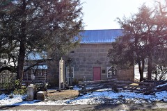 | Maries County Jail and Sheriff's House | building | 2002 | 02000101 |
Every wildfire the federal occurrence database records inside this county: 191 of them, burning about 2,544 acres. 3 started naturally and 10 were recorded as arson. Each settlement page carries the fires within five miles of it.
| Reported cause | Fires |
|---|---|
| Debris and open burning | 106 |
| Missing data/not specified/undetermined | 51 |
| Equipment and vehicle use | 14 |
| Arson/incendiarism | 10 |
| Smoking | 6 |
| Natural | 3 |
| Recreation and ceremony | 1 |
The five largest, by the area the report gives. None of them was recorded as arson.
| Date | Cause | Size | Reported by | Name on the report |
|---|---|---|---|---|
| 6 March 2010 | Missing data/not specified/undetermined | 454 acres | Missouri Department of Conservation | KK RANCH ROAD |
| 7 March 1997 | Debris and open burning | 120 acres | Missouri Department of Conservation | not named |
| 16 March 1994 | Debris and open burning | 110 acres | Missouri Department of Conservation | not named |
| 21 November 1999 | Debris and open burning | 80 acres | Missouri Department of Conservation | not named |
| 17 March 1994 | Debris and open burning | 75 acres | Missouri Department of Conservation | not named |
| 16 February 1994 | Missing data/not specified/undetermined | 60 acres | Missouri Department of Conservation | not named |
| 14 February 1994 | Debris and open burning | 55 acres | Missouri Department of Conservation | not named |
| 18 April 1995 | Debris and open burning | 50 acres | Missouri Department of Conservation | not named |
Every settlement page carries the fires within five miles of it - see the settlement index below.
The NOAA Storm Events Database holds 287 reports for this county, causing no deaths, 7 injuries and about $9,991,250 in recorded property damage. Each settlement page carries the reports that name it.
| Kind of event | Reports |
|---|---|
| Thunderstorm Wind | 103 |
| Hail | 96 |
| Flash Flood | 60 |
| Flood | 14 |
| Tornado | 10 |
| Heavy Rain | 4 |
The most serious of them, by death, then injury, then recorded damage. The accounts are quoted exactly as the forecast office filed them.
| When | Event | Place named | Harm | What the report says |
|---|---|---|---|---|
| April 2023 | Tornado (EF2) | Veto | 5 hurt, $2,000,000 | A National Weather Service storms survey determined that an EF-2 tornado with maximum winds of 122 mph touched down west of Vichy and traveled 6.8 miles lifting just northeast of the Vichy/Rolla airport. The path of the tornado was intermittent with mostly EF-1 damage but EF-2 damage did occur west of Vichy to north east of Vichy. Along the path, which was 880 yards at its widest, multiple trees were uprooted or snapped. A home suffered significant damage to exterior walls and some interior walls. Several other homes suffered minor siding damage. Two metal frame buildings lost roofs, and another metal building had two walls blown down at the Vichy/Rolla Airport where the ASOS measured 97 mph winds. Several outbuildings suffered minor to major damage, two aircraft suffered minor damage. Five people suffered minor injuries. |
| January 2008 | Tornado (EF0) | Veto | 1 hurt, $5,000,000 | This tornado is an extension of the Phelps County tornado. A National Weather Service storm survey revealed that an EF-1 tornado tracked into southeast Maries County. The tornado tracked directly over the Vichy Airport where it damaged four airplanes. Approximately 40 structures were damaged including a destroyed mobile home northeast of Vichy. As the storm moved across the airfield, the Vichy ASOS, located at the Rolla/Vichy airport, measured an 83 knot gust and a rapid change in wind direction. |
| March 1998 | Thunderstorm Wind | Vichy | 1 hurt, $30,000 | Thunderstorms winds blew over a mobile home along County Road 452 near Vichy. A teenage girl inside suffered minor injuries. VIH ASOS site nearby reported a wind gust to 68 knots at 1609 CST. |
| April 2017 | Flood | Vienna | $500,000 | Several homes and roads sustained flood damage across the county. This report will contain the total dollar estimate for flood damage to infrastructure, businesses, and homes across Maries County. |
| August 2013 | Flash Flood | Vienna | $500,000 | This storm report will include the total estimated damages and cost for the flooding event. Numerous roads were under water and impassable throughout the county. One resident was evacuated from their home on County Road 213 on the northwest side of town. Several high water rescues were performed. Several homes were flooded and low water crossings damaged. |
| April 1994 | Thunderstorm Wind | Belle | $500,000 | A shed was blown off its foundation and into the west side of a neighboring house. Winds ripped apart the breezeway from another house and drove the pole supports into the roof. At least two other houses received damage to shingles. Strong winds also brought down a few power lines and large trees. |
| December 2015 | Flash Flood | (Vih)Rolla/Vichy Arp | $250,000 | Numerous low water crossings were flooded. Several county roads and homes sustained flood damage. This storm report will contain the damage estimates for the entire county for this event. |
| April 1982 | Tornado (F2) | not stated | $250,000 | no account filed |
| April 2011 | Flood | Vienna | $100,000 | Several low water crossing and rural roads were flooded and impassable.||The total cost estimate for flooding damages for Maries County for this entire episode has been included. This includes roads, bridges, and structures which were affected. |
| April 2011 | Flood | Veto | $100,000 | A housing area off State Highway E near the Gasconade River was cut off due to flooding of County Road 540. |
| August 2023 | Hail | Vienna | $75,000 | Gold ball sized hail was reported. Minor damage to a few homes and vehicles occurred. |
| June 1999 | Tornado (F1) | Brinktown | $75,000 | no account filed |
| April 2023 | Thunderstorm Wind | (Vih)Rolla/Vichy Arp | $60,000 | Two mobile homes suffered light to moderate damage with one being moved off its foundation. Multiple trees were blown down and a barn suffered moderate roof damage. |
| August 2023 | Thunderstorm Wind | Vienna | $60,000 | Multiple power poles and lines were reported down due to high winds. |
| September 2023 | Thunderstorm Wind | Vienna | $50,000 | Several trees and power lines were reported down. |
| August 2020 | Thunderstorm Wind | Vienna | $50,000 | Multiple tree limbs were down on power lines and several power poles were snapped. |
| April 1994 | Thunderstorm Wind | Vienna | $50,000 | Strong winds caused a barn to collapse along County Road AA at the north side of Vienna. The barn trapped six head of cattle but all were rescued without injury. Wind also pushed over and uprooted several large trees, as well as power lines. |
| June 2010 | Thunderstorm Wind | Vichy | $35,000 | Thunderstorm winds heavily damaged the roofs of two condominium units along Copper Ridge Drive. Two docks were also damaged. |
| April 2023 | Thunderstorm Wind | Vichy | $30,000 | Multiple large limbs up to 3 inches in diameter were reported down along with multiple power lines. |
| May 2009 | Flash Flood | Brinktown | $25,000 | Two to four inches of rain fell over Maries County that resulted in widespread flooding of county roads. Several roads, low water crossings, and culverts were washed out. |
| November 1960 | Tornado (F2) | not stated | $25,000 | no account filed |
| November 1960 | Tornado (F2) | not stated | $25,000 | no account filed |
| April 2024 | Thunderstorm Wind | Safe | $20,000 | A NWS storm survey determined that straight line winds up to 80 mph caused damage to several outbuildings. |
| June 2007 | Thunderstorm Wind | Vienna | $20,000 | Severe downbursts blew over a large tree into a house. |
| July 2002 | Flash Flood | North Central Portion | $20,000 | no account filed |
| May 2010 | Flood | Shantytown | $15,000 | A water rescue was performed along County Road 624. Excessive rainfall caused the Maries River to flood over a low water crossing which a motorist attempted to drive across. |
| May 1996 | Flash Flood | Vienna | $15,000 | no account filed |
| December 2024 | Flash Flood | Safe | $10,000 | A successful water rescue occurred at a low water crossing on county road 432 in Maries County at the Bourbeuse River. A vehicle attempting to cross the river was swept off the bridge. |
| June 2022 | Thunderstorm Wind | Vienna | $10,000 | Four large trees and a power line were reported down on Highway 42 near the Gasconade River Bridge. |
| July 2009 | Thunderstorm Wind | Brinktown | $10,000 | Severe thunderstorm winds downed power lines along County Road 607 south of Highway 42. |
| March 1995 | Thunderstorm Wind | Vienna | $10,000 | Strong winds damaged the roofs of several houses. Most damage occurred to shingles. |
| July 2002 | Thunderstorm Wind | Belle | $10,000 | no account filed |
| May 2024 | Tornado (EF0) | Shantytown | $5,000 | This is a continuation of the EF-0 tornado that touched down in Pulaski County and tracked northeast into far northwest Phelps County and finally into Maries County. Once it crossed the Phelps/Maries County line, it continues its intermittent path for 1.07 miles, uprooting a few trees before lifting 5 miles northeast of Dixon. |
| May 2017 | Thunderstorm Wind | Belle | $5,000 | There were multiple trees and power lines blown down. |
| August 2015 | Thunderstorm Wind | Vienna | $5,000 | Several trees and power lines were blown down north of Vienna. |
| May 2015 | Thunderstorm Wind | Brinktown | $5,000 | Numerous trees were blown down and a barn had roof damage about a mile west of Highway 42 along Maries Road 215. |
| March 2012 | Flash Flood | (Vih)Rolla/Vichy Arp | $5,000 | A low water crossing was washed out on County Road 454 making the road impassable. Several other low water crossings were reported to be flooded across Maries County. |
| April 1998 | Hail | Belle | $5,000 | Hail accumulated to a depth of two to three inches along Highway M from just east of Summerfield to Belle. |
| June 1994 | Thunderstorm Wind | Vienna | $5,000 | Power lines and large tree limbs were snapped or blown down. |
| June 2002 | Thunderstorm Wind | Belle | $5,000 | no account filed |
| June 1996 | Flash Flood | Belle | $5,000 | no account filed |
| March 2008 | Thunderstorm Wind | Brinktown | $4,000 | Severe thunderstorm winds damaged a barn on Highway 28 between the towns of Dixon and Vienna. |
| April 2011 | Thunderstorm Wind | Vichy | $2,000 | A roof was blown off a 20 foot by 40 foot tractor shed near the intersection of County Road 449 and Highway 68. |
| June 2009 | Thunderstorm Wind | Belle | $2,000 | Severe thunderstorm wind gusts knocked over large trees over causing power lines to fall. |
| June 2005 | Thunderstorm Wind | Vichy | $2,000 | Severe thunderstorm wind gusts downed a couple of power lines near the junction of Highways 63 and 68. |
| June 2024 | Thunderstorm Wind | Belle | $1,500 | A large tree fell down on a house near Belle. |
| May 2024 | Thunderstorm Wind | Belle | $1,000 | Report of a tree down off Highway 28 south of Belle. |
| April 2011 | Thunderstorm Wind | Lanes Prairie | $1,000 | A tree was reported down and blocking County Road 219 near the Z Highway intersection. |
| March 2008 | Flash Flood | Van Cleve | $1,000 | Four to five inches of rain fell over Maries County. Major damage to county roads occurred, while all locations that typically experience flooding during periods of heavy rain were flooded. A few sections of Highway 63 became impassable to motorists. |
| April 1998 | Thunderstorm Wind | Vichy | $1,000 | Thunderstorms estimated at 50 mph blew down a shed near the community of Paydown and blew down power lines along Highway 42 between Belle and Vichy. |
| June 1994 | Thunderstorm Wind | Dixon | $500 | Large trees were blown down. |
| July 1957 | Tornado (F1) | not stated | $250 | no account filed |
| April 2025 | Flash Flood | Vienna | - | Route AA at the Maries River and the Little Maries River crossings was flooded and impassable. |
| May 2025 | Hail | Vichy | - | Report of quarter size hail. |
| May 2024 | Thunderstorm Wind | (Vih)Rolla/Vichy Arp | - | The Vichy ASOS recorded a 67 mph wind gust. |
| May 2024 | Flash Flood | Veto | - | Several county roads were flooded in Maries County due to heavy rain. |
| February 2023 | Thunderstorm Wind | (Vih)Rolla/Vichy Arp | - | The Vichy/Rolla ASOS recorded a 53 knot wind gust. |
| April 2023 | Thunderstorm Wind | (Vih)Rolla/Vichy Arp | - | Several trees were reported uprooted or snapped. |
| April 2023 | Hail | Vichy | - | Golf ball sized hail was reported. |
| July 2023 | Thunderstorm Wind | Belle | - | A few large trees were reported blown down at Belle. |
The Survey's mineral resources record lists 167 workings inside this county. 1 still produces and 166 are closed or unrecorded. Each settlement page carries the workings within five miles of it.
| Commodity | Workings |
|---|---|
| Fire Clay (Refractory) | 139 |
| Stone, Crushed/Broken | 11 |
| Iron | 7 |
| Sand and Gravel, Construction | 3 |
| Lead | 2 |
| Sulfur-Pyrite | 2 |
| Zinc, Lead | 1 |
| Iron, Fire Clay (Refractory) | 1 |
| Lead, Zinc | 1 |
The least common of them first, because a county's hundredth gravel pit says nothing its first ten did not.
| Where | Site | Commodity | Status | Recorded |
|---|---|---|---|---|
| Great Future Mine | Zinc, Lead | Past Producer | ||
| O. H. Jones Pit | Iron, Fire Clay (Refractory) | Past Producer | ||
| Unknown - Lead & Zinc | Lead, Zinc | Past Producer | ||
| Chrisman Diggins | Lead | Past Producer | ||
| Copper Mine | Sulfur-Pyrite | Past Producer | ||
| Pioneer #1 Mine | Sulfur-Pyrite | Past Producer | ||
| Unknown - Lead | Lead | Past Producer | ||
| Unknown - Sand & Gravel | Sand and Gravel, Construction | Past Producer | ||
| Unknown - Sand & Gravel | Sand and Gravel, Construction | Past Producer | ||
| Unknown - Sand & Gravel | Sand and Gravel, Construction | Past Producer | ||
| Chrisman Bank | Iron | Past Producer | ||
| Unknown - Fe | Iron | Past Producer | ||
| Unknown - Iron | Iron | Past Producer | ||
| Unknown - Iron | Iron | Past Producer | ||
| Unknown - Iron | Iron | Past Producer | ||
| Unknown - Iron | Iron | Past Producer | ||
| Unknown - Iron | Iron | Past Producer | ||
| Unknown - Limestone | Stone, Crushed/Broken | Past Producer | ||
| Unknown - Limestone | Stone, Crushed/Broken | Past Producer | ||
| Unknown - Limestone | Stone, Crushed/Broken | Past Producer | ||
| Unknown - Limestone | Stone, Crushed/Broken | Past Producer | ||
| Unknown - Limestone | Stone, Crushed/Broken | Past Producer | ||
| Unknown - Limestone | Stone, Crushed/Broken | Past Producer | ||
| Unknown - Limestone | Stone, Crushed/Broken | Past Producer | ||
| Unknown - Limestone | Stone, Crushed/Broken | Past Producer | ||
| Unknown - Limestone | Stone, Crushed/Broken | Past Producer | ||
| Vichy Quarry | Stone, Crushed/Broken | Producer | ||
| Virgil Smith | Stone, Crushed/Broken | Past Producer | ||
| Berkner Pits | Fire Clay (Refractory) | Past Producer | ||
| Bray Pit | Fire Clay (Refractory) | Past Producer | ||
| Clark Pit | Fire Clay (Refractory) | Past Producer | ||
| Clark Pit | Fire Clay (Refractory) | Past Producer | ||
| Crider Mine | Fire Clay (Refractory) | Past Producer | ||
| Dewitt Terrill Pit | Fire Clay (Refractory) | Past Producer | ||
| Donnan Pit | Fire Clay (Refractory) | Past Producer | ||
| Garner #2 | Fire Clay (Refractory) | Past Producer | ||
| Jannick #1 | Fire Clay (Refractory) | Unknown | ||
| Klebba Pit | Fire Clay (Refractory) | Past Producer | ||
| Klein Pit | Fire Clay (Refractory) | Past Producer | ||
| Newbound Mine | Fire Clay (Refractory) | Past Producer | ||
| Pointer Pit | Fire Clay (Refractory) | Past Producer | ||
| R. Brown Pit | Fire Clay (Refractory) | Past Producer | ||
| Ronike Pit | Fire Clay (Refractory) | Past Producer | ||
| Shockley #2 | Fire Clay (Refractory) | Past Producer | ||
| Shuman Pit | Fire Clay (Refractory) | Past Producer | ||
| Stockton Mine | Fire Clay (Refractory) | Past Producer | ||
| Swarty Pit | Fire Clay (Refractory) | Past Producer | ||
| Terrill #1 | Fire Clay (Refractory) | Past Producer | ||
| Terrill Clay Pit | Fire Clay (Refractory) | Past Producer | ||
| Terrill Pit | Fire Clay (Refractory) | Past Producer | ||
| Tipton Pit | Fire Clay (Refractory) | Past Producer | ||
| Unknown - Clay | Fire Clay (Refractory) | Past Producer | ||
| Unknown - Clay | Fire Clay (Refractory) | Past Producer | ||
| Unknown - Clay | Fire Clay (Refractory) | Past Producer | ||
| Unknown - Clay | Fire Clay (Refractory) | Past Producer | ||
| Unknown - Clay | Fire Clay (Refractory) | Past Producer | ||
| Unknown - Clay | Fire Clay (Refractory) | Past Producer | ||
| Unknown - Clay | Fire Clay (Refractory) | Past Producer | ||
| Unknown - Clay | Fire Clay (Refractory) | Past Producer | ||
| Unknown - Clay | Fire Clay (Refractory) | Past Producer | ||
| Unknown - Clay | Fire Clay (Refractory) | Past Producer | ||
| Unknown - Clay | Fire Clay (Refractory) | Past Producer | ||
| Unknown - Clay | Fire Clay (Refractory) | Unknown | ||
| Unknown - Clay | Fire Clay (Refractory) | Past Producer | ||
| Unknown - Clay | Fire Clay (Refractory) | Past Producer | ||
| Unknown - Clay | Fire Clay (Refractory) | Past Producer | ||
| Unknown - Clay | Fire Clay (Refractory) | Past Producer | ||
| Unknown - Clay | Fire Clay (Refractory) | Past Producer | ||
| Unknown - Clay | Fire Clay (Refractory) | Past Producer | ||
| Unknown - Clay | Fire Clay (Refractory) | Past Producer | ||
| Unknown - Clay | Fire Clay (Refractory) | Past Producer | ||
| Unknown - Clay | Fire Clay (Refractory) | Past Producer | ||
| Unknown - Clay | Fire Clay (Refractory) | Past Producer | ||
| Unknown - Clay | Fire Clay (Refractory) | Past Producer | ||
| Unknown - Clay | Fire Clay (Refractory) | Past Producer | ||
| Unknown - Clay | Fire Clay (Refractory) | Past Producer | ||
| Unknown - Clay | Fire Clay (Refractory) | Past Producer | ||
| Unknown - Clay | Fire Clay (Refractory) | Past Producer | ||
| Unknown - Clay | Fire Clay (Refractory) | Past Producer | ||
| Unknown - Clay | Fire Clay (Refractory) | Past Producer | ||
| Unknown - Clay | Fire Clay (Refractory) | Past Producer | ||
| Unknown - Clay | Fire Clay (Refractory) | Past Producer | ||
| Unknown - Clay | Fire Clay (Refractory) | Past Producer | ||
| Unknown - Clay | Fire Clay (Refractory) | Past Producer | ||
| Unknown - Clay | Fire Clay (Refractory) | Past Producer | ||
| Unknown - Clay | Fire Clay (Refractory) | Past Producer | ||
| Unknown - Clay | Fire Clay (Refractory) | Past Producer | ||
| Unknown - Clay | Fire Clay (Refractory) | Past Producer | ||
| Unknown - Clay | Fire Clay (Refractory) | Past Producer | ||
| Unknown - Clay | Fire Clay (Refractory) | Past Producer | ||
| Unknown - Clay | Fire Clay (Refractory) | Past Producer | ||
| Unknown - Clay | Fire Clay (Refractory) | Past Producer | ||
| Unknown - Clay | Fire Clay (Refractory) | Past Producer | ||
| Unknown - Clay | Fire Clay (Refractory) | Unknown | ||
| Unknown - Clay | Fire Clay (Refractory) | Past Producer | ||
| Unknown - Clay | Fire Clay (Refractory) | Past Producer | ||
| Unknown - Clay | Fire Clay (Refractory) | Past Producer | ||
| Unknown - Clay | Fire Clay (Refractory) | Past Producer | ||
| Unknown - Clay | Fire Clay (Refractory) | Past Producer | ||
| Unknown - Clay | Fire Clay (Refractory) | Past Producer | ||
| Unknown - Clay | Fire Clay (Refractory) | Past Producer | ||
| Unknown - Clay | Fire Clay (Refractory) | Past Producer | ||
| Unknown - Clay | Fire Clay (Refractory) | Past Producer | ||
| Unknown - Clay | Fire Clay (Refractory) | Past Producer | ||
| Unknown - Clay | Fire Clay (Refractory) | Past Producer | ||
| Unknown - Clay | Fire Clay (Refractory) | Past Producer | ||
| Unknown - Clay | Fire Clay (Refractory) | Past Producer | ||
| Unknown - Clay | Fire Clay (Refractory) | Past Producer | ||
| Unknown - Clay | Fire Clay (Refractory) | Past Producer | ||
| Unknown - Clay | Fire Clay (Refractory) | Past Producer | ||
| Unknown - Clay | Fire Clay (Refractory) | Past Producer | ||
| Unknown - Clay | Fire Clay (Refractory) | Past Producer | ||
| Unknown - Clay | Fire Clay (Refractory) | Past Producer | ||
| Unknown - Clay | Fire Clay (Refractory) | Past Producer | ||
| Unknown - Clay | Fire Clay (Refractory) | Past Producer | ||
| Unknown - Clay | Fire Clay (Refractory) | Past Producer | ||
| Unknown - Clay | Fire Clay (Refractory) | Past Producer | ||
| Unknown - Clay | Fire Clay (Refractory) | Past Producer | ||
| Unknown - Clay | Fire Clay (Refractory) | Past Producer | ||
| Unknown - Clay | Fire Clay (Refractory) | Past Producer | ||
| Unknown - Clay | Fire Clay (Refractory) | Past Producer | ||
| Unknown - Clay | Fire Clay (Refractory) | Past Producer | ||
| Unknown - Clay | Fire Clay (Refractory) | Past Producer | ||
| Unknown - Clay | Fire Clay (Refractory) | Past Producer | ||
| Unknown - Clay | Fire Clay (Refractory) | Past Producer | ||
| Unknown - Clay | Fire Clay (Refractory) | Past Producer | ||
| Unknown - Clay | Fire Clay (Refractory) | Past Producer | ||
| Unknown - Clay | Fire Clay (Refractory) | Past Producer | ||
| Unknown - Clay | Fire Clay (Refractory) | Past Producer | ||
| Unknown - Clay | Fire Clay (Refractory) | Past Producer | ||
| Unknown - Clay | Fire Clay (Refractory) | Past Producer | ||
| Unknown - Clay | Fire Clay (Refractory) | Past Producer | ||
| Unknown - Clay | Fire Clay (Refractory) | Past Producer | ||
| Unknown - Clay | Fire Clay (Refractory) | Past Producer | ||
| Unknown - Clay | Fire Clay (Refractory) | Past Producer | ||
| Unknown - Clay | Fire Clay (Refractory) | Past Producer | ||
| Unknown - Clay | Fire Clay (Refractory) | Past Producer | ||
| Unknown - Clay | Fire Clay (Refractory) | Past Producer | ||
| Unknown - Clay | Fire Clay (Refractory) | Past Producer | ||
| Unknown - Clay | Fire Clay (Refractory) | Past Producer | ||
| Wallace #2 | Fire Clay (Refractory) | Past Producer | ||
| Wallace Pit | Fire Clay (Refractory) | Past Producer | ||
| Waltenspile Mine | Fire Clay (Refractory) | Past Producer |
Named settlements recorded in the Geographic Names Information System, each with the topographic sheets covering it. Villages, hamlets and abandoned places alike. Each is shown with the nearest named watercourse or landform and the survey quadrangle it falls on.
Johnson township · 65559 · On Bailey Creek · Safe quadrangle
17 sheets, 1934 to 1985
No longer a settlement
Spring Creek township · 65401 · On Morresy Branch · Vichy quadrangle
17 sheets, 1937 to 1985
65401 · On Gaines Ford Branch · Nagogami Lodge quadrangle
17 sheets, 1937 to 1985
No longer a settlement
Dry Creek township · 65459 · Near Montague Hollow · Nagogami Lodge quadrangle
17 sheets, 1937 to 1985
Jackson township · 65582 · On Cedar Creek · Paydown quadrangle
18 sheets, 1937 to 1985
No longer a settlement
Jackson township · 65582 · On Cedar Creek · Vienna quadrangle
17 sheets, 1937 to 1985
Spring Creek township · 65580 · On Jack Creek · Vienna quadrangle
17 sheets, 1937 to 1985
No longer a settlement
Jefferson township · 65580 · Near Indian House Mounds · Paydown quadrangle
18 sheets, 1937 to 1985
Boone township · 65459 · On Meddleberger Branch · Van Cleve quadrangle
20 sheets, 1888 to 1987
Jefferson township · 65013 · On Mill Spring Creek · Paydown quadrangle
18 sheets, 1937 to 1985
Jefferson township · 65013 · On Mill Spring Creek · Paydown quadrangle
18 sheets, 1937 to 1985
No longer a settlement
Dry Creek township · 65459 · On Montague Creek · Nagogami Lodge quadrangle
17 sheets, 1937 to 1985
Jefferson township · 65013 · Near Fish Hollow · Summerfield quadrangle
17 sheets, 1934 to 1985
The vanished settlements of Maries County: the places named above that are no longer on the map.