 Block
From the record
10 National Register listings published here.
Sources: the National Register database, National Park Service
69 topographic sheets cover 16 settlements here, and 10 properties are on the National Register of Historic Places.
10 National Register listings published here.
Sources: the National Register database, National Park Service
Every property in this county listed on the National Register of Historic Places, with the year it was listed and the federal nomination document.
| Photograph | Property | Type | Listed | Reference |
|---|---|---|---|---|
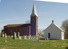 | Assumption of the Blessed Virgin Mary Parish Historic District | district | 2014 | 13001147 |
| Louis Bruce Farmstead Historic District | district | 1992 | 91001916 | |
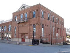 | Finke Opera House | building | 2004 | 04000214 |
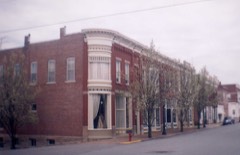 | Gray-Wood Buildings | building | 1984 | 84002594 |
| Harrison School | building | 2021 | 100006080 | |
| High Point Historic District | district | 2005 | 04001561 | |
| Maclay Mansion | building | 1979 | 79001383 | |
 | Moniteau County Courthouse Square | district | 1970 | 70000341 |
| Old Barnhill Building | building | 1982 | 82003151 | |
| Old California City Hall and Fire Station | building | 1982 | 82003152 |
Every wildfire the federal occurrence database records inside this county: 51 of them, burning about 451 acres. 2 started naturally and 1 was recorded as arson. Each settlement page carries the fires within five miles of it.
| Reported cause | Fires |
|---|---|
| Missing data/not specified/undetermined | 20 |
| Debris and open burning | 18 |
| Equipment and vehicle use | 6 |
| Smoking | 3 |
| Natural | 2 |
| Recreation and ceremony | 1 |
| Arson/incendiarism | 1 |
The five largest, by the area the report gives. One of them was set deliberately.
| Date | Cause | Size | Reported by | Name on the report |
|---|---|---|---|---|
| 21 October 1999 | Arson/incendiarism | 105 acres | Missouri Department of Conservation | not named |
| 15 February 1997 | Debris and open burning | 95 acres | Missouri Department of Conservation | not named |
| 28 April 2018 | Missing data/not specified/undetermined | 62 acres | Missouri Department of Conservation | 177841-06843-04282018-1654 |
| 29 March 1993 | Debris and open burning | 25 acres | Missouri Department of Conservation | not named |
| 19 March 2019 | Missing data/not specified/undetermined | 15 acres | Missouri Department of Conservation | 190090-06841-03192019-1955 |
| 31 January 2018 | Missing data/not specified/undetermined | 15 acres | Missouri Department of Conservation | 177701-06843-01312018-1315 |
| 4 May 2018 | Missing data/not specified/undetermined | 15 acres | Missouri Department of Conservation | 177843-06843-05042018-1921 |
| 20 March 2017 | Debris and open burning | 11 acres | Big Muddy National Wildlife Refuge | OVERTON LEVEE |
Every settlement page carries the fires within five miles of it - see the settlement index below.
The NOAA Storm Events Database holds 254 reports for this county, causing no deaths, no injuries and about $26,374,830 in recorded property damage. Each settlement page carries the reports that name it.
| Kind of event | Reports |
|---|---|
| Thunderstorm Wind | 107 |
| Hail | 92 |
| Flash Flood | 27 |
| Tornado | 21 |
| Flood | 4 |
| Heavy Rain | 2 |
| Lightning | 1 |
The most serious of them, by death, then injury, then recorded damage. The accounts are quoted exactly as the forecast office filed them.
| When | Event | Place named | Harm | What the report says |
|---|---|---|---|---|
| June 1990 | Tornado (F2) | not stated | $25,000,000 | no account filed |
| July 1998 | Flash Flood | Countywide | $350,000 | no account filed |
| March 1982 | Tornado (F1) | not stated | $250,000 | no account filed |
| April 2024 | Tornado (EF1) | Tipton | $200,000 | A tornado touched down along Alexander Road just east of intersection with Hays Road at 10:59 pm (northeast of Tipton, MO) snapping off several power poles. It tracked to the east snapping off several large trees, destroying an unoccupied mobile home, and causing minor roof damage to an outbuilding. Then the tornado veered, tracking to the northeast and causing damage to an open sided outbuilding after crossing over Cross Lane Road. The tornado soon lifted and dissipated just south of Old Twelve Highway. Overall, the tornado was rated EF1 with a path length of 1.70 miles and a max path width of 30 yards. No deaths or injuries were reported. |
| June 2005 | Lightning | Fortuna | $200,000 | A lightning strike is believed to have started a fire which destroyed the 103 year old Fortuna United Methodist Church. |
| July 2022 | Thunderstorm Wind | Tipton | $75,000 | Thunderstorm winds caused widespread wind damage across Tipton. Numerous trees and tree limbs, as well as power lines were blown down. Some of the fallen trees and tree limbs caused damage to vehicles and houses. Also, four utility poles were blown down. |
| April 1994 | Thunderstorm Wind | California | $50,000 | Pieces of a tin roof were torn off several barns. Several large trees and power lines were also knocked down. |
| June 1990 | Tornado (F1) | not stated | $25,000 | no account filed |
| November 1990 | Tornado (F1) | not stated | $25,000 | no account filed |
| May 1980 | Tornado (F2) | not stated | $25,000 | no account filed |
| August 1974 | Tornado (F0) | not stated | $25,000 | no account filed |
| August 1974 | Tornado (F0) | not stated | $25,000 | no account filed |
| October 1966 | Tornado (F2) | not stated | $25,000 | no account filed |
| October 1966 | Tornado (F2) | not stated | $25,000 | no account filed |
| May 1963 | Tornado (F1) | not stated | $25,000 | no account filed |
| August 2021 | Thunderstorm Wind | California | $5,000 | Thunderstorm winds blew down a power pole on the south side of town. |
| May 2007 | Thunderstorm Wind | Jamestown | $5,000 | Storm spotters reported a power pole and several trees down. |
| May 2007 | Flood | Lupus | $5,000 | The Missouri River flooded the northeast part of Moniteau County from Lupus to Jamestown. Some sandbagging was done in the Lupus area to protect a couple of homes. Otherwise the flooding was limited to farmland in the flood plain and roads close to the river. |
| April 1994 | Hail | Fortuna | $5,000 | Pieces of a tin roof were torn off several barns. Several large trees and power lines were also knocked down. |
| June 1994 | Thunderstorm Wind | California | $5,000 | A local radio station reported wind gusts to 79 mph with numerous trees down and shingles blown off roofs on the west side of California. |
| July 1994 | Thunderstorm Wind | California | $5,000 | A local radio station reported wind gusts of 79 mph which broke 10-inch-diameter tree limbs. |
| April 1994 | Hail | Clarksburg | $5,000 | no account filed |
| September 1972 | Tornado (F0) | not stated | $2,500 | no account filed |
| October 1967 | Tornado (F2) | not stated | $2,500 | no account filed |
| March 1961 | Tornado (F1) | not stated | $2,500 | no account filed |
| March 1961 | Tornado (F1) | not stated | $2,500 | no account filed |
| May 1955 | Tornado (F1) | not stated | $2,500 | no account filed |
| April 2008 | Flash Flood | Tipton | $1,000 | Very heavy rain, between one and three inches of rain, fell over a short amount of time on already saturated soils. Over a foot of water was reported over Park Avenue in California and 6 inches of water was flowing over U.S. 50 on the west side of Tipton. Several secondary roads had water over them as well. |
| May 1995 | Thunderstorm Wind | California | $600 | The county sheriff's department reported trees and power lines down. |
| April 1993 | Thunderstorm Wind | California | $500 | no account filed |
| July 1995 | Thunderstorm Wind | Jamestown | $200 | Power lines and poles were blown down in the Jamestown area. Winds gusts as high as 60 mph were reported several minutes later in McGirk. |
| May 1982 | Tornado (F1) | not stated | $30 | no account filed |
| April 2025 | Thunderstorm Wind | Clarksburg | - | Thunderstorm winds downed multiple 6 to 8 inch tree limbs in Clarksburg. |
| April 2025 | Thunderstorm Wind | California | - | A mesonet station measured a 61 mph wind gust near California. |
| July 2025 | Thunderstorm Wind | California | - | Thunderstorm winds snapped healthy tree branches of up to 6 inches in diameter. |
| August 2023 | Flash Flood | Enon | - | Up to seven inches of rain fell in a short amount of time causing flash flooding across the southern portions of Moniteau County. Several roads in and around High Point were flooded, including Highways 87 and C and State Route CC. |
| August 2020 | Thunderstorm Wind | California | - | Thunderstorm winds blew down several large tree limbs and a short light pole. |
| August 2020 | Thunderstorm Wind | California | - | Thunderstorm winds blew down numerous tree limbs around town as well as a tree on Howard Street. |
| May 2019 | Thunderstorm Wind | High Pt | - | Thunderstorm winds blew down some trees onto Highway CC just west of High Point. |
| May 2018 | Thunderstorm Wind | Tipton | - | Thunderstorm winds blew down numerous large tree limbs and a couple of trees around town. |
| May 2018 | Thunderstorm Wind | California | - | Thunderstorm winds blew down numerous trees and power lines around town. |
| December 2017 | Thunderstorm Wind | Enon | - | Thunderstorm winds caused some minor roof damage to a house, as well as a shed, at the intersection of Fahrni Road and Morrow Road. Further east, several trees were uprooted and a metal outbuilding had it's roof blown off. |
| March 2017 | Thunderstorm Wind | California | - | Thunderstorm winds caused minor damage to a roof of a building on the north side of California. The debris landed on Highway 87. |
| May 2017 | Thunderstorm Wind | California | - | Thunderstorm winds blew down several large trees around town. Also, a transformer caught fire. |
| April 2017 | Flash Flood | Tipton | - | Between 4 and 6 inches of rain caused flash flooding. Numerous roads were flooded including Route D northwest of Kliever. |
| October 2017 | Thunderstorm Wind | California | - | Thunderstorm winds blew down a tree onto power lines in town. |
| August 2016 | Flash Flood | Lupus | - | Up to five inches of rain fell in a short amount of time causing flash flooding. Numerous roads were flooded including Highway 179. Also, there were several roads in Jamestown flooded. |
| July 2016 | Thunderstorm Wind | California | - | A line of severe storms moved through Moniteau County. Numerous trees, tree limbs and power lines were blown down between California and Jamestown. |
| July 2016 | Flash Flood | Lupus | - | Up to five inches of rain fell in a short amount of time causing flash flooding. Numerous roads were flooded including Highway 179. Also, there were several roads in Jamestown flooded. |
| July 2015 | Thunderstorm Wind | High Pt | - | Thunderstorm winds blew down several large trees. A couple of the trees landed on power lines knocking them down. |
| July 2014 | Thunderstorm Wind | Tipton | - | Thunderstorm winds pushed over several power poles in Tipton. |
| October 2014 | Thunderstorm Wind | Tipton | - | Thunderstorm winds blew down a couple of trees and a billboard in town. |
| April 2014 | Flash Flood | Tipton | - | Up to four inches of rain fell in a short amount of time causing flash flooding. U.S. Highway 50 had a foot of water flowing over it about a mile west of Tipton. |
| April 2014 | Thunderstorm Wind | Mc Girk | - | Thunderstorm winds blew over an anchored aluminum carport and destroyed it. |
| May 2013 | Thunderstorm Wind | Tipton | - | Thunderstorm winds blew down several large trees just east of Tipton and in California. |
| May 2013 | Thunderstorm Wind | California | - | Thunderstorm winds blew down a few large trees. |
| April 2012 | Thunderstorm Wind | High Pt | - | Thunderstorm winds blew down a large cedar tree onto Highway C near intersection with Highway CC. |
| April 2011 | Thunderstorm Wind | California Phllps Ar | - | Thunderstorm winds blew over two large trees. |
| June 2011 | Thunderstorm Wind | Tipton | - | Thunderstorm winds blew down a large tree and took part of the roof off of a metal outbuilding. |
| May 2011 | Thunderstorm Wind | Clarksburg | - | Thunderstorm winds blew down several large tree limbs in town. |
The Survey's mineral resources record lists 120 workings inside this county. 3 still produce and 117 are closed or unrecorded. Each settlement page carries the workings within five miles of it.
| Commodity | Workings |
|---|---|
| Lead, Zinc | 35 |
| Stone, Crushed/Broken | 23 |
| Barium-Barite | 12 |
| Lead | 10 |
| Zinc, Lead | 9 |
| Limestone, Dimension | 5 |
| Barium-Barite, Lead, Zinc | 5 |
| Barium-Barite, Lead | 3 |
| Clay | 3 |
| Iron | 2 |
| Bituminous, Zinc | 2 |
| Flagstone | 1 |
| Barium-Barite, Bituminous, Lead, Zinc | 1 |
| Zinc, Iron, Lead | 1 |
The least common of them first, because a county's hundredth gravel pit says nothing its first ten did not.
| Where | Site | Commodity | Status | Recorded |
|---|---|---|---|---|
| Beck Mine | Zinc, Barium-Barite, Lead | Past Producer | ||
| Beck Quarry | Bituminous, Stone, Crushed/Broken | Past Producer | ||
| High Point Mine | Lead, Zinc, Barium-Barite | Past Producer | ||
| Keller Mine | Barium-Barite, Bituminous, Lead, Zinc | Past Producer | ||
| Simpson Mine | Bituminous, Lead | Past Producer | ||
| Unknown - Coal Lead Zinc | Lead, Zinc, Bituminous | Past Producer | ||
| Unknown - Lead Zinc Iron | Zinc, Iron, Lead | Past Producer | ||
| Unknown - Lead Zinc Iron | Iron, Lead, Zinc | Past Producer | ||
| Unknown - Ls Lead Zinc | Stone, Crushed/Broken, Zinc, Lead | Past Producer | ||
| Unknown - S+G | Sand and Gravel, Construction | Past Producer | ||
| Unknown - Sandstone Dimension | Flagstone | Past Producer | ||
| Hardin Mine | Bituminous, Zinc | Past Producer | ||
| Newkirk Mine | Bituminous, Zinc | Past Producer | ||
| Unknown - Iron | Iron | Past Producer | ||
| Unknown - Iron | Iron | Past Producer | ||
| Enloe Mine | Barium-Barite, Lead | Past Producer | ||
| New Brady Mines | Barium-Barite, Lead | Past Producer | ||
| Porcelain Clay Shaft | Clay | Past Producer | ||
| Unknown - Clay | Clay | Past Producer | ||
| Unknown - Clay | Clay | Past Producer | ||
| Unknown - Lead Barite | Barium-Barite, Lead | Past Producer | ||
| Crown Mine | Barium-Barite, Lead, Zinc | Past Producer | ||
| Dickson Mine | Barium-Barite, Lead, Zinc | Past Producer | ||
| King Jack Mine | Barium-Barite, Lead, Zinc | Past Producer | ||
| Liberty Mine | Barium-Barite, Lead, Zinc | Past Producer | ||
| Tiff Diggings | Barium-Barite, Lead, Zinc | Past Producer | ||
| Unknown - Ls Dimemsion | Limestone, Dimension | Past Producer | ||
| Unknown - Ls Dimension | Limestone, Dimension | Past Producer | ||
| Unknown - Ls Dimension | Limestone, Dimension | Past Producer | ||
| Unknown - Ls Dimension | Limestone, Dimension | Past Producer | ||
| Unknown - Ls Dimension | Limestone, Dimension | Past Producer | ||
| Cotton Tail Diggings | Zinc, Lead | Past Producer | ||
| Hot Springs Mine | Zinc, Lead | Prospect | ||
| Koortz Mines | Zinc, Lead | Past Producer | ||
| Shelley Mine | Zinc, Lead | Prospect | ||
| Standard Mine | Zinc, Lead | Past Producer | ||
| Unknown - Lead Zinc | Zinc, Lead | Past Producer | ||
| Unknown - Lead Zinc | Zinc, Lead | Past Producer | ||
| Unknown - Lead Zinc | Zinc, Lead | Past Producer | ||
| Unknown - Lead Zinc | Zinc, Lead | Past Producer | ||
| Carr Mines | Lead | Past Producer | ||
| Enon Mine | Lead | Past Producer | ||
| Old Brady Mines | Lead | Past Producer | ||
| Unknown - Lead | Lead | Past Producer | ||
| Unknown - Lead | Lead | Past Producer | ||
| Unknown - Lead | Lead | Past Producer | ||
| Unknown - Lead | Lead | Past Producer | ||
| Unknown - Lead | Lead | Past Producer | ||
| Unknown - Lead | Lead | Past Producer | ||
| Unknown - Lead | Lead | Past Producer | ||
| Honey Mine | Barium-Barite | Past Producer | ||
| Mcdonald Mine | Barium-Barite | Past Producer | ||
| Ramon Mine | Barium-Barite | Past Producer | ||
| Rastover Prospect | Barium-Barite | Prospect | ||
| Simmers Barite Mine | Barium-Barite | Past Producer | ||
| Starks Mine | Barium-Barite | Past Producer | ||
| Steubinger Mine | Barium-Barite | Past Producer | ||
| Tiff Mine | Barium-Barite | Past Producer | ||
| Unknown - Barite | Barium-Barite | Past Producer | ||
| Unknown - Barite | Barium-Barite | Past Producer | ||
| Unknown - Barite | Barium-Barite | Past Producer | ||
| Unknown - Barite | Barium-Barite | Past Producer | ||
| Balmer Quarry | Stone, Crushed/Broken | Past Producer | ||
| Lime & Rock Quarry & Plant | Stone, Crushed/Broken | Producer | ||
| Lupus Quarry | Stone, Crushed/Broken | Producer | ||
| Lupus Quarry | Stone, Crushed/Broken | Past Producer | ||
| Moniteau Co Quarry & Plant | Stone, Crushed/Broken | Producer | ||
| Thomas Quarry #1 | Stone, Crushed/Broken | Past Producer | ||
| Unknown - Ls | Stone, Crushed/Broken | Past Producer | ||
| Unknown - Ls | Stone, Crushed/Broken | Past Producer | ||
| Unknown - Ls | Stone, Crushed/Broken | Past Producer | ||
| Unknown - Ls | Stone, Crushed/Broken | Past Producer | ||
| Unknown - Ls | Stone, Crushed/Broken | Past Producer | ||
| Unknown - Ls | Stone, Crushed/Broken | Past Producer | ||
| Unknown - Ls | Stone, Crushed/Broken | Past Producer | ||
| Unknown - Ls | Stone, Crushed/Broken | Past Producer | ||
| Unknown - Ls | Stone, Crushed/Broken | Past Producer | ||
| Unknown - Ls | Stone, Crushed/Broken | Past Producer | ||
| Unknown - Ls | Stone, Crushed/Broken | Past Producer | ||
| Unknown - Ls | Stone, Crushed/Broken | Past Producer | ||
| Unknown - Ls | Stone, Crushed/Broken | Past Producer | ||
| Unknown - Ls | Stone, Crushed/Broken | Past Producer | ||
| Unknown - Ls | Stone, Crushed/Broken | Past Producer | ||
| Unknown - Ls | Stone, Crushed/Broken | Past Producer | ||
| Unknown - Sandstone C+B | Stone, Crushed/Broken | Past Producer | ||
| Clarke + Blair Mine | Lead, Zinc | Past Producer | ||
| Eames Diggings | Lead, Zinc | Past Producer | ||
| English + Powell Diggings | Lead, Zinc | Past Producer | ||
| English Mine | Lead, Zinc | Past Producer | ||
| Geneva Mine | Lead, Zinc | Prospect | ||
| Gundling Mine | Lead, Zinc | Past Producer | ||
| Hart Diggings | Lead, Zinc | Past Producer | ||
| Herschey Mine | Lead, Zinc | Prospect | ||
| Howard Mine | Lead, Zinc | Past Producer | ||
| Joslyn Mine | Lead, Zinc | Past Producer | ||
| Kellog Diggings | Lead, Zinc | Past Producer | ||
| Kelsay Mine | Lead, Zinc | Past Producer | ||
| Klinger Diggings | Lead, Zinc | Past Producer | ||
| Little Rose Mine | Lead, Zinc | Past Producer | ||
| Longshot Mine | Lead, Zinc | Past Producer | ||
| Merrill Mine | Lead, Zinc | Past Producer | ||
| Mineral Point Dig | Lead, Zinc | Past Producer | ||
| New Discovery Mine | Lead, Zinc | Past Producer | ||
| Penn Mine | Lead, Zinc | Past Producer | ||
| Reed Diggings | Lead, Zinc | Past Producer | ||
| Rose Mine | Lead, Zinc | Past Producer | ||
| Sartin Mine | Lead, Zinc | Past Producer | ||
| Superior Mine | Lead, Zinc | Past Producer | ||
| Unknown - Lead Zinc | Lead, Zinc | Past Producer | ||
| Unknown - Lead Zinc | Lead, Zinc | Past Producer | ||
| Unknown - Lead Zinc | Lead, Zinc | Past Producer | ||
| Unknown - Lead Zinc | Lead, Zinc | Past Producer | ||
| Unknown - Lead Zinc | Lead, Zinc | Past Producer | ||
| Unknown - Lead Zinc | Lead, Zinc | Past Producer | ||
| Unknown - Lead Zinc | Lead, Zinc | Past Producer | ||
| Unknown - Lead Zinc | Lead, Zinc | Past Producer | ||
| Unknown - Lead Zinc | Lead, Zinc | Past Producer | ||
| Unknown - Lead Zinc | Lead, Zinc | Prospect | ||
| Unknown - Lead Zinc | Lead, Zinc | Past Producer | ||
| Wells Mine | Lead, Zinc | Past Producer |
Named settlements recorded in the Geographic Names Information System, each with the topographic sheets covering it. Villages, hamlets and abandoned places alike. Each is shown with the nearest named watercourse or landform and the survey quadrangle it falls on.
Walker township · 65046 · On Little Moniteau Creek · Centertown NW quadrangle
18 sheets, 1886 to 1982
Willow Fork township · 65034 · On Willow Branch · Fortuna quadrangle
18 sheets, 1888 to 1982
Linn township · 65046 · On Factory Creek · Centertown NW quadrangle
18 sheets, 1886 to 1982