 Block
From the record
9 National Register listings published here.
Sources: the National Register database, National Park Service
67 topographic sheets cover 36 settlements here, and 9 properties are on the National Register of Historic Places.
9 National Register listings published here.
Sources: the National Register database, National Park Service
Every property in this county listed on the National Register of Historic Places, with the year it was listed and the federal nomination document.
| Photograph | Property | Type | Listed | Reference |
|---|---|---|---|---|
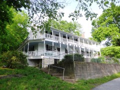 | Bonnots Mill Historic District | district | 1993 | 92001738 |
| Chamois Public School | building | 2003 | 03000295 | |
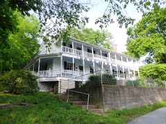 | Dauphine Hotel | building | 1980 | 80002386 |
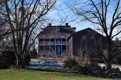 | Huber's Ferry Farmstead Historic District | district | 1999 | 98001609 |
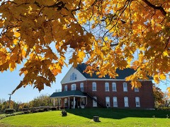 | Osage County Poorhouse | building | 1998 | 98000038 |
| Sacred Heart Catholic Church and Parsonage | building | 1982 | 82003155 | |
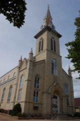 | St. Joseph Church | building | 1972 | 72000726 |
| Alvah WAshington Townley Farmstead Historic District | building | 1999 | 99000937 | |
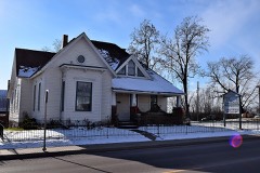 | Dr. Enoch T. and Amy Zewicki House | building | 2002 | 02000121 |
Every wildfire the federal occurrence database records inside this county: 94 of them, burning about 604 acres. 1 started naturally and none was recorded as arson. Each settlement page carries the fires within five miles of it.
| Reported cause | Fires |
|---|---|
| Debris and open burning | 55 |
| Missing data/not specified/undetermined | 26 |
| Equipment and vehicle use | 7 |
| Smoking | 2 |
| Recreation and ceremony | 1 |
| Misuse of fire by a minor | 1 |
| Natural | 1 |
| Railroad operations and maintenance | 1 |
The five largest, by the area the report gives. None of them was recorded as arson.
| Date | Cause | Size | Reported by | Name on the report |
|---|---|---|---|---|
| 2 March 1992 | Debris and open burning | 97 acres | Missouri Department of Conservation | not named |
| 18 March 2019 | Missing data/not specified/undetermined | 55 acres | Missouri Department of Conservation | 178466-07607-03182019-1955 |
| 15 March 1994 | Equipment and vehicle use | 45 acres | Missouri Department of Conservation | not named |
| 14 February 1994 | Debris and open burning | 30 acres | Missouri Department of Conservation | not named |
| 11 November 1999 | Debris and open burning | 26 acres | Missouri Department of Conservation | not named |
| 6 April 1993 | Debris and open burning | 25 acres | Missouri Department of Conservation | not named |
| 14 November 1999 | Debris and open burning | 20 acres | Missouri Department of Conservation | not named |
| 5 February 1994 | Debris and open burning | 20 acres | Missouri Department of Conservation | not named |
Every settlement page carries the fires within five miles of it - see the settlement index below.
The NOAA Storm Events Database holds 225 reports for this county, causing no deaths, 4 injuries and about $3,875,750 in recorded property damage. Each settlement page carries the reports that name it.
| Kind of event | Reports |
|---|---|
| Hail | 95 |
| Thunderstorm Wind | 80 |
| Flash Flood | 30 |
| Tornado | 11 |
| Flood | 7 |
| Heavy Rain | 2 |
The most serious of them, by death, then injury, then recorded damage. The accounts are quoted exactly as the forecast office filed them.
| When | Event | Place named | Harm | What the report says |
|---|---|---|---|---|
| May 1983 | Tornado (F3) | not stated | 3 hurt, $2,500,000 | no account filed |
| September 1959 | Tornado (F1) | not stated | 1 hurt, $25,000 | no account filed |
| April 1999 | Tornado (F1) | Linn | $1,000,000 | no account filed |
| July 1992 | Tornado (F1) | not stated | $250,000 | no account filed |
| April 1969 | Tornado (F1) | not stated | $25,000 | no account filed |
| February 2011 | Thunderstorm Wind | Westphalia | $18,000 | Thunderstorm winds caused scattered damage throughout Osage county. In Westphalia, the roof of a gym on a school sustained major damage when a large portion of the roof was blown off. Further to the east on County Road 811, a large tree was blown down onto a mobile home cutting it into two. No injuries were reported at this location. On County Road 806, a horse barn was blown down. The horses were unhurt, but an RV stored in the barn was damaged. A shed across the street was destroyed as well. In Linn, the high winds damaged several pieces of equipment for track and field events at the high school and a rooftop A/C unit was blown on its side at the elementary school. |
| August 2022 | Thunderstorm Wind | Loose Creek | $17,500 | Thunderstorm winds blew down several large trees, numerous tree limbs, and power lines. One tree was uprooted along County Road 602 just south of U.S. Highway 50. Also, the roof of a partially open sided machine shed was heavily damaged. |
| May 2024 | Thunderstorm Wind | St Aubert | $10,000 | Trees fell on power lines near Mokane and Mount Sterling. A tree was also reported down over a roadway in Chamois. Additional cities impacted include Aud and Mint Hill. |
| May 2007 | Flood | Bonnots Mill | $5,000 | The Missouri River flooded parts of the northern border of Osage County. Flooding was limited to farmland and roads along the river. |
| April 1994 | Thunderstorm Wind | Folk | $5,000 | Several large trees were downed in the west part of the county. |
| June 1994 | Thunderstorm Wind | Linn | $5,000 | Large trees and power lines were blown down. |
| June 1994 | Thunderstorm Wind | Linn | $5,000 | Large tree limbs were snapped off and power lines were blown down. |
| June 1994 | Thunderstorm Wind | Freeburg | $5,000 | Large tree limbs were snapped off and power lines were blown down. |
| April 1994 | Thunderstorm Wind | Freeburg | $5,000 | Strong winds tore away part of the roof off several barns. |
| June 1981 | Tornado (F0) | not stated | $250 | no account filed |
| April 2026 | Hail | Byron | - | A trained spotter reported quarter sized hail in Copper Hill. |
| April 2026 | Hail | Cooper Hill | - | A HAM radio operator reported quarter sized hail at Cooper Hill. |
| April 2024 | Hail | Shubert | - | Up to 1 inch hail was reported in Bonnots Mill and Linn. |
| April 2024 | Thunderstorm Wind | Westphalia | - | Report of trees uprooted in Westphalia. No information on tree size or health. |
| August 2023 | Flash Flood | Cooper Hill | - | Up to three inches of rain fell in a short amount of time causing flash flooding. Several roads were flooded including Highway U just of Linn and County Road 731 near Cooper Hill. |
| August 2023 | Thunderstorm Wind | Babbtown | - | Thunderstorm winds blew down several trees onto Highway 133 about a mile north northeast of Meta. |
| August 2023 | Flash Flood | Chamois | - | Up to 8 inches of rain fell in a short amount of time causing flash flooding across the northeastern portions of Osage County. Numerous roads were flooded. U.S. Highway 50 just southeast of Linn was flooded. Deer creek rose well above it's banks flooding County Roads 323 and 321 four miles southwest of Chamois. Also, Highway 100 was flooded in a section from 1 mile west of Chamois to 2 miles west of Chamois. |
| August 2023 | Thunderstorm Wind | Linn | - | Thunderstorm winds blew down numerous tree limbs onto County Road 303 just northeast of Linn. Also, the roof of a chicken coop was blown off in this area. |
| July 2023 | Thunderstorm Wind | Linn | - | Thunderstorm winds snapped off a power pole on the east side of town. About two miles south of Linn a large tree was blown down onto Highway 89. |
| August 2023 | Flash Flood | Bonnots Mill | - | Up to seven inches of rain fell in a short amount of time causing flash flooding. Numerous roads across the northeastern portions of Osage County were flooded including Highway 100 near Frankenstein. Baileys Creek was well out of it's banks about 6 miles south southwest of Morrison near County Road 271. |
| August 2023 | Thunderstorm Wind | Loose Creek | - | Thunderstorm winds uprooted several trees which fell across Bank Road in Loose Creek. |
| July 2023 | Thunderstorm Wind | Bonnots Mill | - | Thunderstorm winds blew down several large trees onto the railroad tracks along Osage and Missouri Rivers. |
| July 2023 | Thunderstorm Wind | Linn | - | Thunderstorm winds blew down several trees as well as power lines along Highway J about 5 miles northeast of Linn. Also, more trees were blown down about 5 miles east of Linn. |
| August 2022 | Hail | Loose Creek | - | Large hail up to 1.25 inches fell between Loose Creek and Linn. |
| June 2021 | Thunderstorm Wind | Linn | - | Thunderstorm winds blew down a large tree onto a house causing minor roof damage. |
| December 2021 | Thunderstorm Wind | Westphalia | - | Widespread wind damage across Osage County. A roof was blown off of a storage building at the intersection of Highway 133 and County Road 503. Also, there were numerous trees blown down along Highway 133. A roof was blown off of a business on U.S. Highway 63 about two miles north of Westphalia. A large tree was blown down onto U.S. Highway 63 blocking both lanes. Just east of Loose Creek a home sustained minor damage and another home sustained minor damage from a trampoline being blown into it. Otherwise, numerous large tree limbs were blown down. |
| March 2020 | Hail | St Aubert | - | Large hail up to baseball size was reported in far northern portions of Osage County in the Chamois area. |
| January 2020 | Thunderstorm Wind | Linn | - | Thunderstorm winds blew down a tree onto County Road 310. |
| January 2020 | Flash Flood | Meta | - | Betwen 2 and 4 inches of rain, with isolated amounts up to 6 inches, fell in a short amount of time causing flash flooding across Osage County. Numerous roads were flooded including Highways E, W, and 133. |
| July 2020 | Flash Flood | Fredericksburg | - | Up to three inches of rain fell in a short amount of time causing flash flooding. Baileys Creek was out of its banks about 3 miles southwest of Morrison, flooding sections of County Road 275. |
| July 2019 | Thunderstorm Wind | Linn | - | Thunderstorm winds blew down several large tree limbs around town. |
| June 2019 | Flash Flood | Fredericksburg | - | Up to three inches of rain caused flash flooding across Osage County. Numerous roads were flooded. |
| May 2019 | Thunderstorm Wind | Meta | - | Thunderstorm winds blew down at least 8 large trees across the county as well as numerous large tree limbs,in several towns including Loose Creek and Rich Fountain. |
| May 2018 | Thunderstorm Wind | Shubert | - | Trained spotter estimated 50 to 60 mph winds just west of Loose Creek near intersection of US 50 and US 63. |
| August 2018 | Thunderstorm Wind | Loose Creek | - | Thunderstorm winds uprooted several trees and caused damage to several outbuildings including a metal roof on one of the buildings. |
| August 2018 | Flash Flood | Gascondy | - | Up to four inches of rain fell in a short amount of time causing flash flooding. Several roads were flooded and numerous creeks were out of their banks in the southeastern portions of Osage County. |
| March 2017 | Tornado (EF1) | Argyle | - | A small tornado formed just to the west northwest of Argyle, MO and traveled east northeast to just northeast of Freeburg, MO. The tornado was at its strongest at the very beginning as it destroyed a hay barn, snapped and uprooted trees. The rest of the path consisted of occasional downed trees and broken large tree limbs. Overall, the tornado was rated EF1 with a path length of 7.26 miles and a max path width of 75 yards. |
| May 2017 | Thunderstorm Wind | Freeburg | - | A line of severe thunderstorms moved through Osage County. A metal outbuilding was destroyed in Freeburg. In the Linn area, several trees were either uprooted or snapped off. One large tree fell blocking U.S. Highway 50 west of Linn. One tree in Linn fell onto a house and a nearby barn causing roof damage to both. Also, windows at the Osage Ambulance District building were broken from fallen tree limbs. |
| March 2017 | Thunderstorm Wind | Freeburg | - | Thunderstorm winds blew down several large tree limbs onto County Road 636. |
| March 2017 | Thunderstorm Wind | Westphalia | - | Thunderstorm winds blew over two large pine trees onto U.S. Highway 63 south of Westphalia. Further to the east northeast, several trees were blown down along U.S. Highway 50 about 5 to 8 miles east of Linn. |
| May 2017 | Thunderstorm Wind | Babbtown | - | A line of severe storms moved eastward across Osage County. The strongest storm tracked across the southern portions of the county, knocking down numerous trees, tree limbs and power lines. Several trees were blown down onto Highway P just northeast of Meta. Also, a large tree was blown down onto U.S. Highway 63 near Freeburg. |
| April 2017 | Flash Flood | Meta | - | Between 4 and 6 inches of rain caused flash flooding. Numerous roads were flooded including Route RA southeast of Linn. |
| April 2017 | Flood | Argyle | - | The Maries River rose to major flood levels for a couple of hours due to the heavy rainfall in the basin. A number of county and state roads near the river were flooded. However, no structures were affected by the flooding. |
| May 2017 | Flood | Gascondy | - | The Gasconade River at Rich Fountain went above major flood stage, with a record crest of 37.46 feet on May 2nd, due to very heavy rain over the river basin in late April. A number of secondary roads were closed due to the river flooding. |
| August 2016 | Flash Flood | Gascondy | - | Up to 5 inches of rain fell onto saturated soils causing flash flooding. Numerous roads across southern Osage County were flooded. Highway T near Koeltztown was washed out. Also, Highway P near County Road 524 was washed out. In Freeburg, a water rescue had to be performed after someone drove into a flooded section of roadway and their car stalled. |
| August 2016 | Flash Flood | Chamois | - | Up to two inches of rain fell onto already saturated soils causing flash flooding. Several roads were flooded including Highway 100 between Chamois and Morrison. |
| June 2016 | Thunderstorm Wind | Westphalia | - | Thunderstorm winds blew down a tree onto a house causing moderate damage. Also, several other trees and power lines were blown down in the area. |
| July 2016 | Thunderstorm Wind | Byron | - | Thunderstorm winds blew down several large trees onto Highway 89 between Highways Y and D. |
| August 2015 | Thunderstorm Wind | Linn | - | Thunderstorm winds blew down several power lines around town. |
| April 2015 | Hail | Loose Creek | - | A wide swath of golfball sized hail fell from 5 miles west of Linn to 4 miles southeast of Linn. However, two and a half inch hail was reported in Rich Fountain. |
| December 2015 | Flash Flood | Byron | - | Between 3 and 5 inches of rain fell causing flash flooding. Numerous roads were flooded including U.S. Highway 50 at several locations along it. Also, Route RA was closed. |
| December 2015 | Flood | Meta | - | Between 6 and 8 inches of rain fell across Osage County during a 2 day period. All of this rain caused the creeks and rivers to rise. The Osage, Gasconade and Missouri Rivers went into major flood. About 20 structures were either damaged or destroyed from the river flooding. |
| June 2015 | Thunderstorm Wind | Bonnots Mill | - | Thunderstorm winds blew down several large trees. A parked trailer carrying boats was flipped over crushing the boats. The size of the boats on the trailer are unknown. |
| July 2015 | Flash Flood | Meta | - | Up to three inches of rain fell onto already saturated soils causing flash flooding. Numerous roads were flooded including Route T north of Argyle and Route P west of Freeburg. |
| July 2014 | Thunderstorm Wind | Linn | - | Thunderstorm winds blew over several mail boxes in Linn. |
The Survey's mineral resources record lists 225 workings inside this county. 2 still produce and 223 are closed or unrecorded. Each settlement page carries the workings within five miles of it.
| Commodity | Workings |
|---|---|
| Fire Clay (Refractory) | 182 |
| Stone, Crushed/Broken | 25 |
| Sand and Gravel, Construction | 9 |
| Iron | 7 |
| Sulfur-Pyrite | 1 |
| Lead | 1 |
The least common of them first, because a county's hundredth gravel pit says nothing its first ten did not.
| Where | Site | Commodity | Status | Recorded |
|---|---|---|---|---|
| Meta Mine | Sulfur-Pyrite | Past Producer | ||
| Unknown - Pb | Lead | Past Producer | ||
| Heck - Leesee Mine - Lot 2 | Iron | Past Producer | ||
| Jackets Mine | Iron | Past Producer | ||
| Unknonw - Fe | Iron | Past Producer | ||
| Unknown - Fe | Iron | Past Producer | ||
| Unknown - Fe | Iron | Past Producer | ||
| Unknown - Fe | Iron | Past Producer | ||
| Unknown - Fe. | Iron | Past Producer | ||
| Marvin Frederick Pit & Plant | Sand and Gravel, Construction | Producer | ||
| Unknown - S&G | Sand and Gravel, Construction | Past Producer | ||
| Unknown - S&G | Sand and Gravel, Construction | Past Producer | ||
| Unknown - S&G | Sand and Gravel, Construction | Past Producer | ||
| Unknown - S&G | Sand and Gravel, Construction | Past Producer | ||
| Unknown - S&G | Sand and Gravel, Construction | Past Producer | ||
| Unknown - S&G | Sand and Gravel, Construction | Past Producer | ||
| Unknown - S&G | Sand and Gravel, Construction | Past Producer | ||
| Unknown - S&G | Sand and Gravel, Construction | Past Producer | ||
| Borymeier Quarry | Stone, Crushed/Broken | Past Producer | ||
| Emloe Quarry | Stone, Crushed/Broken | Past Producer | ||
| Koeng Quarry | Stone, Crushed/Broken | Past Producer | ||
| Osage County Quarry | Stone, Crushed/Broken | Producer | ||
| Panck Quarry | Stone, Crushed/Broken | Past Producer | ||
| Schlief Quarry | Stone, Crushed/Broken | Past Producer | ||
| Smith Quarry & Plant | Stone, Crushed/Broken | Unknown | ||
| Unknown - Ls | Stone, Crushed/Broken | Past Producer | ||
| Unknown - Ls. | Stone, Crushed/Broken | Past Producer | ||
| Unknown - Ls. | Stone, Crushed/Broken | Past Producer | ||
| Unknown - Ls. | Stone, Crushed/Broken | Past Producer | ||
| Unknown - Ls. | Stone, Crushed/Broken | Past Producer | ||
| Unknown - Ls. | Stone, Crushed/Broken | Past Producer | ||
| Unknown - Ls. | Stone, Crushed/Broken | Past Producer | ||
| Unknown - Ls. | Stone, Crushed/Broken | Past Producer | ||
| Unknown - Ls. | Stone, Crushed/Broken | Past Producer | ||
| Unknown - Ls. | Stone, Crushed/Broken | Past Producer | ||
| Unknown - Ls. | Stone, Crushed/Broken | Past Producer | ||
| Unknown - Ls. | Stone, Crushed/Broken | Past Producer | ||
| Unknown - Ls. | Stone, Crushed/Broken | Past Producer | ||
| Unknown - Ls. | Stone, Crushed/Broken | Past Producer | ||
| Unknown - Ls. | Stone, Crushed/Broken | Past Producer | ||
| Unknown - Ls. | Stone, Crushed/Broken | Past Producer | ||
| Unknown - Ls. | Stone, Crushed/Broken | Past Producer | ||
| Virgil Smith Quarry | Stone, Crushed/Broken | Past Producer | ||
| A.P.Green Pits # 1 & 2 | Fire Clay (Refractory) | Past Producer | ||
| A.P.Green Pits # 3 & 4 | Fire Clay (Refractory) | Past Producer | ||
| Adelhard #1 Pit | Fire Clay (Refractory) | Past Producer | ||
| Arthur David Pit | Fire Clay (Refractory) | Past Producer | ||
| Barker Pit Et.Al. | Fire Clay (Refractory) | Past Producer | ||
| Brandt Mine | Fire Clay (Refractory) | Past Producer | ||
| Dingley Pit | Fire Clay (Refractory) | Past Producer | ||
| Fitzgerald Pit | Fire Clay (Refractory) | Past Producer | ||
| Frank Poring Pit | Fire Clay (Refractory) | Past Producer | ||
| Gress Pit | Fire Clay (Refractory) | Past Producer | ||
| H.Drewell Claypit | Fire Clay (Refractory) | Past Producer | ||
| Haynes Pit | Fire Clay (Refractory) | Past Producer | ||
| Lambs Prospects | Fire Clay (Refractory) | Past Producer | ||
| Langenburg Pit | Fire Clay (Refractory) | Past Producer | ||
| Limberg Pit | Fire Clay (Refractory) | Past Producer | ||
| Linnebrink Pit | Fire Clay (Refractory) | Past Producer | ||
| Manieke Prospect | Fire Clay (Refractory) | Past Producer | ||
| Mason - Roher Pit | Fire Clay (Refractory) | Past Producer | ||
| Matthers # 1 Pit | Fire Clay (Refractory) | Past Producer | ||
| Matthews Pits | Fire Clay (Refractory) | Past Producer | ||
| Mcgraw Pit | Fire Clay (Refractory) | Past Producer | ||
| Oscheskey Pit | Fire Clay (Refractory) | Past Producer | ||
| Phillips - Roussett Pit | Fire Clay (Refractory) | Past Producer | ||
| Reynolds - Bubes - A.P.Green Pit | Fire Clay (Refractory) | Past Producer | ||
| Richardson Pits | Fire Clay (Refractory) | Past Producer | ||
| Ruetgens Pits | Fire Clay (Refractory) | Past Producer | ||
| Schwagular Prospect | Fire Clay (Refractory) | Past Producer | ||
| Townley Pits | Fire Clay (Refractory) | Past Producer | ||
| Underwood - Bledoor Pit | Fire Clay (Refractory) | Past Producer | ||
| Underwood Pits | Fire Clay (Refractory) | Past Producer | ||
| Unknown - Clay | Fire Clay (Refractory) | Past Producer | ||
| Unknown - Clay | Fire Clay (Refractory) | Past Producer | ||
| Unknown - Clay | Fire Clay (Refractory) | Past Producer | ||
| Unknown - Clay | Fire Clay (Refractory) | Past Producer | ||
| Unknown - Clay | Fire Clay (Refractory) | Past Producer | ||
| Unknown - Clay | Fire Clay (Refractory) | Past Producer | ||
| Unknown - Clay | Fire Clay (Refractory) | Past Producer | ||
| Unknown - Clay | Fire Clay (Refractory) | Past Producer | ||
| Unknown - Clay | Fire Clay (Refractory) | Past Producer | ||
| Unknown - Clay | Fire Clay (Refractory) | Past Producer | ||
| Unknown - Clay | Fire Clay (Refractory) | Past Producer | ||
| Unknown - Clay | Fire Clay (Refractory) | Past Producer | ||
| Unknown - Clay | Fire Clay (Refractory) | Past Producer | ||
| Unknown - Clay | Fire Clay (Refractory) | Past Producer | ||
| Unknown - Clay | Fire Clay (Refractory) | Past Producer | ||
| Unknown - Clay | Fire Clay (Refractory) | Past Producer | ||
| Unknown - Clay | Fire Clay (Refractory) | Past Producer | ||
| Unknown - Clay | Fire Clay (Refractory) | Past Producer | ||
| Unknown - Clay | Fire Clay (Refractory) | Past Producer | ||
| Unknown - Clay | Fire Clay (Refractory) | Past Producer | ||
| Unknown - Clay | Fire Clay (Refractory) | Past Producer | ||
| Unknown - Clay | Fire Clay (Refractory) | Past Producer | ||
| Unknown - Clay | Fire Clay (Refractory) | Past Producer | ||
| Unknown - Clay | Fire Clay (Refractory) | Past Producer | ||
| Unknown - Clay | Fire Clay (Refractory) | Past Producer | ||
| Unknown - Clay | Fire Clay (Refractory) | Past Producer | ||
| Unknown - Clay | Fire Clay (Refractory) | Past Producer | ||
| Unknown - Clay | Fire Clay (Refractory) | Past Producer | ||
| Unknown - Clay | Fire Clay (Refractory) | Past Producer | ||
| Unknown - Clay | Fire Clay (Refractory) | Past Producer | ||
| Unknown - Clay | Fire Clay (Refractory) | Past Producer | ||
| Unknown - Clay | Fire Clay (Refractory) | Past Producer | ||
| Unknown - Clay | Fire Clay (Refractory) | Past Producer | ||
| Unknown - Clay | Fire Clay (Refractory) | Past Producer | ||
| Unknown - Clay | Fire Clay (Refractory) | Past Producer | ||
| Unknown - Clay | Fire Clay (Refractory) | Past Producer | ||
| Unknown - Clay | Fire Clay (Refractory) | Past Producer | ||
| Unknown - Clay | Fire Clay (Refractory) | Past Producer | ||
| Unknown - Clay | Fire Clay (Refractory) | Past Producer | ||
| Unknown - Clay | Fire Clay (Refractory) | Past Producer | ||
| Unknown - Clay | Fire Clay (Refractory) | Past Producer | ||
| Unknown - Clay | Fire Clay (Refractory) | Past Producer | ||
| Unknown - Clay | Fire Clay (Refractory) | Past Producer | ||
| Unknown - Clay | Fire Clay (Refractory) | Past Producer | ||
| Unknown - Clay | Fire Clay (Refractory) | Past Producer | ||
| Unknown - Clay | Fire Clay (Refractory) | Past Producer | ||
| Unknown - Clay | Fire Clay (Refractory) | Past Producer | ||
| Unknown - Clay | Fire Clay (Refractory) | Past Producer | ||
| Unknown - Clay | Fire Clay (Refractory) | Past Producer | ||
| Unknown - Clay | Fire Clay (Refractory) | Past Producer | ||
| Unknown - Clay | Fire Clay (Refractory) | Past Producer | ||
| Unknown - Clay | Fire Clay (Refractory) | Past Producer | ||
| Unknown - Clay | Fire Clay (Refractory) | Past Producer | ||
| Unknown - Clay | Fire Clay (Refractory) | Past Producer | ||
| Unknown - Clay | Fire Clay (Refractory) | Past Producer | ||
| Unknown - Clay | Fire Clay (Refractory) | Past Producer | ||
| Unknown - Clay | Fire Clay (Refractory) | Past Producer | ||
| Unknown - Clay | Fire Clay (Refractory) | Past Producer | ||
| Unknown - Clay | Fire Clay (Refractory) | Past Producer | ||
| Unknown - Clay | Fire Clay (Refractory) | Past Producer | ||
| Unknown - Clay | Fire Clay (Refractory) | Past Producer | ||
| Unknown - Clay | Fire Clay (Refractory) | Past Producer | ||
| Unknown - Clay | Fire Clay (Refractory) | Past Producer | ||
| Unknown - Clay | Fire Clay (Refractory) | Past Producer | ||
| Unknown - Clay | Fire Clay (Refractory) | Past Producer | ||
| Unknown - Clay | Fire Clay (Refractory) | Past Producer | ||
| Unknown - Clay | Fire Clay (Refractory) | Past Producer | ||
| Unknown - Clay | Fire Clay (Refractory) | Past Producer | ||
| Unknown - Clay | Fire Clay (Refractory) | Past Producer | ||
| Unknown - Clay | Fire Clay (Refractory) | Past Producer | ||
| Unknown - Clay | Fire Clay (Refractory) | Past Producer | ||
| Unknown - Clay | Fire Clay (Refractory) | Past Producer | ||
| Unknown - Clay | Fire Clay (Refractory) | Past Producer | ||
| Unknown - Clay | Fire Clay (Refractory) | Past Producer | ||
| Unknown - Clay | Fire Clay (Refractory) | Past Producer | ||
| Unknown - Clay | Fire Clay (Refractory) | Past Producer | ||
| Unknown - Clay | Fire Clay (Refractory) | Past Producer | ||
| Unknown - Clay | Fire Clay (Refractory) | Past Producer | ||
| Unknown - Clay | Fire Clay (Refractory) | Past Producer | ||
| Unknown - Clay | Fire Clay (Refractory) | Past Producer | ||
| Unknown - Clay | Fire Clay (Refractory) | Past Producer | ||
| Unknown - Clay | Fire Clay (Refractory) | Past Producer | ||
| Unknown - Clay | Fire Clay (Refractory) | Past Producer | ||
| Unknown - Clay | Fire Clay (Refractory) | Past Producer | ||
| Unknown - Clay | Fire Clay (Refractory) | Past Producer | ||
| Unknown - Clay | Fire Clay (Refractory) | Past Producer | ||
| Unknown - Clay | Fire Clay (Refractory) | Past Producer | ||
| Unknown - Clay | Fire Clay (Refractory) | Past Producer | ||
| Unknown - Clay | Fire Clay (Refractory) | Past Producer | ||
| Unknown - Clay | Fire Clay (Refractory) | Past Producer | ||
| Unknown - Clay | Fire Clay (Refractory) | Past Producer | ||
| Unknown - Clay | Fire Clay (Refractory) | Past Producer | ||
| Unknown - Clay | Fire Clay (Refractory) | Past Producer | ||
| Unknown - Clay | Fire Clay (Refractory) | Past Producer | ||
| Unknown - Clay | Fire Clay (Refractory) | Past Producer | ||
| Unknown - Clay | Fire Clay (Refractory) | Past Producer | ||
| Unknown - Clay | Fire Clay (Refractory) | Past Producer | ||
| Unknown - Clay | Fire Clay (Refractory) | Past Producer | ||
| Unknown - Clay | Fire Clay (Refractory) | Past Producer | ||
| Unknown - Clay | Fire Clay (Refractory) | Past Producer | ||
| Unknown - Clay | Fire Clay (Refractory) | Past Producer | ||
| Unknown - Clay | Fire Clay (Refractory) | Past Producer | ||
| Unknown - Clay | Fire Clay (Refractory) | Past Producer | ||
| Unknown - Clay | Fire Clay (Refractory) | Past Producer | ||
| Unknown - Clay | Fire Clay (Refractory) | Past Producer | ||
| Unknown - Clay | Fire Clay (Refractory) | Past Producer | ||
| Unknown - Clay | Fire Clay (Refractory) | Past Producer | ||
| Unknown - Clay | Fire Clay (Refractory) | Past Producer | ||
| Unknown - Clay | Fire Clay (Refractory) | Past Producer | ||
| Unknown - Clay | Fire Clay (Refractory) | Past Producer | ||
| Unknown - Clay | Fire Clay (Refractory) | Past Producer | ||
| Unknown - Clay | Fire Clay (Refractory) | Past Producer | ||
| Unknown - Clay | Fire Clay (Refractory) | Past Producer | ||
| Unknown - Clay | Fire Clay (Refractory) | Past Producer | ||
| Unknown - Clay | Fire Clay (Refractory) | Past Producer | ||
| Unknown - Clay | Fire Clay (Refractory) | Past Producer | ||
| Unknown - Clay | Fire Clay (Refractory) | Past Producer | ||
| Unknown - Clay | Fire Clay (Refractory) | Past Producer | ||
| Unknown - Clay | Fire Clay (Refractory) | Past Producer | ||
| Unknown - Clay | Fire Clay (Refractory) | Past Producer | ||
| Unknown - Clay | Fire Clay (Refractory) | Past Producer | ||
| Unknown - Clay | Fire Clay (Refractory) | Past Producer | ||
| Unknown - Clay | Fire Clay (Refractory) | Past Producer | ||
| Unknown - Clay | Fire Clay (Refractory) | Past Producer | ||
| Unknown - Clay | Fire Clay (Refractory) | Past Producer | ||
| Unknown - Clay | Fire Clay (Refractory) | Past Producer | ||
| Unknown - Clay | Fire Clay (Refractory) | Past Producer | ||
| Unknown - Clay | Fire Clay (Refractory) | Past Producer | ||
| Unknown - Clay | Fire Clay (Refractory) | Past Producer | ||
| Unknown - Clay | Fire Clay (Refractory) | Past Producer | ||
| Unknown - Clay | Fire Clay (Refractory) | Past Producer | ||
| Unknown - Clay | Fire Clay (Refractory) | Past Producer | ||
| Unknown - Clay | Fire Clay (Refractory) | Past Producer | ||
| Unknown - Clay | Fire Clay (Refractory) | Past Producer | ||
| Unknown - Clay | Fire Clay (Refractory) | Past Producer | ||
| Unknown - Clay | Fire Clay (Refractory) | Past Producer | ||
| Unknown - Clay | Fire Clay (Refractory) | Past Producer | ||
| Unknown - Clay | Fire Clay (Refractory) | Past Producer | ||
| Unknown - Clay | Fire Clay (Refractory) | Past Producer | ||
| Unknown - Clay | Fire Clay (Refractory) | Past Producer | ||
| Unknown - Clay | Fire Clay (Refractory) | Past Producer | ||
| Unknown - Clay | Fire Clay (Refractory) | Past Producer | ||
| Unknown - Clay | Fire Clay (Refractory) | Past Producer | ||
| Unknown - Clay | Fire Clay (Refractory) | Past Producer | ||
| Unknown - Clay Pits | Fire Clay (Refractory) | Past Producer | ||
| Unknown - Clay Pits | Fire Clay (Refractory) | Past Producer | ||
| Unknown - Clay Pits | Fire Clay (Refractory) | Past Producer | ||
| Unknown - Clay Pits | Fire Clay (Refractory) | Past Producer | ||
| Unknown - Clay Pits | Fire Clay (Refractory) | Past Producer | ||
| Unknown - Clay Pits - 2 | Fire Clay (Refractory) | Past Producer | ||
| Welcome - Turner Pit | Fire Clay (Refractory) | Past Producer | ||
| Wright - Turner Pit Et.Al. | Fire Clay (Refractory) | Past Producer |
Named settlements recorded in the Geographic Names Information System, each with the topographic sheets covering it. Villages, hamlets and abandoned places alike. Each is shown with the nearest named watercourse or landform and the survey quadrangle it falls on.
Linn township · 65016 · On Luzon Branch · Loose Creek quadrangle
19 sheets, 1890 to 1985
Jackson township · 65085 · Wardsville quadrangle
17 sheets, 1888 to 1987
No longer a settlement
Jefferson township · 65014 · On Third Creek · Cooper Hill quadrangle
16 sheets, 1934 to 1985
Washington township · 65013 · On Reichel Creek · Summerfield quadrangle
17 sheets, 1934 to 1985
No longer a settlement
Jefferson township · 65013 · Belle quadrangle
16 sheets, 1934 to 1985
No longer a settlement
Jefferson township · 65014 · Near Nixon Ridge · Cooper Hill quadrangle
16 sheets, 1934 to 1985
No longer a settlement
Jackson township · 65085 · Near Bloody Island · Westphalia West quadrangle
17 sheets, 1888 to 1987
Crawford township · 65051 · On Ferguson Branch · Cooper Hill quadrangle
16 sheets, 1934 to 1985
Linn township · 65101 · On Luzon Branch · Loose Creek quadrangle
19 sheets, 1890 to 1985
No longer a settlement
Jefferson township · 65013 · Near Steuber Hollow · Summerfield quadrangle
17 sheets, 1934 to 1985
Linn township · 65016 · On Loose Creek · Loose Creek quadrangle
19 sheets, 1890 to 1985
No longer a settlement
Crawford township · 65051 · On North Fork Pointers Creek · Linn quadrangle
17 sheets, 1934 to 1985
Jefferson township · 65013 · Near Skillet Hollow · Summerfield quadrangle
17 sheets, 1934 to 1985
Jefferson township · 65014 · On Sweetwater Branch · Cooper Hill quadrangle
16 sheets, 1934 to 1985
No longer a settlement
Washington township · 65101 · On Maries River · Westphalia West quadrangle
17 sheets, 1888 to 1987
No longer a settlement
Crawford township · 65016 · On Luystown Creek · Luystown quadrangle
19 sheets, 1890 to 1985
Washington township · 65051 · On Buchler Creek · Westphalia East quadrangle
17 sheets, 1934 to 1985
Crawford township · 65051 · On Ferguson Branch · Cooper Hill quadrangle
16 sheets, 1934 to 1985
Benton township · 65024 · On Owl Creek · Mokane East quadrangle
21 sheets, 1890 to 2000
Washington township · 65085 · On Little Maries Creek · Westphalia East quadrangle
17 sheets, 1934 to 1985
The vanished settlements of Osage County: the places named above that are no longer on the map.