 Block
From the record
12 National Register listings published here.
Sources: the National Register database, National Park Service
175 topographic sheets cover 44 settlements here, and 12 properties are on the National Register of Historic Places.
12 National Register listings published here.
Sources: the National Register database, National Park Service
Every property in this county listed on the National Register of Historic Places, with the year it was listed and the federal nomination document.
| Photograph | Property | Type | Listed | Reference |
|---|---|---|---|---|
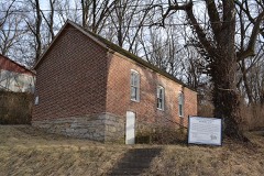 | Benjamin Banneker School | building | 1995 | 95001115 |
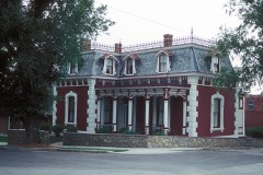 | Frederick Krause Mansion | building | 1978 | 78001672 |
 | Mackay Building | building | 1979 | 79001389 |
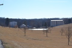 | McCormick Distillery | district | 1974 | 74001090 |
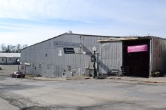 | Missouri District Warehouse | building | 2010 | 10000476 |
| Platte County Courthouse | building | 1979 | 79001390 | |
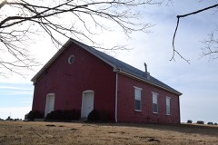 | Pleasant Ridge United Baptist Church | building | 2002 | 02000162 |
 | Charles Smith Scott Memorial Observatory | building | 1992 | 92000625 |
 | TWA Administrative Offices Building | building | 2007 | 07001157 |
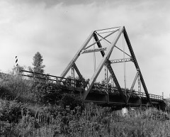 | Waddell "A" Truss Bridge | structure | 1991 | 90002173 |
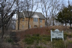 | Washington Chapel C.M.E. Church | building | 1992 | 92001055 |
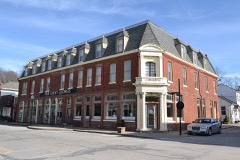 | Weston Historic District | district | 1972 | 72000727 |
Every wildfire the federal occurrence database records inside this county: 35 of them, burning about 874 acres. 1 started naturally and 5 were recorded as arson. Each settlement page carries the fires within five miles of it.
| Reported cause | Fires |
|---|---|
| Missing data/not specified/undetermined | 19 |
| Debris and open burning | 5 |
| Arson/incendiarism | 5 |
| Equipment and vehicle use | 2 |
| Recreation and ceremony | 2 |
| Natural | 1 |
| Smoking | 1 |
The five largest, by the area the report gives. Two of them were set deliberately.
| Date | Cause | Size | Reported by | Name on the report |
|---|---|---|---|---|
| 17 April 2018 | Arson/incendiarism | 667 acres | Missouri Department of Conservation | 176765-00000-04172018-1710 |
| 26 January 2014 | Debris and open burning | 180 acres | Missouri Department of Conservation | not named |
| 6 August 2007 | Missing data/not specified/undetermined | 10 acres | Missouri State Fire Marshal's Office | not named |
| 24 February 2006 | Missing data/not specified/undetermined | 5.0 acres | Missouri State Fire Marshal's Office | not named |
| 25 February 2006 | Arson/incendiarism | 2.0 acres | Missouri State Fire Marshal's Office | not named |
| 2 December 2008 | Missing data/not specified/undetermined | 1.0 acres | Missouri State Fire Marshal's Office | not named |
| 29 November 2008 | Missing data/not specified/undetermined | 1.0 acres | Missouri State Fire Marshal's Office | not named |
| 7 December 2007 | Equipment and vehicle use | 1.0 acres | Missouri State Fire Marshal's Office | not named |
Every settlement page carries the fires within five miles of it - see the settlement index below.
The NOAA Storm Events Database holds 670 reports for this county, causing no deaths, 18 injuries and about $42,408,060 in recorded property damage. Each settlement page carries the reports that name it.
| Kind of event | Reports |
|---|---|
| Hail | 321 |
| Thunderstorm Wind | 263 |
| Flash Flood | 50 |
| Tornado | 19 |
| Flood | 14 |
| Heavy Rain | 2 |
| Lightning | 1 |
The most serious of them, by death, then injury, then recorded damage. The accounts are quoted exactly as the forecast office filed them.
| When | Event | Place named | Harm | What the report says |
|---|---|---|---|---|
| April 1965 | Tornado (F3) | not stated | 9 hurt, $250,000 | no account filed |
| May 1971 | Tornado (F2) | not stated | 4 hurt, $25,000 | no account filed |
| May 1985 | Tornado (F1) | not stated | 2 hurt, $250,000 | no account filed |
| June 1969 | Tornado (F3) | not stated | 2 hurt, $25,000 | no account filed |
| March 2017 | Thunderstorm Wind | (Mci)Ks City Intl Ar | 1 hurt | An injury accident occurred on I-29 near Kansas City International Airport when a tractor trailer rig overturned due to high winds. |
| May 2003 | Tornado (F4) | Parkville | $32,000,000 | Tornado crossed from Wyandotte county into Platte county and continued to Clay county. There were 14 buildings destroyed, 42 with major damage. No injuries or fatalaties reported. |
| October 1998 | Flash Flood | Platte City | $4,000,000 | no account filed |
| May 2003 | Tornado (F1) | Beverly | $1,950,000 | Tornado in Leavenworth county crossed the Missouri River into Platte county around Missouri Route 92, near its intersection with North Farley Road. F1 damage was noted and extended one and a half miles to the east, with a width around 50 yards. Two barns had major damage and there were 16 homes with minor damage. There was also tree and fence damage noted. |
| March 2006 | Hail | Parkville | $900,000 | Numerous roofs and cars damaged due to the large hail. |
| May 2007 | Flood | Platte City | $500,000 | The Platte River at Platte City crested at 32.50 feet, or 12.50 feet above flood stage. This was its third highest crest on record and was on May 10, 2007. Several homes suffered loss and there was widespread agricultural losses in the adjacent bottom lands. |
| June 1969 | Tornado (F2) | not stated | $250,000 | no account filed |
| May 1961 | Tornado (F4) | not stated | $250,000 | no account filed |
| May 1961 | Tornado (F4) | not stated | $250,000 | no account filed |
| May 1961 | Tornado (F4) | not stated | $250,000 | no account filed |
| November 2005 | Thunderstorm Wind | Weston | $200,000 | Several businesses and residences suffered roof damage and partial collapses. There were also many tree branches reported down. |
| March 2006 | Hail | Weatherby Lake | $200,000 | no account filed |
| March 2019 | Flood | Bean Lake | $100,000 | While Platte County escaped much of the devastating flooding that affected portions of Buchanan, Holt and Atchison Counties, the Missouri River still rose to near record levels and impacted portions of Platte County. Most notable was the flooding in Parkville, where the river rose to 35.01 feet. This was a record at the time, but the gauge was only in existence for a short time before the flood, so it's unknown how this ranked historically; however, the upstream gauge in Leavenworth, Kansas reached 31.30 feet (2nd place at the time). Portions of Parkville were flooded, as well as English Landing Park. The river remained in flood into the middle part of May. Note: The dollar value assigned to the damages is likely not accurate, as the full extent of the damage is unknown. |
| May 2005 | Lightning | Dearborn | $100,000 | Home totally destroyed by fire started by lightning. |
| July 2004 | Flash Flood | Edgerton | $100,000 | Bridge washed out on Edgerton Junction Road. |
| June 2002 | Thunderstorm Wind | Bean Lake | $100,000 | Several buildings had severe roof damage. |
| October 2000 | Thunderstorm Wind | Camden Pt | $100,000 | Numerous trees and power lines were downed by thunderstorm winds. Four homes were damaged, including one that was damaged when a large tree fell on it. |
| July 1994 | Thunderstorm Wind | Platte City | $50,000 | Numerous large trees and power lines were blown down throughout northern parts of the county. |
| March 2006 | Hail | Parkville | $50,000 | no account filed |
| March 2006 | Hail | Ferrelview | $50,000 | no account filed |
| March 2006 | Hail | Riverside | $50,000 | no account filed |
| March 2006 | Hail | Parkville | $50,000 | no account filed |
| June 1999 | Flood | Countywide | $50,000 | no account filed |
| June 2011 | Hail | Platte City | $30,000 | All exposed car wind shields cracked or broken. Numerous dings on vehicles. |
| May 2004 | Tornado (F3) | Camden Pt | $30,000 | Tornado crossed into Buchanan county 5 northwest of Camden Point. Tornado destroyed a barn, and threw an axle from a heavy truck nearly 300 yards. |
| September 2001 | Thunderstorm Wind | Platte City | $30,000 | Large section of grocery store roof blown off. Also car windows and store front windows broken or blown out. Restaurant door blown off. |
| December 1975 | Tornado (F1) | not stated | $25,000 | no account filed |
| June 1969 | Tornado (F1) | not stated | $25,000 | no account filed |
| April 1964 | Tornado (F3) | not stated | $25,000 | no account filed |
| July 2020 | Thunderstorm Wind | Edgerton | $20,000 | There were several tree limbs and at least one tree down in the Edgerton area. One of these tree limbs fell on the roof of a home and punctured through the roof and ceiling. There were no reported injuries. |
| April 1995 | Hail | Riverside | $20,000 | no account filed |
| April 1995 | Hail | Houston Lake | $15,000 | no account filed |
| July 2000 | Thunderstorm Wind | Camden Pt | $10,000 | A maple tree 44 inches in diameter was blown down, damaging the roof of a house. |
| May 2004 | Hail | Dearborn | $10,000 | no account filed |
| April 1995 | Hail | Dearborn | $10,000 | no account filed |
| May 2008 | Thunderstorm Wind | Riverside | $8,000 | Numerous 5 to 6 inch diameter trees and power lines down. Five empty train cars were blown over near Interstate 635. |
| July 2012 | Thunderstorm Wind | Dearborn | $7,500 | Thunderstorm wind gusts were estimated up to 65 mph. Tree branches were reported down, and a 7 ton feed bin was blown down. |
| July 1996 | Thunderstorm Wind | Platte City | $7,000 | no account filed |
| June 2015 | Thunderstorm Wind | Platte City | $5,000 | HH Highway and Bethel Road was closed due to trees into the power lines. |
| August 2011 | Thunderstorm Wind | Barry | $4,000 | Light poles were reported down in a hospital parking lot, on Barry Road. Trees were also reported down, with power outages reported as well. Thunderstorm wind gusts were estimated up to 60 mph. |
| April 2003 | Thunderstorm Wind | Camden Pt | $3,500 | Roof of garage blown off...several tree limbs down up to 8 to 12 inches in diameter. Shingles also blown off home. |
| August 2011 | Thunderstorm Wind | Platte Woods | $3,000 | Power poles and trees were reported down. Thunderstorm wind gusts were estimated up to 60 mph. |
| April 2010 | Thunderstorm Wind | (Mci)Ks City Intl Ar | $3,000 | Kansas City International Airport had signs with concrete bases blown over. |
| May 2008 | Thunderstorm Wind | Riverside | $3,000 | Numerous trees were downed and widespread power outages reported, due to downed power lines. Communications was lost through much of Riverside. |
| April 2010 | Thunderstorm Wind | Platte City | $2,000 | Power lines were reported down at I-29 and Highway 92. |
| April 2010 | Thunderstorm Wind | (Mci)Ks City Intl Ar | $2,000 | Winds estimated up to 70 mph, caused three semi tractor trailers to be blown over, at the intersection of I-29 and Mexico Avenue. |
| August 2006 | Thunderstorm Wind | Weston | $2,000 | Trees and power lines down. |
| May 2002 | Thunderstorm Wind | Weston | $2,000 | no account filed |
| May 2013 | Thunderstorm Wind | Parkville | $1,000 | Trees and powerlines were reported down at English Landing. Thunderstorm wind gusts were estimated up to 60 mph. |
| June 2010 | Thunderstorm Wind | Tiffany Spgs | $1,000 | A large business sign was snapped off, with winds estimated to 70 mph. |
| July 2007 | Thunderstorm Wind | Platte City | $1,000 | Several shingles blown off roof. |
| May 2002 | Thunderstorm Wind | Ferrelview | $1,000 | Car blown off of Interstate 29 southbound at exit 15. |
| May 2002 | Thunderstorm Wind | Kansas City Intl Arp | $1,000 | Two cargo buildings and a sand barn had minor damage. |
| August 2011 | Thunderstorm Wind | Barry | $500 | A tree was reported knocked down on a house, at 69th and Berkley. Thunderstorm wind gusts were estimated up to 60 mph. |
| August 2011 | Thunderstorm Wind | Barry | $500 | Thunderstorm wind gusts were estimated up to 60 mph. Tree limbs up to 12 inches in diameter were snapped off. A few sheds were also blown over. |
| May 1981 | Tornado (F0) | not stated | $30 | no account filed |
The Survey's mineral resources record lists 123 workings inside this county. 4 still produce and 119 are closed or unrecorded. Each settlement page carries the workings within five miles of it.
| Commodity | Workings |
|---|---|
| Stone, Crushed/Broken | 118 |
| Clay | 3 |
| Sand and Gravel, Construction | 2 |
The least common of them first, because a county's hundredth gravel pit says nothing its first ten did not.
| Where | Site | Commodity | Status | Recorded |
|---|---|---|---|---|
| Unknown S&G | Sand and Gravel, Construction | Past Producer | ||
| Unknown S&G | Sand and Gravel, Construction | Past Producer | ||
| New Market Pit | Clay | Producer | ||
| Unknown Clay | Clay | Past Producer | ||
| Unknown Clay | Clay | Past Producer | ||
| Babcock Quarry | Stone, Crushed/Broken | Past Producer | ||
| Baker Quarry | Stone, Crushed/Broken | Past Producer | ||
| Baker Quarry | Stone, Crushed/Broken | Past Producer | ||
| Baker Quarry | Stone, Crushed/Broken | Past Producer | ||
| Benner Quarry | Stone, Crushed/Broken | Past Producer | ||
| Blankenship Quarry | Stone, Crushed/Broken | Past Producer | ||
| Boydston Quarry | Stone, Crushed/Broken | Past Producer | ||
| Bramble Quarry | Stone, Crushed/Broken | Past Producer | ||
| Coffey Quarry | Stone, Crushed/Broken | Past Producer | ||
| Daniel Quarry | Stone, Crushed/Broken | Past Producer | ||
| Dearborn Quarry | Stone, Crushed/Broken | Past Producer | ||
| Drennon Quarry | Stone, Crushed/Broken | Past Producer | ||
| Duncan Quarry | Stone, Crushed/Broken | Past Producer | ||
| Everett & Clark Quarry | Stone, Crushed/Broken | Past Producer | ||
| Everett Quarry # 49 | Stone, Crushed/Broken | Producer | ||
| Farley Quarry | Stone, Crushed/Broken | Past Producer | ||
| Ferrelview Quarry | Stone, Crushed/Broken | Past Producer | ||
| Ferris Quarry | Stone, Crushed/Broken | Past Producer | ||
| Green Hills Quarry | Stone, Crushed/Broken | Past Producer | ||
| Hampton Quarry | Stone, Crushed/Broken | Past Producer | ||
| Harris Quarry | Stone, Crushed/Broken | Past Producer | ||
| Harvant Quarry | Stone, Crushed/Broken | Past Producer | ||
| Hevalow & Shields Quarry | Stone, Crushed/Broken | Past Producer | ||
| Hillix Quarry | Stone, Crushed/Broken | Past Producer | ||
| Hull Quarry | Stone, Crushed/Broken | Past Producer | ||
| Iatan Quarry | Stone, Crushed/Broken | Unknown | ||
| Miller Quarry | Stone, Crushed/Broken | Past Producer | ||
| Miller Quarry | Stone, Crushed/Broken | Past Producer | ||
| Miller Quarry & Mill | Stone, Crushed/Broken | Producer | ||
| Oberdick Quarry | Stone, Crushed/Broken | Past Producer | ||
| Parkville Special Road Dist Quarry | Stone, Crushed/Broken | Producer | ||
| Platte City Quarry | Stone, Crushed/Broken | Past Producer | ||
| Platte City Quarry | Stone, Crushed/Broken | Past Producer | ||
| Pratt Quarry | Stone, Crushed/Broken | Past Producer | ||
| Riley Quarry | Stone, Crushed/Broken | Past Producer | ||
| Rose Quarry | Stone, Crushed/Broken | Past Producer | ||
| Spratt Quarry | Stone, Crushed/Broken | Past Producer | ||
| Spratt Quarry | Stone, Crushed/Broken | Past Producer | ||
| Stephens Quarry | Stone, Crushed/Broken | Past Producer | ||
| Teaney-Brumley Quarry | Stone, Crushed/Broken | Past Producer | ||
| Unknown | Stone, Crushed/Broken | Past Producer | ||
| Unknown Lks | Stone, Crushed/Broken | Past Producer | ||
| Unknown Ls | Stone, Crushed/Broken | Past Producer | ||
| Unknown Ls | Stone, Crushed/Broken | Past Producer | ||
| Unknown Ls | Stone, Crushed/Broken | Past Producer | ||
| Unknown Ls | Stone, Crushed/Broken | Past Producer | ||
| Unknown Ls | Stone, Crushed/Broken | Past Producer | ||
| Unknown Ls | Stone, Crushed/Broken | Past Producer | ||
| Unknown Ls | Stone, Crushed/Broken | Past Producer | ||
| Unknown Ls | Stone, Crushed/Broken | Past Producer | ||
| Unknown Ls | Stone, Crushed/Broken | Past Producer | ||
| Unknown Ls | Stone, Crushed/Broken | Past Producer | ||
| Unknown Ls | Stone, Crushed/Broken | Past Producer | ||
| Unknown Ls | Stone, Crushed/Broken | Past Producer | ||
| Unknown Ls | Stone, Crushed/Broken | Past Producer | ||
| Unknown Ls | Stone, Crushed/Broken | Past Producer | ||
| Unknown Ls | Stone, Crushed/Broken | Past Producer | ||
| Unknown Ls | Stone, Crushed/Broken | Past Producer | ||
| Unknown Ls | Stone, Crushed/Broken | Past Producer | ||
| Unknown Ls | Stone, Crushed/Broken | Past Producer | ||
| Unknown Ls | Stone, Crushed/Broken | Past Producer | ||
| Unknown Ls | Stone, Crushed/Broken | Past Producer | ||
| Unknown Ls | Stone, Crushed/Broken | Past Producer | ||
| Unknown Ls | Stone, Crushed/Broken | Past Producer | ||
| Unknown Ls | Stone, Crushed/Broken | Past Producer | ||
| Unknown Ls | Stone, Crushed/Broken | Past Producer | ||
| Unknown Ls | Stone, Crushed/Broken | Past Producer | ||
| Unknown Ls | Stone, Crushed/Broken | Past Producer | ||
| Unknown Ls | Stone, Crushed/Broken | Past Producer | ||
| Unknown Ls | Stone, Crushed/Broken | Past Producer | ||
| Unknown Ls | Stone, Crushed/Broken | Past Producer | ||
| Unknown Ls | Stone, Crushed/Broken | Past Producer | ||
| Unknown Ls | Stone, Crushed/Broken | Past Producer | ||
| Unknown Ls | Stone, Crushed/Broken | Past Producer | ||
| Unknown Ls | Stone, Crushed/Broken | Past Producer | ||
| Unknown Ls | Stone, Crushed/Broken | Past Producer | ||
| Unknown Ls | Stone, Crushed/Broken | Past Producer | ||
| Unknown Ls | Stone, Crushed/Broken | Past Producer | ||
| Unknown Ls | Stone, Crushed/Broken | Past Producer | ||
| Unknown Ls | Stone, Crushed/Broken | Past Producer | ||
| Unknown Ls | Stone, Crushed/Broken | Past Producer | ||
| Unknown Ls | Stone, Crushed/Broken | Past Producer | ||
| Unknown Ls | Stone, Crushed/Broken | Past Producer | ||
| Unknown Ls | Stone, Crushed/Broken | Past Producer | ||
| Unknown Ls | Stone, Crushed/Broken | Past Producer | ||
| Unknown Ls | Stone, Crushed/Broken | Past Producer | ||
| Unknown Ls | Stone, Crushed/Broken | Past Producer | ||
| Unknown Ls | Stone, Crushed/Broken | Past Producer | ||
| Unknown Ls | Stone, Crushed/Broken | Past Producer | ||
| Unknown Ls | Stone, Crushed/Broken | Past Producer | ||
| Unknown Ls | Stone, Crushed/Broken | Past Producer | ||
| Unknown Ls | Stone, Crushed/Broken | Past Producer | ||
| Unknown Ls | Stone, Crushed/Broken | Past Producer | ||
| Unknown Ls | Stone, Crushed/Broken | Past Producer | ||
| Unknown Ls | Stone, Crushed/Broken | Past Producer | ||
| Unknown Ls | Stone, Crushed/Broken | Past Producer | ||
| Unknown Ls | Stone, Crushed/Broken | Past Producer | ||
| Unknown Ls | Stone, Crushed/Broken | Past Producer | ||
| Unknown Ls | Stone, Crushed/Broken | Past Producer | ||
| Unknown Ls | Stone, Crushed/Broken | Past Producer | ||
| Unknown Ls | Stone, Crushed/Broken | Past Producer | ||
| Unknown Ls | Stone, Crushed/Broken | Past Producer | ||
| Unknown Ls | Stone, Crushed/Broken | Past Producer | ||
| Unknown Ls | Stone, Crushed/Broken | Past Producer | ||
| Unknown Ls | Stone, Crushed/Broken | Past Producer | ||
| Unknown Ls | Stone, Crushed/Broken | Past Producer | ||
| Unknown Ls | Stone, Crushed/Broken | Past Producer | ||
| Unknown Ls | Stone, Crushed/Broken | Past Producer | ||
| Unknown Ls | Stone, Crushed/Broken | Past Producer | ||
| Unknown Ls | Stone, Crushed/Broken | Past Producer | ||
| Unknown Ls | Stone, Crushed/Broken | Past Producer | ||
| Unknown Ls | Stone, Crushed/Broken | Past Producer | ||
| Unknown Ls | Stone, Crushed/Broken | Past Producer | ||
| Unknown Ls | Stone, Crushed/Broken | Past Producer | ||
| Unknown Ls | Stone, Crushed/Broken | Past Producer | ||
| Watson Quarry | Stone, Crushed/Broken | Past Producer | ||
| Whitten Quarry | Stone, Crushed/Broken | Past Producer | ||
| Zarah Quarry | Stone, Crushed/Broken | Past Producer |
Named settlements recorded in the Geographic Names Information System, each with the topographic sheets covering it. Villages, hamlets and abandoned places alike. Each is shown with the nearest named watercourse or landform and the survey quadrangle it falls on.
Marshall township · 64484 · On Short Creek · Oak Mills quadrangle
26 sheets, 1886 to 1984
Pawnee township · 64151 · On Old Maids Creek · North Kansas City quadrangle
40 sheets, 1890 to 1997
Lee township · 64079 · On Odie Branch · Platte City quadrangle
46 sheets, 1890 to 1983
Preston township · 64444 · On Mitchell Branch · Edgerton quadrangle
18 sheets, 1925 to 1986
Green township · 64439 · On Bell Creek · Camden Point quadrangle
36 sheets, 1890 to 1983
Fox township · 64151 · On Old Maids Creek · North Kansas City quadrangle
40 sheets, 1890 to 1997
Carroll township · 64079 · On Little Platte River · Camden Point quadrangle
36 sheets, 1890 to 1983
Pawnee township · 64151 · On East Fork · North Kansas City quadrangle
40 sheets, 1890 to 1997
Green township · 64439 · On Bleazard Branch · Dearborn quadrangle
18 sheets, 1927 to 1986
Pawnee township · 64151 · On Old Maids Creek · North Kansas City quadrangle
40 sheets, 1890 to 1997
Pawnee township · 64118 · On East Fork · North Kansas City quadrangle
40 sheets, 1890 to 1997
Pettis township · 64151 · On East Creek · North Kansas City quadrangle
40 sheets, 1890 to 1997
Sioux township · 64152 · On White Aloe Branch · Parkville quadrangle
40 sheets, 1890 to 1996
Pettis township · 64150 · On Jumping Branch · North Kansas City quadrangle
40 sheets, 1890 to 1997
Lee township · 64079 · Near Leavenworth Island · Leavenworth quadrangle
49 sheets, 1890 to 1984
Marshall township · 64484 · On Short Creek · Atchison East quadrangle
32 sheets, 1885 to 1990