 Block
From the record
6 National Register listings published here.
Sources: the National Register database, National Park Service
99 topographic sheets cover 39 settlements here, and 6 properties are on the National Register of Historic Places.
6 National Register listings published here.
Sources: the National Register database, National Park Service
Every property in this county listed on the National Register of Historic Places, with the year it was listed and the federal nomination document.
| Photograph | Property | Type | Listed | Reference |
|---|---|---|---|---|
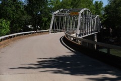 | Devil's Elbow Historic District | district | 2017 | 100000566 |
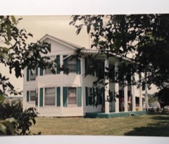 | Calloway Manes Homestead | building | 1980 | 80002390 |
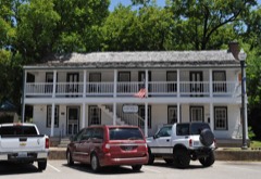 | Old Stagecoach Stop | building | 1980 | 80002391 |
| Onyx Cave | site | 1999 | 99000529 | |
| Piney Beach | district | 2017 | 100000567 | |
 | Pulaski County Courthouse | building | 1979 | 79001391 |
Every wildfire the federal occurrence database records inside this county: 393 of them, burning about 9,389 acres. 3 started naturally and 63 were recorded as arson. Each settlement page carries the fires within five miles of it.
| Reported cause | Fires |
|---|---|
| Debris and open burning | 174 |
| Missing data/not specified/undetermined | 111 |
| Arson/incendiarism | 63 |
| Equipment and vehicle use | 15 |
| Smoking | 10 |
| Railroad operations and maintenance | 8 |
| Misuse of fire by a minor | 4 |
| Recreation and ceremony | 4 |
| Natural | 3 |
| Fireworks | 1 |
The five largest, by the area the report gives. Three of them were set deliberately.
| Date | Cause | Size | Reported by | Name on the report |
|---|---|---|---|---|
| 21 April 2007 | Arson/incendiarism | 1,212 acres | Mark Twain National Forest | DECKERS |
| 18 November 1999 | Debris and open burning | 1,049 acres | Mark Twain National Forest | DEMOCRAT RIDGE |
| 23 March 2017 | Debris and open burning | 300 acres | Missouri Department of Conservation | not named |
| 12 May 1993 | Missing data/not specified/undetermined | 300 acres | Missouri Department of Conservation | not named |
| 19 March 2017 | Missing data/not specified/undetermined | 250 acres | Missouri Department of Conservation | not named |
| 17 November 2016 | Missing data/not specified/undetermined | 246 acres | Mark Twain National Forest | VINTAGE |
| 2 April 2007 | Arson/incendiarism | 240 acres | Mark Twain National Forest | POCKET EDDY |
| 19 April 1996 | Arson/incendiarism | 235 acres | Mark Twain National Forest | OTTER |
Every settlement page carries the fires within five miles of it - see the settlement index below.
The NOAA Storm Events Database holds 564 reports for this county, causing 13 deaths, 21 injuries and about $120,947,530 in recorded property damage. Each settlement page carries the reports that name it.
| Kind of event | Reports |
|---|---|
| Hail | 217 |
| Thunderstorm Wind | 198 |
| Flash Flood | 76 |
| Heavy Rain | 25 |
| Flood | 24 |
| Tornado | 19 |
| Funnel Cloud | 2 |
| Lightning | 2 |
| Wildfire | 1 |
The most serious of them, by death, then injury, then recorded damage. The accounts are quoted exactly as the forecast office filed them.
| When | Event | Place named | Harm | What the report says |
|---|---|---|---|---|
| December 2015 | Flash Flood | Crocker | 5 killed | There were five international soldiers stationed at Fort Leonard Wood in a car which was swept off of Highway U at Tavern Creek because of flash flooding. All five victims from the car drowned. |
| August 2013 | Flash Flood | Waynesville | 2 killed, $5,000,000 | This storm report will be a summary of the total damage for the Waynesville area and Pulaski County for this flooding event. Approximately 90 percent of the roads in the county were damaged with 65 percent of the roads had major damage. There were 25 low water crossings that were totally washed out and numerous more needed repairs. There were up to 100 homes and businesses that were inundated by flood waters. Numerous cars were flooded or washed away. Most of the homes flooded were along Mitchell Creek and Rubidoux River near downtown Waynesville. Over 100 people were rescued from swift and high water. There were two flash flood fatalities which occurred near downtown Waynesville. |
| November 2024 | Flood | Helm | 2 killed, $25,000 | At an unknown time on November 7th, a vehicle driving near Riddle Bridge Access along the Gasconade River in Pulaski County became submerged in the flood waters. After a search was conducted, both occupants reportedly drowned. |
| December 2015 | Flash Flood | Swedeborg | 2 killed | Several vehicles were washed off of roadways in two separate incidents around Crocker, Missouri. One occurred along the headwaters of Tavern Creek. The other incident was near the Gasconade River. Two people drowned when their car was swept off of Highway O near Dixon. |
| July 2011 | Lightning | Laquey | 1 killed, 2 hurt | A small group was canoeing on the Gasconade River. As storms approached they left the river and took shelter under a tree. Lightning struck the three, killing one on site. |
| April 2017 | Flash Flood | Crocker | 1 killed, $10,000 | An 18 year old male drowned after his vehicle entered a flooded area on Buffalo Road west of Crocker. |
| October 1966 | Tornado (F2) | not stated | 6 hurt, $2,500,000 | no account filed |
| December 2010 | Tornado (EF3) | Bloodland | 4 hurt, $90,000,000 | A NWS storm survey team determined that a tornado occurred over Fort Leonard Wood. Numerous homes were destroyed on the east side of the base. Several homes suffered complete wall damage. A total of 159 homes were damaged with 41 destroyed and 32 others with significant damage. Extensive to moderate damage occurred to numerous military training areas, moderate damage occurred to installation utility systems, and extensive damage occurred in one installation family housing area. The water treatment plant on the base was severely damage which completely lost its second level of the building. The tornado disrupted the base's power supply system, shut off the water system, and damaged gas lines on the base. |
| May 1978 | Tornado (F2) | not stated | 4 hurt, $2,500,000 | no account filed |
| January 2008 | Tornado (EF3) | Hooker | 3 hurt, $1,000,000 | A National Weather Service storm survey revealed that an EF-3 tornado tracked across a rural section of northeast Pulaski County. A few homes and several outbuildings were destroyed. The tornado then tracked into northeast Phelps County. |
| May 1995 | Tornado (F1) | Waynesville | 2 hurt, $30,000 | A tornado touched down six miles south of Waynesville along the Roubidoux Creek at a sand and gravel company. The tornado heavily damaged a building at the company as well as some of the vehicles in the parking lot. Two people inside of a pick-up truck received cuts when gravel blown by the tornado shattered the windows of the vehicle. Once the event was over gravel had accumulated two inches on the floor of the truck. The tornado then travelled one mile to the east and turned over a trailer, damaged two barns and twisted apart several power line poles. Only scattered tree damage was reported between the two locations where the property damage occurred. |
| April 2017 | Flash Flood | (Tbn)Ft Leonard Wood | $5,400,000 | Several homes and business sustained flood damage across the county. Numerous roads and bridges were severely damaged or washed away across the county. There was some infrastructure damage on the Fort Leonard Wood base, including damage to Water Pump Station, roads, bridge, golf course, and the East Gate Access Control Point. This report will contain the total dollar estimate for flood damage to infrastructure, businesses, and homes across Pulaski County. |
| November 1988 | Tornado (F2) | not stated | $2,500,000 | no account filed |
| April 1980 | Tornado (F2) | not stated | $2,500,000 | no account filed |
| November 2024 | Flood | St Robert | $2,400,000 | The Roubidoux River flooded the Roubidoux Park and RV Park along with nearby homes. Additional damage occurred to roads and bridges across northern Pulaski County along the Roubidoux and Gasconade Rivers. Additionally, $1 million in damages occurred to road and bridge damages across the county with the most significant damage in the southern part of the county along the Little Piney and Big Piney near Devils Elbow. Seven homes suffered major damage and 30 homes with minor damage. |
| December 2015 | Flash Flood | Hancock | $2,000,000 | Route HH was closed due to flooding at Bell Creek. Nearly all low water crossings across the county were flooded. There were several rural and county roads that sustained damage from flooding. There were a few homes and businesses that had flood damage as well across the county. This storm report will contain the damage estimates for the entire county for this event. |
| March 2008 | Flash Flood | Crocker | $1,000,000 | Rainfall amounts ranged from five to nine inches over Pulaski County. Southern sections of the county experienced the greatest rainfall, though all areas that typically experiences flooding during periods of excessive rain. Damage was reported on county roads and bridges. |
| April 2011 | Flood | Gospel Ridge | $500,000 | Numerous low water crossings and rural roads were flooded in the county. The most intense flooding was in the southern portion of the county.||The total cost estimate for flooding damages for Pulaski County for this entire episode has been included. This includes roads, bridges, and structures which were affected. |
| May 2003 | Tornado (F1) | Waynesville | $500,000 | no account filed |
| April 2002 | Flash Flood | Countywide | $500,000 | no account filed |
| July 1992 | Tornado (F1) | not stated | $250,000 | no account filed |
| July 2023 | Hail | Waynesville | $200,000 | Hail up to golf balls in size was reported with minor roof damage to several homes and damage to some vehicles. |
| July 2015 | Flood | Waynesville | $200,000 | Superior Road was closed due to flooding. This storm report will contain the overall flood damage estimates across Pulaski County for this storm event. There were several episodes and heavy rainfall events which led to a compound affect to the flooding damage. Numerous roads, bridges, and low water crossings were heavily damaged. |
| May 2019 | Tornado (EF1) | Laquey | $155,000 | A National Weather Service storm survey confirmed an EF-1 tornado with maximum winds of 94 mph began in a wooded area about 4 miles south of Hazelgreen and continued east crossing Prairie Creek into Pulaski County. As the tornado moved east across Pulaski County, it uprooted or snapped numerous trees as it moved through a wooded area before crossing Highway K and the Gasconade River twice. It proceeded across Smokey and Seminole Lane and through a heavily wooded area. As it crossed Highway 17 it overturned or damaged three mobile homes and damaged several outbuildings along Sunnyside Road. Minor roof damage occurred to one home. The tornado then continued east across more heavily wooded areas before lifting just east of Skagway Road. |
| July 2023 | Hail | Waynesville | $150,000 | Hail up to ping pong balls in size was reported. Minor damage to some vehicles occurred. |
| May 2023 | Hail | Gospel Ridge | $100,000 | Pin pong ball sized hail was reported. Several homes and vehicles suffered minor damage. |
| August 2013 | Flash Flood | Dixon | $100,000 | Widespread flooding was reported around the Dixon area from the Maries River. Several homes had water in them and numerous streets were impassable. |
| November 2020 | Thunderstorm Wind | Devils Elbow | $90,000 | A few mobile homes suffered damage and a camper was blown on its side. Multiple trees were uprooted and large sections of fencing were blown over. |
| May 2025 | Hail | Gospel Ridge | $60,000 | Report of three inch hail. |
| May 2025 | Hail | St Robert | $60,000 | Report of three inch size hail. |
| March 2025 | Tornado (EF1) | Palace | $50,000 | An EF1 tornado with peak winds around 90 mph continued from Texas County into southern Pulaski County, including Fort Leonard Wood. In Pulaski County, the tornado damaged outbuildings and uprooted numerous trees. |
| August 2020 | Thunderstorm Wind | Richland | $50,000 | Thunderstorm winds downed numerous limbs and several trees. The roof of a barn suffered significant damage and a car port was lifted out of its foundation and blown into a mobile home. Damage to the mobile home was minimal. |
| April 2019 | Thunderstorm Wind | Laquey | $50,000 | Several power poles and lines were reported down along Highways AB and AA. |
| May 2019 | Thunderstorm Wind | Laquey | $50,000 | The Emergency Manager received multiple reports of power lines down throughout the county with many people without power. |
| May 2004 | Thunderstorm Wind | Richland | $50,000 | Severe downburst winds caused significant damage to homes and vehicles within the community of Richland. Numerous trees were downed. |
| June 2004 | Thunderstorm Wind | Richland | $50,000 | Severe thunderstorm down bursts damaged several roofs to homes and businesses in the city of Richland. |
| April 1994 | Hail | Dixon | $50,000 | Strong winds broke six to eight inch tree limbs, toppled several build board signs and downed a few power lines. Large hail also covered the ground at Dixon. |
| April 1994 | Tornado (F0) | Buckhorn | $50,000 | A tornado touched down briefly causing $30,000 worth of damage to a gas station. The roof pulled about 200 feet in the air and a pickup truck was moved 50 feet. |
| April 2000 | Thunderstorm Wind | Waynesville | $50,000 | no account filed |
| May 2025 | Hail | Laquey | $45,000 | Report of two inch size hail that caused damage to vehicles. |
| January 2020 | Thunderstorm Wind | Crocker | $45,000 | Significant roof damage was reported to a few homes. Shingles were blown 100 to 200 yards along with many branches down. |
| May 2025 | Hail | St Robert | $35,000 | Report of two inch size hail. |
| May 2025 | Hail | Waynesville | $35,000 | Report of two inch size hail. |
| May 2024 | Hail | Dixon | $30,000 | A swath of hail ranging between quarter and tennis ball size was reported in Dixon. |
| August 2020 | Thunderstorm Wind | Ft Leonard Wood | $25,000 | Several trees and power lines were reported down. |
| May 2016 | Lightning | Waynesville | $25,000 | A lightning strike hit the Pulaski County 911 center. Several of the computer systems, equipment, and radios inside the building were damaged or destroyed by the lightning strike. Time was estimated. |
| April 1997 | Thunderstorm Wind | St Robert | $25,000 | no account filed |
| June 1973 | Tornado (F1) | not stated | $25,000 | no account filed |
| April 2019 | Thunderstorm Wind | Gospel Ridge | $20,000 | A large tree fell on a home causing minor structural damage. |
| August 2019 | Thunderstorm Wind | Robert | $20,000 | Downed trees and damage to a roof occurred in St. Robert. Numerous power outages were also reported. |
| August 2017 | Thunderstorm Wind | Devils Elbow | $20,000 | A large tree fell on a small truck. Numerous trees and power lines were blown down southeast of St. Roberts. |
| June 2009 | Flash Flood | Hawkeye | $20,000 | Two to five inches of rain fell over central and northern Pulaski County. Flash flooding resulted over several locations including a section of Texas Road, a section of Highway O, and a section of Highway U. The section of Texas Road that flooded was completely washed out. |
| June 2005 | Flash Flood | Richland | $20,000 | Heavy thunderstorms caused flash flooding in the community of Richland. Several homes and businesses were flooded. |
| April 2024 | Thunderstorm Wind | Hooker | $15,000 | Several large chicken coops were rolled over and a barn had a portion of its roof removed. |
| April 2024 | Thunderstorm Wind | Laquey | $15,000 | A NWS storm survey determined that straight line winds up to 75 mph downed many trees and powerlines all laying to the east. |
| May 2020 | Flood | Laquey | $15,000 | A water rescue was performed on Spring Road at the Spring Creek low water crossing. No injuries were reported and the people were rescued without incident. |
| June 2013 | Thunderstorm Wind | Hancock | $15,000 | A large tree was snapped at the base and toppled onto a home and breaking windows. A tree was snapped several feet above the ground. One structure had some roof material removed. |
| October 2001 | Hail | Crocker | $15,000 | no account filed |
| May 2025 | Hail | Robert | $10,000 | Report of golf ball size hail. |
| May 2024 | Tornado (EF0) | Franks | $10,000 | NWS survey found an intermittent EF-0 tornado with maximum winds of 80 mph. The tornado touched down 6 miles south of Dixon near the Gasconade River and tracked to the northeast, uprooting several trees and snapping large limbs along its intermittent path. The tornado then continued its path into far northwest Phelps County and later Maries County. |
The Survey's mineral resources record lists 50 workings inside this county. 7 still produce and 43 are closed or unrecorded. Each settlement page carries the workings within five miles of it.
| Commodity | Workings |
|---|---|
| Sand and Gravel, Construction | 25 |
| Stone, Crushed/Broken | 18 |
| Iron | 5 |
| Lead | 1 |
| Limestone, Dimension | 1 |
The least common of them first, because a county's hundredth gravel pit says nothing its first ten did not.
| Where | Site | Commodity | Status | Recorded |
|---|---|---|---|---|
| Old Indian Lead Mine | Lead | Past Producer | ||
| Unknown | Limestone, Dimension | Past Producer | ||
| Keeth Prospect | Iron | Past Producer | ||
| Lambert Iron Bank | Iron | Past Producer | ||
| Moccasin Bend Mine | Iron | Past Producer | ||
| Unknown | Iron | Past Producer | ||
| Unknown | Iron | Past Producer | ||
| Devils Elbow Quarry | Stone, Crushed/Broken | Producer | ||
| Fred Gray Quarry | Stone, Crushed/Broken | Producer | ||
| Lentz Quarry | Stone, Crushed/Broken | Past Producer | ||
| Quarry # 25 | Stone, Crushed/Broken | Producer | 1929 | |
| Ta 256 Quarry + Mill | Stone, Crushed/Broken | Producer | ||
| Unknown | Stone, Crushed/Broken | Past Producer | ||
| Unknown | Stone, Crushed/Broken | Past Producer | ||
| Unknown | Stone, Crushed/Broken | Past Producer | ||
| Unknown | Stone, Crushed/Broken | Past Producer | ||
| Unknown | Stone, Crushed/Broken | Past Producer | ||
| Unknown | Stone, Crushed/Broken | Past Producer | ||
| Unknown | Stone, Crushed/Broken | Past Producer | ||
| Unknown | Stone, Crushed/Broken | Past Producer | ||
| Unknown | Stone, Crushed/Broken | Past Producer | ||
| Unknown | Stone, Crushed/Broken | Past Producer | ||
| Unknown | Stone, Crushed/Broken | Past Producer | ||
| Unknown | Stone, Crushed/Broken | Past Producer | ||
| Unknown | Stone, Crushed/Broken | Past Producer | ||
| Howard Ready Mix Gravel Pit | Sand and Gravel, Construction | Producer | ||
| Ta 256 Pit + Plant | Sand and Gravel, Construction | Producer | ||
| Ta 256 S&G Pit | Sand and Gravel, Construction | Past Producer | ||
| Unknown | Sand and Gravel, Construction | Past Producer | ||
| Unknown | Sand and Gravel, Construction | Past Producer | ||
| Unknown | Sand and Gravel, Construction | Past Producer | ||
| Unknown | Sand and Gravel, Construction | Past Producer | ||
| Unknown | Sand and Gravel, Construction | Past Producer | ||
| Unknown | Sand and Gravel, Construction | Past Producer | ||
| Unknown | Sand and Gravel, Construction | Past Producer | ||
| Unknown | Sand and Gravel, Construction | Past Producer | ||
| Unknown | Sand and Gravel, Construction | Past Producer | ||
| Unknown | Sand and Gravel, Construction | Past Producer | ||
| Unknown | Sand and Gravel, Construction | Past Producer | ||
| Unknown | Sand and Gravel, Construction | Past Producer | ||
| Unknown | Sand and Gravel, Construction | Past Producer | ||
| Unknown | Sand and Gravel, Construction | Past Producer | ||
| Unknown | Sand and Gravel, Construction | Past Producer | ||
| Unknown | Sand and Gravel, Construction | Past Producer | ||
| Unknown | Sand and Gravel, Construction | Past Producer | ||
| Unknown | Sand and Gravel, Construction | Past Producer | ||
| Unknown | Sand and Gravel, Construction | Past Producer | ||
| Unknown | Sand and Gravel, Construction | Past Producer | ||
| Unknown | Sand and Gravel, Construction | Past Producer | ||
| Waynesville Pit & Plant | Sand and Gravel, Construction | Producer |
Named settlements recorded in the Geographic Names Information System, each with the topographic sheets covering it. Villages, hamlets and abandoned places alike. Each is shown with the nearest named watercourse or landform and the survey quadrangle it falls on.
Roubidoux township · 65473 · Near Musgrave Hollow · Bloodland quadrangle
20 sheets, 1941 to 2004
Cullen township · 65457 · Near Hooker Hollow · Devils Elbow quadrangle
22 sheets, 1936 to 2004
Cullen township · 65584 · Near Burchard Hollow · Waynesville quadrangle
22 sheets, 1936 to 2004
Liberty township · 65583 · By Red Bluff · Ozark Springs quadrangle
16 sheets, 1943 to 2004
Union township · 65459 · Near Mud Cave Hollow · Dixon quadrangle
20 sheets, 1936 to 2004
Cullen township · 65459 · Near Ware Hollow · Devils Elbow quadrangle
22 sheets, 1936 to 2004
Cullen township · 65584 · Near Gillis Hollow · Devils Elbow quadrangle
22 sheets, 1936 to 2004
No longer a settlement
Cullen township · 65584 · Devils Elbow quadrangle
22 sheets, 1936 to 2004
No longer a settlement
Liberty township · 65583 · By Red Bluff · Ozark Springs quadrangle
16 sheets, 1943 to 2004
Cullen township · 65583 · Near Trower Hollow · Waynesville quadrangle
16 sheets, 1943 to 2004
Cullen township · 65459 · Near Weeks Hollow · Devils Elbow quadrangle
22 sheets, 1936 to 2004
No longer a settlement
Piney township · 65461 · Near Crossing Hollow · Big Piney quadrangle
23 sheets, 1941 to 2004
Roubidoux township · 65473 · Near Mush Paddle Hollow · Bloodland quadrangle
20 sheets, 1941 to 2004
No longer a settlement
Cullen township · 65584 · Near Burchard Hollow · Waynesville quadrangle
22 sheets, 1936 to 2004
Liberty township · 65583 · Near Collie Hollow · Ozark Springs quadrangle
16 sheets, 1943 to 2004
Liberty township · 65556 · Near Laquey Hollow · Ozark Springs quadrangle
16 sheets, 1943 to 2004
Union township · 65550 · Near Mud Cave Hollow · Dixon quadrangle
20 sheets, 1936 to 2004
Cullen township · 65583 · Near Bradford Hollow · Waynesville quadrangle
22 sheets, 1936 to 2004
The vanished settlements of Pulaski County: the places named above that are no longer on the map.