 Block
From the record
12 National Register listings published here.
Sources: the National Register database, National Park Service
100 topographic sheets cover 54 settlements here, and 12 properties are on the National Register of Historic Places.
12 National Register listings published here.
Sources: the National Register database, National Park Service
Every property in this county listed on the National Register of Historic Places, with the year it was listed and the federal nomination document.
| Photograph | Property | Type | Listed | Reference |
|---|---|---|---|---|
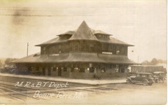 | Bonne Terre Depot | building | 1984 | 84002606 |
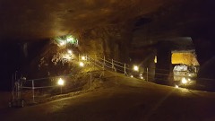 | Bonne Terre Mine | structure | 1974 | 74002281 |
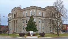 | Courthouse Square Historic District | district | 2004 | 04000582 |
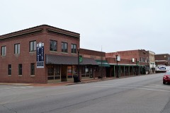 | East Columbia Historic District | district | 2004 | 04000699 |
| East Columbia Historic District (Boundary Increase) | district | 2007 | 07000482 | |
| Eugene Field School | building | 2005 | 05000997 | |
| Farmington State Hospital No. 4 Cemetery | site | 2010 | 08001360 | |
| Howlett Gulf | building | 2019 | 100004602 | |
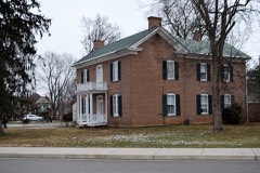 | James Robinson McCormick House | building | 1998 | 98000945 |
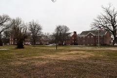 | Presbyterian Orphanage of Missouri | district | 2006 | 06000322 |
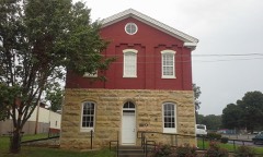 | St. Francois County Jail and Sheriff's Residence | building | 1996 | 96000764 |
| St. Joe Lead Company Administration Building | building | 1984 | 84002611 |
Every wildfire the federal occurrence database records inside this county: 94 of them, burning about 995 acres. 2 started naturally and 6 were recorded as arson. Each settlement page carries the fires within five miles of it.
| Reported cause | Fires |
|---|---|
| Debris and open burning | 47 |
| Missing data/not specified/undetermined | 35 |
| Arson/incendiarism | 6 |
| Equipment and vehicle use | 4 |
| Natural | 2 |
The five largest, by the area the report gives. None of them was recorded as arson.
| Date | Cause | Size | Reported by | Name on the report |
|---|---|---|---|---|
| 12 April 2018 | Debris and open burning | 254 acres | Missouri Department of Conservation | 176750-09401-04122018-1636 |
| 28 February 1992 | Debris and open burning | 125 acres | Missouri Department of Conservation | not named |
| 7 March 2016 | Debris and open burning | 70 acres | Missouri Department of Conservation | 138116-09401-03072016-1443 |
| 24 February 1995 | Debris and open burning | 60 acres | Missouri Department of Conservation | not named |
| 17 March 1995 | Debris and open burning | 40 acres | Missouri Department of Conservation | not named |
| 25 February 1995 | Debris and open burning | 40 acres | Missouri Department of Conservation | not named |
| 25 March 1995 | Debris and open burning | 30 acres | Missouri Department of Conservation | not named |
| 16 April 1992 | Natural | 29 acres | Mark Twain National Forest | not named |
Every settlement page carries the fires within five miles of it - see the settlement index below.
The NOAA Storm Events Database holds 378 reports for this county, causing 15 deaths, 71 injuries and about $59,264,900 in recorded property damage. Each settlement page carries the reports that name it.
| Kind of event | Reports |
|---|---|
| Thunderstorm Wind | 179 |
| Hail | 135 |
| Flash Flood | 30 |
| Tornado | 27 |
| Lightning | 3 |
| Heavy Rain | 2 |
| Flood | 2 |
The most serious of them, by death, then injury, then recorded damage. The accounts are quoted exactly as the forecast office filed them.
| When | Event | Place named | Harm | What the report says |
|---|---|---|---|---|
| May 1957 | Tornado (F3) | not stated | 8 killed, 49 hurt, $25,000,000 | no account filed |
| June 1969 | Tornado (F4) | not stated | 4 killed, 14 hurt, $2,500,000 | no account filed |
| December 1957 | Tornado (F2) | not stated | 1 killed, 1 hurt, $25,000 | no account filed |
| January 2007 | Flood | Bonne Terre | 1 killed | Several inches of rain caused flooding of small creeks and streams and low-water crossings across much of St. Francois County. A 71 year-old man was killed near Bonne Terre when he tried to cross a low-water crossing on Cedar Run Road through Terre Blue Creek. |
| February 1997 | Heavy Rain | Coundywide | 1 killed | no account filed |
| June 1963 | Tornado (F2) | not stated | 2 hurt, $250,000 | no account filed |
| December 1982 | Tornado (F1) | not stated | 2 hurt, $25,000 | no account filed |
| March 1952 | Tornado (F2) | not stated | 1 hurt, $25,000 | no account filed |
| January 1996 | Thunderstorm Wind | Farmington | 1 hurt, $15,000 | no account filed |
| June 1998 | Thunderstorm Wind | Doe Run | 1 hurt | no account filed |
| May 1957 | Tornado (F3) | not stated | $25,000,000 | no account filed |
| June 1969 | Tornado (F4) | not stated | $2,500,000 | no account filed |
| June 1969 | Tornado (F4) | not stated | $2,500,000 | no account filed |
| May 2004 | Thunderstorm Wind | Farmington | $300,000 | no account filed |
| December 2015 | Flash Flood | Iron Mtn | $275,000 | Between 4 and 6 inches of rain fell over St. Francois County in a 48 hour period. The heaviest rain fell in the early morning hours of December 28th causing flash flooding. Numerous roads were flooded including Highway 221 over the St. Francis River and Route F from Old Jackson Road to Wolf Creek Bridge. Around 10 structures were damaged by the flash flooding. Damage was estimated around $275,000. |
| May 1963 | Tornado (F2) | not stated | $250,000 | no account filed |
| July 2023 | Thunderstorm Wind | Cantwell | $100,000 | Widespread wind damage in Desloge, Park Hills and Leadington areas. Numerous trees, tree limbs and power lines were blown down. One tree was blown down onto a house briefly trapping 5 occupants in the home. No one was injured. Otherwise, the home will need extensive repairs before family can return to it. |
| April 2025 | Flash Flood | Libertyville | $60,000 | Multiple water rescues were reported in St. Francois County, one in Blackwell and another in an unnamed location in northern St. Francois County. Near Libertyville, an estimated 3 feet of water was running swiftly across Highway DD into a small lake across the street. The lake was reportedly spilling onto the road. |
| May 2022 | Thunderstorm Wind | Iron Mtn | $50,000 | Widespread wind damage occurred across St. Francois County. In Iron Mountain, a large tree was snapped. On Highway M, about a mile southwest of Frankclay, a large was blown over onto the highway. In Park Hills and Bonne Terre, large trees were blown over onto houses causing moderate roof damage. Otherwise, numerous tree limbs as well as several large trees and power poles were blown down in Farmington, Desloge and Leadwood. No injuries were reported. |
| May 2003 | Thunderstorm Wind | Bonne Terre | $50,000 | Amateur radio spotters reported numerous trees and power lines down. Some cars were damaged by downed trees. |
| April 1994 | Thunderstorm Wind | Knob Lick | $50,000 | Trees were uprooted and a chimney was blown over damaging a roof. Reported by a local newspaper. |
| July 2022 | Thunderstorm Wind | French Vlg | $40,000 | Thunderstorm winds caused widespread damage in and around French Village. Several garages were damaged and numerous trees and tree limbs were blown down. |
| May 2025 | Tornado (EF1) | Iron Mtn | $30,000 | A tornado touched down in Iron Mountain causing tree damage and minor roof damage before moving northeast. From there, the tornado moved northeast causing similar damage on Highway N and severely damaging a home's roof on Lake Avalon Road. The tornado dissipated shortly after. |
| June 2025 | Tornado (EF0) | Libertyville | $25,000 | An EF-0 tornado briefly touched down and remained on the ground for about 1.25 miles, resulting in removal of a large portion of a barn roof, roof damage to a home, and notable damage to a number of trees. The tornado was rated EF-0 with a path length of 1.25 miles and a maximum path width of 65 yards. |
| April 1979 | Tornado (F1) | not stated | $25,000 | no account filed |
| June 1973 | Tornado (F2) | not stated | $25,000 | no account filed |
| February 1960 | Tornado (F2) | not stated | $25,000 | no account filed |
| July 2022 | Thunderstorm Wind | Iron Mtn | $20,000 | Thunderstorm winds blew a tree down onto an unoccupied police vehicle. |
| July 2021 | Tornado (EF0) | Ogborn | $20,000 | A brief, weak tornado first touched down just to the west of Turkey Mill Road in the late morning hours of July 31st. The tornado first did some damage to cedar trees along Turkey Mill, which were displaced over the roadway. The tornado then did some minor structural damage to a home on the east side of Turkey Mill, ripping off a few shingles and damaging the fascia. The tornado then continued to the southeast, completely uprooting a large walnut tree. The tornado completely destroyed a well built swing set, lofting parts of it nearly 100 yards into a pond and a nearby treeline. It also destroyed a well built vinyl fence, and did some minor roof damage to another home along Lober Farm Road. The tornado continued southeast, uprooting a couple of large trees as it moved towards Quail Run Road. Several large tree limbs were downed along part of Quail Run Road, before the tornado lifted as it approached State Route EE. The tornado was rated EF0 with a path length of 0.88 miles and a max path width of 120 yards. No deaths or injuries were reported. |
| May 1995 | Thunderstorm Wind | Park Hills | $20,000 | Golf ball-size hail fell in Bonne Terre with numerous large trees down over central parts of the county. Several windows were broken in the Park Hills area due to large hail and the strong wind gusts. A commercial building in Park Hills also sustained roof damage when a section of the roof peeled back. The county sheriff's department also reported hail the size of quarters before the storm moved out of the county. |
| July 2022 | Thunderstorm Wind | East Bonne Terre | $10,000 | Thunderstorm winds caused widespread tree damage from Bonne Terre to just east of Leadington. Numerous tree limbs were blown down. Also, several trees were blown down including a couple onto Highway D just east of Leadington. |
| May 2022 | Thunderstorm Wind | Bonne Terre | $8,000 | Thunderstorm winds blew down a power pole along Berry Road, about 3 miles north of Bonne Terre. |
| May 1995 | Hail | Bonne Terre | $8,000 | The county sheriff reported baseball-size hail right on the Washington-St. Francois County line. A few cars in the area had minor damage. |
| August 2021 | Thunderstorm Wind | Bonne Terre | $5,000 | Thunderstorm winds caused damage across the western portions of St. Francois County. A tree was blown down near the intersection of Highway 8 and St. Francois Road. Another tree was blown down near the intersection of Highway 32 and Old Irondale Road. A house two miles southwest of Bonne Terre had some siding torn off. |
| April 2008 | Flash Flood | Bonne Terre | $5,000 | Several inches of rain fell over a short amount of time over St. Francois county. Several roads were flooded for a time, including roads on the southeast side of Farmington. A few homes were affected in this area as well. |
| April 1994 | Hail | Desloge | $5,000 | Golf ball-size hail was reported at two area radio stations. Large hail was also reported in Park Hills. |
| June 1994 | Thunderstorm Wind | Bonne Terre | $5,000 | The county sheriff reported numerous trees and power lines down between Bonne Terre and Farmington. |
| April 1994 | Thunderstorm Wind | Farmington | $5,000 | Trees were blown down in numerous areas around Farmington. Some downed trees damaged nearby houses and brought down power lines. |
| October 1993 | Hail | Farmington | $5,000 | The county sheriff reported dime-size hail at 1540 CST and golf ball-size hail between Farmington and Flat River a few minutes later. |
| December 1966 | Tornado (F1) | not stated | $2,500 | no account filed |
| June 1994 | Thunderstorm Wind | Farmington | $500 | The county sheriff reported numerous trees and power lines down between Bonne Terre and Farmington. |
| April 1993 | Thunderstorm Wind | Bonne Terre | $500 | Hail up to 1.00 inch in diameter was reported by the public. A small group of large trees was also knocked down 2 miles east of town. |
| June 1995 | Thunderstorm Wind | Bonne Terre | $200 | Several large trees were blown down. |
| July 1995 | Thunderstorm Wind | Iron Mountain Lake | $200 | Large trees were blown over or snapped near Iron Mountain Lake. |
| March 2026 | Flash Flood | Esther | - | Two to five inches of rain fell in St. Francois county in about 24 hours ending on March 5th. This rain caused Flat Creek to rise above its banks as far east as Garrett St and as far west as Camilla St. A few evacuations were required as water approached homes in these areas. Water receded by 4am. |
| March 2026 | Flash Flood | Bonne Terre | - | Heavy rain caused flooding on several streets of Bonne Terre. |
| March 2026 | Thunderstorm Wind | Daytown | - | Thunderstorm winds downed a tree. The tree fell onto a home in Leadwood. |
| March 2026 | Thunderstorm Wind | Esther | - | A row of powerlines was reportedly bent over by high winds near Park Hills. 10 minutes later, a member of the public reported an estimated wind gust of 60 mph 1 mile north of Farmington. |
| April 2026 | Thunderstorm Wind | Farmington | - | A trained spotter in Farmington estimated a 60 mph wind gust. |
| April 2026 | Hail | Farmington | - | Photo of multiple large hail stones. Largest is measured at 2 inches. |
| March 2025 | Hail | French Vlg | - | Quarter sized hail fell in French Village for approximately 5 minutes. |
| May 2025 | Hail | Farmington | - | Hail fell near KREI Radio in Farmington. |
| May 2025 | Thunderstorm Wind | Esther | - | Thunderstorm winds downed powerlines in Park Hills and trees in Farmington. |
| May 2025 | Hail | Silver Spgs | - | An NWS employee received this information from a family member in the area. |
| April 2025 | Thunderstorm Wind | Leadington | - | Thunderstorm winds downed power lines at Camilla Street and Polk Avenue near Park Hills. They also downed power lines in Desloge. |
| April 2025 | Thunderstorm Wind | Farmington | - | A trained spotter reported estimated 60 mph thunderstorm wind gusts. |
| April 2025 | Flood | Iron Mtn | - | Heavy rain on the scale of 9 to 11 inches caused Dry Creek near Bismarck and Indian Creek near Iron Mountain Lake. Near Farmington, 6 inches of water was reported on Maple Street, and Westmeyer Road had an estimated foot of running water over it. An older model Chevy Trailblazer drove through the water and floated to the other side. This is a persistent issue when nearby creeks such as Wolf Creek and Kennedy Branch flood. |
| March 2024 | Thunderstorm Wind | Flat River | - | Thunderstorm winds uprooted several trees in Desloge and Park Hills. Some of the trees were two feet in diameter. |
| March 2024 | Thunderstorm Wind | Doe Run | - | Thunderstorm winds uprooted or snapped off numerous trees between Doe Run and Farmington. Two of the trees were large oaks that were uprooted near the intersection of Missouri Highway 221 and Route B. Also, numerous tree limbs and power lines were blown down. In Farmington, a business sign was blown across a road. |
| May 2024 | Thunderstorm Wind | Bonne Terre Arpt | - | There was one report of a tree down on Highway 47 between Bonne Terre and Terre du Lac. |
The Survey's mineral resources record lists 311 workings inside this county. 9 still produce and 302 are closed or unrecorded. Each settlement page carries the workings within five miles of it.
| Commodity | Workings |
|---|---|
| Stone, Crushed/Broken | 148 |
| Lead | 129 |
| Iron | 10 |
| Lead, Zinc | 5 |
| Copper, Zinc | 4 |
| Zinc, Lead | 4 |
| Barium-Barite | 4 |
| Copper | 3 |
| Cadmium, Cobalt, Nickel | 2 |
| Copper, Nickel, Cobalt | 1 |
| Cobalt, Copper, Lead, Nickel | 1 |
| Copper, Nickel, Cobalt, Lead | 1 |
| Nickel, Lead, Copper, Cobalt | 1 |
| Dolomite | 1 |
The least common of them first, because a county's hundredth gravel pit says nothing its first ten did not.
| Where | Site | Commodity | Status | Recorded |
|---|---|---|---|---|
| Bonne Terre | Lead, Copper, Nickel, Cobalt | Past Producer | 1821 | |
| Bonne Terre Mill | Dolomite | Producer | ||
| Bonne Terre Mine | Lead, Copper, Zinc, Cobalt, Nickel | Past Producer | 1864, 1868 | |
| Bonne Terre Quarry and Mill | Magnesite | Producer | ||
| Flat River Sub-District | Lead, Zinc, Silver | Past Producer | 1742 | |
| Leadwood Plant | Stone | Producer | ||
| Mine La Motte #1 | Copper, Nickel, Cobalt, Lead | Past Producer | ||
| Mine La Motte #2 | Cobalt, Copper, Lead, Nickel | Past Producer | ||
| Shaft Number Two | Nickel, Lead, Copper, Cobalt | Past Producer | ||
| Unknown - Clay Kaolin | Kaolin | Past Producer | ||
| Unknown - Lead - Iron | Iron, Lead | Past Producer | ||
| Unknown - Sand & Gravel | Sand and Gravel, Construction | Past Producer | ||
| Flat River | Lead, Copper, Zinc, Cadmium, Cobalt, Nickel | Past Producer | 1890 | |
| Leadwood Mine | Lead, Copper, Zinc, Cadmium, Cobalt, Nickel | Producer | 1898, 1903 | |
| Desloge Mines | Lead, Copper | Producer | 1801 | |
| Jordans Copper Diggings | Copper | Past Producer | ||
| Unknown - Copper | Copper | Past Producer | ||
| Blackwell | Barium-Barite | Prospect | 1977, 1979 | |
| Central Lead Co. Shaft | Zinc, Lead | Past Producer | ||
| Central Mining Co. Mine | Lead, Copper, Zinc | Producer | 1893 | |
| Crawley Mine | Zinc, Lead | Past Producer | ||
| Doe Run Shaft | Zinc, Lead | Past Producer | ||
| Howard and Ruth Cole Property | Barium-Barite | Occurrence | 1977 | |
| Shaft Number Fourdoe Run Lead Co | Zinc, Lead | Past Producer | ||
| Unknown - Barite | Barium-Barite | Past Producer | ||
| Unknown - Barite | Barium-Barite | Past Producer | ||
| Brown Mine | Lead, Zinc | Past Producer | ||
| Hazel Run Mines | Lead, Zinc | Past Producer | ||
| Mccormack Shaft | Lead, Zinc | Past Producer | ||
| Taylors Shaft #2 | Lead, Zinc | Past Producer | ||
| Unknown - Lead - Zinc | Lead, Zinc | Past Producer | ||
| Cushing Bank | Iron | Past Producer | ||
| Greasy Mine | Iron | Past Producer | Vein | |
| Greasy Mines | Iron | Past Producer | ||
| Iron Mountain | Iron | Past Producer | 1845 | |
| Iron Mountain Mine | Iron | Past Producer | 1803, 1843 | |
| Iron Mountain Mine | Iron | Past Producer | ||
| Mars Hill Prospect | Iron | Prospect | ||
| Mine La Motte Bank No. One | Iron | Past Producer | ||
| Mine Lamotte Bank No. 1 | Iron | Past Producer | ||
| Unknown - Iron | Iron | Past Producer | ||
| African Mine | Lead | Past Producer | ||
| Appleberry Mine | Lead | Past Producer | ||
| Ashburn Mine | Lead | Past Producer | ||
| Baker Mine | Lead | Past Producer | ||
| Big Bill Mine | Lead | Past Producer | ||
| Bisch Mine | Lead | Past Producer | ||
| Brown Mine | Lead | Past Producer | ||
| Casey Mine | Lead | Past Producer | ||
| Cedar Mine | Lead | Past Producer | ||
| Central Lead Co Shaft | Lead | Past Producer | ||
| Cole Mine | Lead | Past Producer | ||
| Cottonwood Mine | Lead | Past Producer | ||
| Crobar Mine | Lead | Past Producer | ||
| Desloge Mine | Lead | Past Producer | ||
| Doe Run | Lead | Producer | 1885 | |
| F. Roberts Mine | Lead | Past Producer | ||
| Federal Group | Lead | Past Producer | ||
| Field Shaft | Lead | Past Producer | ||
| Finney Mine | Lead | Past Producer | ||
| Fletcher Mine | Lead | Past Producer | ||
| Green Mine | Lead | Past Producer | ||
| Hale Mine | Lead | Past Producer | ||
| Hatcher Mine | Lead | Past Producer | ||
| Haverstick Mine | Lead | Past Producer | ||
| Hayden Creek | Lead | Past Producer | Galena | |
| Hayden Creek Mine | Lead | Past Producer | ||
| Hazel Run | Lead | Past Producer | Galena | |
| Hazel Run Diggings | Lead | Past Producer | ||
| Hoadly Shaft | Lead | Past Producer | ||
| Hunt Mine | Lead | Past Producer | ||
| Johnson Mine | Lead | Past Producer | ||
| Johnson Mine | Lead | Past Producer | ||
| Little Bill Mine | Lead | Past Producer | ||
| Madden Mine | Lead | Past Producer | ||
| Mcgregory Mine | Lead | Past Producer | ||
| Mcguire Mine | Lead | Past Producer | ||
| Mclain Mine | Lead | Past Producer | ||
| Mine A Joe | Lead | Past Producer | ||
| Mine Number 25doe Run Lead Co | Lead | Past Producer | ||
| Mine Number Eightdoe Run Mines | Lead | Past Producer | ||
| Mine Number Eightfederal Lead Co | Lead | Past Producer | ||
| Mine Number Fivedesloge Mines | Lead | Past Producer | ||
| Mine Number Fivefederal Lead | Lead | Past Producer | ||
| Mine Number Fivenational Lead Co | Lead | Past Producer | ||
| Mine Number Fivevalle Mines | Lead | Past Producer | ||
| Mine Number Fourdoe Run Lead Co | Lead | Past Producer | ||
| Mine Number Fourfederal Lead Co | Lead | Past Producer | ||
| Mine Number Fournational Lead Co | Lead | Past Producer | ||
| Mine Number Fourteenst Joe Lead Co | Lead | Past Producer | ||
| Mine Number Fourvalle Mine | Lead | Past Producer | ||
| Mine Number Ninedoe Run Lead Co | Lead | Past Producer | ||
| Mine Number Ninefederal Lead Co | Lead | Past Producer | ||
| Mine Number Onedoe Run Lead Co | Lead | Past Producer | ||
| Mine Number Onefederal Lead Co | Lead | Past Producer | ||
| Mine Number Onenational Lead Co | Lead | Past Producer | ||
| Mine Number Sevennational Lead | Lead | Past Producer | ||
| Mine Number Sixdesloge Mines | Lead | Past Producer | ||
| Mine Number Sixfederal Lead Co | Lead | Past Producer | ||
| Mine Number Ten | Lead | Past Producer | ||
| Mine Number Tenst Joe Lead Co | Lead | Past Producer | ||
| Mine Number Threedesloge Lead Co | Lead | Past Producer | ||
| Mine Number Threenational Lead Co | Lead | Past Producer | ||
| Mine Number Threevalle Mines | Lead | Past Producer | ||
| Mine Number Twelvest Joe Lead Co | Lead | Past Producer | ||
| Mine Number Twodoe Run Lead Co | Lead | Past Producer | ||
| Mine Number Twonational Lead Co | Lead | Past Producer | ||
| Mine Number Twovalle Mines Co | Lead | Past Producer | ||
| Murray Mine | Lead | Past Producer | ||
| Nash Mine | Lead | Past Producer | ||
| National Group | Lead | Past Producer | Galena | |
| Owl Creek Basin Group | Lead | Past Producer | Galena | |
| Pearl Mine | Lead | Past Producer | ||
| Pen Diggings | Lead | Past Producer | ||
| Perry's Mine | Lead | Past Producer | ||
| Schultz Basin Group | Lead | Past Producer | ||
| Shaft Number Eleven | Lead | Past Producer | ||
| Shaft Number Fivest Mineral Corp | Lead | Past Producer | ||
| Shaft Number Fourst Joe Minerals | Lead | Past Producer | ||
| Shaft Number Ninest Joe Mineral | Lead | Past Producer | ||
| Shaft Number Onest Joe's Mineral | Lead | Past Producer | ||
| Shaft Number Sevenst Joe Mineral | Lead | Past Producer | ||
| Shaft Number Sixst Joe Mineral Co | Lead | Past Producer | ||
| Shaft Number Threest Joe Lead Co | Lead | Past Producer | ||
| Shaft Number Twodoe Run Lead Co | Lead | Past Producer | ||
| Shaft Number Twofederal Land Co | Lead | Past Producer | ||
| Shaft Number Twost Joe's Mineral | Lead | Past Producer | ||
| Silver Springs Mine | Lead | Past Producer | ||
| Spludge Mine | Lead | Past Producer | ||
| St. Joseph Lead Company No. 8 Mine | Lead | Past Producer | Galena | |
| Stoney Mine | Lead | Past Producer | ||
| Taylor Mine | Lead | Past Producer | Galena | |
| Taylor Mine #1 | Lead | Past Producer | ||
| Taylor Mine #2 | Lead | Past Producer | ||
| Taylor Shafts #1 | Lead | Past Producer | ||
| Unknown - Lead | Lead | Past Producer | ||
| Unknown - Lead | Lead | Past Producer | ||
| Unknown - Lead | Lead | Past Producer | ||
| Unknown - Lead | Lead | Past Producer | ||
| Unknown - Lead | Lead | Past Producer | ||
| Unknown - Lead | Lead | Past Producer | ||
| Unknown - Lead | Lead | Past Producer | ||
| Unknown - Lead | Lead | Past Producer | ||
| Unknown - Lead | Lead | Past Producer | ||
| Unknown - Lead | Lead | Past Producer | ||
| Unknown - Lead | Lead | Past Producer | ||
| Unknown - Lead | Lead | Past Producer | ||
| Unknown - Lead | Lead | Past Producer | ||
| Unknown - Lead | Lead | Past Producer | ||
| Unknown - Lead | Lead | Past Producer | ||
| Unknown - Lead | Lead | Past Producer | ||
| Unknown - Lead | Lead | Past Producer | ||
| Unknown - Lead | Lead | Past Producer | ||
| Unknown - Lead | Lead | Past Producer | ||
| Unknown - Lead | Lead | Past Producer | ||
| Unknown - Lead | Lead | Past Producer | ||
| Unknown - Lead | Lead | Past Producer | ||
| Unknown - Lead | Lead | Past Producer | ||
| Unknown - Lead | Lead | Past Producer | ||
| Unknown - Lead | Lead | Past Producer | ||
| Unknown - Lead | Lead | Past Producer | ||
| W. Rozier Mine #2 | Lead | Past Producer | ||
| Wilkerson Mine | Lead | Past Producer | ||
| Alexander & Burks Mine | Stone, Crushed/Broken | Past Producer | ||
| Alexander Hansen Quarry | Stone, Crushed/Broken | Past Producer | ||
| Asplof Quarry | Stone, Crushed/Broken | Past Producer | ||
| Biels Quarry | Stone, Crushed/Broken | Past Producer | ||
| Cowans Quarry | Stone, Crushed/Broken | Past Producer | ||
| Eaves Quarry | Stone, Crushed/Broken | Past Producer | ||
| Eaves Quarry | Stone, Crushed/Broken | Past Producer | ||
| Elvins Quarry and Mill | Stone, Crushed/Broken | Producer | ||
| Hawn Quarries | Stone, Crushed/Broken | Past Producer | ||
| Hill O'Mera Construction Co Quarry | Stone, Crushed/Broken | Past Producer | ||
| Holler Quarry | Stone, Crushed/Broken | Past Producer | ||
| Irwin Quarry | Stone, Crushed/Broken | Past Producer | ||
| M.P.Cayce Quarry | Stone, Crushed/Broken | Past Producer | ||
| Main Quarry | Stone, Crushed/Broken | Past Producer | ||
| Miller & Sikes Quarry | Stone, Crushed/Broken | Past Producer | ||
| Milni & Gordon Quarry | Stone, Crushed/Broken | Past Producer | ||
| Missouri Granite Const. Co. Quarry | Stone, Crushed/Broken | Past Producer | ||
| Mueller & Sons Quarry | Stone, Crushed/Broken | Past Producer | ||
| North Quarry | Stone, Crushed/Broken | Past Producer | ||
| Parkhurst Quarry | Stone, Crushed/Broken | Past Producer | ||
| Scotts Quarry #1 | Stone, Crushed/Broken | Past Producer | ||
| Scotts Quarry #2 | Stone, Crushed/Broken | Past Producer | ||
| State Hospital Quarry | Stone, Crushed/Broken | Past Producer | ||
| Syenite Mine | Stone, Crushed/Broken | Past Producer | ||
| Turpin Switch Quarry | Stone, Crushed/Broken | Past Producer | ||
| Unknown - Granite C+B | Stone, Crushed/Broken | Past Producer | ||
| Unknown - Granite C+B | Stone, Crushed/Broken | Past Producer | ||
| Unknown - Granite C+B | Stone, Crushed/Broken | Past Producer | ||
| Unknown - Granite C+B | Stone, Crushed/Broken | Past Producer | ||
| Unknown - Granite C+B | Stone, Crushed/Broken | Past Producer | ||
| Unknown - Granite C+B | Stone, Crushed/Broken | Past Producer | ||
| Unknown - Granite C+B | Stone, Crushed/Broken | Past Producer | ||
| Unknown - Granite C+B | Stone, Crushed/Broken | Past Producer | ||
| Unknown - Granite C+B | Stone, Crushed/Broken | Past Producer | ||
| Unknown - Granite C+B | Stone, Crushed/Broken | Past Producer | ||
| Unknown - Granite C+B | Stone, Crushed/Broken | Past Producer | ||
| Unknown - Granite C+B | Stone, Crushed/Broken | Past Producer | ||
| Unknown - Granite C+B | Stone, Crushed/Broken | Past Producer | ||
| Unknown - Granite C+B | Stone, Crushed/Broken | Past Producer | ||
| Unknown - Granite C+B | Stone, Crushed/Broken | Past Producer | ||
| Unknown - Granite C+B | Stone, Crushed/Broken | Past Producer | ||
| Unknown - Granite C+B | Stone, Crushed/Broken | Past Producer | ||
| Unknown - Granite C+B | Stone, Crushed/Broken | Past Producer | ||
| Unknown - Granite C+B | Stone, Crushed/Broken | Past Producer | ||
| Unknown - Granite C+B | Stone, Crushed/Broken | Past Producer | ||
| Unknown - Granite C+B | Stone, Crushed/Broken | Past Producer | ||
| Unknown - Granite C+B | Stone, Crushed/Broken | Past Producer | ||
| Unknown - Granite C+B | Stone, Crushed/Broken | Past Producer | ||
| Unknown - Granite C+B | Stone, Crushed/Broken | Past Producer | ||
| Unknown - Granite C+B | Stone, Crushed/Broken | Past Producer | ||
| Unknown - Granite C+B | Stone, Crushed/Broken | Past Producer | ||
| Unknown - Granite C+B | Stone, Crushed/Broken | Past Producer | ||
| Unknown - Granite C+B | Stone, Crushed/Broken | Past Producer | ||
| Unknown - Granite C+B | Stone, Crushed/Broken | Past Producer | ||
| Unknown - Granite C+B | Stone, Crushed/Broken | Past Producer | ||
| Unknown - Granite C+B | Stone, Crushed/Broken | Past Producer | ||
| Unknown - Granite C+B | Stone, Crushed/Broken | Past Producer | ||
| Unknown - Granite C+B | Stone, Crushed/Broken | Past Producer | ||
| Unknown - Granite C+B | Stone, Crushed/Broken | Past Producer | ||
| Unknown - Granite C+B | Stone, Crushed/Broken | Past Producer | ||
| Unknown - Granite C+B | Stone, Crushed/Broken | Past Producer | ||
| Unknown - Granite C+B | Stone, Crushed/Broken | Past Producer | ||
| Unknown - Granite C+B | Stone, Crushed/Broken | Past Producer | ||
| Unknown - Granite C+B | Stone, Crushed/Broken | Past Producer | ||
| Unknown - Granite C+B | Stone, Crushed/Broken | Past Producer | ||
| Unknown - Granite C+B | Stone, Crushed/Broken | Past Producer | ||
| Unknown - Granite C+B | Stone, Crushed/Broken | Past Producer | ||
| Unknown - Granite C+B | Stone, Crushed/Broken | Past Producer | ||
| Unknown - Granite C+B | Stone, Crushed/Broken | Past Producer | ||
| Unknown - Granite C+B | Stone, Crushed/Broken | Past Producer | ||
| Unknown - Granite C+B | Stone, Crushed/Broken | Past Producer | ||
| Unknown - Granite C+B | Stone, Crushed/Broken | Past Producer | ||
| Unknown - Granite C+B | Stone, Crushed/Broken | Past Producer | ||
| Unknown - Granite C+B | Stone, Crushed/Broken | Past Producer | ||
| Unknown - Granite C+B | Stone, Crushed/Broken | Past Producer | ||
| Unknown - Granite C+B | Stone, Crushed/Broken | Past Producer | ||
| Unknown - Granite C+B | Stone, Crushed/Broken | Past Producer | ||
| Unknown - Granite C+B | Stone, Crushed/Broken | Past Producer | ||
| Unknown - Granite C+B | Stone, Crushed/Broken | Past Producer | ||
| Unknown - Granite C+B | Stone, Crushed/Broken | Past Producer | ||
| Unknown - Granite C+B | Stone, Crushed/Broken | Past Producer | ||
| Unknown - Granite C+B | Stone, Crushed/Broken | Past Producer | ||
| Unknown - Granite C+B | Stone, Crushed/Broken | Past Producer | ||
| Unknown - Granite C+B | Stone, Crushed/Broken | Past Producer | ||
| Unknown - Granite C+B | Stone, Crushed/Broken | Past Producer | ||
| Unknown - Granite C+B | Stone, Crushed/Broken | Past Producer | ||
| Unknown - Granite C+B | Stone, Crushed/Broken | Past Producer | ||
| Unknown - Granite C+B | Stone, Crushed/Broken | Past Producer | ||
| Unknown - Granite C+B | Stone, Crushed/Broken | Past Producer | ||
| Unknown - Granite C+B | Stone, Crushed/Broken | Past Producer | ||
| Unknown - Granite C+B | Stone, Crushed/Broken | Past Producer | ||
| Unknown - Granite C+B | Stone, Crushed/Broken | Past Producer | ||
| Unknown - Granite C+B | Stone, Crushed/Broken | Past Producer | ||
| Unknown - Granite C+B | Stone, Crushed/Broken | Past Producer | ||
| Unknown - Granite C+B | Stone, Crushed/Broken | Past Producer | ||
| Unknown - Granite C+B | Stone, Crushed/Broken | Past Producer | ||
| Unknown - Granite C+B | Stone, Crushed/Broken | Past Producer | ||
| Unknown - Granite C+B | Stone, Crushed/Broken | Past Producer | ||
| Unknown - Granite C+B | Stone, Crushed/Broken | Past Producer | ||
| Unknown - Granite C+B | Stone, Crushed/Broken | Past Producer | ||
| Unknown - Granite C+B | Stone, Crushed/Broken | Past Producer | ||
| Unknown - Granite C+B | Stone, Crushed/Broken | Past Producer | ||
| Unknown - Granite C+B | Stone, Crushed/Broken | Past Producer | ||
| Unknown - Granite C+B | Stone, Crushed/Broken | Past Producer | ||
| Unknown - Granite C+B | Stone, Crushed/Broken | Past Producer | ||
| Unknown - Granite C+B | Stone, Crushed/Broken | Past Producer | ||
| Unknown - Granite C+B | Stone, Crushed/Broken | Past Producer | ||
| Unknown - Granite C+B | Stone, Crushed/Broken | Past Producer | ||
| Unknown - Granite C+B | Stone, Crushed/Broken | Past Producer | ||
| Unknown - Granite C+B | Stone, Crushed/Broken | Past Producer | ||
| Unknown - Granite C+B | Stone, Crushed/Broken | Past Producer | ||
| Unknown - Limestone | Stone, Crushed/Broken | Past Producer | ||
| Unknown - Limestone | Stone, Crushed/Broken | Past Producer | ||
| Unknown - Limestone | Stone, Crushed/Broken | Past Producer | ||
| Unknown - Limestone | Stone, Crushed/Broken | Past Producer | ||
| Unknown - Limestone | Stone, Crushed/Broken | Past Producer | ||
| Unknown - Limestone | Stone, Crushed/Broken | Past Producer | ||
| Unknown - Limestone | Stone, Crushed/Broken | Past Producer | ||
| Unknown - Limestone | Stone, Crushed/Broken | Past Producer | ||
| Unknown - Limestone | Stone, Crushed/Broken | Past Producer | ||
| Unknown - Limestone | Stone, Crushed/Broken | Past Producer | ||
| Unknown - Limestone | Stone, Crushed/Broken | Past Producer | ||
| Unknown - Limestone | Stone, Crushed/Broken | Past Producer | ||
| Unknown - Limestone | Stone, Crushed/Broken | Past Producer | ||
| Unknown - Limestone | Stone, Crushed/Broken | Past Producer | ||
| Unknown - Limestone | Stone, Crushed/Broken | Past Producer | ||
| Unknown - Limestone | Stone, Crushed/Broken | Past Producer | ||
| Unknown - Limestone | Stone, Crushed/Broken | Past Producer | ||
| Unknown - Limestone | Stone, Crushed/Broken | Past Producer | ||
| Unknown - Limestone | Stone, Crushed/Broken | Past Producer | ||
| Unknown - Limestone | Stone, Crushed/Broken | Past Producer | ||
| Unknown - Limestone | Stone, Crushed/Broken | Past Producer | ||
| Unknown - Limestone | Stone, Crushed/Broken | Past Producer | ||
| Unknown - Limestone | Stone, Crushed/Broken | Past Producer | ||
| Unknown - Limestone | Stone, Crushed/Broken | Past Producer | ||
| Unknown - Limestone | Stone, Crushed/Broken | Past Producer | ||
| Unknown - Limestone | Stone, Crushed/Broken | Past Producer | ||
| Unknown - Limestone | Stone, Crushed/Broken | Past Producer | ||
| Unknown - Limestone | Stone, Crushed/Broken | Past Producer | ||
| Unknown - Limestone | Stone, Crushed/Broken | Past Producer | ||
| Unknown - Limestone | Stone, Crushed/Broken | Past Producer | ||
| Unknown - Limestone | Stone, Crushed/Broken | Past Producer | ||
| Unknown - Limestone | Stone, Crushed/Broken | Past Producer | ||
| Unknown - Limestone | Stone, Crushed/Broken | Past Producer | ||
| Unknown - Limestone | Stone, Crushed/Broken | Past Producer | ||
| Unknown - Limestone | Stone, Crushed/Broken | Past Producer | ||
| Valley Dolomite Mine | Stone, Crushed/Broken | Producer | ||
| Wells Quarry | Stone, Crushed/Broken | Past Producer |
Named settlements recorded in the Geographic Names Information System, each with the topographic sheets covering it. Villages, hamlets and abandoned places alike. Each is shown with the nearest named watercourse or landform and the survey quadrangle it falls on.
St. Francois township · 63640 · On Flanery Branch · Farmington quadrangle
19 sheets, 1904 to 1989
Pendleton township · 63637 · Near Chalk Hill · Wachita Mountain quadrangle
18 sheets, 1939 to 1989
Perry township · 63628 · On Pike Run · Bonne Terre quadrangle
21 sheets, 1905 to 1989
St. Francois township · 63601 · On Shaw Branch · Flat River quadrangle
21 sheets, 1905 to 1989
St. Francois township · 63601 · On Shaw Branch · Farmington quadrangle
19 sheets, 1904 to 1989
Randolph township · 63601 · On Shaw Branch · Flat River quadrangle
21 sheets, 1905 to 1989
St. Francois township · 63601 · On Shaw Branch · Flat River quadrangle
21 sheets, 1905 to 1989
St. Francois township · 63601 · On Shaw Branch · Flat River quadrangle
21 sheets, 1905 to 1989
Randolph township · 63601 · On Hayden Creek · Flat River quadrangle
21 sheets, 1905 to 1989
Pendleton township · 63637 · Near Chalk Hill · Wachita Mountain quadrangle
18 sheets, 1939 to 1989
Marion township · 63628 · On Jacobs Creek · French Village quadrangle
18 sheets, 1904 to 1989
Randolph township · 63601 · On Walker Branch · Bonne Terre quadrangle
21 sheets, 1905 to 1989
Randolph township · 63653 · On Eaton Branch · Flat River quadrangle
21 sheets, 1905 to 1989
Iron township · 63650 · Near Reservoir Hill · Graniteville quadrangle
24 sheets, 1937 to 1989
Iron township · 63624 · Near Reservoir Hill · Iron Mountain Lake quadrangle
25 sheets, 1937 to 2000
Liberty township · 63640 · On Knob Lick Mountain · Knob Lick quadrangle
18 sheets, 1939 to 1989
St. Francois township · 63601 · On Shaw Branch · Farmington quadrangle
19 sheets, 1904 to 1989
Randolph township · 63653 · On Eaton Branch · Flat River quadrangle
21 sheets, 1905 to 1989
Liberty township · 63640 · Near Crow Hill · Knob Lick quadrangle
18 sheets, 1939 to 1989
St. Francois township · 63601 · On Ritter Creek · Flat River quadrangle
21 sheets, 1905 to 1989
Pendleton township · 63637 · Near Stono Mountain · Iron Mountain Lake quadrangle
25 sheets, 1937 to 2000
St. Francois township · 63640 · Near Wiggins Hill · Farmington quadrangle
19 sheets, 1904 to 1989
St. Francois township · 63601 · On Shaw Branch · Flat River quadrangle
21 sheets, 1905 to 1989
St. Francois township · 63601 · On Shaw Branch · Flat River quadrangle
21 sheets, 1905 to 1989
Pendleton township · 63637 · Near Chalk Hill · Farmington quadrangle
19 sheets, 1904 to 1989
St. Francois township · 63601 · On Shaw Branch · Flat River quadrangle
21 sheets, 1905 to 1989
Perry township · 63628 · On Number Seven Creek · Bonne Terre quadrangle
21 sheets, 1905 to 1989
Liberty township · 63640 · Near Butler Hill · Wachita Mountain quadrangle
18 sheets, 1939 to 1989
St. Francois township · 63640 · On Taylor Branch · Sprott quadrangle
18 sheets, 1904 to 1989
No longer a settlement
Randolph township · 63601 · On Harris Branch · Flat River quadrangle
21 sheets, 1905 to 1989
The vanished settlements of St. Francois County: the places named above that are no longer on the map.